|
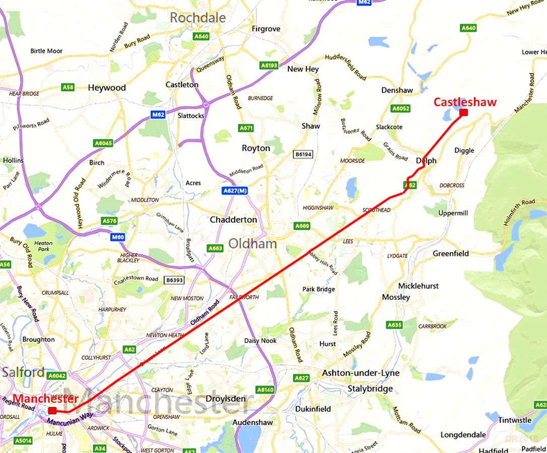
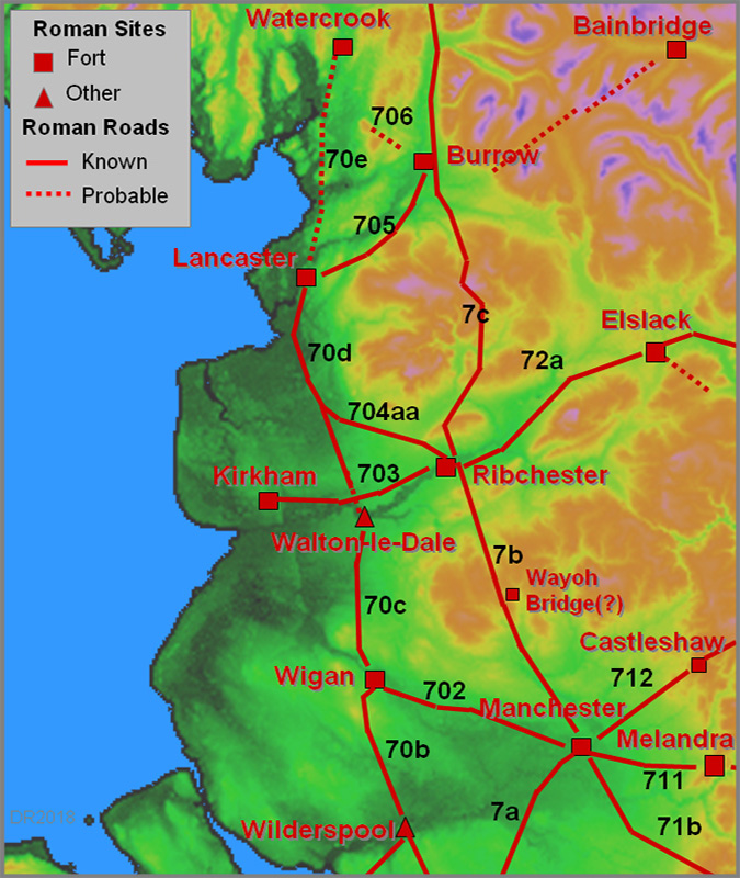
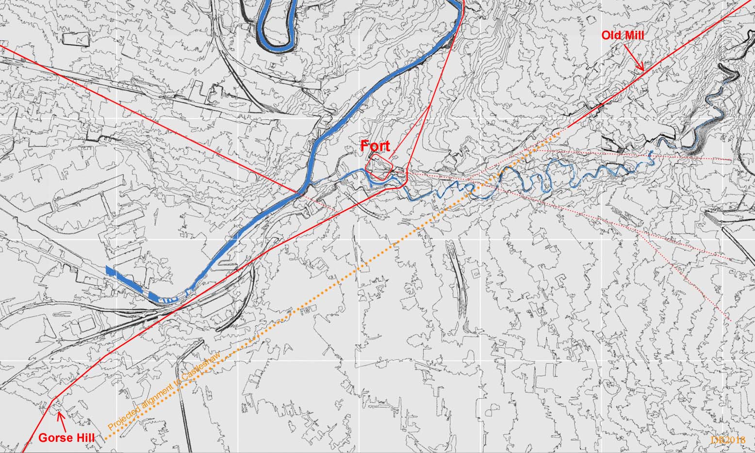
The Roman Road from Manchester to CastleshawMargary Number: 712Distance: 13.5 milesThis was part of a major inter-city highway for the Romans - Chester to York - and probably the most important road in northern England. The line today is preserved in a series of minor roads, Briscoe Lane, Roman Road, The Street and Honeywell Lane (Oldham). The road features a long straight alignment from Store Street, Manchester, all the way to High Moor beyond Oldham. The route out of Manchester fort to join it perhaps would have been close to Whitworth Street. The proving of the route of this road by the 712 Group is described in "Saddleworth Seven One Two". The 712 number is, of course, the reference to the number given by I.D. Margary. Excavations of this road by the 712 Group proved their route where it differed in the Saddleworth area from that suggested by both the OS and Margary. Lidar has now added a few minor corrections. They also suggested that the main alignment was set-out from Gorse Hill, Stretford but as we shall see later this was almost certainly not the case. For a detailed route map see the bottom of this page. |
Historic Counties: Lancashire & West Riding of Yorkshire Current County: Greater Manchester HER: Greater Manchester
|
|
|
|
|
|
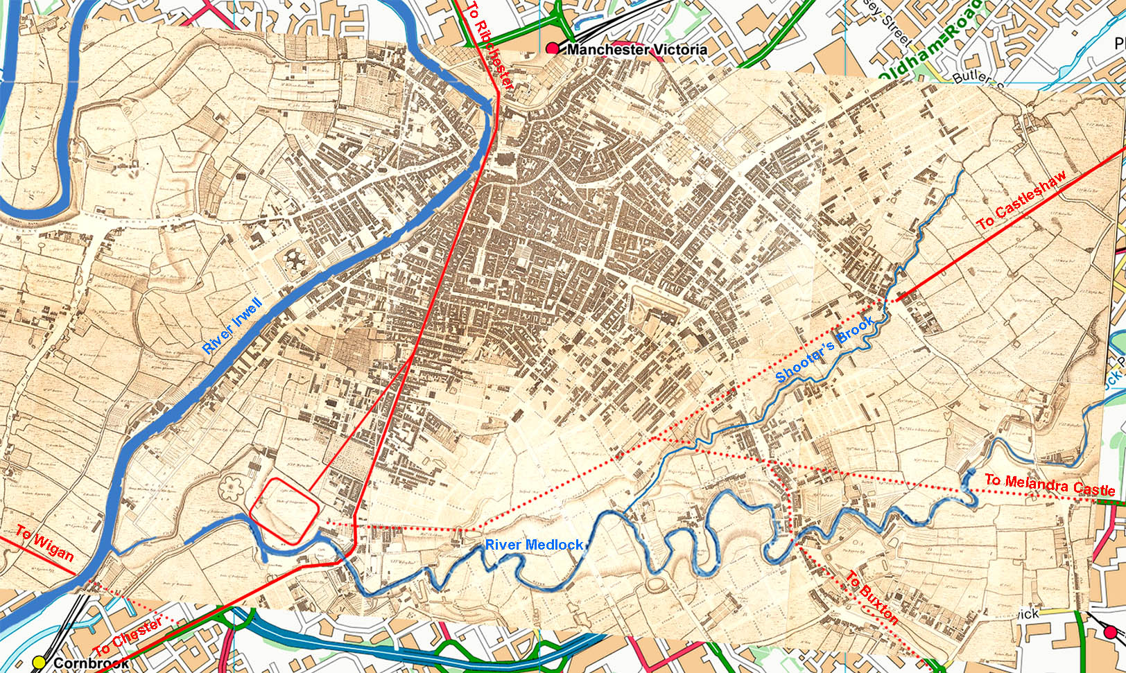
Manchester to Old Mill Street - Green's Map 1787-94 The courses of the Castleshaw Road and those to Melandra and Buxton are somewhat speculative in city centre Manchester. What we are reasobably secute on is the alignment of both the Castleshaw Road and that to Melandra. Projecting these into Manchester then a reasonable guess can be made at where they joined up - a little to the north of the UMIST main building. This does fit logically with the courses of the River Medlock and Shooter's Brook with the Castleshaw road keeing to the north bank of Shooter's Brook.The latter does still exist as an underground culvert. However, routes in city centre Manchester should be regarded as speculative. |
Click for larger view |
 |
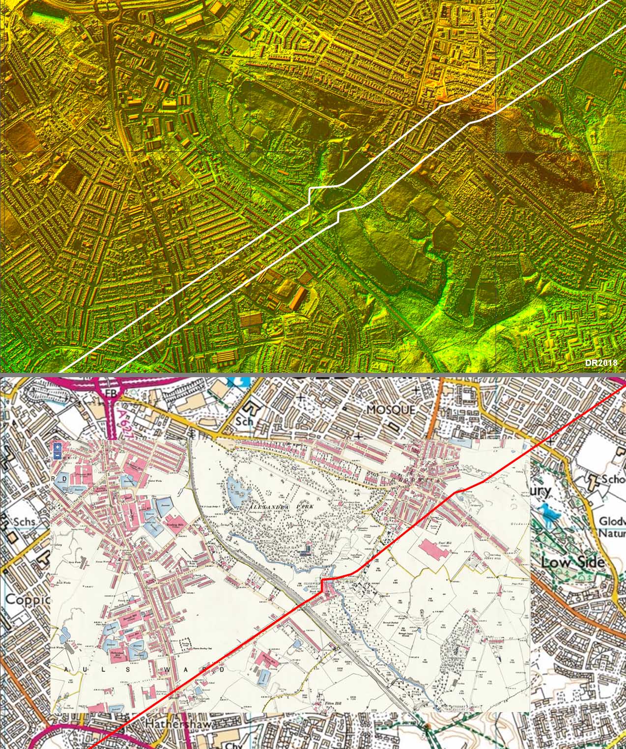
Contour Map The 712 Group suggested that Gorse Hill at Stretford was the sighting/setting out point from Manchester for the main alignment to High Moor, Oldham (see later). However, using a modern contour map (right) to evaluate this then it appears highly unlikely. Gorse Hill is hardly a hill at all to warrant going 2.5 miles in the wrong direction. It wouldn't offer any advantage over a setting-out point actually on line. Also the road in from Chester does not share the High Moor alignment, which they thought was the case. In fact the Castleshaw alignment projected down to Stretford doesn't even coincide with Gorse Hill or any hill for that matter. The simplest and most practical setting-out point was on the line itself, probably on Old Mill Street. There is a suitable crest (SJ 8530 9835) in trendy New Islington. It is an easy walk up to this spot from Great Ancoats Street. Note this map was prepared before the rooute of the melandra road was found. |
Click for larger view |
 |
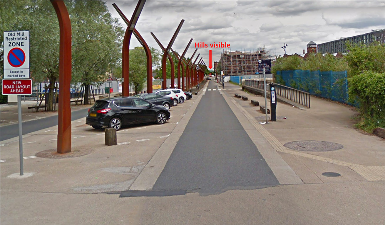
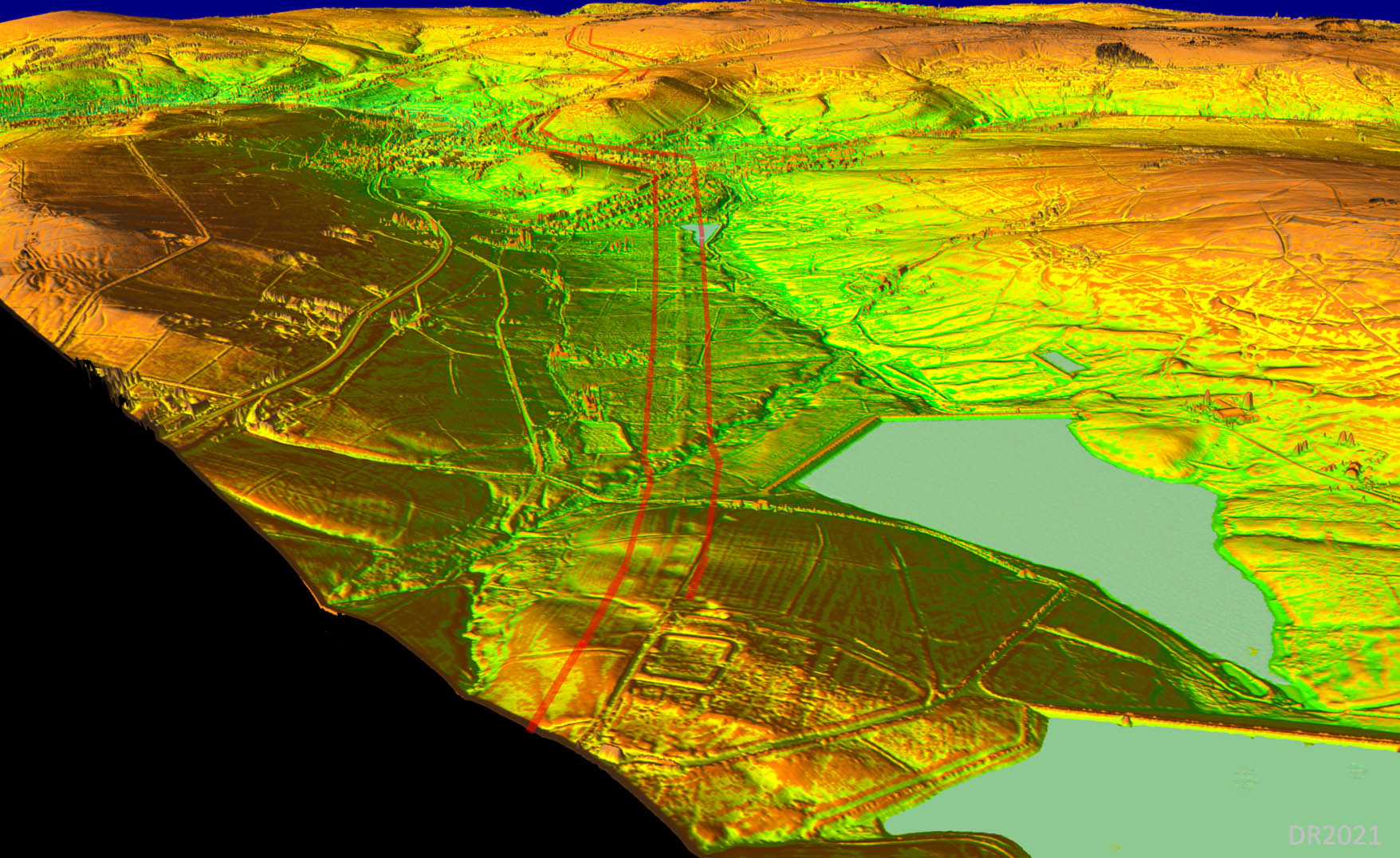
Setting-Out Point - Old Mill Street, New Islington (SJ 8530 9835) All things considered this seems the likely sighting/setting-out point at the Manchester end for the main alignment to High Moor above Oldham. It also would explain why Store Street (behind us) is slightly off line. From this spot the hills above Oldham can still be seen today. Not sure what the Roman's would make of what has happened to their road here! A 3D lidar model viewed from this spot confirms the visibility of High Moor and the reverse view from High Moor (see later) also agrees with this. |
Click for larger view |
 |
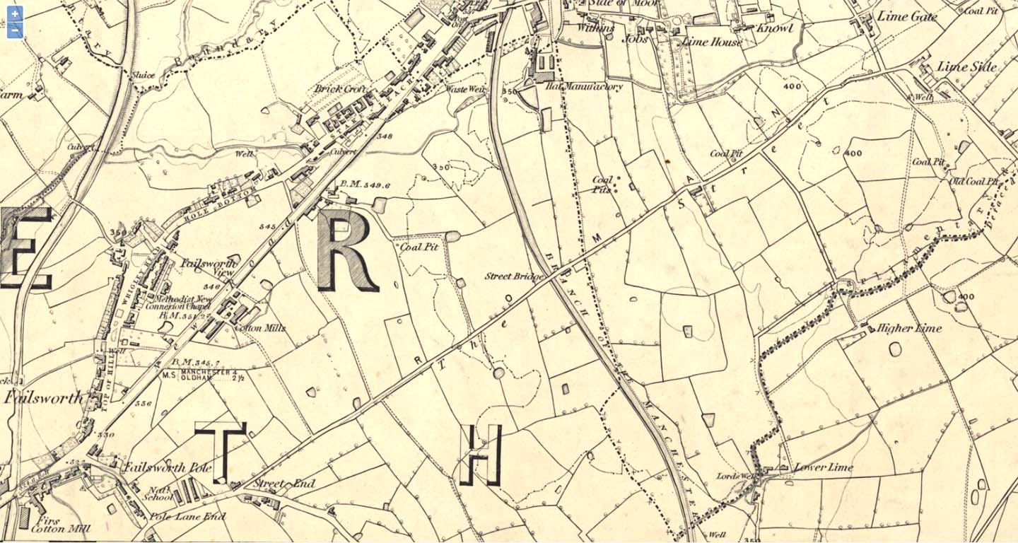
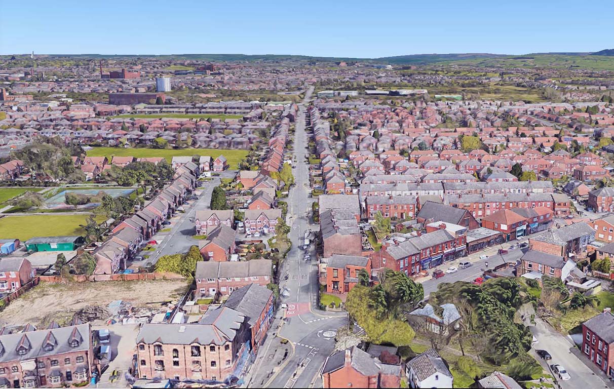
Briscoe Lane, Newton Heath Unmistakably a Roman road. The Roman agger on this road was huge and was too good a foundation to ignore for modern road builders. Briscoe Lane continues into Roman Road via Street End, Streetbridge Inn, Lime Gate and finally Honeywell Lane (Oldham). |
Click for larger view |
 |
OS First Edition Map - Street End to Lime Gate The road was known as The Street on this 1845 map but today it is called Roman Road. The replacement turnpike "new road" to Oldham is further north on the map.
Today Roman Road is traffic calmed - dead straight roads through residential areas are perhaps a touch too dangerous. |
Click for larger view |
 |
Roman Road, Street End, Failsworth The slight bend here is down to the M60 motorway which the modern road now crosses on a new bridge. |
Click for larger view |
 |
Alexander Park, Oldham - Lidar Image & Route Map Although the setting out alignment runs dead straight, to negotiate the Glodwick valley and Fenny Hill the road would more than likely have zig-zagged to ease the gradients. The modern road across Glodwick Brook is almost certainly not the course and the old OS map (1890) give a much more likely line with a typical zig-zag down and up. Glodwick Brook is however no more - well it is out of sight and presumably culverted. There might just be a trace of the "up" stretch surviving on the Lidar image. Similarly over Fenny Hill there is perhaps an indication of a dogleg to ease the climb. |
Click for larger view |
 |
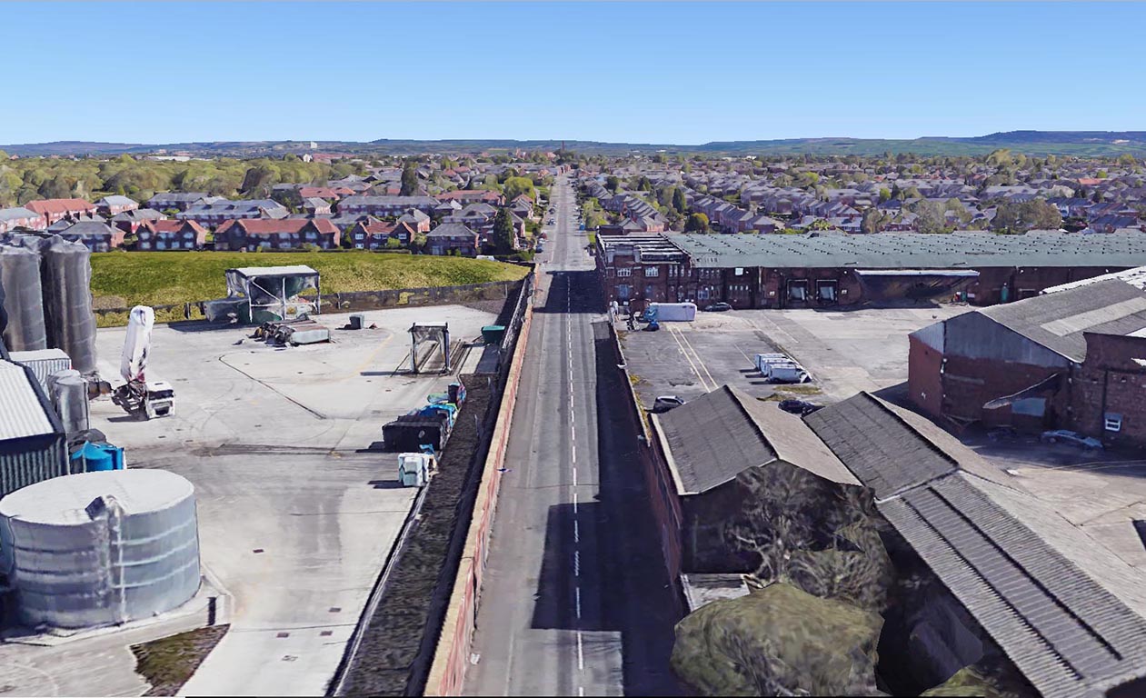
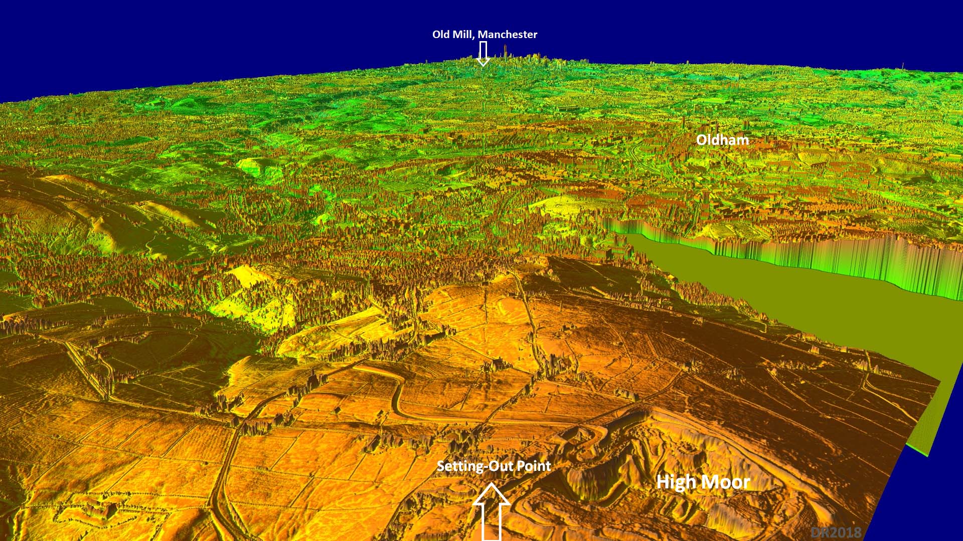
3D Oblique Lidar Image - High Moor Alignment Here we are looking back towards Manchester from the main alignment setting-out point on High Moor. This was not the highest point on the hill, which is common, but determining the exact spot is impossible now due to quarrying. It is amazing that 1600 years after the Roman's left then the line of this road can be still made out across a hugely developed city region. The Manchester setting-out point was, as we have seen, was almost certainly on Old Mill Street in New Islington. Dropping the viewing position in this 3D lidar model to ground level confirms Old Mill was visible from here. To the right of Old Mill, on the skyline, can be seen Beetham Tower, which is close to the fort site. |
Click for larger view |
 |
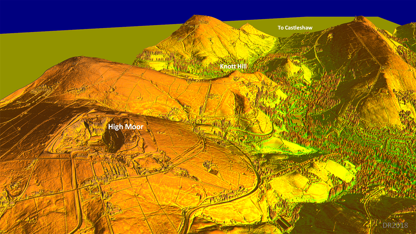
Lidar Image - High Moor Long straight alignments were not possible from High Moor to Delph so the road adapted to the contours rather than fighting them. Clear from the Lidar imagery is the huge size of the agger. This was a major inter-city highway for the Romans - Chester to York - and it warranted a substantial construction. |
Click for larger view |
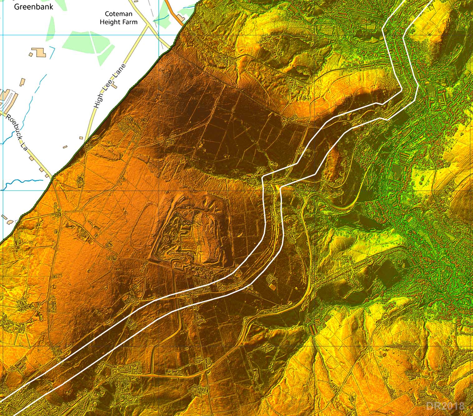 |
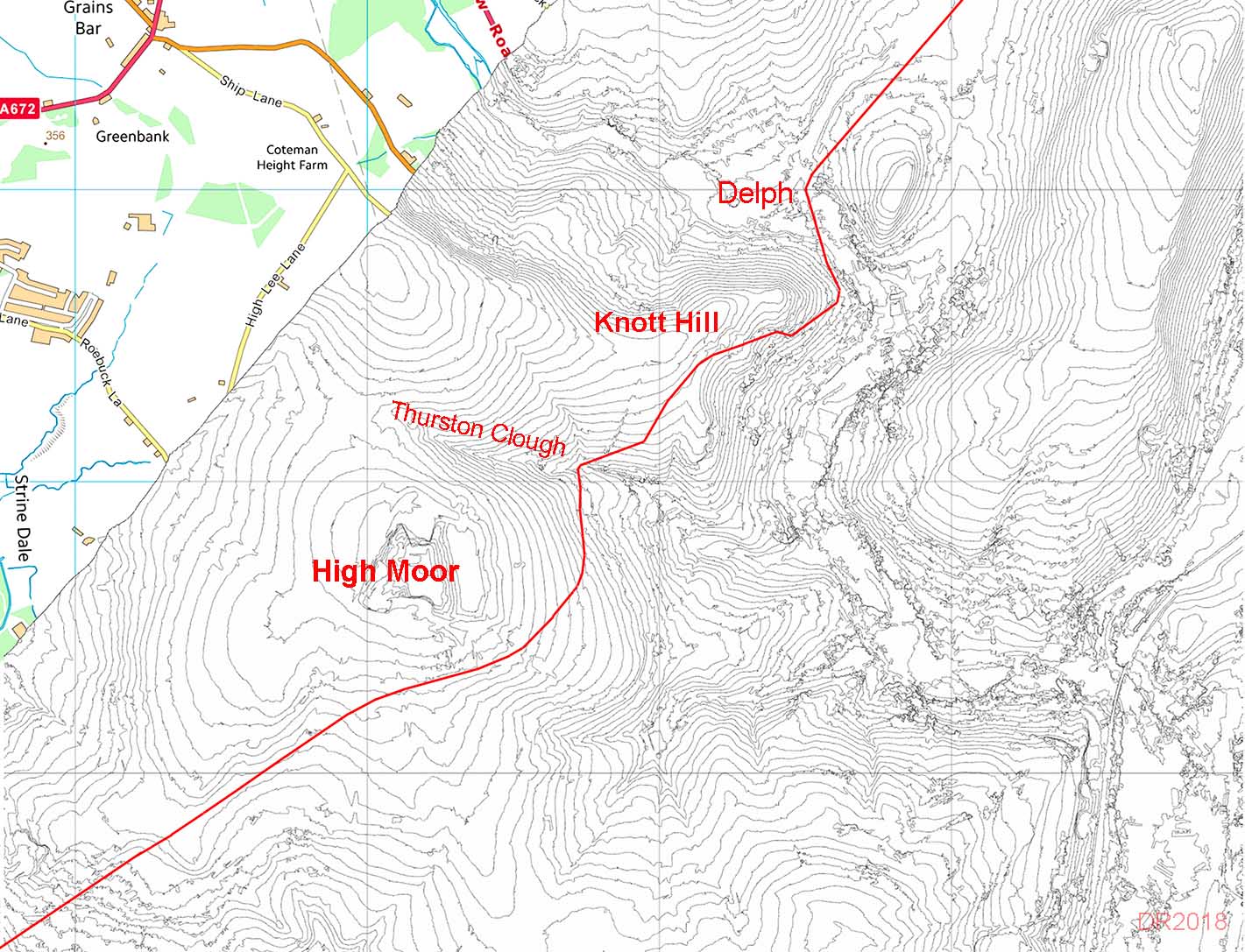
Route Map - High Moor The Ordnance Survey thought Thurston Clough Road was the Roman line but the 712 Group knew better! In reality the huge agger of this road was hard to miss but even the legendary Ivan Margary did spot not it and accepted the old OS route. Doctor Lane has sometimes been suggested as a Roman Road from Melandra fort coming in to join our road. See the Saddleworth Seven One Two booklet although they themselves were not convinced. |
Click for larger view |
 |
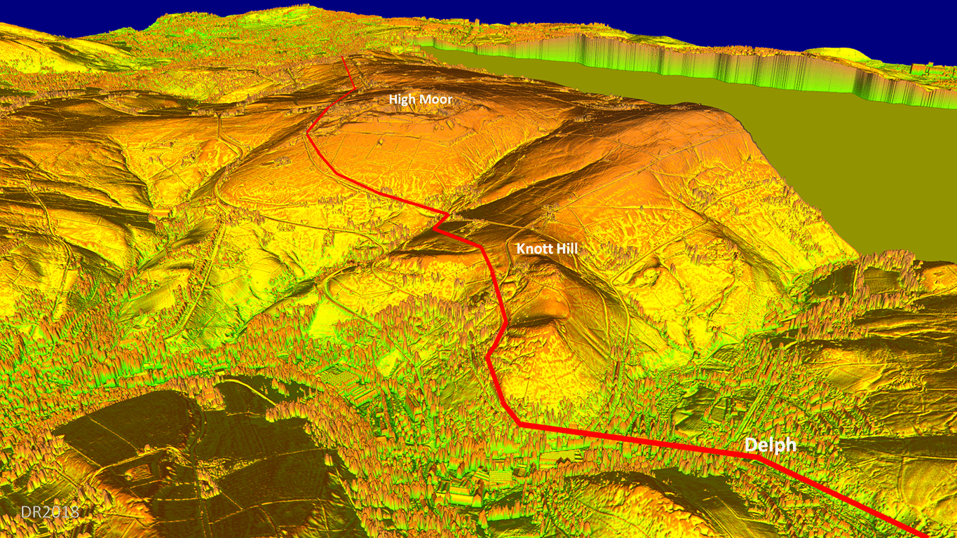
3D Oblique Lidar Image - High Moor Route Brilliant Roman engineering to negotiate High Moor and Knott Hill. The agger of the Roman road has survived well and is easily visible. It was after all a well built major road. The full size image is an animated gif so will display with and without the route (red) in sequence. |
Click for larger view |
 |
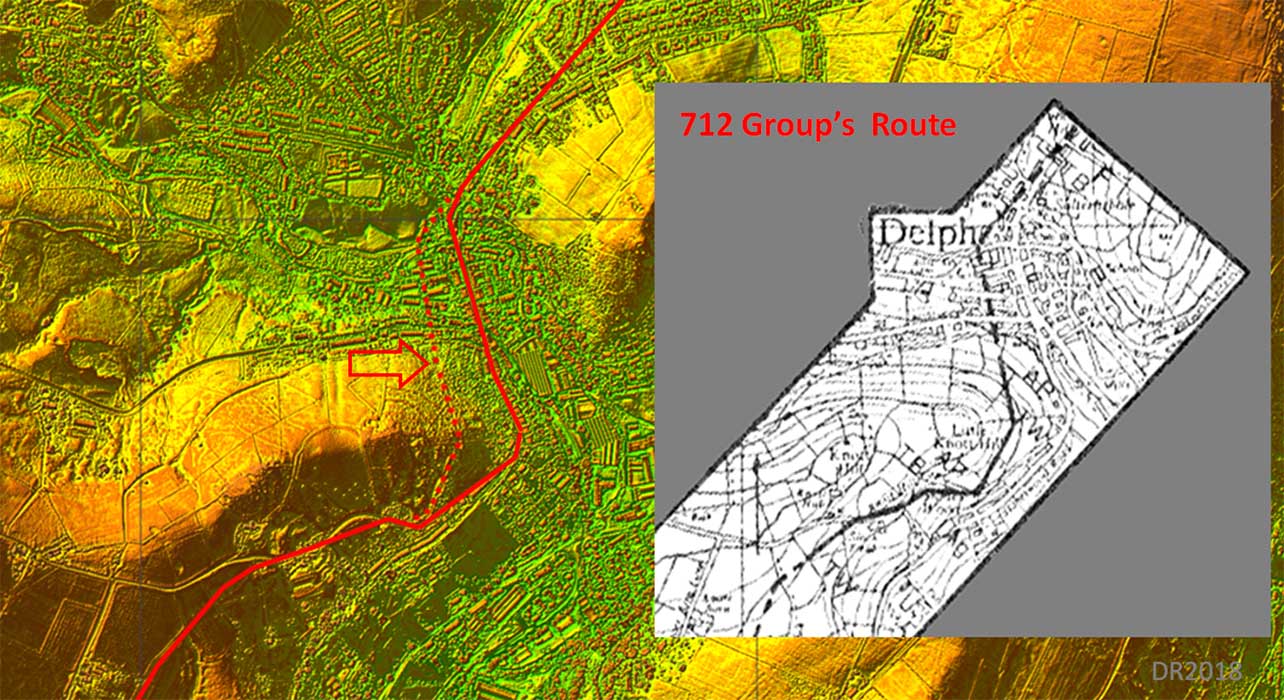
Lidar Image & 712 Group's Route Map - Delph The route shown differs slightly to that of the 712 Group approaching Delph. That group took it over the side slope of Knott Hill (see inset) - not too practical and the trace they followed is much too slender to be our major Roman agger. Everywhere else the surviving agger is huge so, on balance, the lower road is much more likely to be the actual route. Apart from the Glodwick Brook zig-zags this is the only section of road I believe the group probably got wrong. Amazing work on their part - and no lidar then! |
Click for larger view |
 |
Contour Map - High Moor to Delph Thurston Clough was a major obstacle here. The Roman engineer setting-out this road out has compromised in how much level to drop (and reclimb) to keep a reasonably direct route. I think this contour map also helps confirm the lower route around Knott Hill to get down to Delph is the correct one. The Roman engineer has achieved a steady gradient from the south side of Knott Hill all the way down to Delph. No need to climb up only to make for a steeper descent.
|
Click for larger view |
 |
3D Oblique Lidar Image - Route Knott Hill - Delph In this view we can see the higher route over Lower Knott Hill proposed by the 712 Group is simply too insignificant to be the Roma agger. The lower route shown in red is almost certainly the correct line. The full size image is an animated gif so will display with and without the route (red) in sequence.
|
Click for larger view |
 |
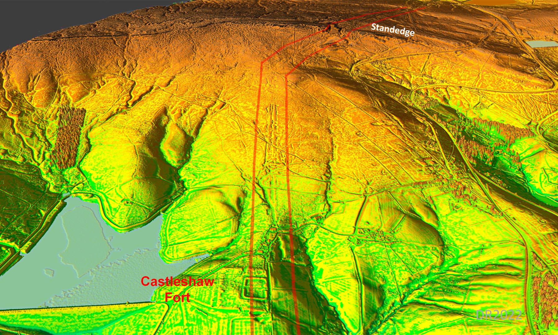
3D Oblique Lidar Image - Castleshaw looking back Looking back towards Delph from over Castleshaw Fort(s). Strange route for the Roman road - the Romans tended to avoid valley bottoms much preferring higher and drier ground. The inner (later) fortlet ramparts are reconstructed.
|
Click for larger view |
 |
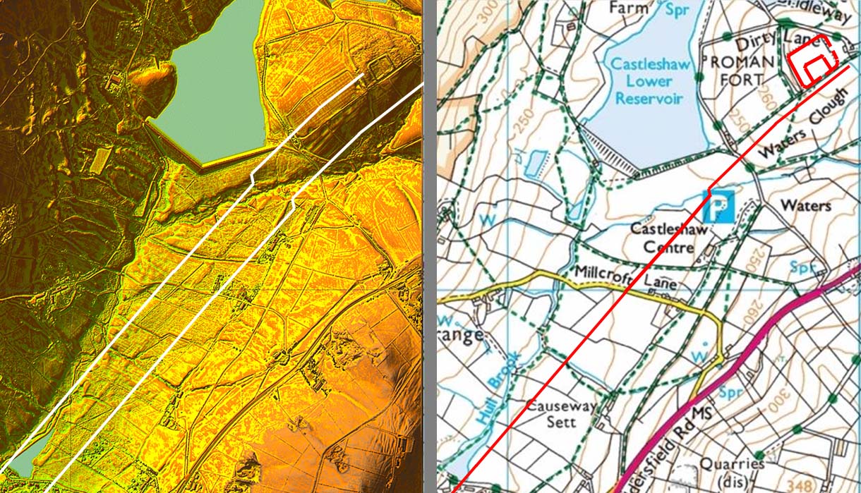
Lidar Image & Route Map - Castleshaw With the release of series 2 lidar data we at last have coverage for the fort. Both the road and forts show clearly. The fort was reduced in size in Roman times. For more information of the fort site see Castleshaw Archaeology
|
Click for larger view |
 |
3D Oblique Lidar Image - Looking ahead to Standedge Beyond the fort, the agger of the road can still be seen heading for the county boundary and into Yorkshire. The course of the road in Yorkshire has been located by Huddersfield and District Archaeological Society. |
Click for larger view |
 |
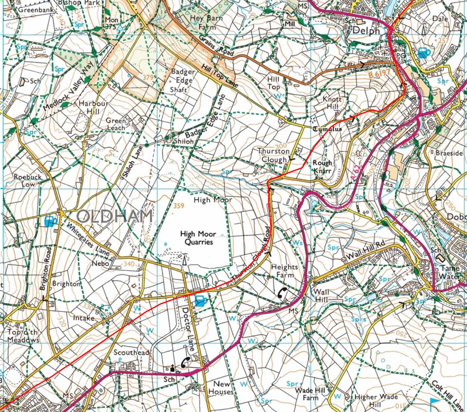
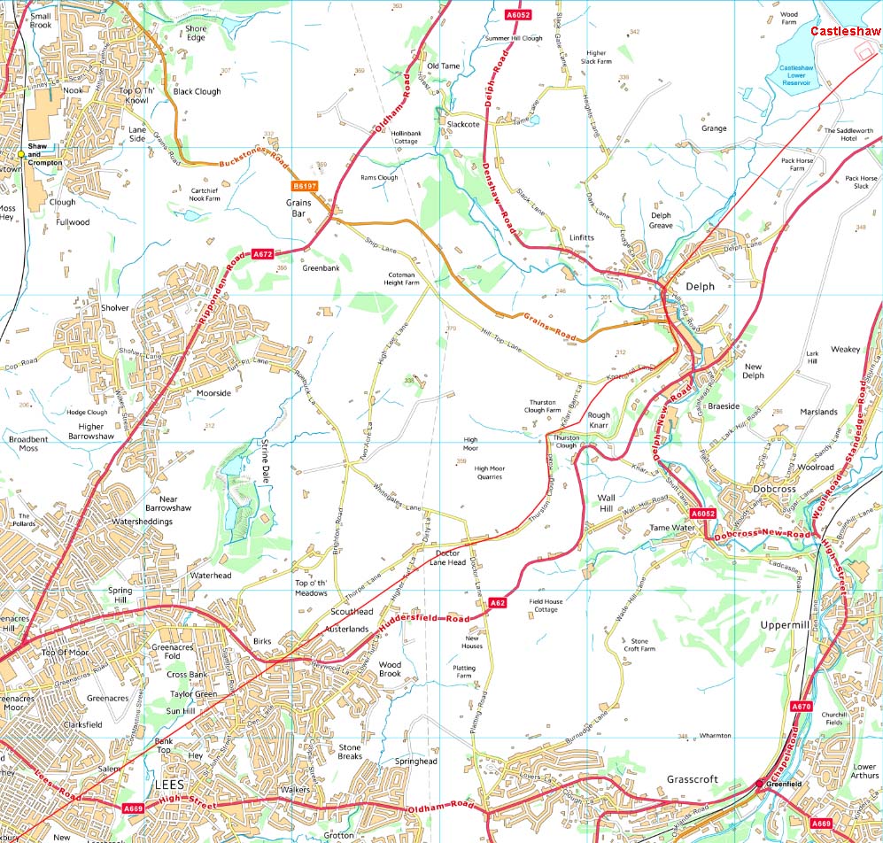
Detailed Route Maps Route Map 1 - Manchester to the M60 Motorway Route Map 2 - M60 Motorway to Oldham Route Map 3 - Oldham to Castleshaw
|
Click for larger view |
|
|
|
|
Last update: January 2021 |
© David Ratledge |