|
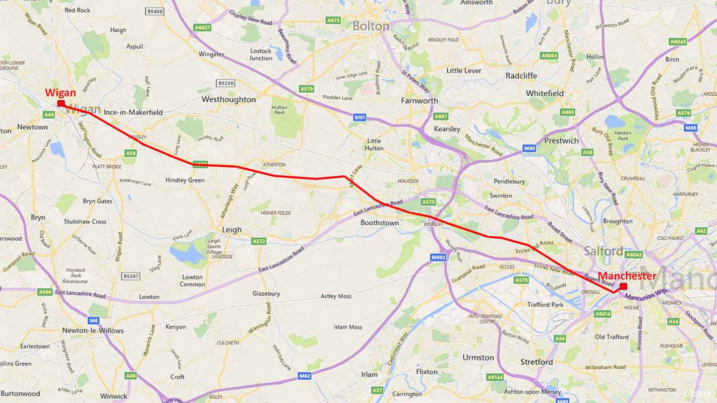
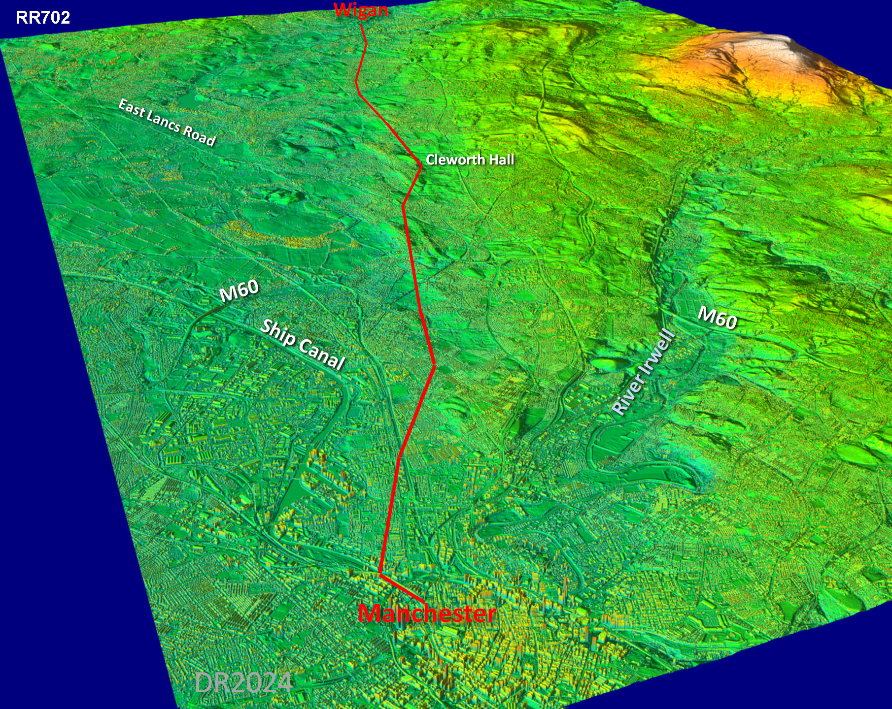
The Roman Road from Manchester to WiganMargary Number: 702Distance: 17 milesThis road was proved by Sibson and Watkin (ref: Watkin, 1883) and the route they found seems to be an example of excellent engineering being a series of straight alignments between high points on a fairly direct line to Wigan as the route map reveals. Watkin devotes much attention to this road as he was keen to prove Wigan was Coccium of the Antonine Itinerary, for which a road from Manchester would be essential. Regent Road/Eccles New Road despite looking Roman does not represent the line but the Roman road crossed it at a shallow angle and headed for the high ground at Hope Hall (near Hope School and Buile Hill Park). From there the line to Wigan is very direct apart from a strange kink to the north at Cleworth Hall, Tyldesley. |
Historic County: Lancashire Current County: Greater Manchester HER: Greater Manchester
|
|
|
|
|
|
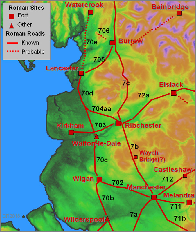
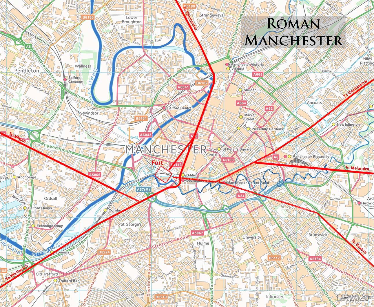
Roman Manchester Road Map From the Manchester fort it would appear that the road for Wigan went south-west to Woden Ford (now Woden Street?) before it began its alignment on Wigan. This would appear to be the correct location for Woden Ford at Watkin does place it just downstream of the confluence or the rivers Irwell and Medlock. Watkin remarks the course from the ford to Hope Hall is very direct. For much of the route to Wigan we are totally reliant on Watkin and Sibson as the road has only been located in a few sporadic locations. These have however confirmed their route giving us confidence in what they recorded where proof no longer exists.
|
Click for larger view
|
 |
Oblique Lidar Image - Full Route That kink at Cleworth Hall does look odd but perhaps it was not as extreme as it appears - see later. |
Click for larger view |
 |
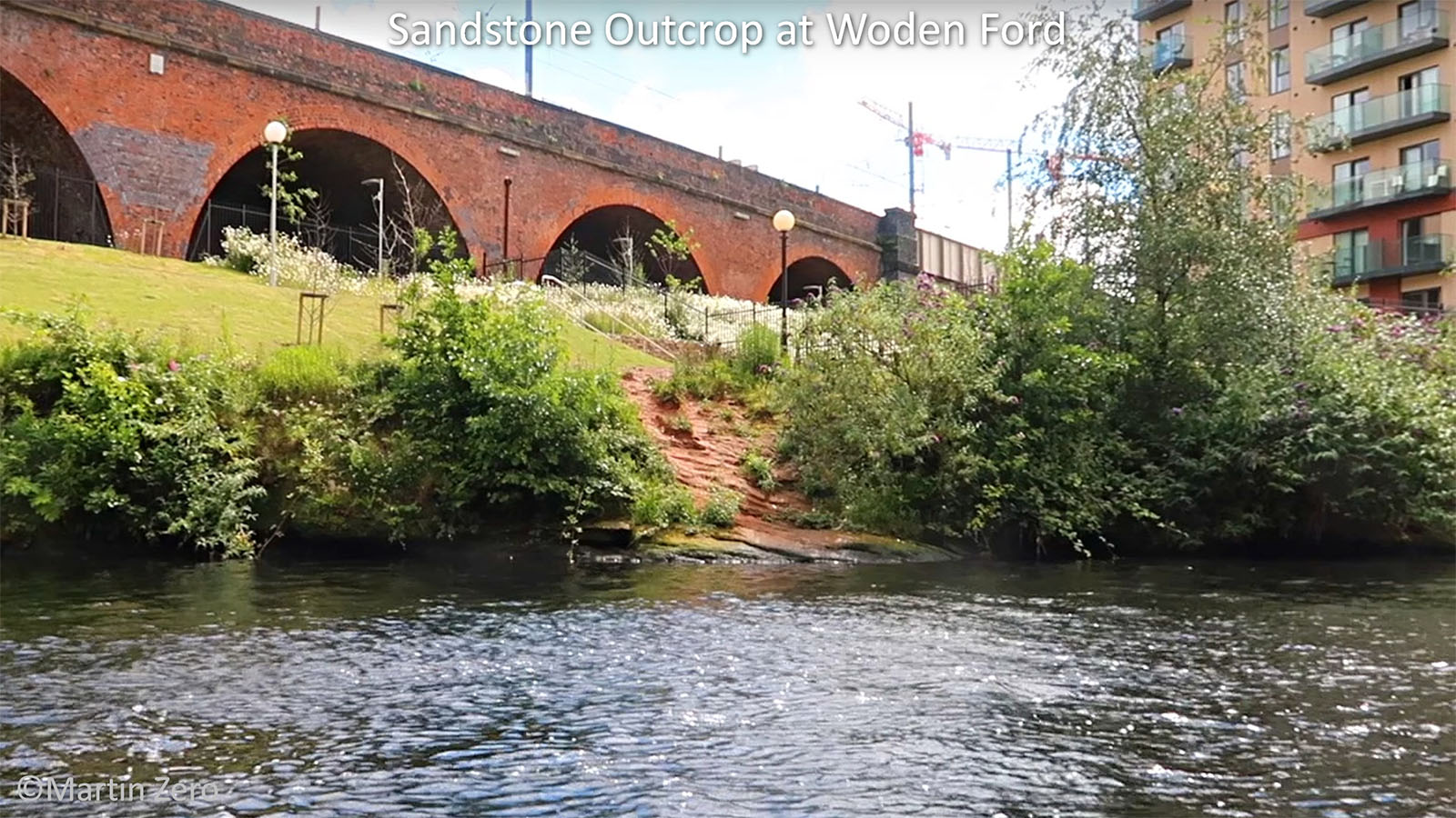
Woden Ford At the location of Woden ford is a sandstone outcrop. The Romans almost certainly would have had a bridge with the ford name coming from later times when the Roman bridge would have been long gone. The sandstone would make it an ideal bridging point, literally proving a rock-solid foundation. This does strengthen this as being the likely Roman crossing point. Image: Martin Zero |
Click for larger view |
 |
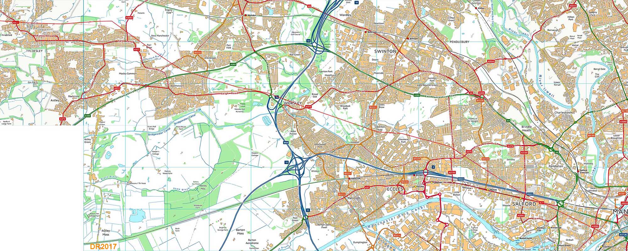
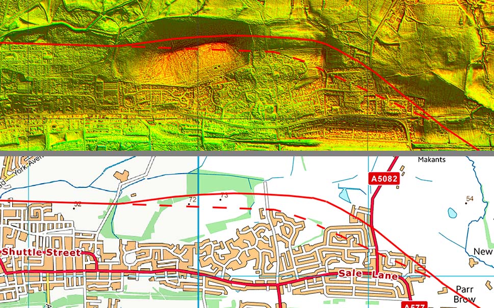
Route Map - Manchester to Tyldesley From Woden ford, Watkin/Sibson quote the road crossing Regent Road at a shallow angle and being found when the railway was being constructed. They locate the spot as between Derby Road and Langworthy Road bridges at the western end of Seedley Station. The station is long gone but the crossing point would have been about 150 metres west of Langworthy Road. They continue this alignment to Hope Hall (near Hope School and Buile Hill Park). From here to Cleworth Hall we do have modern evidence to confirm the line - see next series of images. |
Click for larger view |
 |
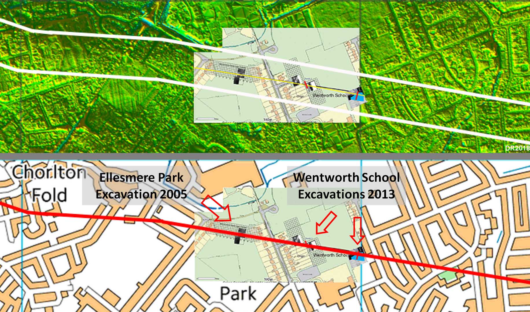
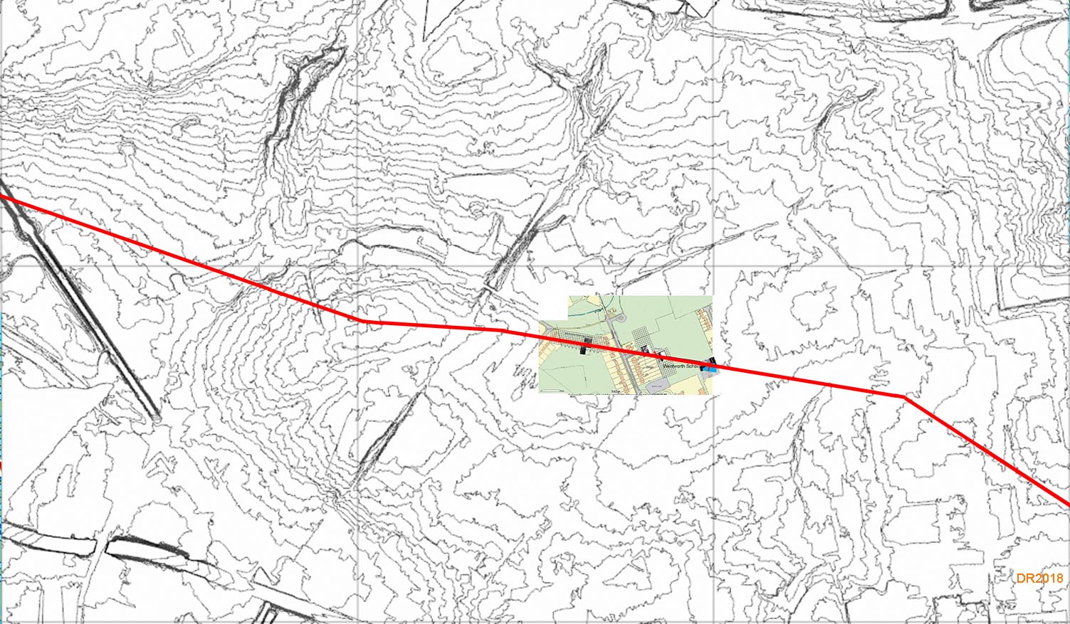
Lidar & Map - Wentworth School and Ellesmere Park Excavations We are more definite ground now with two modern excavations finding the road. It was not precisely on the line shown on the OS First Edition maps but pretty close giving confidence in Watkin and Sibson assertions as to the course of the road. The excavation at Ellesmere Park was part of the 2005 Time Team Big Dig - see next image but one. The 2013 excavations at nearby Wentworth School were by the Centre for Applied Technology, University of Salford. Again the road was found very close to the OS line. Thanks are due to Norman Redhead for supplying the location map for their trenches. The excavations at Ellesmere Park carried out by John Rabbitt’s team in 2005 were in collaboration with Wigan .A.S. and they did the resistivity survey which guided where to put in the trenches. They also did the surveys for Wentworth School. |
Click for larger view |
 |
Wentworth School and Ellesmere Park - Geophys This is a close-up the geophys carried out by Wigan Archaeological Society prior to the excavations. Thanks to Bill Aldridge for supplying this. |
Click for larger view |
.jpg) |
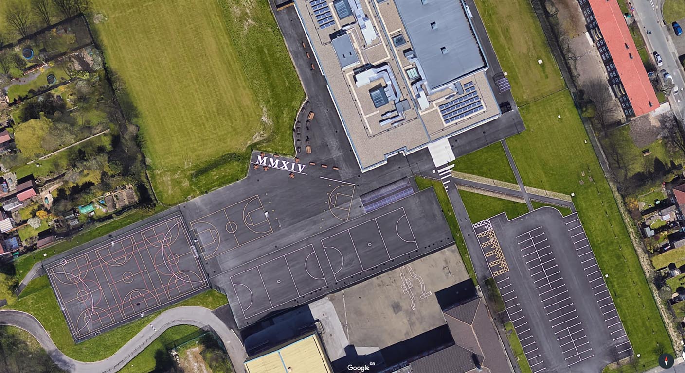
Wentworth School - Google Earth The school would appear to have marked the centre(?) line of the road with white paint and labelled it MMX1V - should have been MMXIV but never mind. The line of the path to the right also seems to preserve the line and would perhaps coincide with the road's northern edge/ditch. Thanks are due to Mike Hinchey of Tampa, Florida for bringing this to my attention. Image: Google Earth |
Click for larger view |
 |
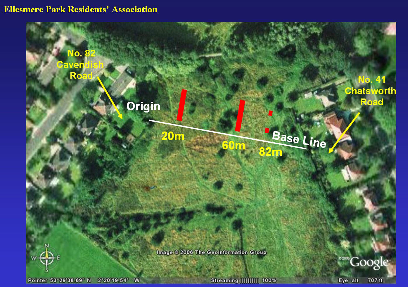
Ellesmere Park - Trench Locations Following on from the Geophys these were the trench locations at Ellesmere Park. The numbers refer to the distance from the origin rather than the trench length. Thanks to Bill Aldridge for supplying this map. |
Click for larger view |
 |
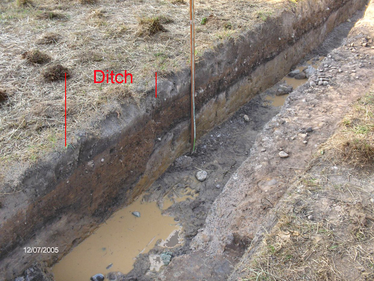
Ellesmere Park Excavation 2005 In July 2005 the road was found in remarkable condition crossing Ellesmere Park by an Ellesmere residents team led by John Rabbitt. It was less than 1 foot below the surface, about 23 feet wide and consisting of small stones with a double ditch on the south side. Image: DR |
Click for larger view |
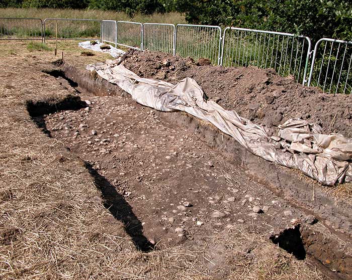 |
Ellesmere Park Excavation 2005 This shows the double ditches on the south side very clearly. Presumably at some time the ditch filled up - a likely common problem with all the Lancashire rain - and it had to be re-cut. Image: DR |
Click for larger view |
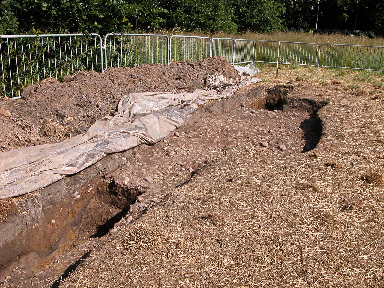 |
Ellesmere Park Excavations 2005 - Single Ditch There were actually two trenches with the double ditch shown above only occurring in one. The second trench shown here had a single ditch.Thanks to Bill Aldridge for bringing this to my attention. Image: Bill Aldridge |
Click for larger view |
 |
Contour Map - Chorlton Fold The alignment found at Wentworth School and Ellesmere Park doesn't quite align with the route across Worsley Golf Course so there must have been a slight dog-leg between these two sections. The contour map shows a clear hill and the road would likely climb the ridge to its top and then made the turn so we can be reasonably confident of the route here.. That bend to right (east) of Wentworth School looks a bit suspicious and un-Roman like but that was the line recorded by Sibson and Watkin. |
Click for larger view |
 |
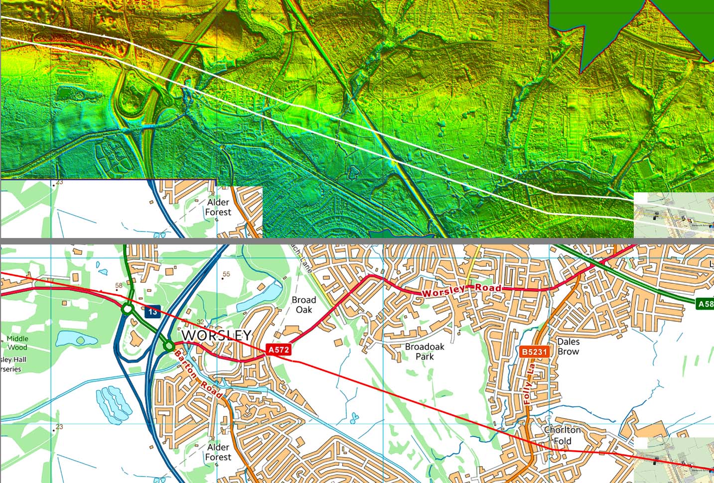
Lidar Image & Route Map - Chorlton Fold to Worsley Across Worsley Golf Course the road shows faintly but it is much more obvious west of the old railway crossing Broadoak Park. Watkin recorded the road crossing the railway at the distance signal for Worsley Station - no GPS in his days and no railway in our days! The old railway is a public footpath with parking available at the former Worsley station. |
Click for larger view |
 |
3D Oblique Lidar Image - Broadoak Park, Worsley The Roman road is faint across the golf course but clearer beyond the old railway crossing Broadoak Park. The last visible stretch has a strange little kink to the left (south). |
Click for larger view |
 |
Worsley Just west of Worsley (SD 743008) the agger with ditches was clear in 1984 but landscaping for a golf course has removed all traces. This is west of Worsley Church and across the road. Thanks to Patrick Maloney, Chairman of Wigan Archaeological Society for bringing this to my attention. Image: Courtesy Patrick Maloney |
Click for larger view |
 |
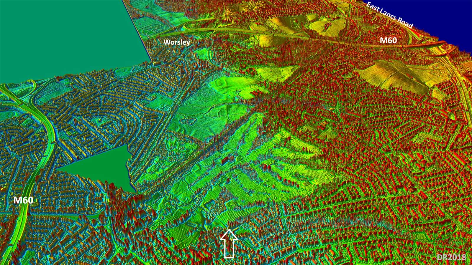
Lidar Image & Route Map - Worsley to Mosley Common Across another golf course (Worsley Park) and again traces of our road are very faint. North of the East Lancs Road then we do have a clear stretch of agger visible across Mosley Common. It is fainter after crossing Honksford Brook and there are possibly a couple of indications either side of the old railway line - now a guided busway. Note the line here is slighly west of the OS Route (Sibson's) - see below. |
Click for larger view |
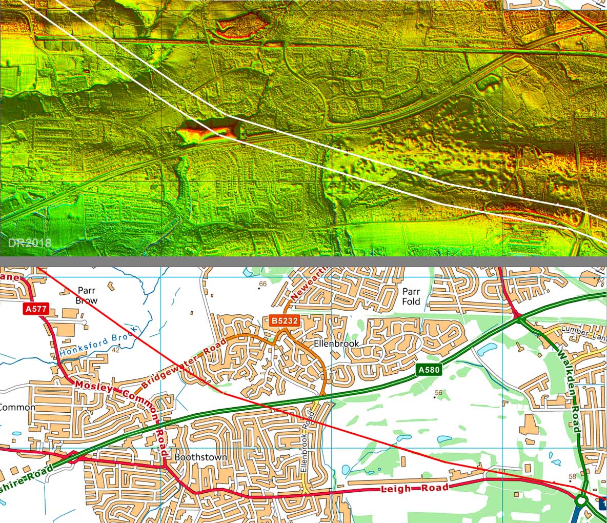 |
First Edition OS Map - Mosley Common Sibson's (OS) route here is not quite correct. Lidar shows a very clear agger west of his line. |
Click for larger view |
 |
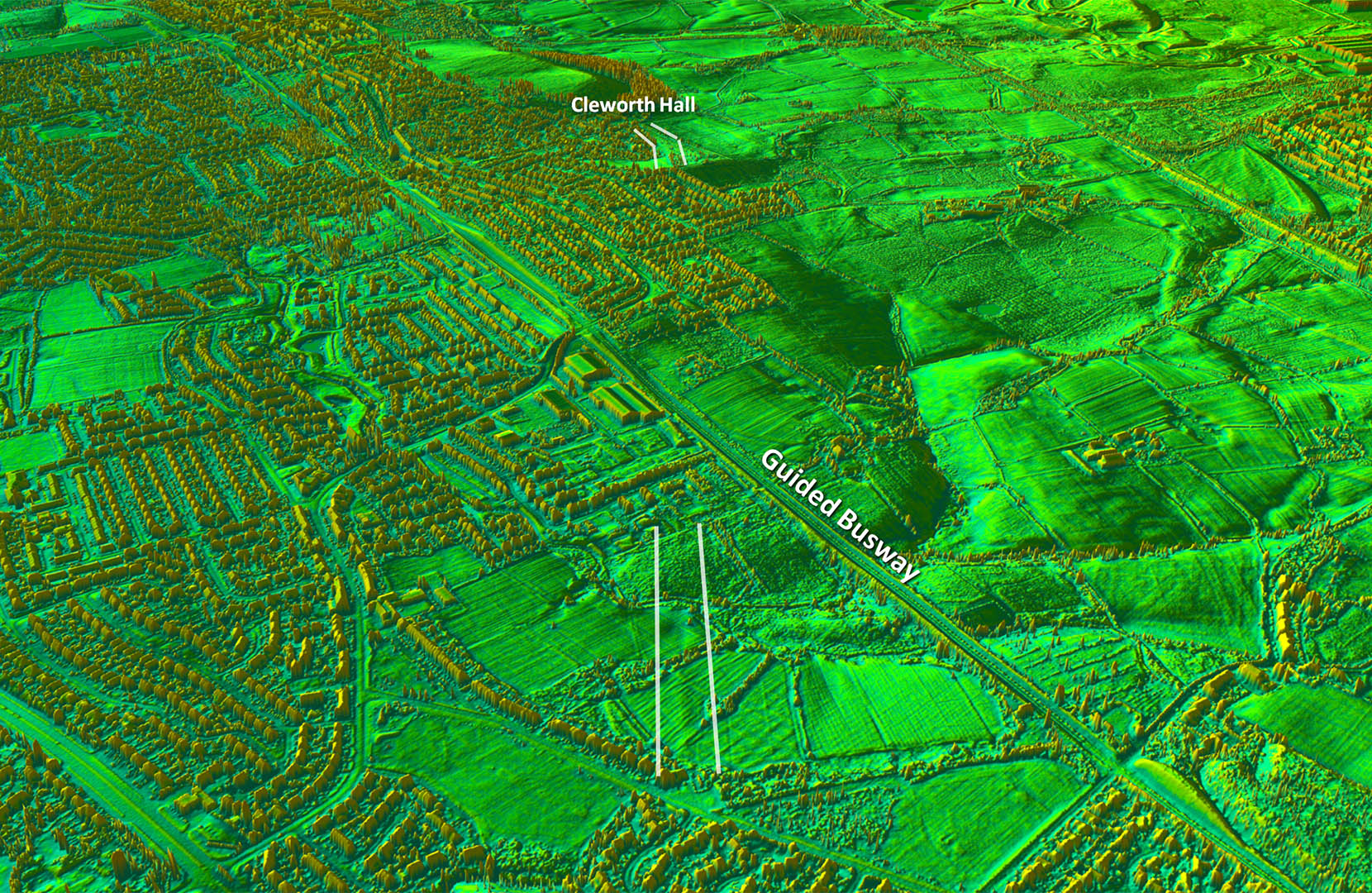
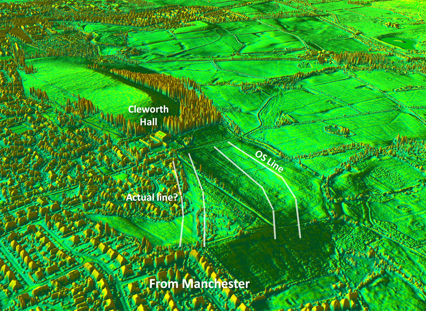
Oblique 3D Lidar Image - Mosley Common towards Cleworth Hall The agger on Mosley Common revealed by lidar provides not only a modern day locational fix but a direction too. This seems to imply the road was heading for the suggested feature (see below) near Cleworth Hall rather than the OS/Sibson's route there. |
Click for larger view |
 |
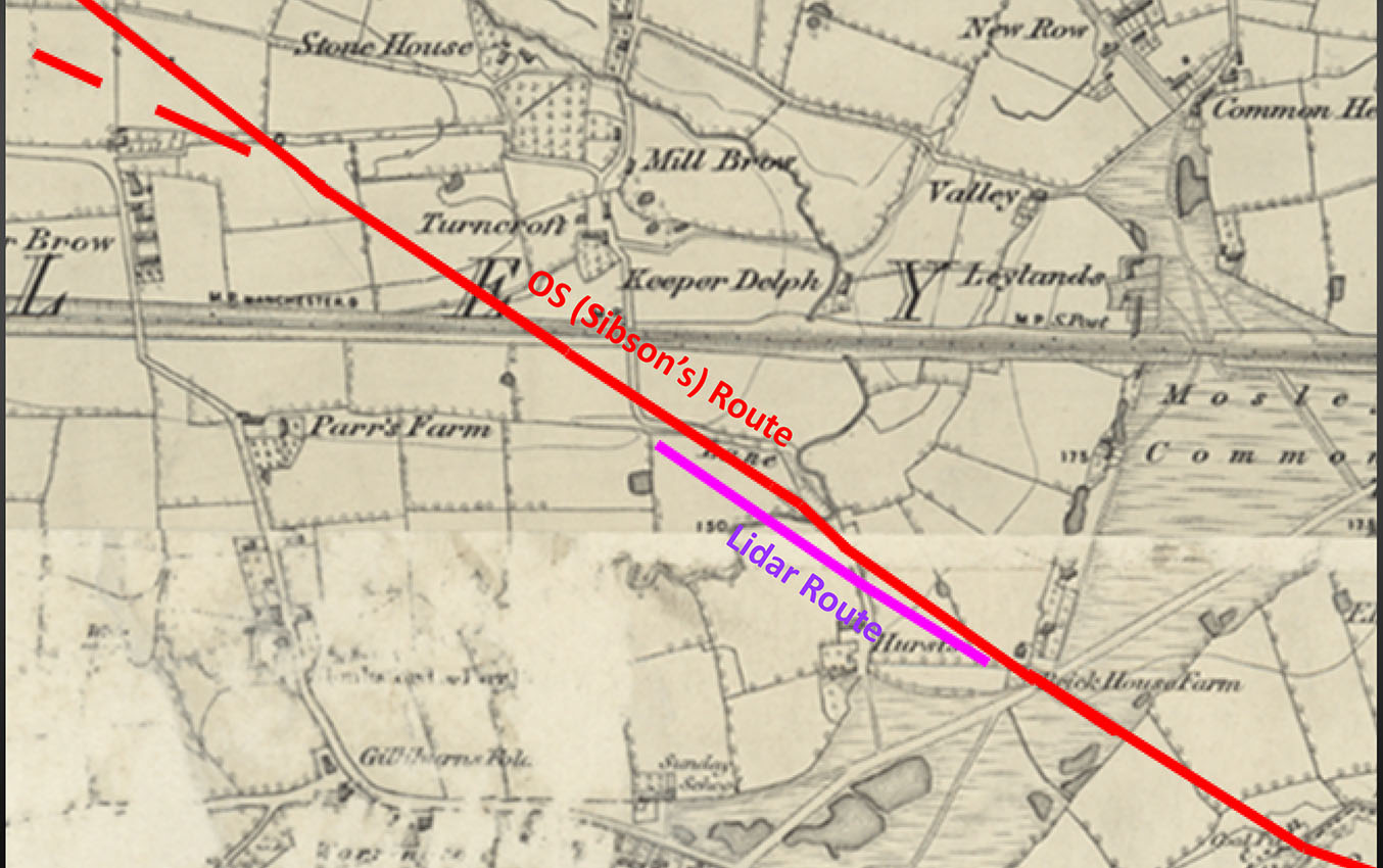
Lidar Image & Route Map - Cleworth Hall The supposed kink at Cleworth Hall is strange and a route cutting the corner surely more likely. It is shown dashed. Much mining activity hereabouts makes solving this puzzle difficult but see the lidar view below for the possible evidence. 2024 Update: Wigan AS are hoping to investigate here and hopefully come up with some answers. |
Click for larger view |
 |
Oblique 3D Lidar Image - Cleworth Hall There is nothing visible on the OS route to Cleworth Hall but the alternative line shown above does have the suspicion of a Roman road. On balance this would seem the more likely location for the road as it aligns better with the road both sides of this spot ie from Mosley Common and towards Tyldesley. |
Click for larger view |
 |
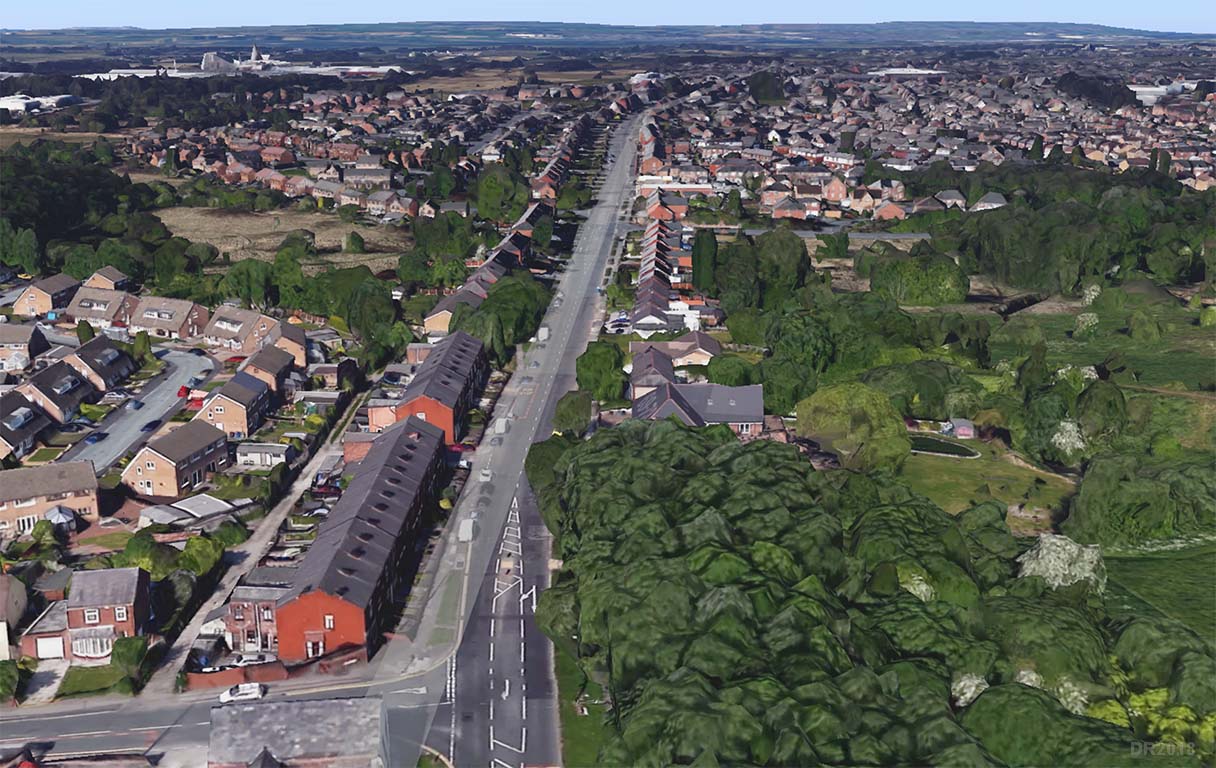
Route map - Tyldesley to Wigan Basically two main alignments with a change of direction at Dangerous Corner. |
Click for larger view |
 |
Lidar Image & Route Map - Atherton Nothing really visible on the Lidar imagery - land reclamation has taken its toll. |
Click for larger view |
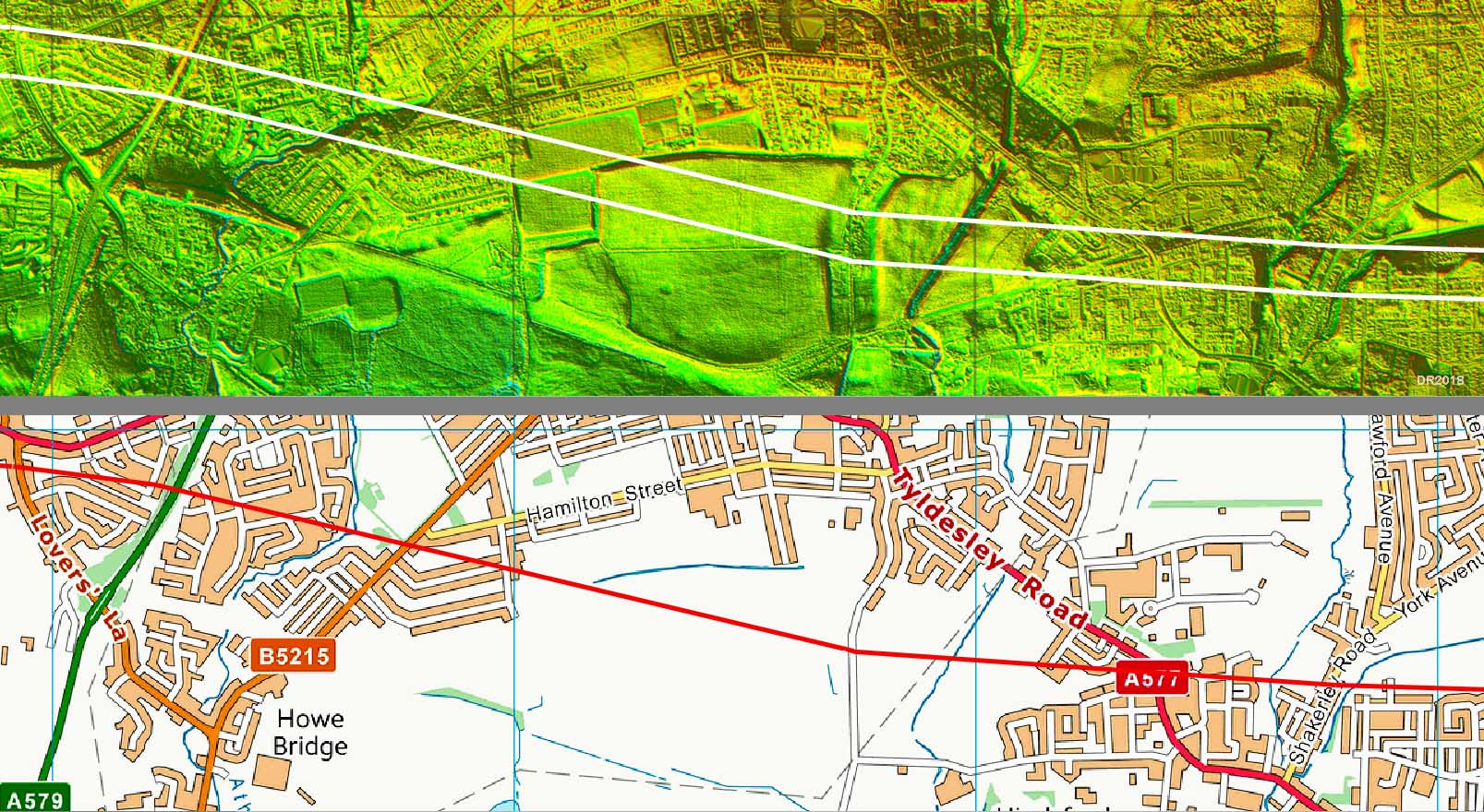 |
Lidar Image & Route Map - Dangerous Corner The A577 is clearly derived from the Roman line here but has drifted off over the centuries. |
Click for larger view |
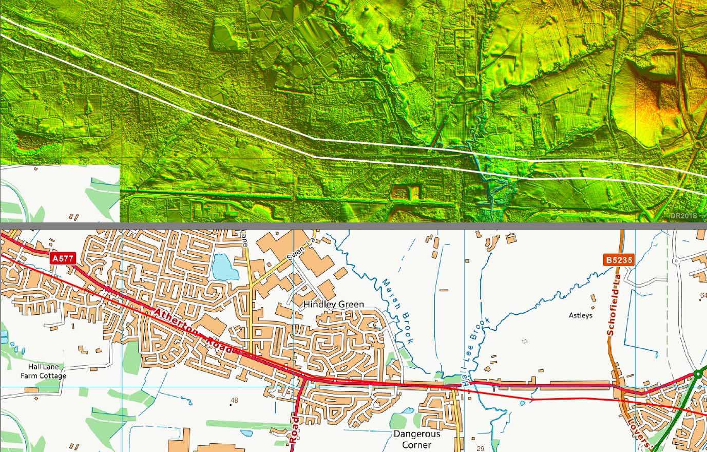 |
Dangerous Corner - Corner Lane A577 This is about the only piece of modern road that coincides with the Roman Line. The Roman alignment is shown lightly shaded on top of this Google Earth image.
|
Click for larger view |
 |
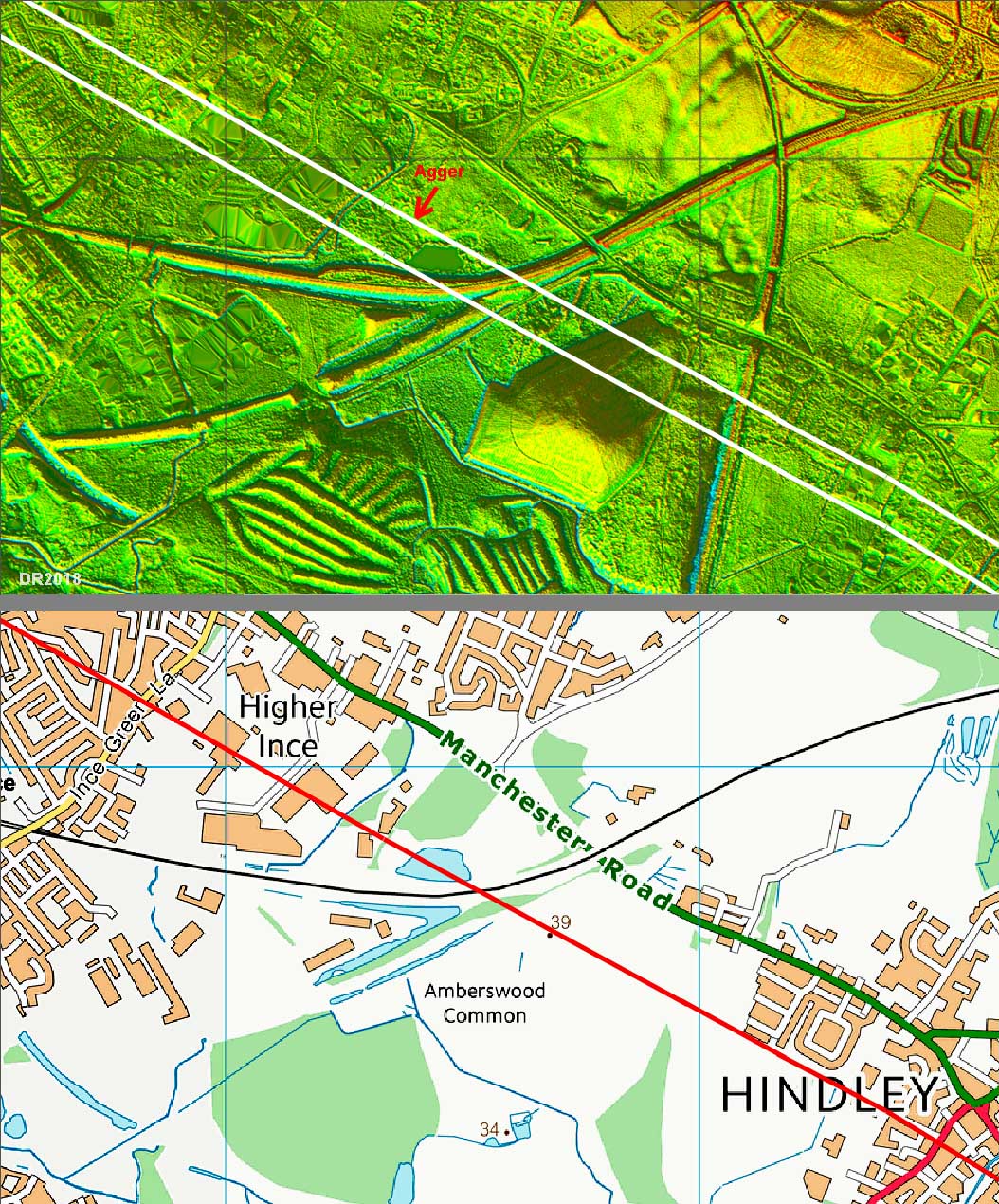
Lidar Image & Route Map - Amberswood Common Nothing has survived across Amberswood Common where it was recorded in Victorian times but in Walmesley Park a short length of the Roman agger is visible - red arrow. This is where Wigan Archaeological Society excavated it in 2003 - see later.
|
Click for larger view |
 |
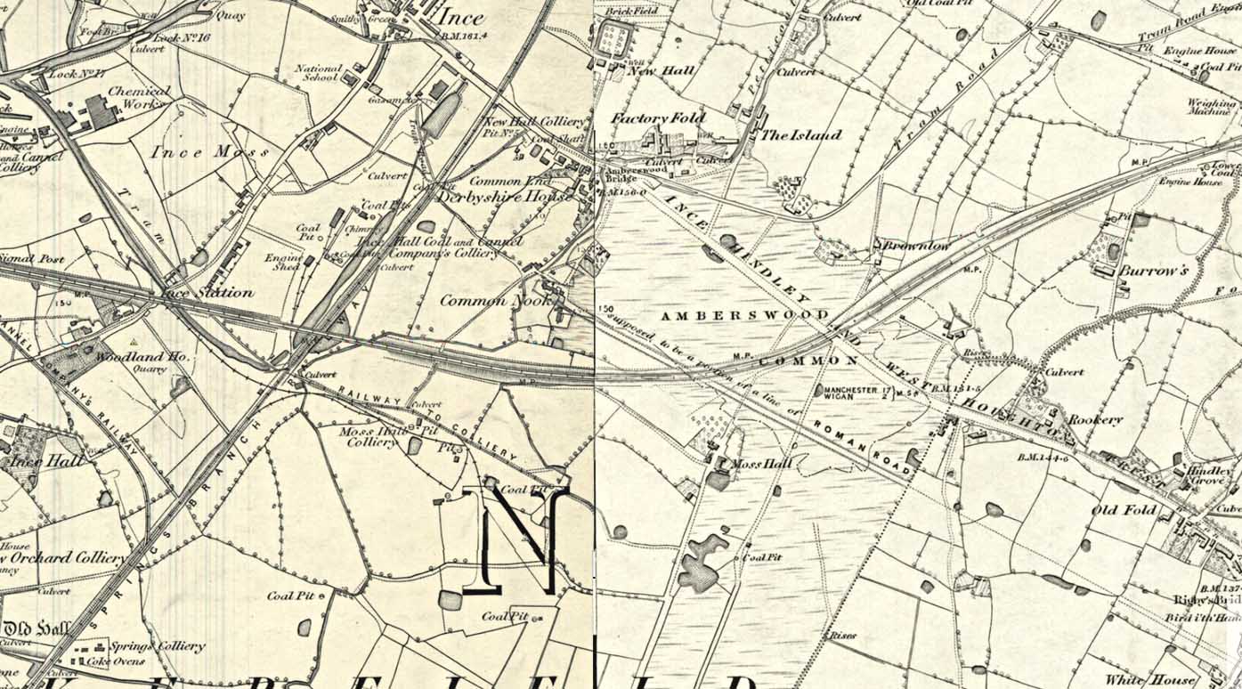
OS First Edition Map - Amberswood Common The famous stretch across Amberswood Common that is sadly no more. Colliery workings have taken its toll and the former best surviving length of agger in Watkin's day has gone - well apart from the short length in Walmesley Park that is - see below. |
Click for larger view |
 |
Walmesley Park Wigan Archaeological Society, as part of Time Team's Big Dig 2003, excavated 3 trenches across the line and found the road and its side ditches where it crossed Walmesley Park Image: DR |
Click for larger view |
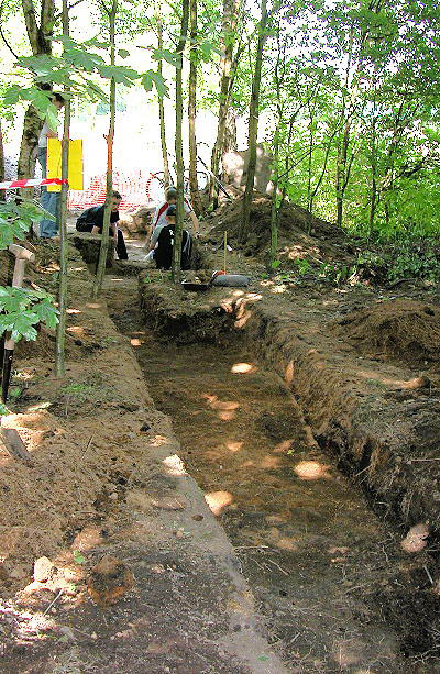 |
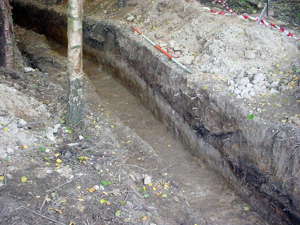
Walmesley Park Close-up a the section through the Roman road. Image: DR |
Click for larger view |
 |
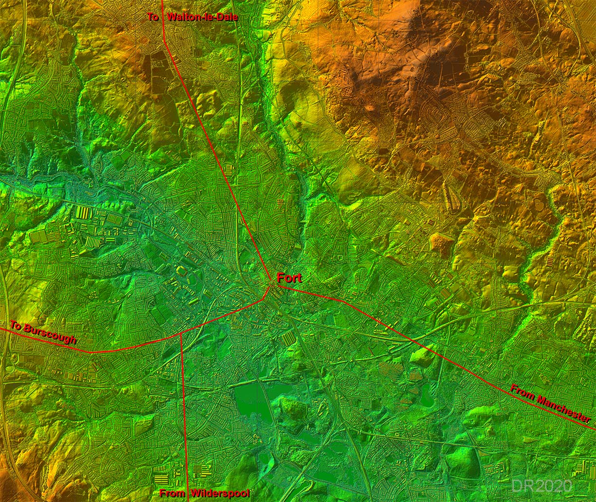
Lidar Image - Roman Roads of Wigan I think at long last we may may getting an accurate map of the Roman roads of Wigan. There is now a logic as to why the road from Wilderspool does not take a short cut into the fort at Wigan - it joins the Burscough road for a common route into the town. The Manchester road we are reliant on Watkin but he does seem to have generally got the route correct. The road to Walton-le-Dale, thanks to Wigan AS and lidar series 2 data, is now also pretty secure.
|
Click for larger view |
 |
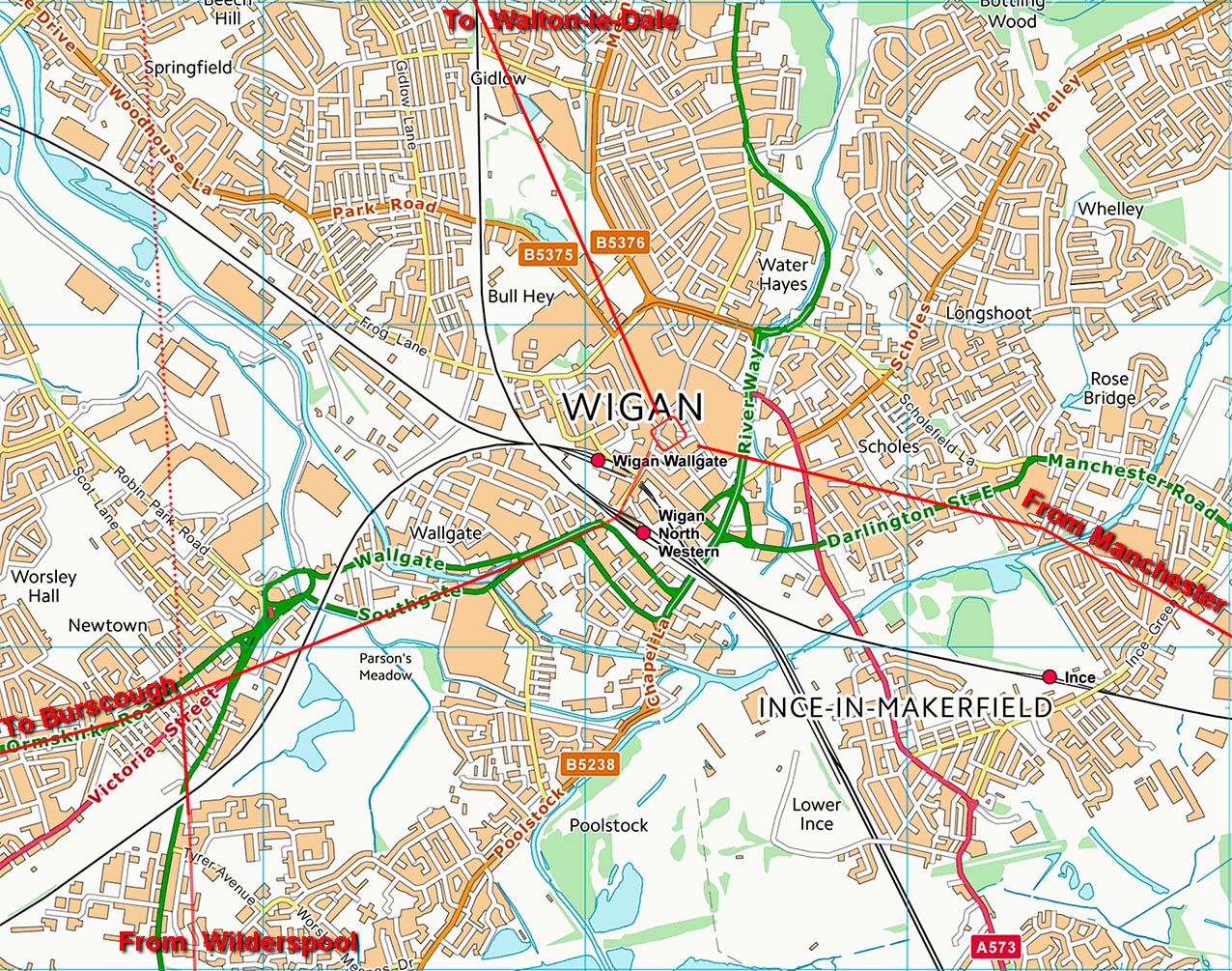
Wigan Map - Roman Roads The above routes transferred to a modern map of Wigan. No trace of a possible direct road to Ribchester is evident - that road is looking increasinly non-existant. For full details of the work Wigan Archaeological Society has done in the the area - see link |
Click for larger view |
 |
|
|
|
Last update: February 2024 |
© David Ratledge |