|
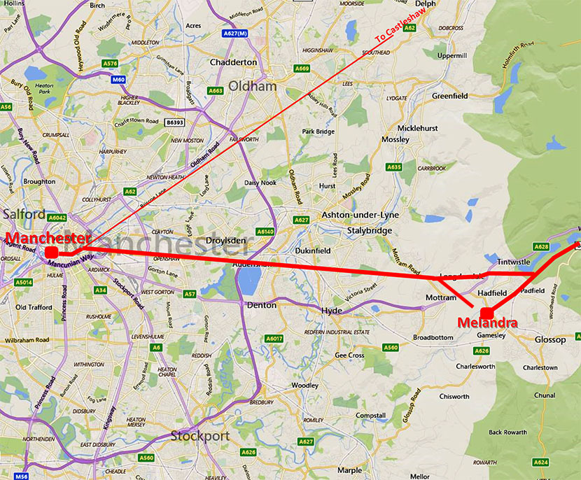
The Roman Road from Manchester to Melandra CastleMargary Number: 711 (Updated number 715x)Distance: 12 milesAt long last the route of this road has been found thanks to Neil Buckley, who spotted a tell-tale length of Roman agger at Matley. This aligns perfectly with Ashton Old Road - a bit of a clue that name - which has enabled the route to be determined with reasonably high confidence. The road was clearly set out on the Longdendale Valley and passes Melandra fort one mile to its north. A road agger was recently discovered in the Longdendale valley so it all fits together. By Bottoms Reservoir, Tintwistle, Lidar shows a clear junction between the main road and almost certainly a link road to the fort. There would have been another link road for Manchester traffic and this has now been located. Until the correct alignment was found there were two or three competing suggestions. The first by Dr. Michael Nevell (reference: Tameside before 1066) who suggested a route just north of Ashton Old Road before heading south-east for Broomstair Bridge. The second is a line shown on modern OS map via Hyde New Road and again via Broomstair Bridge. These can now be safely discounted. The third was by Alan Richardson (Romans in the Manchester Area) who suggested an alignment via Matley Lane to Roe Cross - this turned out to be pretty close. Note 1: Melandra is modern name for the fort and its Roman name was possibly Ardotalia. Note 2: I have used Margary's number 711 for this road but his description of it was very confused and in the light of the discovery that the road headed further east it has now been renumbered by the RRRA as 715x. |
Historic Counties: Lancashire, Cheshire & Derbyshire Current County: Greater Manchester & Derbyshire HER: Greater Manchester & Derbyshire
|
|
|
|
|
|
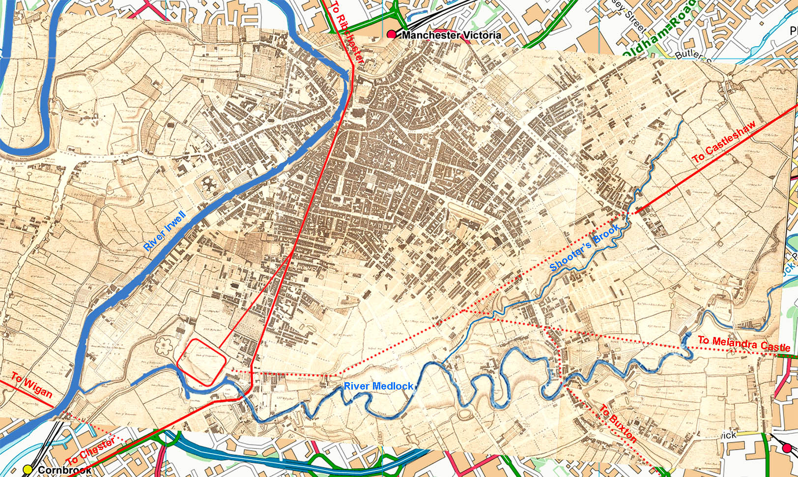
Manchester Roman Road Map - Green's Map 1787-94 The courses of the Melandra Road and those to Castleshaw and Buxton are somewhat speculative in city centre Manchester. What we are reasonably secure on is the alignment of both the Castleshaw Road and that to Melandra. Projecting these into Manchester then a reasonable guess can be made at where they joined up - a little to the north of the UMIST main building. This does fit logically with the courses of the River Medlock and Shooter's Brook.The latter does still exist as an underground culvert. However, routes in city centre Manchester should be regarded as speculative. |
Click for larger view
|
 |
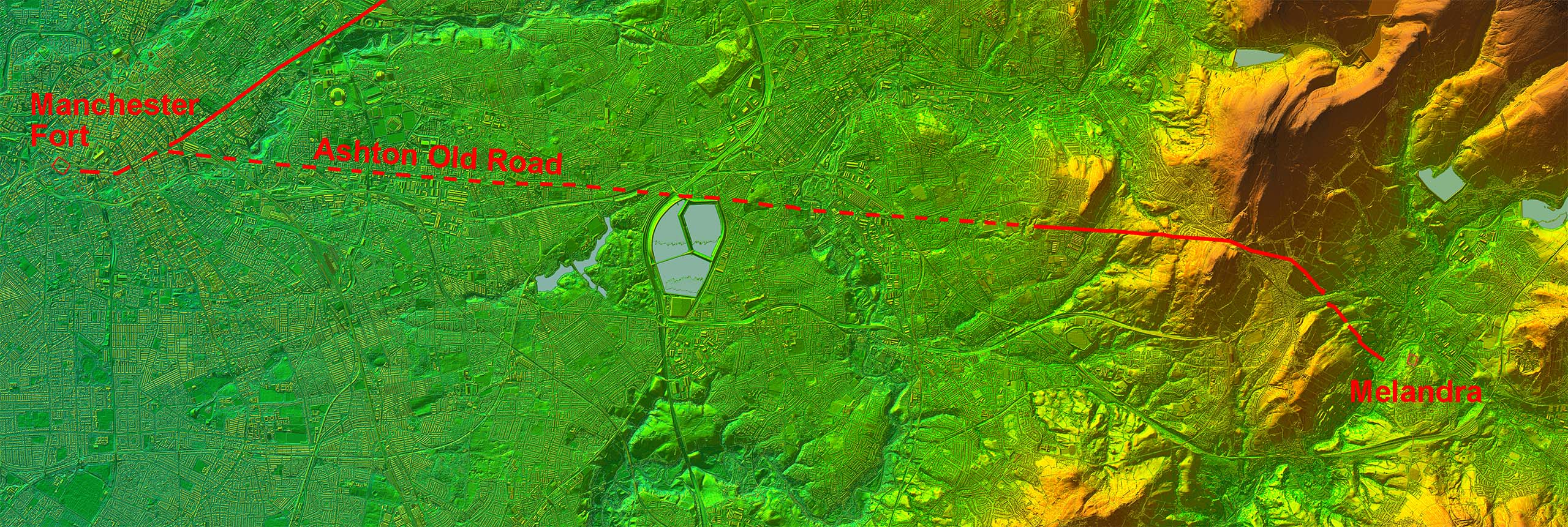
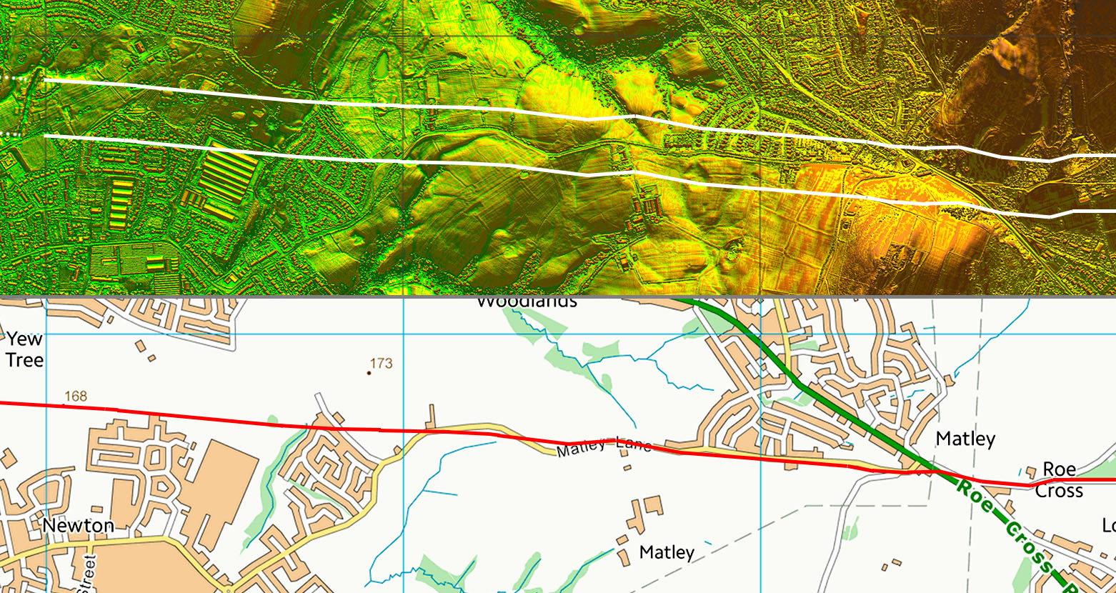
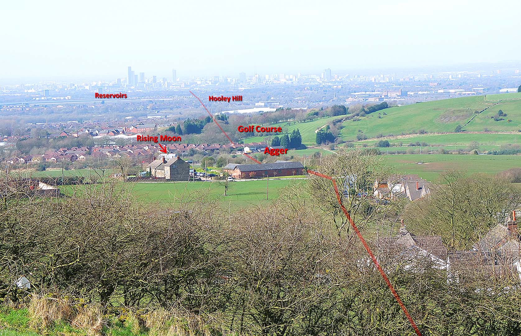
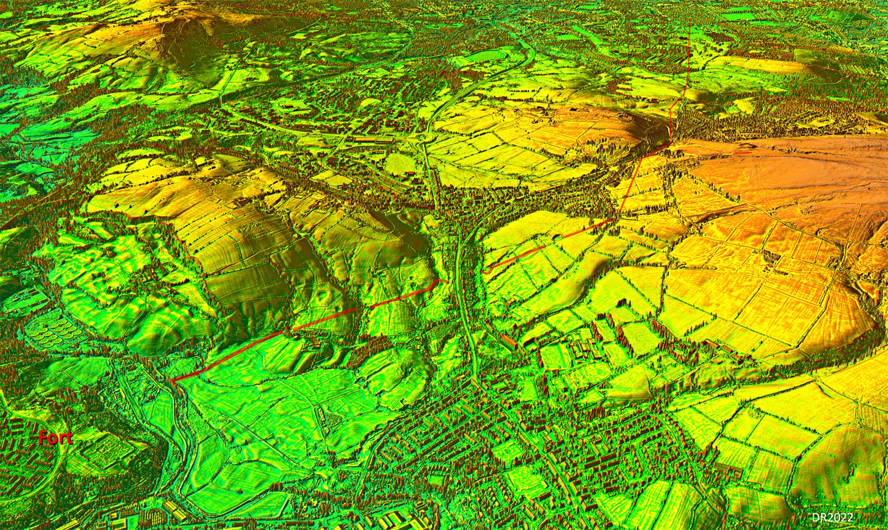
Full Route - Lidar Image What a straight forward and direct route but it was clearly targeting the Longdendale Valley rather than Melandra Fort as it passes it a mile to its north. This is however, not a unique occurrence and indicates a through route to somewhere in Yorkshire (as yet unknown) was the primary destination. The road made use of a natural gap in the hills at Roe Cross - typical Roman surveying. |
Click for larger view |
 |
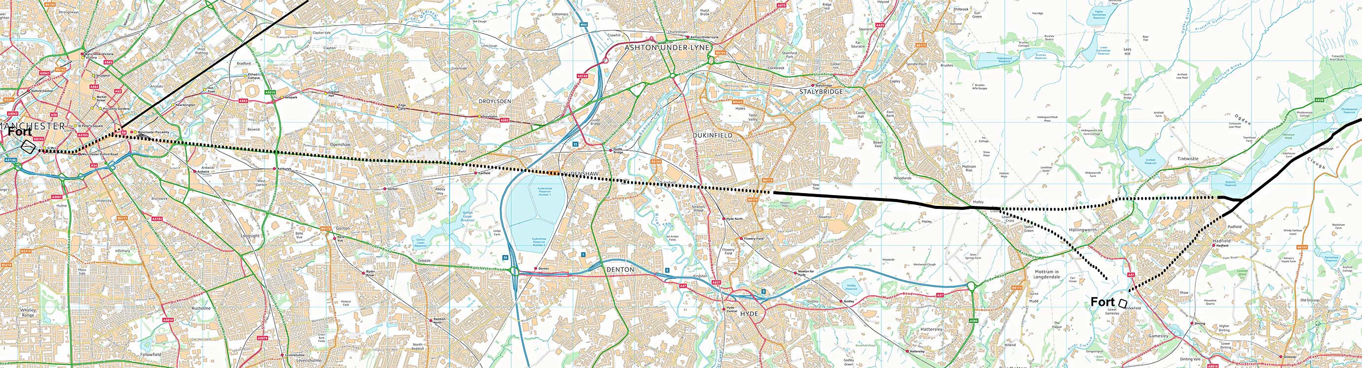
Full Route - Opendata Map Yes quite a bit of the route is dotted but I think we can be reasonably confident as to its course. There are suggestions that its course was north of Ashton Old Road but old maps show the field boundaries consistent with the modern road and not an alternative on its north side. The fact that Ashton Old Road perfectly aligns with the aggers at Matley Lane confirms it was the original Roman road. |
Click for larger view |
 |
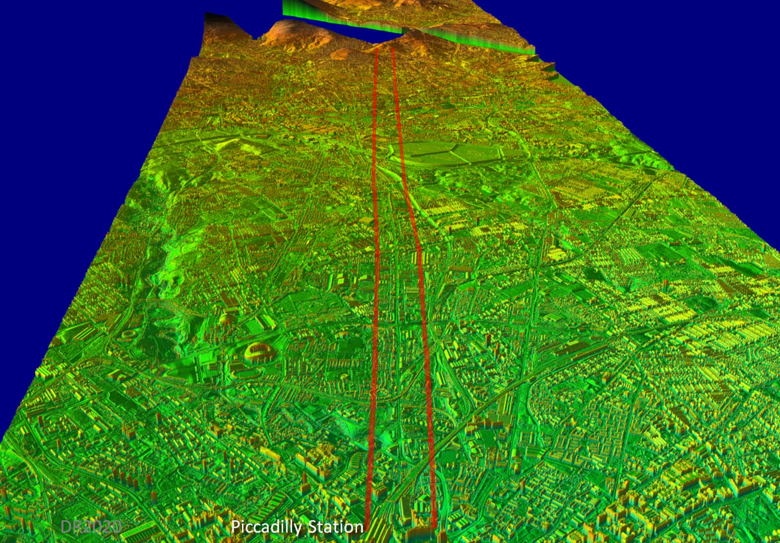
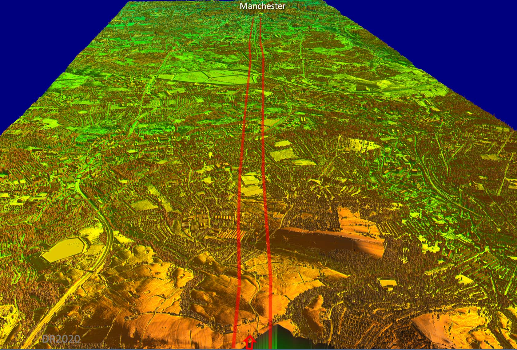
Oblique 3D Lidar Image - looking east We are above Piccadilly Railway Station looking east towards the Longdendale Valley. Ashton Old Road, despite being improved in the turnpike era, is almost certainly based on the original Roman alignment. |
Click for larger view |
 |
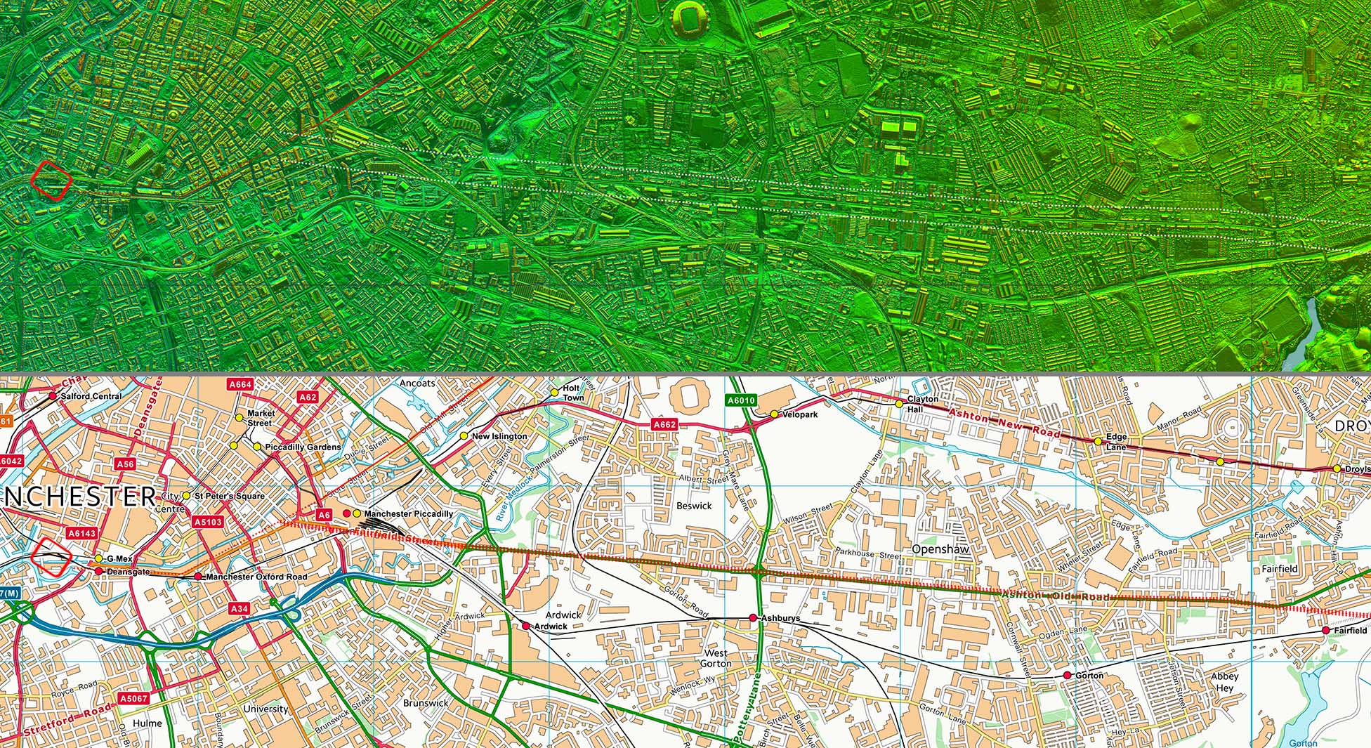
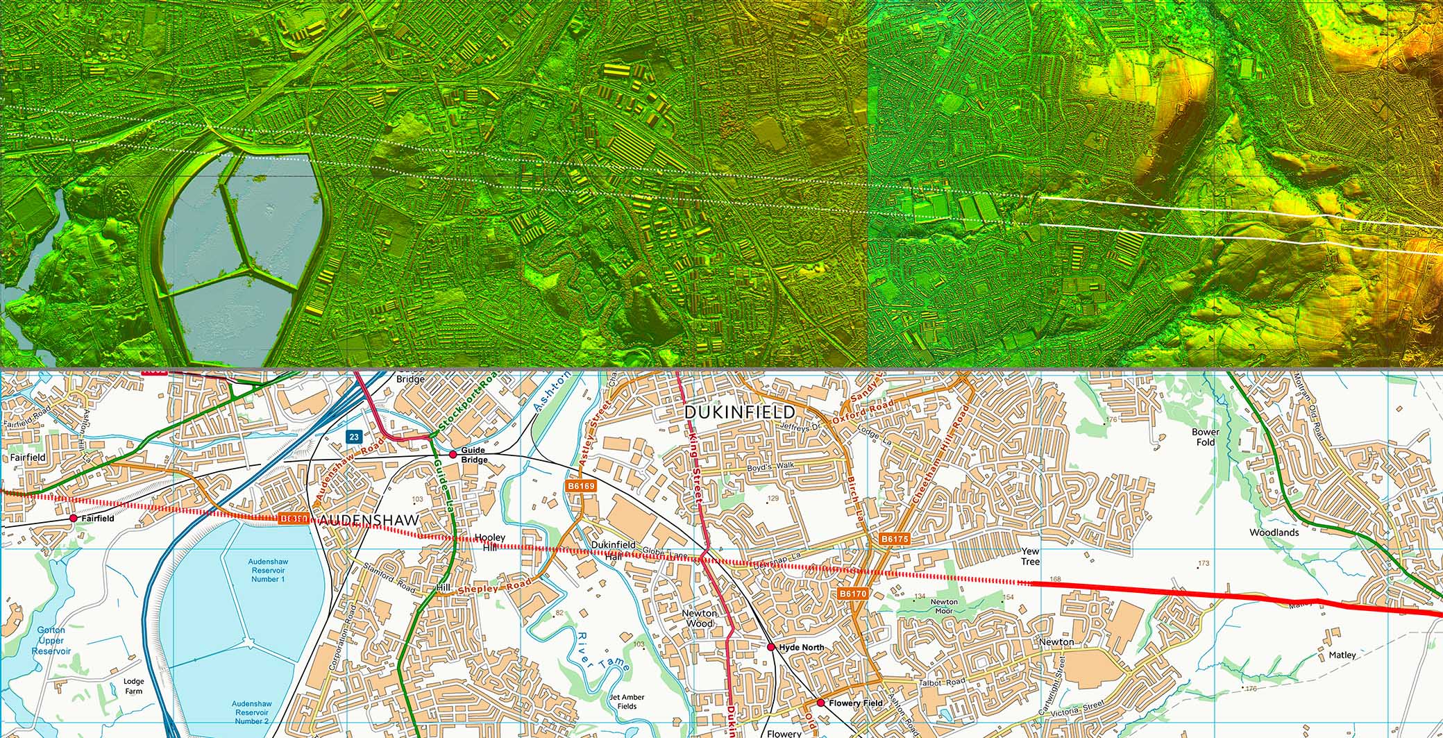
Route Map 1 - Lidar & Opendata map There doesn't really seem any reason to doubt that Ashton Old Road is not derived from the Roman alignment. That subtle turn at Fairfield aligns with an old length of road in Audenshaw, now altered by the northern end of the reservoirs. That cannot be a coincidence. |
Click for larger view |
 |
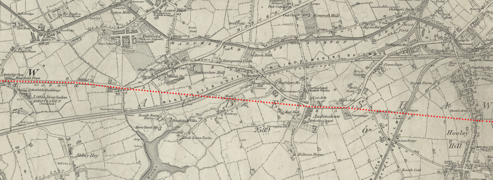
OS First Edition Map Lancashire 105 This map dates to pre the reservoirs and shows how that slight turn at the end of Aston Old Road aligns with a stretch of road through Audenshaw and over Hooley Hill to Matley. Hooley Hill would have been a good sighting point for the alignment and making use of it would be a typical surveying technique of the Romans. |
Click for larger view |
 |
Route Map 2 - Lidar & Opendata map That old road in Audenshaw was perfectly aligned with the agger at Matley spotted by Neil Buckley. With modern developments in between there is slim hope of finding anything surviving today. |
Click for larger view |
 |
Oblique 3D Lidar Image - looking west We are now above Matley looking back towards Manchester. The alignment with Ashton Old Road is obvious. |
Click for larger view |
 |
Lidar Image, Matley (high resolution) This is the agger that Neil spotted and changed everything! The line even appears to continue on the aerial photo, where the Lidar data currently ends. |
Click for larger view |
 |
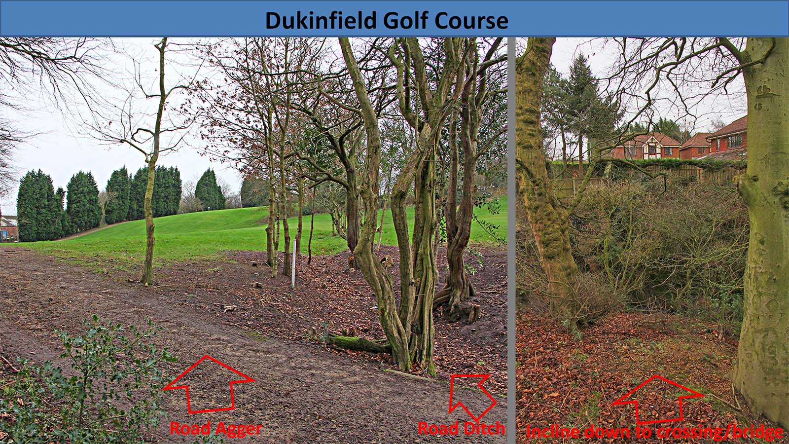
Dukinfield Golf Course Lidar shows a short length of agger on the edge of the golf course - see above. In these views we are in the same spot. Left is looking towards Manchester and right is looking east. Left: the agger and north ditch has survived despite golf course landscaping. Right; the road inclines down to almost certainly a bridge site for crossing the stream. There are even masonry blocks in the stream at the bottom of the incline but nowhere else - possibly remnants of the Roman bridge? Image: DR |
Click for larger view |
 |
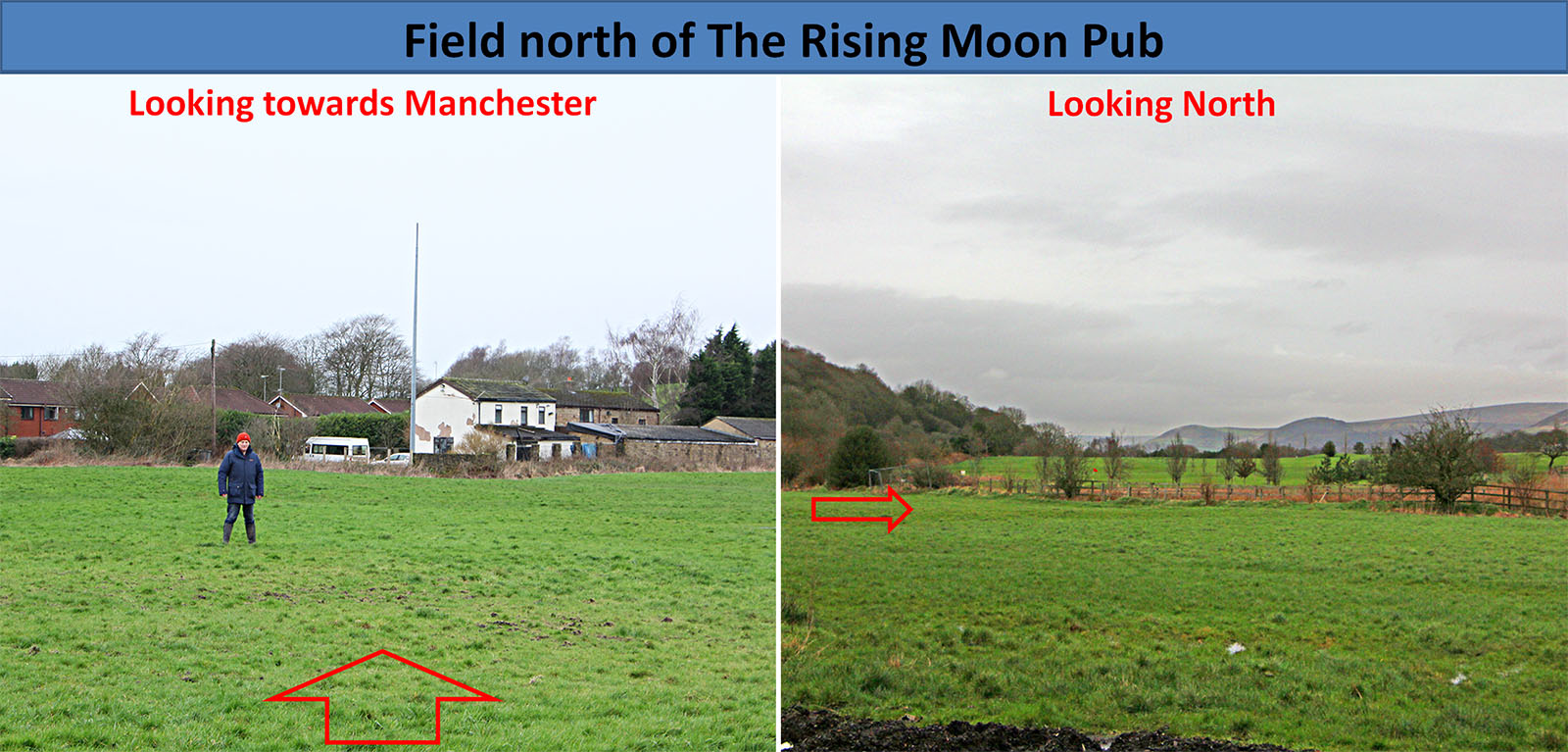
Agger north of Matley Lane 1 Near the Rising Moon pub the agger is visible north of Matley Lane (right). Obvious from this distance but when you stand on it then it all but disappears! In the left image we are stood on the line looking back towards Dukinfield Golf Course & Manchester. Neil (the discoverer of the agger here) is perhaps on the line of the south ditch. Image: DR |
Click for larger view |
 |
Agger north of Matley Lane 2 This is the field east of the one above. The agger is most obvious on the fence line - the fence actually humps over the road. The alignment of the road is aiming to get through the natural valley between Scout Moor and Harrop Edge. Image: DR |
Click for larger view |
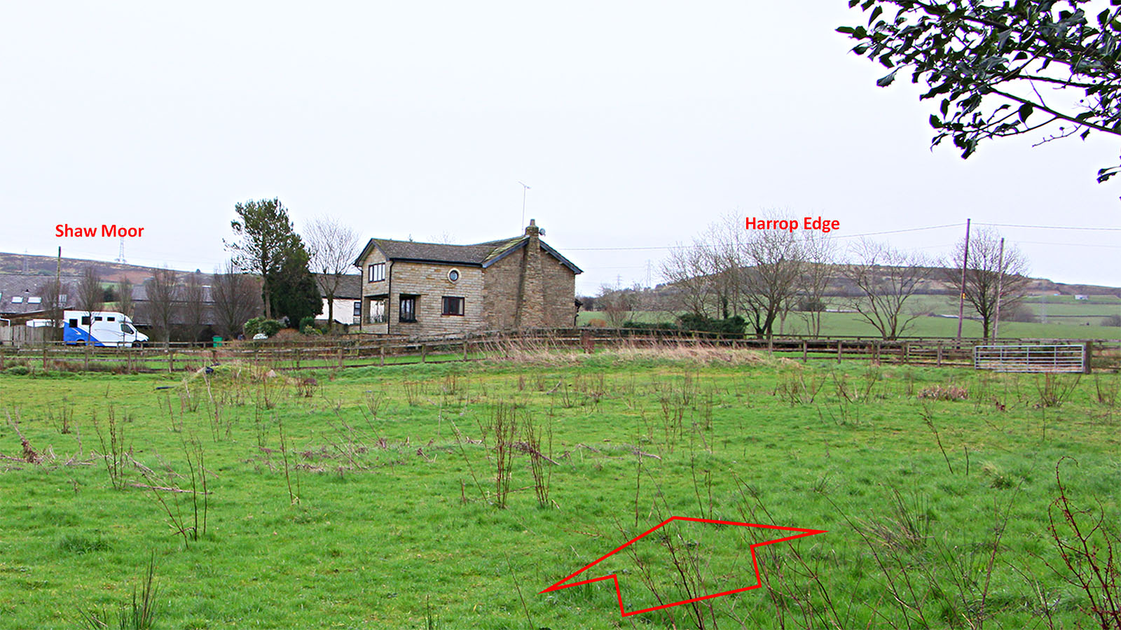 |
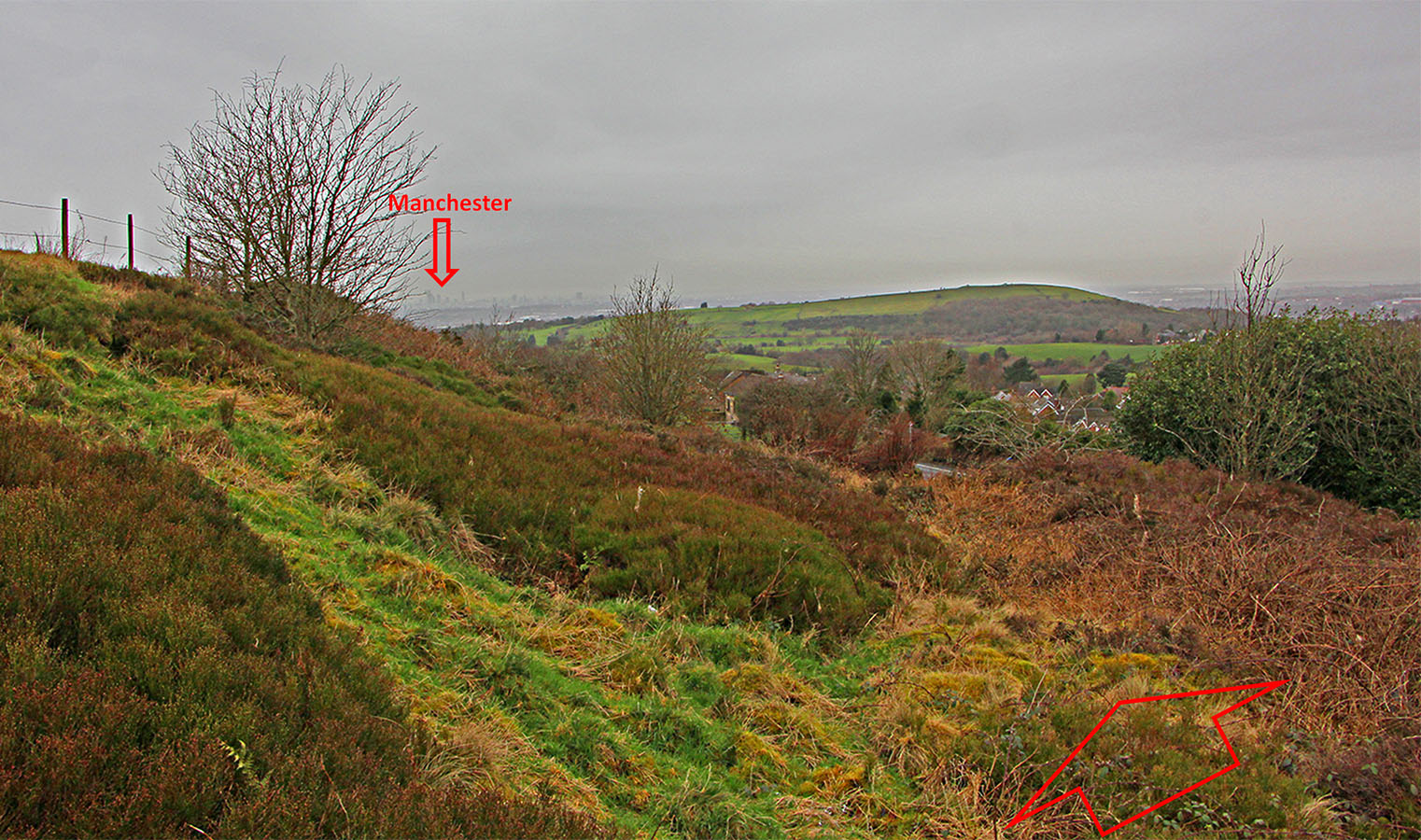
Harrop Edge view to Manchester This spot could have been one of the setting-out points for the road but perhaps the high point on the Golf Course was an alternative. From either the sighting would probably have been to Hooley Hill. The latter is just visible before the reservoirs at Audenshaw. The cutting in the next image is behind the camera in this view. Image: Neil Buckley |
Click for larger view |
 |
Roman Cutting - between Harrop Edge Road & Matley Lane 1 The initial start of Harrop Edge Road appears to mark the Roman line. However, just up the slope there is on older cutting to the right (north) of the modern road which is almost certainly the Roman alignment. Matley Road is in a modern post-Roman much deeper cutting to the right. The skyscrapers of Manchester mark the route of the road. Image: DR |
Click for larger view |
 |
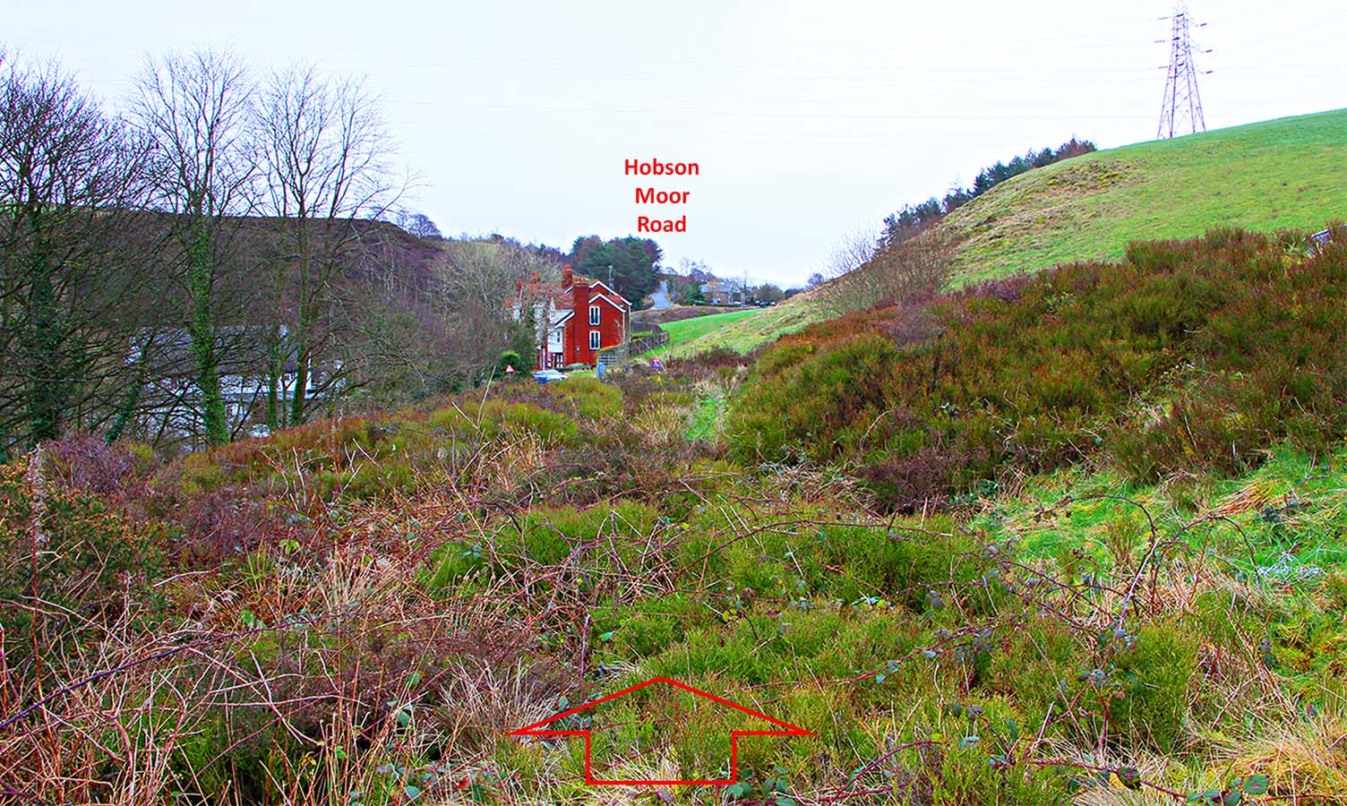
Roman Cutting - Harrop Edge looking east We are still in the Roman cutting but now looking east. The route would have been left of the red house and up Hobson Moor Road. It would then have turned off to the right roughly near the skyline. Image: DR |
Click for larger view |
 |
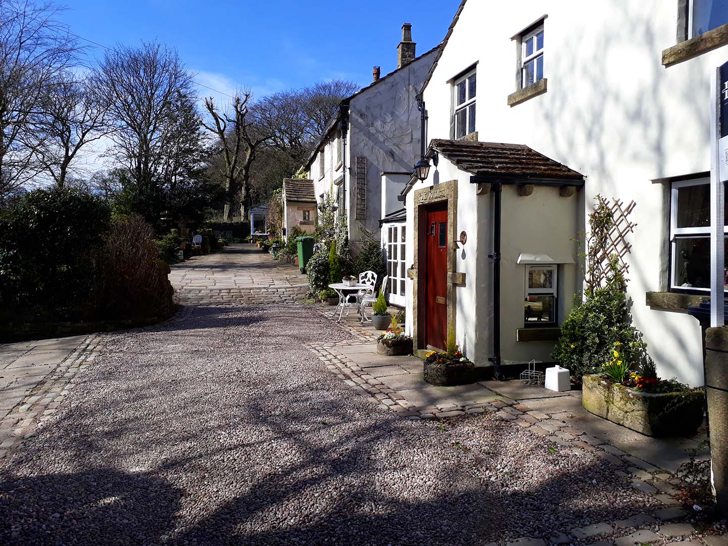
Rabbit Lane Cottages Just beyond Roe Cross, the link road to Melandra Castle likely turned off to the fort but the main alignment probably carried straight on in front of Rabbit Lane Cottages. Image: Neil Buckley |
Click for larger view |
 |
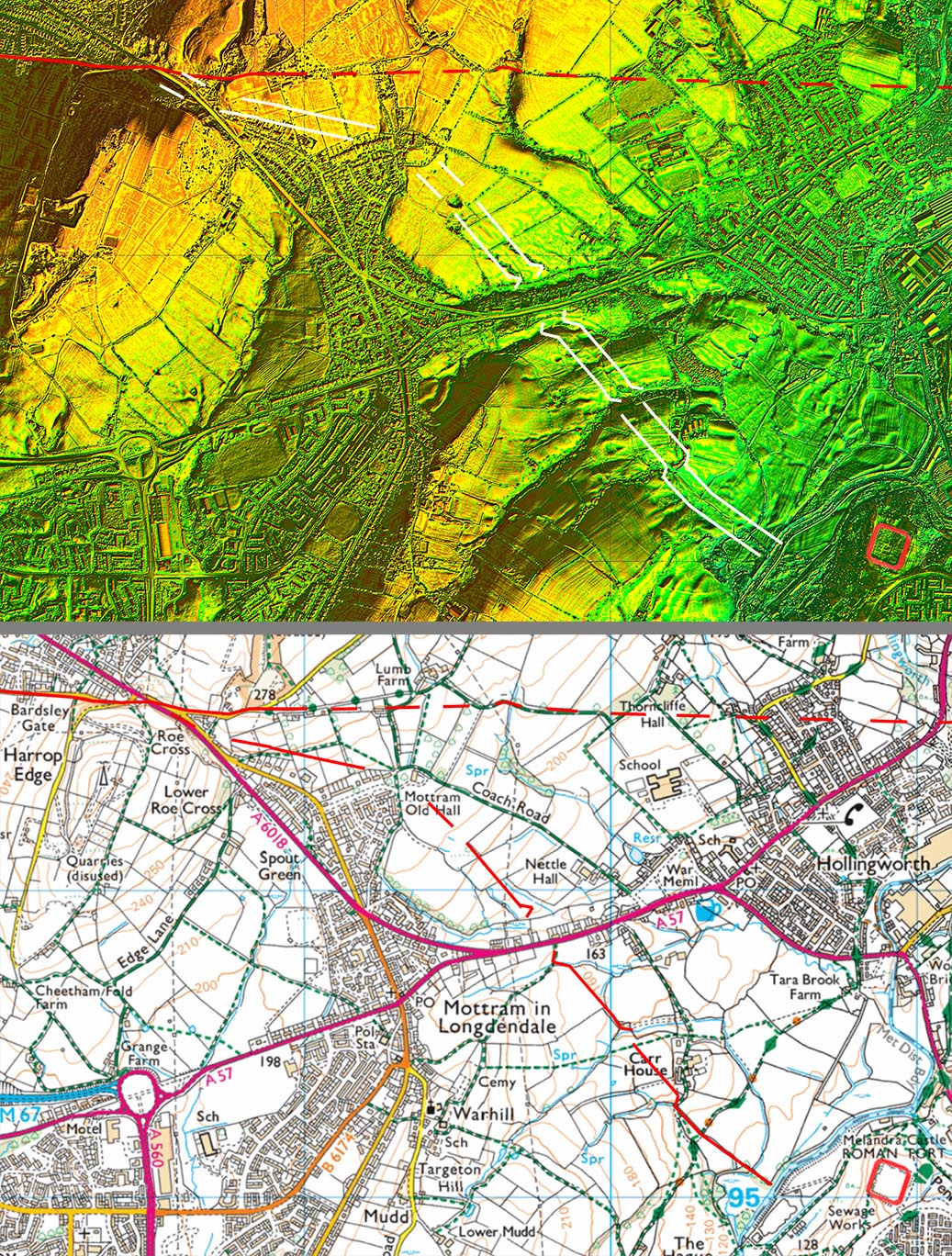
3D Oblique Lidar Image - Link Road to the Fort The road from Manchester was aligned around one mile north of Melandra fort and as we now know was heading on through the Longdendale Valley and into Yorkshire. Clearly a link road to the fort would have been needed. Thanks to Neil Buckley spotting the likely road heading from Roe Cross towards Mottram Old Hall, we have been able to complete the probable link road to the fort. |
Click for larger view |
 |
Melandra link roads - Lidar & Opendata map The fact that the alignments either side of the A57 road line through is strong evidence that this is the correct course for the road. The zig-zags are also typical of Roman engineering. The River Etherow is likely to have altered course over the centuries so the exact crossing point is uncertain |
Click for larger view |
 |
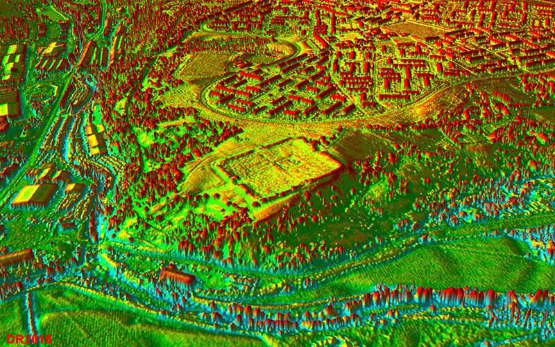
3D Oblique Lidar Image - Melandra Castle Viewed from the north, the fort shows up extremely well but it would appear in the recent past that there has been "remodeling" so perhaps not quite original. Visible is a road heading left (north-east) for the Longdendale Valley - almost certainly the link road to the east. For details of the fort site see - Glossop Heritage Trust |
Click for larger view |
 |
Longdendale Valley We are now in Derbyshire so will leave our road here. It was clearly aiming for somewhere in Yorkshire - details of its likely destination see link |
|
|
|
Last update: May 2022 |
© David Ratledge |