|
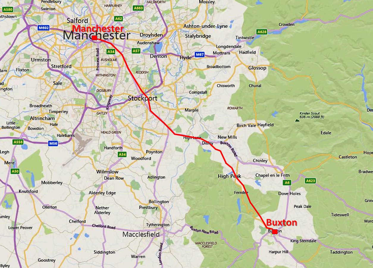
The Roman Road from Manchester to BuxtonMargary Number: 71bDistance: 23 milesWhilst the general course of this route is not in doubt pinning down its precise position especially between Manchester and Hazell Grove has proved difficult. For once historic records are very minimal and the street names at Heaton Norris and the crossing of the Mersey at Stop Ford are about the the only reliable clues. Nevertheless putting the few records together and consulting various old maps a logical route can be surmised with a degree of confidence. It does at least look like a plausible Roman alignment. Beyond Hazell Grove and into more open country then we are on much firmer ground. My thanks are due to Neil Buckley for his local knowledge and input into this page. Note: Given the length of this road an intermediate fort would to have been expected, possibly around High Lane. For a set of detailed route maps see the bottom of this page. |
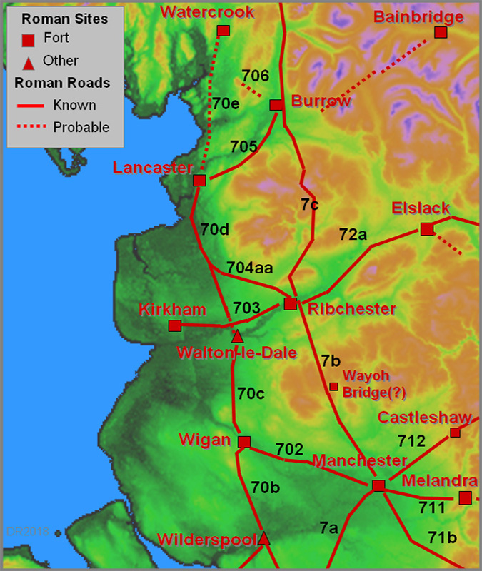
Historic Counties: Lancashire, Cheshire & Derbyshire Current Counties: Greater Manchester & Derbyshire HER: Greater Manchester, Derbyshire & Peak District National Park
|
|
|
|
|
|
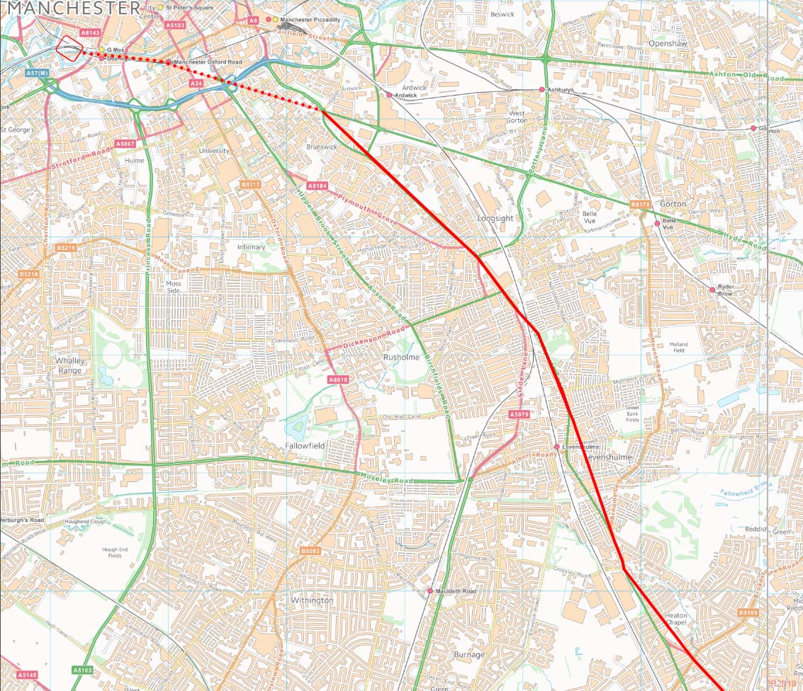
Manchester Roman Road Map - Green's Map 1787-94 From the fort the Roman road to Buxton would almost certainly shared the first part of its route with that of the road to Castleshaw and Melandra. The direction of the road coming in from Stockport would suggest it crossed the Medlock at or very near where Ardwick Bridge now lies. However, routes in city centre Manchester should be regarded as speculative.
|
Click for larger view
|
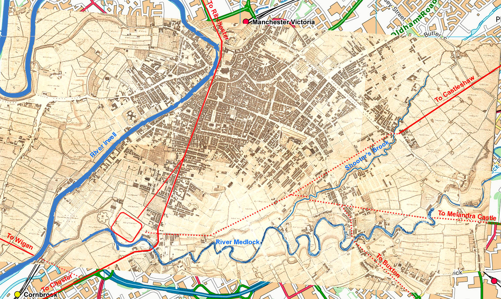 |
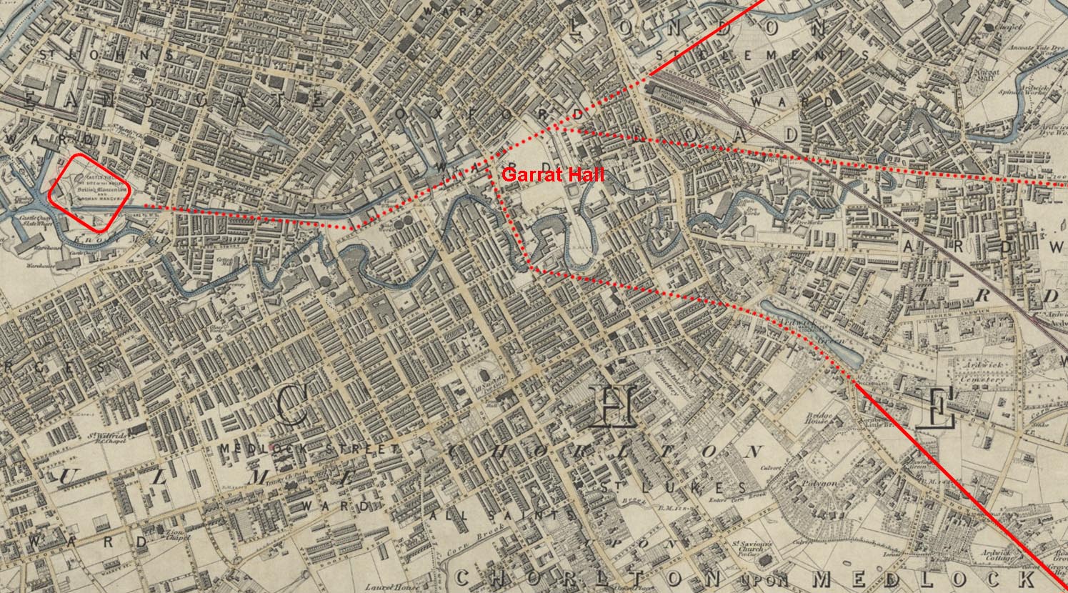
OS First Edition Map 104 - Garrat Hall Option Watkin quotes Whitaker as suggesting the Buxton Road after leaving the fort then turned off at Garrat Hall. This would suggest a crossing of the Medlock on Brook Street. Possible but not very direct so perhaps not convincing. The Ancoats route looks much more likely.
|
Click for larger view |
 |
OS First Edition Map - Longsight We are reliant on OS 1-inch first edition maps to plot the road's course through the suburbs of Manchester. Two clues are given as to its course visible on this extract. All we can realistically do is join them up.
|
Click for larger view |
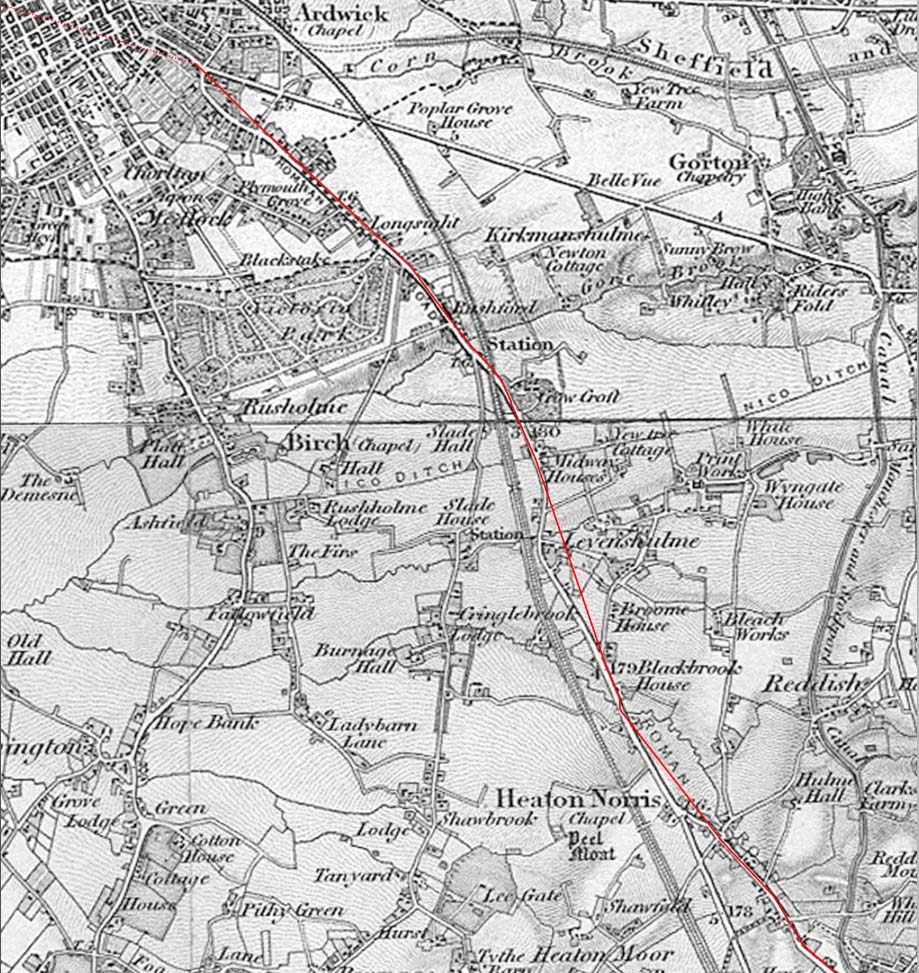 |
OS First Edition Map - Levenshulme to Heaton Norris Perhaps the best clue on the section to Stockport occurs at Heaton Norris. Stockport Road through Heaton Norris was formerly called High Street, Streethouse Lane and Streethouses (ref: Crofton, 1905 Transactions of Lancs. & Cheshire Antiquarian Society, published 1906). |
Click for larger view |
 |
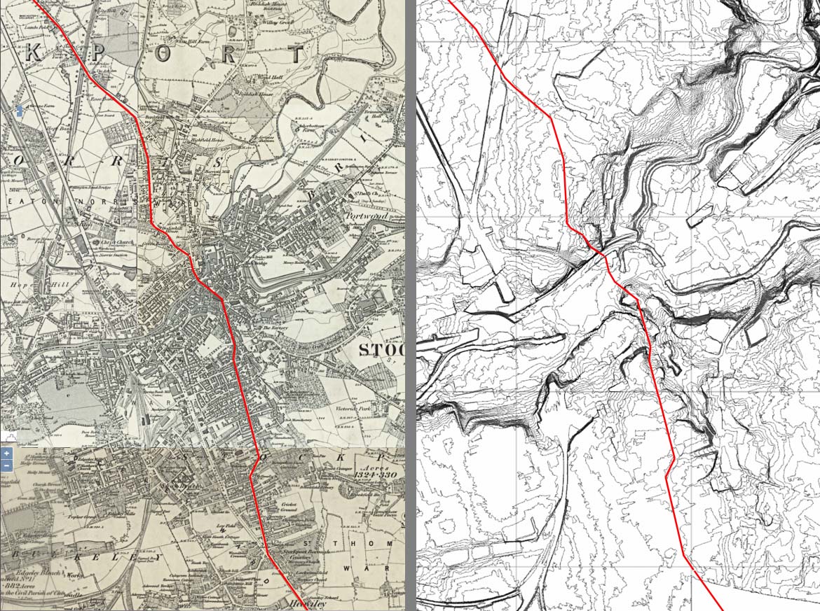
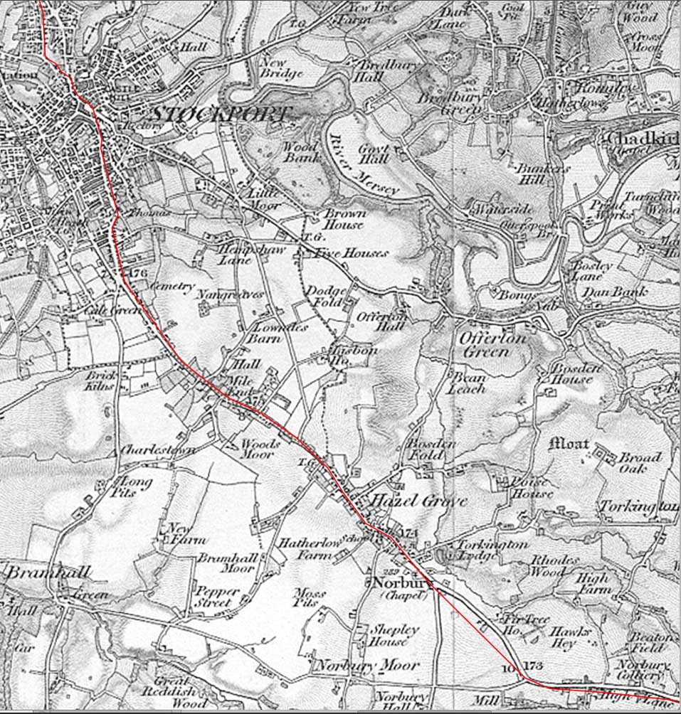
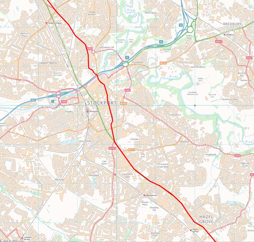
OS First Edition 6-inch Mpa & Contour Map - Stockport The modern A6 looks very straight and convincing but is not the original line - it is a turnpike. The ancient crossing of the Mersey was by way of Stop Ford. This was reached via Old Road to the bottom of Lancashire Hill. On the Stockport (old Cheshire side) then Bridge Street and the Hillgates would look to be its probable course Lidar is of limited use in such an urban area so a switch to a contour map was employed here. This is very much a "suggested" route based on the site of the old Stop Ford across the River Mersey. In the Roman era it would more than likely have been a bridge. |
Click for larger view |
 |
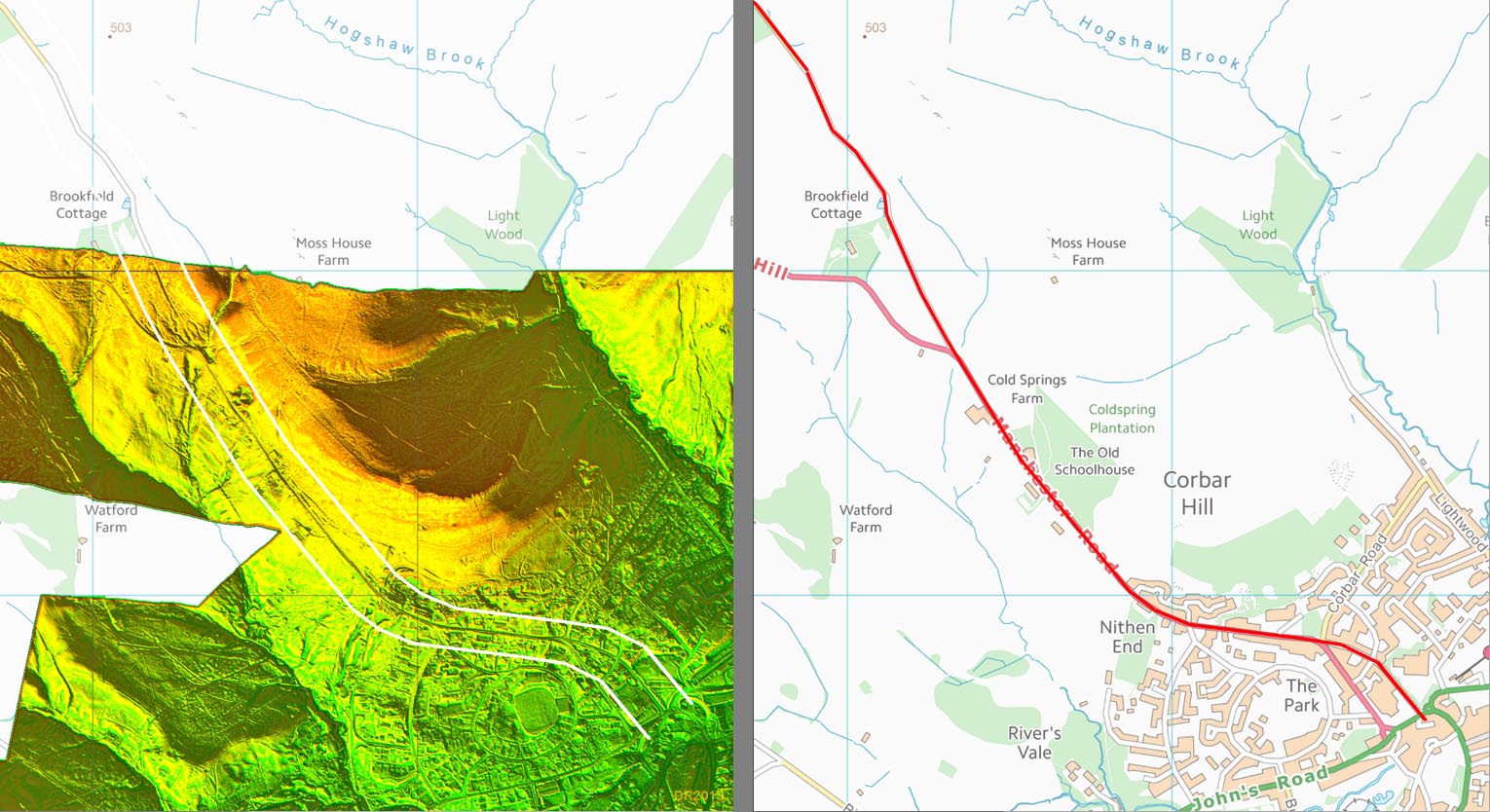
OS First Edition 1-inch Map - Stockport to Hazel Grove No clues this time on the OS map but Neil Buckley suggested that Hillgate as the most likely route - there's no substitute for local knowledge. As the contour map above shows this is probably a logical route as any and perhaps the name itself is suggestive of an old route. The turn for High Lane would have been at or very near to Mill Lane. Note: it has often been suggested that the Roman line could have followed the A626 to Offerton Green and headed straight to High Lane - the GM HER even has this route option. But. I have searched the Lidar for this route and there is simply no evidence for it. The Hazel Grove route is still the best candidate. |
Click for larger view |
 |
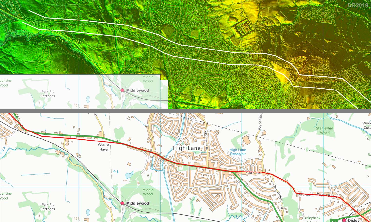
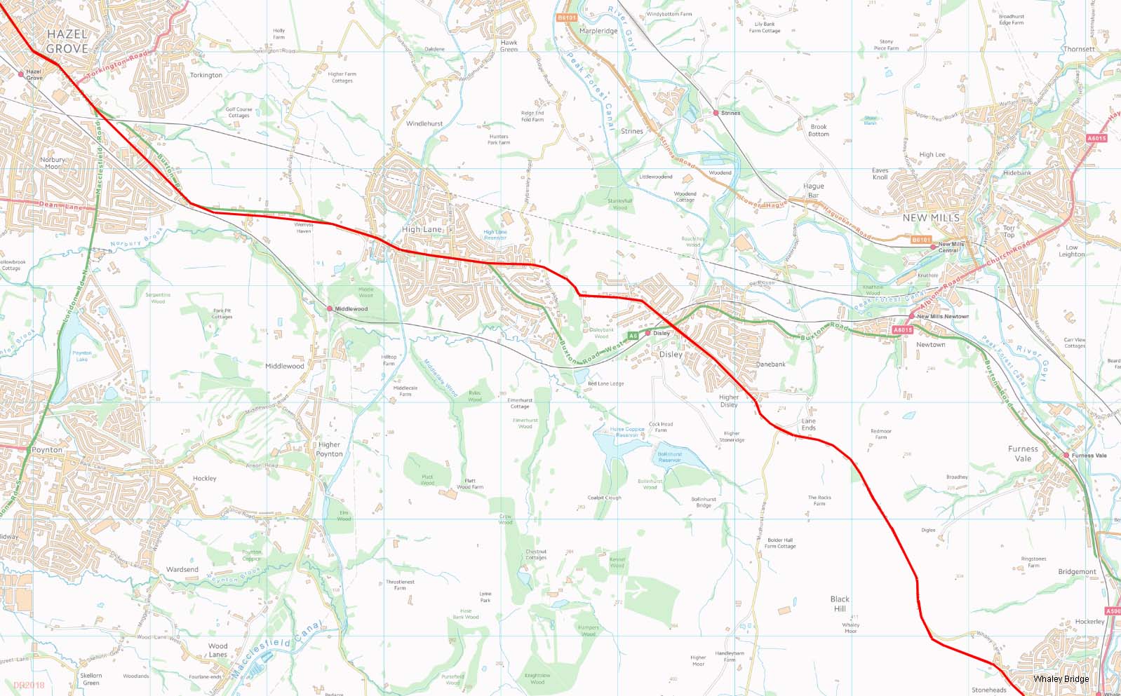
Lidar Image & Route Map We hit some open country at last and can start to make some use of the Lidar data. The Roman road appears to be south of the modern Buxton Road A6 approaching the former High Lane Station. Beyond High Lane the Roman line is up Carr Brow to Jackson Edge Lane. The top of the hill is about half way between Buxton and Manchester and would be an ideal spot for a small intermediate fort. Unfortunately quarrying and a reservoir have probably removed any trace if there were any.
|
Click for larger view |
 |
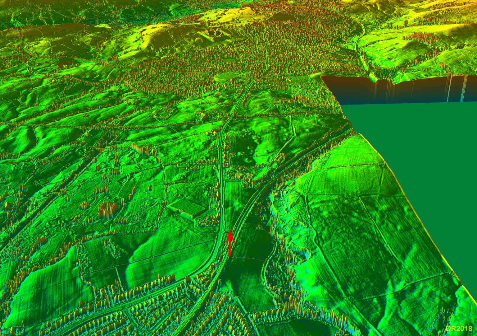
Oblique 3D Lidar View - A6 at High Lane Old Station This is about the only evidence for the Roman road between Stockport and High Lane. Not a lot to go on but it looks a typical agger. Until something better turns up then conventional wisdom that the A6 is on, or close to the Roman line, must still prevail. |
Click for larger view |
 |
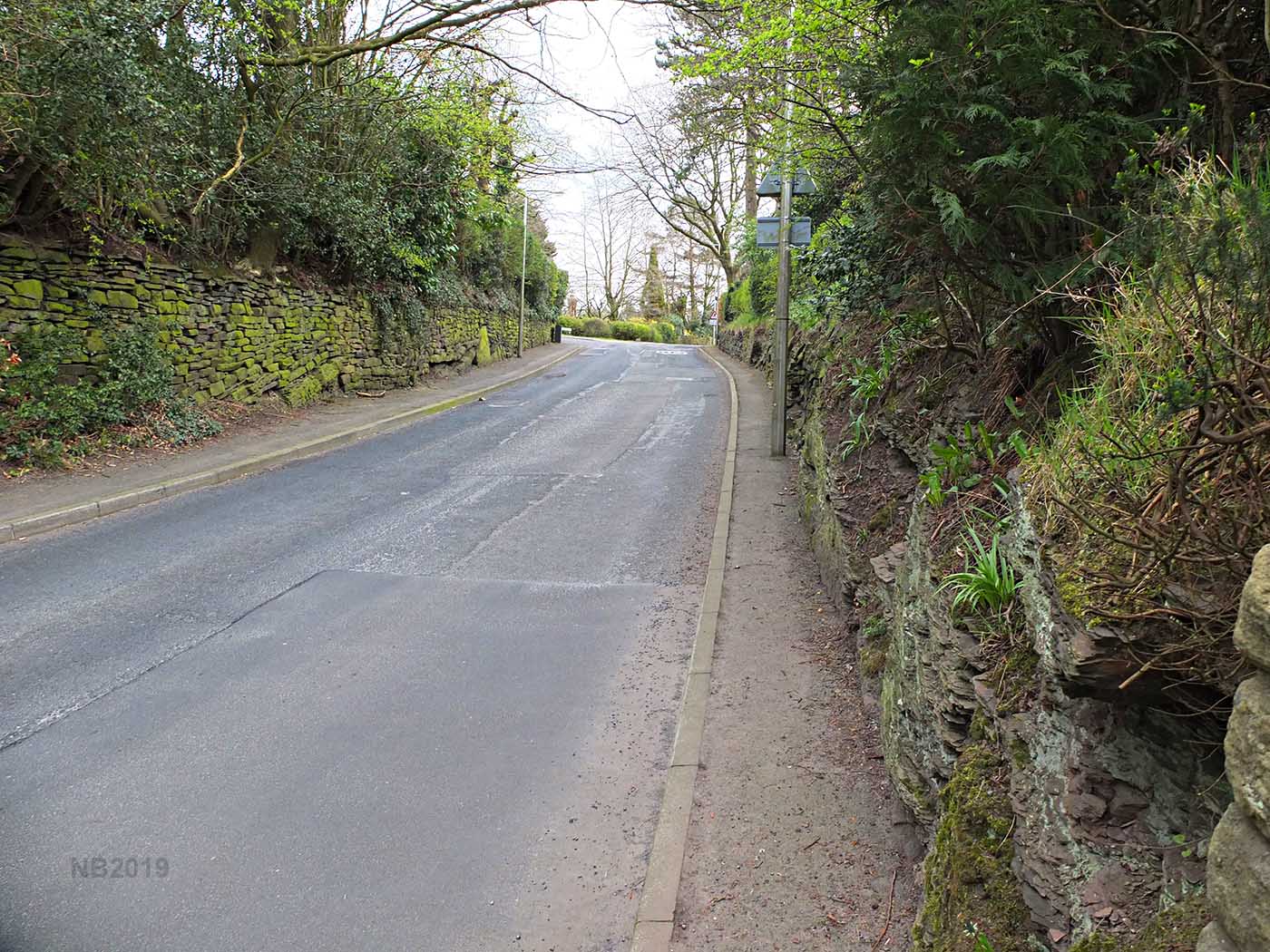
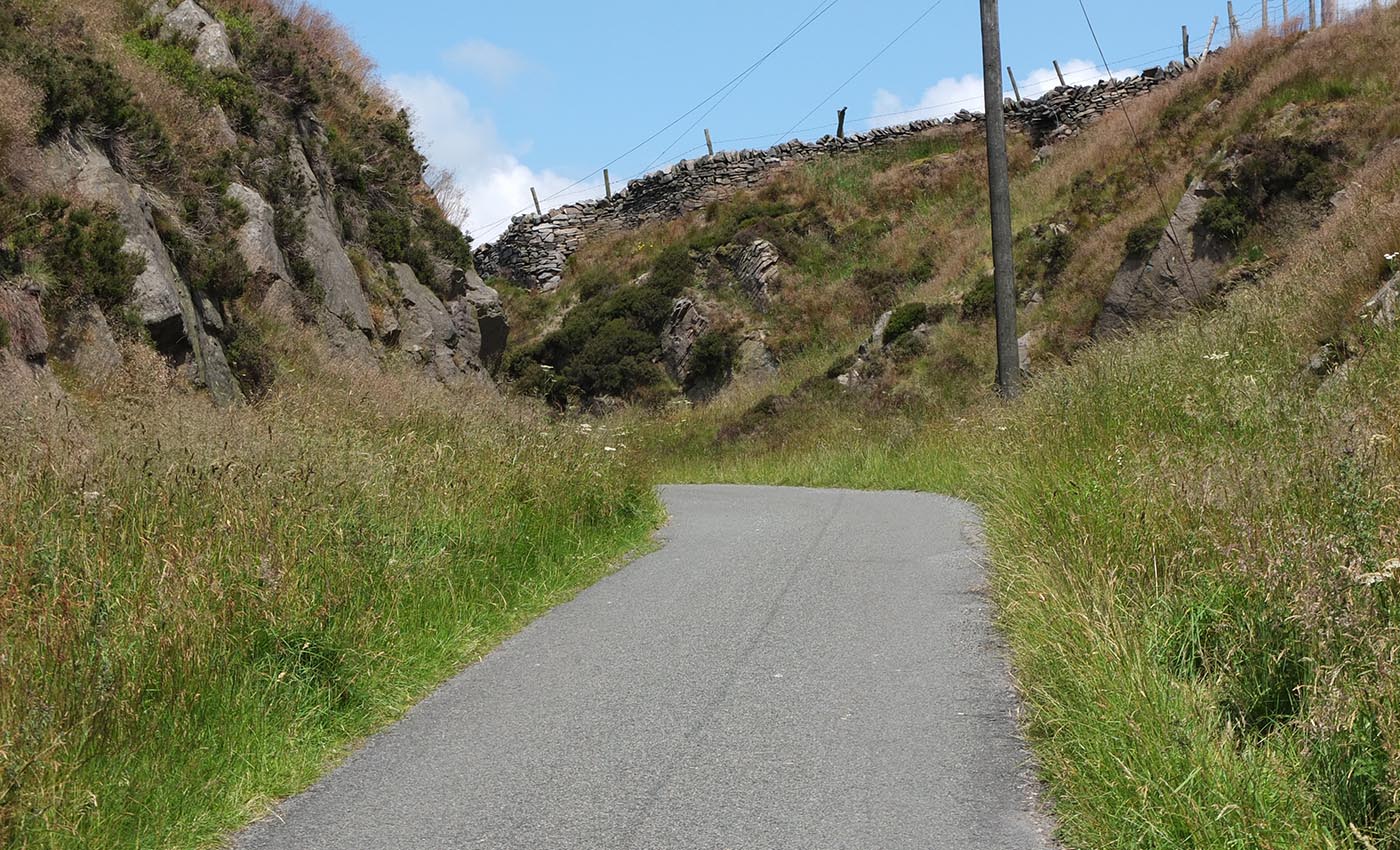
Carr Brow, High Lane The ascent to Jackson's Edge up Carr Brow is via a rock cutting (right). This fixes the line of the road pretty securely here. Whether is was a Roman cutting is difficult to prove now but would be typical of their engineering for easing a gradient. Around 1212AD, there were two charters written transferring the lands of Marple and Wibbersley Manors to and then from Robert de Stockport. These records are quite well known and have been used by historians many times. What seems to have been missed is a clear reference to the manorial border crossing the "Magnum Cheminum" (Great Road) above Wibbersley Hall. Note the Hall is still there in a run down state, now a farm. That great road could only have been a reference to this Roman road - further confirmation that the A6 and then Carr Brow represents the Roman alignment. Thanks are due to Neil Buckley for this research. Image: Neil Buckley |
Click for larger view |
 |
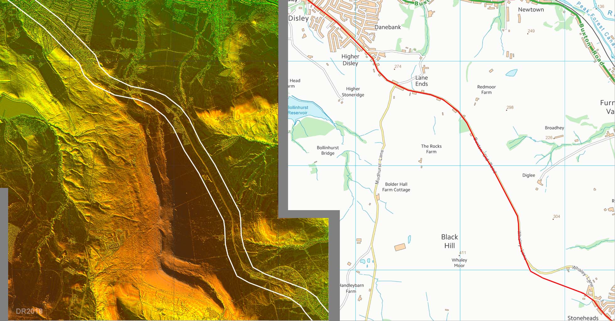
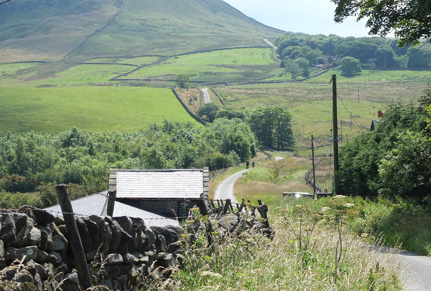
Lidar Image & Route Map After the drop from Jackson Edge Lane down to Disley, our road climbs again following the old road to Whaley Bridge. The old and modern routes coincide most of the way apart from approaching Stoneheads. Here the modern road makes a large curving detour whereas the Roman road carries straight on. |
Click for larger view |
 |
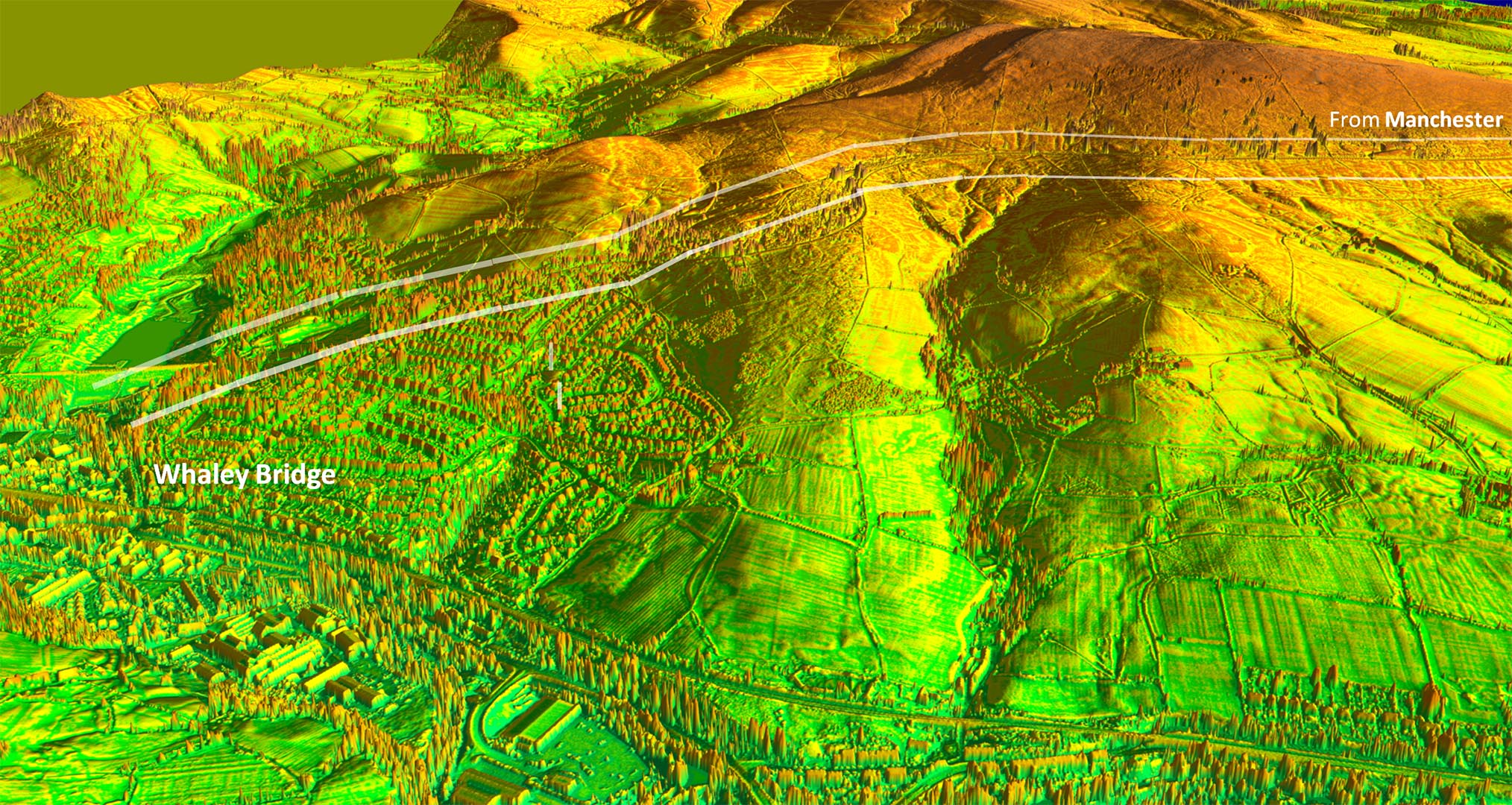
Oblique Lidar Image - Whaley bridge The descent into Whaley Bridge is quite spectacular and would have been very onerous. |
Click for larger view |
 |
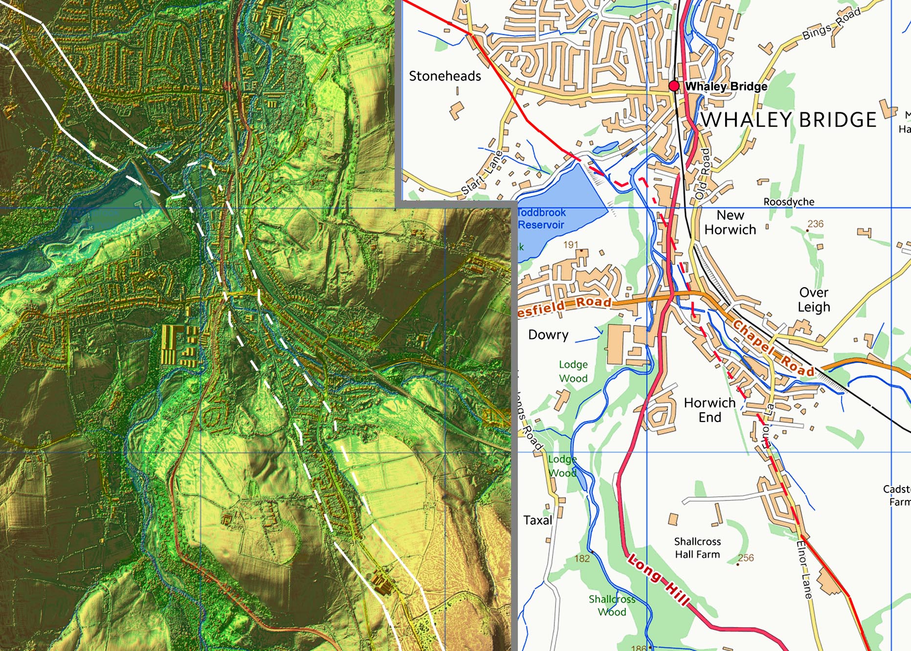
Lidar Image & Route Map - Whaley Bridge The big obstacle at Whaley Bridge is Todd Brook now a reservoir. There are clear signs for the descent (above) but across the town then it is a bit speculative. The various rivers to cross means a straight course was not practical and what is shown is probably close if not exactly correct. |
Click for larger view |
 |
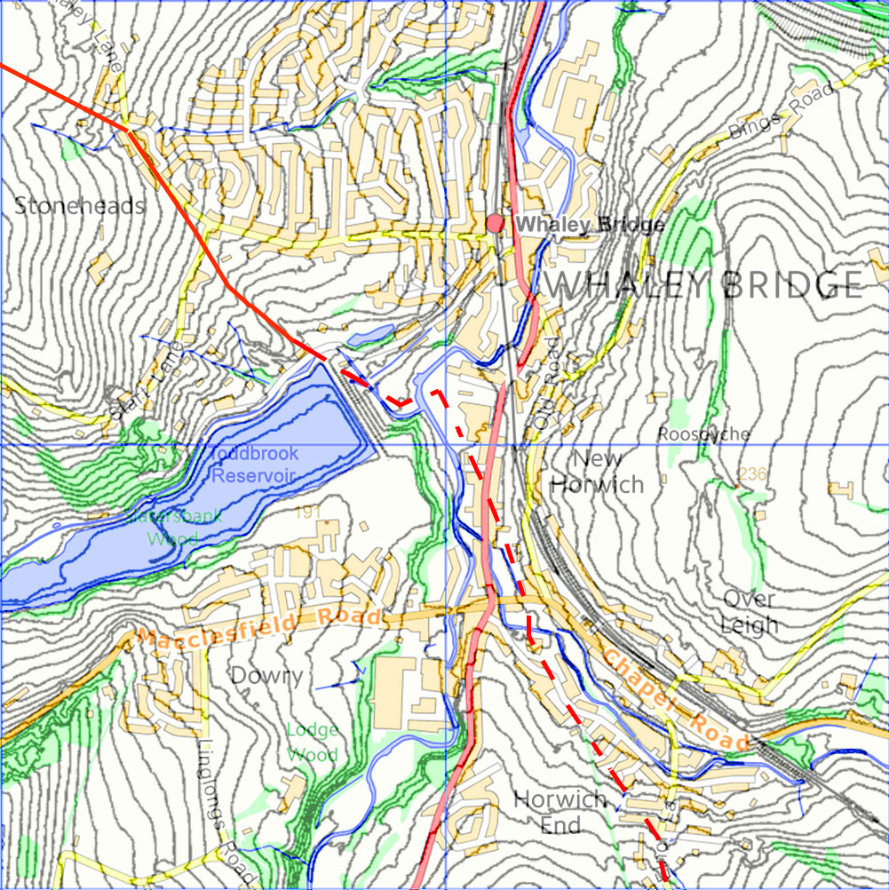
Contour Map Whaley Bridge The contour map for Whaley Bridge was investigated to see if it could give a clue as to the route the Romans were likely to taken. It is mostly determined by the rivers but at the south edge of the town the climb up would probably have angled across the slope as shown. |
Click for larger view |
 |
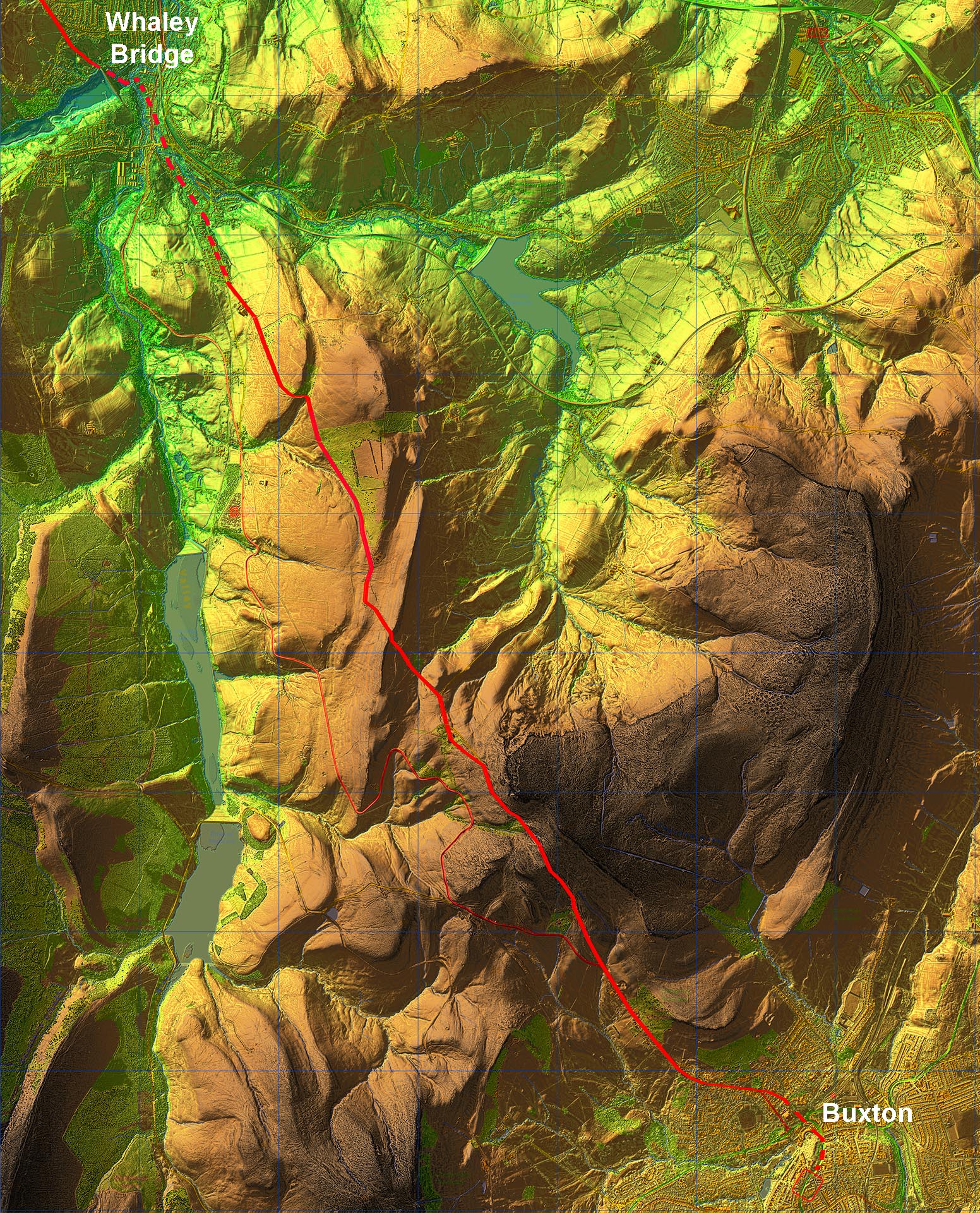
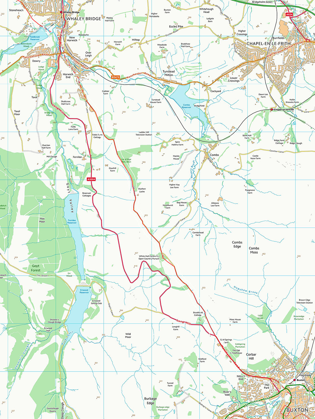
Lidar Image - Whaley Bridge to Buxton Excellent Roman engineering, as we would expect, to build a remarkably direct road across this high terrain to Buxton. |
Click for larger view |
 |
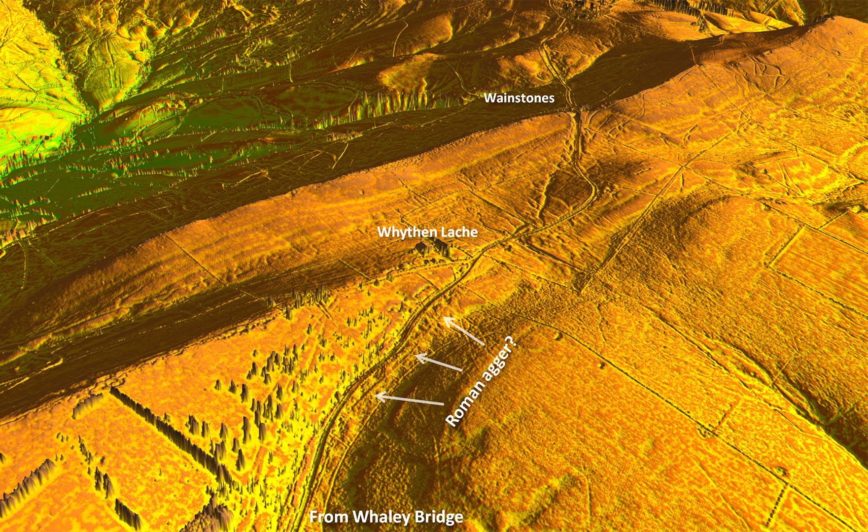
3D Oblique Lidar Image - Old Road, Wythen Lache Towards Wythen Lache a section of the original Roman agger appears to have survived below the Old Road..
|
Click for larger view |
 |
Wainstones - Old Road Looking North, this is the substantial rock cutting at Wainstones. It could be all Roman or partial Roman and later deepened as a turnpike. Image: Neil Buckley |
Click for larger view |
 |
Wainstones looking South - Old Road The view South East with the Wainstones cutting behind, White Hall is in the trees in the distance behind the top of the telegraph pole. Image: Neil Buckley |
Click for larger view |
 |
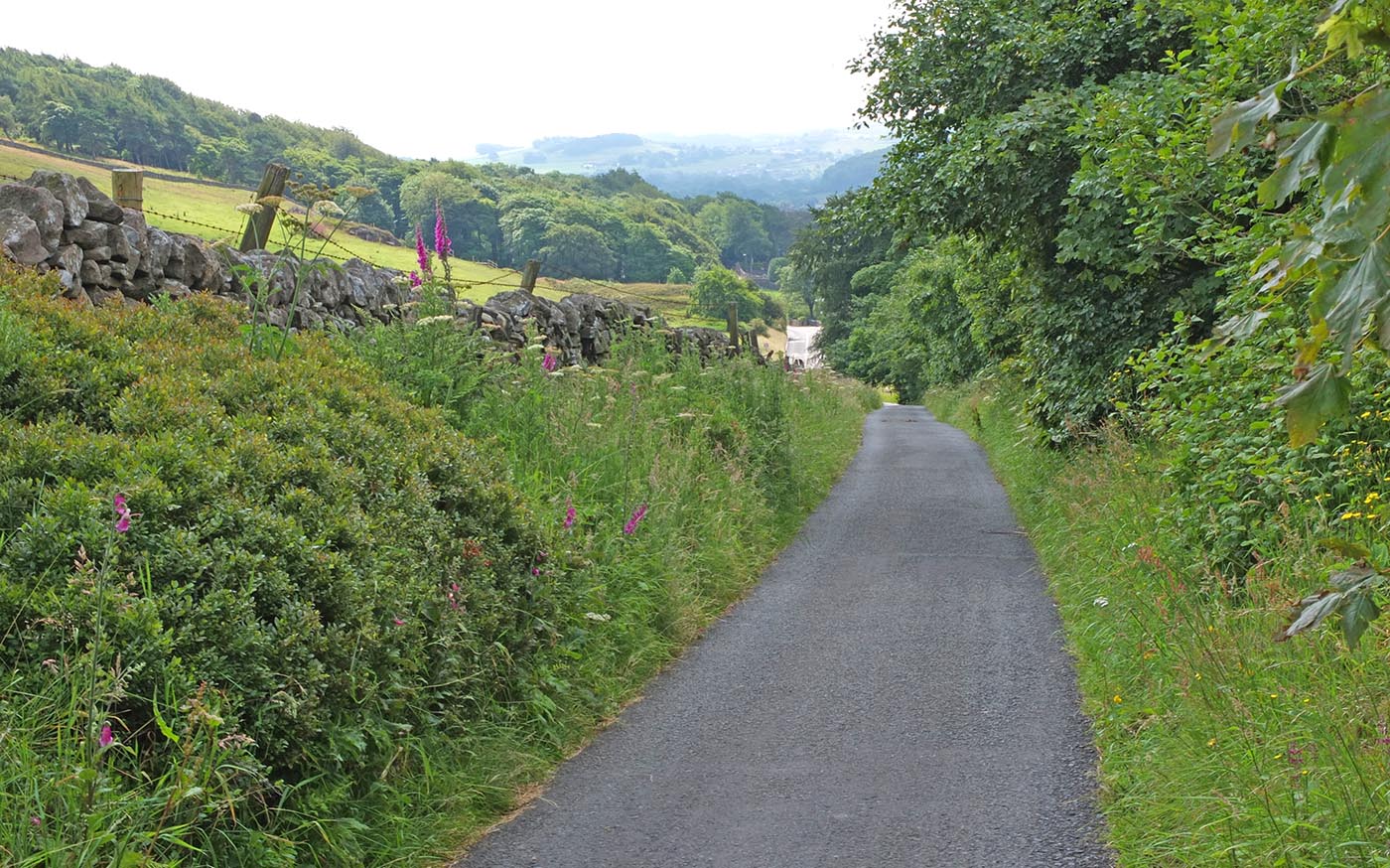
White Hall looking North - Old Road With the entrance to the White Hall Centre behind, this is the reverse view of above looking back towards the Wainstones cutting. Image: Neil Buckley |
Click for larger view |
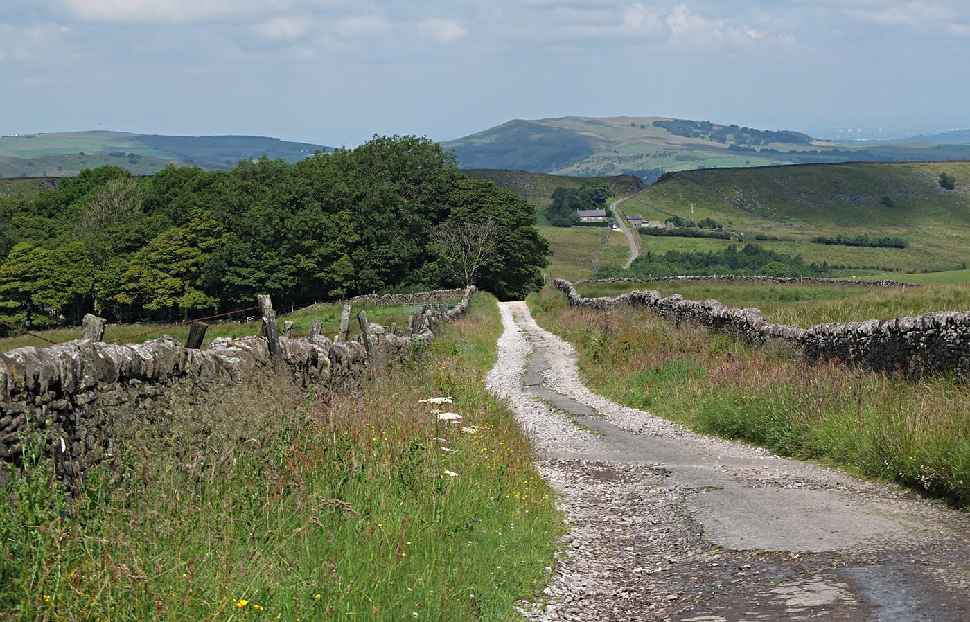 |
Descent towards Buxton - Old Road Finally the Old Road descends to join the modern road into Buxton. Image: Neil Buckley |
Click for larger view |
 |
Lidar Image & Route Map - Buxton The final descent to Buxton rejoins the modern road and heads for the centre but quite where is unknown, as is the nature of what type of fortification/settlement was actually here. All that is certain is that there were Roman baths enjoying the Buxton springs, hence its name Aquae Arnemetiae. |
Click for larger view |
 |
Detailed Route Maps Route Map 1 - Manchester to Heaton Chapel Route Map 2 - Heaton Chapel to Hazel Grove Route Map 3 - Hazel Grove to Whaley Bridge Route Map 4 - Whaley Bridge to Buxton
|
Click for larger view |
|
|
|
|
Last update: January 2024 |
© David Ratledge |