|
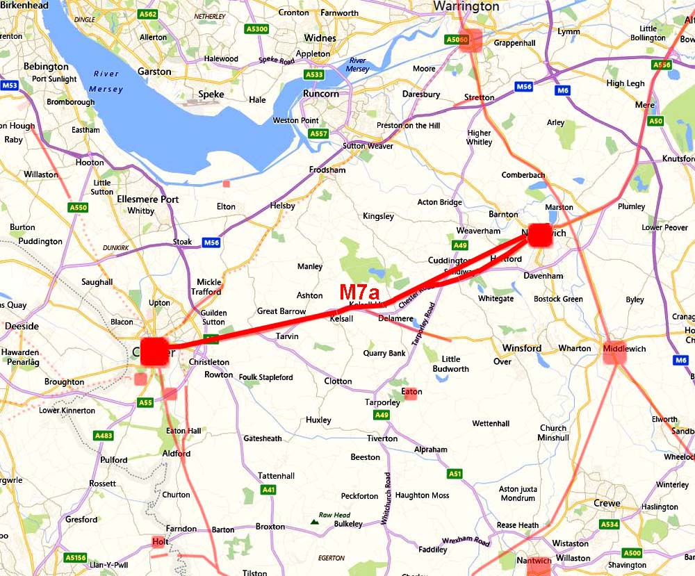
The Roman Road from Chester to NorthwichMargary Number: 7aDistance: 16.5 milesThis was the start of a major cross-country highway for the Romans - Chester to York - and would become probably the most important road in northern England. It is commonly known at Watling Street in Cheshire. The road left the fortress by Eastgate - the gate with the famous clock. The route is well attested as far as Kelsall and Delamere Forest but east of there then it was much more uncertain. Indications are that there were probably two routes into Northwich - the long assumed one via the A566 and a more direct one via Sandiway and Forest Hill. The latter almost certainly the earlier. Parts of the route were investigated over 100 years ago by Edward Kirk (L&CAS, 1885) and re-examined by Adrian & Edward Waddelove in 1982 (Cheshire Archaeological Bulletin 9, 1983 and L&CAS, 1985). These have now been supplemented by Lidar data. Thanks are due to Adrian Waddelove for providing details of his and his father's work in the area.
|
Historic Counties: Cheshire Current Counties: Cheshire HER: Cheshire
|
|
|
|
|
|
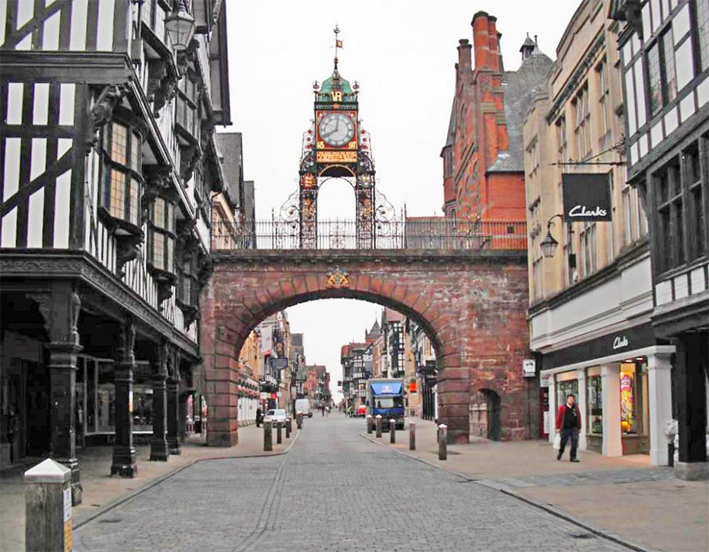
Chester Eastgate - looking East This is the start of Watling Street, the Roman road to Northwich and ultimately York. The arch is modern - the Roman gate would have had two smaller arches. Excavations on one of the other gateways at Chester revealed huge foundations indicating that the gateways must have been exceptionally large and impressive, probably 3 stories high.
|
Click for larger view |
 |
Chester - Modern Map overlaid with Roman sites (ref. English Heritage) The fortress at Chester was the biggest in the country, it also had the biggest amphitheatre. Chester was by no means a provincial backwater! Our road went via Eastgate Street, The Bars, Boughton and Tarvin Road. The first mile follows the course of the Roman aqueduct bringing water to the fortress. |
Click for larger view |
 |
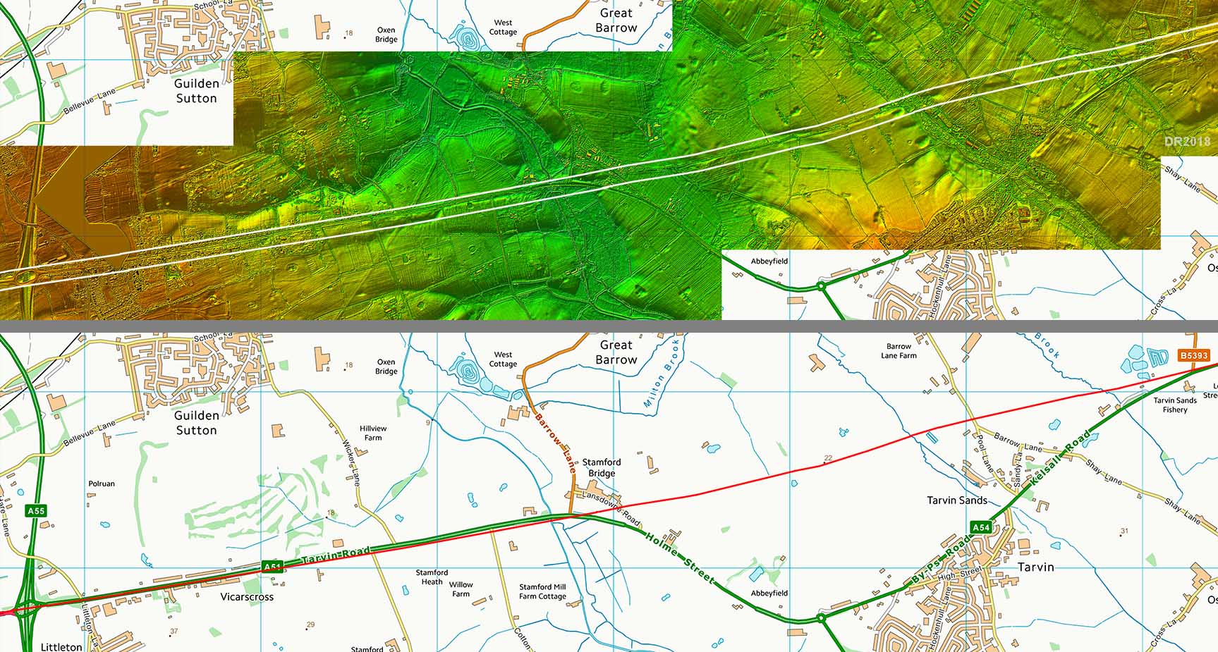
Lidar Image and Route Map - A55 to Kelsall The first visible signs of the Roman road are immediately south of Tarvin Road from Vicarscross eastwards. For some reason the modern road swings away south at Stamford Bridge towards Tarvin leaving the Roman road line to head straight on. Note the so called "Roman" bridges at Tarvin do not represent the line. |
 |
|
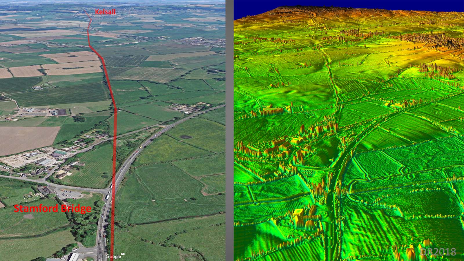
Oblique view, Google Earth & Lidar - Stamford Bridge to Kelsall The route beyond Stamford Bridge is clear on both aerial photographs (Google Earth) and in the Lidar data. |
Click for larger view |
 |
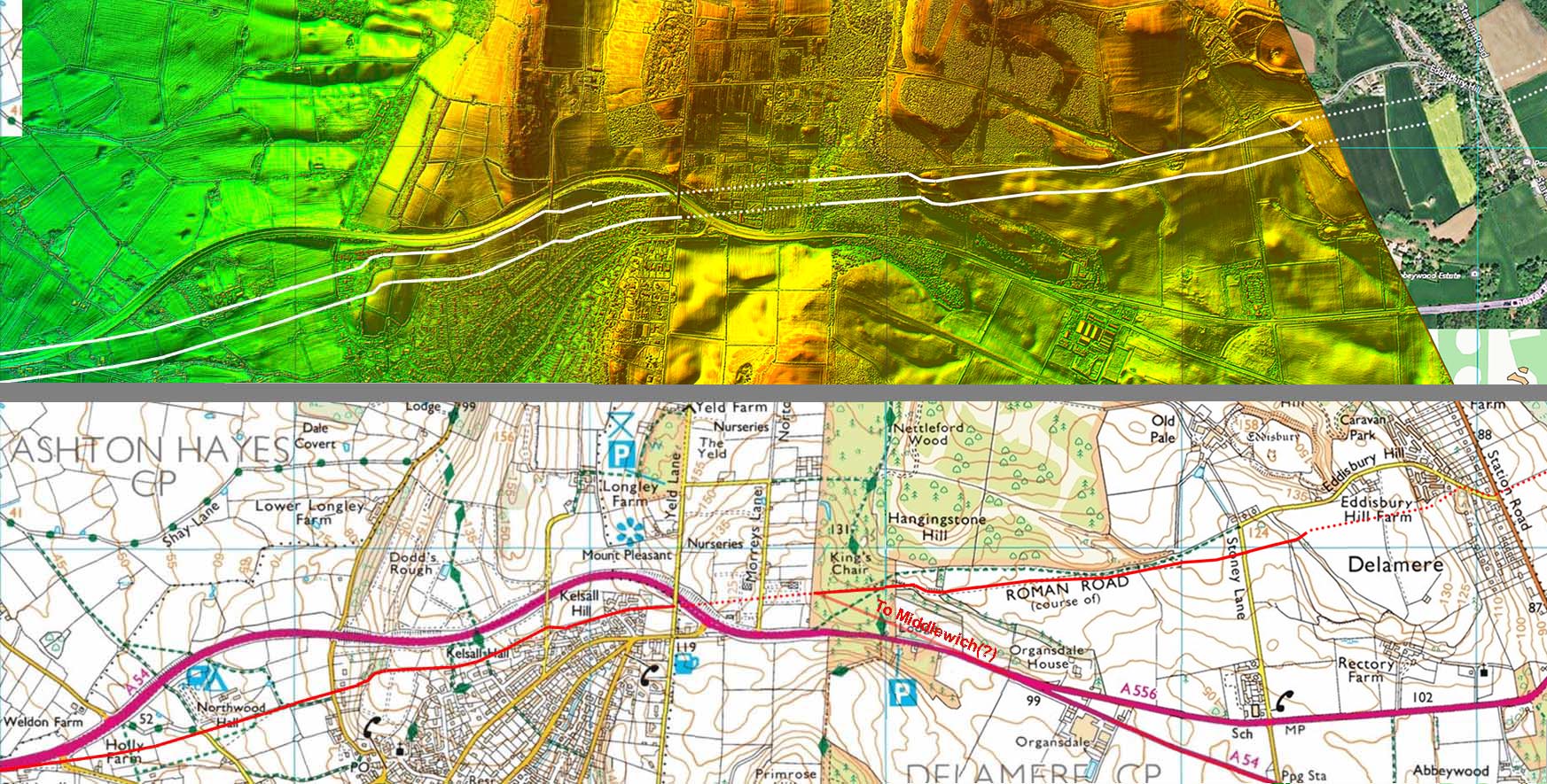
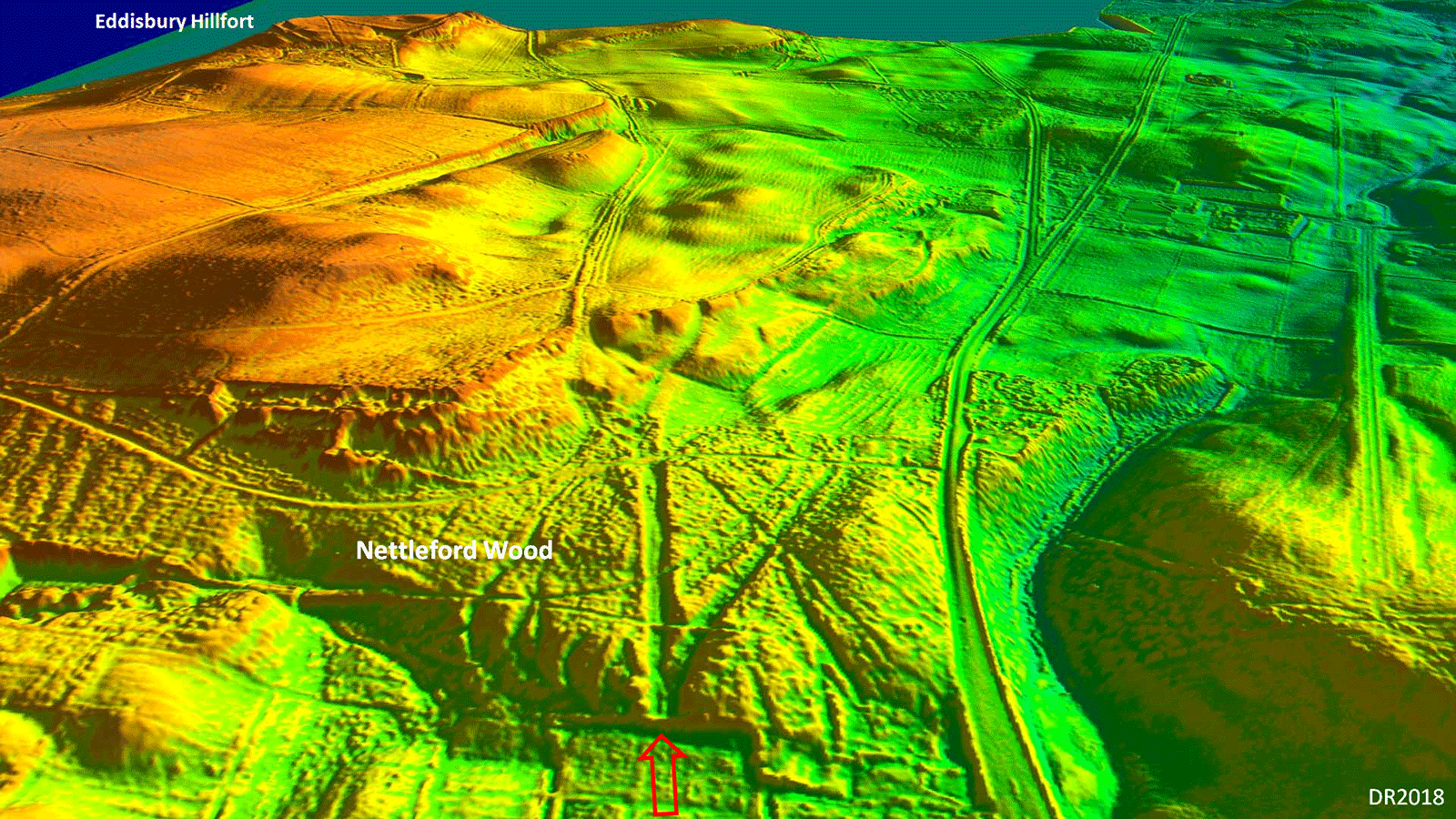
Lidar Image and Route Map - Kelsall to Delamere Here for the first time hilly terrain was encountered and the Roman engineers adapted their route accordingly. The famous cuttings in Nettleford Wood are well worth visiting. |
Click for larger view |
 |
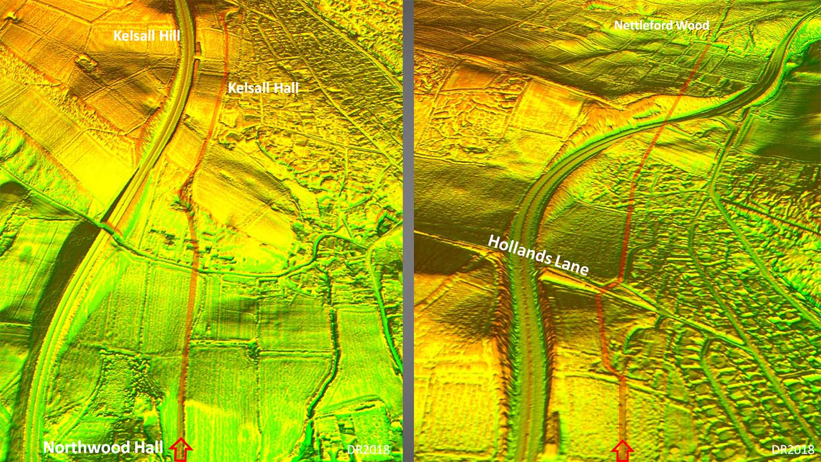
Oblique 3D Lidar Images - Kelsall Hill & Hollands Lane The first hill was approaching Kelsall (left) and the Romans negotiated this using a curving cutting to ease the gradient. Similarly at Hollands Lane a curving ascent was utilised. This feature was examined and described in detail by the Waddeloves (ref. above) |
Click for larger view |
 |
Oblique 3D Lidar Image - Nettleford Wood The famous cutting and junction is clearly visible in this Lidar DTM model. The right hand road almost certainly went to Middlewich but this has yet to be confirmed. Beyond the wood the curving route around the knoll is also visible (see later). |
Click for larger view |
 |
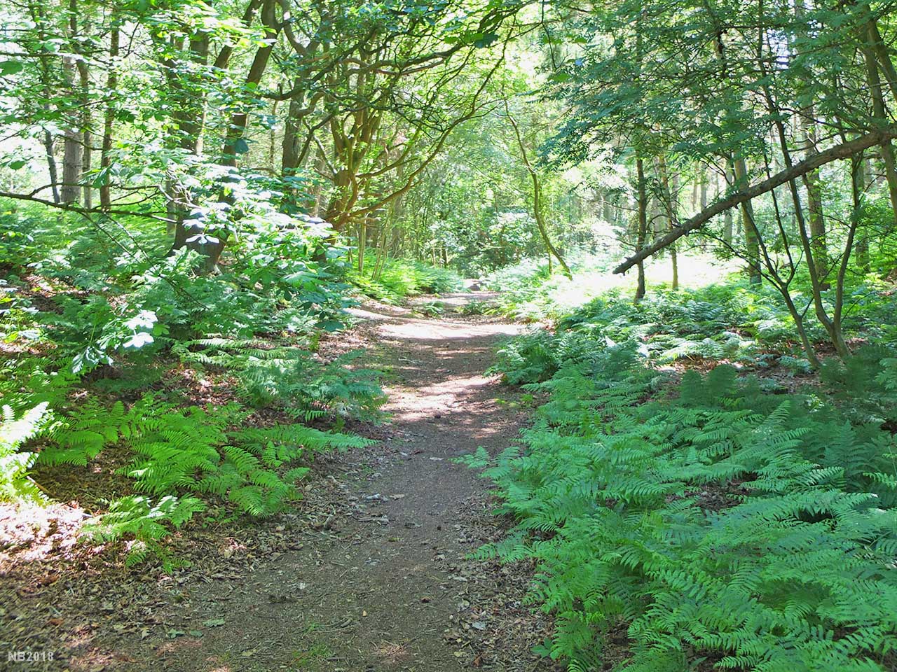
Nettleford Wood - Roman Road in Cutting The Roman road cutting through Nettleford Wood. The junction with the road to Middlewich(?) is just beyond this point. The road is in a cutting around 3 metres deep cut partially through sandstone bedrock The cutting was examined in detail by the Waddeloves and their paper has extensive details (ref. above). Image: Neil Buckley |
Click for larger view |
 |
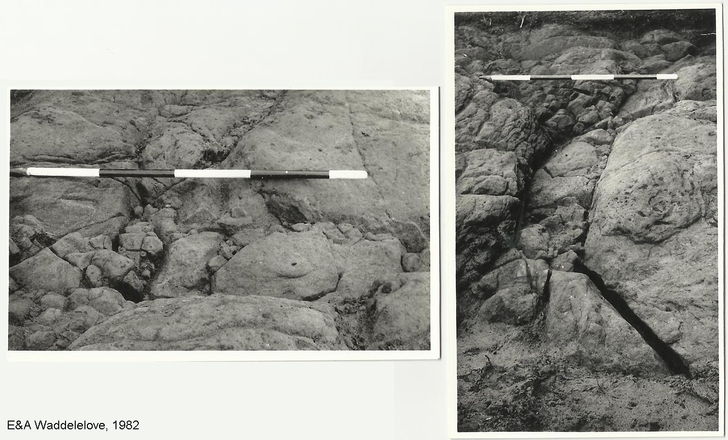
Nettleford Wood - Junction revealed in 1982 Excavation Description by Adrian Waddelove: "The two photos (scale in feet) from the 1982 excavations by my father and I showing (i) the channel cut into the sandstone bedrock to take the water from the converging roadside gullies in a culvert under the Middlewich road and (ii) the small steps cut into the northern side to support the slab that would have formed the top of the culvert." Images courtesy of Adrian Waddelove |
Click for larger view |
 |
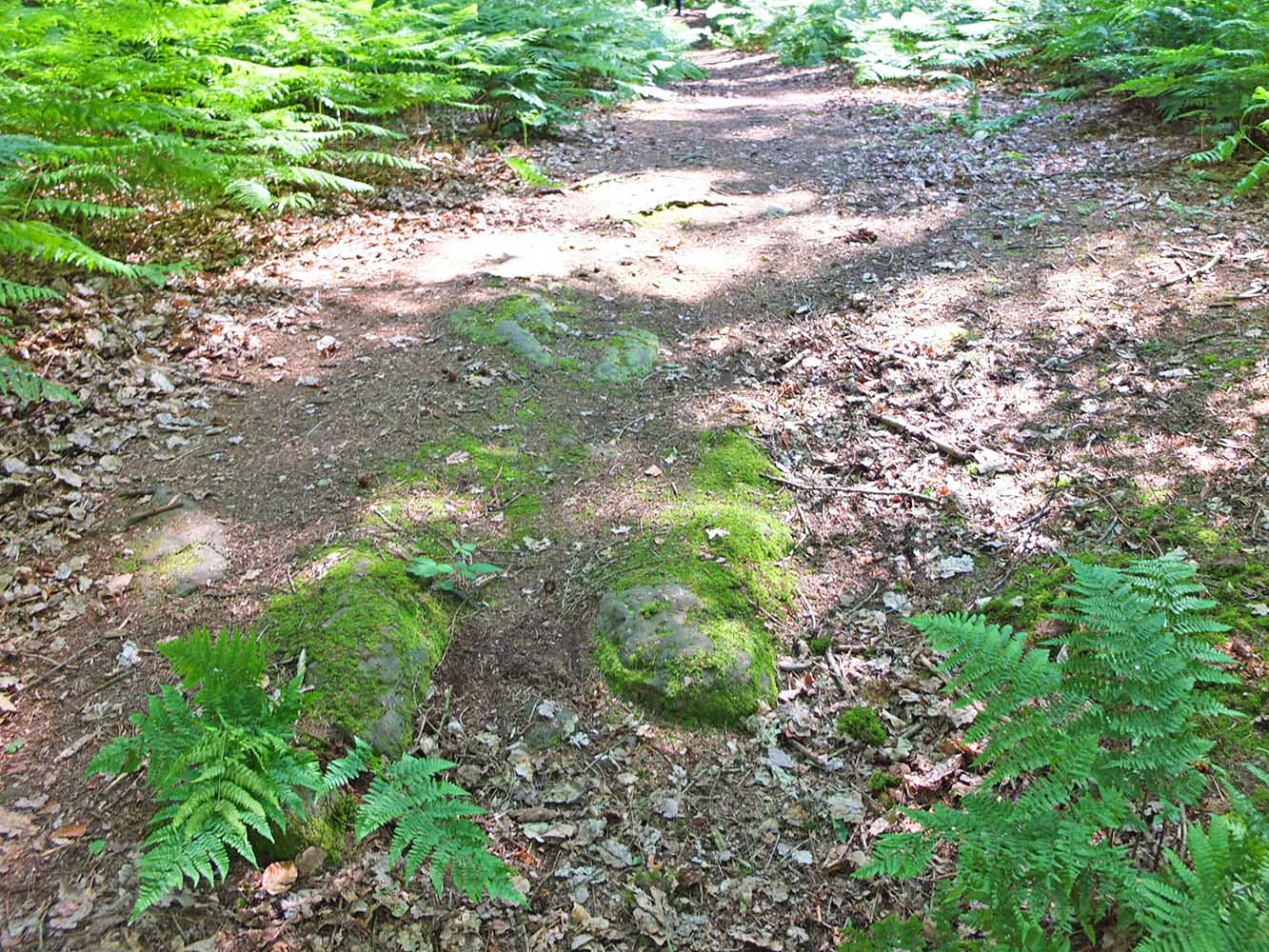
Nettleford Wood - Sandstone Bedrock 2018 There are still traces of the sandstone bedrock in the cutting today. A bit mossy now but it must have been a major civil engineering effort to take the cutting down through the bedrock. Still it would provide excellent building stone for use elsewhere. Image: Neil Buckley |
Click for larger view |
 |
East of Nettleford Wood Viewed from the eastern end of Nettleford Wood, the Roman road can be seen as a terrace curving around a knoll. A very sensible and logical course to take. Image: Neil Buckley |
Click for larger view |
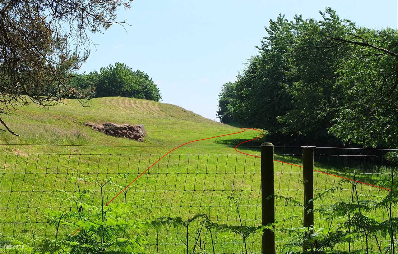 |
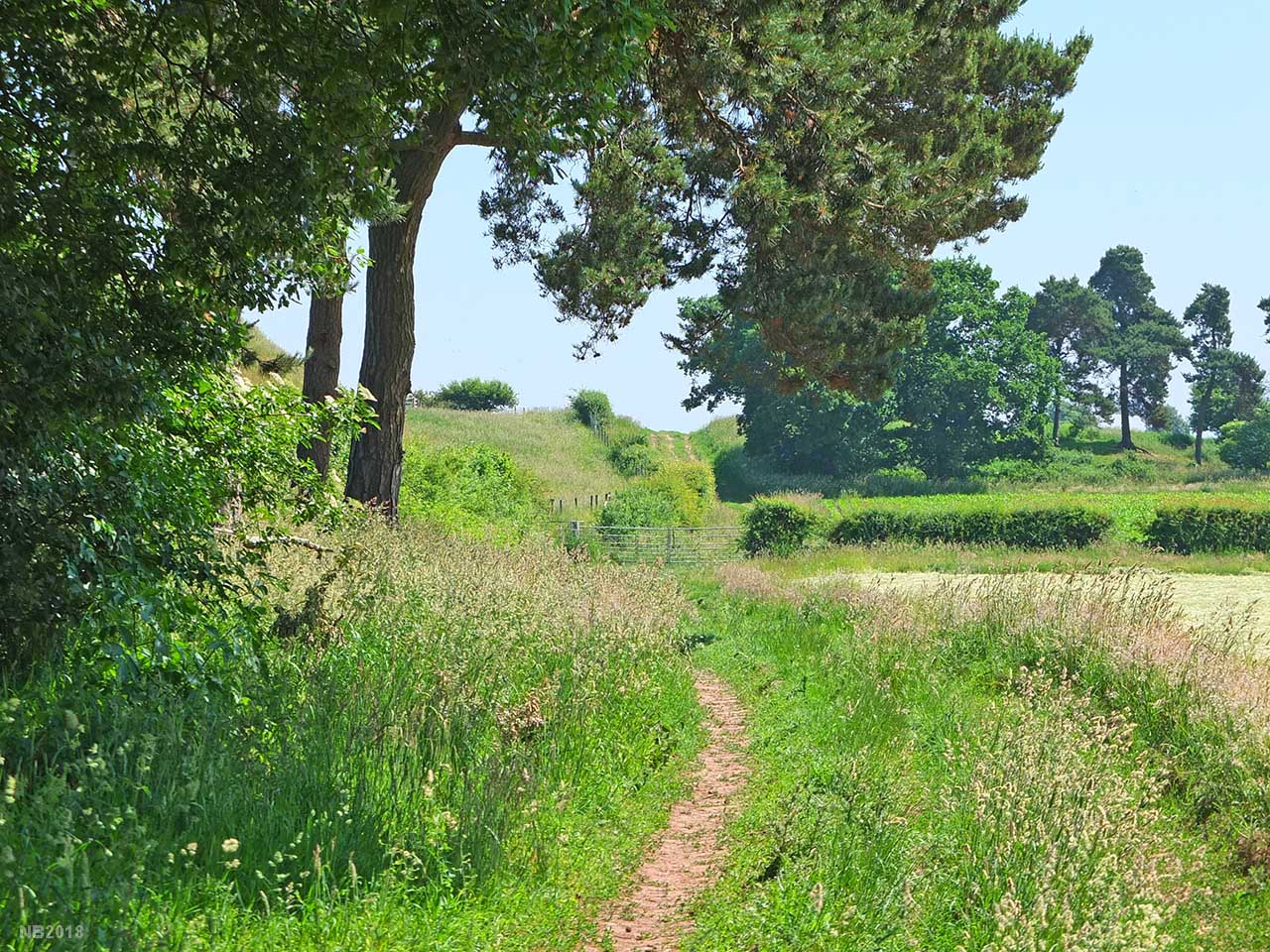
Track passing a copse approaching Stoney Lane. Here we have two options for the route of the road to Station Road, Delamere. One option is left of the copse following the track/cutting visible here. The second is through the centre of the copse and taking a very direct route to Station Road. Both have some evidence and both could be correct just perhaps representing different periods. Image: Neil Buckley |
Click for larger view |
 |
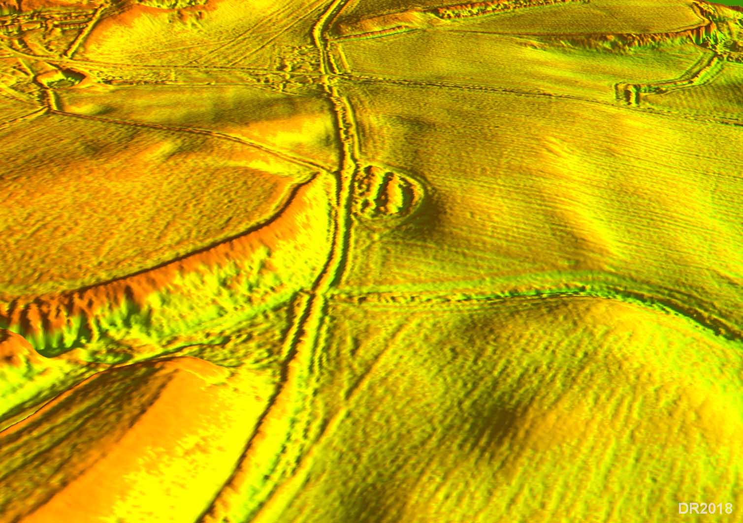
Oblique 3D Lidar Image - Track & Copse approaching Stoney Lane There is evidence for a cutting going straight through the copse and perhaps some very faint traces continuing that line. At the scarp slope at the very top of the image there is also perhaps a dogleg cutting to get up the incline there. The Ordnance Survey line (First Edition Mapping) for beyond the copse is almost certainly wrong - it appears to be based on what looks like a natural feature. |
Click for larger view |
 |
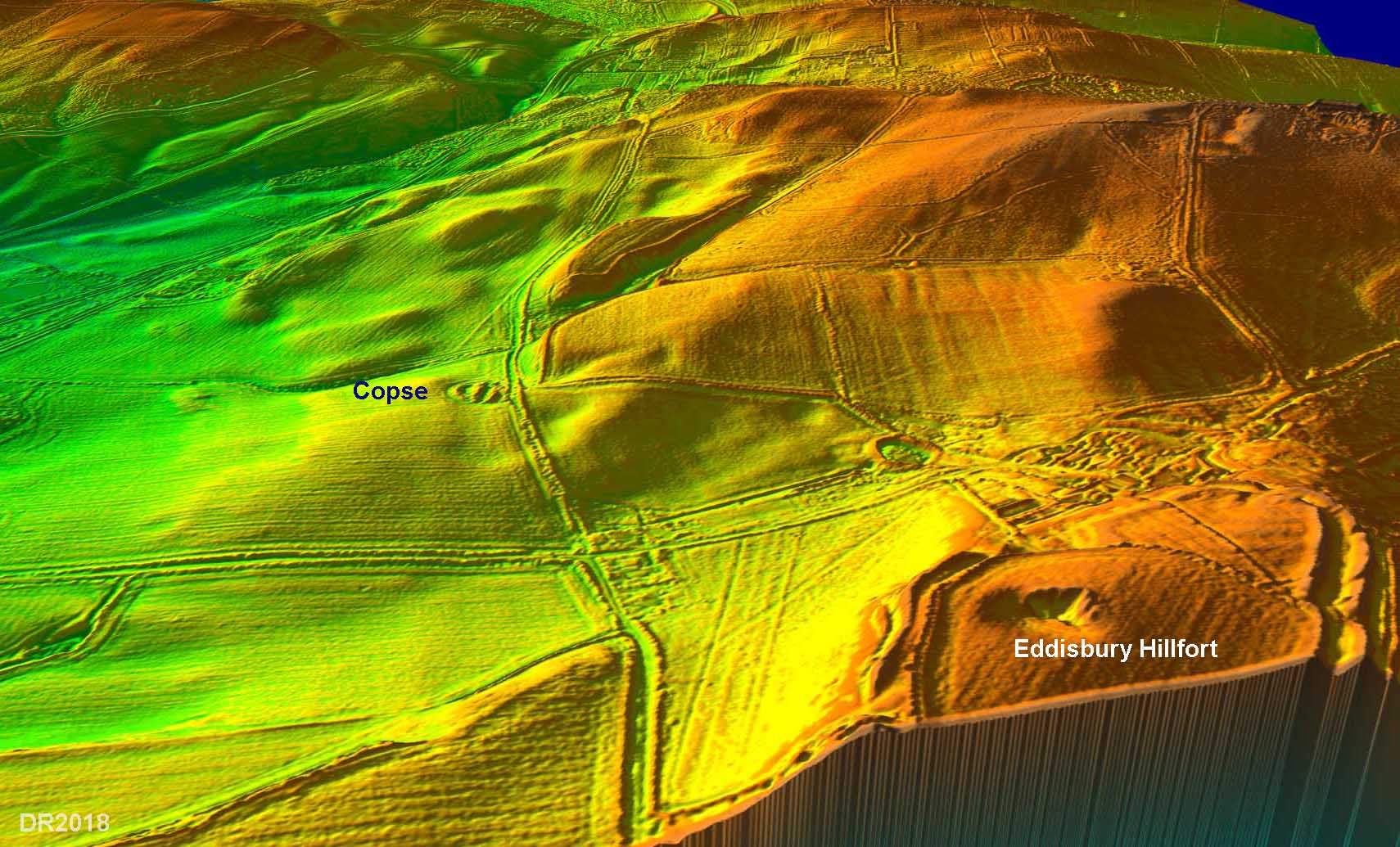
Oblique 3D Lidar Image - Looking West from Eddisbury Looking back westwards to the copse. There is faint evidence for both options and my guess is that there were perhaps two routes - the northern one being the later one as it would ease the steep descent to Station Road by running diagonally across the slope there. The southern option is the one shown on the Route Map above. But see below for the alternative. |
Click for larger view |
 |
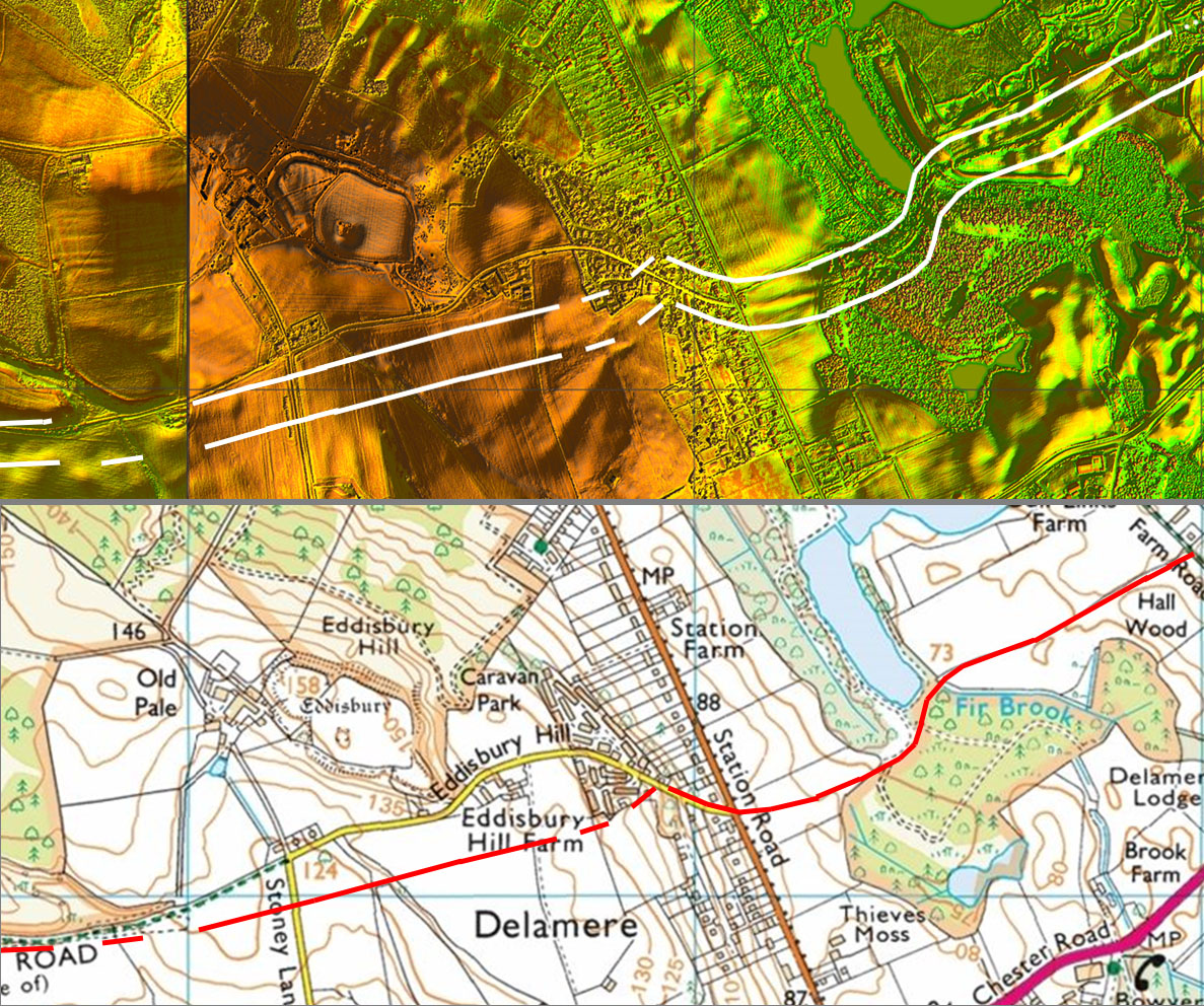
Lidar Image & Route Map - Delamere, Eddisbury, 2024 update New Lidar has clarified the route at Delamere. Previously there was a gap in the coverage here. Update: A recent excavation by Wardell Armstrong Archaeology prior to a quarry extension confirmed the road in poor condition to the east of Fir Brook - details |
Click for larger view |
 |
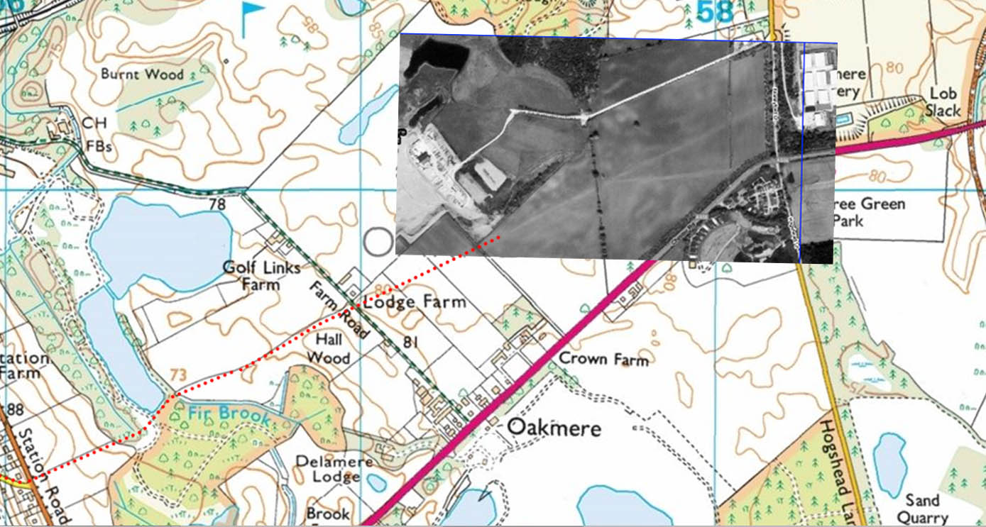
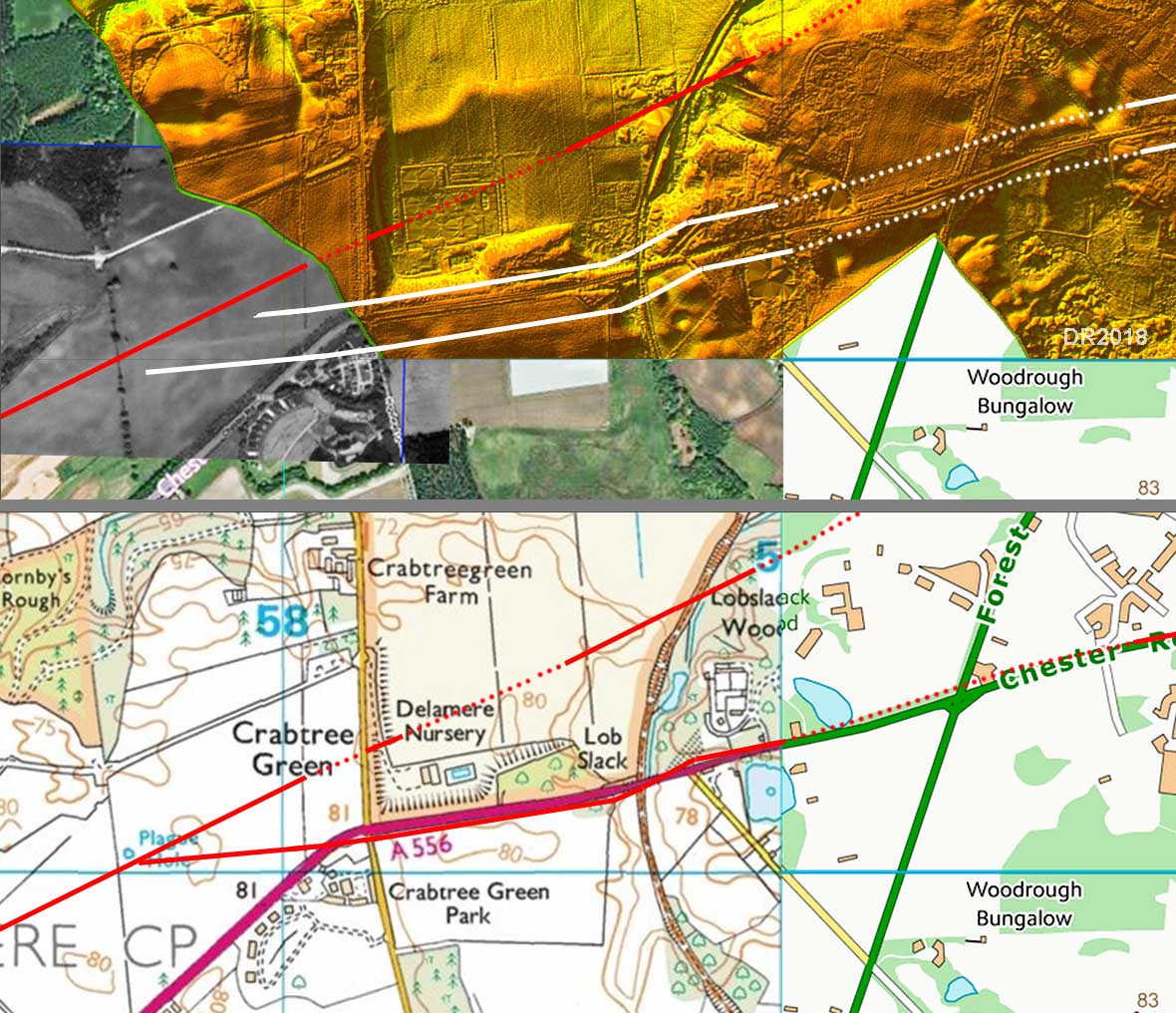
Oakmere, Crabtree Green - Google Aerial & Map This is the crucial aerial photograph that confirms Kirk's discovery of a road junction in the field at Crabtree Green. The straight-on road was recorded as the more prominent and would almost certainly be the earlier road as the southern option branches off it. The alignment of the straight-on road would indicate a direct route to Northwich but Kirk thought it would have turned north-east and headed for Cuddington and Weaverham. There is a long held supposition that a Roman road passed under Weaverham church but Lidar lends no support to this. The logical interpretation is that there were two routes to Northwich. An earlier direct road (the straight-on road) and a less direct, later southern route today largely followed by the A559. |
Click for larger view |
 |
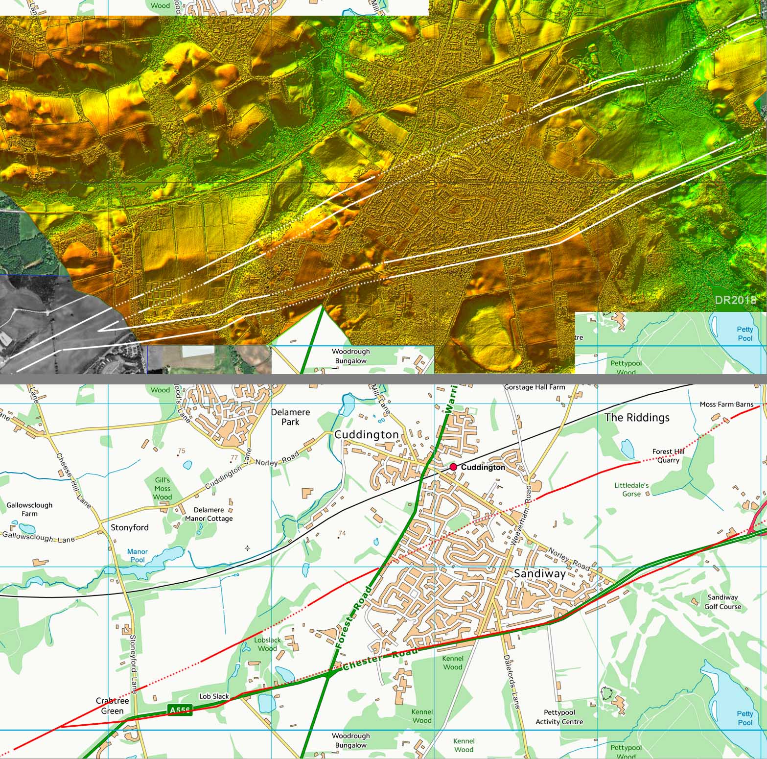
Lidar Image & Route Map The two alternative routes to Northwich are shown for the section Crabtree Green to just east of Sandiway. The northern one is more direct but perhaps has more hilly terrain to negotiate. Beyond Sandiway the northern route follows old tracks |
Click for larger view |
 |
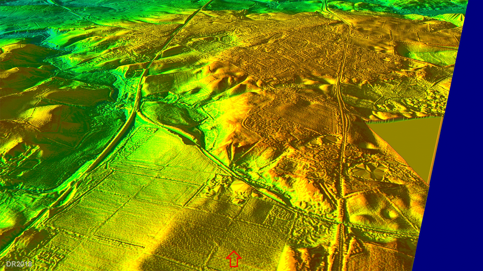
North Route - Cutting beyond the old railway at Lobslack Wood On the east of the old railway line is a prominent cutting on the direct (northern) route at Lobslack Wood. Both Kirk and the Waddeloves remarked on this construction. However both these surmise the road then turned north east for the supposed route under Weaverham Church. It would appear more likely that the cutting was part of the direct route to Northwich. Another cutting is visible further along this same straight alignment so Northwich seems favourite. No possible road is visible around Weaverham in the Lidar data. |
Click for larger view |
 |
North Route - OS First Edition Map at The Riddings Beyond Lobslack Wood and the 2 cuttings then the northern route is marked by old tracks, passing The Riddings. Forest Hill quarry will however have destroyed part of it.. |
Click for larger view |
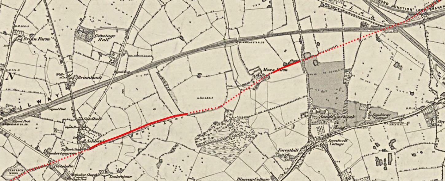 |
South Route - Crabtree Green The southern road from the Crabtree Green Roman road junction aligns just to the south side of the A559 - it was previously thought to be on its north side. It switches to the north side when it makes a dog-leg crossing of Lob Slack. |
Click for larger view |
 |
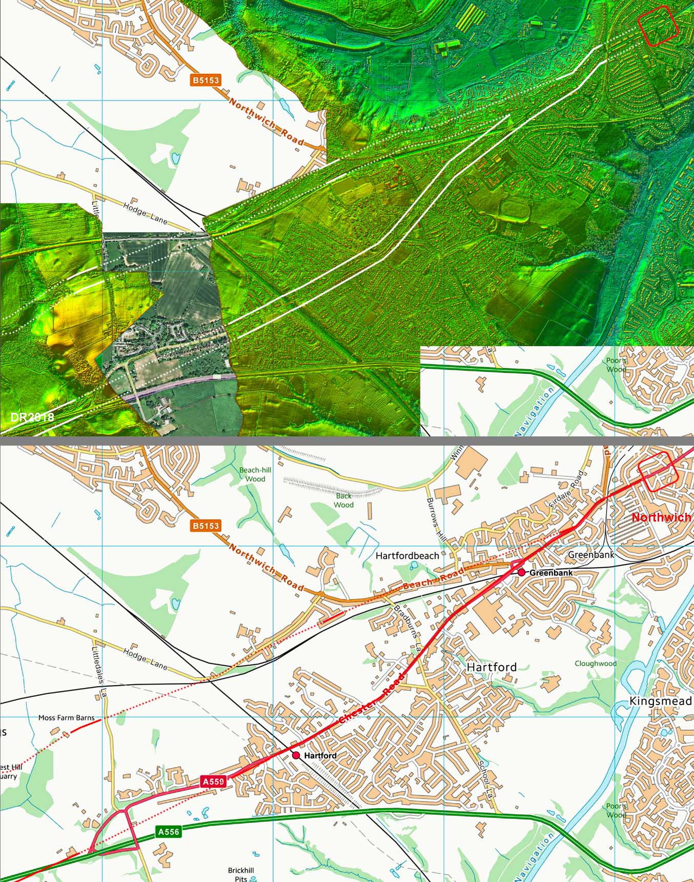
Detailed Lidar Image - approaching Northwich Fort The two routes rejoin close to Northwich fort. The reason for the likelihood of two routes is a puzzle. |
Click for larger view |
 |
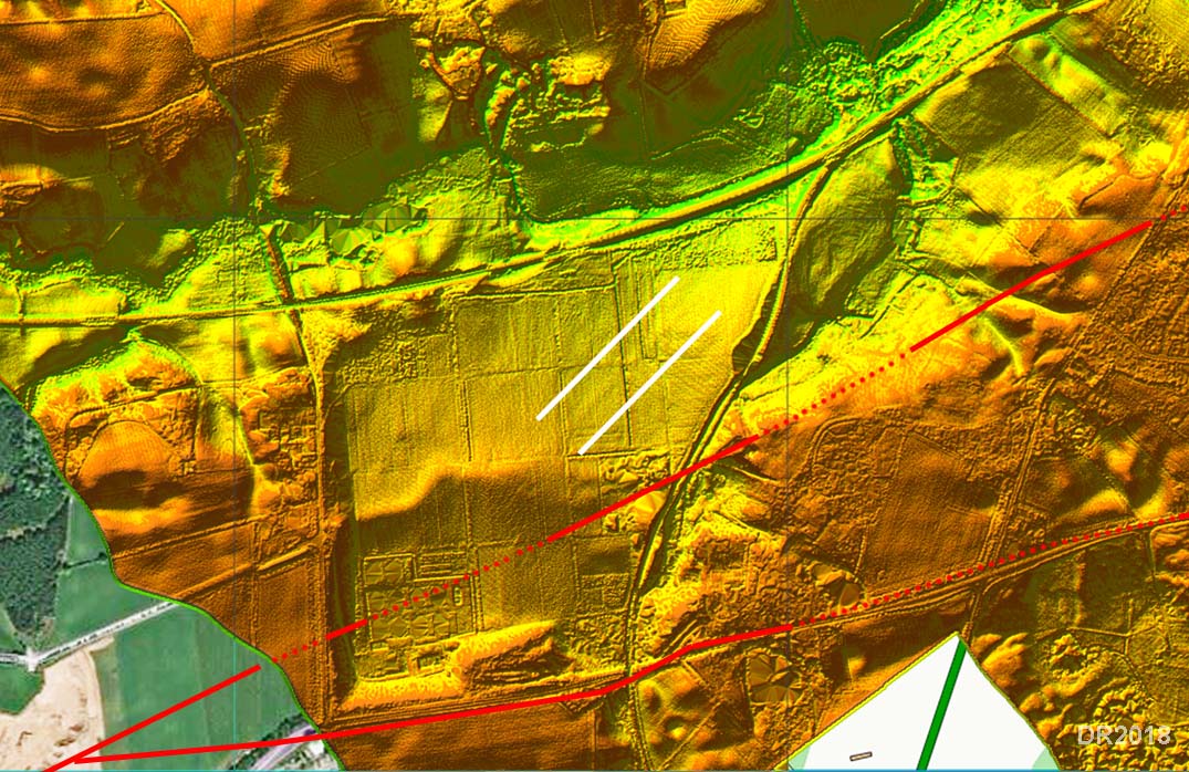
Lidar Image - Possible Agger After the junction at Crabtree Green, Kirk thought the northern route turned north east and headed for Cuddington & Weaverham Church. This is only piece of Lidar evidence I could find to support that belief. It does look like an agger but extending it further has not proved possible. There is nothing visible aligning with Weaverham Church either. So this remains a puzzle. |
Click for larger view |
 |
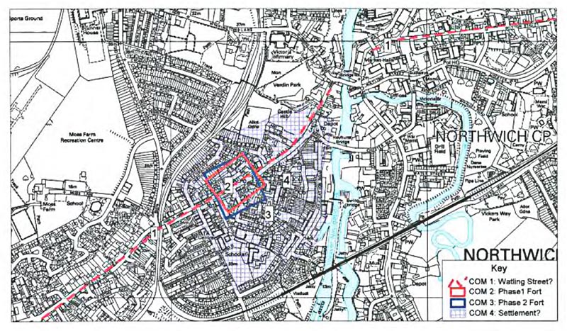
Northwich - Historic Town Survey Map Northwich Roman sites according to Historic Town Survey by Cheshire Archaeology/English Heritage, copyright Cheshire Archaeology. |
Click for larger view |
 |
|
|
|
Last update: Jan 2024 |
© David Ratledge & Neil Buckley |