|
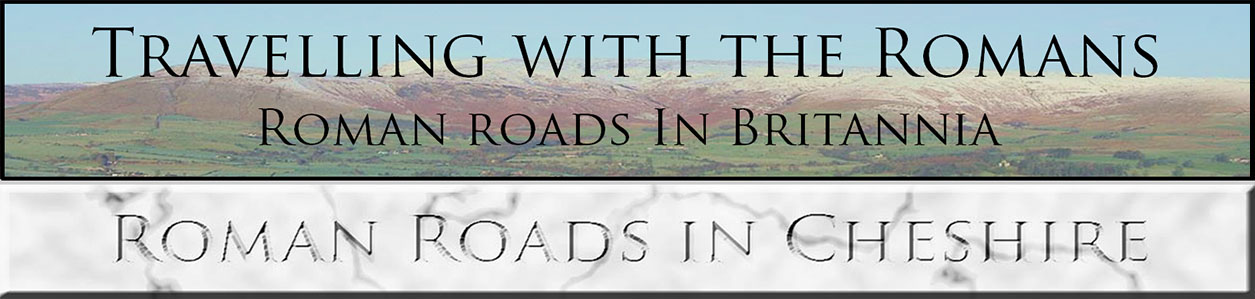
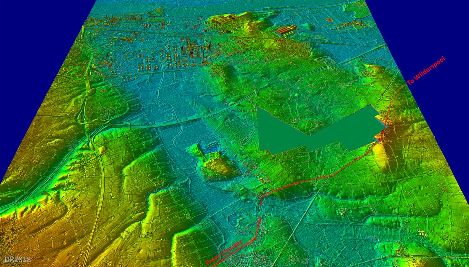
The Roman Road from Chester to WilderspoolMargary Number: 701Distance: 19 milesThere can be little doubt a road from Chester to Wilderspool would have been a necessity for the Romans. It would have been the best way to the north. However, evidence is very limited. This is no doubt due to it being mostly overlaid by modern roads mainly the A56 and several Chester/old Chester roads. Probably the strongest evidence is that the alignment of Mannings Lane/The Street is the optimum to reach the best crossing point of the Gowy (see 3D lidar image below). A road in that direction can realistically have only had Wilderspool as its objective. The road's course was dictated by that crossing of the River Gowy marshes and also having to get around Helsby Hill. Modern roads have had little option but to follow the same course and these have ended up on top of the most of the Roman line masking a lot of the evidence. |
Historic Counties: Cheshire Current Counties: Cheshire HER: Cheshire
|
|
|
|
|
|
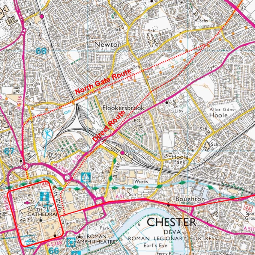
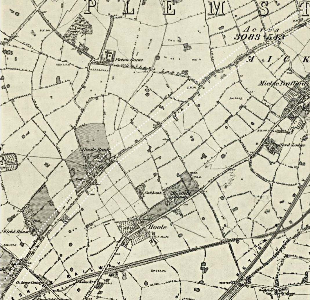
Lidar Image & OS First Edition Map - Chester Did the Roman road from Chester to Wilderspool leave by the east gate or the north gate? Watkin favoured the northern gate but his evidence is hardly the strongest. He quotes Shrubsole as finding a road aligned with the north gate but the direction was to the north not towards Wilderspool. There can be no doubt there would have been a road from the north gate but it cannot realistically be regarded as proof it was heading for Wilderspool. The only evidence he provides for a right turn towards Hoole is a tradition for an old road going via Dickson Nurseries. That is it - no concrete evidence. He was aware of Newton Hollows (on the direct route) but very dismissive of it and regarded it as a pack horse road. Yet at The Street he found a pack horse road on top the Roman line - could the same not be true of Newton Hollows?
|
Click for larger view
|
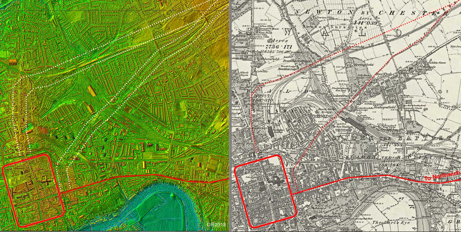 |
Route Map 1 - Chester The north route we show going through the site of the old Nurseries so is probably a reasonable interpretation of where Watkin thought the road would have run. Quite why it diverted off a straight course (from The Street - see later) he offers no explanation. The Newton Hollows route on the other hand has the same alignment as Mannings Lane and The Street and is obviously the shortest and most direct route to the Chester fort. There is perhaps a possibility of both route being valid. In that case it would be most logical if the northern nursery route was a later one branching off the original alignment. |
Click for larger view |
 |
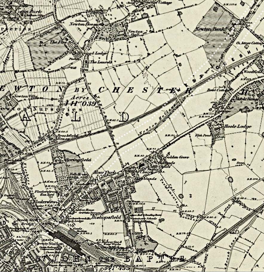
Newton Hollows - OS First Edition Map It seems too big a coincidence for Newton Hollows not to represent the Roman line. It continues the alignment from The Street and Mannings Lane right back into Chester. |
Click for larger view |
 |
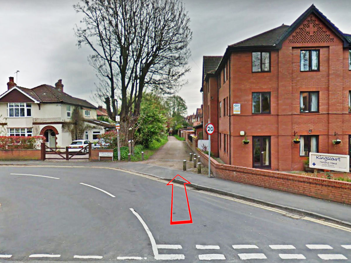
Newton Hollows - viewed from Kilmorey Park This is what Newton Hollows looks like today - a footpath between housing. |
Click for larger view |
 |
Route Map 2 - Chester to Bridge Trafford Here we have some reasonable proof with the name The Street and evidence visible in Watkin's time for a Roman width of "56 to 60 feet". He does describe a 3 to 4 foot wide pack horse road on top of it. He is no doubt correct in concluding today's wobbles in The Street were caused by centuries of encroachment. Mickle Trafford and Bridge Trafford are probably derived from a corruption of Stratford or Street Ford. In Roman times no doubt there would have been a bridge - they had the technology. The ford would be from a time when the Roman bridge was no more. |
Click for larger view |
 |
Mannings Lane & The Street - OS First Edition Map As mentioned already, the Roman alignment at The Street would have been much straighter. Today The Street is extremely narrow - see later. |
Click for larger view |
 |
The Street - looking towards Mickle Trafford The name is a good clue but the looks are not quite as convincing. All things considered though this must be the course of our road and looking in the adjacent fields Watkins recorded a total with of around 18 metres. Be aware though if you do drive down The Street today then most of it is very narrow and passing can be difficult. |
Click for larger view |
 |
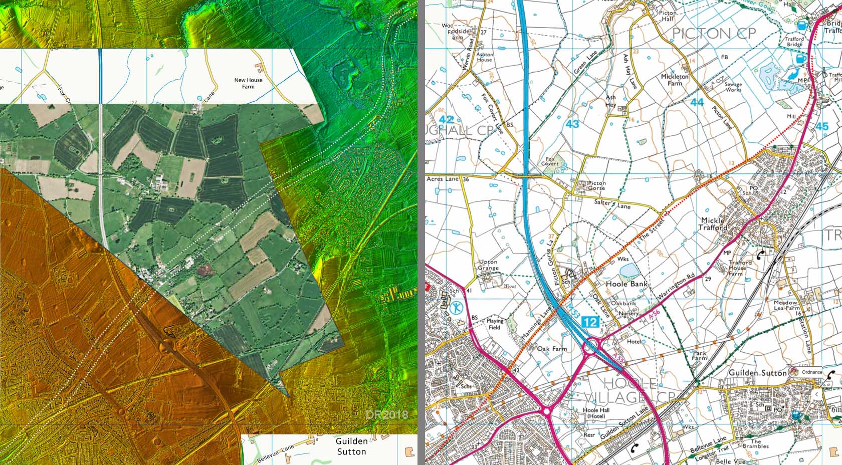
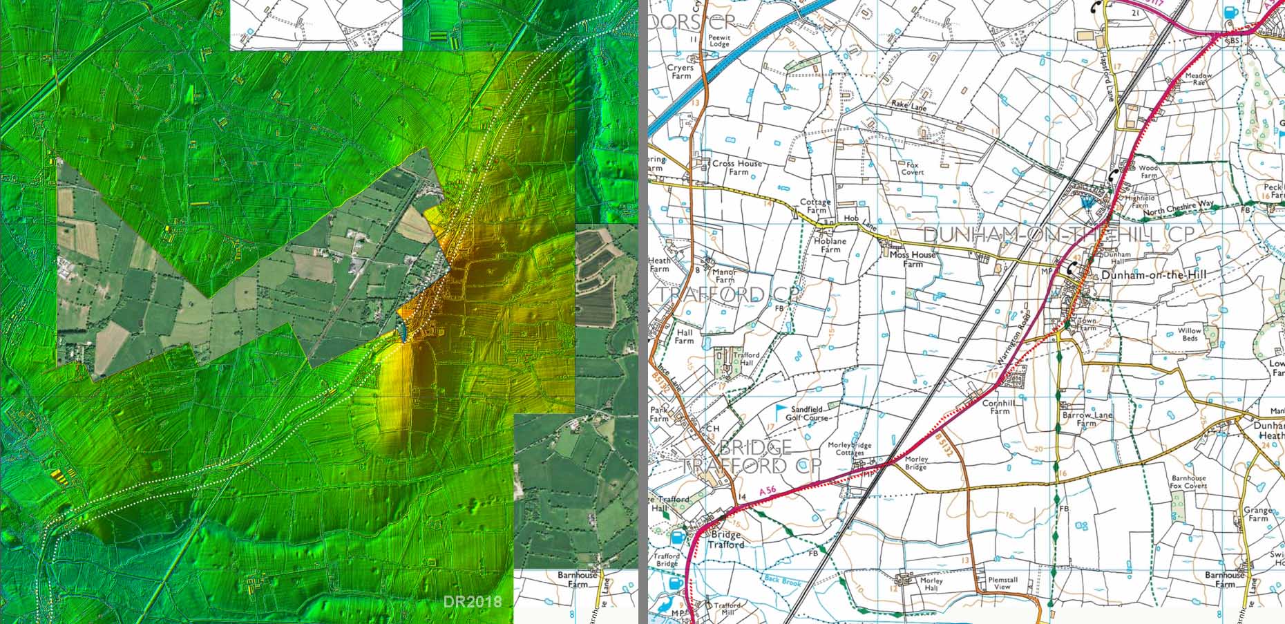
Oblique 3D Lidar Image - Bridge Trafford Even a quick glance at the Lidar image is sufficient to see why the Roman's had to cross the River Gowy and its marshes at this point. It is by far the best point utilising approaches on dry land. Dutton was confused as to why the Roman line dog-legged to the crossing point. It can also be seen that the line from Chester has to negotiate around an area of marsh. The Romans had found the most practical and logical route to the best crossing point and it had to bend to get there. |
Click for larger view |
 |
Route Map 3 - Dunham-on-the-Hill There are various suggestions for the route the Roman's took from the Gowy crossing (bridge) but none are convincing in the Lidar data. The A56 therefore probably overlies the road. Today the A56 bypasses Dunham-on-the-Hill but the old road and the Roman line no doubt went through the village.
|
Click for larger view |
 |
Dunham-on-the-Hill It's wide, it's straight and it does look Roman. This is looking north towards Helsby.
|
Click for larger view |
 |
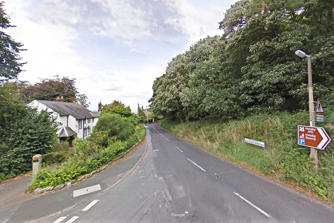
Route Map 4 - Helsby The Roman road had no real option but to circumnavigate Helsby Hill on its northern side. Again Old Chester Road probably masks its course. In 1958, just off Vicarage Lane Helsby, an uninscribed Roman altar of red sandstone was discovered with a carved jug on one side and an axe and knife on the other (ref wiki). |
Click for larger view |
 |
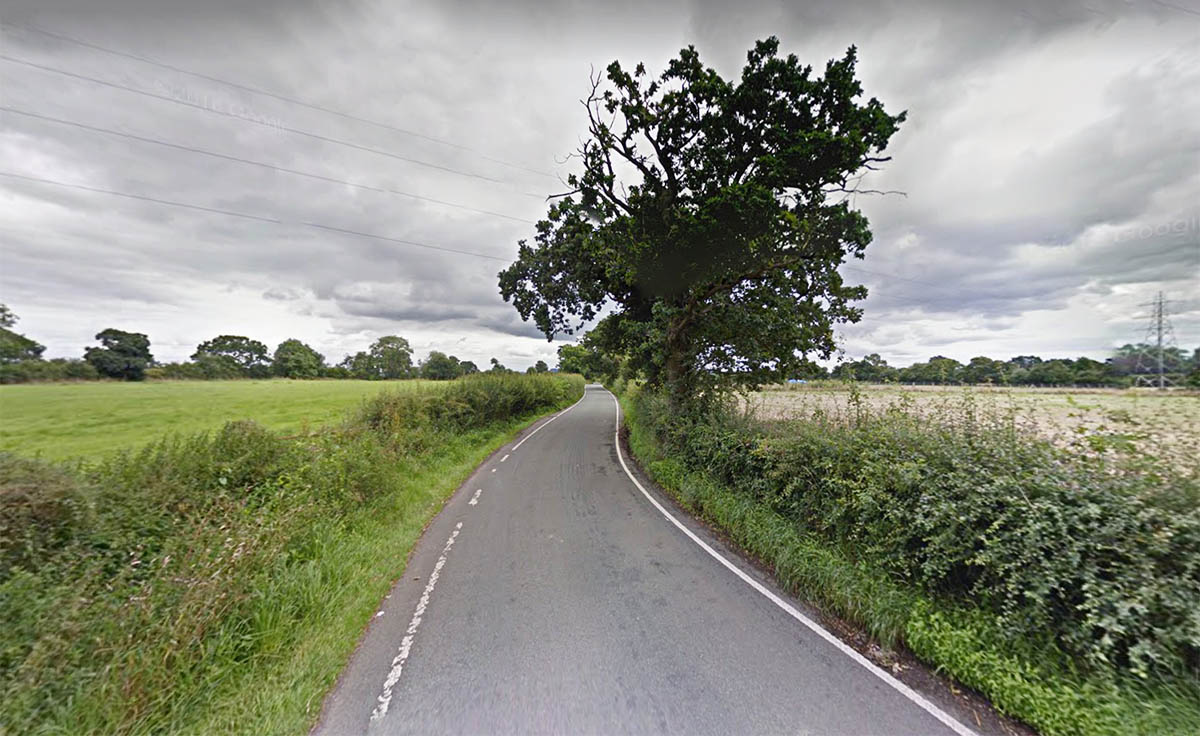
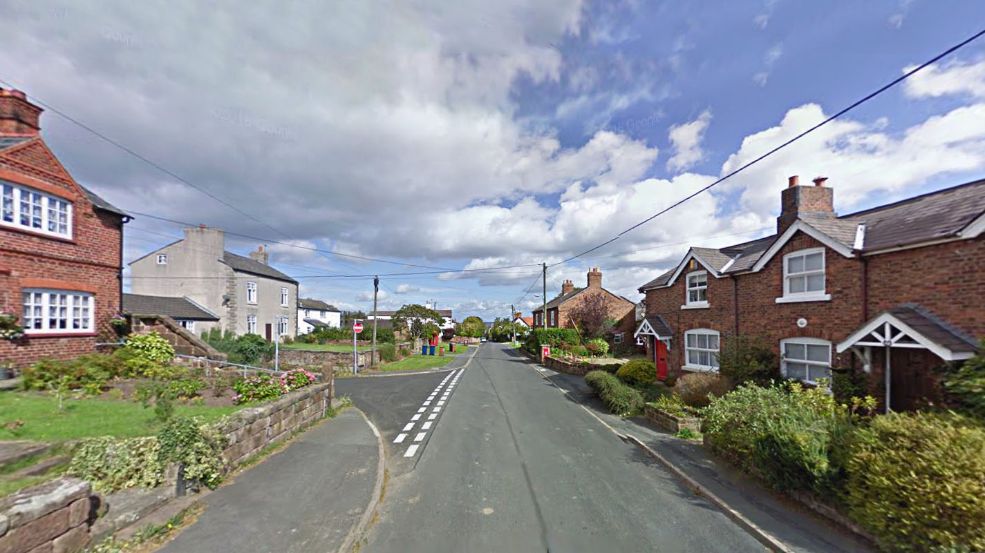
Old Chester Road, Helsby Almost certainly the Roman line follows Chester Old Road around the foot of Helsby Hill. It is very narrow today but that is probably a consequence of later encroachment.
|
Click for larger view |
 |
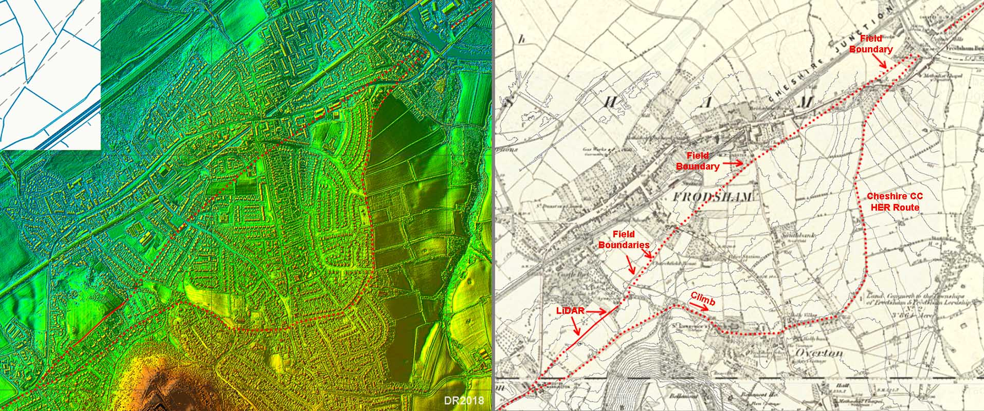
Frodsham - Lidar & OS First Edition Map with 1 metre contours The route across Frodsham was always a puzzle and modern development has not made finding the likely route any easier. A very circuitous southern route (Cheshire HER route on map) has been suggested as it would follow the contours and save on climbing up and down. However, the First Edition Map right has had 1 metre contours added to it (from Lidar data) and this shows a more direct and typical roman line is viable. It actually does not involve any more climbing than the circuitous route. There is some good Lidar evidence for its initial course and some old field boundaries on the remainder of the route to the River Weaver crossing. |
Click for larger view |
 |
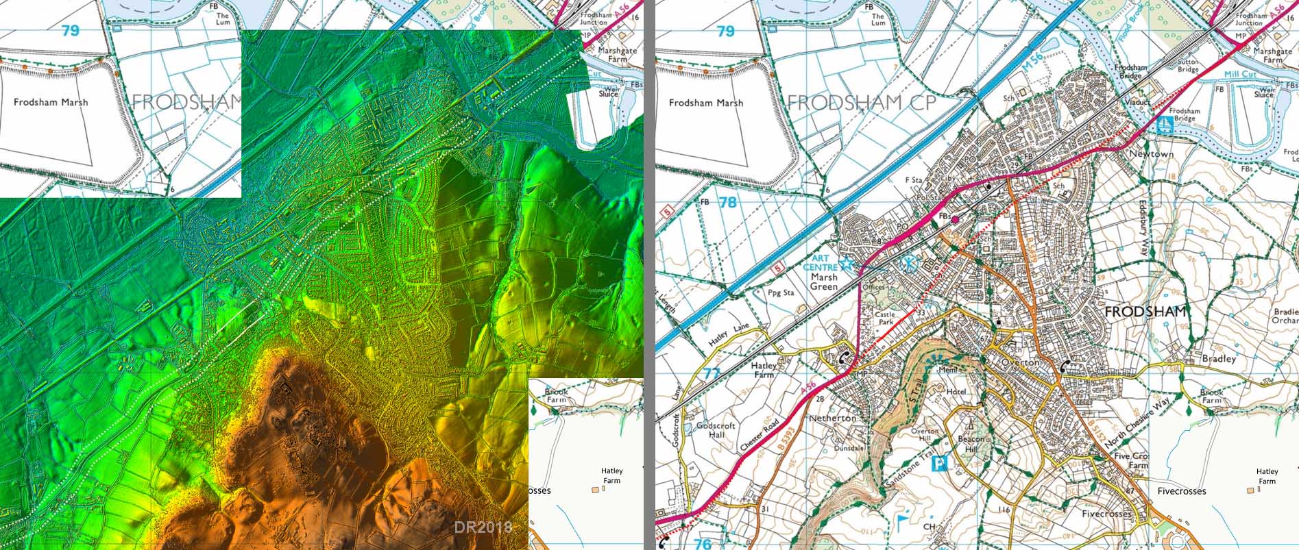
Route Map 5 - Frodsham As can be seen on the modern map, the route suggested is very direct towards the River Weaver crossing point. It does have some gentle climbing but no more than the circuitous southern route and, of course, is a lot shorter. |
Click for larger view |
 |
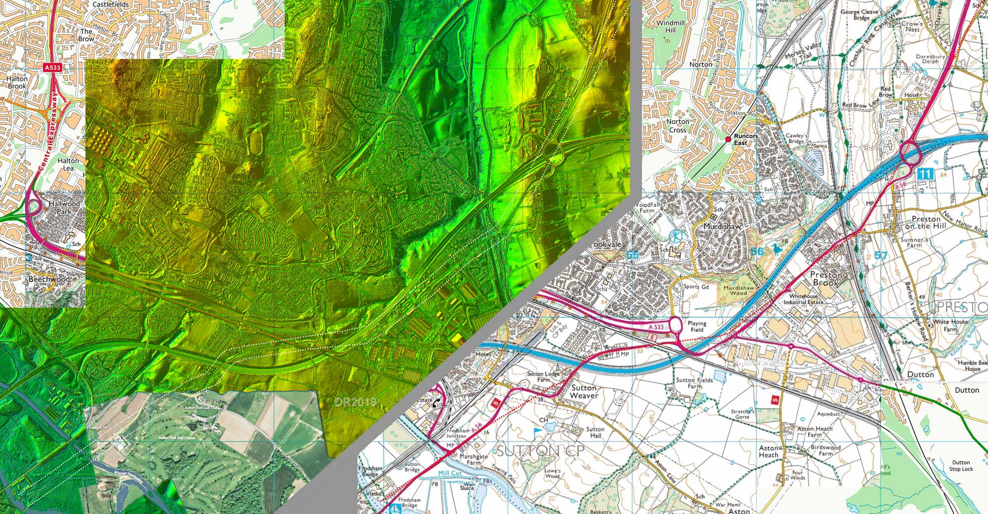
Route Map 6 - Frodsham to Daresbury The route at Sutton Weaver is the puzzle. Unfortunately the lidar data (currently) only partially covers this stretch. What evidence there is perhaps indicates a straight Roman alignment rather than the big dog-leg the modern road takes. |
Click for larger view |
 |
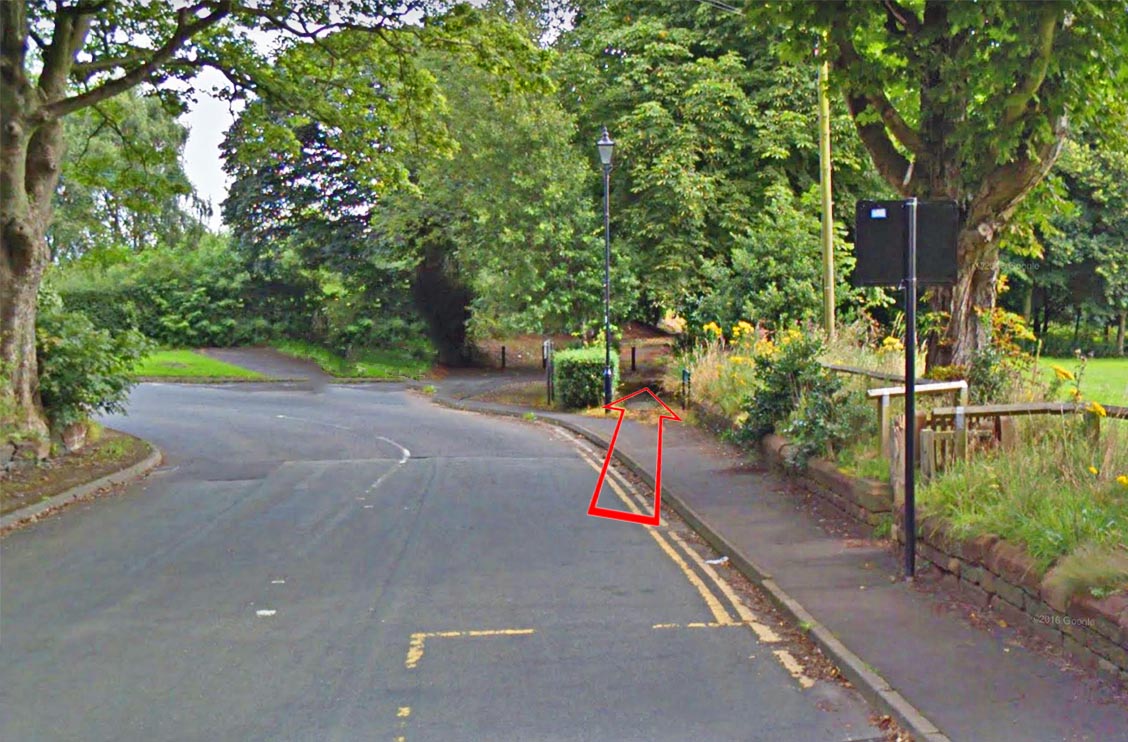
Daresbury - north end At the north end of Daresbury the old Chester Road swings left to join Daresbury bypass (A56). The old line can be seen heading straight on. |
Click for larger view |
 |
Route Map 7 - Daresbury to Wilderspool Masked mostly by the modern A56, the Roman line only really emerges to pass through Higher Walton. The A56 is very straight and obviously aligned on Wilderspool for it final run so can be trusted as representing the Roman alignment. |
Click for larger view |
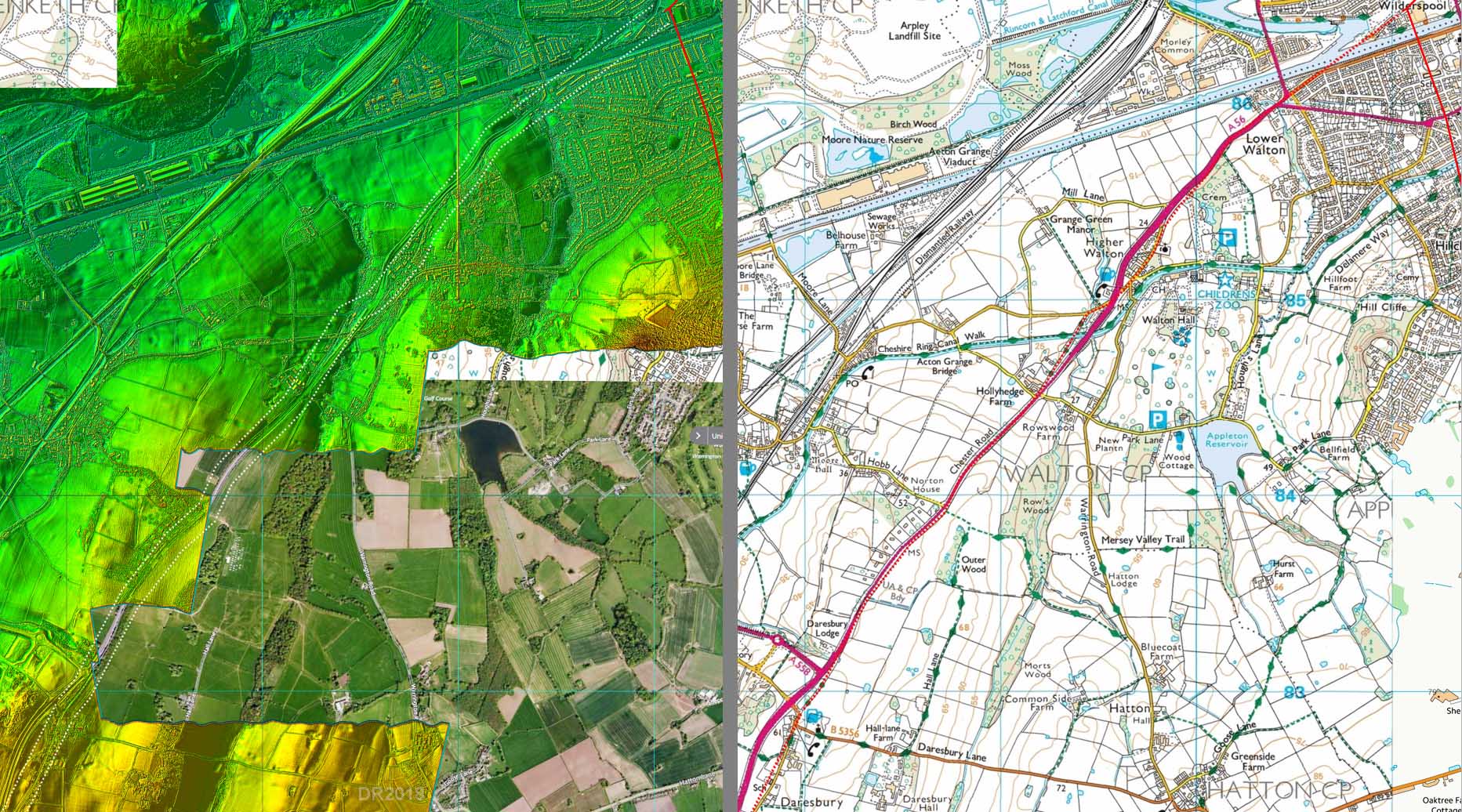 |
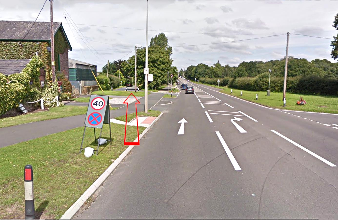
A56 approaching Higher Walton Near Hollyhedge Farm the old Roman line continues off to the left whereas the modern A56 now diverges right. |
Click for larger view |
 |
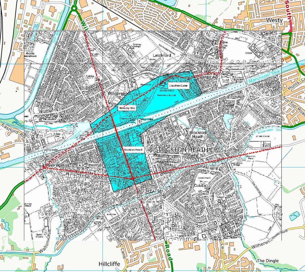
Roman Site, Wilderspool The Roman settlement at Warrington/Wilderspool seems to have been quite extensive from Stockton Heath in the south to under Warrington town centre itself. It appears to have been an important road junction with not just King Street but a probable road to Chester and perhaps one to Manchester as well. There also appears to have been two river crossings. Presumably a bridge at Wilderspool on the direct road north to Wigan and a second, probably a ford, at Howley. No fort has been found (yet) so it is classed as an industrial site and port with a primary purpose of supplying the military in the north-west. Ref: Cheshire Historic Towns Survey, Warrington |
Click for larger view |
 |
|
|
|
Last update: August 2018 |
© David Ratledge & Neil Buckley |