|
The Roman Road from Chester to North WalesMargary Number: 67aDistance: ?? milesThis route is certain in its existence - it features in Antonine Itinerary XI - but vague in its precise location at least in Cheshire. A straight route was impossible due to the extensive marshes of the Dee estuary. Margary suggests a southern diversion via Balderton and then via Bretton. That is what we have adopted here - it does seem the most logical.
|
Historic Counties: Cheshire & Flintshire Current Counties: Cheshire & Flintshire HER: Cheshire & Flintshire
|
|
|
|
|
|
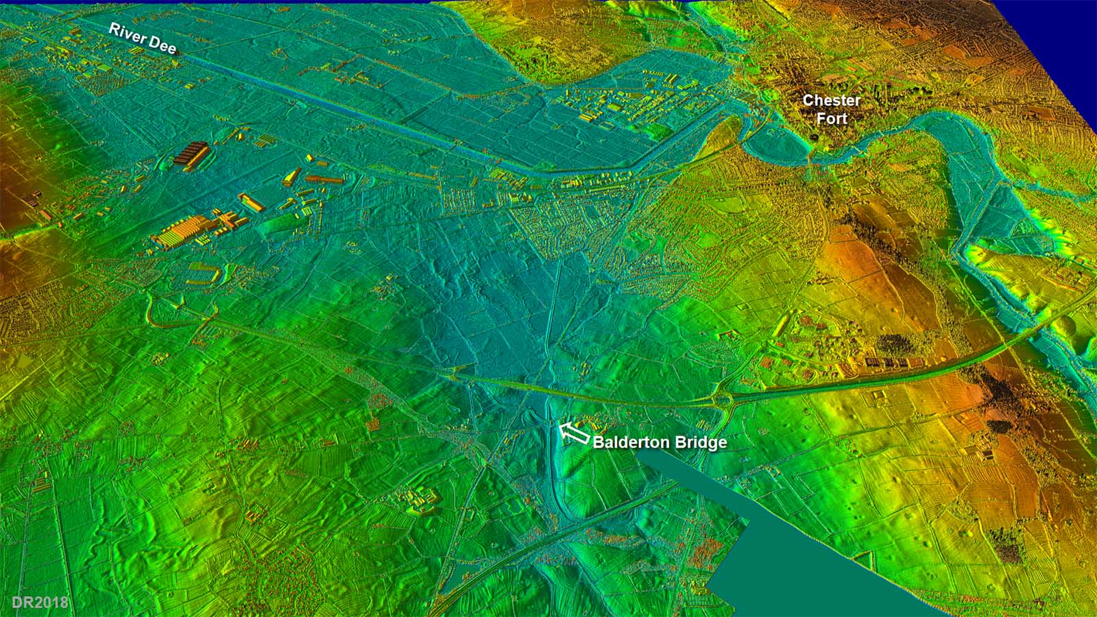
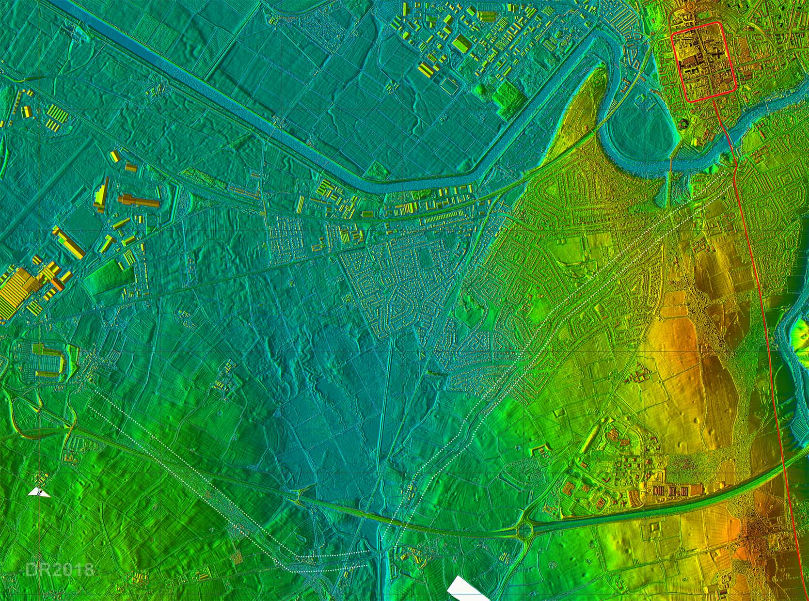
Oblique 3D Lidar Image - Dee Estuary The colour scheme on this lidar image has been selected to indicate what was probably sea-marsh in Roman times. To head west then a long diversion south was first necessary to get around Lache marsh (eyes). Balderton Bridge would appear to be the first and easiest crossing point. Margary hedges his bets on the line and said it could either be as shown or perhaps a branch off route Margary 6a - the Whitchurch road. English Heritage (Roman Chester, 1994) suggest a branch from Heronbridge. Nothing is visible that would confirm this and Eccleston is perhaps a more likely branching point.
|
Click for larger view |
 |
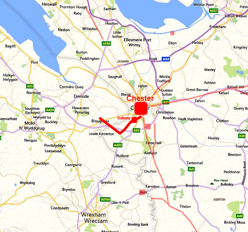
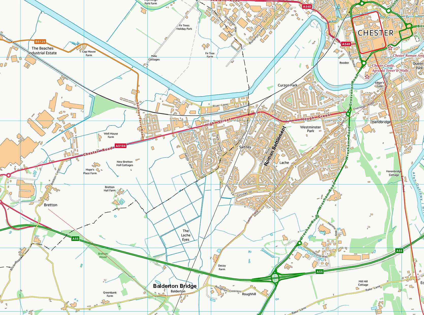
Route Map The route shown is based on Lache Lane and has the added support in that it passes close to the Saltney Roman Settlement. This lies just east of Clivedon Road and was discovered in the 1930s during housing development. It seems to have had a long existence but buildings appeared to be of low status. It would, of course, have needed a road connection to Chester. Balderton Bridge is marked as it is believed that this was the Roman crossing point too.
|
Click for larger view
|
 |
Lidar Image - Route Corridor There is not a lot of supporting Lidar image for the Lache Lane route - as it is mostly overlaid by the modern road. However, it is the most direct route to Balderton Bridge and does have the added benefit, as mentioned above, of probably serving the Saltney site as well. West of Balderton Bridge there is some faint lidar evidence for the line of the road heading in the direction of Bretton. This was suggested as the likely course by Margary. At Bretton we have now crossed into Wales. |
Click for larger view |
 |
|
|
|
Last update: July 2018 |
© David Ratledge |