
|
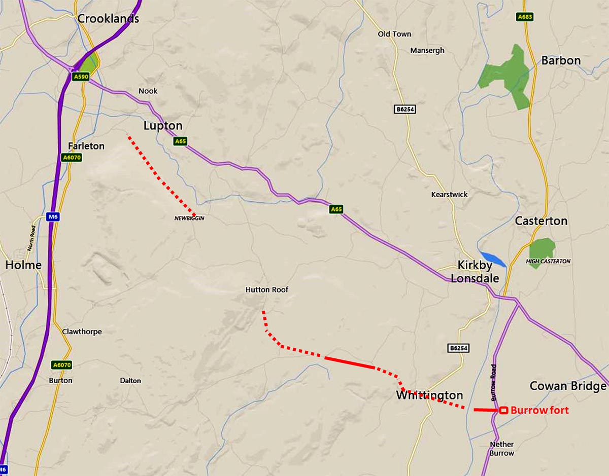
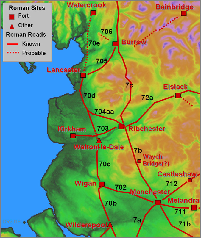
The Roman Road Burrow (in Lonsdale) to the North WestMargary Number: 706Distance: unknownThe suggestion for this possible Roman road is down to one man, Villy. In 1936 (C&WAAS), he suggested a route north-west from Burrow fort through Hutton Roof and Newbiggin. It has to be said the evidence is somewhat slim and no one else has ever produced anything more to support it. The connection to Kendal is even more problematic. Alternatively it could have been just a local road to stone quarries for the fort. |
Historic County: Lancashire & Westmorland Current County: Lancashire & Cumbria HER: Lancashire & Cumbria
|
|
Click for full size map
|
|
|
|
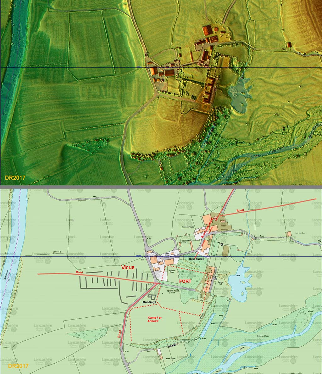
Lidar Image and Map - Burrow Fort Lidar has given us a route to the River Lune. Whether there was a bridge here is another issue. |
Click for larger view |
 |
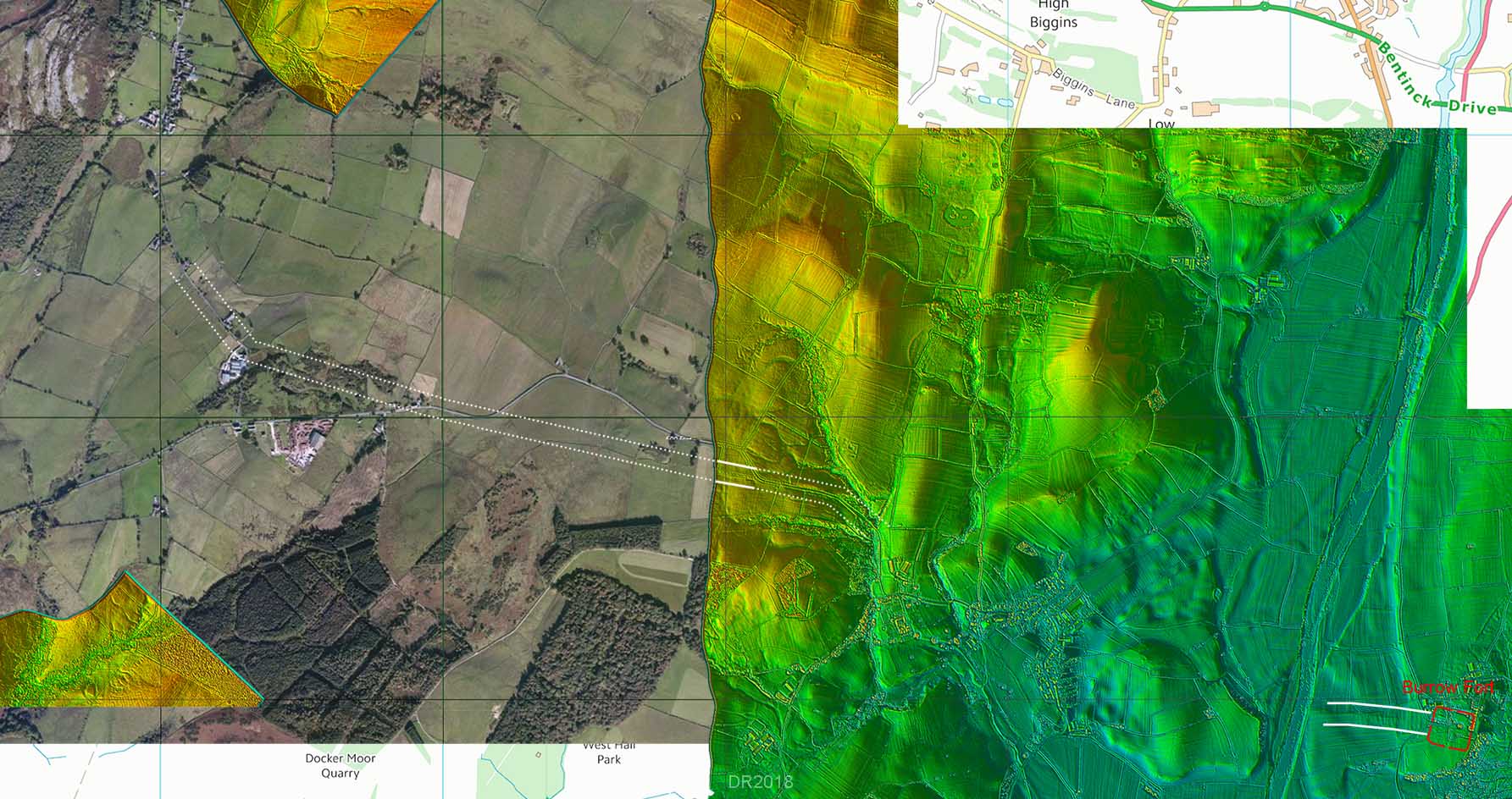
Lidar & Aerial Composite Image - Burrow to Hutton Roof That there is an old abandoned straight course of the minor road is not in doubt. But is it Roman? |
Click for larger view |
 |
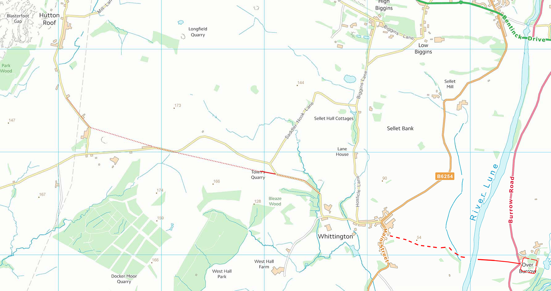
Route Map - Burrow to Hutton Roof On the west bank of the Lune there is a natural gap in the escarpment so surely it would have been exploited and there are some possible tracks extending this towards Whittington.. It is a bit iffy though. |
Click for larger view |
 |
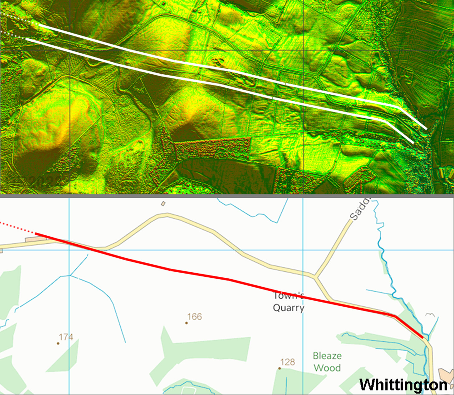
Lidar Image and Route Map - Nanny Hall, Whittington The first traces Villy spotted were west of Whittington where the line of an old road makes for Nanny Hall. The modern minor road takes a diversion off the direct route before rejoining the old road. This 1 km section is very convincing but there is nothing else I can find anywhere. A Roman road with no connections seems unlikely. |
Click for larger view |
 |
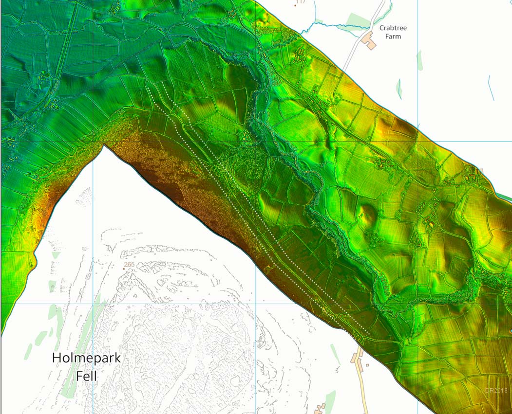
Lidar Image - Newbiggin to Puddlemire Lane Further on, over the county boundary, Villy suggested the route swung to the north towards Hutton Roof village before swinging back to the north-west through Newbiggin and finally along Newbiggin Lane and Puddlemire Lane. This was based purely on the fact that Newbiggin Lane and Puddlemire were straight. Nothing is visible on the Lidar connecting either at the southern or northern ends of Newbiggin Lane and Puddlemire The name "Puddlemire" is a concern too. Its northern end looks to end in what the lane is named after i.e. a wet mire! The A66 takes a much more sensible route and skirts around this presumably former boggy area.
|
Click for larger view |
 |
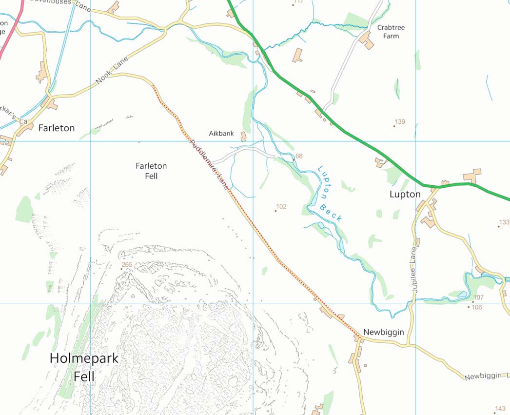
Route Map - Newbiggin to Puddlemire Lane Sure Newbiggin Lane and Puddlemire Lane are straightish but that is their only Roman characteristic. Generally they are far too narrow.
|
Click for larger view |
 |
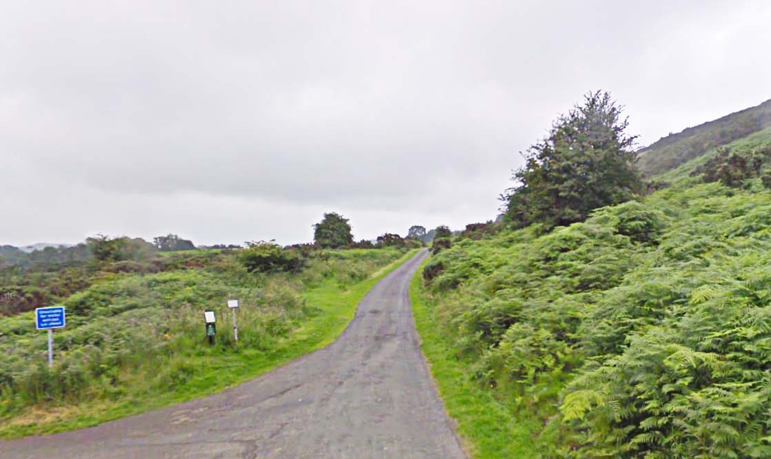
Newbiggin Lane - looking South-East This about the only part of Newbiggin Lane and Puddlemire Lane that could pass as possibly Roman. The image below is much more typical.
|
Click for larger view |
 |
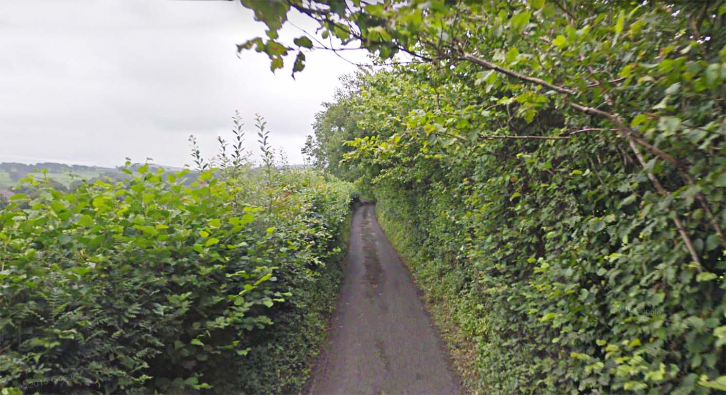
Puddlemire Lane It might be straight but boy is it narrow. Meeting on-coming traffic on this road is a nightmare! Conclusion The evidence for Margary 706 being a Roman route is very weak and all things considered it needs considerably more proof for it to be considered a definite Roman road.
|
Click for larger view |
 |
|
|
|
Last update: May 2025 |
© David Ratledge |