|
The Roman Road from Lancaster to Burrow (in Lonsdale)Margary Number: 705Distance: 13.5 milesThe Lune Valley forts of Lancaster and Burrow-in-Lonsdale were obviously connected by a road but again evidence on the ground for its route has been difficult to pin down until the arrival of Lidar. Virtually all of its route can now be plotted with high confidence. Crucial to the discovery of the route was the milestone found at Artle Beck, Caton. Not only did it indicate there was a road but it placed strict limitations as to the route it must have taken from Lancaster, at least for its first stretch. Conventional wisdom and most publications suggested a dog-legged route via Quernmore Road, which could never match the distance recorded on the milestone. |
Historic County: Lancashire Current County: Lancashire HER: Lancashire
|
|
|
|
|
|
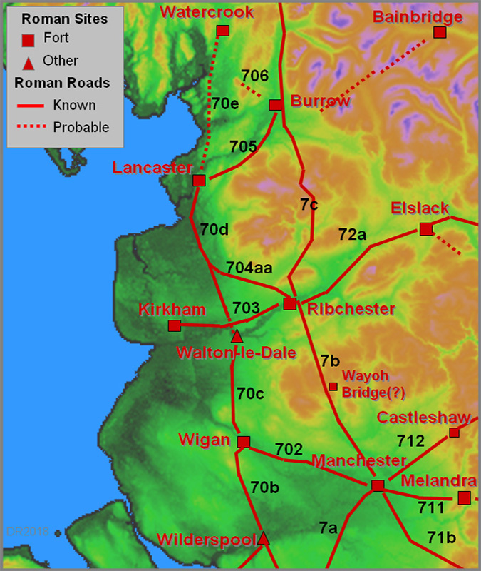
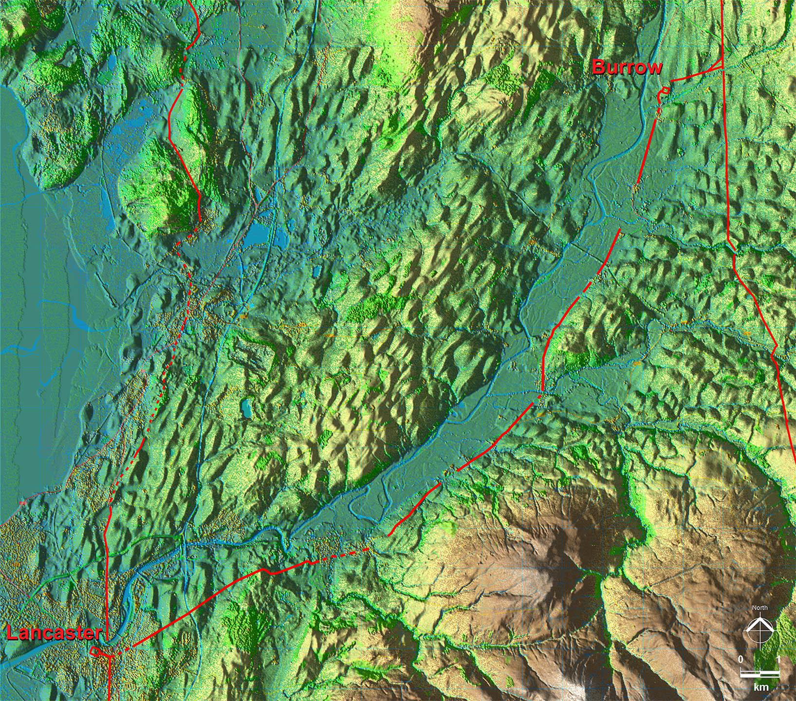
Lidar Image - Full Route The route in the context of the Lune valley and the other Roman roads. The link across to the north road from Ribchester at Burrow clearly indicates that that road was the earlier. |
Click for larger view |
 |
VIDEO - Updated 2025For a fly-over along this Roman road from Lancaster Fort to Burrow then click on the video below. For full screen playing then click on the icon bottom right.
|
||
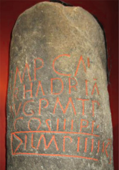
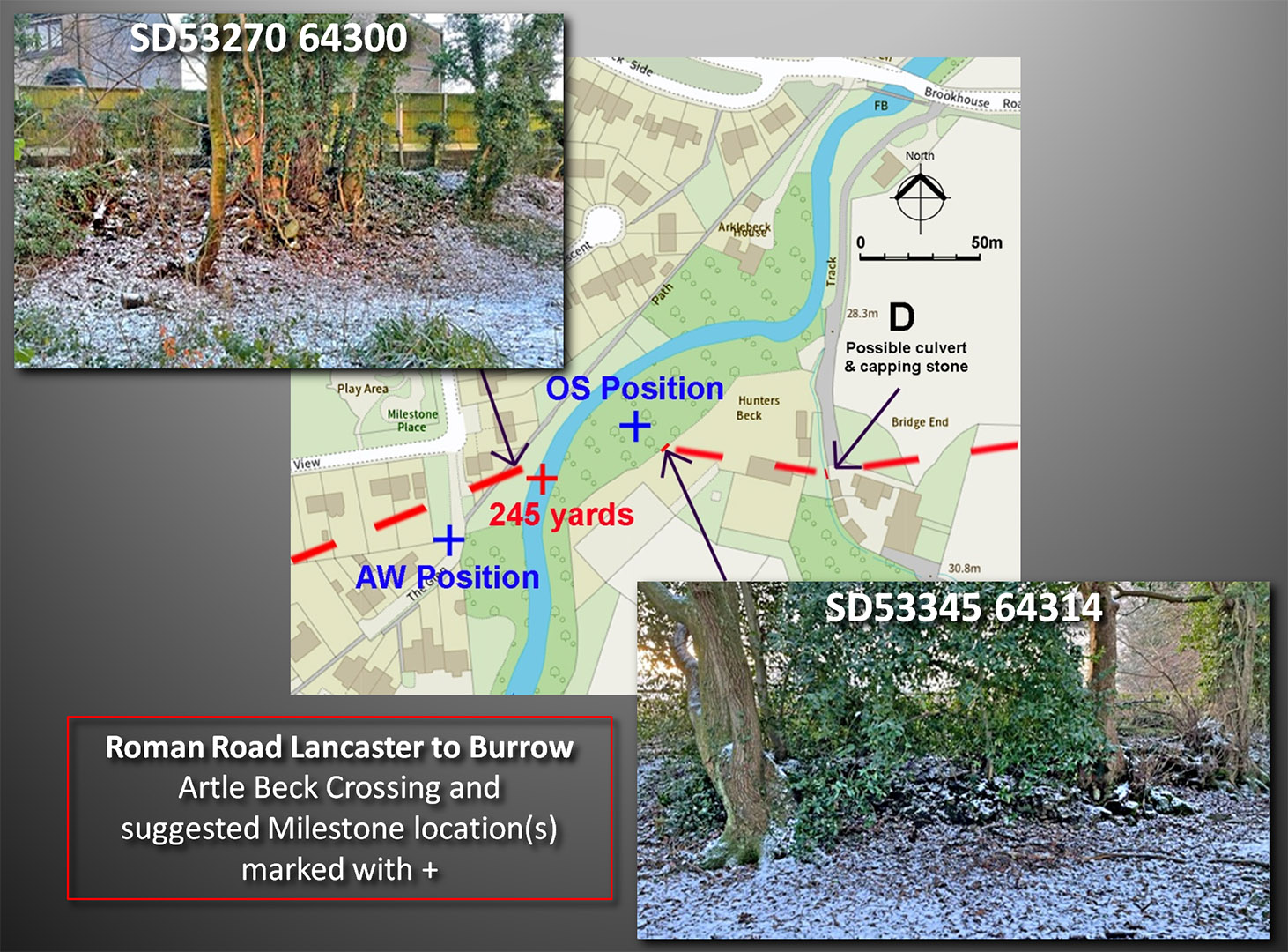
Artle Beck Roman Milestone The find spot was in the vicinity of Milestone Place, Caton. However, historical research by Andrew White placed the find spot at SD53256427 at 245 yards upstream of bridge (Contrebis 1992). This is a little further south-west than shown on the OS map - see later. The important last line seems to comprise >I LMPIIII I<. The start and end symbols appear to be embellishments so we are left with: L (must be short for Roman Lancaster's name), MP mille passuum (miles), IIII (4). The good condition of the milestone indicates that it must have been very close to its original location as if it had been subject to much river movement it would surely have been damaged, which is clearly not the case. The important clue is that the milestone records the distance as 4 (Roman) miles - presumably from Lancaster. The straight line distance to Lancaster fort's eastern gate is approximately 6250 metres or just over 4 Roman miles. The initial route out of Lancaster to Caton must therefore have been very direct. Despite the milestone clue, a route via Quernmore Road had traditionally been assumed to be its probable route and most books/maps still show that indirect course. However, this would invalidate the milestone distance being almost a mile longer but traces of a road were found south of Caton (near Gresgarth Hall) in 1992 and the indications were of a South-West to North-East alignment (ref. Shotter & White). In the light of what has now been discovered, that is perhaps best explained as a possible branch road to the Quernmore kilns. The milestone is kept in Lancaster Museum. |
Click for larger view |
 |
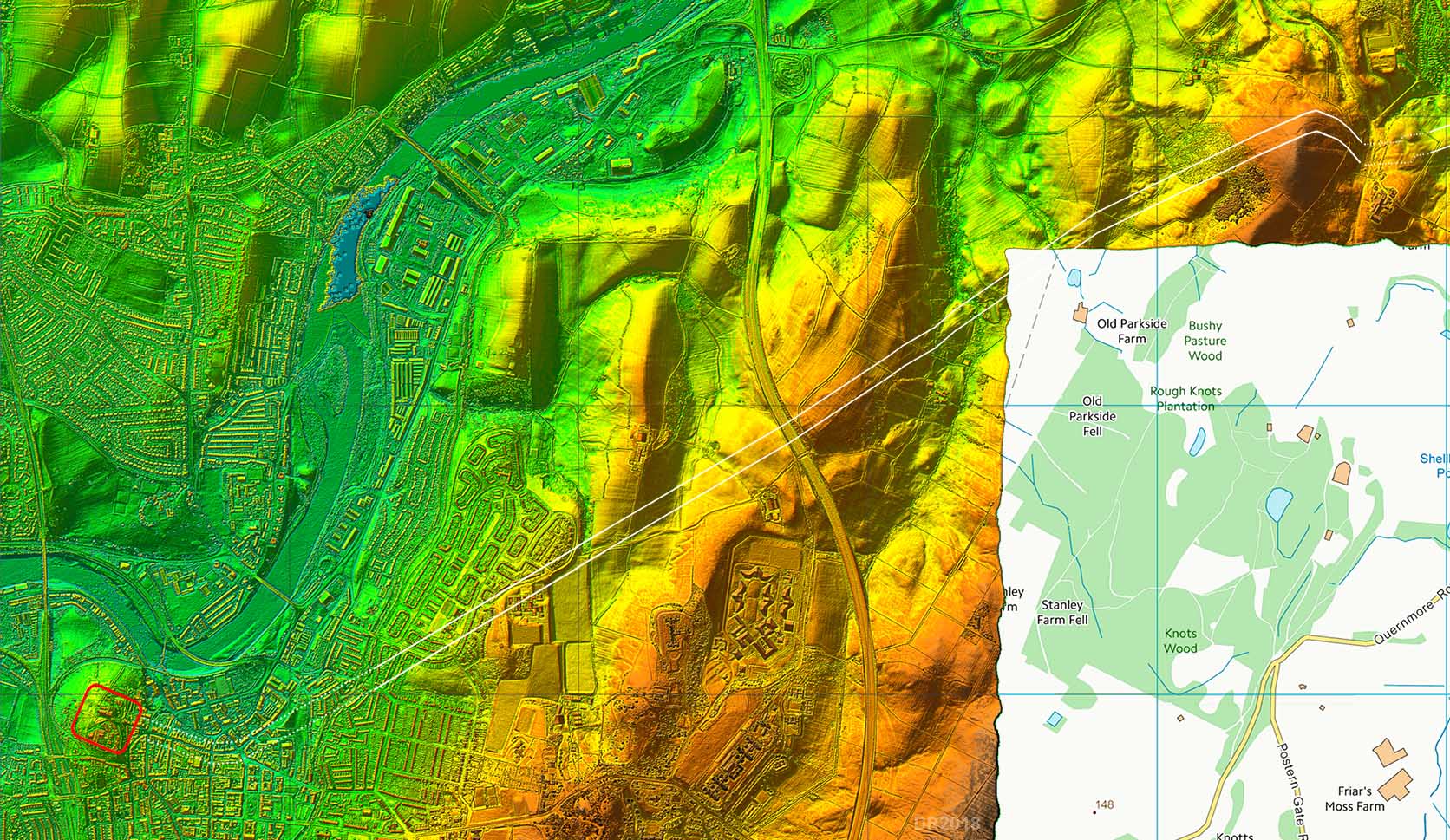
Lidar Image - Lancaster to Old Hall Farm What Lidar has revealed most convincingly is the route to Caton and possibly through Brookhouse too. It does indeed follow a very direct route. Its initial route is marked by Crag Road before ascending via the Ridge and north of Old Parkside Farm. This area has very little public access which possibly explains why the road was not found earlier. |
Click for larger view |
 |
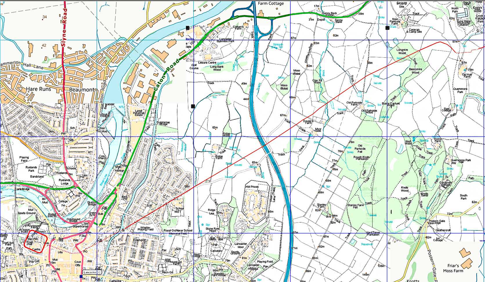
Route Map - Lancaster to Old Hall Farm Church Street and the start of St Leonard's Gate almost certainly mark the initial course of the road. First edition OS maps show a hedge line (near the graving dock) aligning with this course and the Lidar route over the Ridge so we can can be reasonably confident in this alignment. |
Click for larger view |
 |
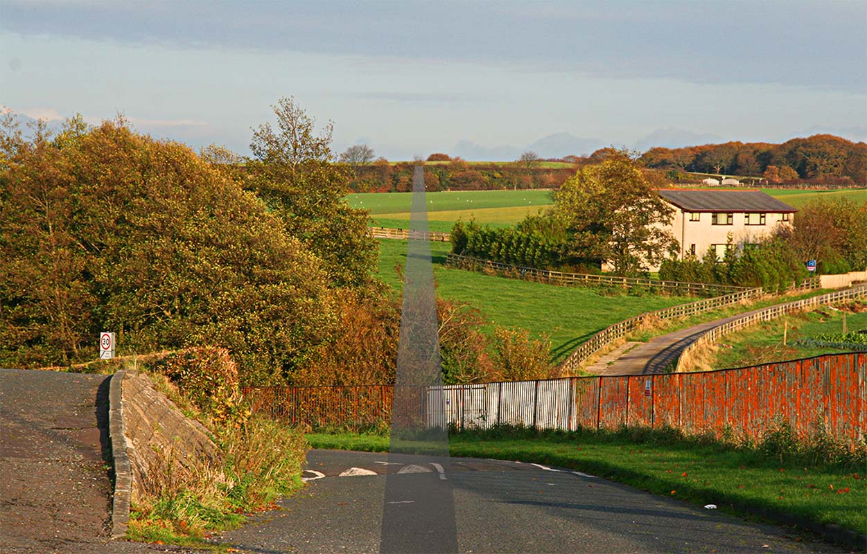
Crag Road - looking towards the Ridge & Caton The route towards the Ridge is first marked by Crag Road before the road ascends via the Ridge, crossing the M6 motorway and then passing Old Parkside Farm. Despite being clear in the Lidar data this first stretch is all but invisible on the ground. The old road over the Ridge is a public right of way giving the only public access to this alignment. |
Click for larger view |
 |
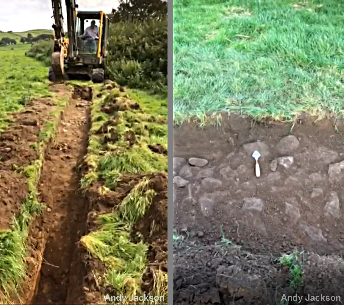
Excavations, The Ridge, 2020 Two private excavations were carried out in August 2020 by Andy Jackson at the Ridge, just east of the M6 Motorway. The road was proved but had suffered much plough damage making determination of the road's width very difficult. The left image was the first trench behind the hedge, the right image is of a smaller pit opened about 30 metres further east. In both cases only the foundation stones of the road had survived. As for its width then the road was at least 6 metres wide but without the ditches being identified this should be regarded as approximate. The trowel indicates the road's direction. Please note the field is private. See below for map of excavation location Images: Andy Jackson |
Click for larger view |
 |
The Ridge, Excavation 9th August 2025, SD49795 62938 The team from Wyre AS returned to the Ridge to excavate the road a little bit further into the field than the 2020 excavation. With 10 diggers the remains of the road were exposed and with rain falling the stones were nicely highlighted. This time the width of the road could be measured - it was 7.5 metres wide. The stones exposed would have been the foundation layer. The road surfacing (gravel down to dust) would have been removed long ago by ploughing. The close up shows a stone damaged by the plough. Diggers: Sian, Kev, Paula, Jenny, Nic, Jim, Simon, Andy, Dave and Helen. Last 2 not in picture Images: Kev, Simon, Dave |
Click for larger view |
 |
Oblique 3D Lidar View - Denny Beck Quite a disturbed section but just enough traces to work out the route. |
Click for larger view |
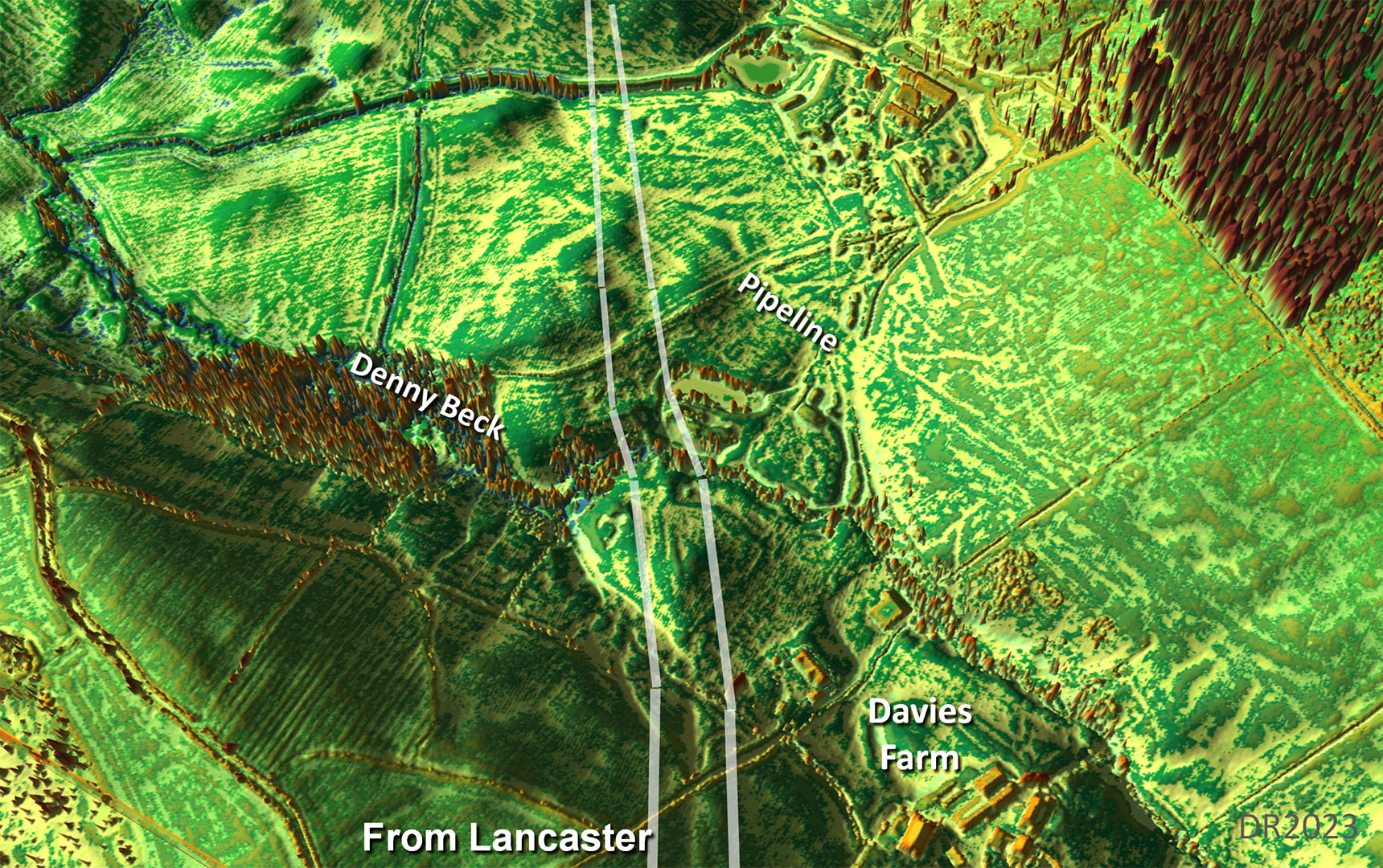 |
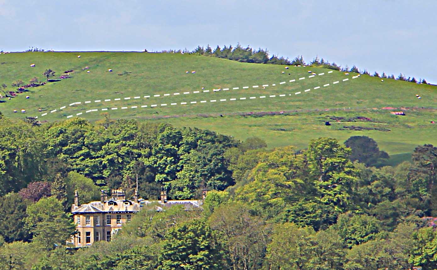
Descent near the Pumping Station Continuing on, the road passes north of a OS triangulation column before turning southwards to angle down the slope - descending to just south of a new Pumping Station. This descent is visible from Caton Green using binoculars but needs the light in the right direction for it to become obvious. Escowbeck House is the fabulous country house visible - see below.
|
Click for larger view |
 |
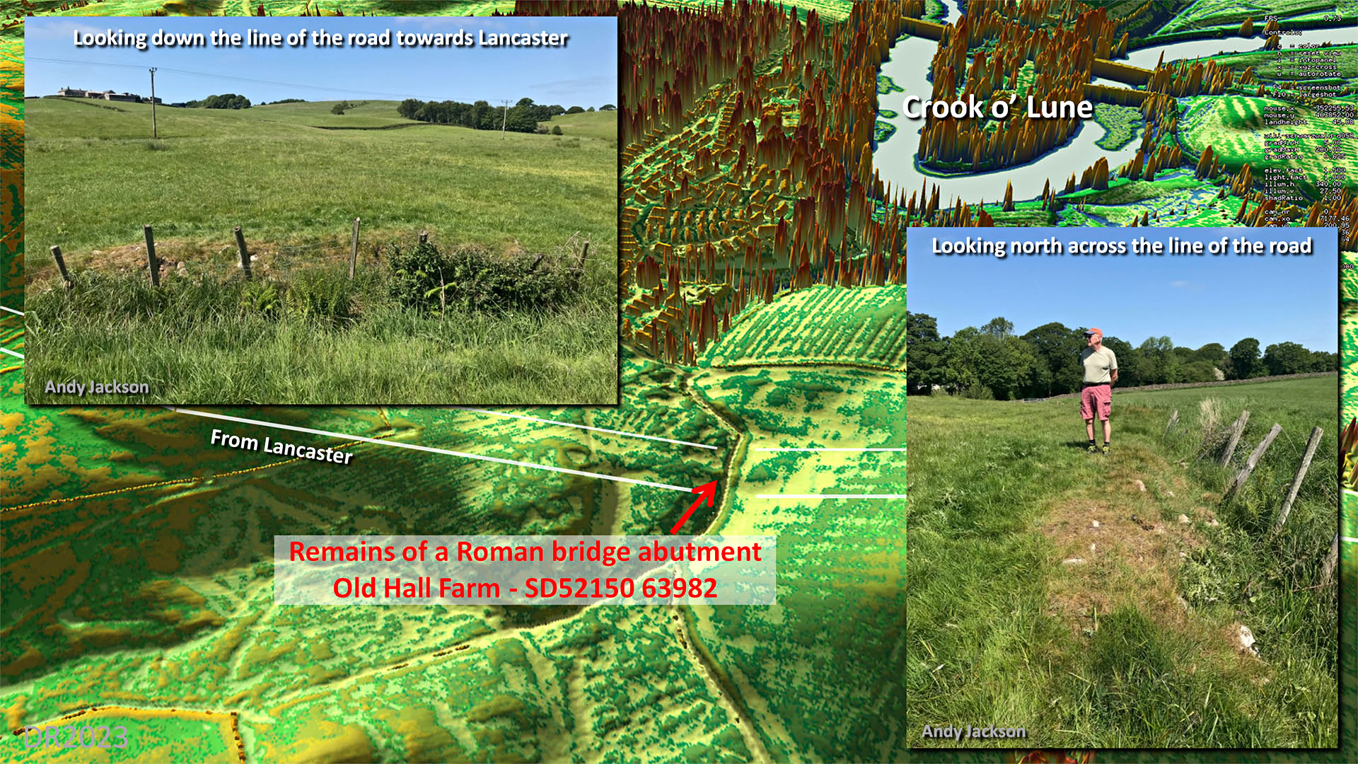
Probable Bridge or Culvert Remains - Old Hall Farm Andy Jackson & Phillip Crawshaw had permission to walk the alignment through Old Hall Farm towards Escowbeck House. Where the orad crossed a small stream were the remains of the Roman bridge or culvert abutment. One explanation for wehat was visible is that the Roman structure had collapsed and the stonework was cleaned out of the stream and heaped on the bank. Images: Andy Jackson |
Click for larger view |
 |
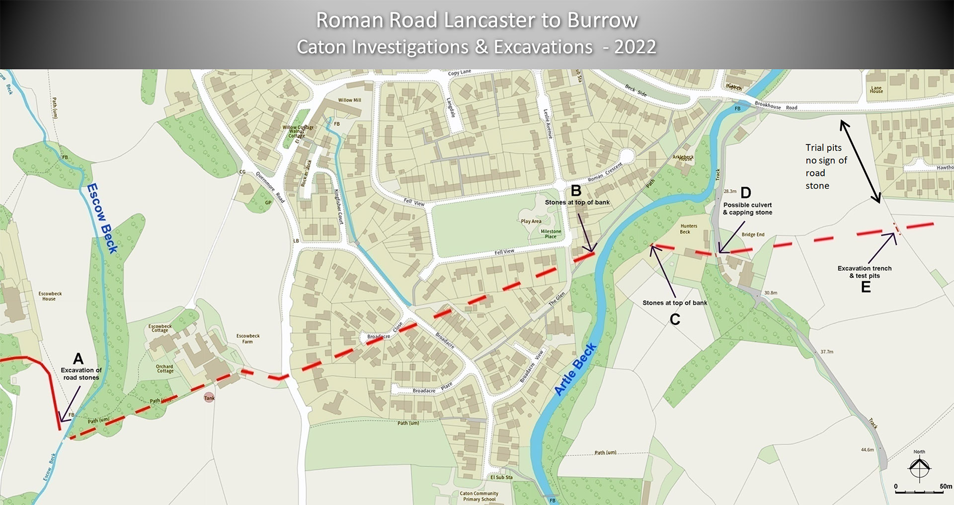
Caton 2022 - Site Investigations and Excavations at Caton Andy Jackson & Phillip Crawshaw mounted a serious attempt to resolve the route of the Roman road across Caton in 2022. Five sites were examined from Escowbeck House to the field just beyond Bridge End. Details of their findings below. Note - they also investigated sites and excavated one in Brookhouse but no firm conclusion could be reached. |
Click for larger view |
 |
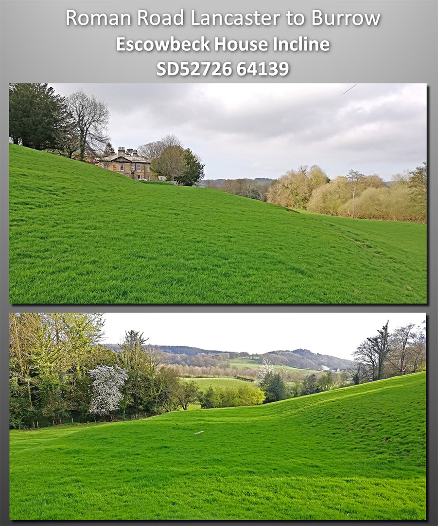
Escowbeck House - Incline We are looking up the incline (top) and down (bottom), which takes the road down to Escow Beck. Escowbeck House is visible in the top image. The incline has been extensively landscaped but it is likely that the Roman route down was simply "improved". It is far too wide for just a path. Images: Mark Johnson
|
Click for larger view |
 |
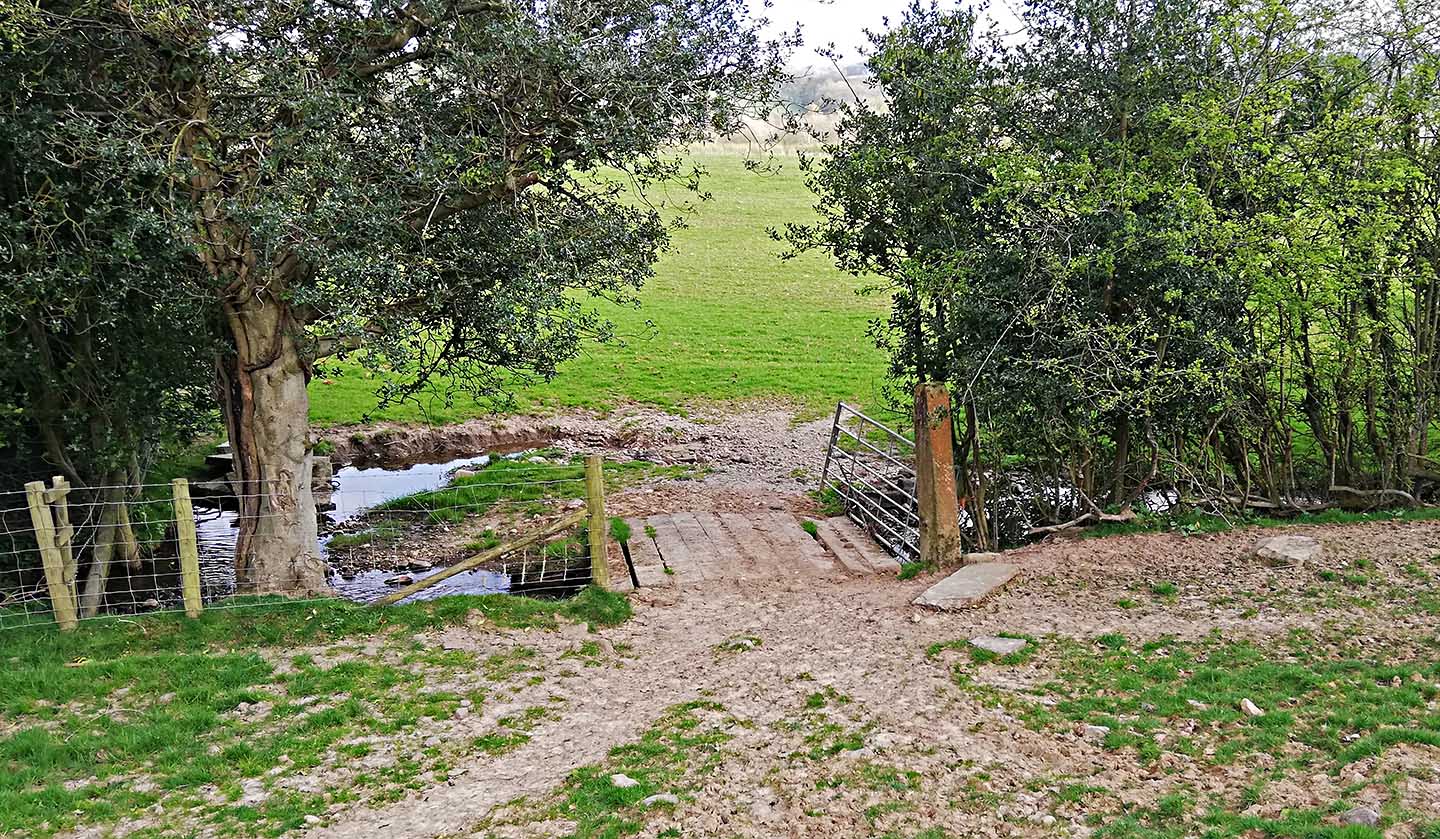
Escowbeck House - Escow Beck Crossing At the bottom of the incline our road turns to the east to cross Escow Beck. Very much disturbed here but the Roman crossing would have been hereabouts. The boundary (left across the little bridge) and track passing Escowbeck Farm possibly represent the Roman line onwards to Artle Beck. Image: Mark Johnson
|
Click for larger view |
 |
Crossing of Artle Beck and the Milestone Location Three possible milestone locations are marked with a "+" . The AW one is that suggested by Andrew WHite in Contrebis 1992 .- this was based on Slinger's position of 245 yards above the bridge. However, for some reason, it does not actually measure 245 yards from the bridge. The actual 245 yard distance is the one marked "245 yards". The third position is that shown on OS mapping. Andy Jackson & Phillip Crawshaw examined the area and found at the top of both banks of the river the remains of the road agger - large stones over an 8 metre width. There were only the odd stone away from these spots. Pretty conclusive proof that the crossing point for the road had finally been located. In reality all 3 milestone positions would fit with this location.
|
Click for larger view |
 |
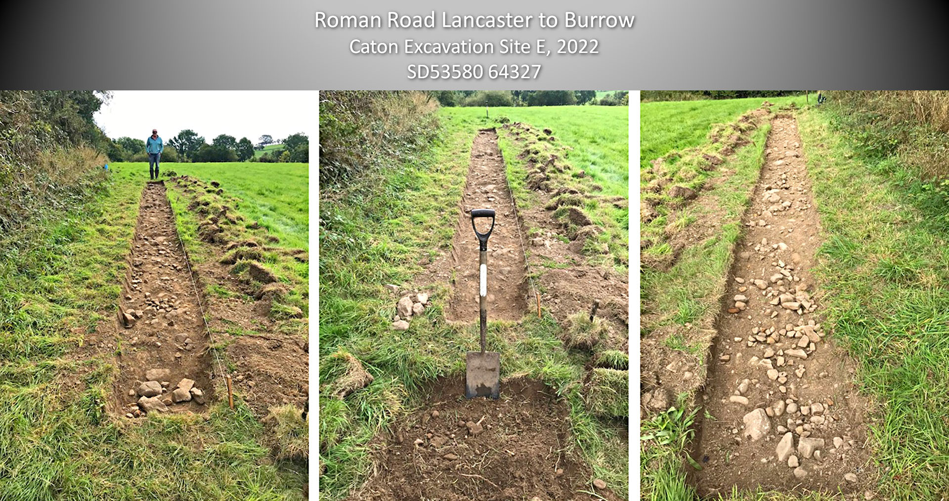
Excavation of the road near Bridge End Cottage - Site E, SD53580 64327 In the fields to the east of Bridge End Cottage, Andy and Phil attempted to locate the road. They ran a series of trial pits across the field nearest the road without finding any trace of it (double ended arrow on location map). However, in the next field, alongside the hedge they found the road. They excavated a trench across it with trial pits beyond.. The stones of the road agger were clear over a 7 to 8 metre width - beyond this in the trial pits were only the odd stone.
|
Click for larger view |
 |
Oblique Lidar Image - looking back across Caton We now have several secure clues as to the course of the Roman road across caton heading into Brookhouse. 2025 Update (inset): A new housing estate has begun construction across the Roman line at Brookhouse. As is normal nothing archaeological was found and development could proceed undelayed. How convenient. Andy Jackson paid a visit and looked into the field in line with where he and Phil carried out the above excavation. The scatter of the road stones was evident just where Lidar shows the faint remains of the road agger. |
Click for larger view |
 |
Excavation of the road opposite No. 55 Caton Green Road - December 2023 Next clue of the far side of Brrokhouse is another excavation by Andy and Phil. There is no trace in the fields leading to this point - looks all ploughed out - but a swell in the hedgeline gave a hint the road may be here. Bingo they found it. From here it will merge in with Caton Green Road |
Click for larger view |
 |
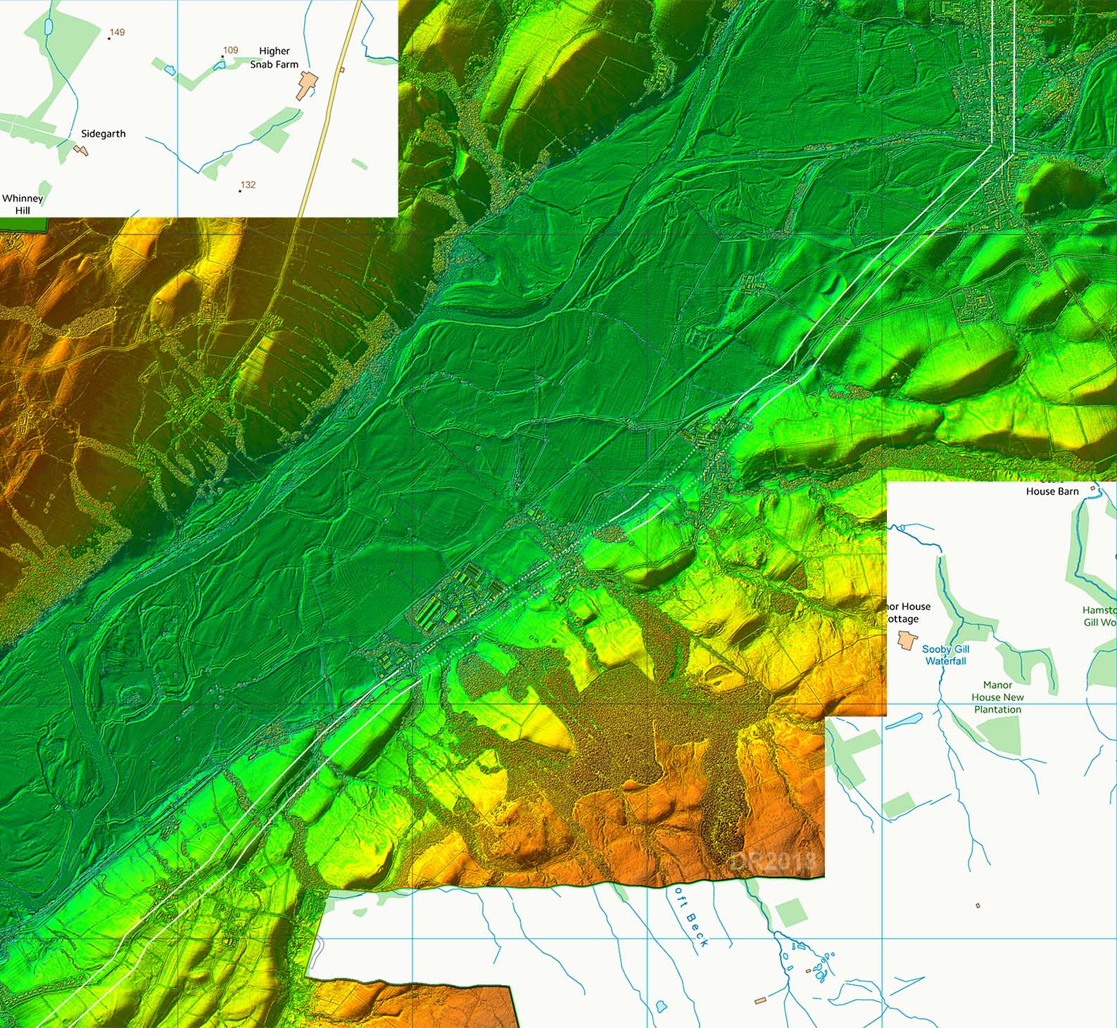
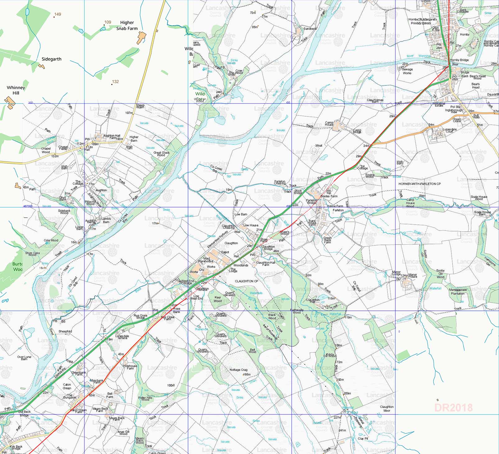
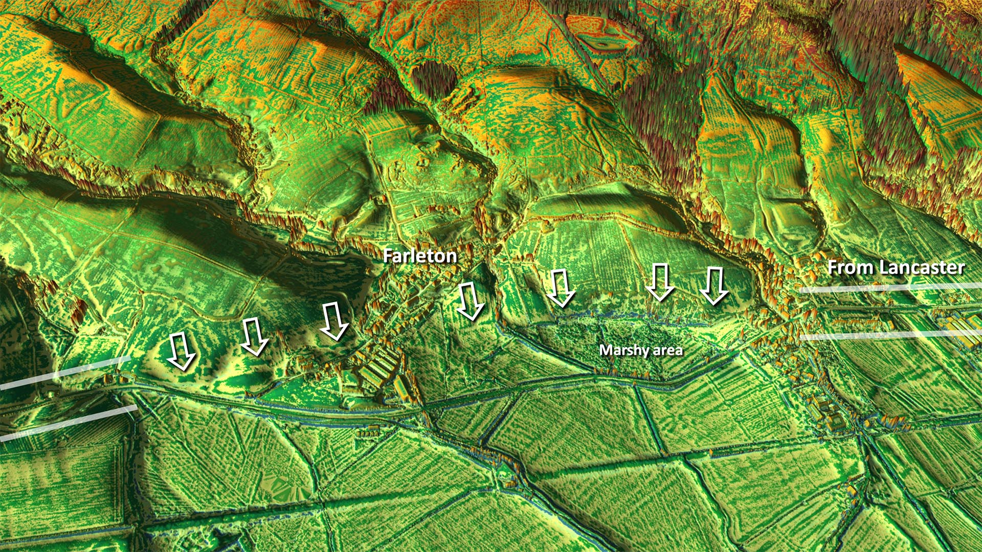
Lidar Image - Caton Green to Hornby Through Caton Green the modern road probably overlies much of the Roman line. Shortly after where the road from Brookhouse joins the A683 at Rose Bank then the agger is again evident (see later). Old and modern routes merge again for a short stretch at Claughton but then diverge at Farleton. Here the Roman route heads south-east to find drier ground around a boggy low lying area. Modern and Roman lines rejoin at the old Toll Cottage and head towards Hornby. Just after the old railway line then the Roman alignment keeps straight on whereas the modern route head off to the south. Projecting the Roman alignments from north of Hornby and south of Hornby indicates that the Roman bridge over the River Wenning was at or very near to the modern bridge. |
Click for larger view |
 |
Route Map - Caton Green to Hornby A pretty direct section of the road with clearly the crossing of the River Wenning being its target.
|
Click for larger view |
 |
Oblique Lidar Image - Claughton The Roman line carries straight on when the modern road from Caton Green drops down to join the A683. Beyond Rose Bank is a fabulous surviving terrace way around 8 metres wide - see below. Note the terrace is on private land with no access.
|
Click for larger view |
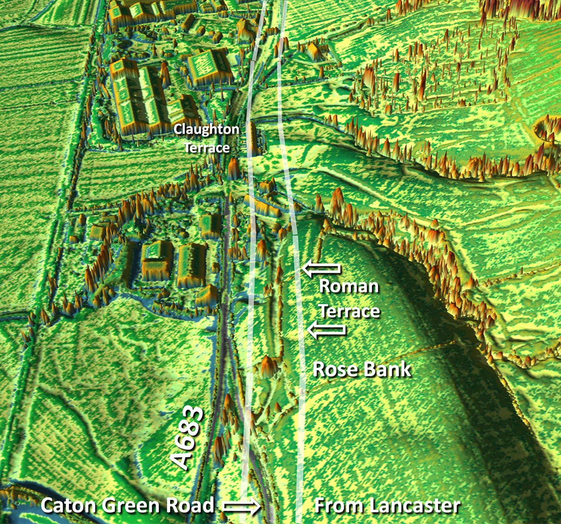 |
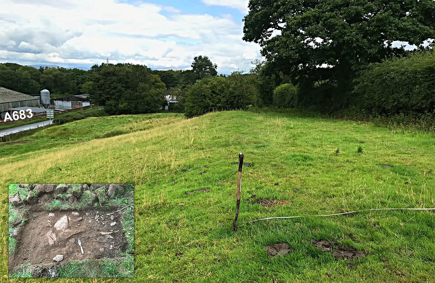
Roman Road north-east of Rose Bank, Claughton 1 Beyond Caton Green and just visible from the A683 are clear indications of the road north-east of Rose Bank at SD559660. Here the road has survived as a terraceway across side-sloping ground. It is perhaps the best surviving stretch on the whole road. The road is to the right of the spade.Inset - shows a test revealing stones just below the surface. Image: Andy Jackson
|
Click for larger view |
 |
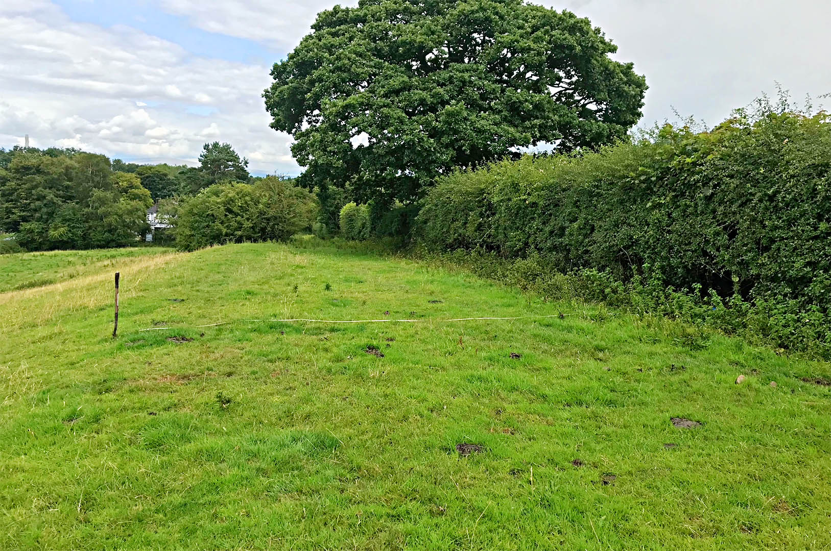
Roman Road north-east of Rose Bank, Claughton 2 We are stood on the road in this view looking towards Burrow, which gives a better idea of the large width of the terrace - around 8 metres. Image: Andy Jackson
|
Click for larger view |
 |
Oblique Lidar Image - Farleton We are looking across the road line as it passes Farleton. The road skirts around a marshy patch and keeps to the edge of dry land out of the River Lune flood plain..
|
Click for larger view |
 |
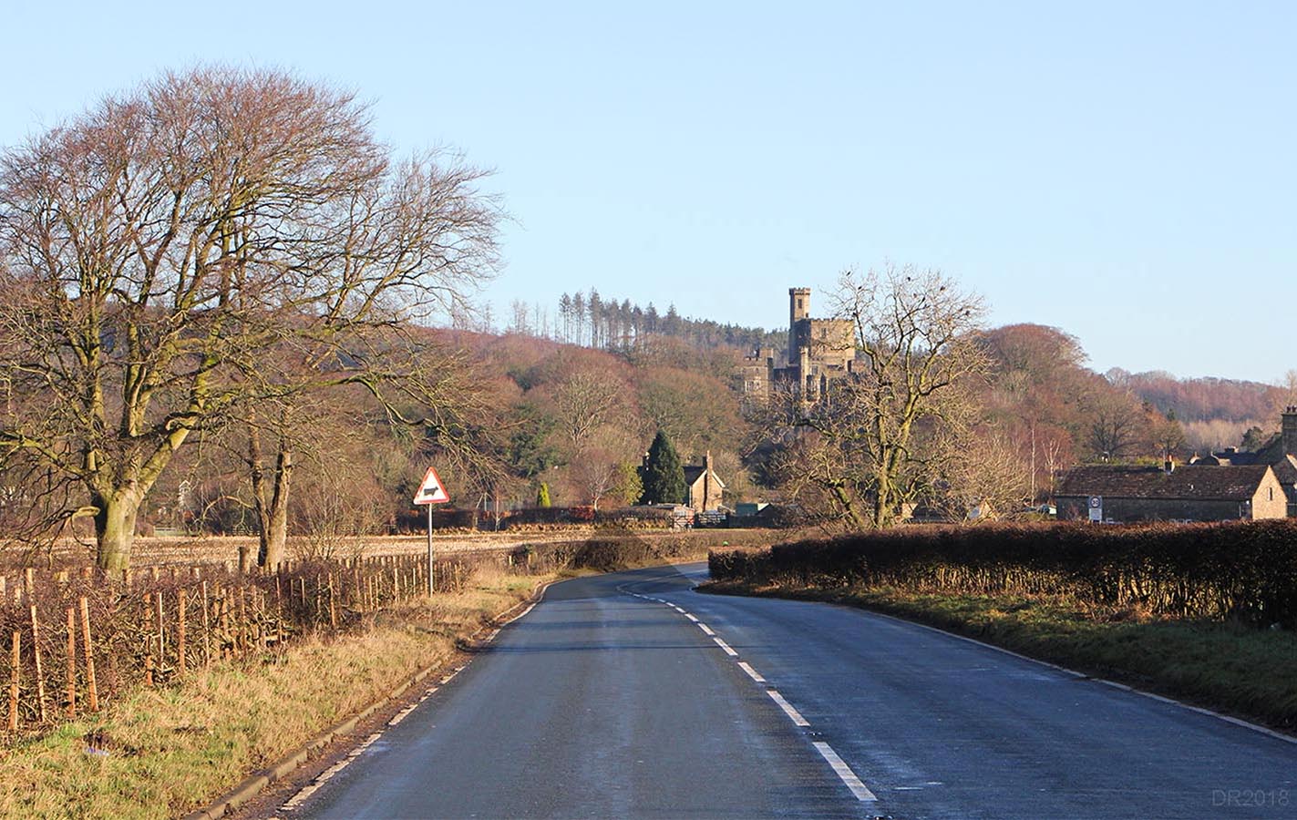
A683 - approaching Hornby The modern road overlies the Roman line approaching Hornby - aligned just left of the Castle. It is aiming for a crossing of the River Wenning at or very close to the modern bridge site. This photo is taken from where the old railway used to cross and shading added to show the Roman line..
|
Click for larger view |
 |
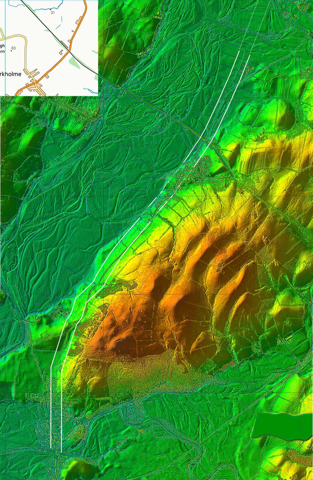
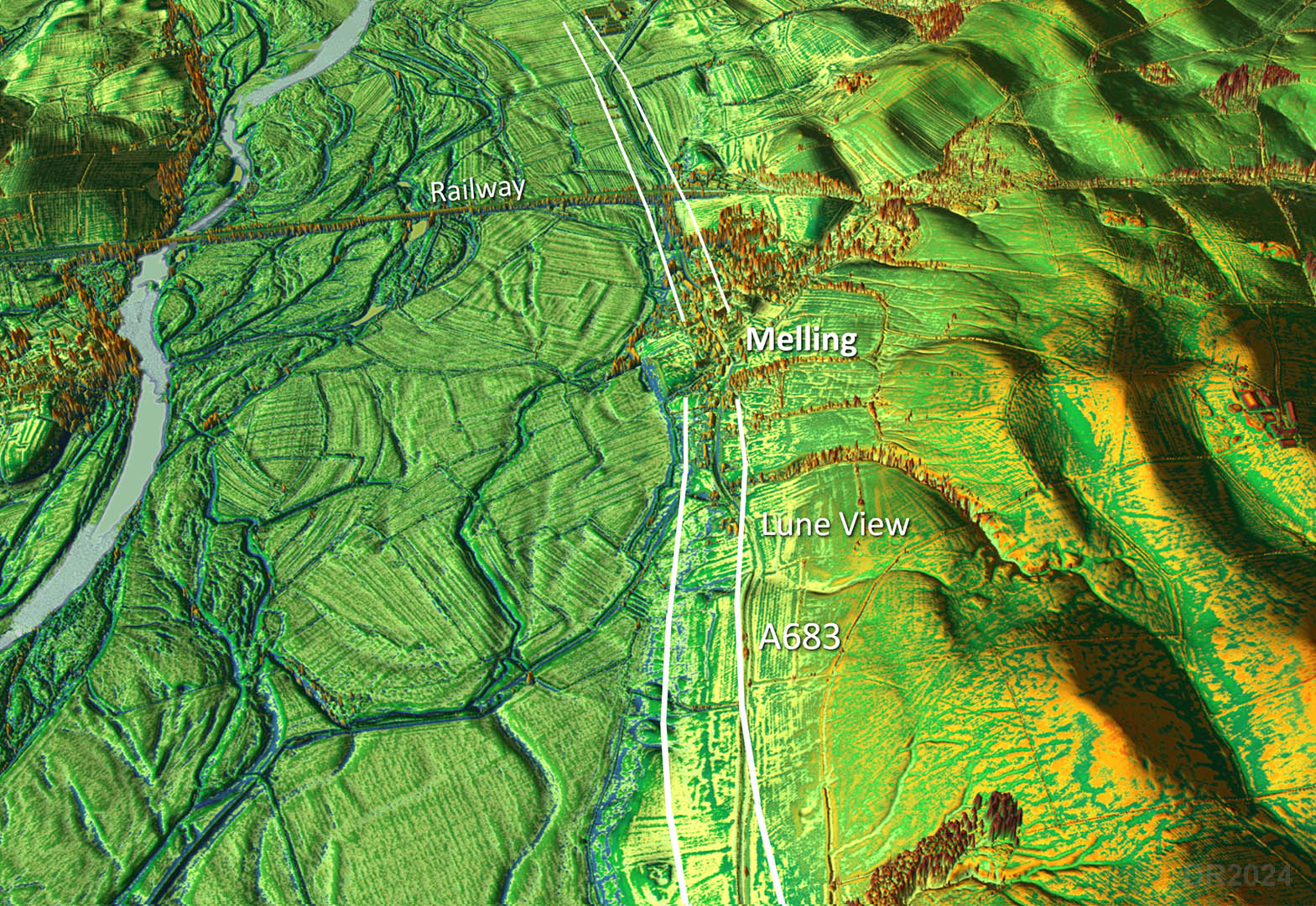
Lidar Image - Hornby to the River Greta The Lidar evidence resumes north of Hornby and the A683 coincides for a couple of short spells before the Roman line diverges off at Holme Head and again approaching Lune View at Melling. Beyond Melling and the railway bridge then opposite Sockburn House then an agger is again visible. Hedgerows follow it a further but eventually it reaches the flood plain of the River Greta and all traces end. Projecting a straight line onwards is probably the best guess but this does align with the road at Tunstall so is probably correct. |
Click for larger view |
 |
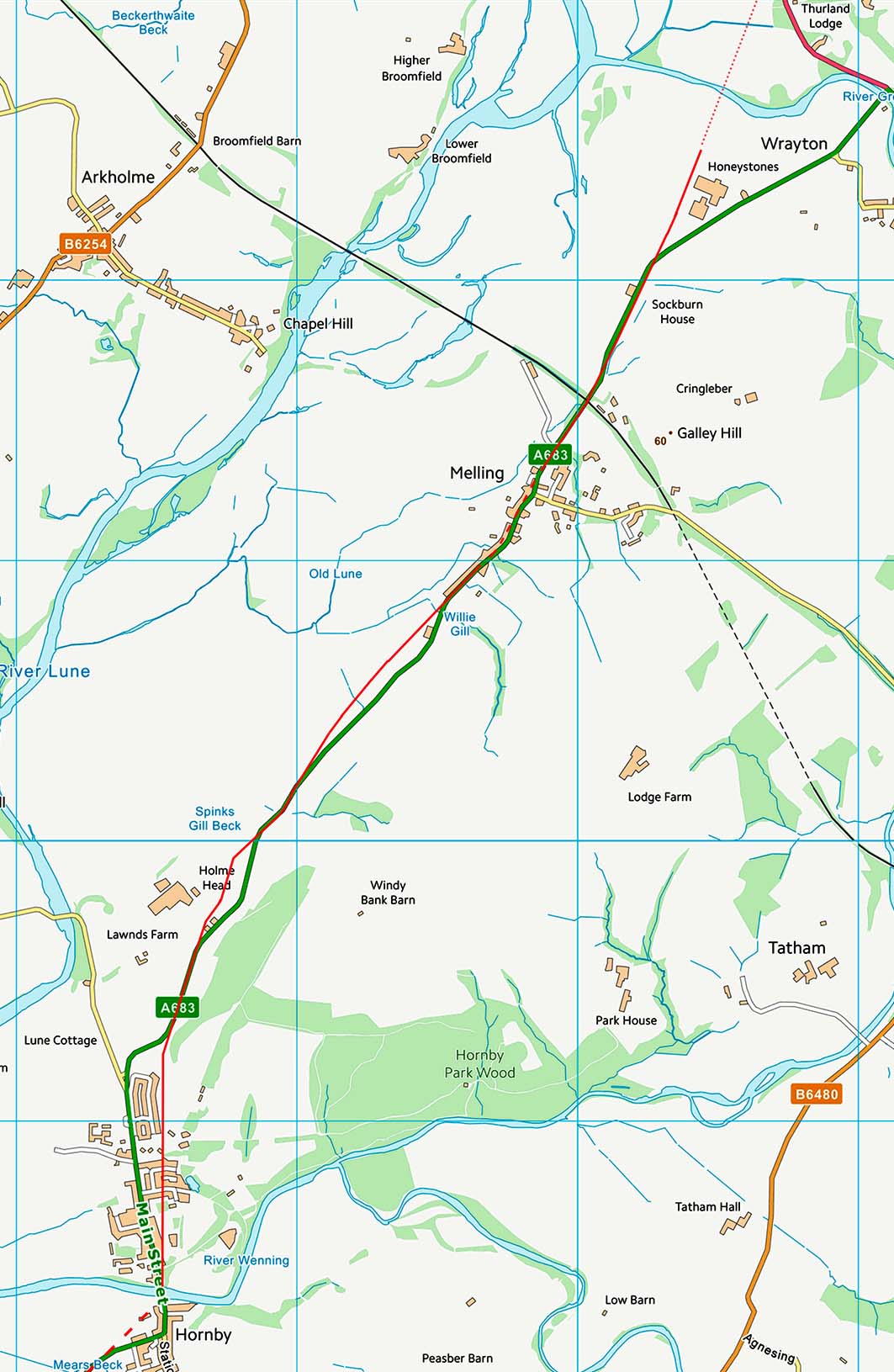
Route Map - Hornby to the River Greta The Roman line through Hornby is to the rear of the properties on the A683. At Melling the Roman line is north-west of the A683 again to the rear of modern properties.
|
Click for larger view |
 |
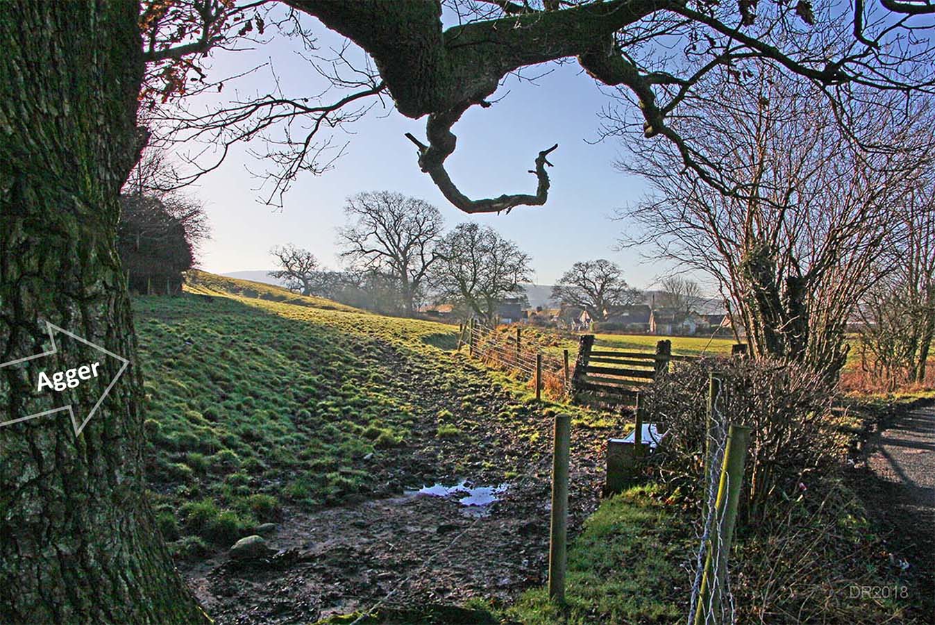
Hornby - looking from the north side of Hornby back to the village (SD 5853 6928) The Roman agger is indicated by the arrow and is seen here on the north side of Hornby. The A683 is on the right of this photo and bends off the the Roman line to join the road from Loyn Bridge.
|
Click for larger view |
 |
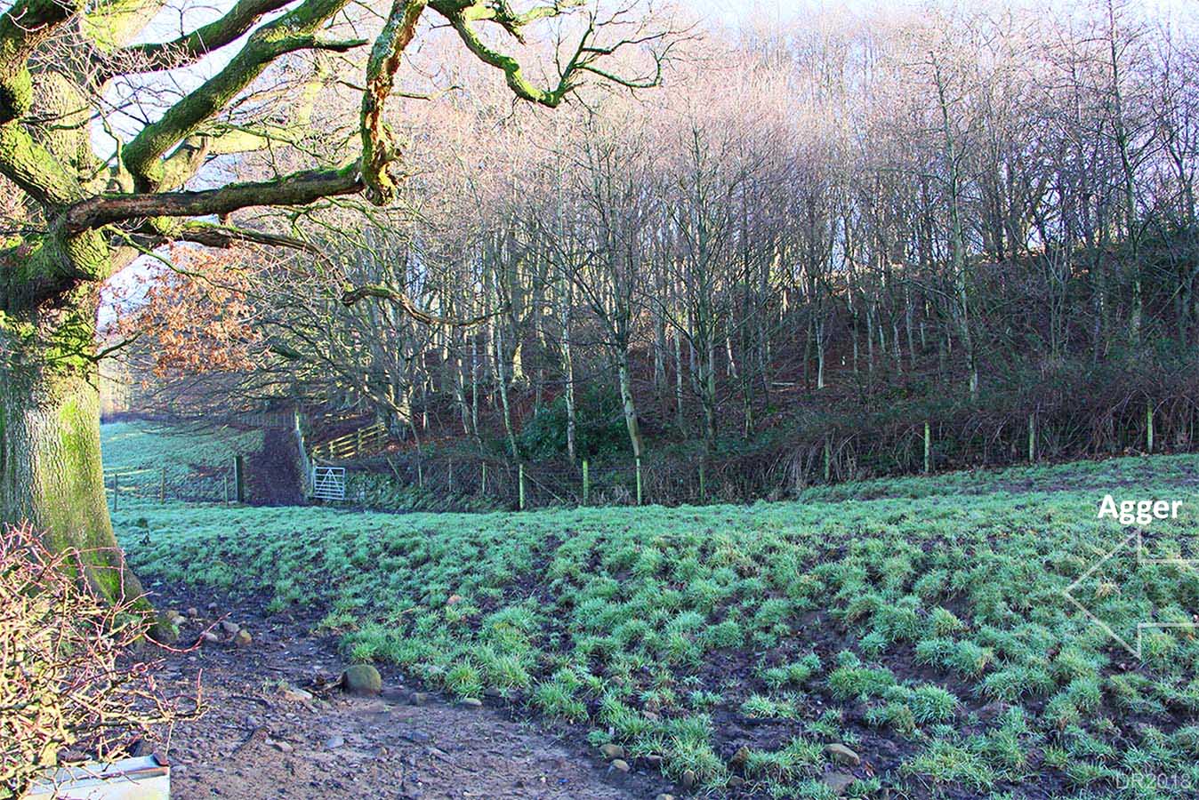
Hornby - SD 5853 6928 Same spot as above but looking around the tree to see the large agger. Some stones from the road are also evident.
|
Click for larger view |
 |
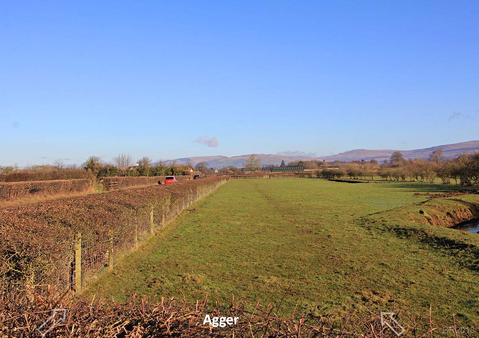
Agger north of A683 - approaching Melling After Hornby the Roman road crosses to the north side of the A683. The agger is even clear on the ground and can be seen opposite a layby providing the hedge is cut low. There is no verge on the north side of the road so viewing this stretch is somewhat risky. During 2025, Andy Jackson walked the line and confirmed the route. It does wobble a bit due to the little valleys it crosses. Andy also carried out a small excavation. As usuall just the foundation stones survived. .Inset images: Andy Jackson
|
Click for larger view |
 |
Stream Crossing - Approaching Lune View This is the stream crossing indicated in the previous view above. Was probably a small bridge but could have been a large culvert. Just the approach surviving now but clear it was not a ford. Images: Andy Jackson
|
Click for larger view |
 |
Oblique 3D Lidar Image - Melling The Roman line through Melling could well be on or close to the modern road (see below).
|
Click for larger view |
 |
Route through Melling Contour maps can often indicate the most practical route when buildings get in the way. The route shown is probably the best given the valleys and hillsides there.
|
Click for larger view |
 |
Sockburn House Clear in the Lidar data this straight length of Roman agger is alongside the modern road on the opposite side of the road to Sockburn House.
|
Click for larger view |
 |
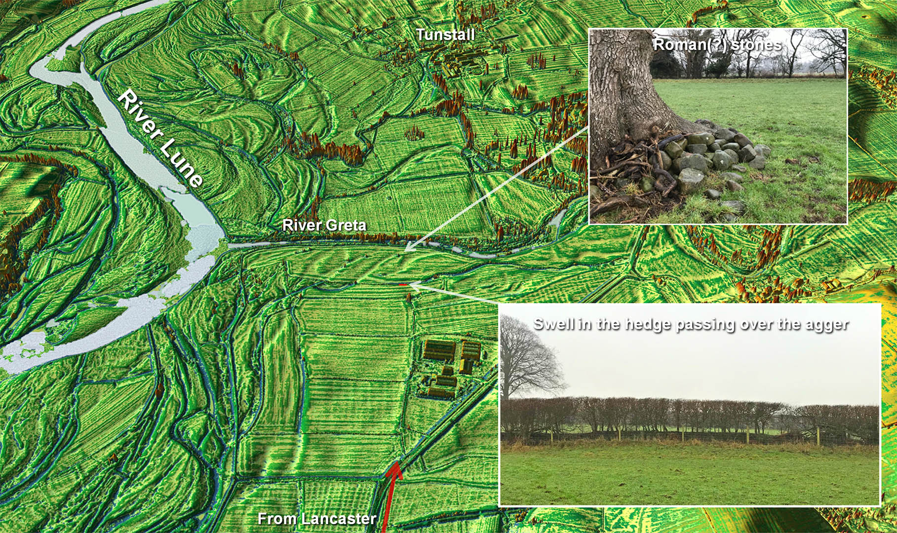
Oblique Lidar Image - River Greta Crossing The active River Greta has washed away all trace of the river crossing but on the southern approach the agger has survived. The last trace is visible at Honeystones Farm, where Andy spotted the hedgeline rising up over the Roman road agger. Beyond there there then old river channels are everywhere but what look like Roman stones have been collected and dumped next to a tree. They are not rounded like river stones so probably Roman but not in their original position.. Inset Images: Andy Jackson
|
Click for larger view |
 |
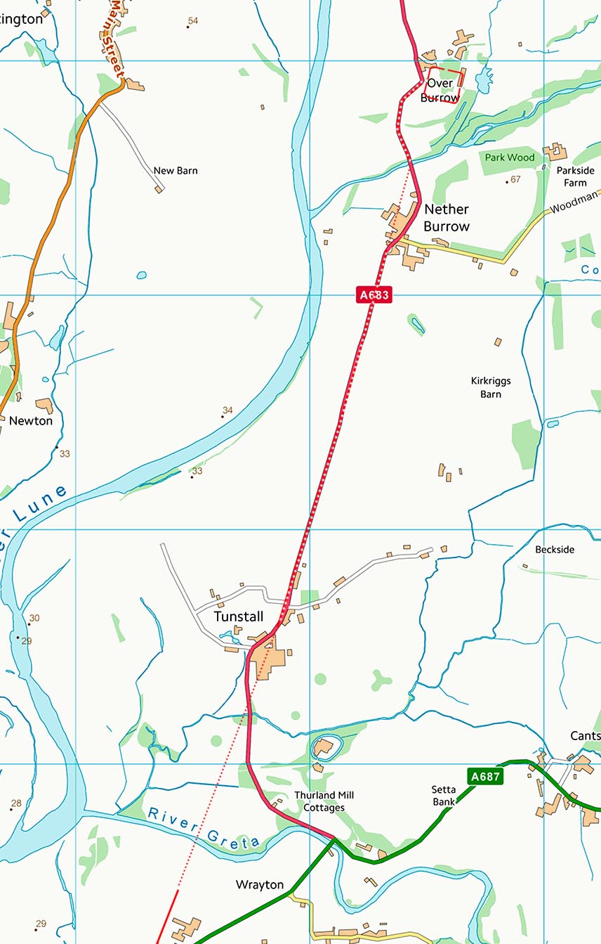
Lidar Image - River Greta to Burrow Fort Lancashire doesn't have many straight modern roads marking Roman roads but the A683 from Tunstall to Burrow is one of them.
|
Click for larger view |
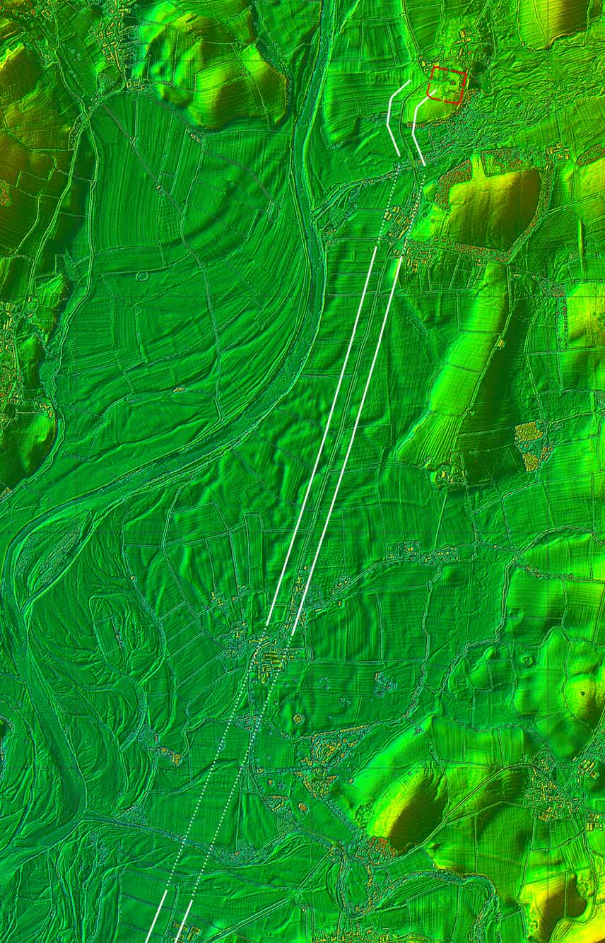 |
Route Map - River Greta to Burrow Fort Beyond Tunstall then the A683 marks the roads course aiming squarely at Burrow. A feature of this length is the number of "wobbles" in the modern road. From a distance it looks dead starlight but close up it wanders about either side of the line of the straight Roman line. This shows a roads age and is indicative of the road post Roman moving to avoid a worn-out length..When the road has shifted to one side then the temptation is for the land owner on the other side to move his boundary and get a bit more land.
|
Click for larger view |
 |
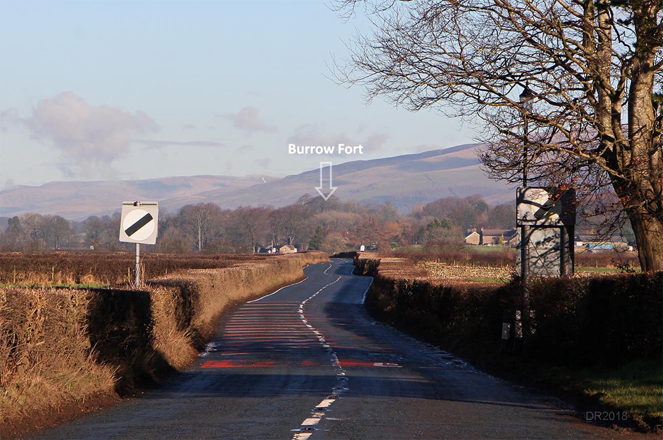
A683 - Tunstall looking towards Burrow Fort Those post-Roman wobbles are very evident in this shot down the road.
|
Click for larger view |
 |
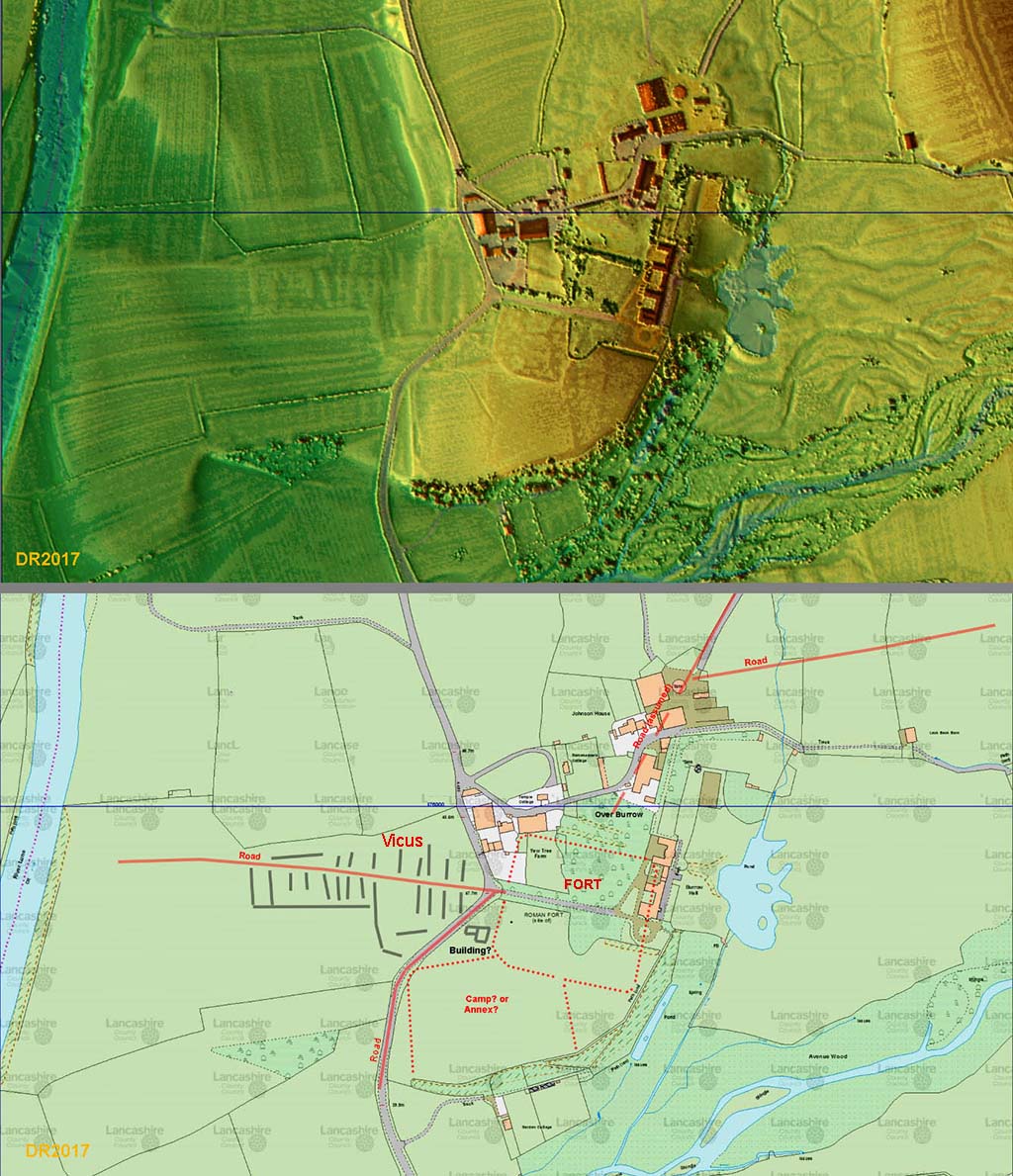
Burrow Fort - Road Arrangement and Vicus The modern road and the Roman line probably coincide north of Leck Beck bridge approaching the fort. This seems to circumvent an annex of the fort. The rampart of this is visible from the A683. However, what shows up most clearly is the western vicus of the fort located along a road heading for the River Lune.
|
Click for larger view |
 |
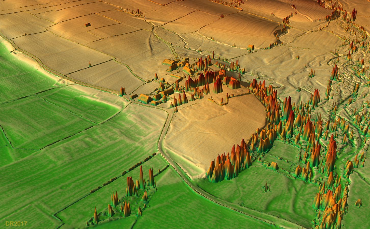
3D Oblique Lidar Image - Burrow Fort and Vicus Vicus and annex again obvious in this view.
|
Click for larger view |
 |
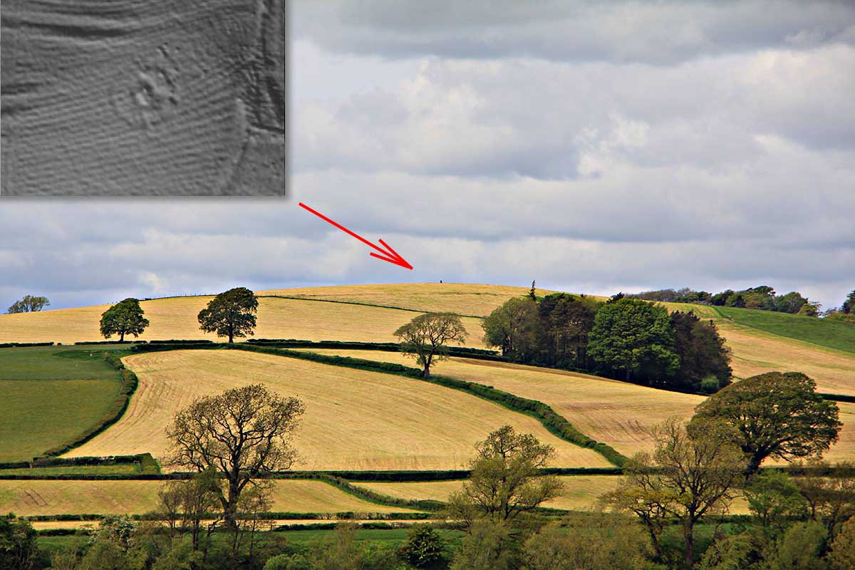
Possible Watch Tower - Sellet Bank Looking from the west gate of Burrow Fort then the high spot of Sellet Bank is prominent. This is the highest spot easily visible from the fort and with its superb views up and down the Lune valley would have been an ideal site for a watch tower. The inset is a close-up lidar view of the top of the hill. There appears to be a circular ditch with a single southern entrance and a squarish feature in the centre. Slightly worryingly, the Lancashire HER has reference to a possible belvedere here.
|
Click for larger view |
 |
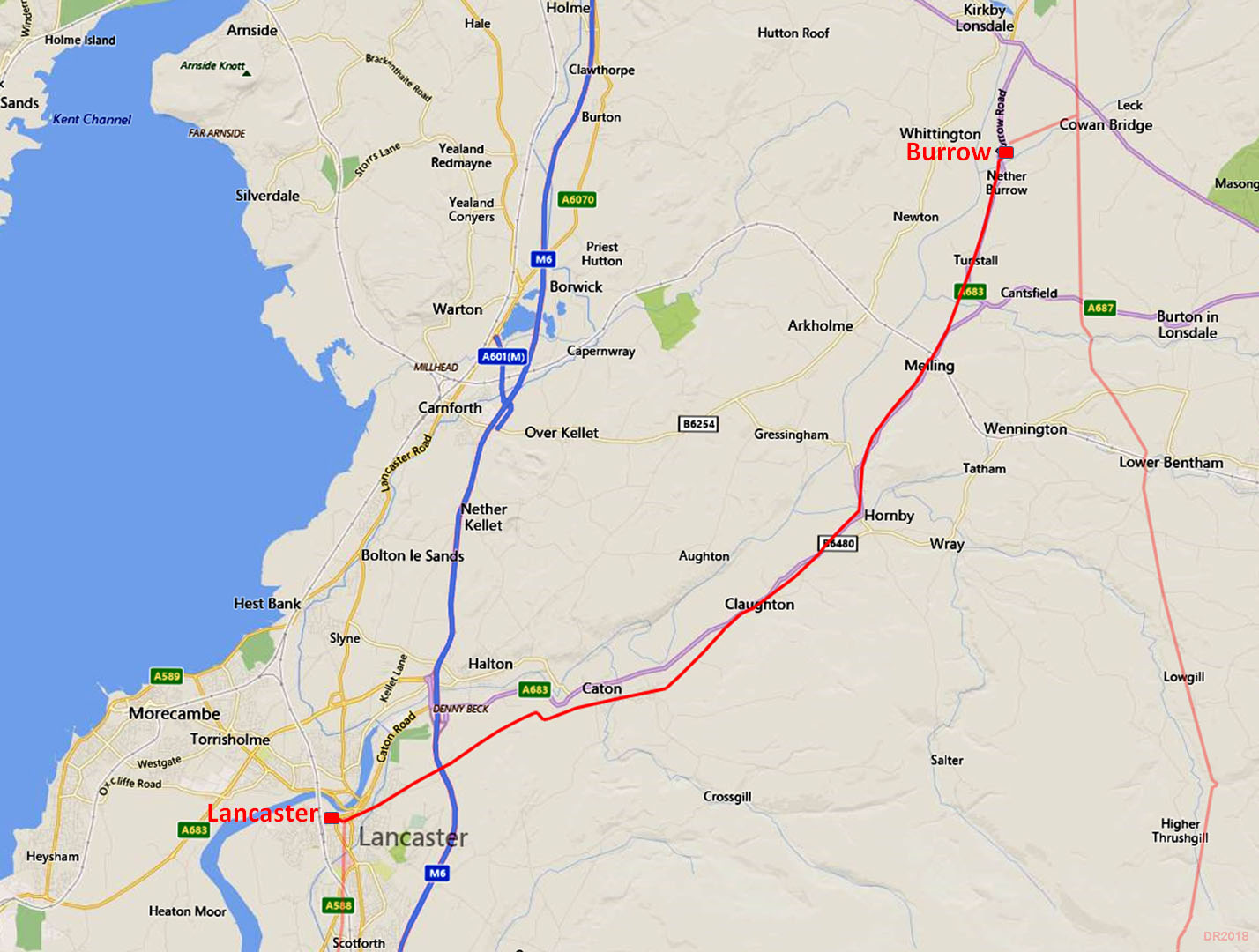
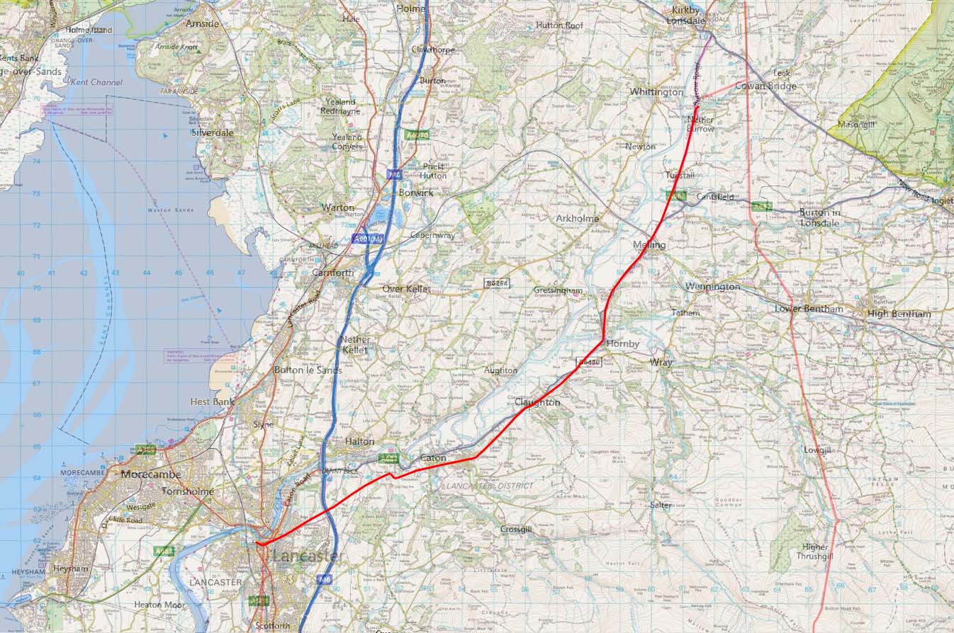
Route Map - Modern Map It is obvious with the arrangement of the Roman roads at Burrow that the Roman road from Lancaster cannot have been the first here. The Lancaster road does not continue straight on but links across to the road from Ribchester, It is clearly predated by the Ribchester road. This must cast considerable doubt on the theory that the first road through Lancashire, the invasion route, was from Warrington to Walton-le-Dale to Lancaster to Burrow and then northwards. Or at least in means the Burrow stretch was not part of it. The invasion route could have continued due north from Lancaster to Watercrook.
|
Click for larger view |
 |
|
|
|
Last update: December 2025 |
© David Ratledge |