|
The Roman Road from Wigan to BurscoughMargary Number: 702aaDistance: Wigan to Burscough 10.5 miles (Burscough to Hesketh Bank 9 miles)The long suspected fort at Burscough has now been confirmed by excavation (Stephen Baldwin, CBA NW Conference 2018) and by geophys (Wigan AS, Bill Aldridge). It would undoubtedly have been connected to Wigan by a Roman road and just such a road can be postulated with reasonably high confidence heading over the high ground alongside Ashurst Beacon. The zig-zag ascent in Up Holland, the modern straight road over Ashurst Beacon and Lowes (Green) Lane all have typical Roman characteristics. Note that Ashurst Beacon can see both forts which would make it an excellent signal/watch tower location. The road carrying on to Hesketh Bank is also a distinct possibility. STOP PRESS: The Burscough site has now (2020) been scheduled by Historic England and is therefore a protected ancient monument - link. Unfortunately the scheduling came to late to prevent damage to the fort from heavy machinery in July 2020. It is estimated that 5% of the fort could have been destroyed. The site is private - please respect this. |
Historic County: Lancashire Current Counties: Lancashire & Greater Manchester HER: Lancashire & Greater Manchester
|
|
|
|
|
|
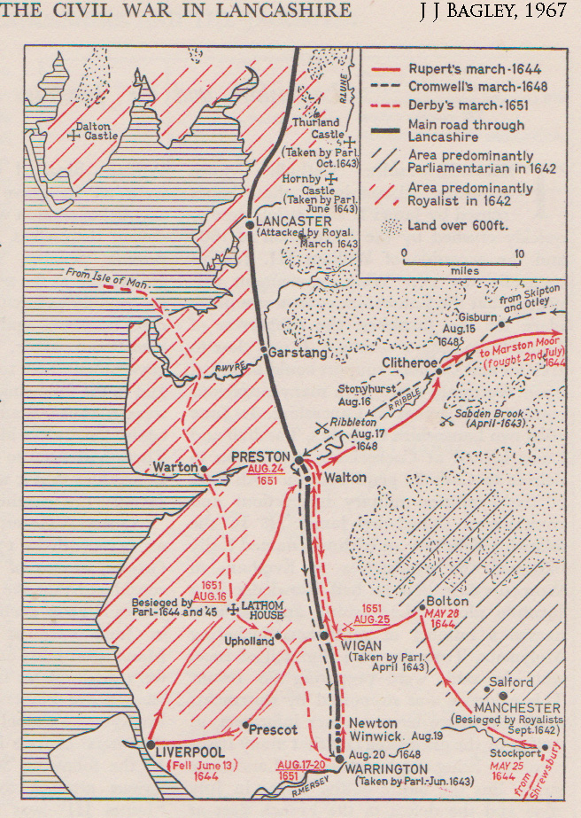
Bagley's Map & Derby's 1651 Route The relevance to this road is Derby’s 1651 invasion route depicted on Bagley's map. This appears to have been Knott End, Kirkham, The Naze, Hesketh Bank, Burscough, Up Holland and down to Warrington. Presumably he would have followed a road rather than ploughing across fields. At that date then Roman routes were still the only option. The Lathom to Upholland and on to Warrington without going through Wigan gives great support to the Roman route suggested below. It also gives credence to the route continuing on to Kirkham.
|
Click for larger view |
|
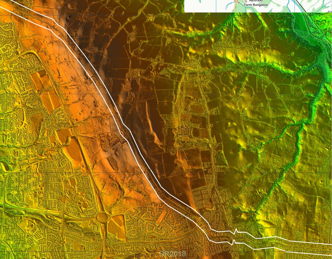
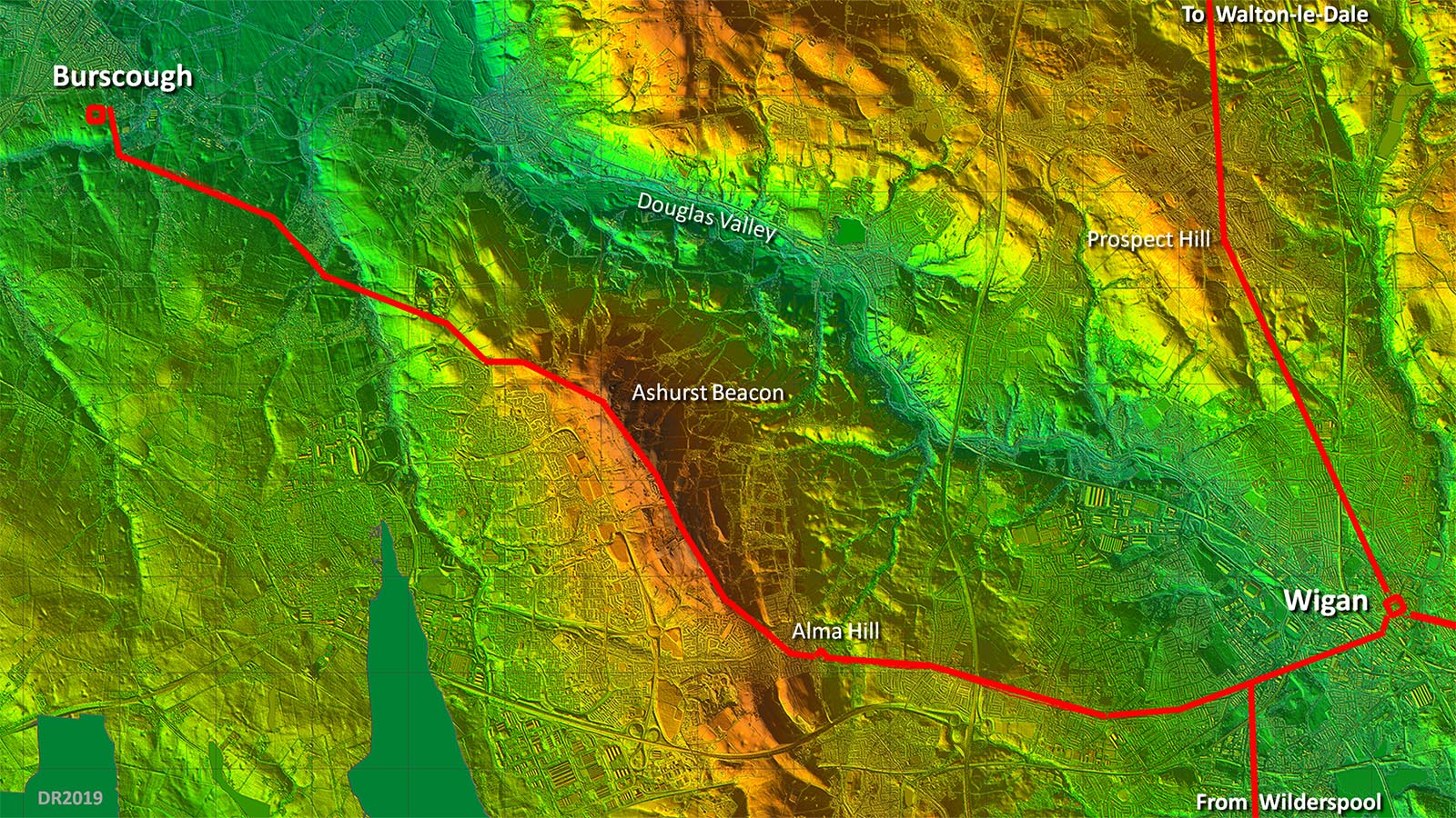
Lidar Image of Full Route (Redacted version) The road to Burscough is highly likely to have branched off the Roman road from Wilderspool (Warrington) or perhaps the other way around. I have adopted the HER route which aligns with Ormskirk Road whereas Watkin (Roman Lancashire) had it slighly further south branching towards Wigan near the railway bridge. The route is best regarded as the most likely option. It avoids the Douglas Valley and keeps to high ground yet is remarkably direct. Blue areas on this Lidar map probably indicate the extent of low marshy ground in Roman times - areas the Roman would most likely have avoided. The arrangement would tend to suggest the Burscough to Wigan road could be the earliest.
|
Click for larger view |
|
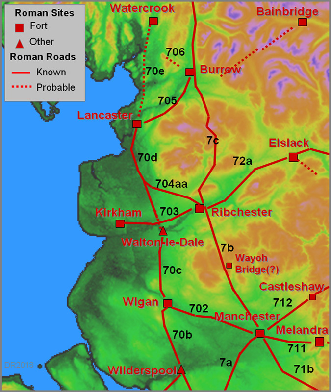
Wigan Map - Roman Roads I think at long last we may may getting an accurate map of the Roman roads of Wigan. There is now a logic as to why the road from Wilderspool does not take a short cut into the fort at Wigan - it joins the Burscough road for a common route into the town. The Manchester road we are reliant on Watkin but he does seem to have generally got the route correct. The road to Walton-le-Dale, thanks to Wigan AS and lidar series 2 data, is now also pretty secure.
|
Click for larger view |
 |
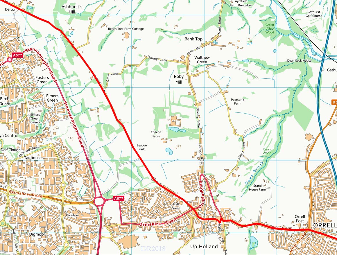
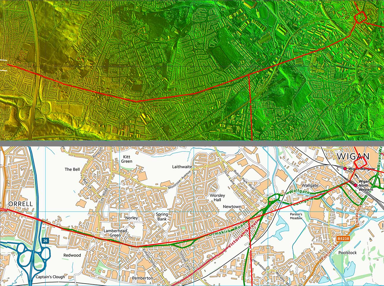
Lidar Image and Route Map - Wigan to Orrell Evidence as far as Orrell is restricted to straight modern roads (Ormskirk & Orrell Roads) so what is shown is approximate rather than precise.. |
Click for larger view |
|
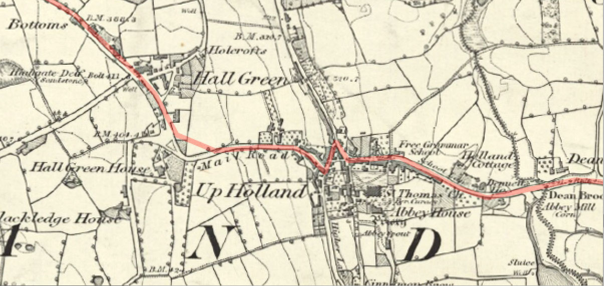
First Edition OS Map - Up Holland The zig-zag ascent in Up Holland, now a footpath, is exactly how the Romans negotiated steep slopes. Note how the alignment before and after the zig-zags matches up.
|
Click for larger view |
 |
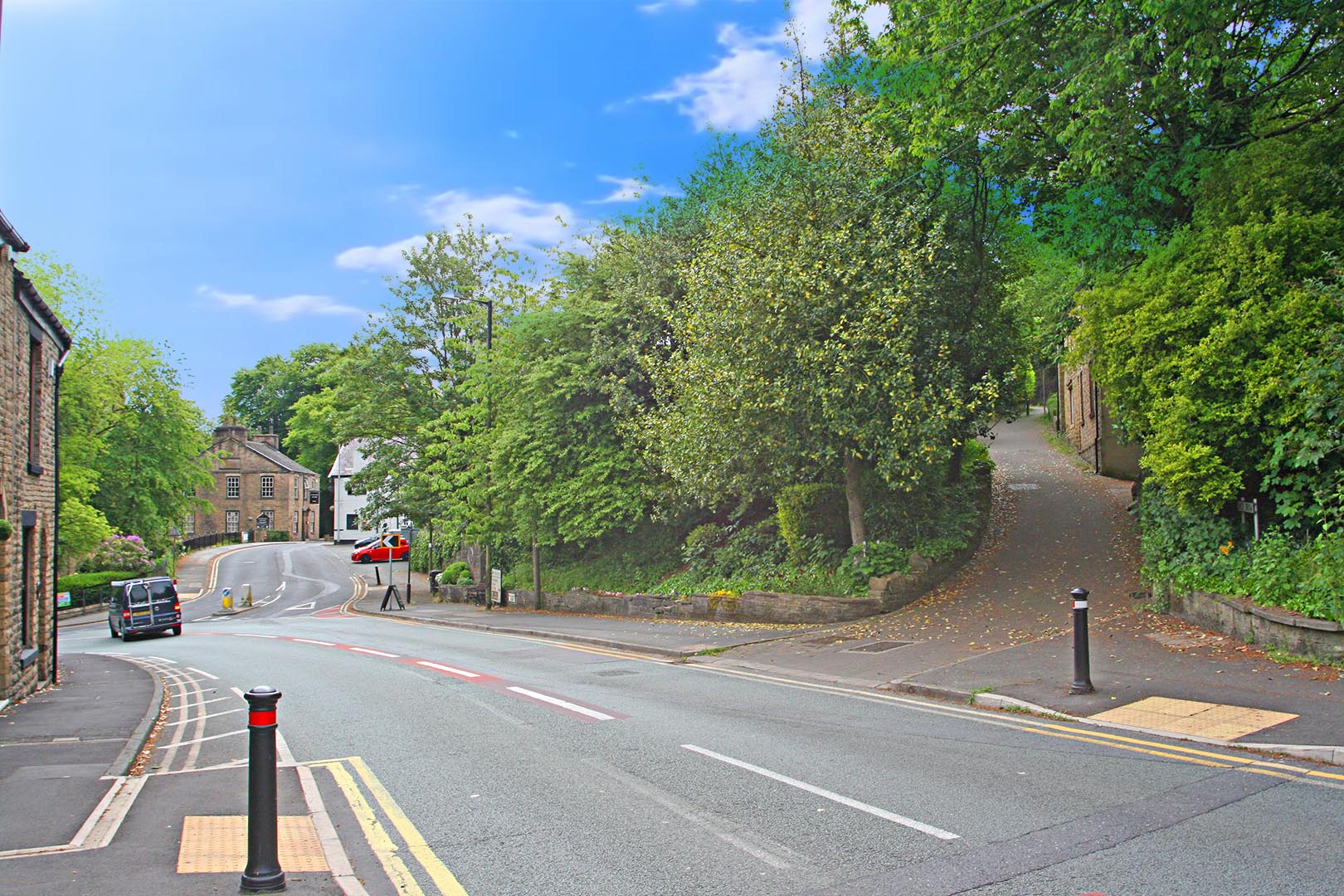
Alma Hill Zig-Zag 1, Up Holland The road from Wigan comes in from the left, doglegs towards the camera then doglegs again to head up Back Brow to ease the climb up Alma Hill. At the top it resumes the same alignment as that before the doglegs - typical Roman surveying.
|
Click for larger view |
 |
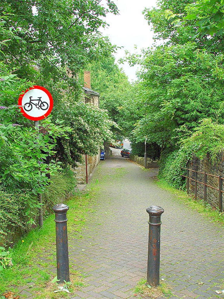
Alma Hill Zig-Zag 2, Up Holland This is looking down Back Brow, the zig-zag. Halfway down is now a series of steps for those wanting a short cut. The modern road now has a huge zig-zag to negotiate Alma Hill providing a much less steep ascent. I took this image many years ago and wondered about it but why would the Romans be heading west from Wigan? We now know why.
|
Click for larger view |
 |
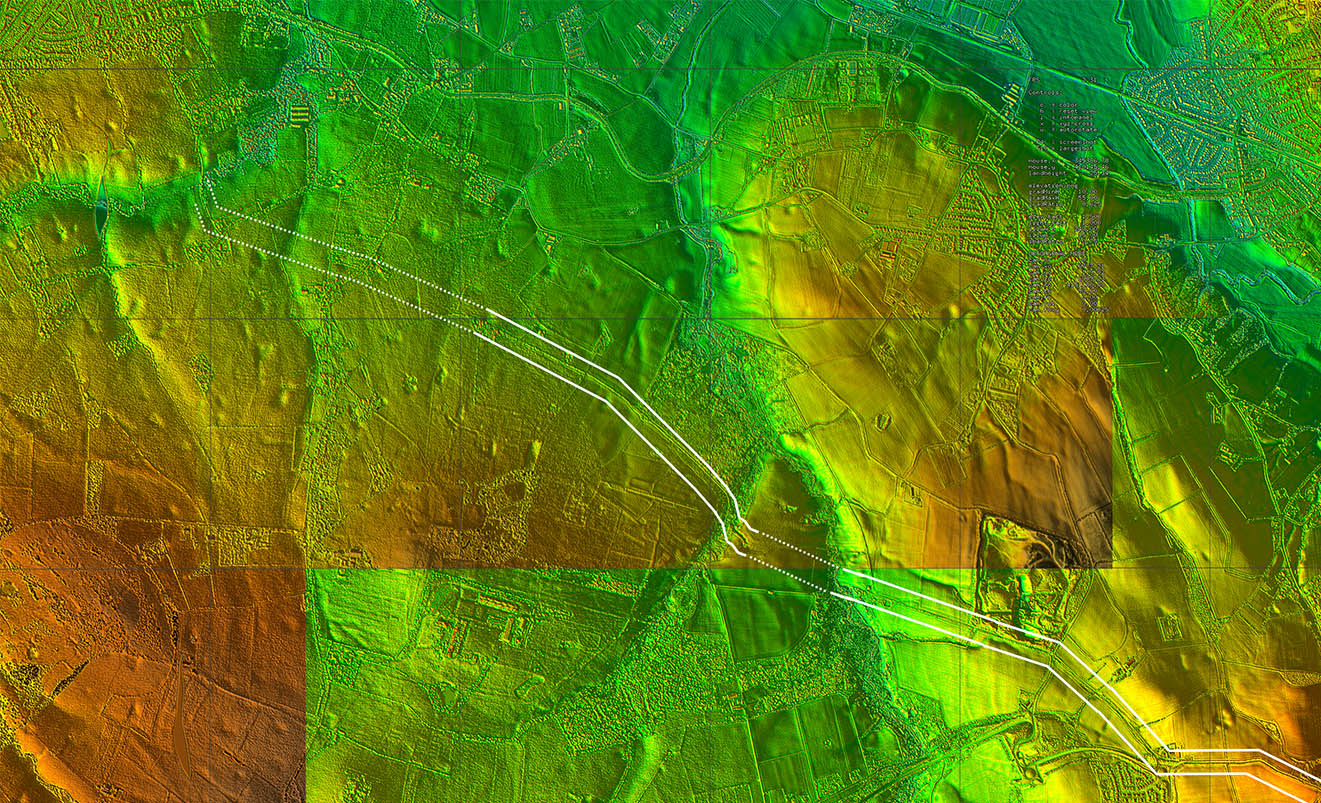
Lidar Image - Ashurst Beacon From Up Holland to Dalton the road adopts the high ground alongside Ashurst Beacon - an expertly chosen route. It is made up a of a series of straight alignments and is typical Roman engineering.
|
Click for larger view |
 |
Route Map - Orrell to Dalton Map corresponding to the Lidar image above.
|
Click for larger view |
 |
Oblique 3D Lidar Image - Ashurst Beacon This is an animated gif with and without the Roman road route overlaid. As pointed out in the introduction, Ashurst Beacon can see both forts which would make it an excellent signal/watch tower location. |
Click for larger view |
|
Beacon Lane The lane does have several Roman characteristics ie in keeping to high ground and right is just one of the several straight alignments. Ridge routes are often a a feature of Roman roads - they tended to keep out of valley bottoms wherever they could.
|
Click for larger view |
|
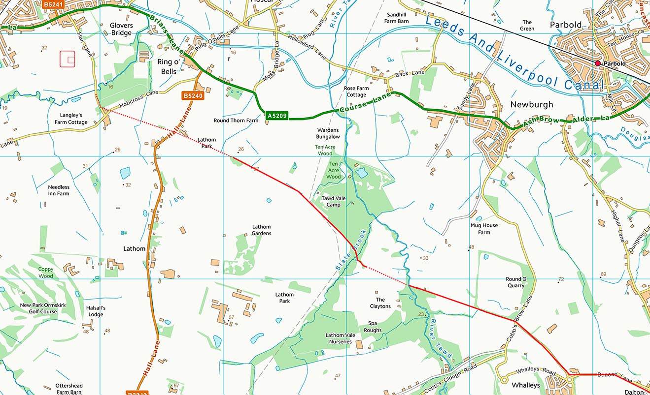
Lidar Image - Dalton to Burscough The route is fairly obvious for all but the last mile. The crossing a Slate Brook, a tributary of the River Tawd, stands out with a cutting to descend down. After crossing the brook it appears the Roman line is just south of the modern track.
|
Click for larger view |
 |
Route Map - Dalton to Burscough Map corresponding to the Lidar image above. |
Click for larger view |
 |
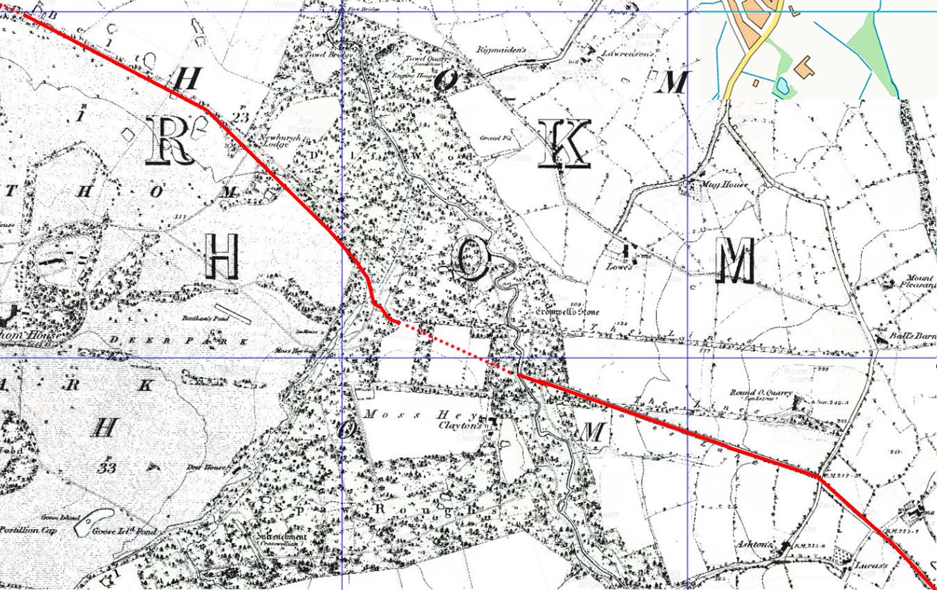
First Edition OS Map - Lathom House Lowes Lane (now called Green Lane) is a large track apparently today going nowhere but it is a continuation of Beacon Lane. Our road from Wigan probably continued in use serving Lathom House, formerly the most prestigious country estate in Lancashire. It was the last Royalist stronghold in Lancashire during the English Civil War and was twice besieged by Parliamentarian forces. It was demolished in 1925. Note: the "lines" shown on this map are probably landscaping avenues for the house. At first glance it would appear that Green Lane must be later than the lines. However, Greenwood's Map of 1818 appears to show Lowes Lane terminated by the lines - it makes no sense as a road/track unless it previously carried straight on and the Lines severed it. Perhaps it was reinstated once the fashion for the Lines was ended. |
Click for larger view |
 |
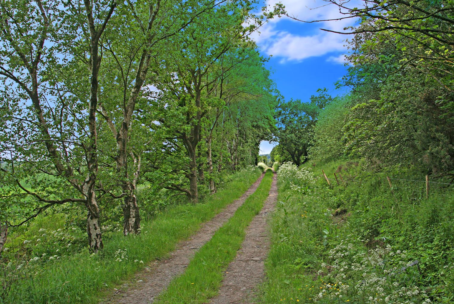
Green (Lowes) Lane Ground level view of Green Lane showing its large construction, built-up agger with side ditches. The left hand ditch does however appear to have been widened for drainage in modern times. Lowes Lane is its name on old mapping. It is a direct extension of Beacon Lane. Image: DR |
Click for larger view |
 |
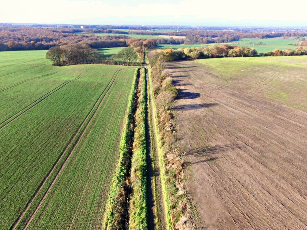
Green (Lowes) Lane - Drone Image The size of Lowes/Green Lane is clear from this drone shot as is the widened south (left) ditch. Drone Image: Bill Aldridge |
Click for larger view |
 |
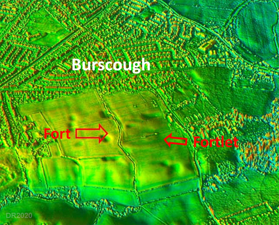
Lidar Image - Burscough Fort Site The location of the fort has now been made public and even Lancashire Live reported its location. This lidar image of the forts can therefore be published. The main fort is almost square with a later fortlet overlying it on its eastern side. It would appear Flax Lane probably represents (or is very close to) the Roman road. Flax Lane crossing the stream is on a very pronounced agger.There would have been a link road into the east gate of the forts. The east gatehouse was exacavated by Steve Baldwin and his team in 2019. |
Click for larger view |
 |
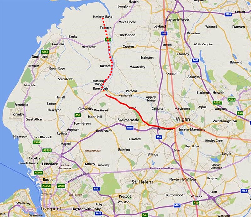
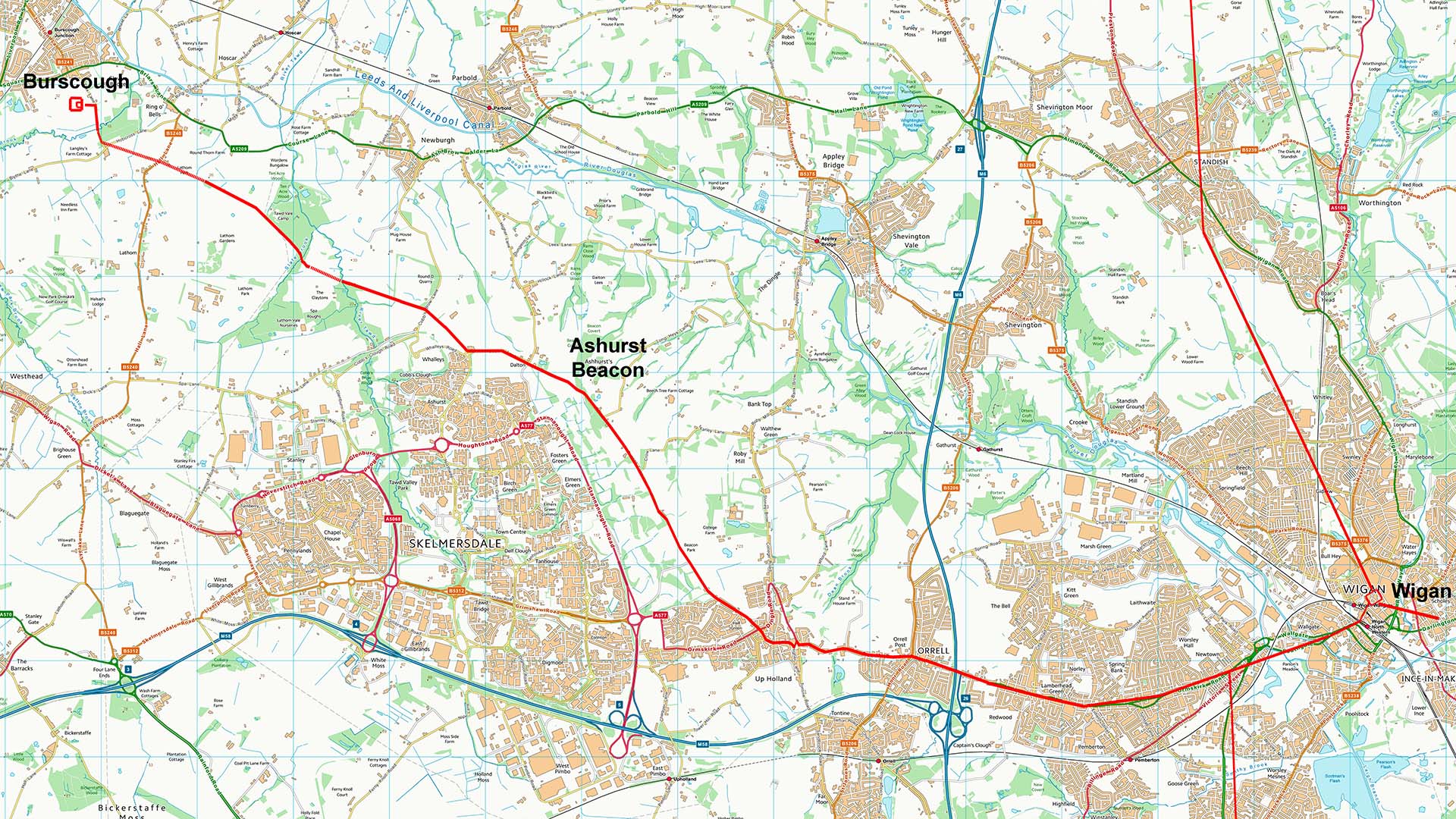
Route Map - Wigan to Burscough Full route map for the Wigan to Burscough section. It is a pretty direct route utilising high ground just what would be expected. Beyond Burscough the road appears likely to have continued on to Hesketh Bank - see link. |
Click for larger view |
 |
|
|
|
Last update: August 2021 |
© David Ratledge |