|
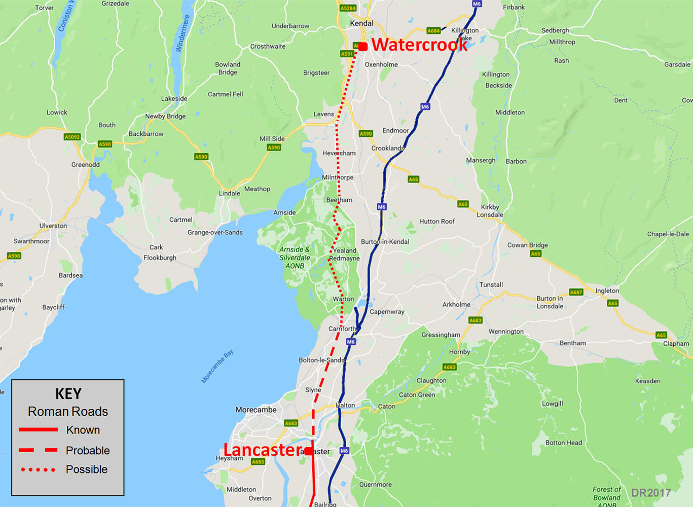
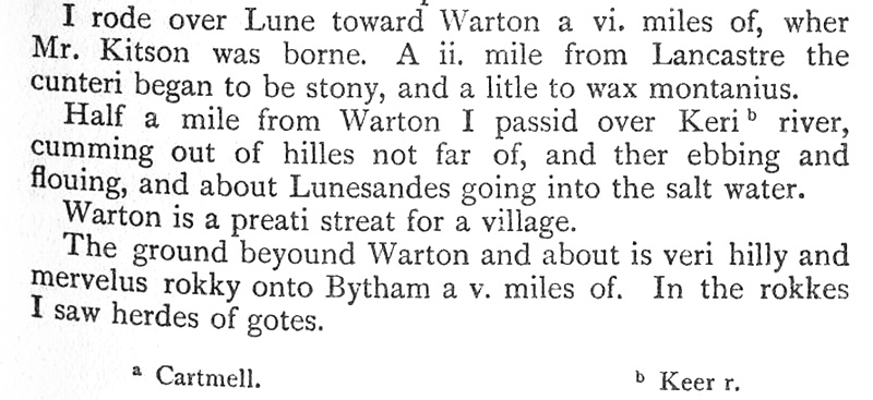
The Roman Road from Lancaster to WatercrookMargary Number: 70e (unofficial)Distance: 20 milesAlthough the existence of this road in not really in doubt, solid evidence has proved very elusive. Cumbria HER (Ref 2532) includes a possible Roman road at Deerslet, south of Burton-in-Kendal but describes it as having only "circumstantial evidence". In Lancashire, the last known course for the road is thought to be in Lancaster via Penny Street heading north to a suggested Lune bridge. The route shown on the map is therefore somewhat speculative. Evidence for it is based on Leland's journey c.1540, which south of Lancaster was based on the Roman road. The route he took from Lancaster to Kendal passed through Warton and Beetham (see later). The A6 north of Milnthorpe does also have Roman characteristics supporting this line.. |
Historic County: Lancashire & Westmorland Current County: Lancashire & Cumbria HER: Lancashire & Cumbria
|
|
|
|
|
|
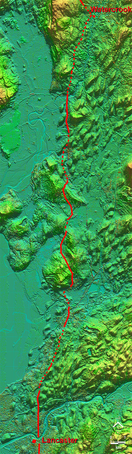
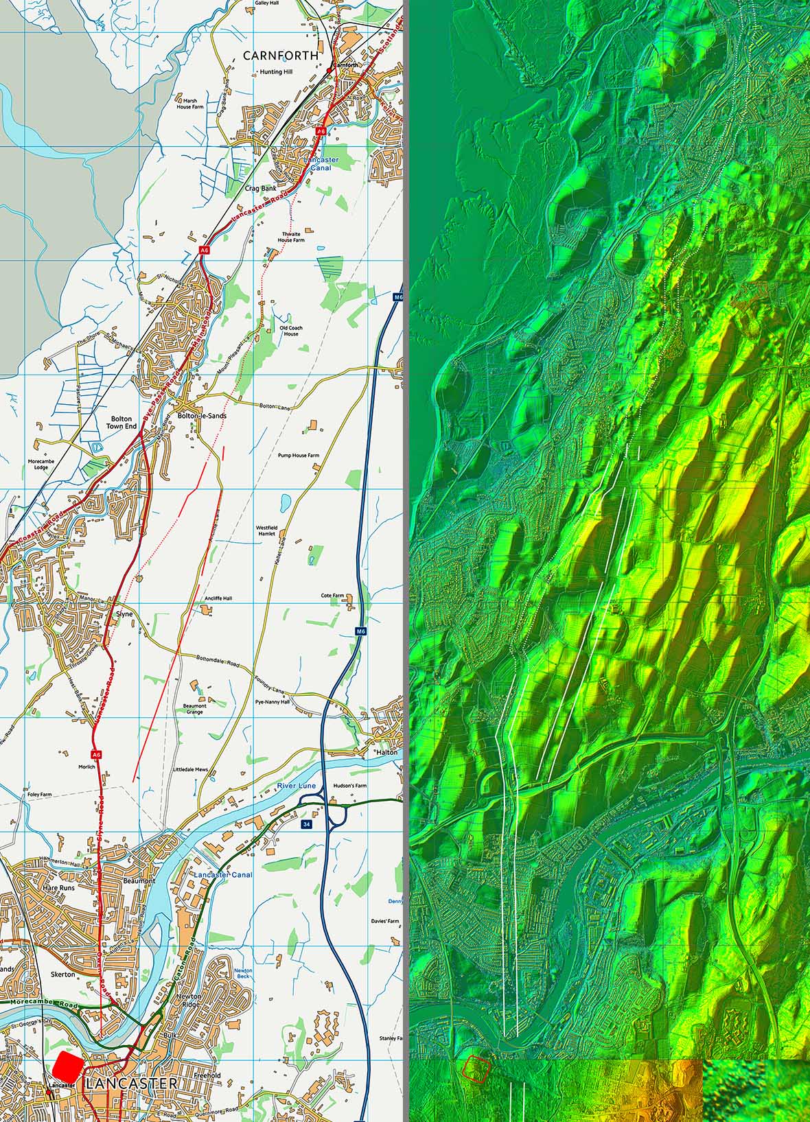
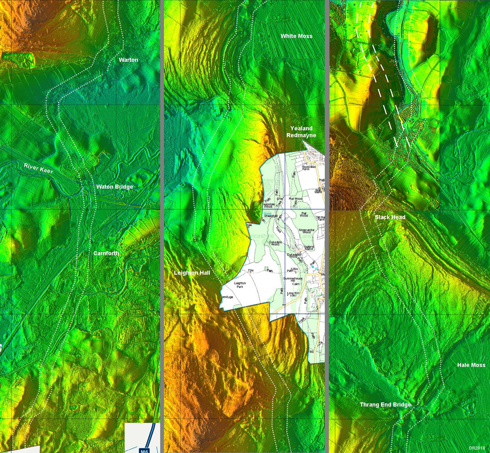
Lidar Image - Full Route Not the straightest route but certainly the most practical. The high ground was skilfully crossed going via the low "saddle" points. The inland marshes (now mostly drained) were also sensibly avoided and higher dry ground was selected. Milnthorpe would have given a sea connection as it used to be a navigable harbour even in relatively recent times. |
Click for larger view
|
 |
Oblique Lidar Image - Lancaster North The evidence across the Lune is a bit vague. The excavation site is probably the only reasonably secure spot although initially the A6, Slyne Road, almost certainly marks the course. |
Click for larger view
|
 |
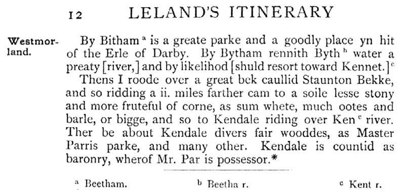
Leland's Itinerary c.1540 Leland's journey through Lancashire seems to have been based on following the remains of the Roman road system - it certainly turned out to be the case south of Lancaster. His route was clearly Lancaster-Warton-Beetham ("Bytham")-Kendal. In addition, the Gough Map of c. 1360 only shows Beetham between Lancaster and Kendal. A good case can therefore be made out for the ancient route being via Beetham. It would be around 100 years after Leland (Ogilby 1675) that the route had switched to be via Burton-in-Kendal so the Deerslet/Burton-in-Kendal suggestion seems unlikely. All things considered we should looking for evidence of the Roman road going via Warton and Beetham. |
Click for larger view
|
 |
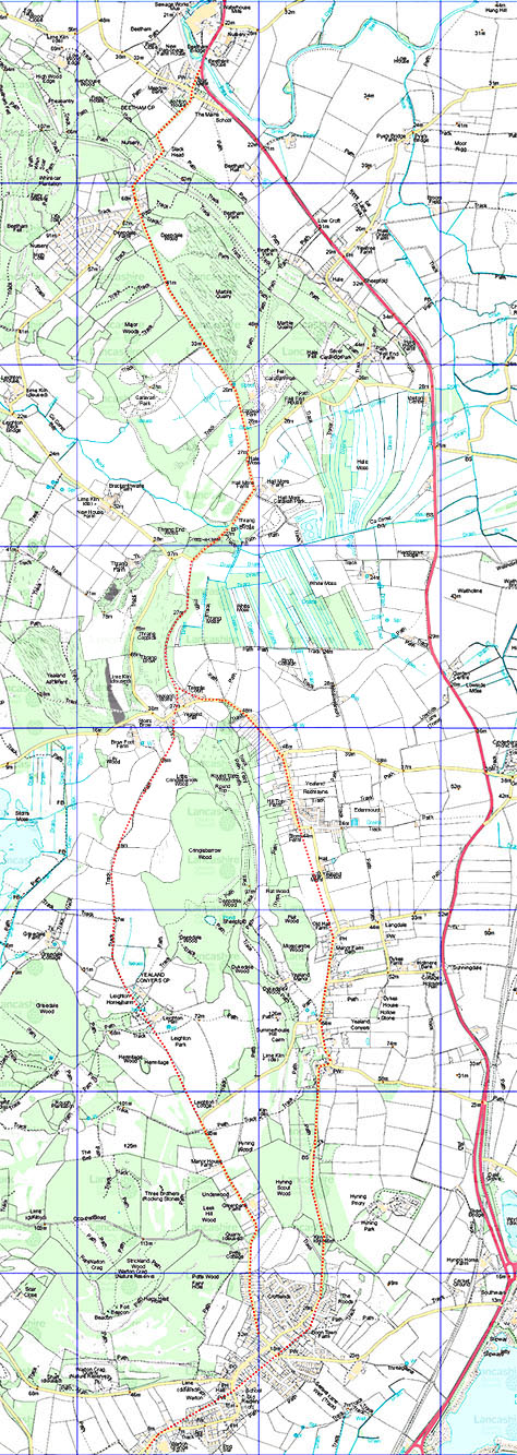
Route map and Lidar Image - Lancaster to Carnforth Heading north from Lancaster there is some Lidar evidence for a short stretch near Bolton-le-Sands where the excavation in 2015 took place - see the excavation below. The alternative Route B does have more Lidar evidence but no excavation support. South of the river the Roman line was on Penny Street and as this more or less aligns with the A6 Slyne Road it would seem logical to assume that this represents the Roman road. Quite where it turned off the A6 to get to the Bolton-le-Sands excavated site (see below) is somewhat vague with a couple of options. Beyond the Bolton-le-Sands length then a course through Carnforth making for Warton Bridge seems very likely. Warton Bridge and would fit with Leland's description of crossing the River Keer where it was still tidal.
|
Click for larger view |
 |
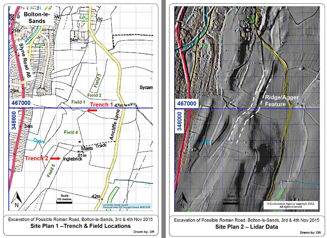
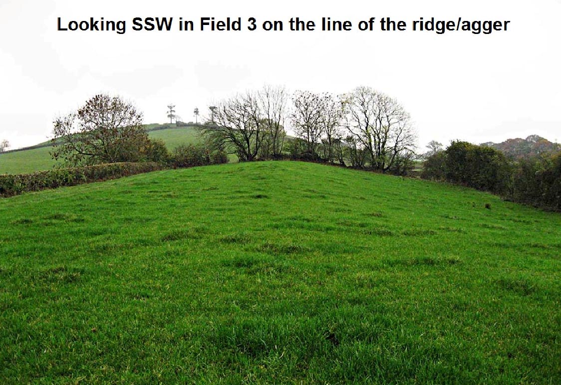
Excavation at Bolton-le-Sands, 3rd & 4th November 2015 Visible in the Lidar data is a short length of what could be our Roman road near Bolton-le-Sands. There are 3 alignments with a pronounced dogleg. This is typical of Roman alignments where a hill or bank has to be climbed. The only way to prove it was by excavation! The location of trench 1 was selected in consultation with the farmer. The ridge/agger across field 1 was where he reported encountering stones whilst ploughing. The actual site selected, at the southern edge of field 1, he always left as un-ploughed. This was therefore believed to be the location having suffered the least plough disturbance. Across field 1: the ridge/agger is clear and is probably too large to be purely Roman and could represent an agger exploiting a natural ridge Between fields 1 and 2 and also between fields 2 and 3, in the hedge bottom on the line of the ridge/agger, is a large cache of stones c. 300-400mm in size. Away from the ridge/agger line there were no or very few stones in the these hedges. This is common where Roman aggers have been ploughed out and the larger stones thrown into the nearest hedge. Field 3: agger/ridge is now not quite as large but very clear. Progressing further northwards towards Ancliffe Lane then the ridge/agger fades out. The excavation team (in alphabetical order) was :Paul Ashman (Wyre AS), Chris Clayton (Wyre AS), John Entwistle, Robert Entwistle, Mike Haken, Dave Hampson (Wyre AS), David Ratledge, Brian Rigby (Wyre AS). Peter Iles, Lancashire's Specialist Advisor on Archaeology was in attendance for the first morning. |
Click for larger view
|
 |
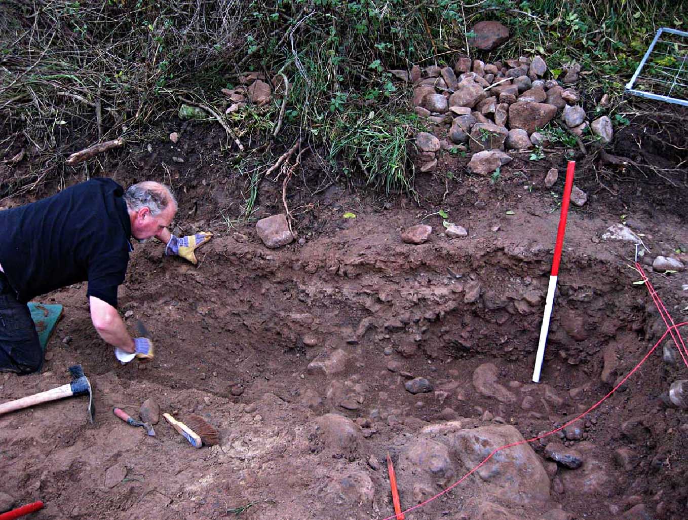
Trench 1 (SD48488/66987) The location of trench 1 was selected in consultation with the farmer where there were too many stones to plough. We were to learn the hard way why this was the case! The position chosen coincided with an unknown demolished farm building of some antiquity. This meant considerable time was lost getting down to the possible road layer. In the picture Mike Haken is cleaning out what was taken to be the possible east ditch of a road. The clay floor of the building can be seen as a horizontal layer much higher in the trench. Without the full extent of the feature/road being excavated no definite conclusion could be reached but best guess it probably is the Roman road. Image: DR |
Click for larger view |
 |
Agger/ridge Field 3 The agger/ridge is still clear in Field 3 looking back towards the excavation site. Progressing further northwards towards Ancliffe Lane then the ridge/agger fades out. Conclusion The ridge/agger feature is commensurate with it being the course of a Roman road without proving that it is. Image: DR |
Click for larger view |
 |
Possible Route(s) - Warton to Beetham Approaching Warton, Leland crossed the Keer river, where it was still tidal. I would assume therefore at or near the modern Keer Bridge. He obviously visited the main street in Warton and his route to Beetham is described as "very hilly". There are two options - one via the Yealands - the second via the grounds of Leighton Hall. They would share a common route from Thrang End Bridge to Beetham passing Deepdale Wood. This road does have long straight stretches. The "very hilly" description would fit the Leighton Hall route much better as there is a climb over the back of Warton Crag. The road towards Leighton is straight but perhaps a touch narrow to be convincingly Roman. The original Leighton Hall dates from 1642 (Wiki) so in Leland's time it did not exist. It is common for country estates to divert roads away from their grounds and the road from Warton now does a right angle bend to avoid the grounds. A field boundary actually preserves the straight-on line at the bend (see below). The current hall dates from 1759. Note the A6 route crosses Hale Moss. Without modern drainage this would almost certainly have been impassable in Roman times. Note also parallel to the A6, but just east of it, is a gas pipeline which initially fooled a couple of Roman road researchers, who shall remain anonymous. |
Click for larger view |
 |
Lidar Image - Possible Route Carnforth to Beetham (via Leighton) This is the suggested more likely route to Beetham matching Leland's "very hilly" and it is more direct than that via the Yealands. Building a country house (Leighton Hall in this case) on top of a Roman road is not uncommon. Alston Hall, near Longridge was built directly on top of the Roman road to Kirkham. It's a free solid foundation. |
Click for larger view |
 |
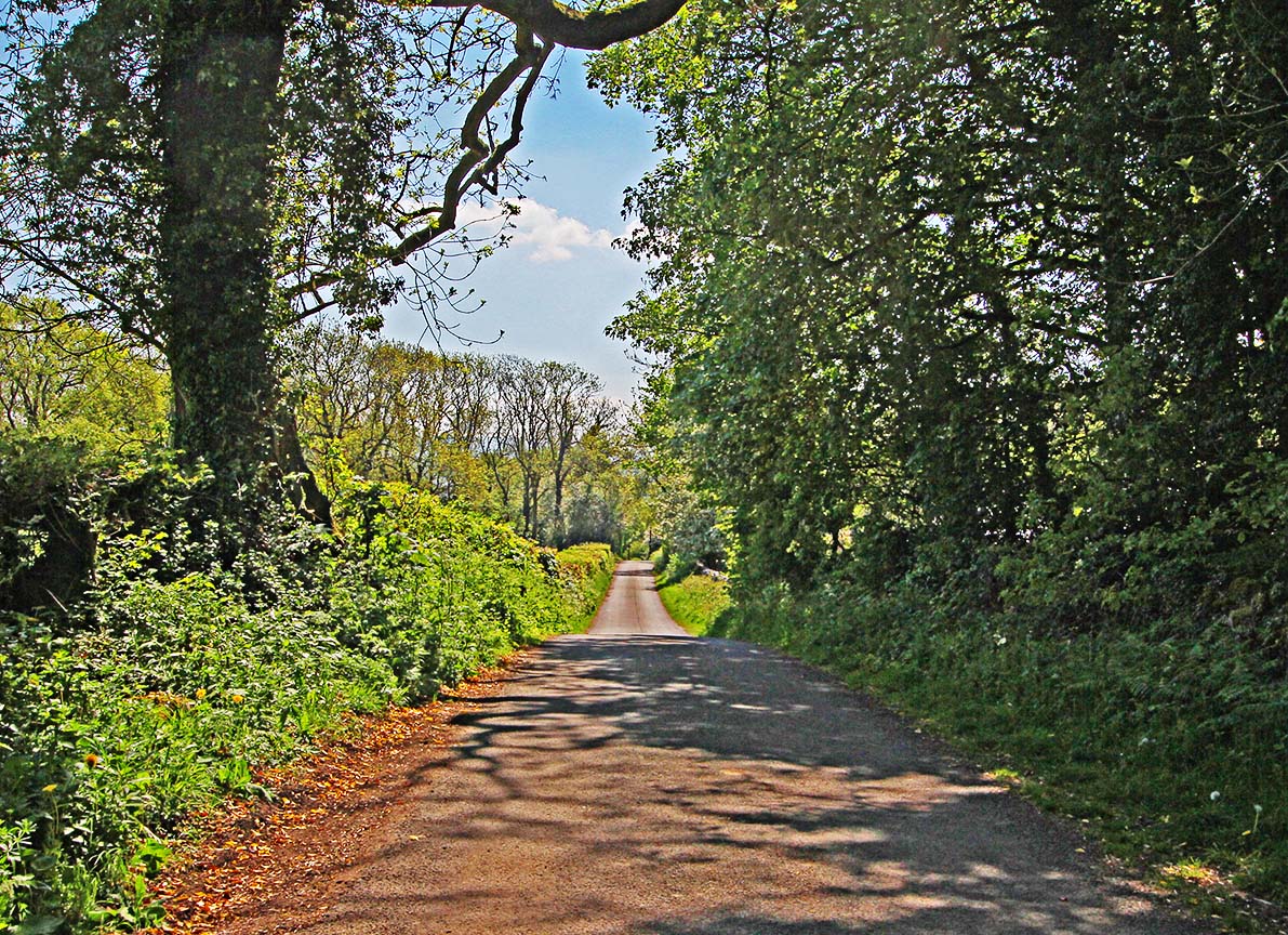
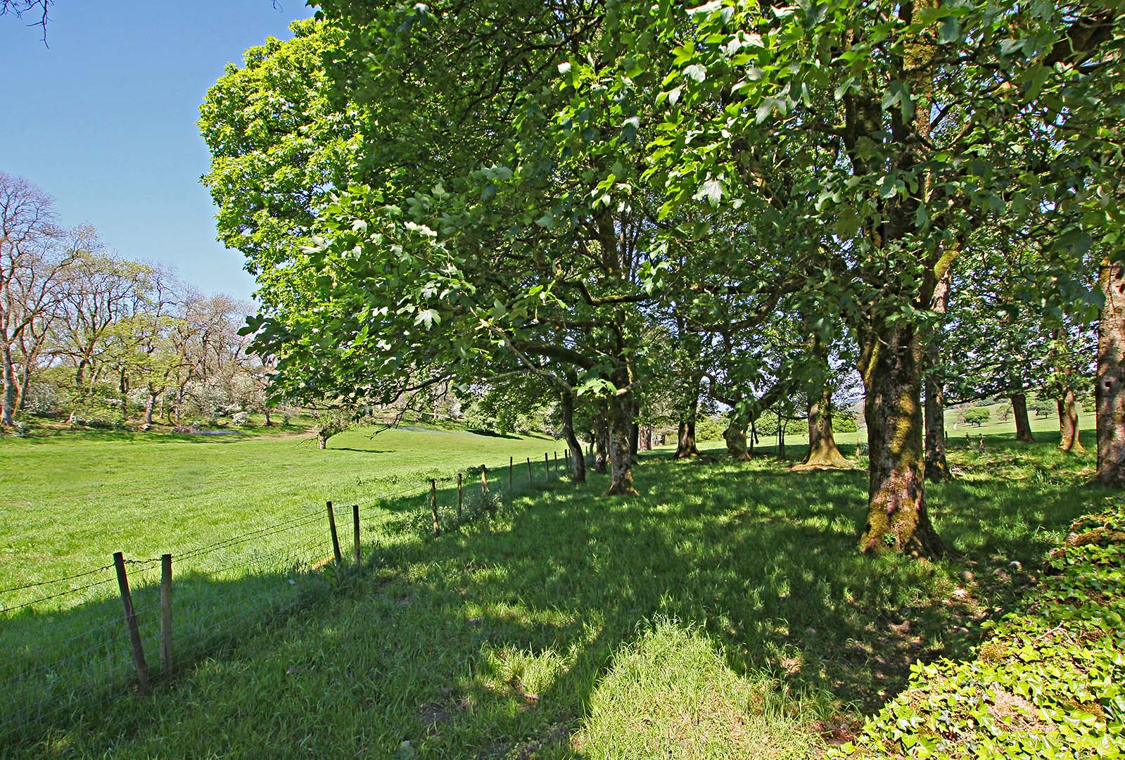
Coach Road, Warton Crag - looking south This is near the top of the road from Warton over the back of Warton Crag heading for the Leighton Estate but we are looking back towards Warton in this view. It is a very straight road - an alignment you would expect if Roman but perhaps a bit too narrow in places to be certain. This route fits with Leland's description of very hilly and marvelous rocky (sic). The name Coach Road is indicative of it being the old coaching road before Leighton Hall blocked the way. Image: DR |
Click for larger view |
 |
Leighton Hall - straight-on route Coach Road now has a right angle bend and changes name to Peter Lane. This is very suggestive of Coach Road originally carrying straight-on before Leighton Hall estate was built. Traffic subsequently being diverted via Peter Lane towards the Yealands. The straight-on route is preserved now by a fence line with the old agger perhaps on its far side. It continues on under Leighton Hall but there is a very suggestive agger trace in the Lidar data beyond the hall. Image: DR |
Click for larger view |
 |
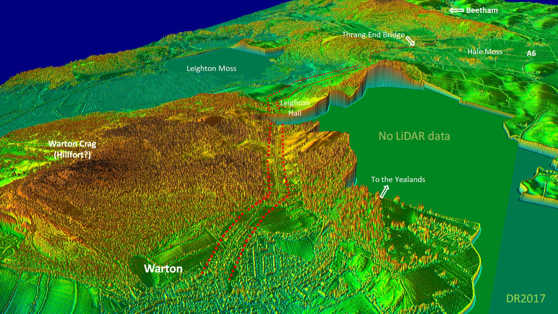
3D Lidar Image Warton - looking towards Beetham If Leland was following the Roman road from Warton to Beetham then there is only one practical course for dry land between Leighton Moss and White & Hale Moss. That is by Thrang End Bridge (see later). Highlighted is the "very hilly" route option via Leighton Hall but, as pointed out above, in Leland's time there was no hall there. That would be 100 years later. The route is typical of Roman engineering - initially angling across the slope from Warton, then following a very straight course through a natural valley to Leighton.
|
Click for full HD version |
 |
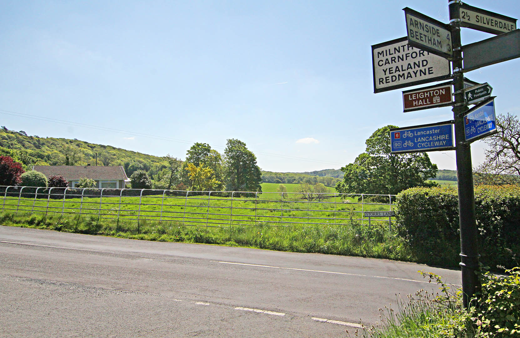
Storrs Lane Junction - looking South towards Leighton Hall Here we are looking back to Leighton Hall from Storrs Lane, Beetham Road Junction. Behind the camera is the road to Beetham via Thrang End Bridge. The road from Leighton Hall to here is now followed by a footpath and the modern road heads left.. Beyond the white fence in this view is a very suggestive agger but it does not align with the current road to Beetham, pointing more to its right (west). Image: DR
|
Click for larger view |
 |
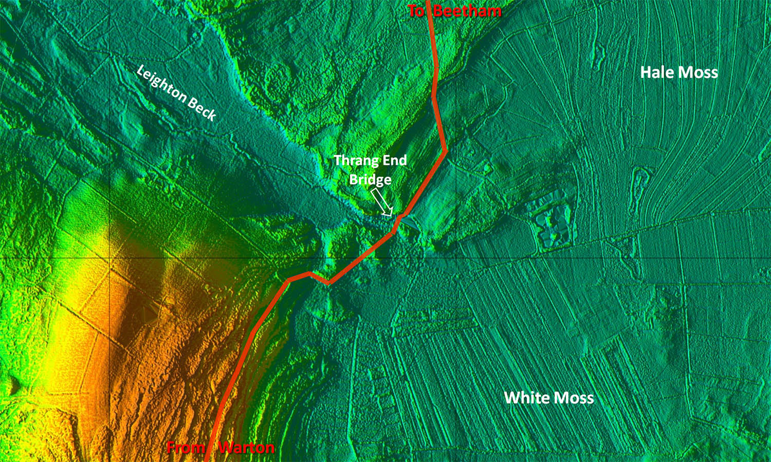
Lidar Image - Thrang End Bridge Before White Moss and Hale Moss were drained there was only one practical course keeping to dry land to get to Beetham and that was via Thrang End Bridge. Note: Today Thrang Bridge is a non-entity - drainage has put paid to its former importance.
|
Click for larger view |
 |
Looking south towards Thrang End Bridge Thrang End Bridge is now virtually undetectable and finding it is tricky. With modern drainage it is no longer a critical point for crossing between the mosses. Image: DR |
Click for larger view |
 |
Beetham Road looking back towards Leighton Beck Moss We have crossed Thrang End Bridge now and are looking back towards Leighton Beck Moss. It still has marshy areas whereas White Moss/Hale Moss, east (left) of the road, is now drained and reclaimed. The road is now climbing in several straight alignments before it will drop down into Beetham. Image: DR |
Click for larger view |
 |
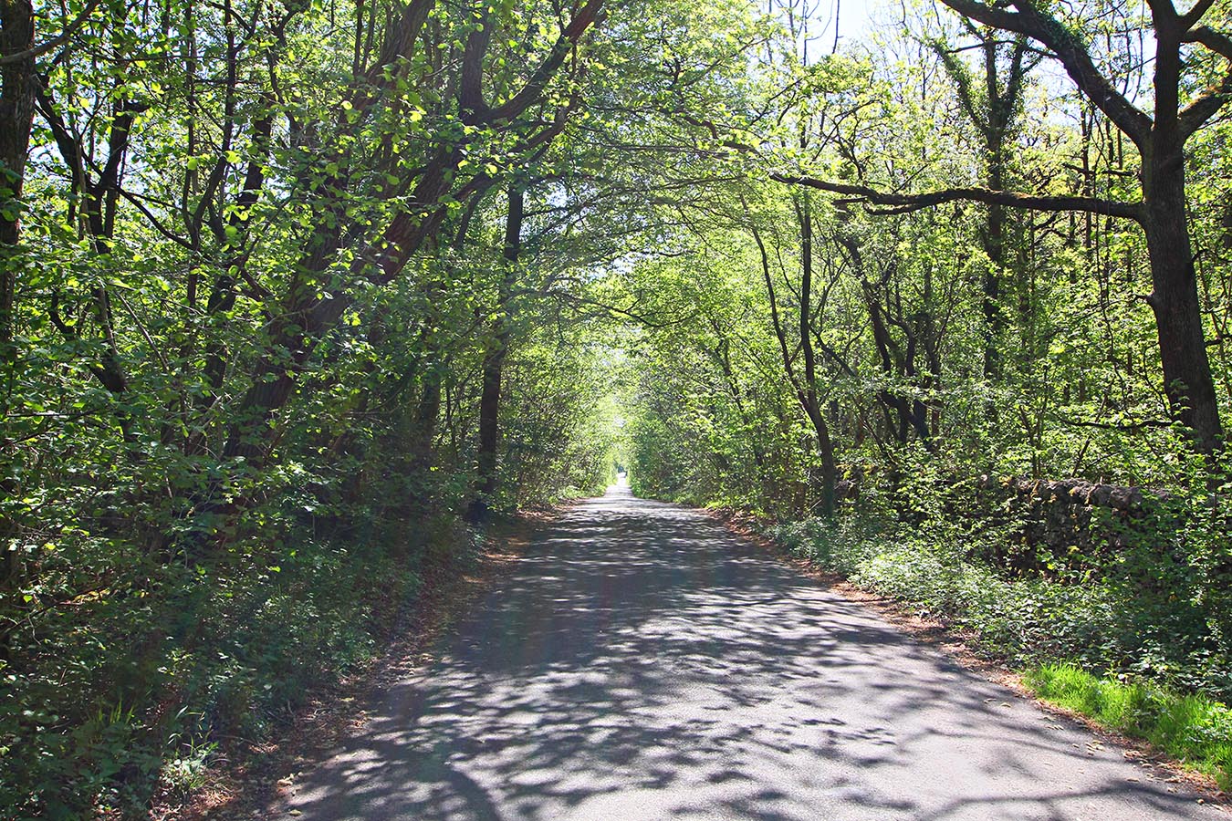
Leland's Itinerary - Beetham to Kendal Leland's route now becomes a puzzle! His description of a "preaty river" fits extremely well with Dallam Deer Park. The river around the park is well-known local beauty spot The puzzle is Staunton Beck, presumably Stainton Beck but he doesn't mention Staunton/Stainton itself. He would cross this beck at Rowell Bridge if he turned east at Milnthorpe for Crooklands. At Rowell Bridge the "great beck" description would fit. This is perhaps heading for another Roman road coming in from Yorkshire and approximated by the A65 today. Why he crossed over to that road he does not give us a clue. It would seem highly likely therefore that he left "our" Roman road at Milnthorpe.
|
Click for larger view |
 |
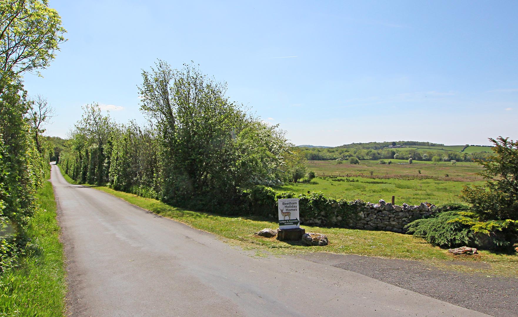
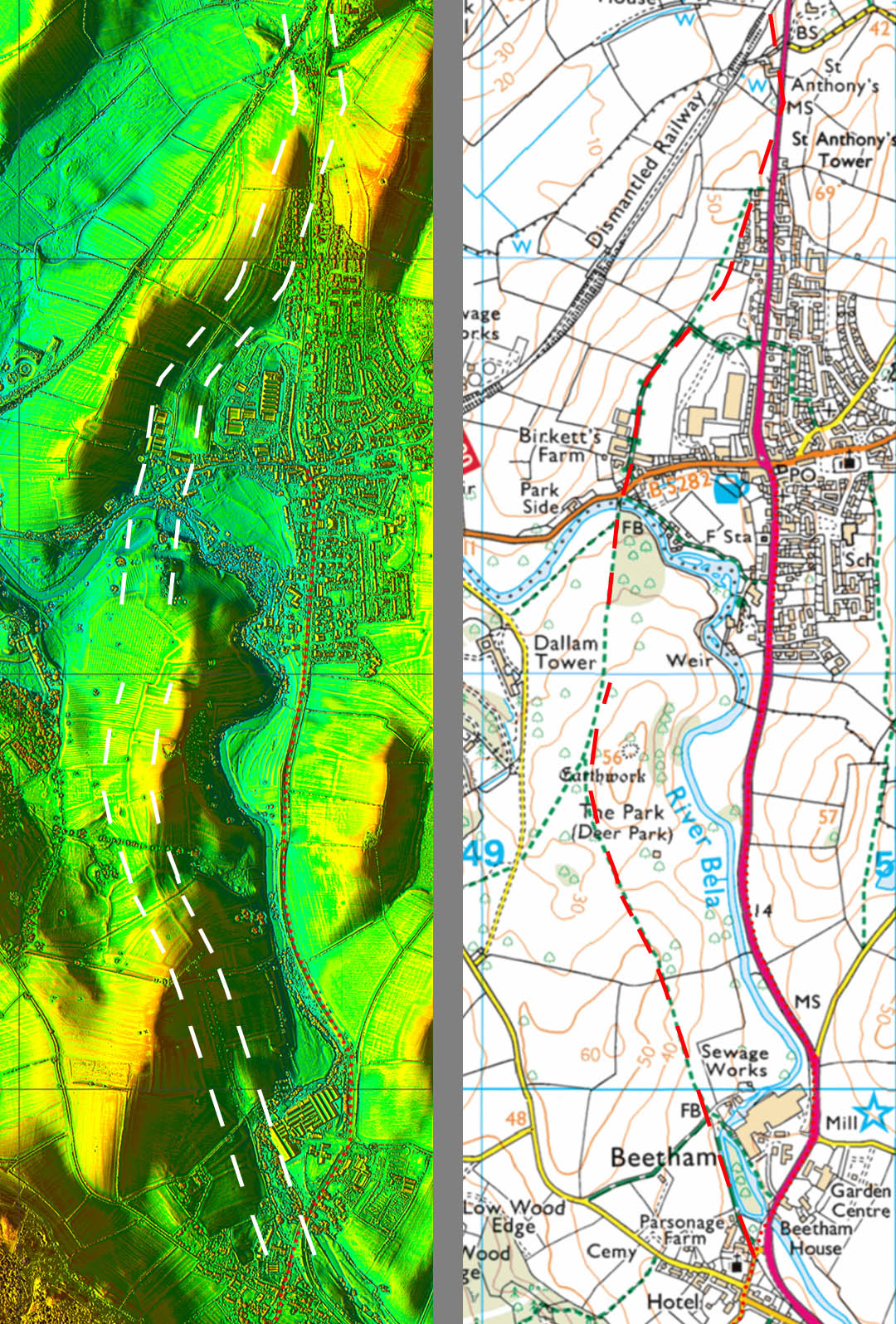
Lidar Image and route map - Milnthorpe Thanks to Dr Jean Turnbull we now have a better understanding of the most likely route through Milnthorpe. Jean drew my attention to Curwen’s map of the old roads around Beetham and Dallam Park. The A6 north of Beetham dates from the turnpike era and the earlier line was west of the River Bela through Dallam Deer Park. There is lidar evidence to support this. Leland's description would probably refer to the north end of Dallam Park where the old route crossed the river - see below. |
Click for larger view |
 |
River Bela at Milnthorpe Was this spot what Leland had in mind with his "preaty river" description? We are looking south into the park over the old bridge crossing the Bela. Below here the river is tidal so it would be a logical point to bridge the Bela. Image: DR
|
Click for larger view |
 |
NEW VIDEOFor a fly-over along this Roman road from Carnforth to Milnthorpe then click on the video below. For full screen playing then click on the icon bottom right.
|
||
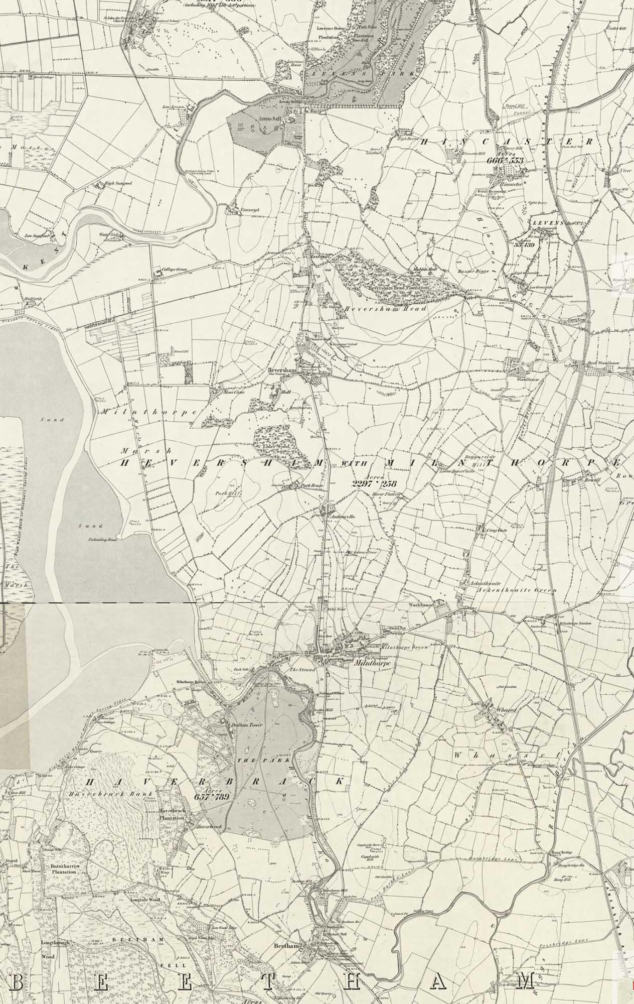
Ordnance Survey First Edition - Beetham to Levens Bridge So if Leland turned right at Milnthorpe what evidence is there for a direct route to Kendal? Lidar has so far revealed no obvious agger north of Beetham. Often, when there is no trace, it can mean that the Roman road is covered by modern roads. Do any modern roads have Roman characteristics? Well certainly the A6 via Beetham-Milnthorpe-Haversham-Leasgill-Levens Bridge does look reasonably convincing with many long straight stretches. It is a logical direct route and does have the benefit of keeping a close coastal connection. The modern A6 now bypasses Heversham and Leasgill. This line would indicate that the road onwards to Watercrook could be on the west bank of the River Kent possibly masked by the old A6 again. The Roman road from Watercrook to Ambleside, the continuation of this road, is also on the west side of Kendal so possibly could align with the road from Lancaster - a common occurrence at Roman forts. Note: near the top of this map, in big letters, is Hincaster - a Roman sounding name if ever there was one. Roman remains were found in the excavated material when the A590 was constructed (Potter CWAAS 1975). These were believed to have come from Tower Hill but the power of modern earth moving machinery has removed any trace. Was this our only Villa?
|
Click for larger view |
 |
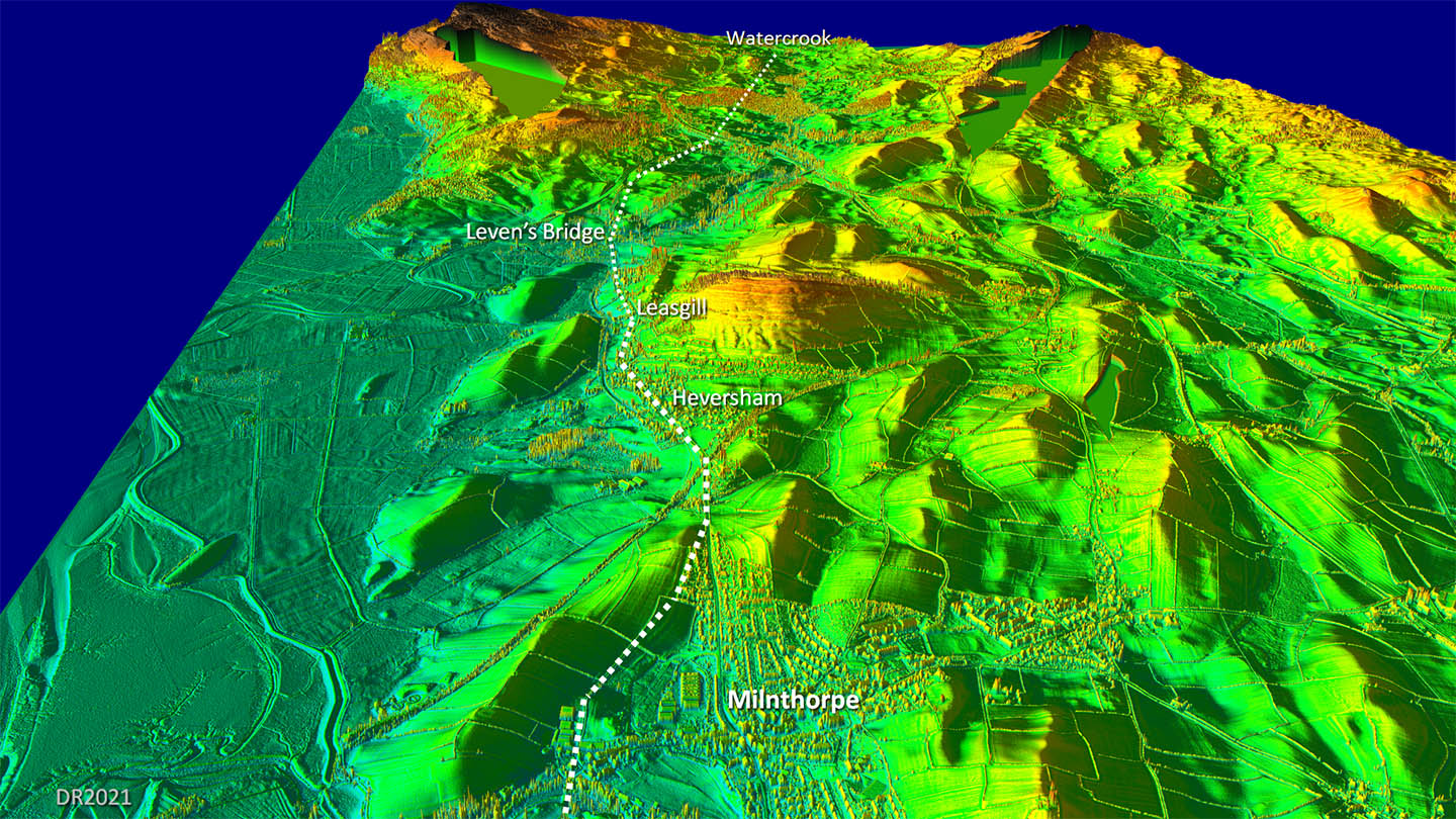
Oblique 3D Lidar Image - Milnthorpe to Watercrook It is a reasonably logical route, fairly direct and keeps close to the coast which is a general feature of this road. I have shown it dotted as we really need a bit more proof to be totally certain.
|
Click for larger view |
 |
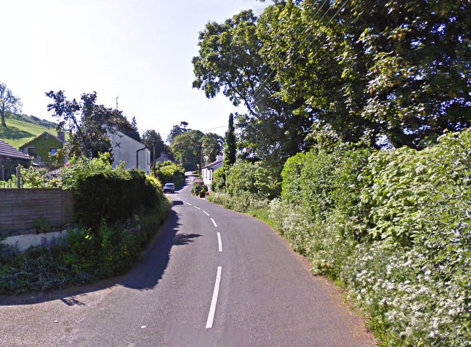
Old Road Leasgill - looking South The original A6 and the main road north before Heversham and Leasgill were bypassed. Image: DR |
Click for larger view |
 |
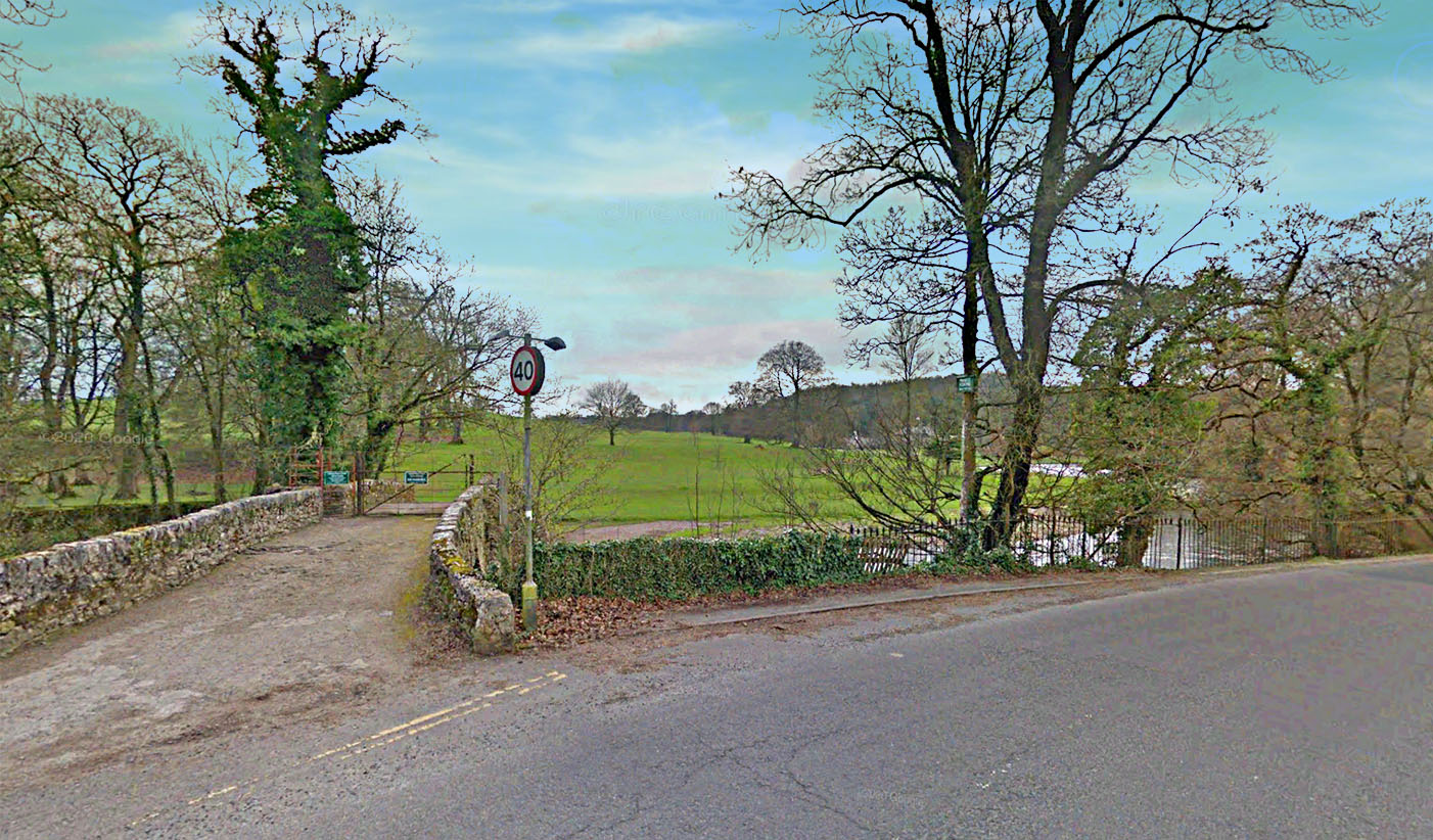
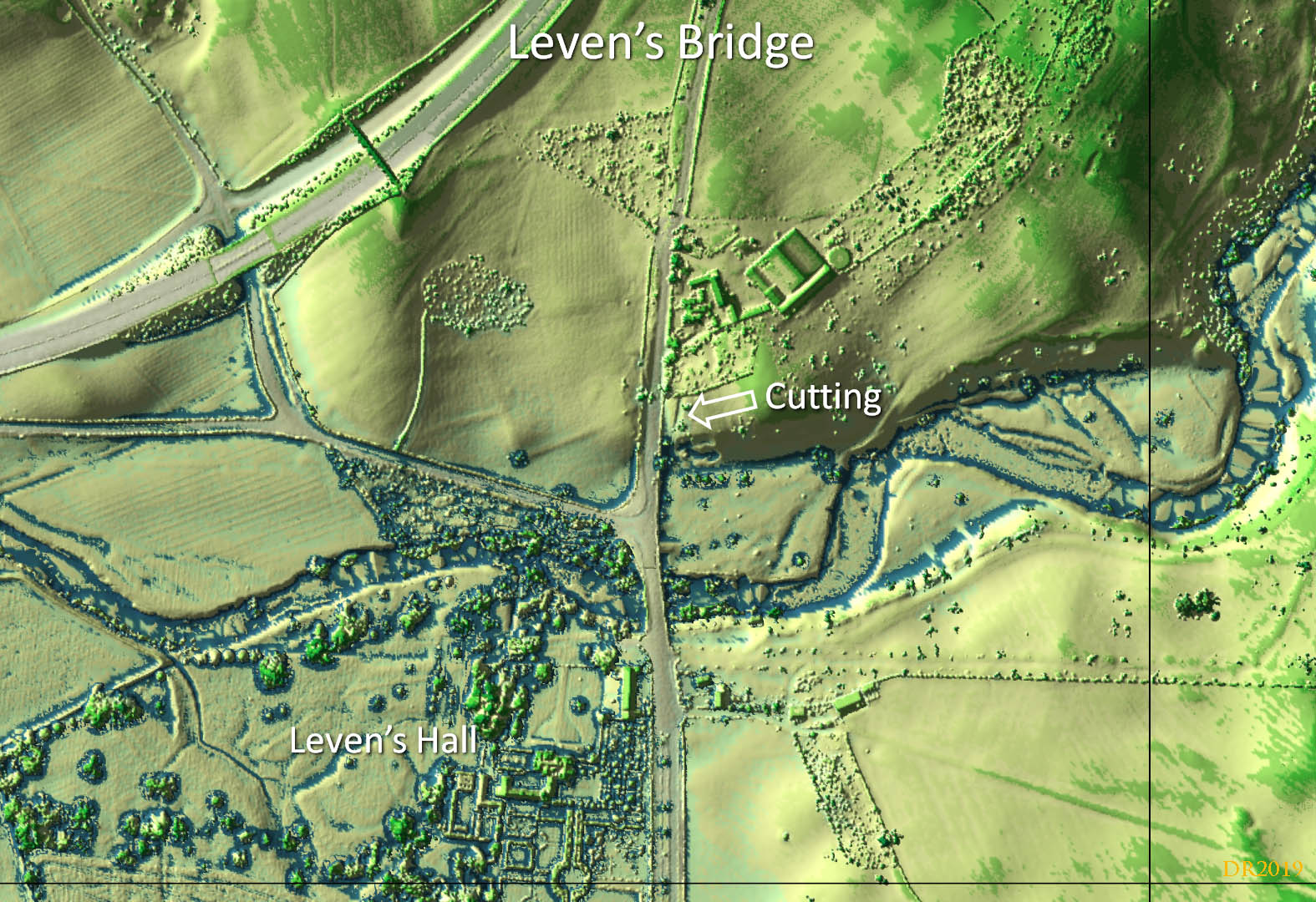
Lidar Image, Leven's Bridge - cutting of old road (SD4962 8537) Leven's Bridge is the ancient lowest crossing point of the River Kent. Just north of the river and to the east of the modern A6, there are the clear signs of an old road in a shallow cutting heading north. This would fit well with it being Roman. |
Click for larger view |
 |
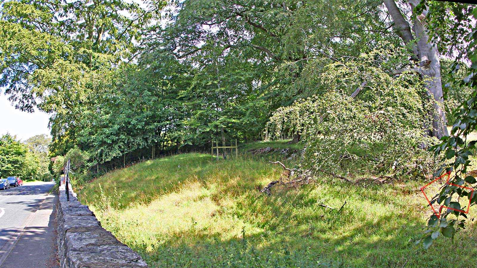
Leven's Bridge - cutting of old road (SD4962 8537) This is the on the ground view of the cutting shown above in the lidar image, which I had spotted before I noticed the Lidar evidence. Image: DR |
Click for larger view |
 |
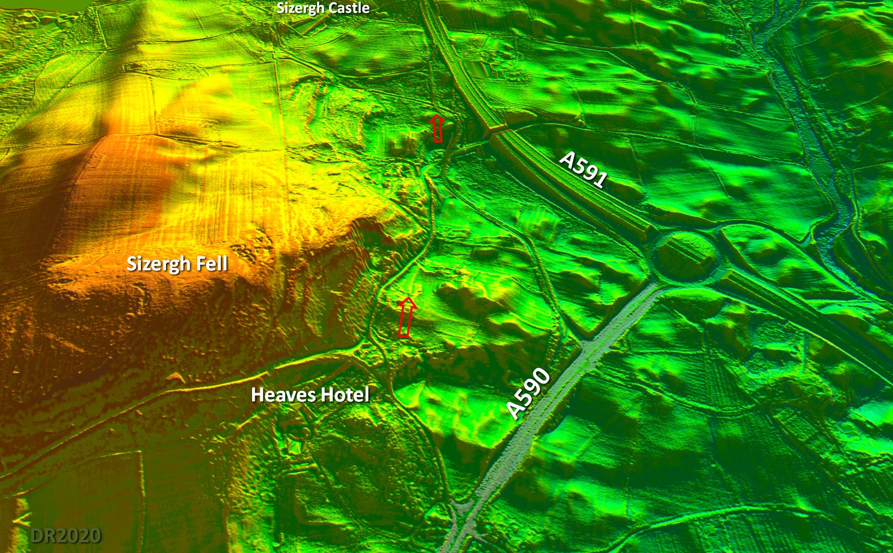
Oblique 3D Lidar Image (DTM) - Sizergh Two lengths of possible agger are visible in this Lidar model looking north towards Sizergh Castle. This is a DTM model so vegetation/trees and buildings have been removed. |
Click for larger view |
 |
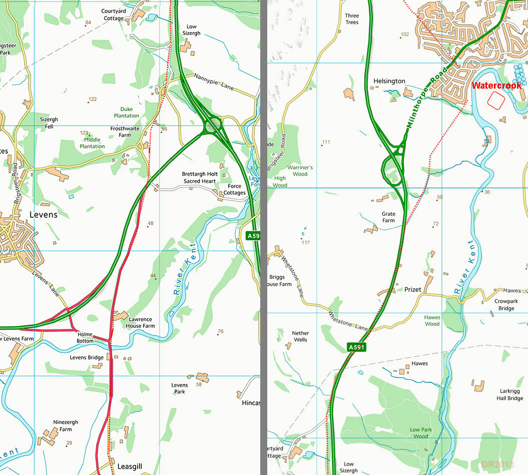
Route Map - Leasgill to Watercrook The route follows the Lidar traces above at Leven's Bridge and Sizergh. There is a logic to a route on the west bank of the River Kent and this would fit well with the route to Ambleside which now know comes down from Stainbank Green (see below). What (limited) evidence there is points to a route on the west bank. |
Click for larger view |
 |
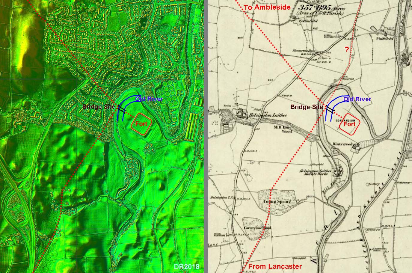
Watercrook Roman Fort, Kendal - Lidar & OS First Edition Map Because of upgrades to the A591/A6 I have had to resort to the OS First Edition Map to supplement the Lidar data. A route on the west bank of the River Kent fits well with the route onwards to Ambleside. We now know this comes down from Stainbank Green. They would have shared a common bridge (where the 2 roads would meet) but its position is likely to have been eroded by river movements. There is some Lidar evidence for the old river course but these positions shown should be regarded as best guesses. There is additional support for this alignment in that the route from the south seems to carry on north towards Kendal via a track. The later route via Helsington Laithes was presumably a diversion when the river destroyed the direct route. |
Click for larger view |
 |
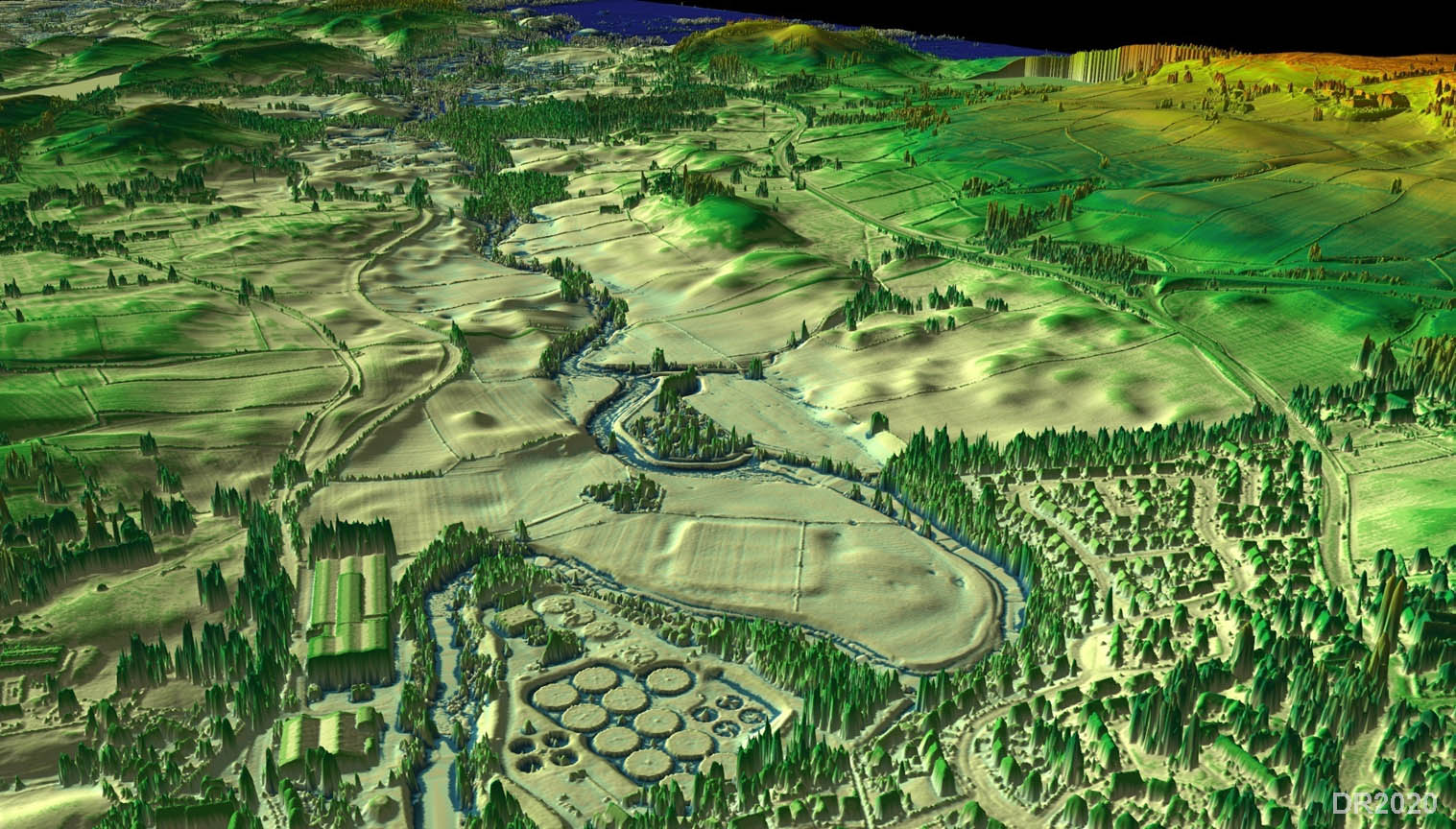
3D Lidar Image Watercrook Roman Fort, Kendal - looking south The fort at Watercrook shows up well in the 3D lidar image. Unfortunately any connecting roads do not hence the likelihood the road from Lancaster is on the west side of the river. For David Shotter's article in Contrebis 2000 on Watercrook - see link |
Click for larger view |
 |
|
|
|
Last update: October 2025 |
© David Ratledge |