
|
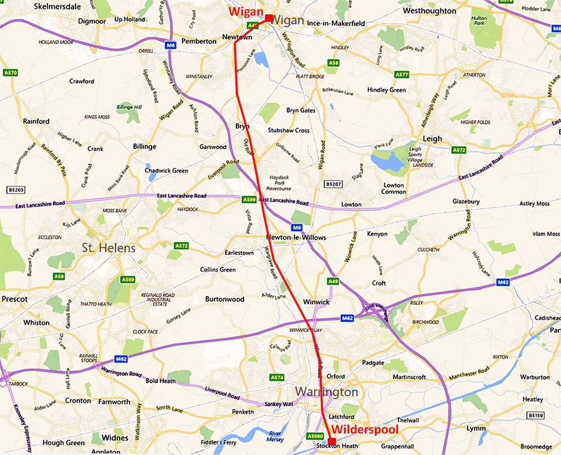
The Roman Road from Wilderspool (Warrington) to WiganMargary Number: 70bDistance: 13.5 milesThe majority of the course of the road has been well recorded over the years and was described in detail by Sibson (1836). However, the traditional route across Warrington via Howley Quay is very cicuitous but there is a more logical alternative and both alternatives are described here. The location map shows the more direct route at Warrington rather than the Howley Quay version. Note: before 1974, both Wigan and Warrington resided in Lancashire so for completeness this road has been included under Lancashire. Without wishing to offend anyone, the current counties for these towns are Greater Manchester and Cheshire respectively plus this road also passes through Merseyside.. |
Historic County: Lancashire Current Counties: Greater Manchester, Merseyside & Cheshire HER: Greater Manchester, Merseyside & Cheshire
|
|
|
|
|
|
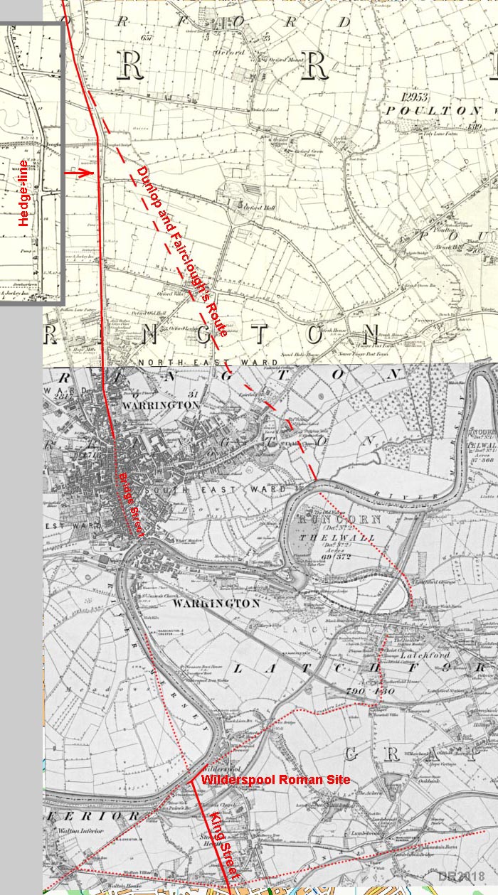
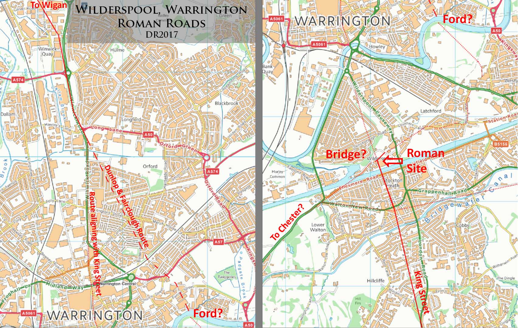
Warrington Roman Road - Modern Map The main Roman settlement was located south of the river in Wilderspool. The Wilderspool site has never been identified as a fort but appears to have at least been a supply base or workshops on the south bank of the then river location. However, in 2000 some Roman finds were located west of Bridge Street north of the river and this could indicate some kind of Roman occupation most logically alongside a road there. There are two options for the road north of Wilderspool. Dunlop and Fairclough (1930s) found evidence for a line branching off the modern A49 (coming from Wigan) and heading for Howley Quay on the River Mersey. As can be seen this is a very circuitous route and does not fit with the direction of King Street coming in from the south (Middlewich). The second option extends the line of King Street northwards and joins up with the modern road at Bridge Street, where those Roman remains were found. On balance the King Street-Bridge Street route looks much more likely. There could, of course, have been both routes. |
Click for larger view |
|
Warrington Roman Road - OS First Edition Map There is some evidence on the west side of Winwick Road heading north out of Warrington of perhaps the original road line. Field boundaries run parallel to the modern A49 just to the west of it. These are a likely clue to the original ancient road line and probably derive from the Roman road. This would lend some support to the Bridge Street route to Wilderspool rather than the Dunlop and Fairclough route.
|
Click for larger view |
 |
Warrington to Wigan - Detailed Route Map The three boxed areas highlighted are where Lidar indicates there is surviving evidence for the Roman road agger. Each one is detailed later.
|
Click for larger view |
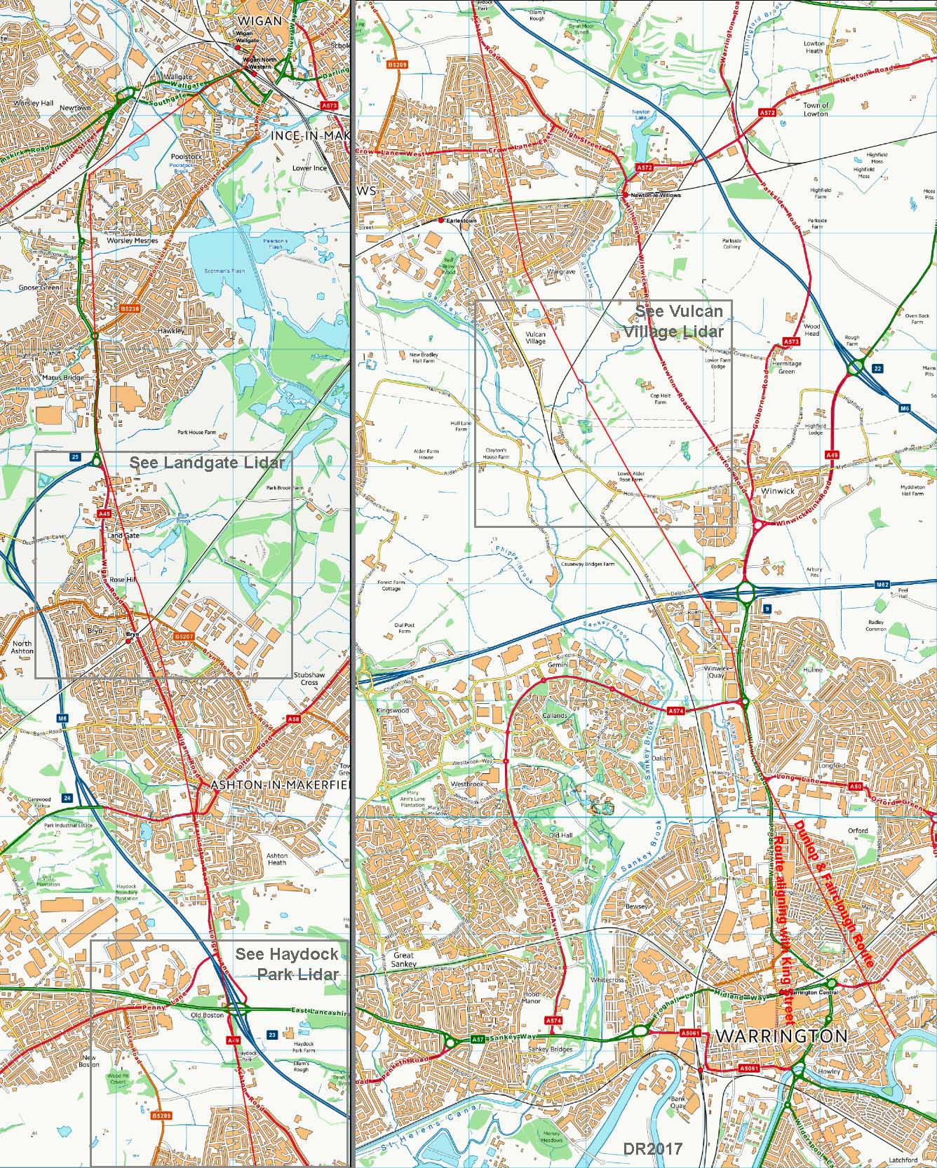 |
Lidar - south of Vulcan Village The first edition OS maps marked the line of the road straight here - between the two white lines. There is some evidence supporting their line. However, the latest OS maps now no longer show this line and have adopted the Dunlop & Fairclough dog-leg here - see next image.
|
Click for larger view |
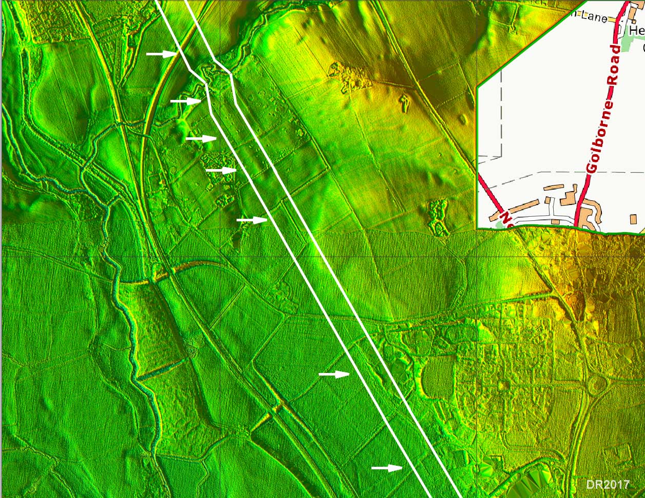 |
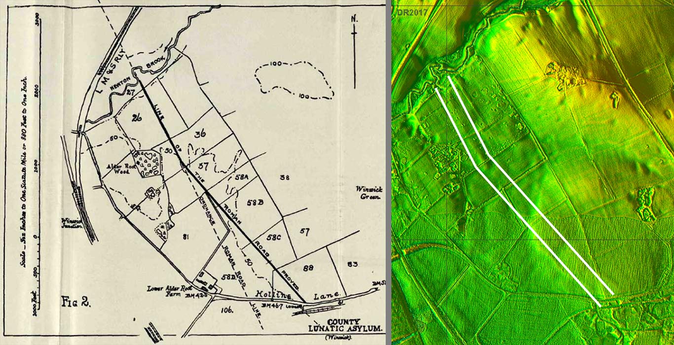
Dunlop & Fairclough Map and Lidar - south of Vulcan Village Dunlop & Fairclough reported that the road changed direction here but as can be seen on the Lidar image (right of map) there is nothing visible now supporting this in the Lidar data. It seems a strange position to change direction and doesn't shorten the distance to where the two options rejoin further south. Clearly more research would be beneficial here. |
Click for larger view |
 |
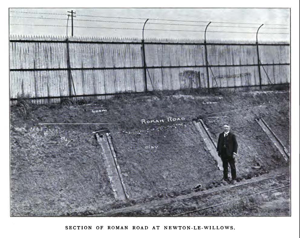
Newton-le-Willows Excavation 1909 Excavated by Captain Doggett in 1909 at Vulcan Enginering works,south of Newton-le-Willows. The road was 22 feet wide and consisted of pebbles/cobbles on clay. Another section on the same site found cobbles on irregular sandstone blocks. Image: Lancashire & Cheshire Antiquarioan Society Transactions 1910. |
Click for larger view |
 |
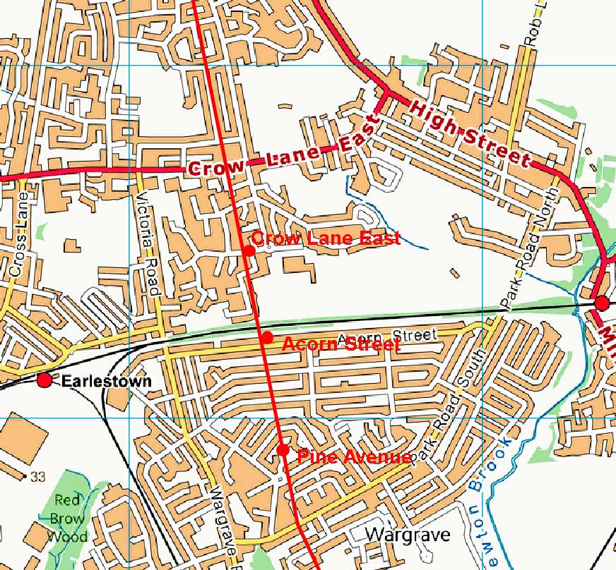
Newton-le-Willows Excavations 1985-1995 There were 3 excavations carried out in Newton-le-Willows in the decade 1985 to 1995 - refrence Rob Philpott, Journal of Merseyside Archaeological Society, 2000. These were about a kilometre north of the Vulcan Engineering Works one mentioned above. They were at:- 1. Acorn Street, Wargrave, 1995 Crow Street (SJ 5832 9549) produced the best surviving evidence for the Roman road. It was 6.2 metres wide and comprised of pebbles on 50mm thick sandstone slabs over more pebbles bedded on sand. There were shallow ditches both sides. |
Click for larger view |
 |
Lidar - Haydock Park, south of East Lancs Road Just north of Newton-le-Willows in the first field beyond the housing are the clear signs of the road agger. It looks from the Lidar data to be in excellent condition - perhaps the best stretch of this road remaining. |
Click for larger view |
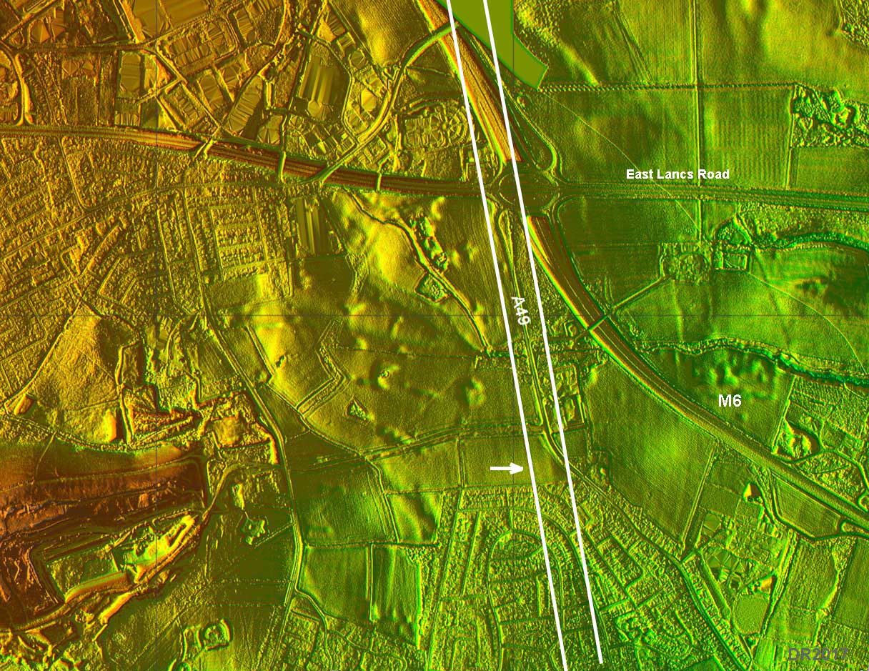 |
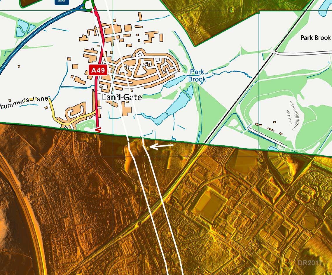
Lidar - south of Land Gate This is where the road merges in with the A49, near the M6 link road, for the final run to Wigan. This area was scheduled for housing in 2018. An open-day was organised by. Wigan AS in consultation with the developer in April prior to its destruction for new housing. The trenches/sites excavated are just north of the Lidar edge on the image right. There was no trace of the cutting(?) visible on the Lidar (marked with an arrow) but the whole top surface of the site had been planed away by a huge earth moving scraper so it was hardly pristine any more.
|
Click for larger view |
 |
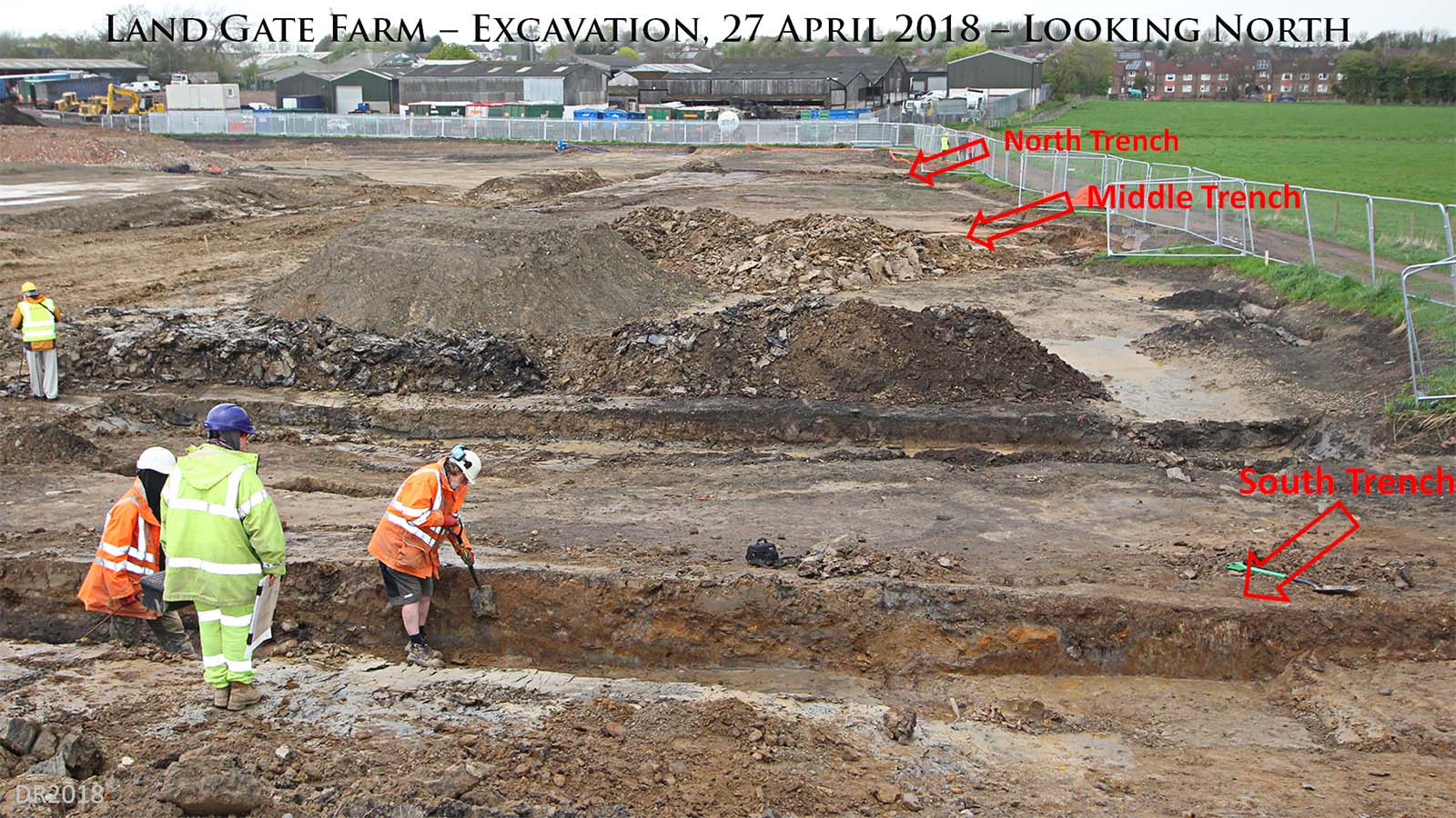
Land Gate Excavation, April 2018 - Site looking North Visible in this picture are the 3 trench sites looking to the north towards Wigan, or more accurately towards the A49 as the alignment is well to the west of Wigan. The 3 nearest personnel are from Salford University’s Centre for Applied Archaeology, who are responsible for providing archaeological advice to planning departments in Greater Manchester and carried out the rescue excavations.. Thanks are due to Bill Aldridge for organising the Open Day.
|
Click for larger view |
 |
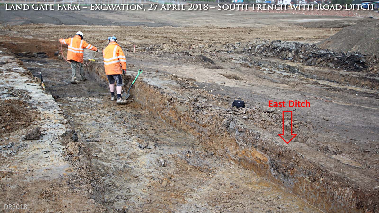
Land Gate Excavation, April 2018 - South Trench This was the only cross section that revealed a road ditch - in this case the east one. Seven paces to the left (west) then were some signs of a possible western ditch marked by stones that had perhaps fallen into it but it had a layer of clay above it which was a puzzle.
|
Click for larger view |
 |
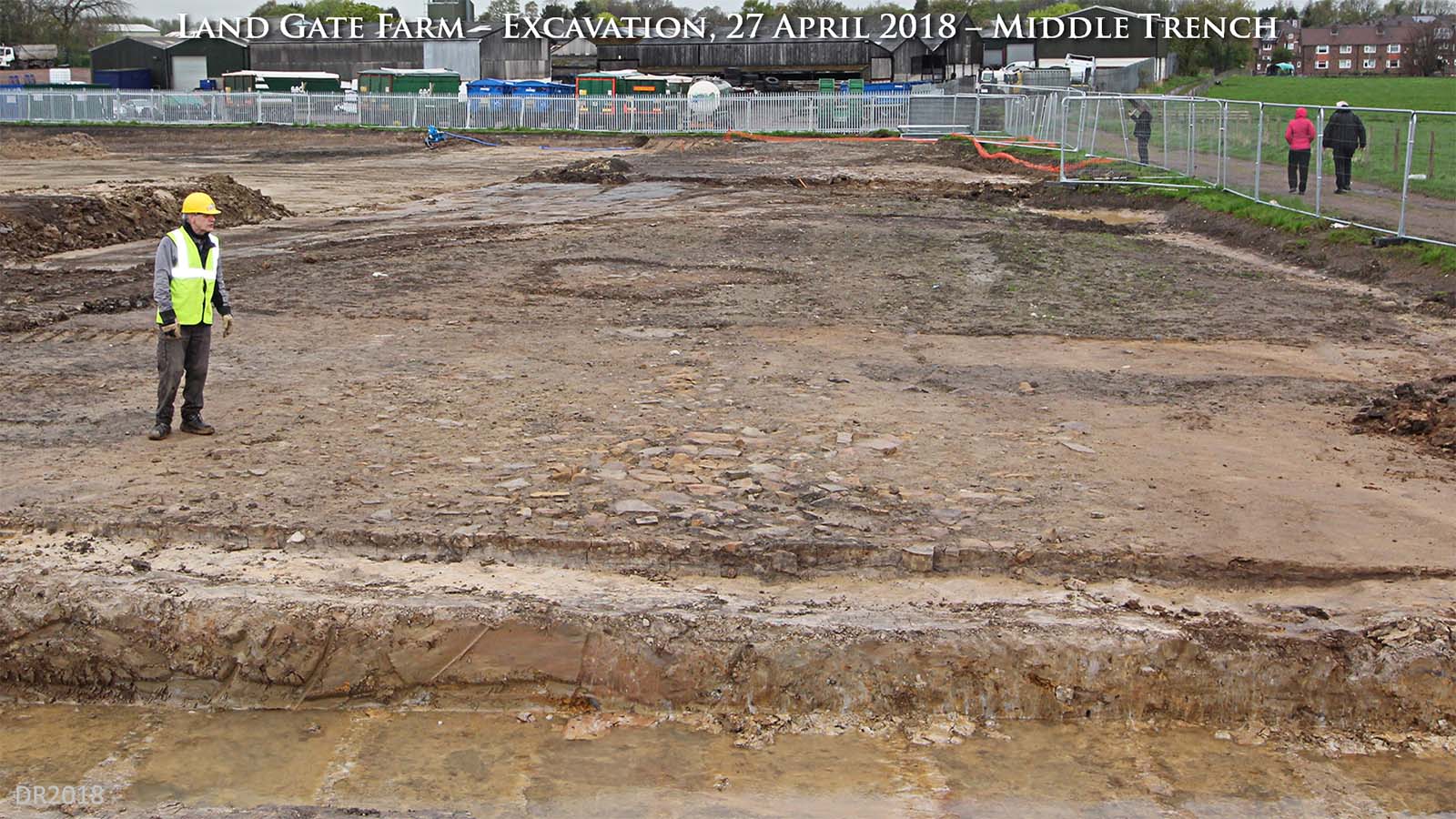
Land Gate Excavation, April 2018 - Middle Trench The middle site/trench with a surviving spread of road stones to the right of Bill Aldridge.
|
Click for larger view |
 |
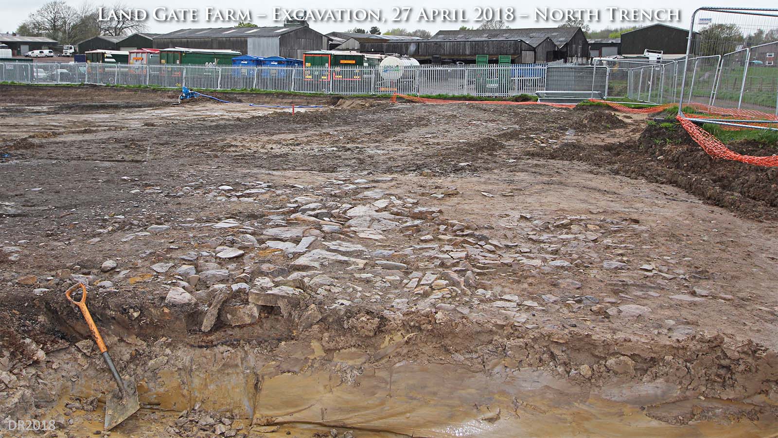
Land Gate Excavation, April 2018 - North Trench Possibly the best surviving spread of road stones was at the northern site. There was no surviving agger. The huge earth moving scraper had probably taken the top surface away and flattened what was left into a pancake! Still it was good to see a Roman road that had been hidden for probably 1000 years.
|
Click for larger view |
 |
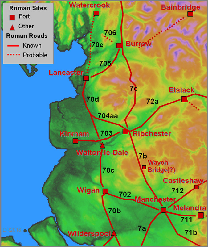
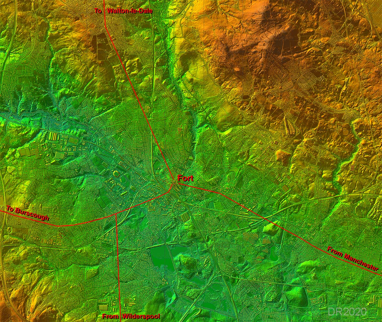
Lidar Image - Roman Roads of Wigan The setting out alignment of the north-south road seems to have been on Prospect Hill, Standish. The road from Wilderspool appears directed at this high point. The road to Walton-le-Dale then heads from Wigan to rejoin the main alignment. Only then does it turn for Walton-le-Dale.
|
Click for larger view |
 |
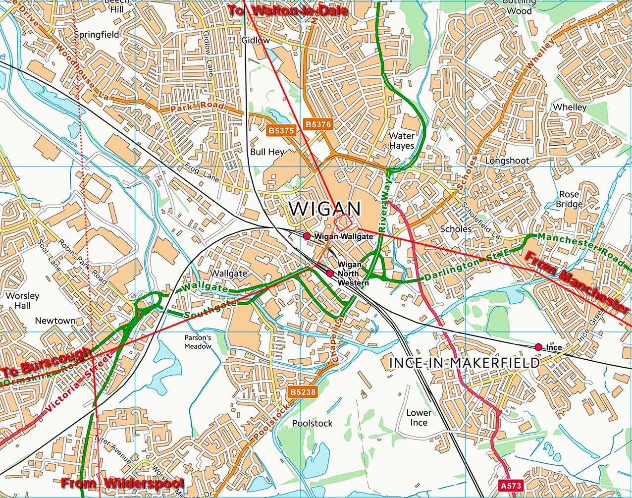
Wigan Map - Roman Roads I think at long last we may may getting an accurate map of the Roman roads of Wigan. There is now a logic as to why the road from Wilderspool does not take a short cut into the fort at Wigan - it joins the Burscough road for a common route into the town. The Manchester road we are reliant on Watkin but he does seem to have generally got the route correct. The road to Walton-le-Dale, thanks to Wigan AS and lidar series 2 data, is now also pretty secure.
|
Click for larger view |
 |
|
|
|
Last update: May 2019 |
© David Ratledge |