
|
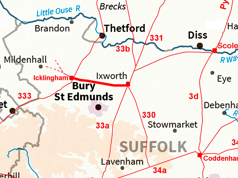
Ixworth to IcklinghamMargary Number: noneDistance: 9 milesIxworth and Icklingham were certainly linked by a direct Roman road but approaching Icklingham there appears to have been two routes - a northern and southern one. It is not unusual to have duplicate Roman alignments - I have come across them several times before. It probably means that within the Roman occupation a second road was deemed needed usually as an upgrade for a better route. Icklingham appears to have been a small Roman settlement alongside this road, the Icknield Way and the River Lark. Finds included a cemetery and as these were located alongside roads then it all fits together. Icklingham was probably Camborico of Antonine Itinerary V - see later.
|
Historic Counties: Suffolk Current Counties: Suffolk HER: Suffolk
|
|
|
|
|
|
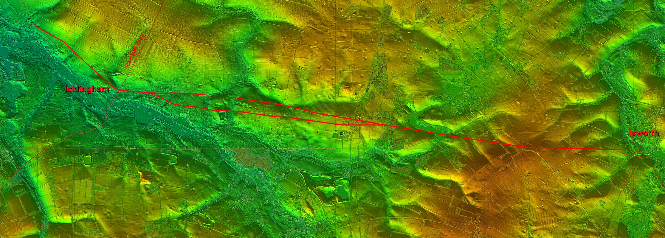
Full Route - Lidar Image The northern option looks the more logical alignment but there is probably just as much, if not more, lidar evidence for the southern route. My thoughts are that there were two roads - one replacing the other for some reason. Just think how often we upgrade roads nowadays. |
Click for larger view |
 |
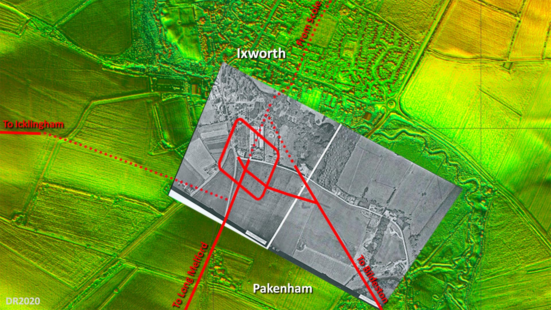
Site Plan - Lidar and Aerial Image The overlaid aerial is believed to have been taken shortly after WW2 and the fort and road system shows up very clearly. Obviously long before the bypass destroyed a large part of it. The only puzzle is the connection to the road to Icklingham. Where I have shown there is some evidence (see 3D lidar below. The main road alignment though appears to have been set out on the fort's north west gate but no trace on that course is evident. Image: Aerial photo overlaid on Lidar is by University of Cambridge (assumed out of copyright - apologies if not) |
Click for larger view
|
 |
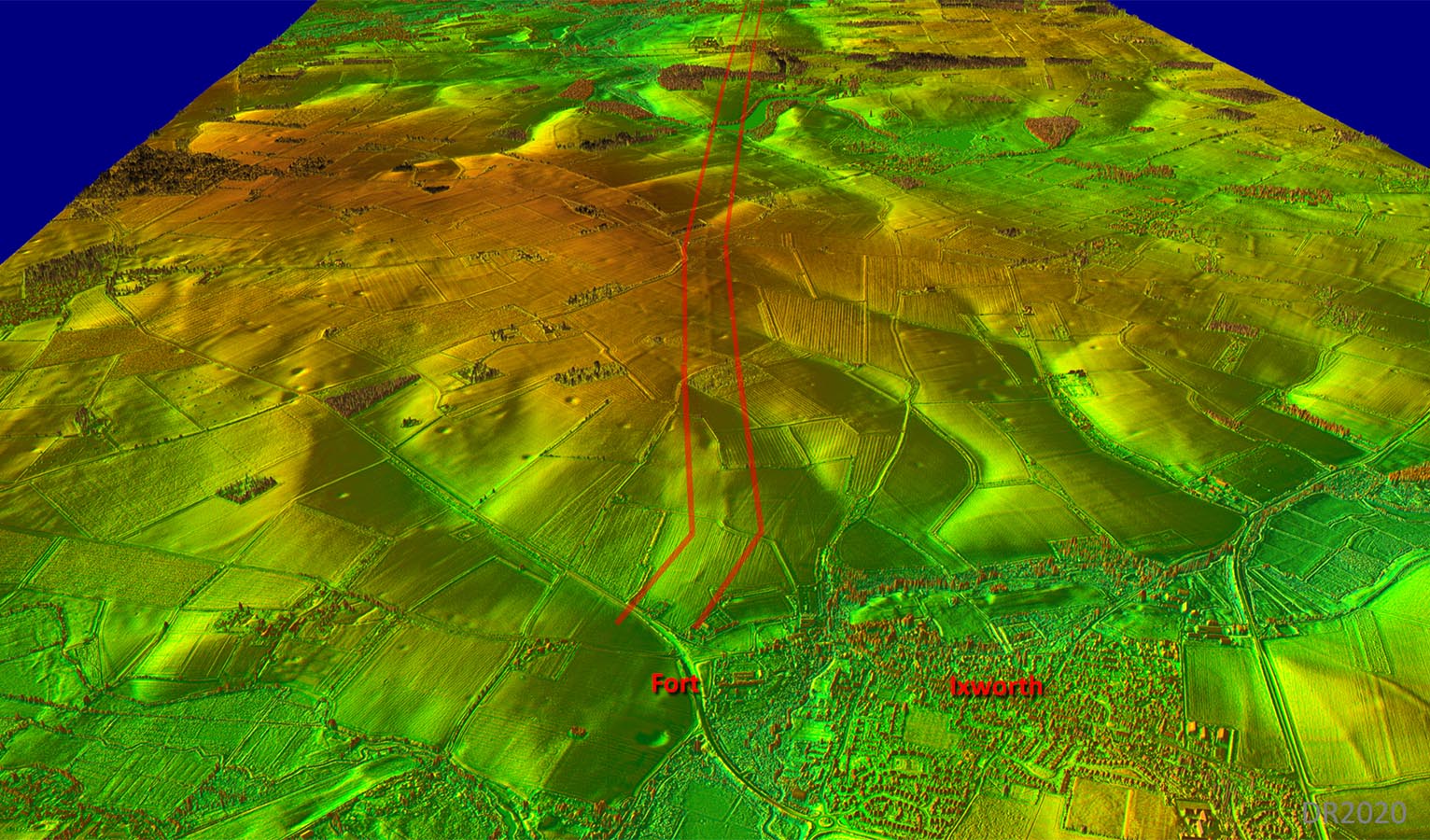
Oblique 3D Lidar Image - Ixworth Looking West As far as Ingham our road shows up very clearly. Note the subtle change of direction about halfway to Ingham. That slight indication that the road started from the south gate of the fort is evident but I am not totally sure..
|
Click for larger view |
 |
Lidar Image & Route Map 1 The route is clear and obvious for the first half. There does appear however to be perhaps two options at the Ixworth end - one aligned to the fort and one from the bridge. The main alignment of the road is more directed to the bridge site. |
Click for larger view |
 |
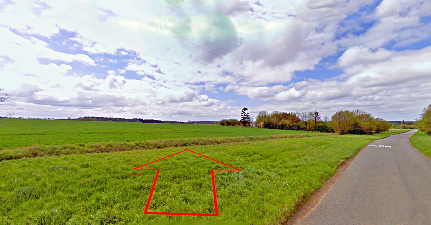
Passing The Thix Our road crosses Brand Road just south of The Thix house. Although an agger is visible here in the Lidar imagery it is not that obvious on the ground.. Image: Google |
Click for larger view |
 |
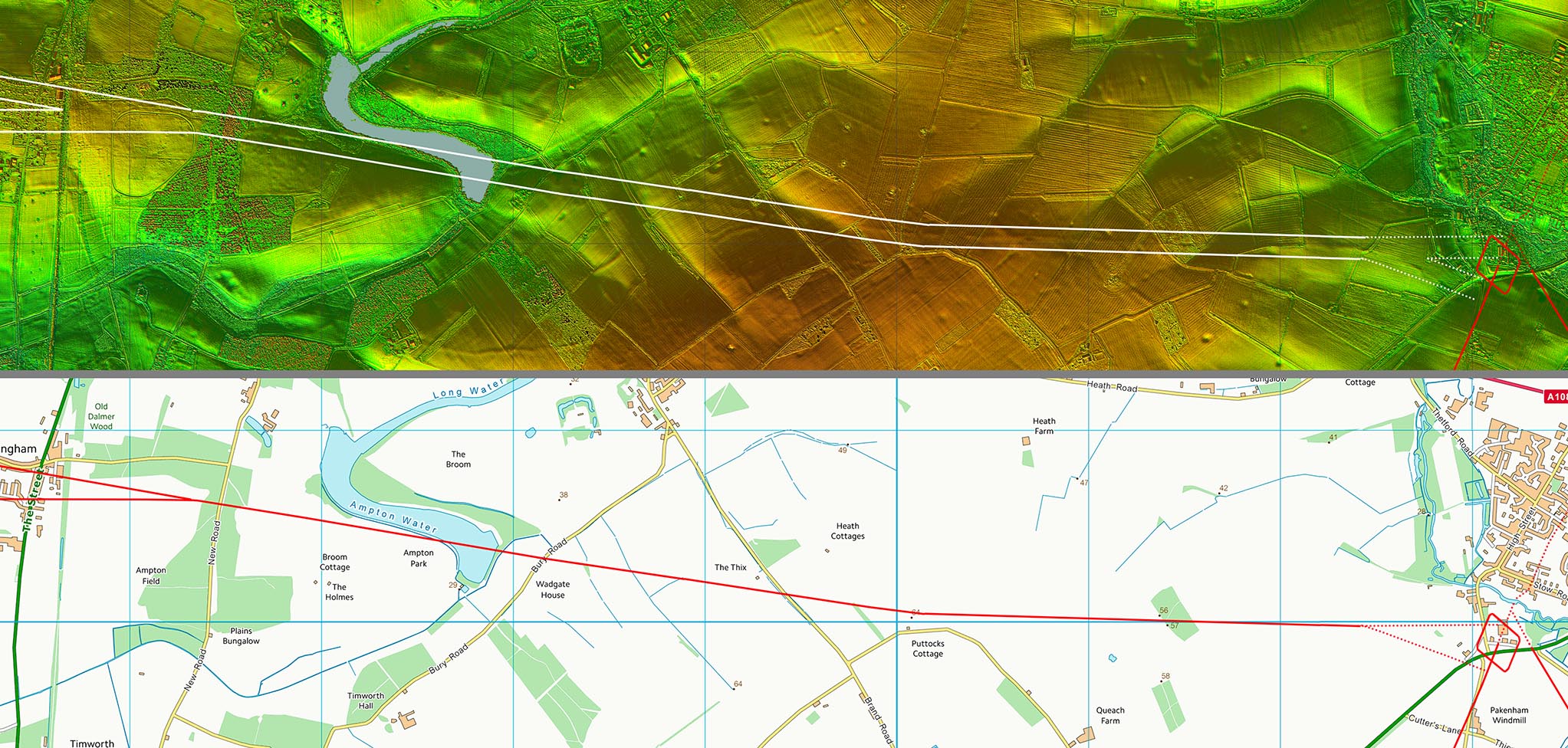
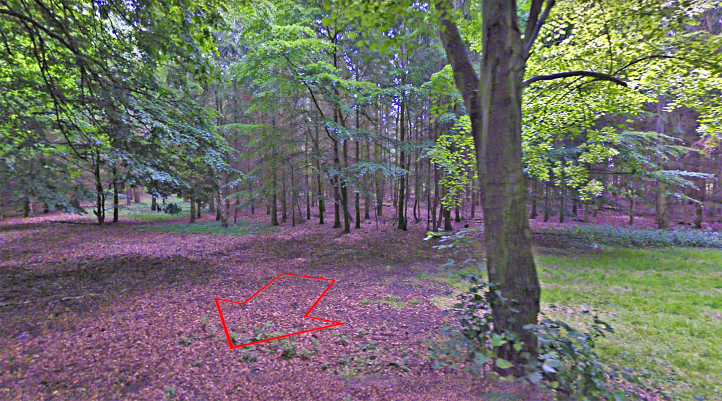
Ampton Wood - Possible Agger There are the remains of the road agger visible in Ampton Woods as it approaches New Road. However, the Ordnance Survey's line for the road appears incorrect here and there is no Lidar evidence supporting their line.. West of Ampton Woods and Ingham then the two parallel routes to Icklingham begin. Image: Google |
Click for larger view |
 |
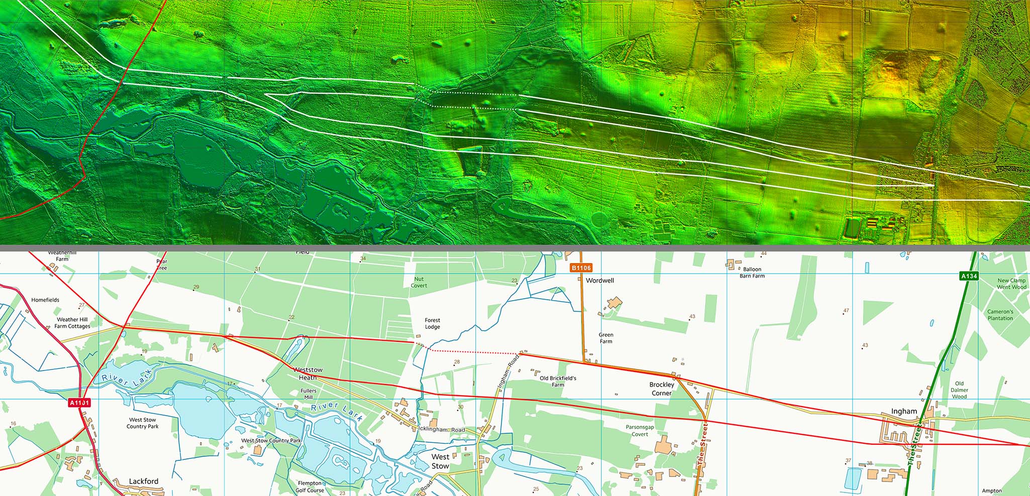
Lidar Image & Route Map 2 This where we have two routes to Icklingham. Both could be correct and represent a later change in alignment for some reason. |
Click for larger view |
 |
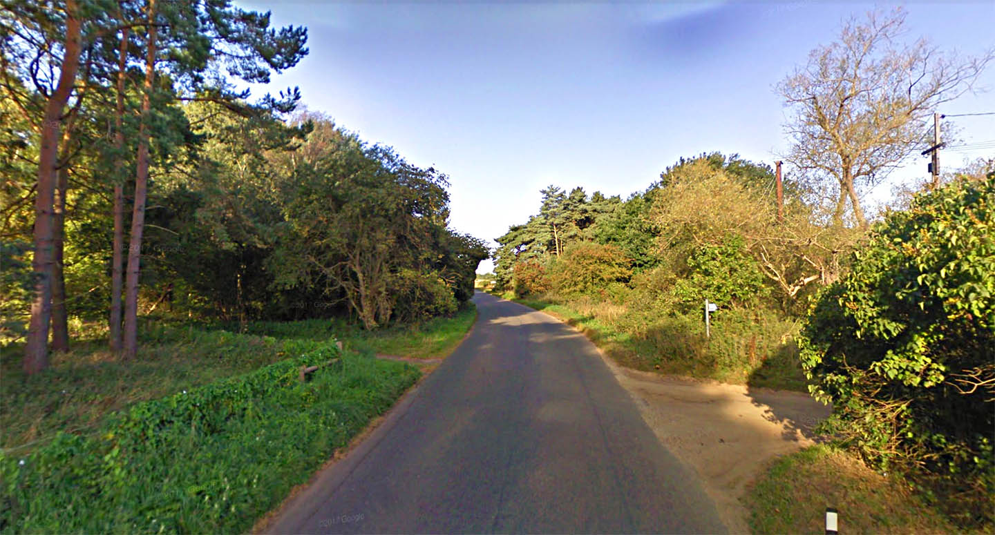
Crossing the Icknield Way The Icknield Way crosses our road here from right to left. Icklingham, the Roman settlement, lies beyond the cross roads about 500 metres further west - see next map. Icklingham was probably Camborico of Antonine Itinerary V. The mileages are a couple of miles adrift (36.5 from Caistor & 27.5 from Cambridge) but it is the closest match available. Image: Google |
Click for larger view |
 |
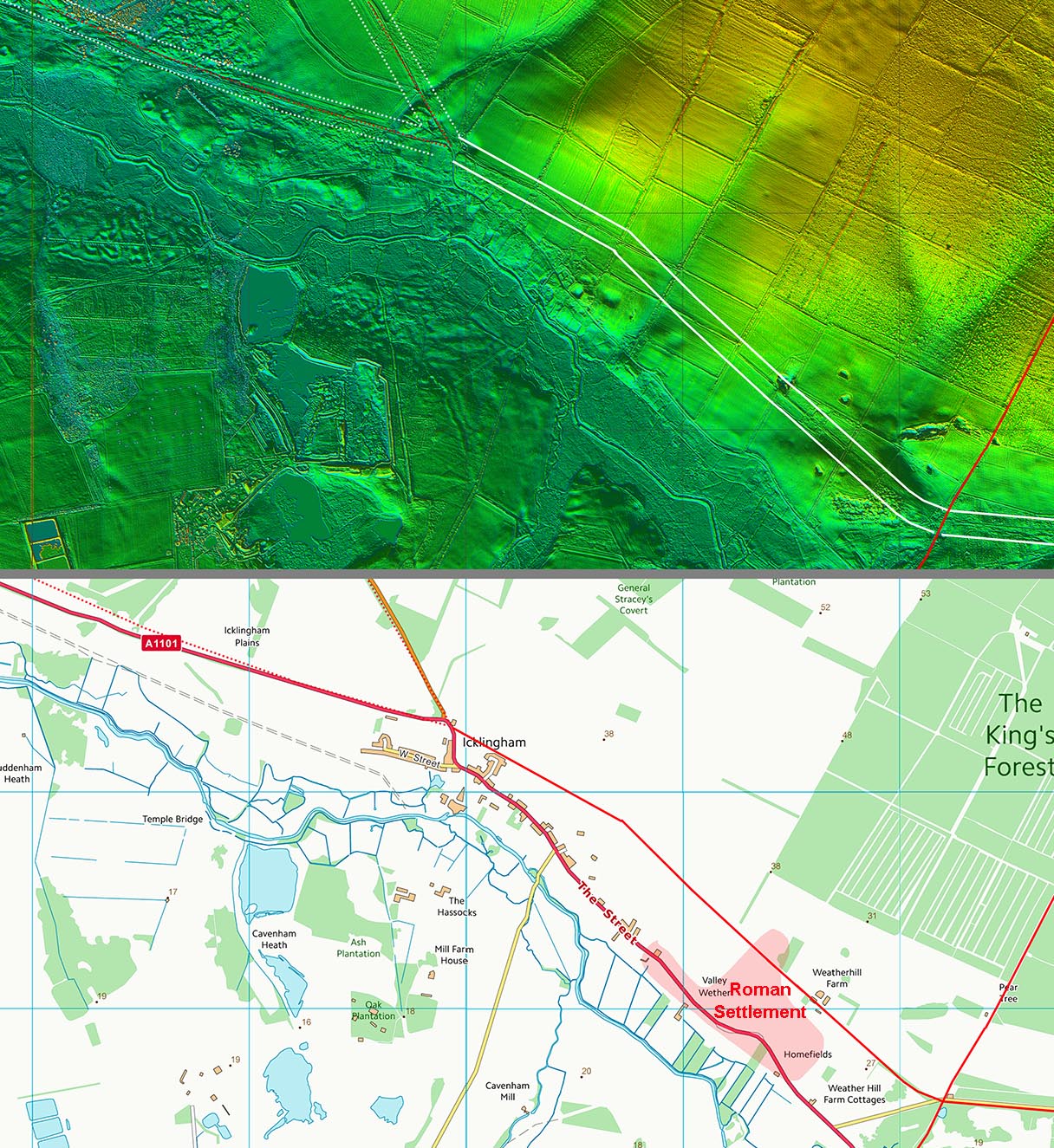
Lidar Image & Route Map 3 It would seem most likely the road continued on beyond Icklingham Roman settlement, its approximate extent shown the map. It could have The road would probably have carried on and perhaps even forked for two destinations - see Icklingham to Prickwillow. |
Click for larger view |
 |
|
|
|
Last update: May 2020 |
© David Ratledge |