
|
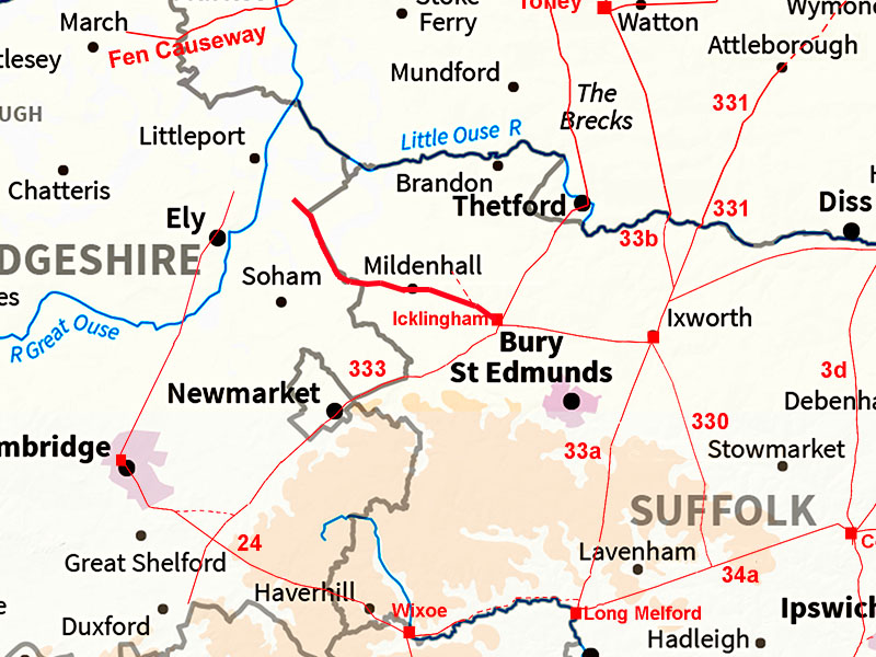
Icklingham to PrickwillowMargary Number: noneDistance: 15 milesIcklingham, the Roman settlement/small town was located west of the Icknield way along this road. Where the road went to was the puzzle. West of Mildenhall is the famous River Lark Roman canal. There are clear signs of a connecting road passing through the centre of Mildenhall. Beyond Prickwillow obvious signs are lacking but the ultimate destination was perhaps Littleport as Akeman Street from Cambridge also appears to have this place as its destination. Icklingham was probably Camborico of Antonine Itinerary V. The River Lark was most likely navigable as far as Icklingham in the Roman era. |
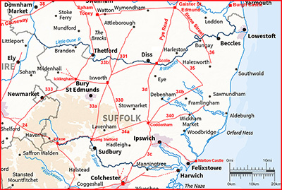
Historic Counties: Suffolk and Cambridgeshire Current Counties: Suffolk and Cambridgeshire HER: Suffolk and Cambridgeshire
|
|
|
|
|
|
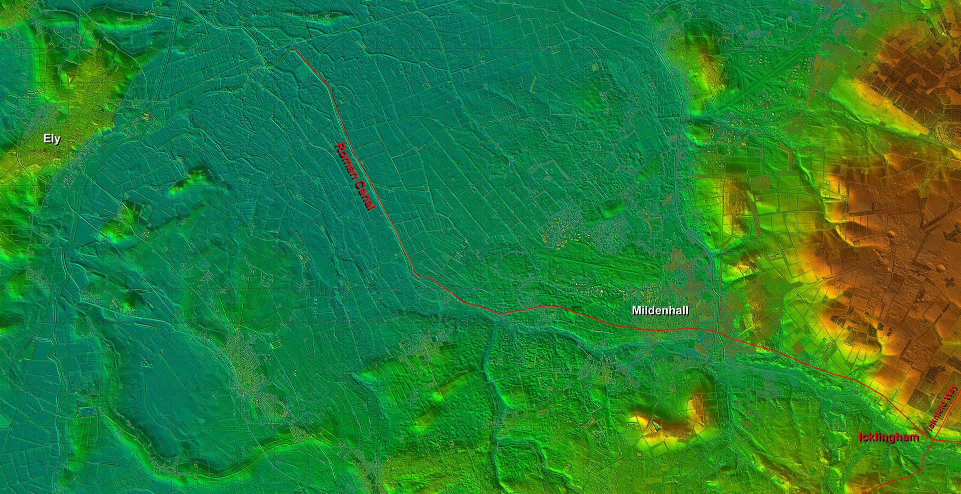
Full Route - Lidar Image The link to the Roman canal is reasonably clear and one would assume that like the Fen Causeway a road would have followed the canal bank. At the Prickwillow end it perhaps turned left for dry land but multiple drainage works over the centuries make tracing our road onwards difficult. |
Click for larger view |
 |
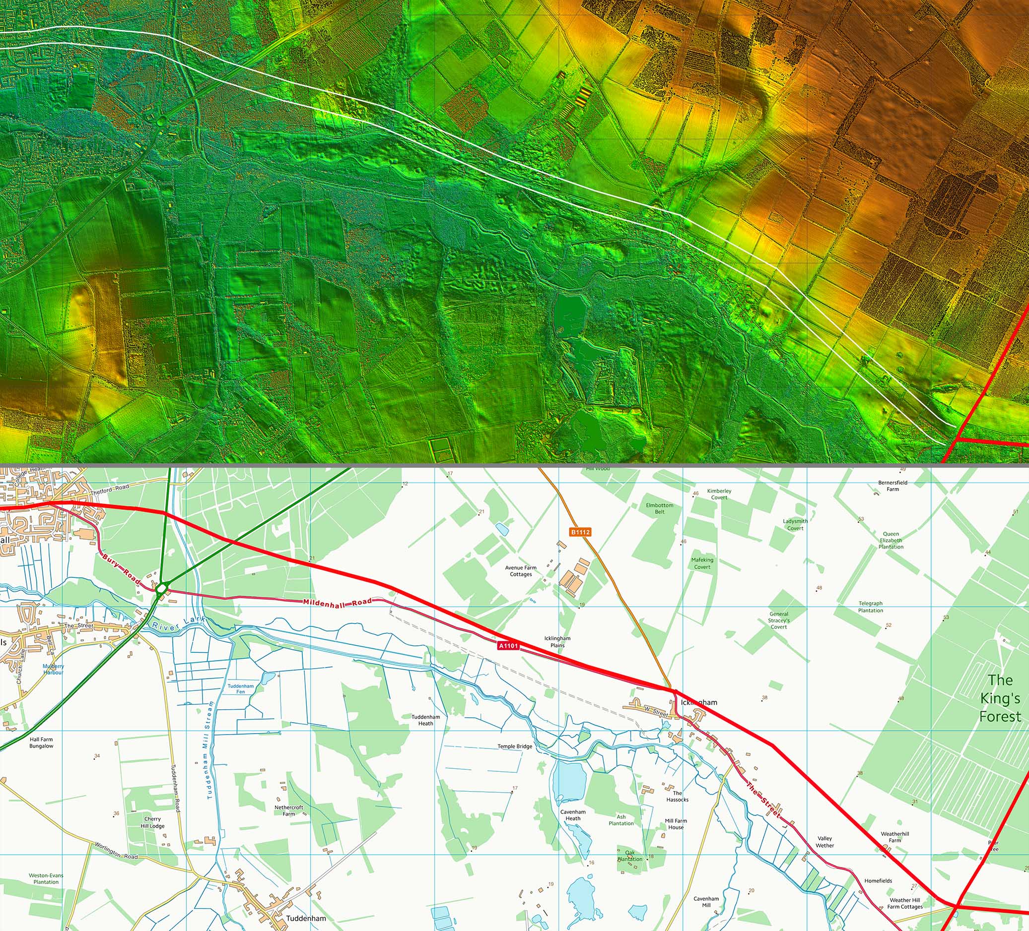
Lidar Image & Route Map 1 There are clear signs all the way to Mildenhall on the north bank of the River Lark. There was perhaps even a branch off our road along the B1112. |
Click for larger view |
 |
Queensway, Mildenhall The course of the Roman would would likely have passed straight through the middle of Mildenhall and out via Queensway. Image: Google |
Click for larger view |
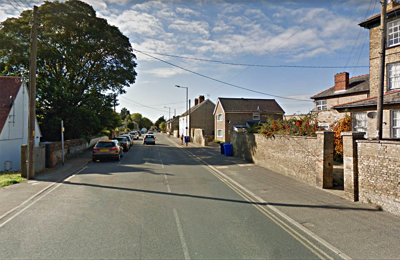 |
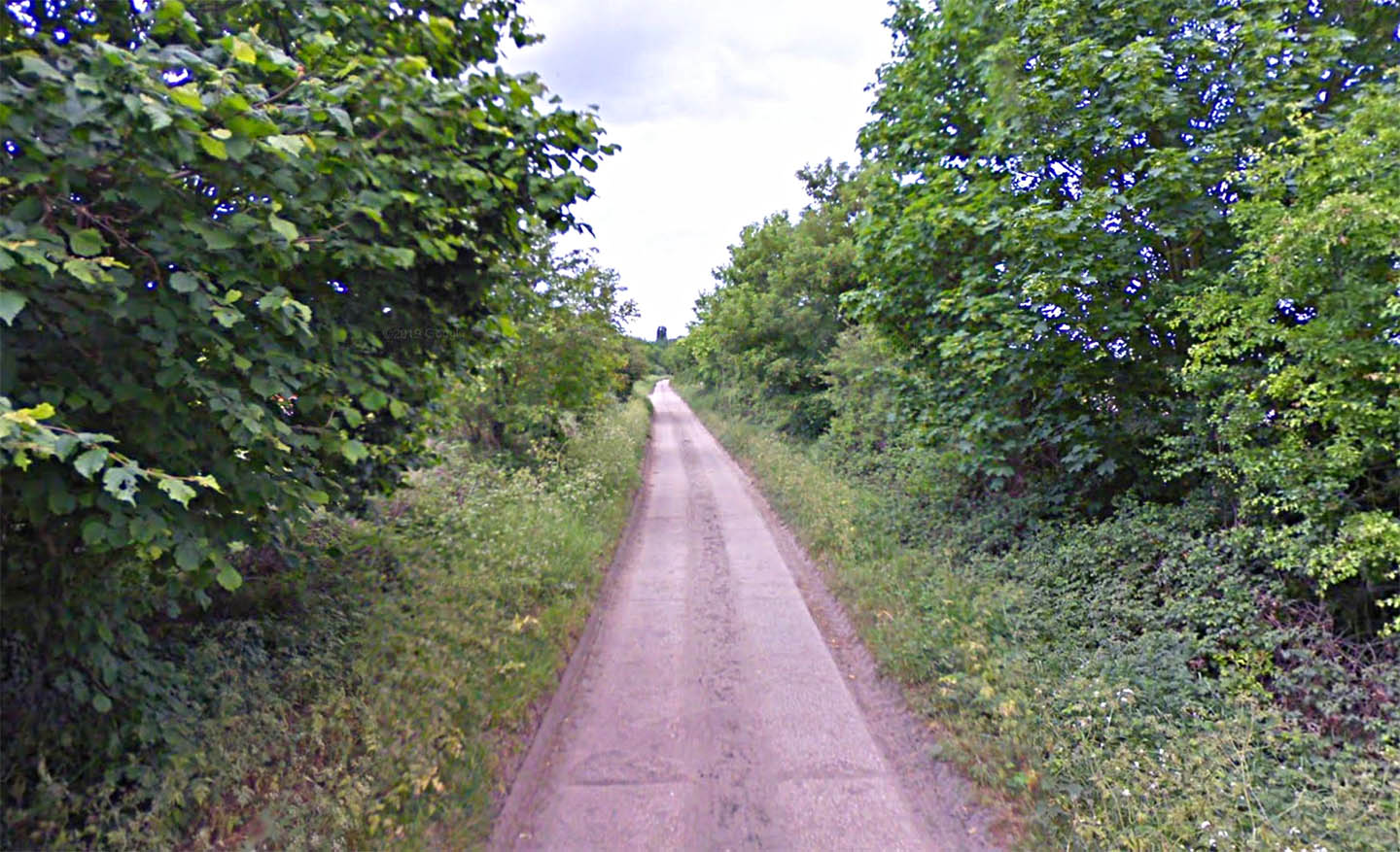
Gravel Drove, West Row Beyond West Row then Gravel Drove would seem to represent the line of the road. Image: Google |
Click for larger view |
 |
Lidar Image & Route Map 2 Again good evidence is visible all the way to the Roman canal. |
Click for larger view |
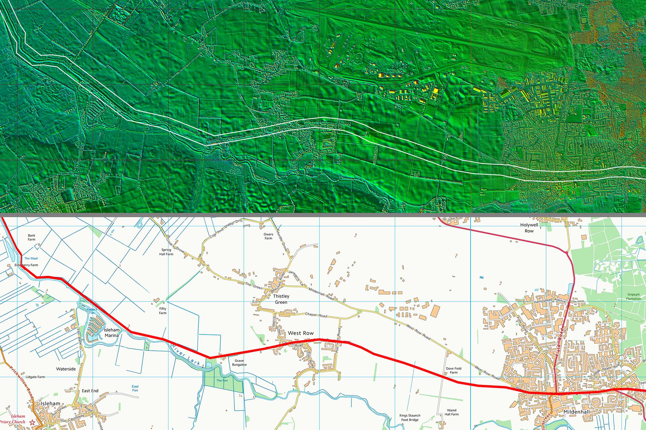 |
Roman Canal - Suffolk HER Entry Suffolk HER: MNL 463 - River Lark; West Row Fen; The Mildenhall River (Rom) Canalised course of the River Lark between approximately TL 640 765, near Bank Farm, northwards to TL 605 829, where the River Lark joins the River Ouse at Prickwillow (Cambs). Total length between these points of circa 7.2km. It is suggested that the section northwards, from Lark Hall Farm, Isleham Fen (TL 624 797), is part of a Roman diversion which continued S from Lark Hall Farm across Baskeybay in Cambs to TL 640 765, as an old slade (an extinct river channel infilled with shell marl),SW of the present course (cf S1, S2, S3). Note for Rom finds from river, or from eroded embanking material(!) where surroundings are below 0m contour (so deep fen location), see MNL 098 & 099 (pot scatters) and in Cambs (see Cambs HER & S1), from an extinct stream at Isleham is a C4 coin hoard, from the bed of the old slade at Isleham is a pewter hoard & indented beakers (S1-237)(R1)(R2) and `found in bed of river in Isleham Fen' are `rude draining tiles, samian and other pottery' (ibid; R3). The present course of the Lark S of Lark Hall Farm, replacing the old slade is thought to be Med, possibly monastic. Note: Baldwins Lode links into the Lark. The present course would certainly appear to have been in existence from the C17 onwards.
|
||
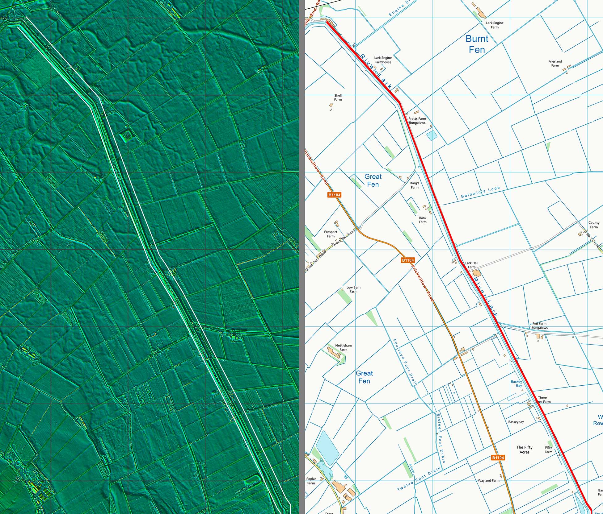
Lidar Image & Route Map 3 This is the famous 5 mile stretch of Roman Canal for the River Lark. It could well have been for both drainage and navigation. It makes sense that there would have been a road along its bank just like the Fen Causeway. Today the canal forms the boundary with Cambridgeshire. |
Click for larger view |
 |
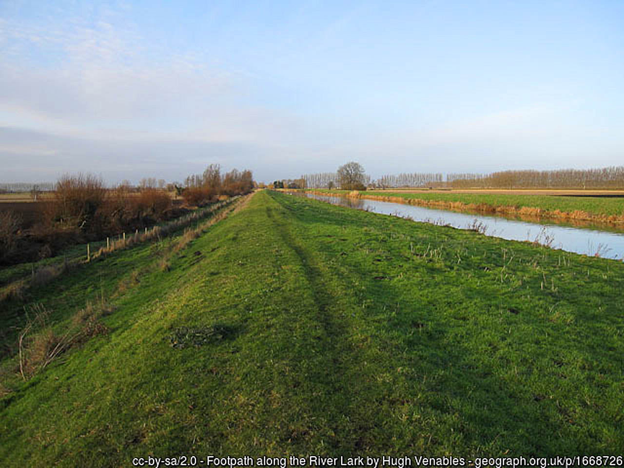
Roman Canal near Isleham Believed to be an original Roman canal on the basis of the finds, some from modern dredging operations. Dredged material is often spread on the bank so the construction here is probably a bit bigger than the Roman original and probably the reason it looks so pristine. Today it is used largely by pleasure boats. Image: Hugh Venables (Creative Commons) |
Click for larger view |
 |
|
|
|
Last update: May 2020 |
© David Ratledge |