
|
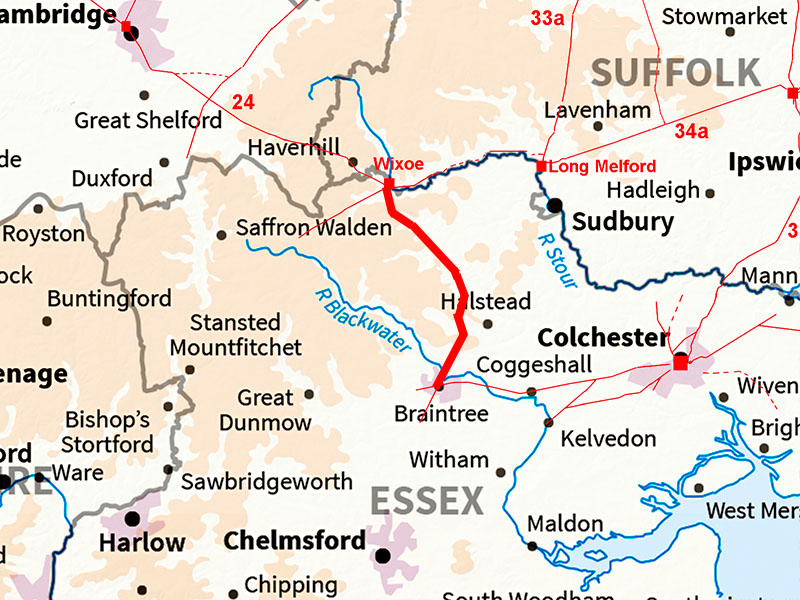
The Roman Road from Wixoe to Braintree (Essex)Margary Number: noneDistance: 15 milesMostly in Essex but as the route was previously unknown it has been included. The agger heading south then south-east from Wixoe was spotted in Lidar imagery. This merges with A1017 at Sible Hedingham and follow this road to Braintree. |
Historic Counties: Suffolk & Essex Current Counties: Suffolk & Essex HER: Suffolk and Essex
|
|
|
|
|
|
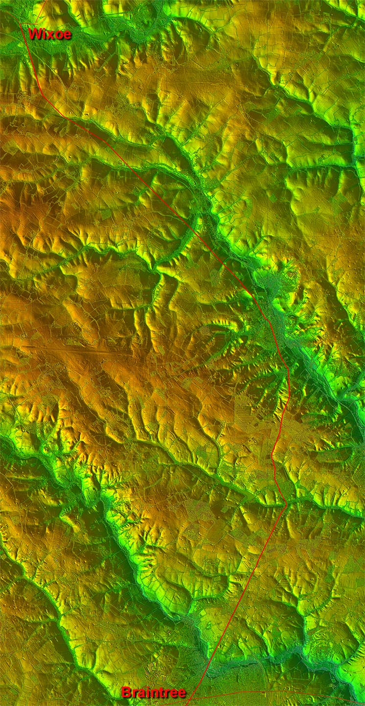
Lidar Image - Full Route As this route is anything but direct it would seem likely that it was a branch of a direct road from Braintree to Long Melford. However, so far evidence for that road is proving difficult. Yes there are some indications but perhaps not enough to be certain - yet.
|
Click for larger view
|
 |
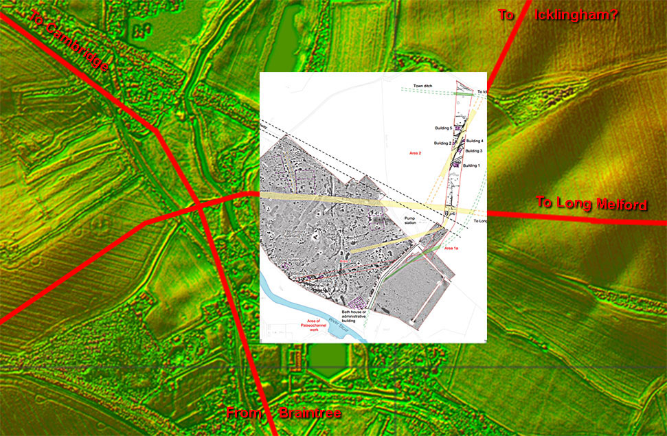
Wixoe Roman Site - Lidar Image & Oxford Archaeology Site Plan Thanks to a pipeline being laid across Wixoe we have an excellent site map of this small town. At least one high status building was recorded together with the road system (shown in yellow). These tie in with what is visible in the Lidar imagery. Ref: Excavations at Wixoe Roman Town, Rob Atkins, Oxford Archaeology, 2012 |
Click for larger view |
 |
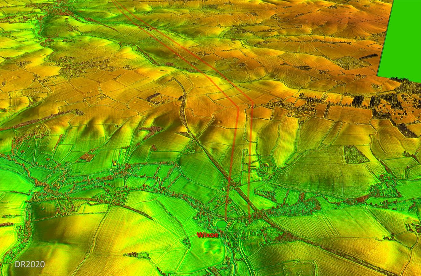
Oblique 3D Lidar Image - Wixoe looking South Our road heads to the hills rather than taking the much easier valley route. This was presumably the reason it fell out of favour for modern travellers. |
Click for larger view |
 |
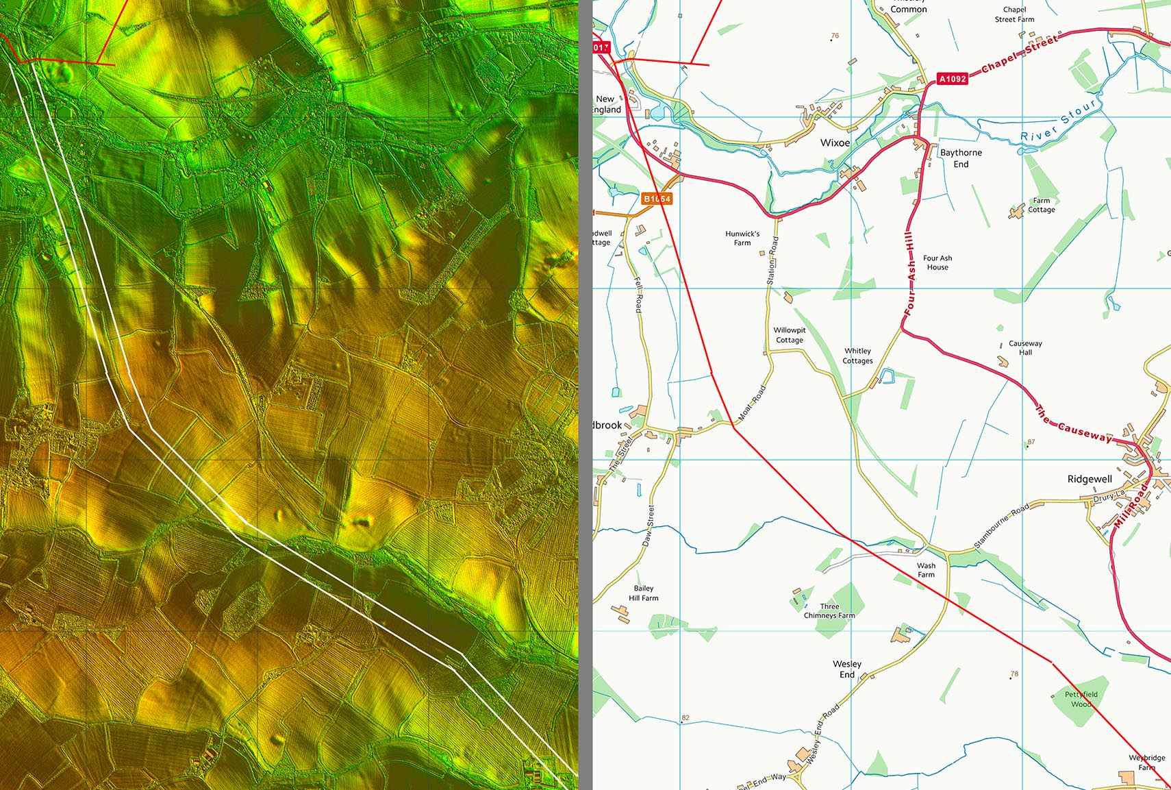
Lidar Image and Route Map 1 The modern road is extremely circuitous and yet it replaced a much more direct Roman road. The disused railway took a much similar route to the Roman one.. |
Click for larger view |
 |
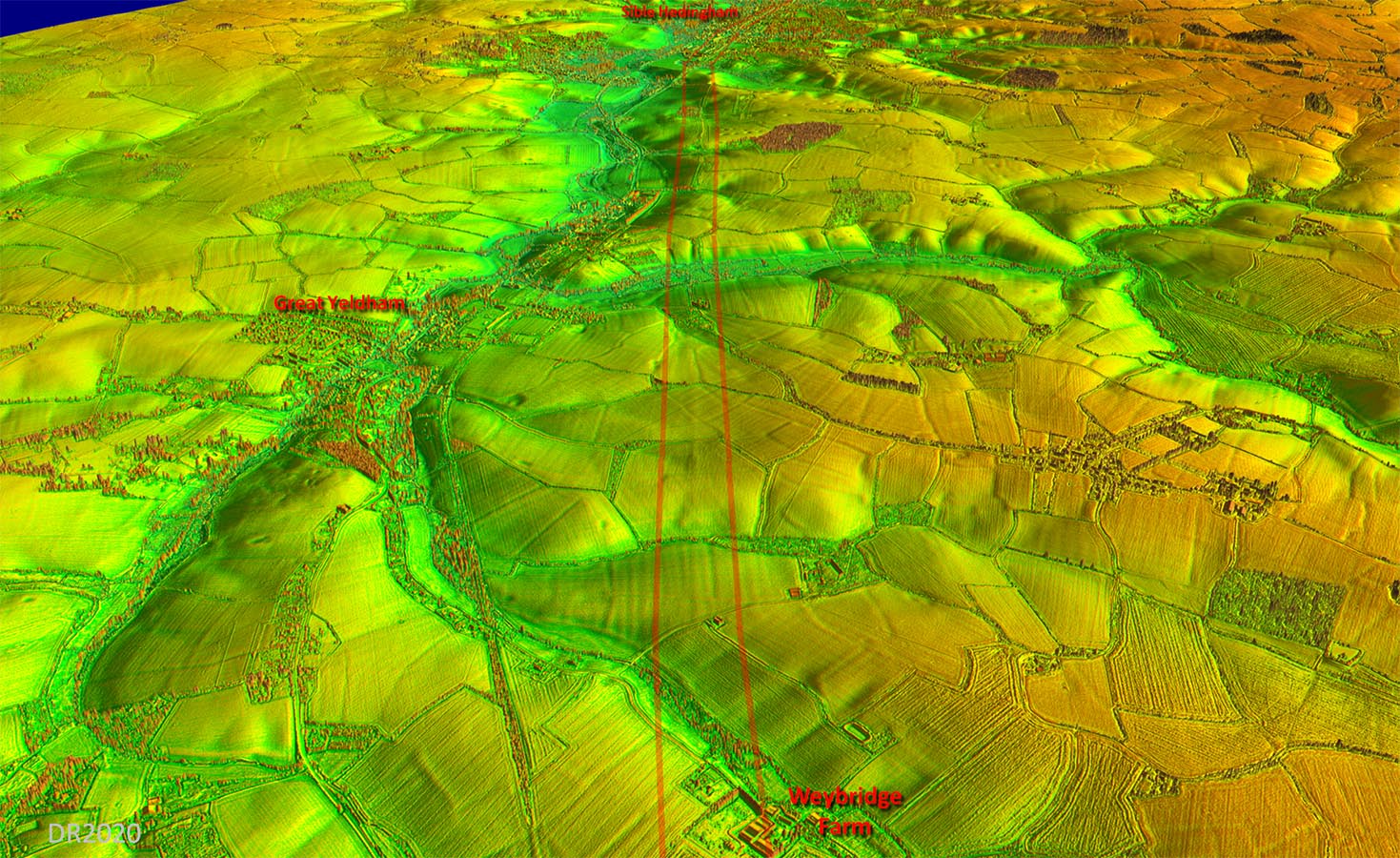
Oblique 3D Lidar Image - Weybridge Farm Very obvious and when I saw this the penny dropped that there was a Roman road here. I was able to trace it back to Wixoe and ahead to Sible Hedingham. |
Click for larger view |
 |
Lidar Image and Route Map 2 This was the stretch I first spotted in the Lidar imagery. I was actually looking for a road to Colchester but it soon became obvious its destination was Braintree. |
Click for larger view |
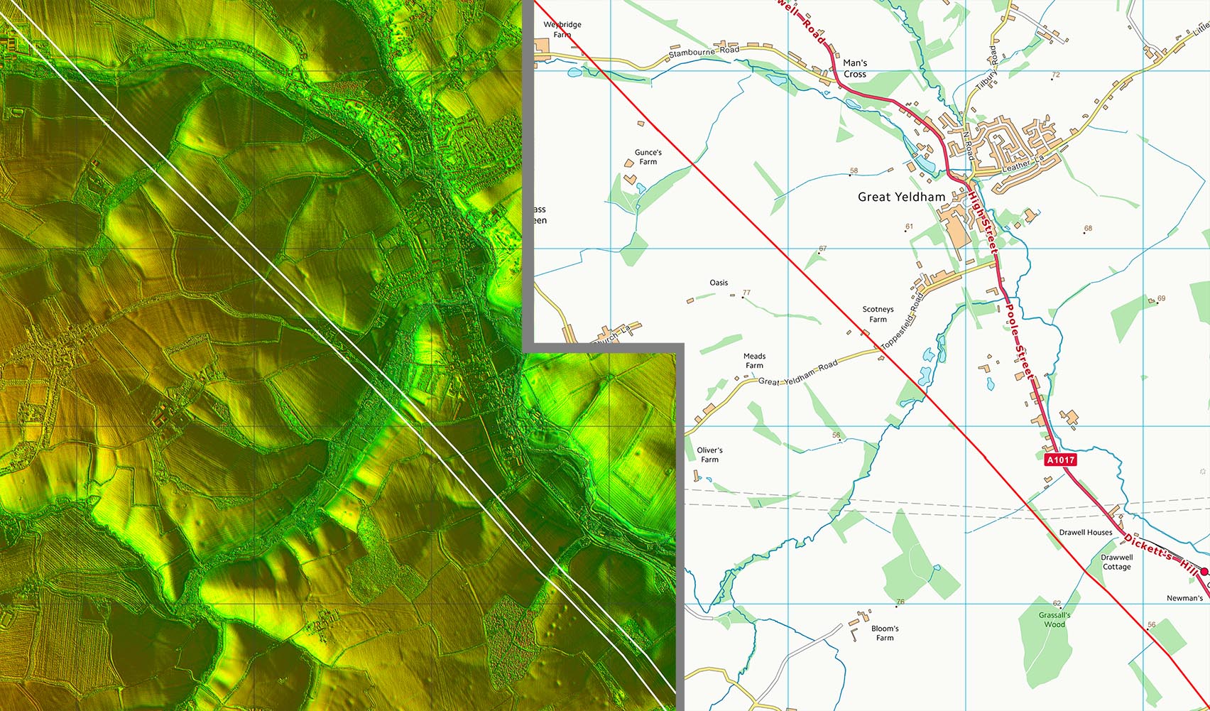 |
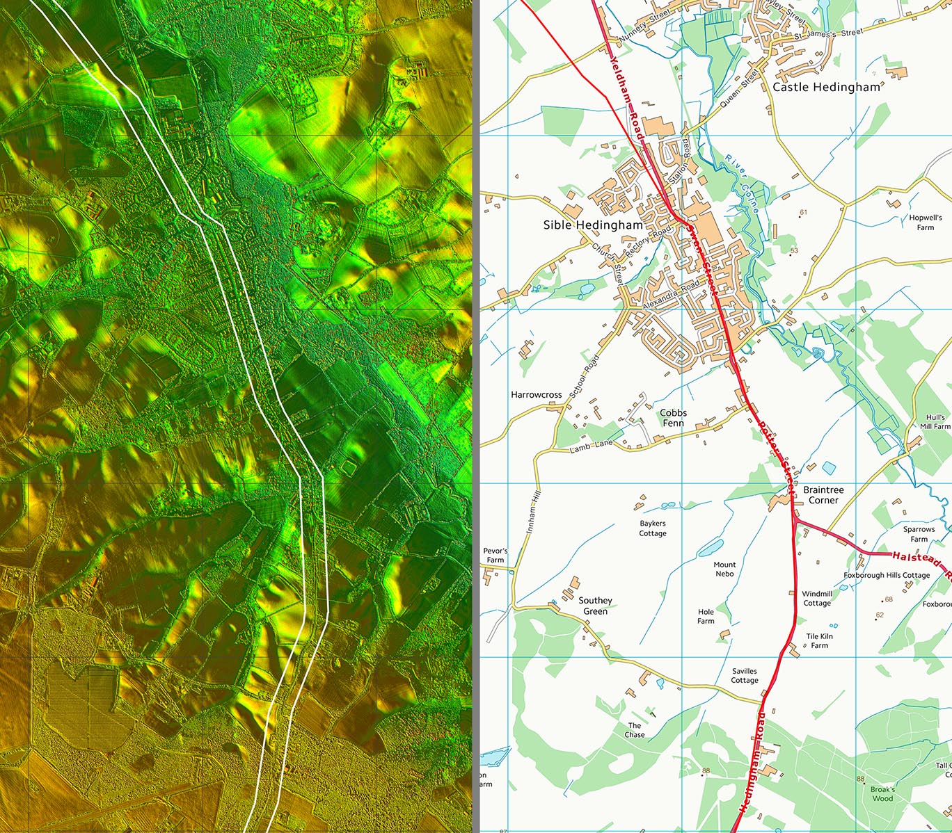
Lidar Image and Route Map 3 This is where the agger we have been following from Wixoe merges into the A1017 along Swan Street. From here on the modern road presumably overlies the Roman line making proof difficult. |
Click for larger view |
 |
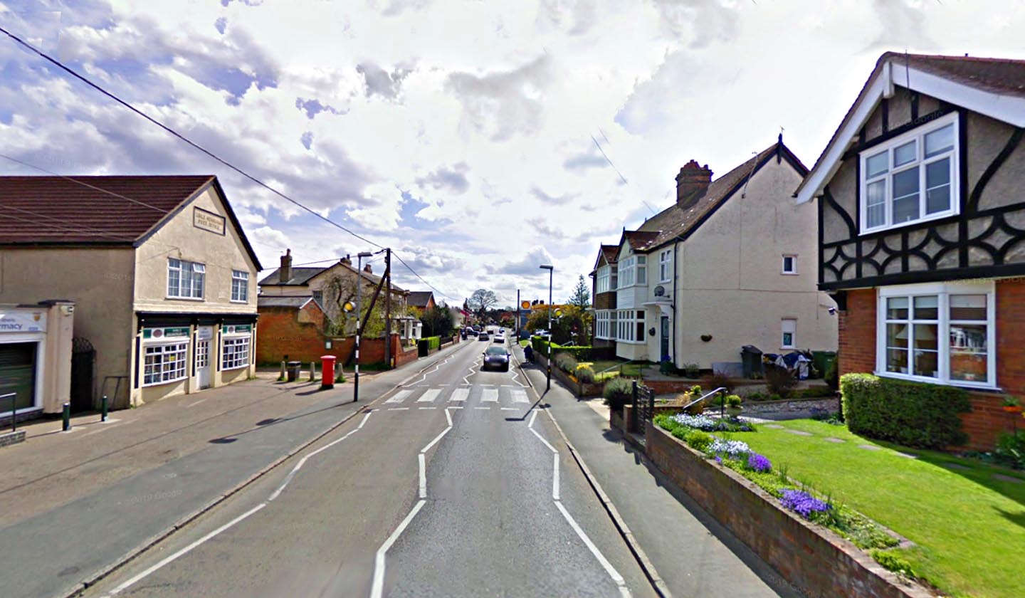
Swan Street, Sible hedingham Our road has now joined the A1017 through Sible Hedingham. Image: Google |
Click for larger view |
 |
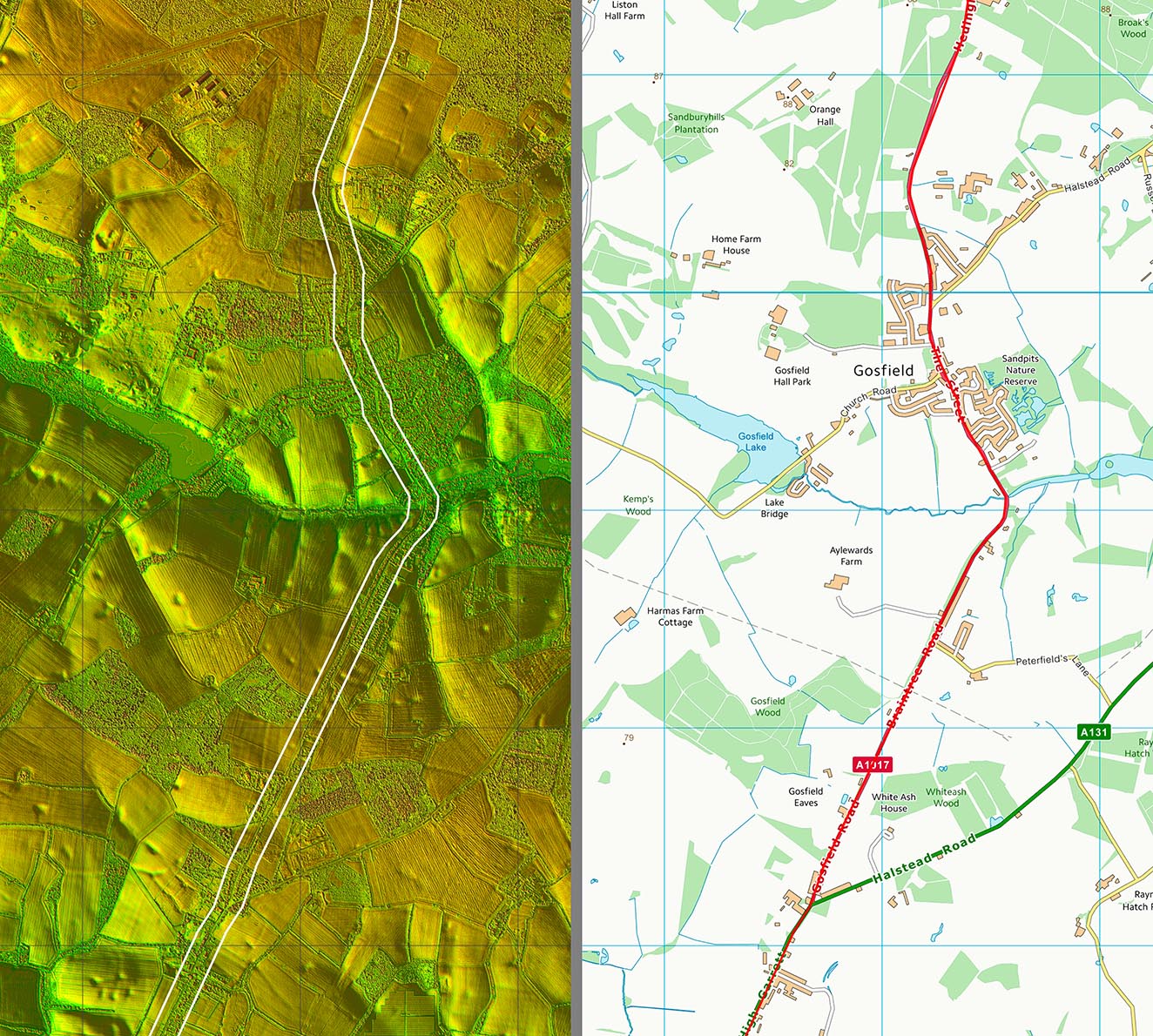
Lidar Image and Route Map 4 Was Gosfield where the Wixoe Roman road branched off a road from Braintree to Long Melford? It is certainly a big dog-leg. |
Click for larger view |
 |
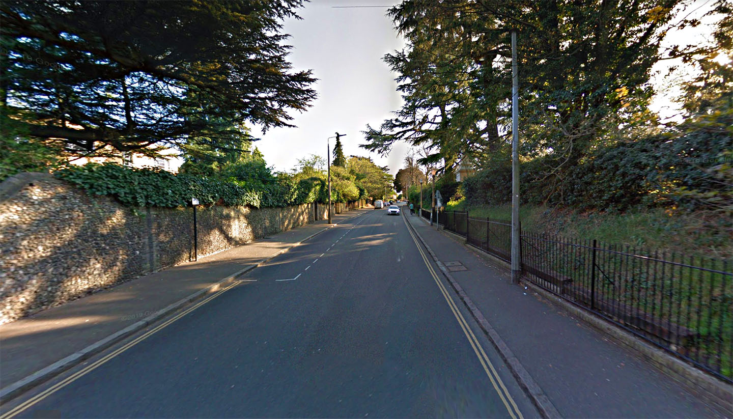
The Causeway, Braintree There is a short stretch of the road into Braintree aptly called The Causeway. Also approaching Braintree is the road name Broad Road, again a clue that there was wide (Roman road) here. Image: Google |
Click for larger view |
 |
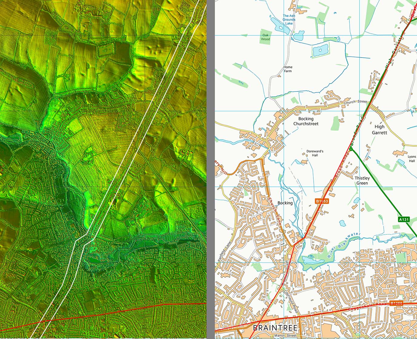
Lidar Image and Route Map 5 The straight road into Braintree has never been in doubt as to its Roman origins. Braintree was an important Roman crossroads. There would have been a chicane at the River Blackwater crossing. I have followed old boundaries on the OS first edition map as to its probable course. This is not as big a deviation as the modern road takes. |
Click for larger view |
 |
|
|
|
Last update: April 2020 |
© David Ratledge |