|
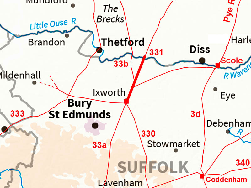
Ixworth to KnettishallMargary Number: 331Distance: 7 miles (to Little Ouse River)Margary regarded the south to north road through Ixworth and then branching to the Wash as being all Peddars Way. In reality it looks like Peddars Way branches off this road no. 331. We will follow the road south to north as that matches the direction used for Norfolk. The ultimate destination of this road is not certain - towards Attleborough in Norfolk then clues dry up. It is almost as if the road was never completed. Did Boudicca's revolution change priorities?
|
Historic Counties: Suffolk Current Counties: Suffolk HER: Suffolk
|
|
|
|
|
|
Full Route - Lidar and Aerial Image At the time of writing (2020) there are still gaps in the Lidar coverage for this part of Suffolk so Bing aerial imagery has been used to fill in the gaps. Virtually a single alignment all the way to the Norfolk border. The road to Scole branches off to the right and then Peddars Way off to the left. |
Click for larger view |
 |
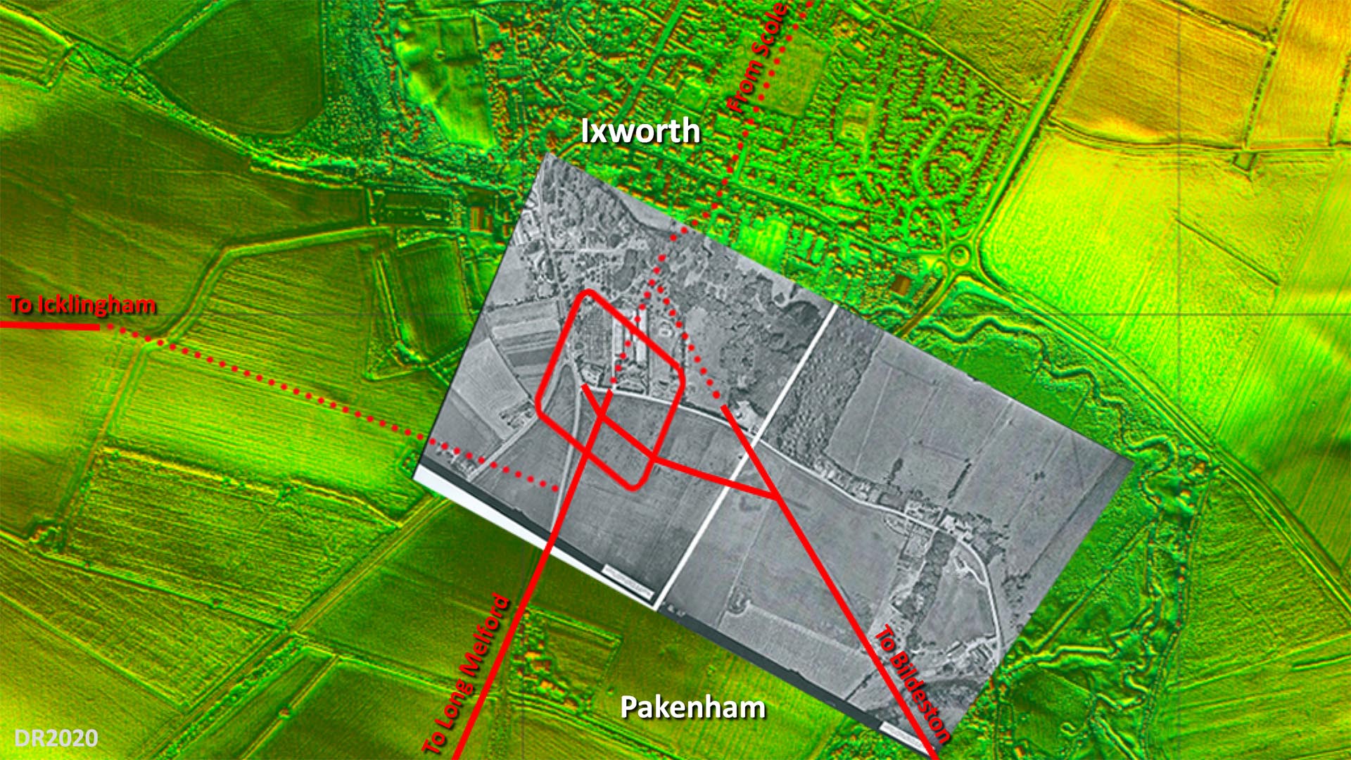
Site Plan - Lidar and Aerial Image The overlaid aerial is believed to have been taken shortly after WW2 and the fort and road system shows up very clearly. Obviously long before the bypass destroyed a large part of it. The only puzzle is the connection to the road to Icklingham. Where I have shown then there is some evidence but not totally certain. The main road alignment appears to have been set out on the fort's north west gate but no trace on that course is evident so what I have shown is my best guess. The rest of the roads are more definite although across Ixworth it is a projected line. Image: The aerial photograph overlaid on the background Lidar imagery is by the Air Photography Unit, University of Cambridge (assumed out of copyright - apologies if not).
|
Click for larger view |
 |
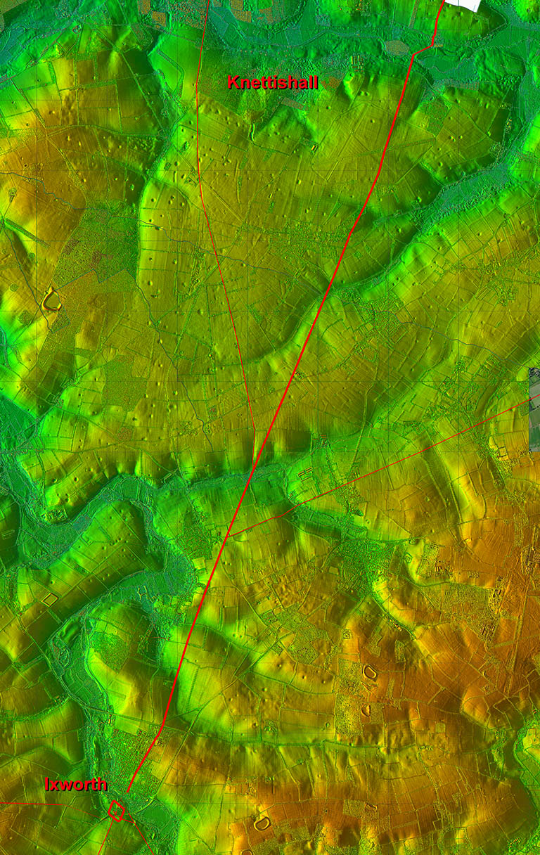
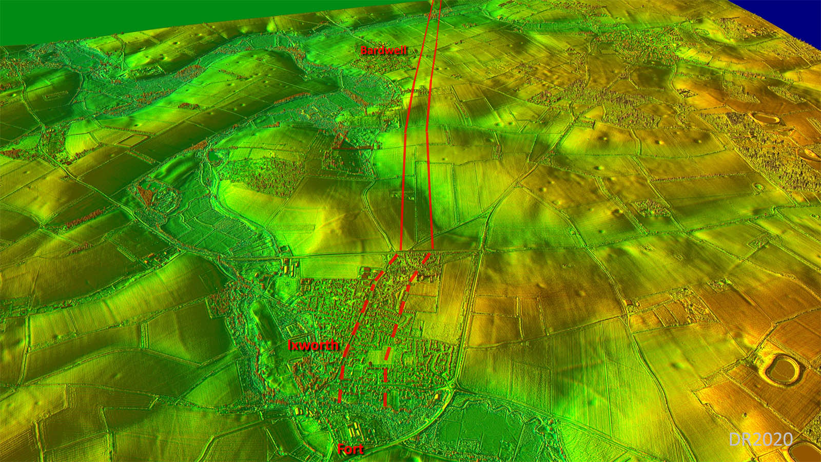
Oblique 3D Lidar Image - Ixworth North The route across Ixworth is very subjective,. The bridge site, based on the roads into Ixworth from the south, was not on line with Margary 331 heading north so there must be a dog-leg somewhere. |
Click for larger view |
 |
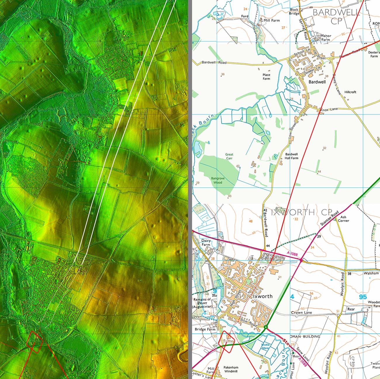
Lidar Image & Route Map 1 At Bardwell, the road to Scole branched off to the right. |
Click for larger view |
 |
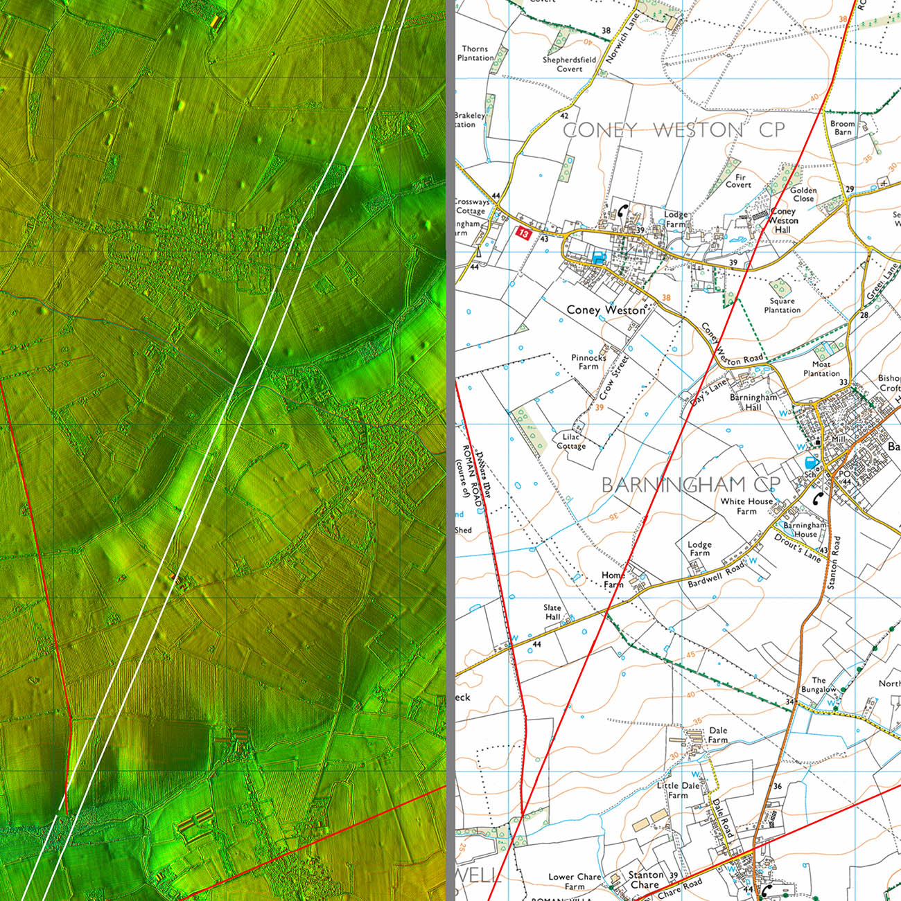
Lidar Image & Route Map 2 Currently a gap in the Lidar data here but the route is not in question passing to the west of Barningham. The Peddars Way branches off left near the bottom of this map. |
Click for larger view |
 |
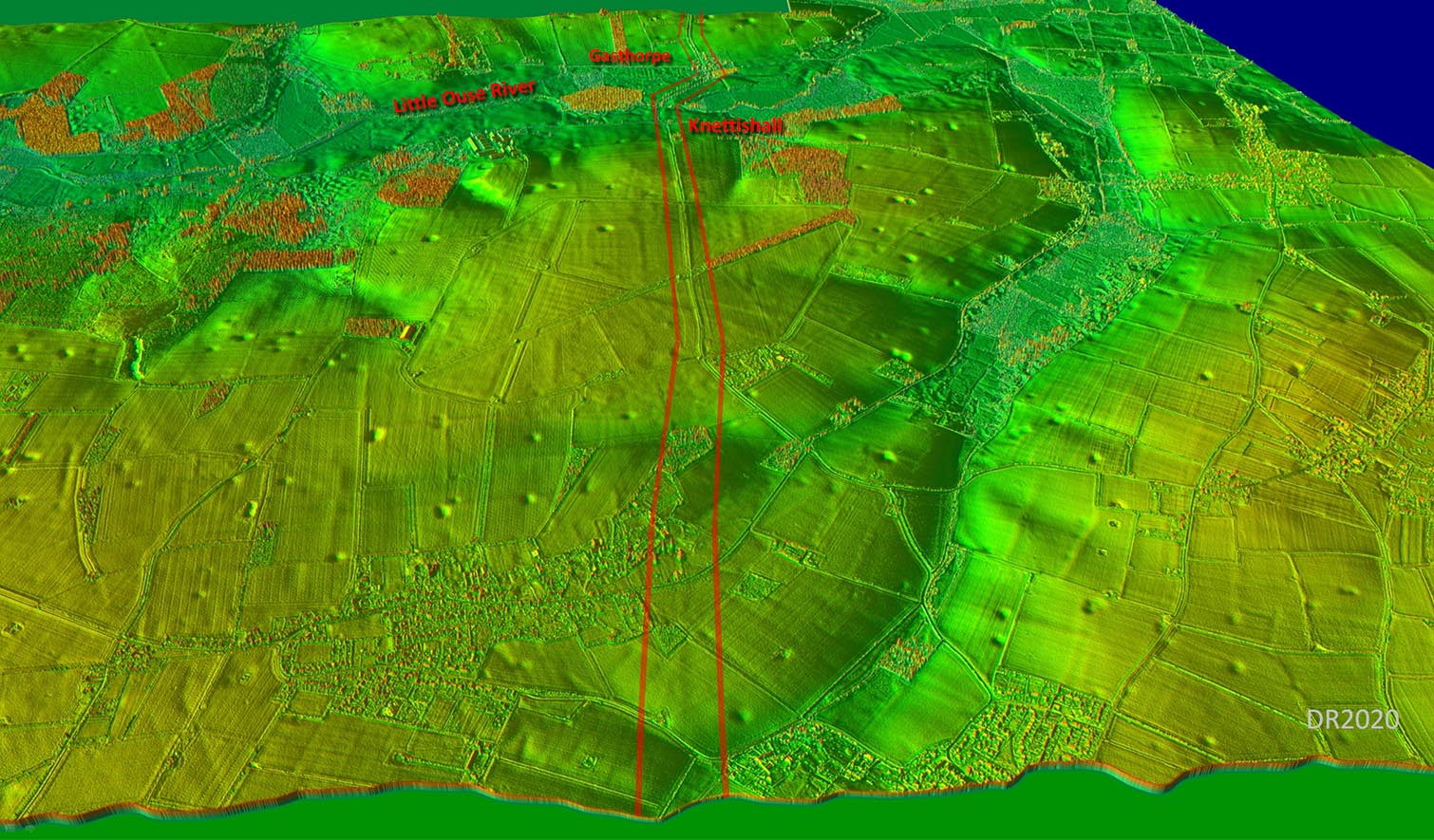
Oblique 3D Lidar Image - Knettishall The lidar coverage resumes just in time for the final few miles into Norfolk. The remains of Snettishall Airfield are evident and road goes through one of the old runways. |
Click for larger view |
 |
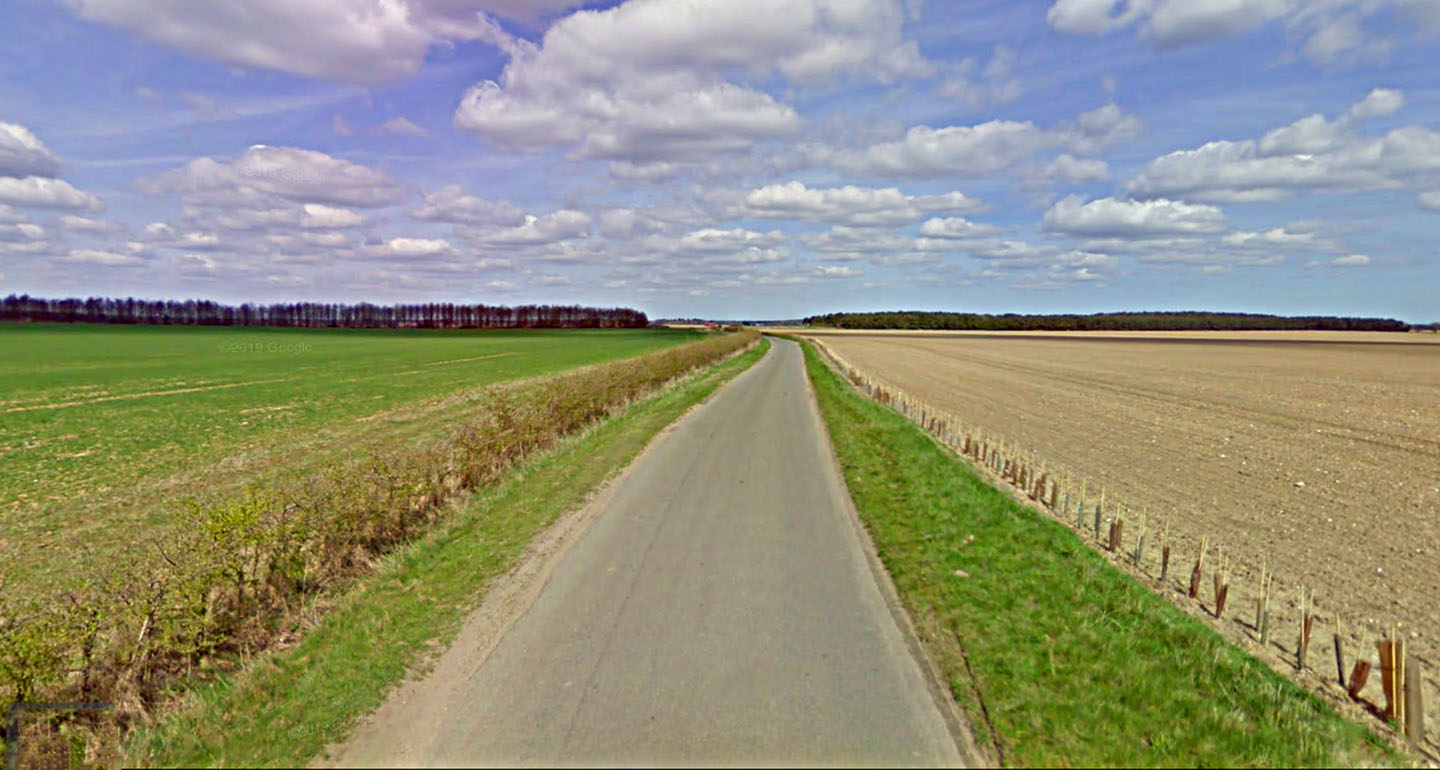
Agger across Snettishall Airfield No sign of the airfield today but it is obvious we are on a Roman agger with the road raised up and a ditch clear on the left. Image: Google |
Click for larger view |
 |
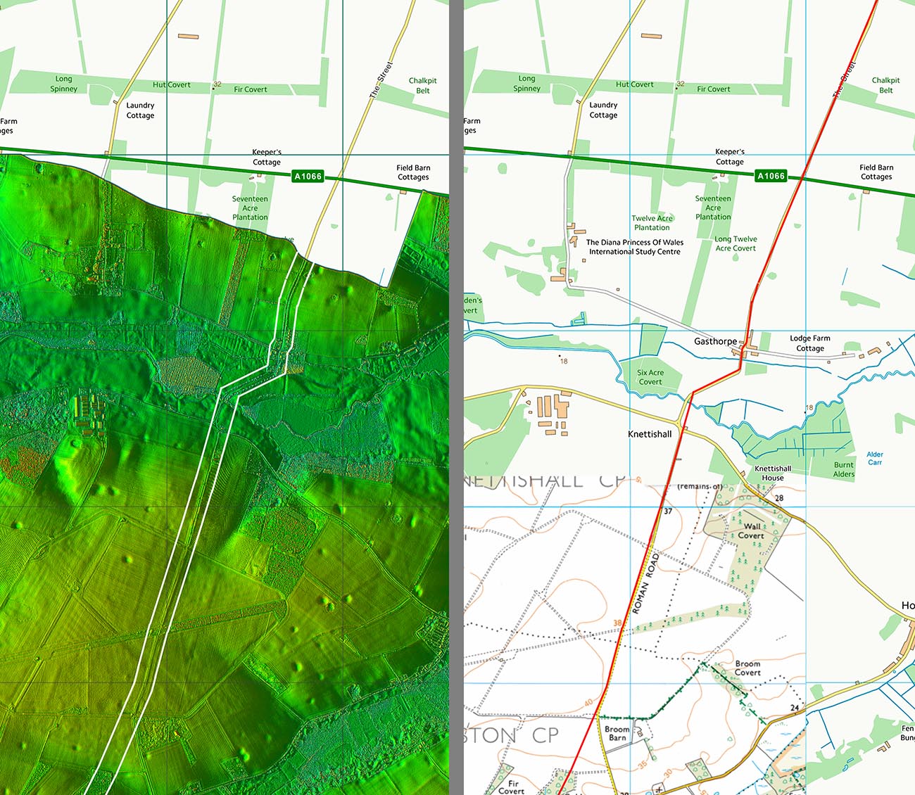
Lidar Image & Route Map 3 A typical dog-leg to cross the Little Ouse River. |
Click for larger view |
 |
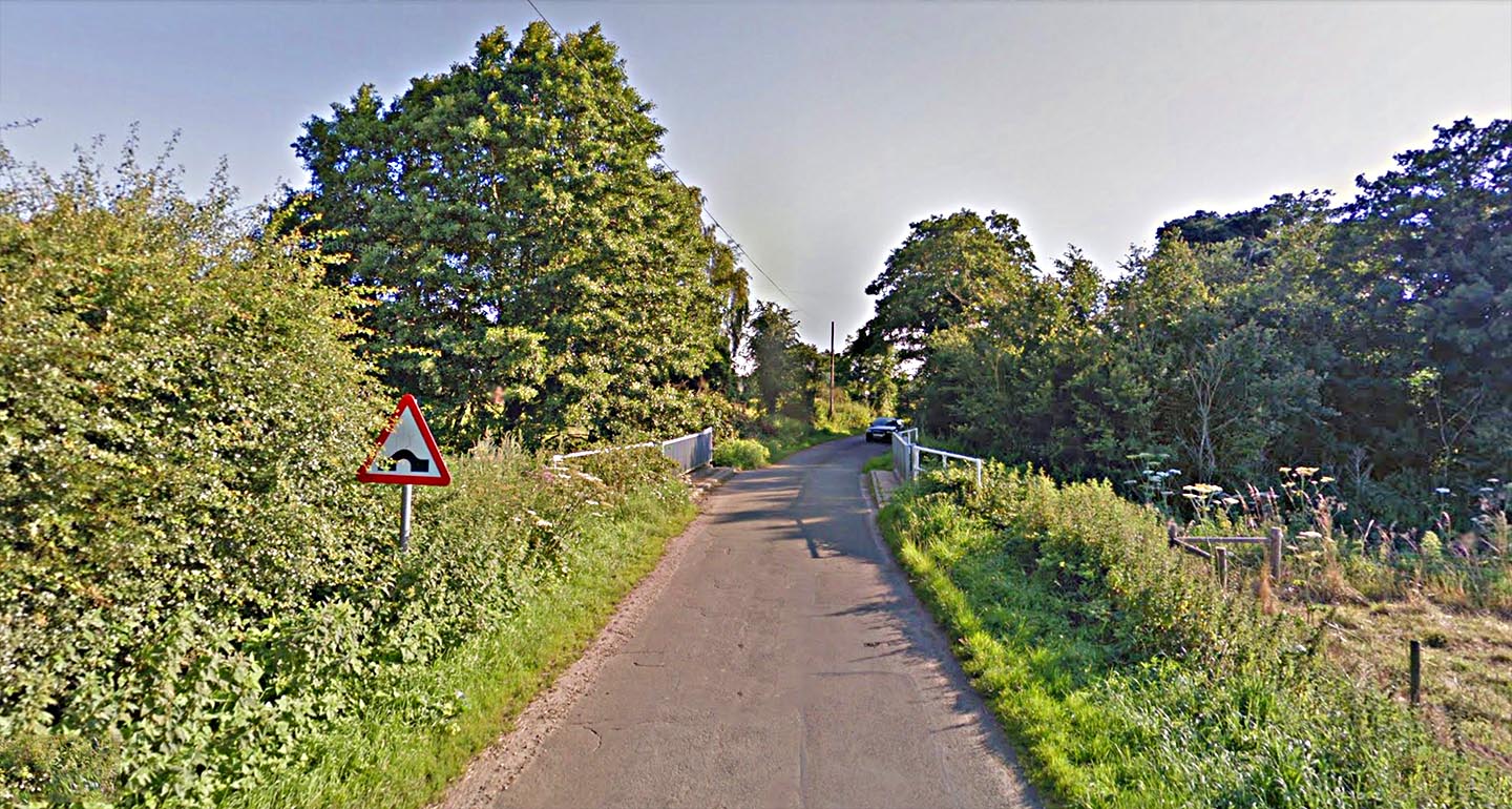
The Street, Ouse Bridge Signed as a hump-backed bridge as we cross the Little Ouse into Norfolk although it looks pretty flat! The road name of "The Street" begins in Suffolk it continues on into Norfolk beyond here through the pretty village of Gasthorpe. See our Norfolk Roman roads for its continuation. Image: Google |
Click for larger view |
 |
|
|
|
Last update: June 2020 |
© David Ratledge |