
|
Ixworth - Pakenham Roman SiteRoman Name: SitomagusWe now know the Roman Town at Ixworth-Pakenham was called Sitomagus - the itinerary IX distance fit exactly. Most of what is known about the site is from aerial photography and rescue excavations before the construction of Ixworth Bypass in the 1980s. South of the river (Black Bourn) is Pakenham parish, north of the river is Ixworth. The Suffolk HER records finds both north and south of the river so both parishes can claim identity. To the east of the fort is Mickle Mere - proximity to water seems to be a common feature for Roman sites in East Anglia. The Roman town is believed to have evolved from an early fort on the Pakenham side of the river. This would have had a short life being replaced by a civilian settlement. Suffolk HER IXW004 records a bath house, hypocaust and villa alongside Stow Lane (Ixworth Parish). Thanks are due to Steve Wilson for freely supplying his excellent aerial photographs. Suffolk HER has several relevant entries including: PKM 003, 005, IXW 004, 005, 028, 033.
|
Historic Counties: Suffolk Current Counties: Suffolk HER: Suffolk
|
|
|
|
|
|
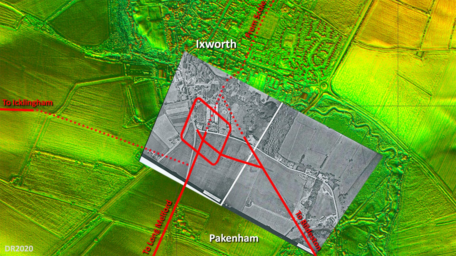
Site Plan - Lidar and Aerial Image The overlaid aerial is believed to have been taken shortly after WW2 and the fort and road system shows up very clearly. Obviously long before the bypass destroyed a large part of it. The only puzzle is the connection to the road to Icklingham. Where I have shown then there is some evidence but not totally certain. The main road alignment appears to have been set out on the fort's north west gate but no trace on that course is evident so what I have shown is my best guess. The rest of the roads are more definite although across Ixworth it is a projected line. Image: The aerial photograph overlaid on the background Lidar imagery is by the Air Photography Unit, University of Cambridge (assumed out of copyright - apologies if not). |
Click for larger view |
 |
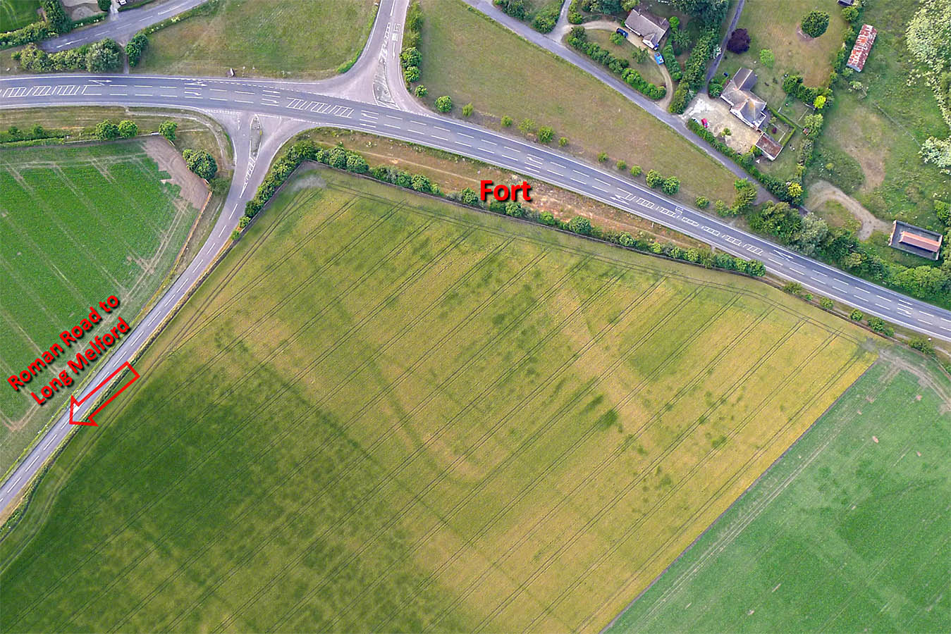
Ixworth/Pakenham Fort - Aerial Photo The fort was rhomboidal in shape - quite why is a puzzle. Three ditches are evident. Commonly two ditches were dug so perhaps the inner ditch results from a post-Roman robber trench. Alternatively after Boudicca perhaps they thought 3 ditches would be safer! Image: Steve Wilson |
Click for larger view |
 |
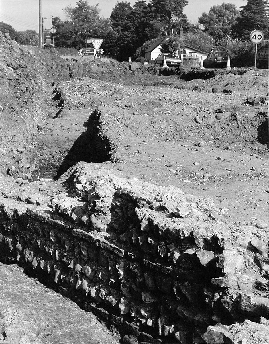
Roman Fort Wall - Bypass Excavations 1980s Fabulous piece of the wall from a high status building within the fort complete with surviving facing. Typical Roman style with 3 rows of flint and then a row of clay tiles and so on. How on earth this was allowed to be destroyed by a bypass is unbelievable. Image supplied by Steve Wilson from a picture found when the local school was closing. Image: Unknown |
Click for larger view |
 |
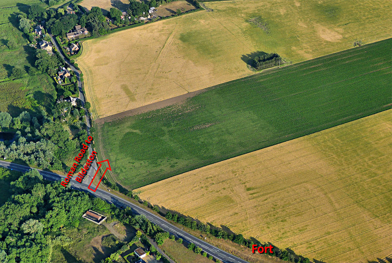
Ixworth/Pakenham Fort - Aerial Photo The road to Bildeston is very clear in this image. Its alignment appears to have been from the river bridge rather than the fort. Image: Steve Wilson |
Click for larger view |
 |
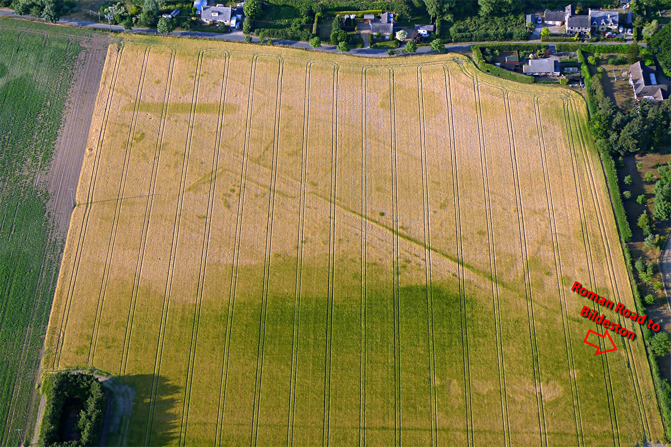
Ixworth/Pakenham Fort - Roadside Enclosures Alongside the road to Bildeston are visible Roman enclosures. The word enclosure is a catch-all term so quite what their precise function was is debatable but possibly fields? The HER describes it as a roadside settlement.
Image: Steve Wilson |
Click for larger view |
 |
|
|
|
Last update: May 2020 |
© David Ratledge |