|
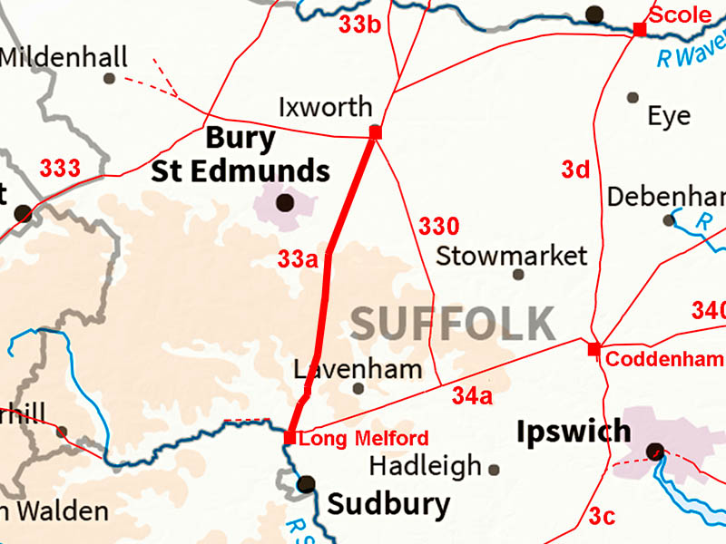
The Roman Road from Ixworth to Long MelfordMargary Number: 33aDistance: 15.75 milesMargary regarded this road as part of Peddars Way which is probably not the case. However, it was an important trunk road connecting Ixworth, Sitomagus, to London with a very direct route almost certainly via Braintree in Essex. |
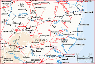
Historic Counties: Suffolk Current Counties: Suffolk HER: Suffolk
|
|
|
|
|
|
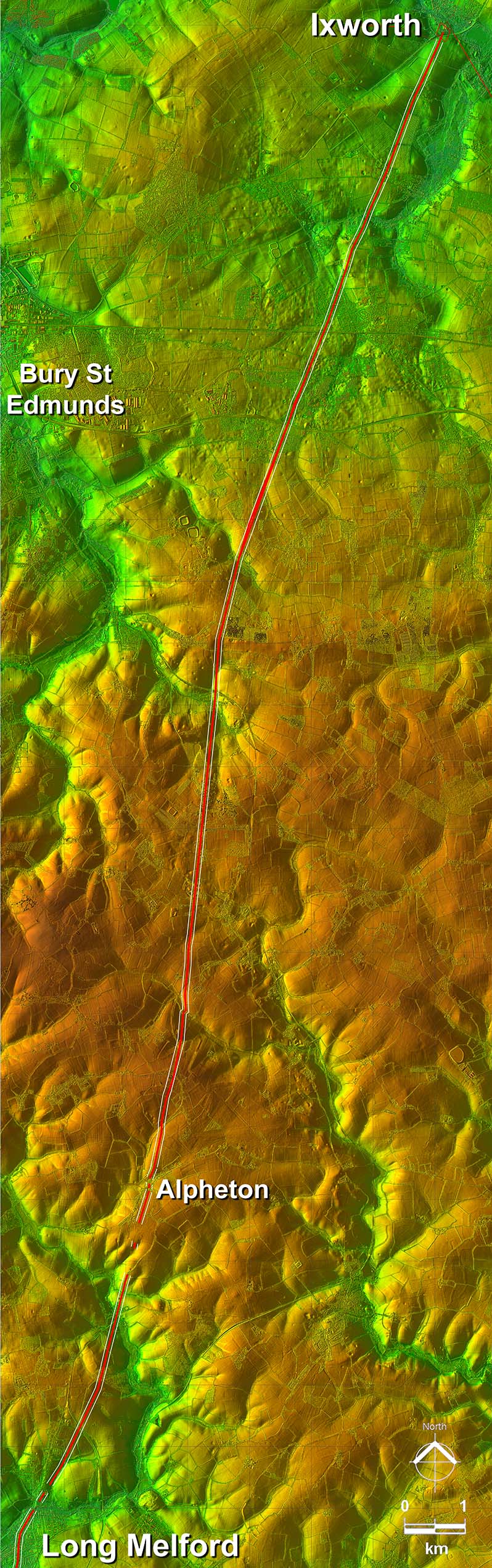
Lidar Image - Full Route A very direct route making the best of the terrain. |
Click for larger view
|
 |
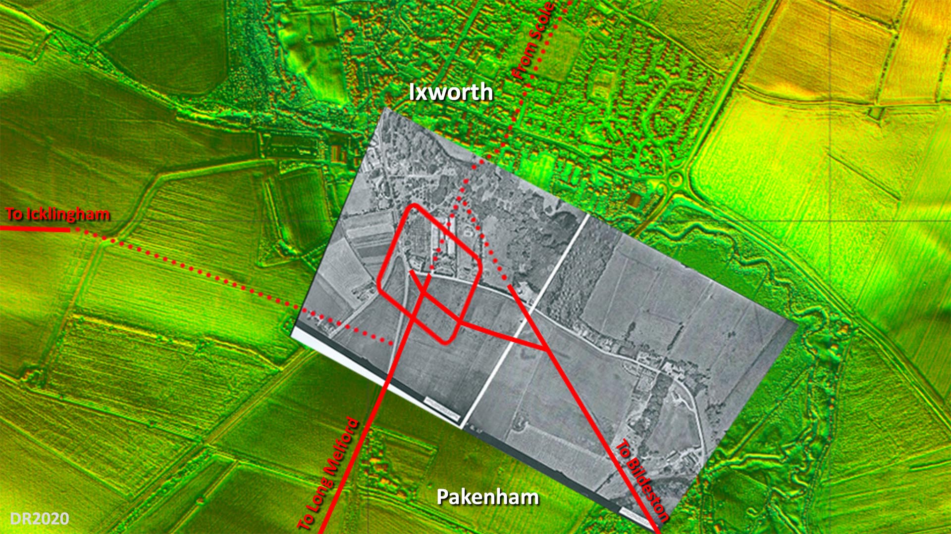
Site Plan - Lidar and Aerial Image The overlaid aerial is believed to have been taken shortly after WW2 and the fort and road system shows up very clearly. Obviously long before the bypass destroyed a large part of it. The only puzzle is the connection to the road to Icklingham. Where I have shown then there is some evidence but not totally certain. The main road alignment appears to have been set out on the fort's north west gate but no trace on that course is evident so what I have shown is my best guess. The rest of the roads are more definite although across Ixworth it is a projected line. Image: The aerial photograph overlaid on the background Lidar imagery is by the Air Photography Unit, University of Cambridge (assumed out of copyright - apologies if not).
|
Click for larger view
|
 |
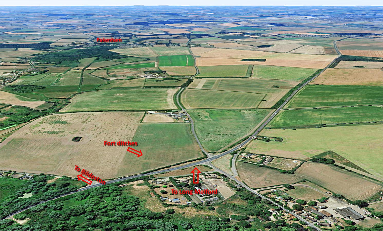
Ixworth Looking South - Google Earth In this oblique Google Earth image we are looking south from over the fort site. The fort ditches and exit to Long Melford are clear. The fort didn't last long and would have been totally dismantled leaving just the outline of the ditches visible today. Our road initially swaps sides of the modern road to Pakenham before old and modern eventually merge together. |
Click for larger view |
 |
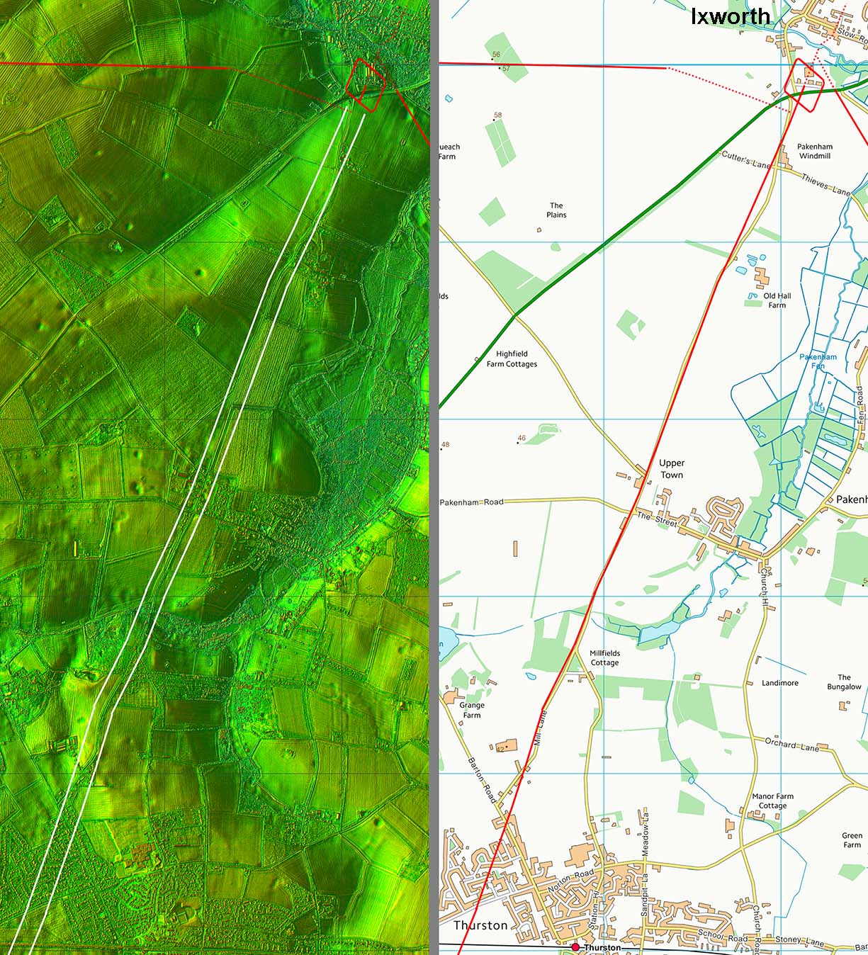
Lidar Image & Route Map 1 The Ixworth site is also referred to as Pakenham but the village is actually a mile away so I have used Ixworth - apologies to residents of Pakenham parish. Across Thurston then modern developments mask the route but there is no reason to doubt the Roman alignment carried straight on. |
Click for larger view |
 |
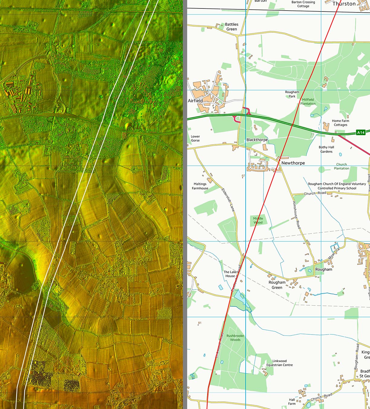
Lidar Image & Route Map 2 There was a subtle change of direction at the Lake House and another just beyond Rushbrooke Woods. |
Click for larger view |
 |
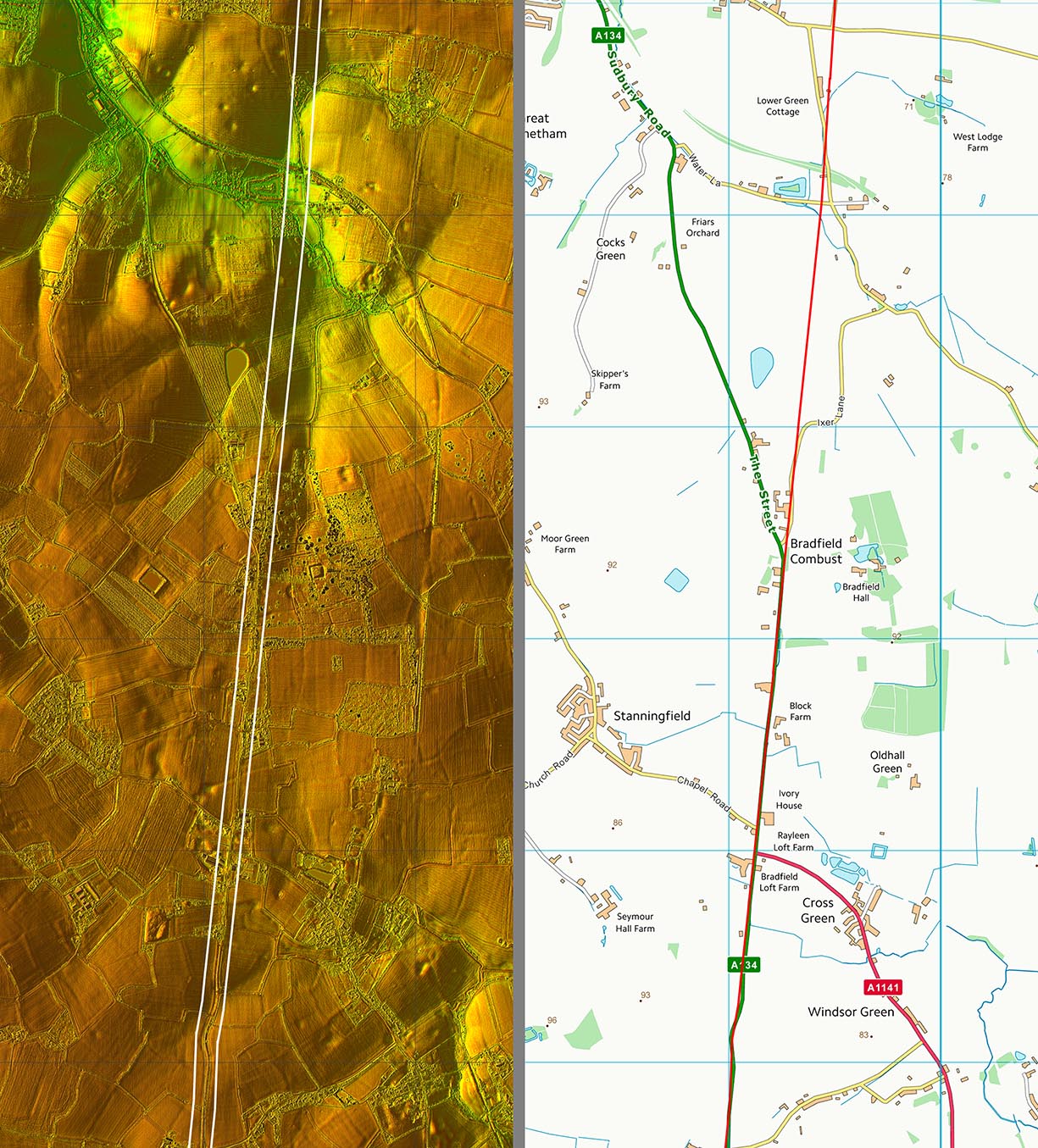
Lidar Image & Route Map 3 Notice how our road "captures" the A134 coming in from Bury St Edmunds. The modern road from Bury obviously linked to an existing Roman road to get to Long Melford - no point building a new road all the way. Make use of what was still there. |
Click for larger view |
 |
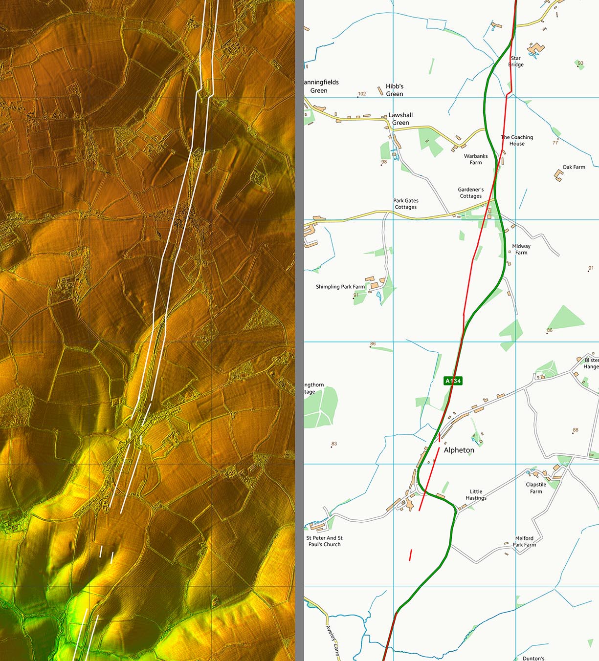
Lidar Image & Route Map 4 This is where tracing the route gets tricky. The modern road has several wanders off the Roman line. However, there is enough lidar evidence to pin down the Roman route. Beyond Alpheton and through Bridge Street (next image) then traces are even fainter but the route shown I would consider as reasonably high confidence. |
Click for larger view |
 |
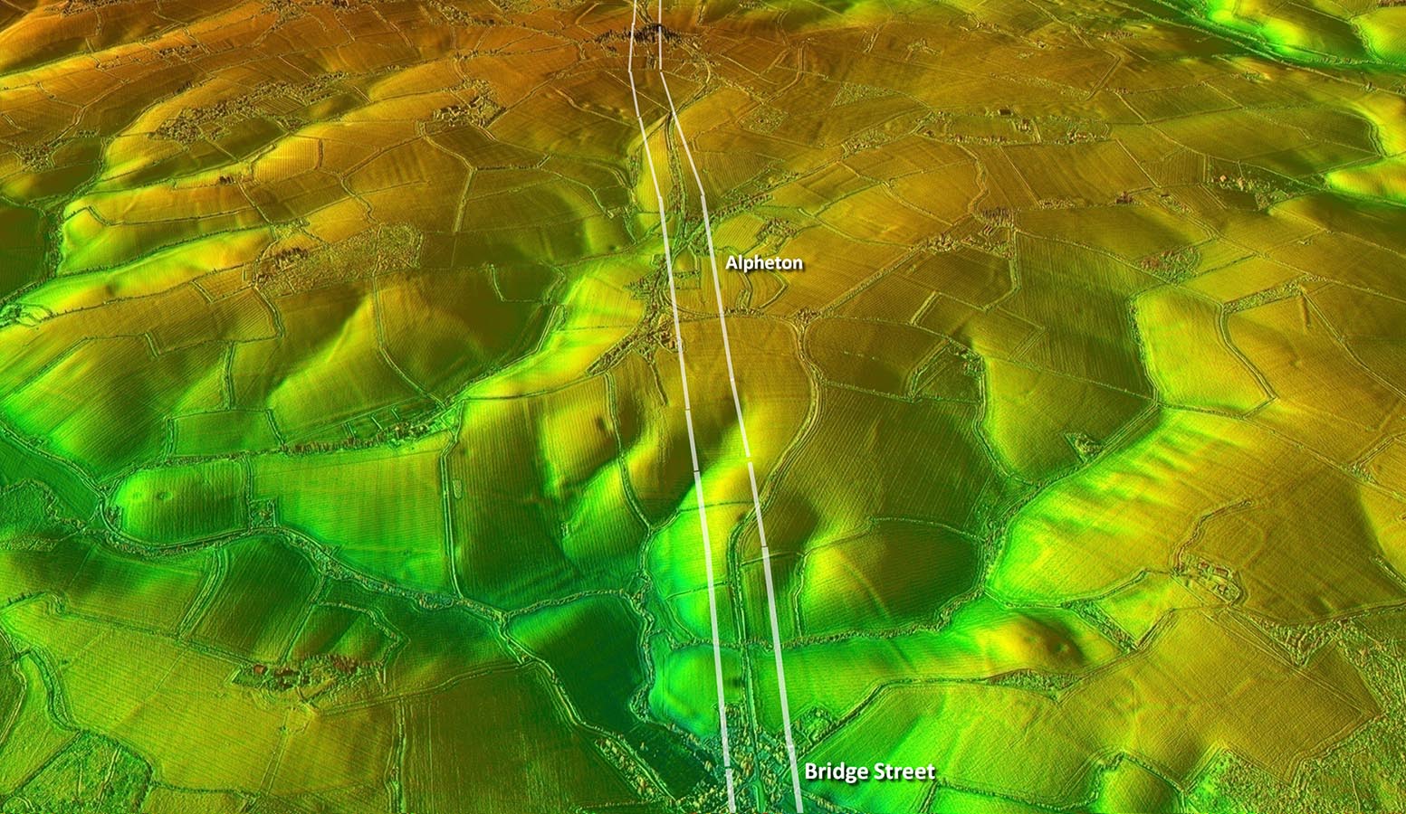
Oblique Lidar Image - Bridge Street We are looking north from Bridge Street towards Alpheton. The actual Roman bridge in Bridge Street would appear to have been upstream of the modern bridge and the Roman road to it is much more direct than that of the A124. |
Click for larger view |
 |
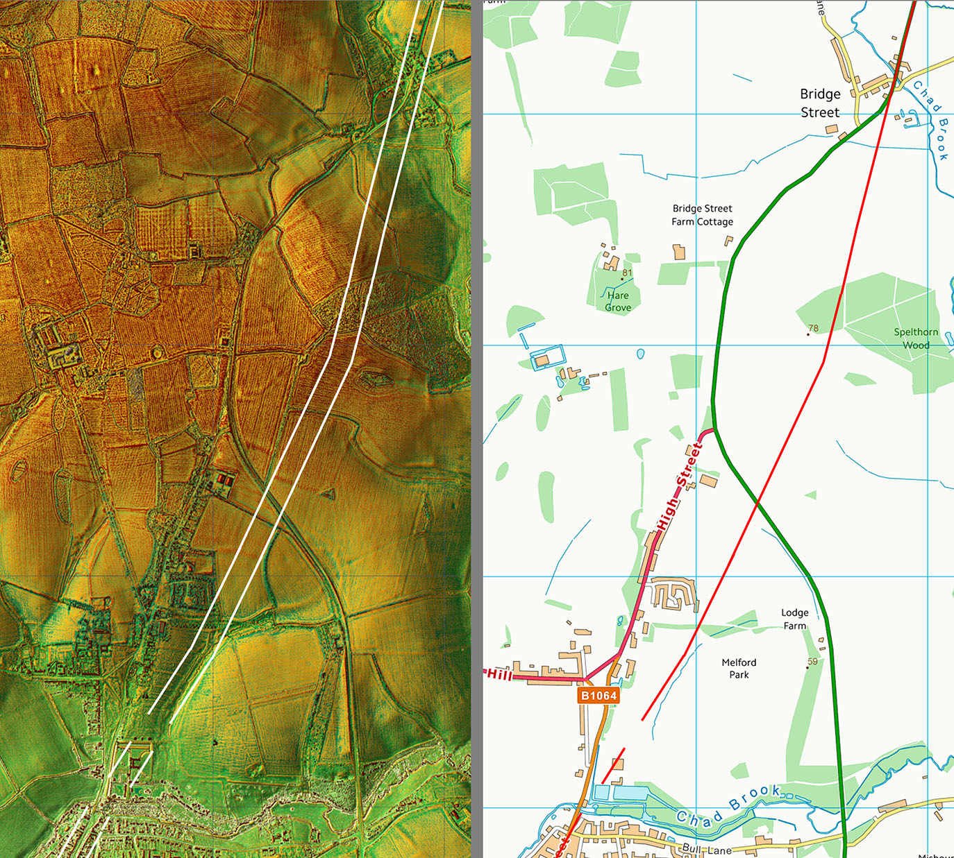
Lidar Image & Route Map 5 2023 Update: Geoff Lunn spotted the Roman line continuing straight on from Bridge Street. There are faint Lidar traces extending this into Long Melford. |
Click for larger view |
 |
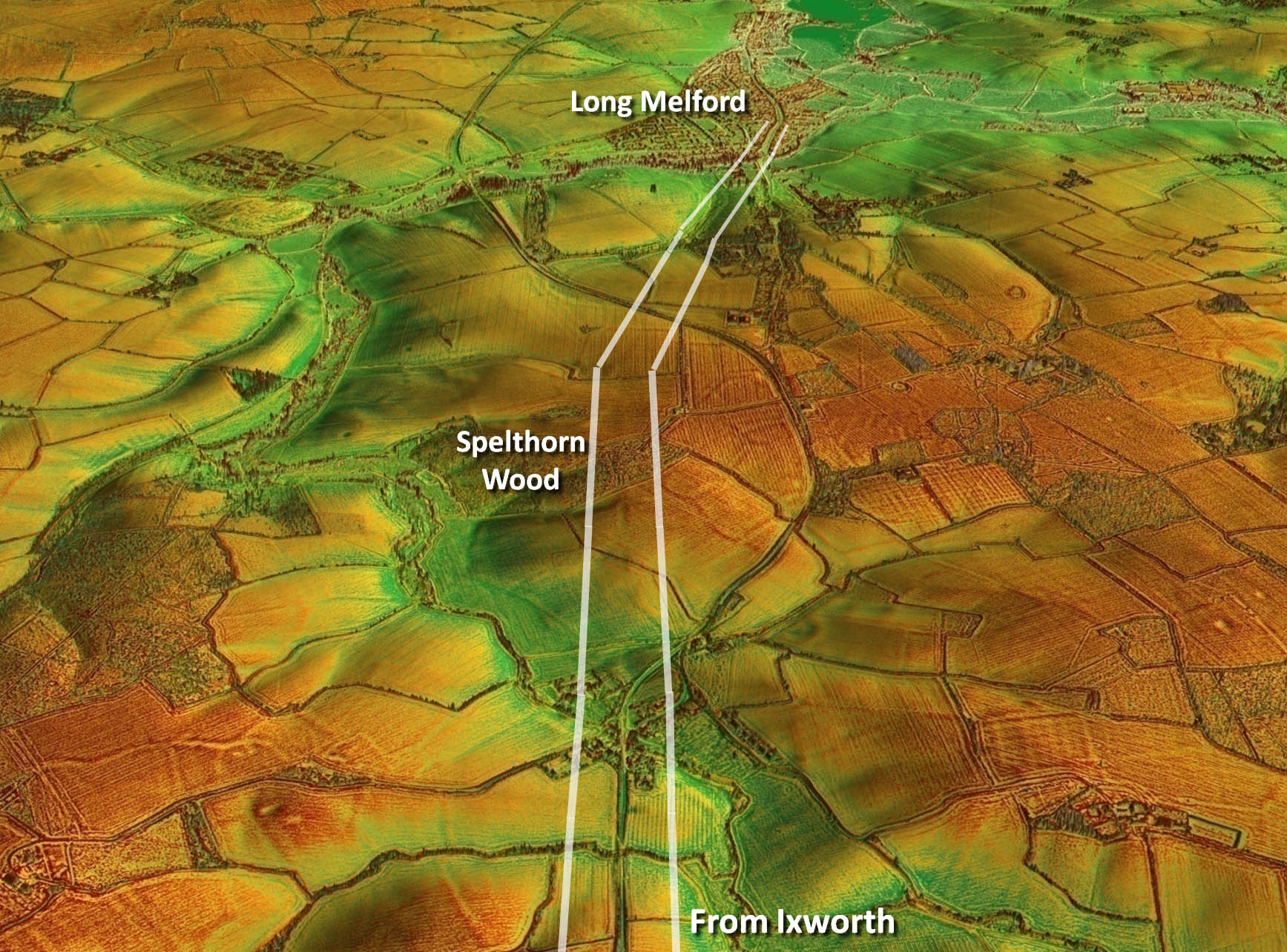
Oblique Lidar Image - Approaching Long Melford This is the new section referred to above and spotted by Geoff Lunn. A subsequent visit by Geoff and the Long Melford Heritage group has confirmed the road in Spelthorn Wood. |
Click for larger view |
 |
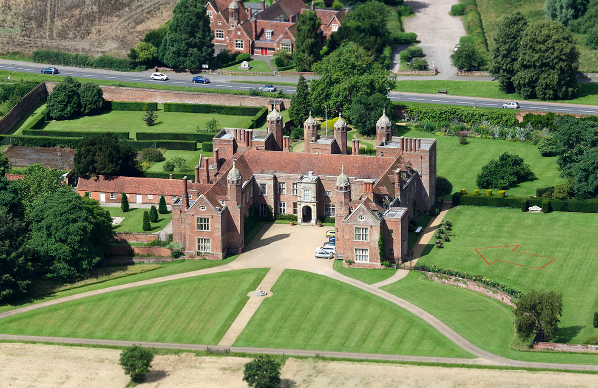
Long Melford Hall - National Trust The latest information would suggest that Long Melford Hall was built on top of the Roman road. There appears to be an agger-like feature heading more or less straight for it. A stately home on top of a Roman road is by no means unique. The red arrow is the approximate position of the road. |
Click for larger view |
 |
|
|
|
Last update: July 2023 |
© David Ratledge |