 |
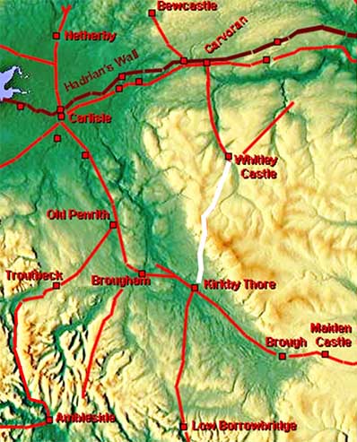
The Maiden Way, Margary 84Part 1: Kirkby Thore to Whitley Castle,
Possibly the highest Roman road in England rising to 2i95 feet (669m) - well the second highest if High Street really is Roman. Despite the difficult terrain involved in crossing the Cross Fell ridge of the Pennines, the Romans were able to engineer a remarkably direct route. However, is not without some steep gradients especially on the climb up from Kirkby Thore with the ascent of Lad slack being possibly the country's steepest incline at 1 in 3.7 for over one third of a kilometre.. The name Maiden Way properly refers to the Roman road from Kirkby Thore to Carvoran via Whitley Castle. It was so called by Camden and the name can be traced back to the twelfth century (Maydengathe, Maidingate, Maidengate, occurring c. 1179 and 1294). Suggestions that it extended to Bewcastle are somewhat speculative as can be seen from the map the two roads do not link directly. According to Collingwood the name probably derives from Maiden Castle on the Stainmore road - see map and link to Collingwood below. The understanding of this road has changed since 2014 when Hugh Toller proved that the road from Low Borrowbridge actually linked to Kirkby Thore. The Maiden Way can now be seen as not as a branch off the Stainmore road but part of a strategic through route from Low Borrowbridge to Carvoran via Kirkby Thore and Whitley Castle. However, the justification for a road 2200 feet up is generally assigned to lead mining in the Alston area. The recent confirmation of a road from Whitley Castle to Corbridge (Gethin/Toller/Haken) would seem to confirm the need for good communications to and from the Alston area. For a full discussion of the derivation of the name Maiden Way and the reasons for the road see Collingwood.
NEW 2022: Video flyover from Kirkby Thore to Whitley Castle
|
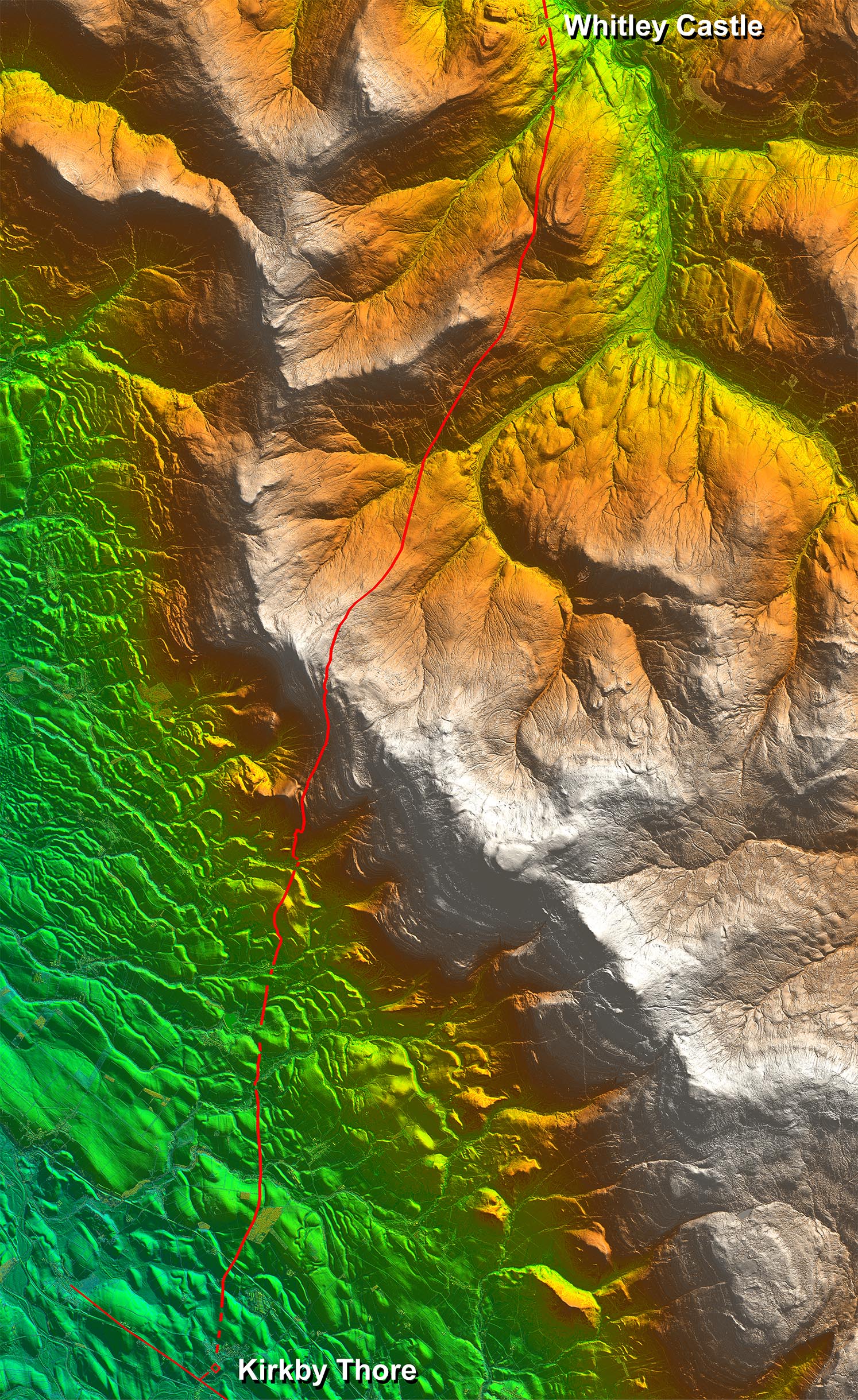
Lidar Image - Full Route Amazingling direct route despite all the drumlins and then crossing the Pennine ridge. In detail the route does wander to adapt to the terrain. The road's summit of 669 metres AOD (2195 feet) is just beyond Meg's Cairn. This height is confirmed by Lidar. |
Click for larger view |
 |
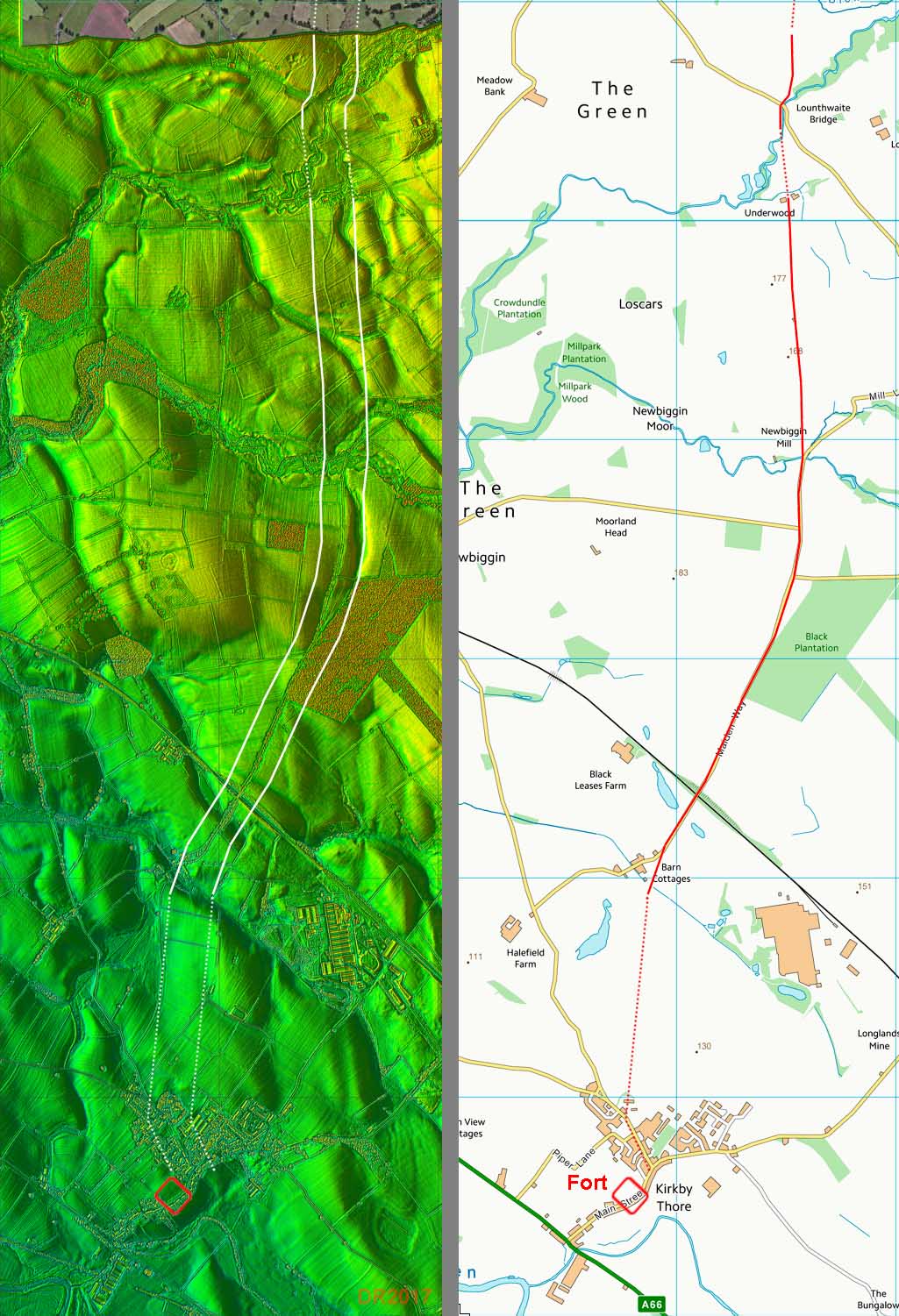
Lidar Image and Map - Kirkby Thore The first kilometre is lost - it is surprising but Lidar shows nothing convincing in the vicinity of the fort. The line is then marked by the modern lane called, Maiden Way! Well that's a clue. Just before Milburn the modern road turns off and the Roman road is visible in the Lidar data heading north to Lounthwaite Bridge. |
Click for larger view |
 |
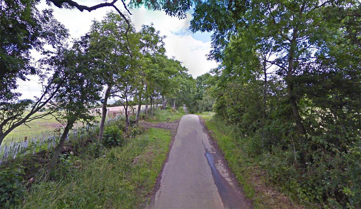
Modern Road - Hale Grange The modern road is called Maiden Way and this stretch north of Hale Grange almost certainly marks the course. However, the south end of the road still carries that name and clearly is not our "Maiden Way". |
Click for larger view |
 |
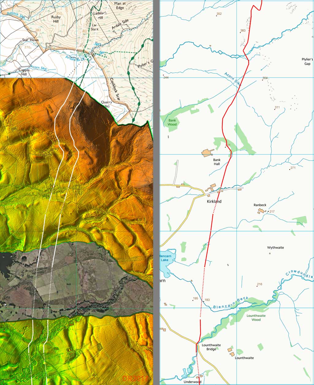
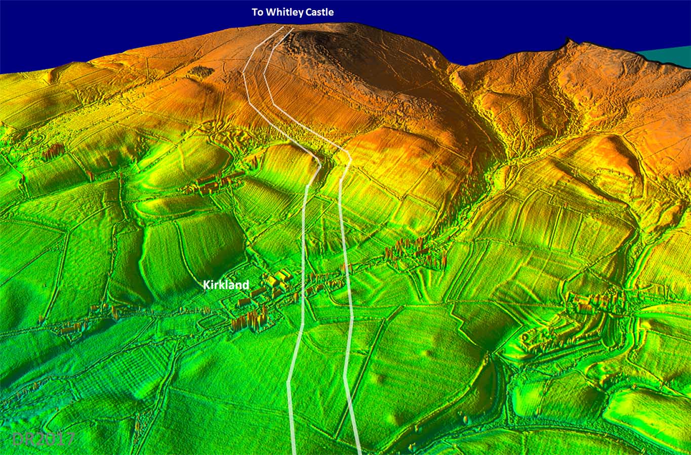
Lidar Image and Map - Kirkland The road now heads for Kirkland but the route passing Kirkland is incorrect on Ordnance Survey maps. Hugh Toller found the correct line was further east and examination of the Lidar data shows he was correct. - |
Click for larger view |
 |
3D Lidar Image - ascent to Bank Rigg Bank Rigg is only the start of the climb to cross the Pennines. |
Click for larger view |
 |
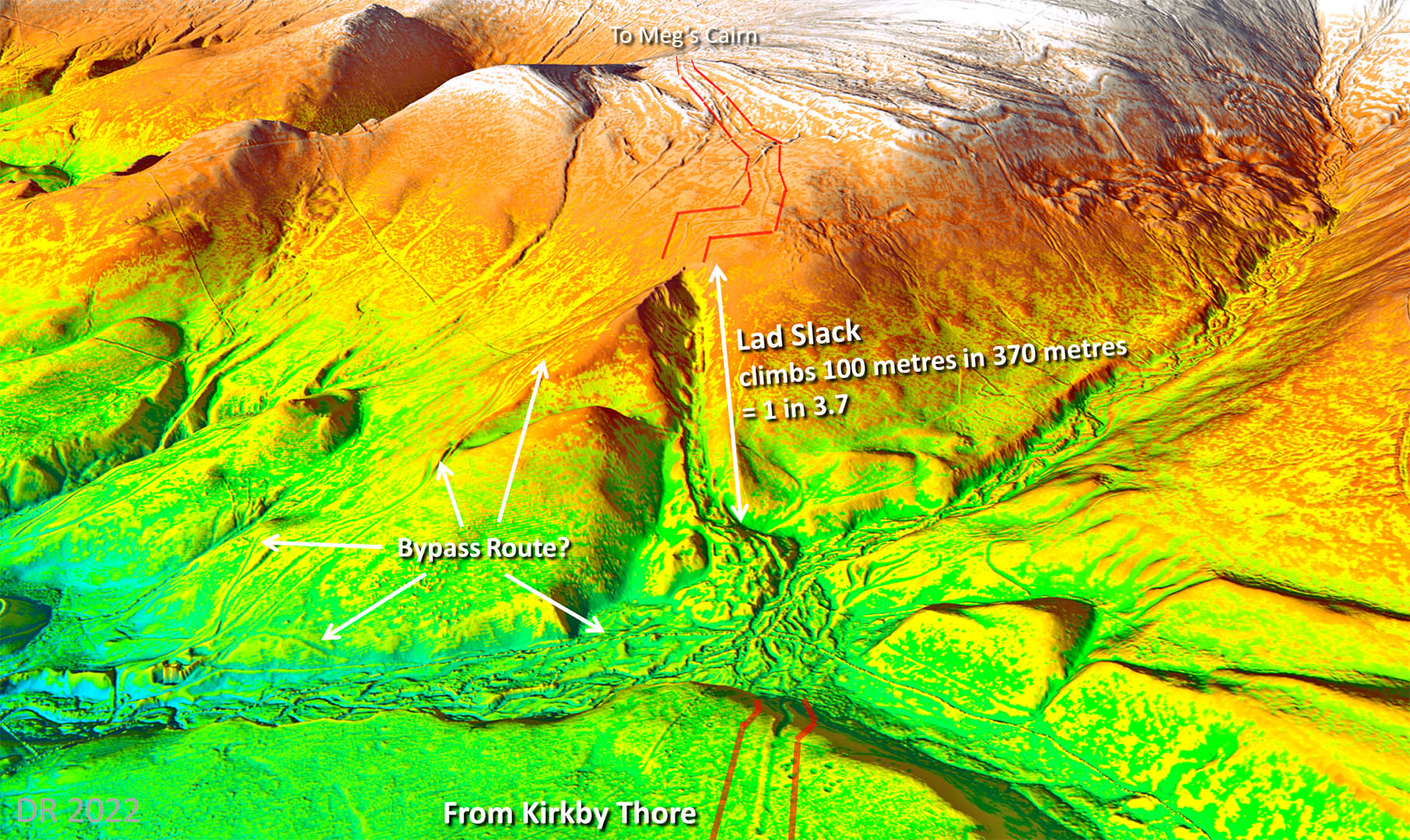
3D Lidar Image - Lad Slack The major hurdle to crossing the Pennines was climbing Lad Slack. There can be no doubt the Romans intended to ascend to the tops using this natural valley - the road from Kirkby Thore makes a direct aim for it. It looks a nice easy way up but it is mighty steep - for over one third of a kilometre the road climbs at 1 in 3.7. There is evidence there could perhaps have been a bypass route which headed to the north (left) before zig-zagging its way up but it is a long way around so perhaps unlikely
|
Click for larger view |
 |
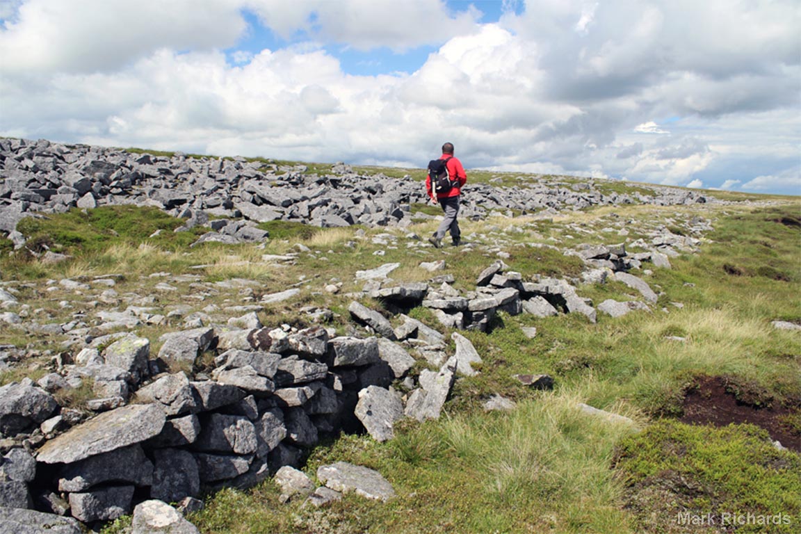
Lad Slack It is steep but at least it is a steedy climb and somewhat sheltered. There are clearly the remnants of what looks like a Roman agger so it would appear the Romans did actually go up and down Lad Slack. Image: Alan Kilduff
|
Click for larger view |
 |
Melmerby Fell Here the Maiden Way is terraced and built up on it low side. So much stone around that there is no need for quarry pits here. Image courtesy of Mark Richards, author of Hadrian's Highway. Book 2 covers this road and is highly recommended as are Mark's other books. |
Click for larger view |
 |
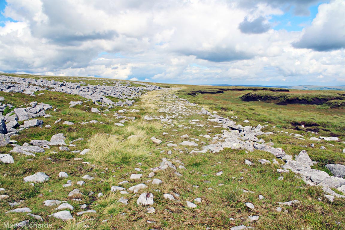
Melmerby Fell looking towards the summit Towards the top of the Pennine crossing the road reveals itself in all its glory. You wouldn't believe this is 2000 feet up! Image courtesy of Mark Richards, author of Hadrian's Highway. |
Click for larger view |
 |
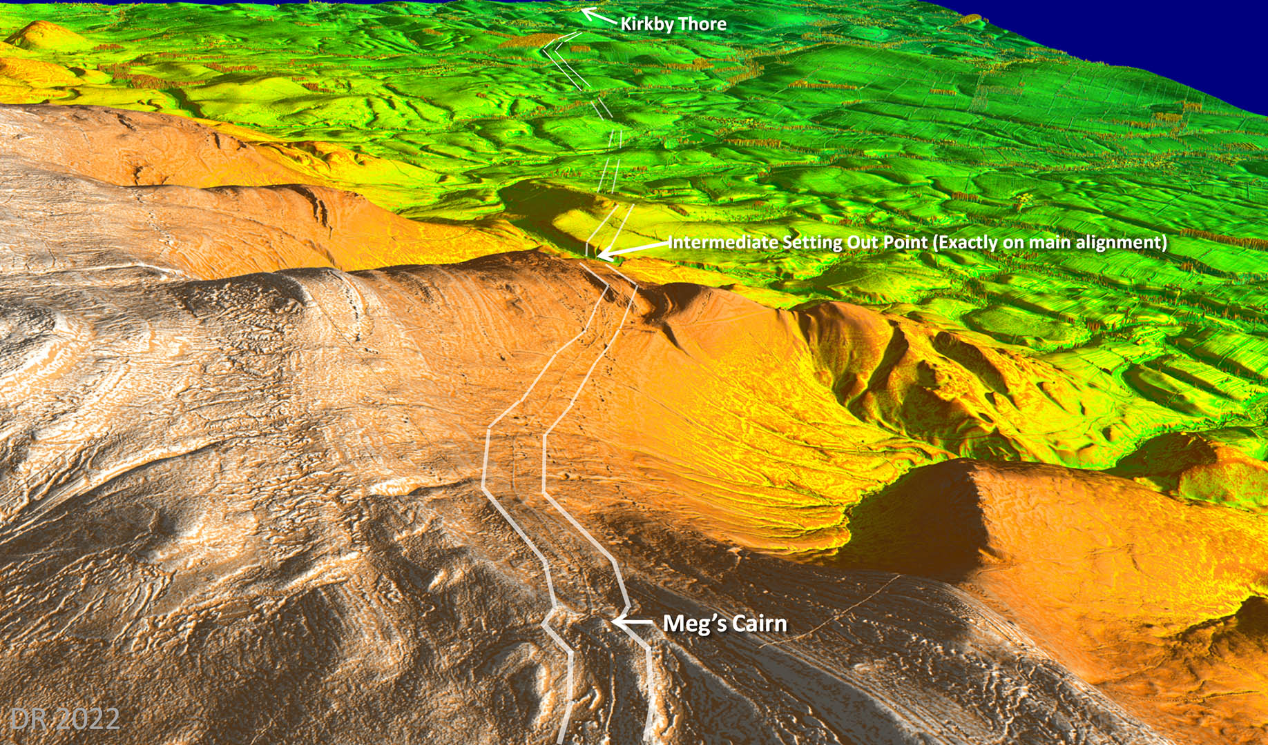
3D Lidar Image - Meg's Cairn looking back to Kirkby Thore There can be little doubt that Meg's Cairn was used by the Romans as its sighting point for the section of the road from Kirkby Thore to the summit. The road never varies far off this direct line. An intermediate sighting point shown was probably used as Meg's Cairn is really only visible close to Kirkby Thore.
|
Click for larger view |
 |
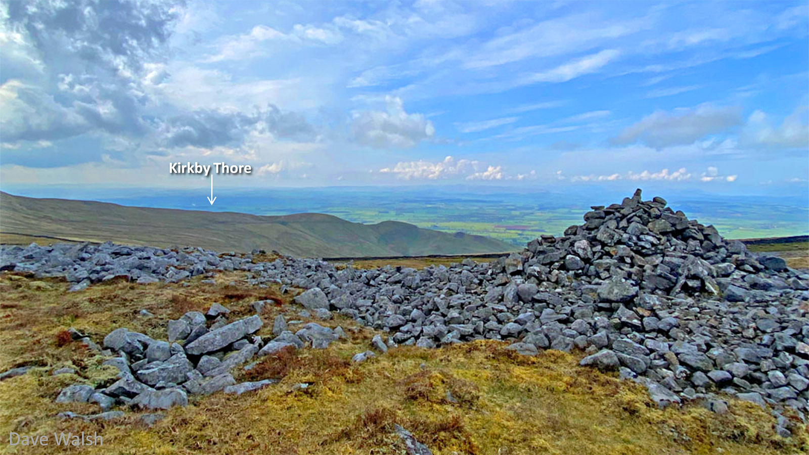
Meg's Cairn looking back to Kirkby Thore The on-the-ground equivalent view to above. Kirkby Thore is visible and can located to the right of the smoke from the Gypsum Works. This also indicates that burning a fire and making smoke here would be an excellent way of spotting Meg's Cairn from Kirkby Thore. Image: Dave Walsh
|
Click for larger view |
 |
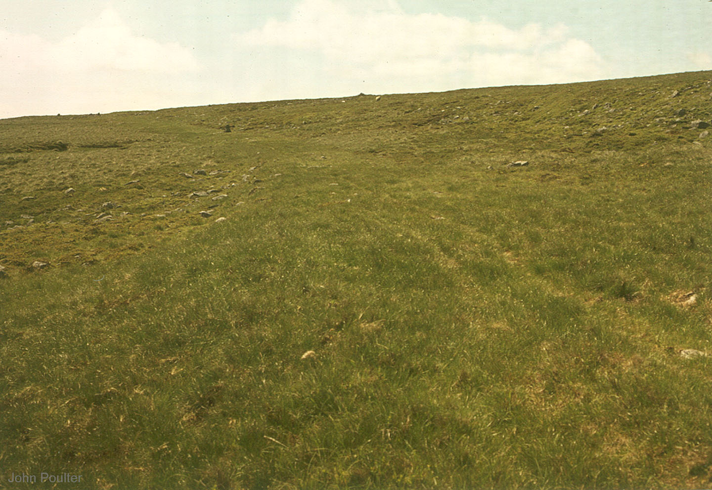
Maiden Way - NY 658 381 We have passed Meg's Cairn and the long descent has begun. Tthe route now becomes more tradional and can easily be identified by the different colour and texture of the grass. Image; John Poulter |
Click for larger view |
 |
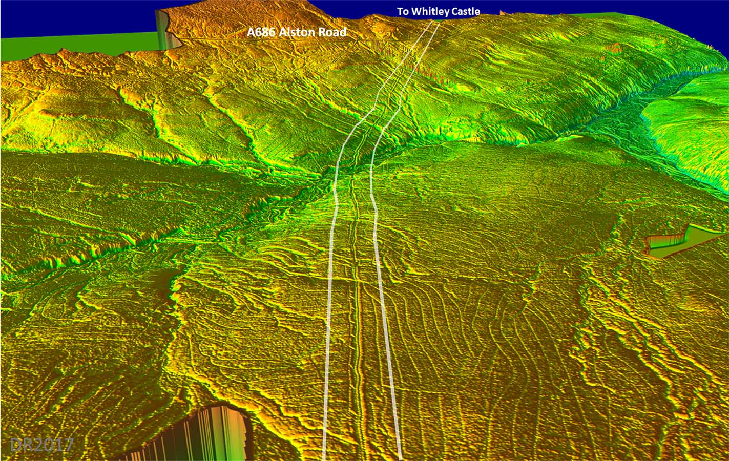
Lidar Image and Map - Alston Road The descent down to the Alston Road is less steep than that on the western side. It can be seen from the Alston Road heading up to the summit of the Pennine ridge. |
Click for larger view |
 |
3D Lidar Image - Alston Road Having descended down the east side there is another stiff climb to negotiate up to the Alston Road and across Park Fell at a height of 475 metres. |
Click for larger view |
 |
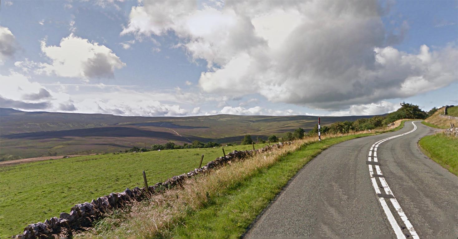
Alston Road A686 - looking back to the summit on Melmerby Fell Maiden Way is visible heading across the moor in the far distance. The road this side of the fell appears to be still in use by 4x4 vehicles for grouse shooting.
|
Click for larger view |
 |
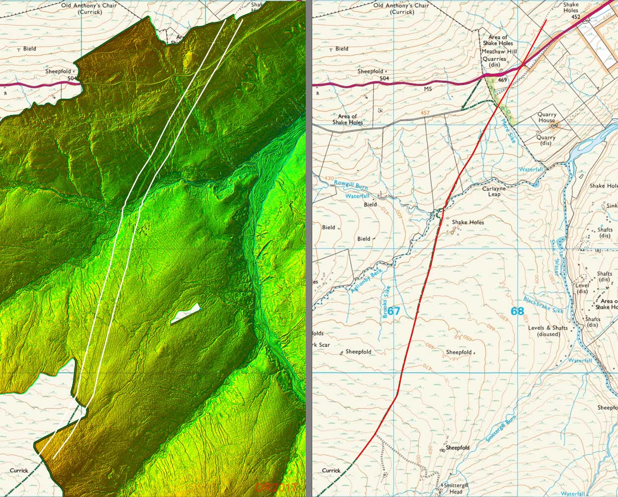
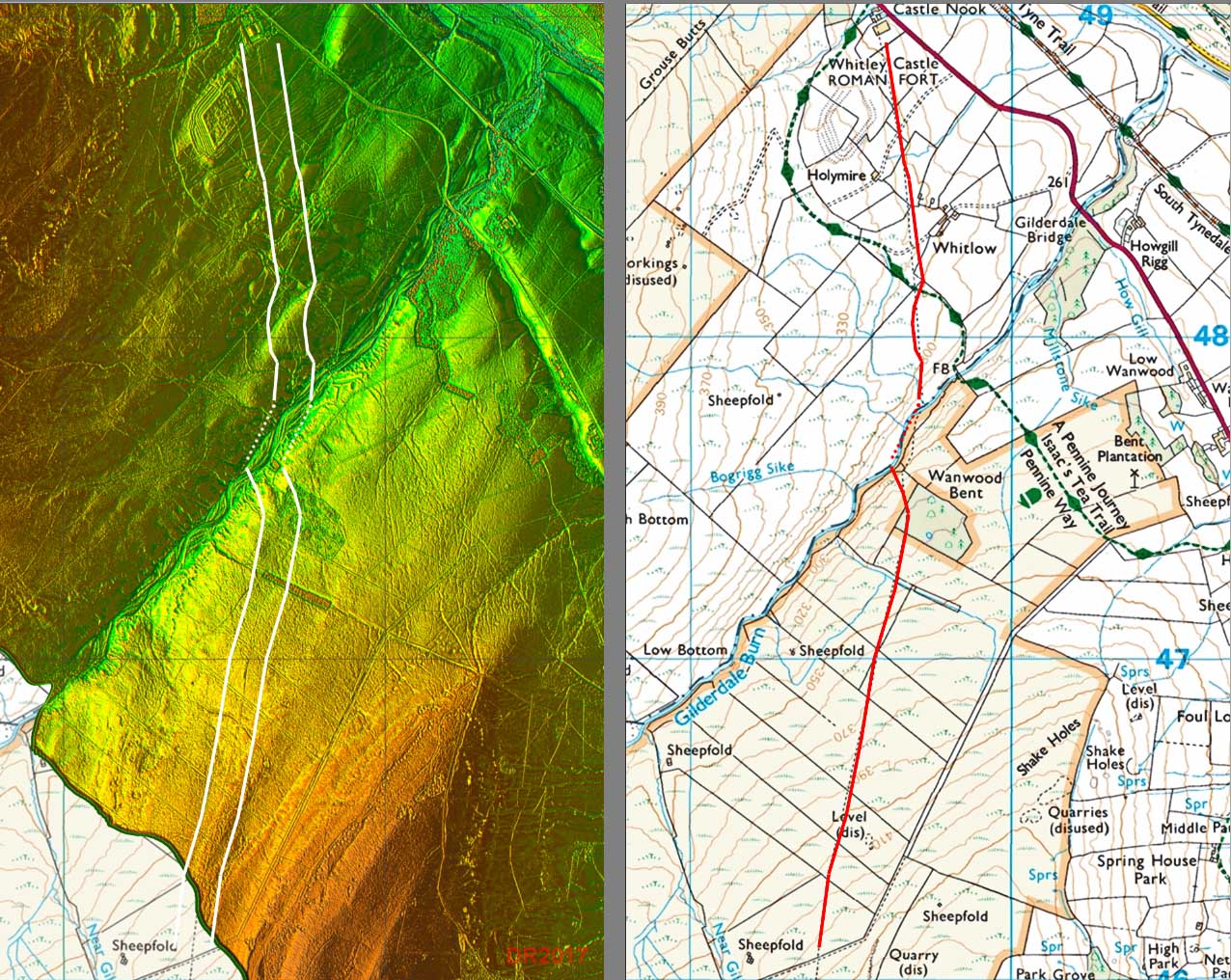
Lidar Image and Map - Whitley Castle The road is reasonably clear apart from the crossing of Gilderdale Brook. No doubt river action has destroyed the Roman route here. The brook marks the boundary with Northumberland. |
Click for larger view |
 |
3D Lidar Image - Whitley Castle looking back to Kirkby Thore What an unusual fort. Presumably no better site was deemed suitable and to adapt to the contours a rhomboid shape for the fort was adopted. |
Click for larger view |
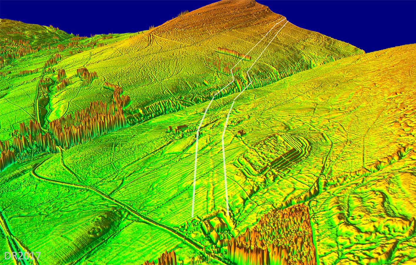 |
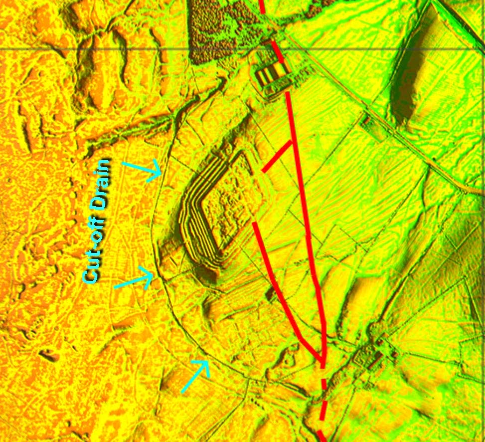
Lidar Image - Whitley Castle detail Although Alston is in Cumbria, the Whitley Castle site is actually over the border and in Northumberland. This is an orthogonal (plan) view with north at the top. That diamond shape does fit the contours. Judging by all those defensive ditches you would have thought it was gold they were defending here not lead but of course there would have been some silver too! The Roman road, Maiden Way, passes on the east side of the fort and had two links to the fort. The road to Corbridge leads off to the right. Also visible above the fort (left) is a cut-off drain. Run off from the hillside would have been a problem. The drain protects the fort and vicus and links to streams north and south. For more details on Whitley Castle visit the Epiacum web site.
For the continuation of the Maiden Way to Carvoran follow link |
Click for larger view |
 |
|
|
|
Return to Cumbria Roman Roads homepage Last update: September 2022 |
© David Ratledge |