 |
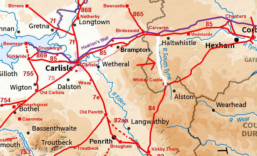
The Maiden Way, Margary 84Part 2: Whitley Castle to Carvoran, 11.25 milesWe continue along Maiden Way into Northumberland now and up the South Tyne Valley to Carvoran. Carvoran was a Stanegate Fort , which preceded Hadrian's Wall by around 50 years. This road would probably be the only route in and out of Whitley Castle (nr. Alston) in the mid-winter months when snows typically block off the high roads. In terms of transporting the lead from the extensive mines at Whitley Castle then it also represented by far the easiest way out. I was surprised to find much of what is shown as the route on modern OS mapping is incorrect. I have therefore used OS/Bing mapping for the route maps so the discrepancies will be evident.. The name Maiden Way properly refers to the Roman road from Kirkby Thore to Carvoran via Whitley Castle. It was so called by Camden and the name can be traced back to the twelfth century (Maydengathe, Maidingate, Maidengate, occurring c. 1179 and 1294). Suggestions that it extended to Bewcastle are somewhat speculative as can be seen from the map the two roads do not link directly. According to Collingwood the name probably derives from Maiden Castle on the Stainmore road - see map and link to Collingwood below. For a full discussion of the derivation of the name Maiden Way and the reasons for the road see Collingwood.
Video flyover from Whitley Castle to Carvoran
|
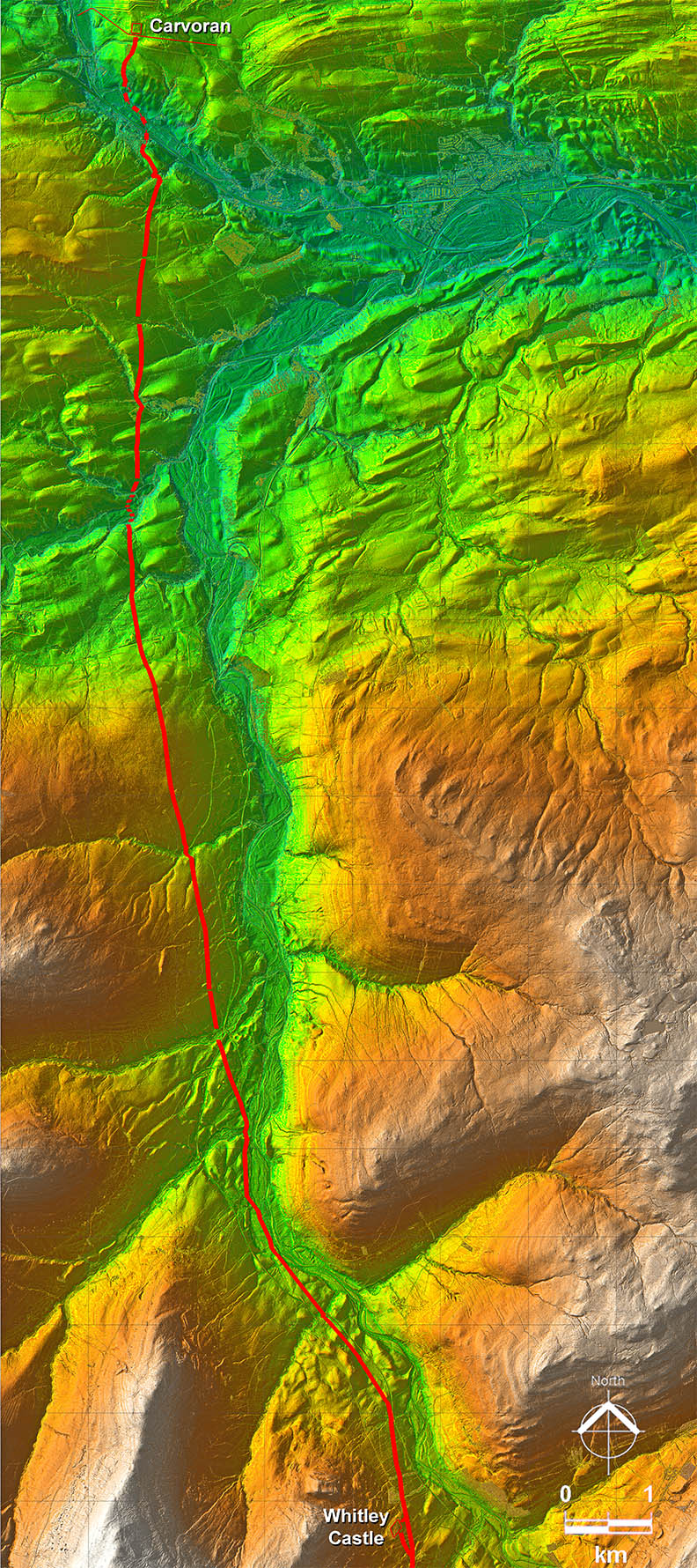
Lidar Image - Full Route Whitley Castle fort controlled the important lead and silver mines near Alston. Surprisingly the route initially goes close to the River South Tyne floodplain near Slaggford before taking a more typical course on higher ground away from valley bottoms. |
Click for larger view |
 |
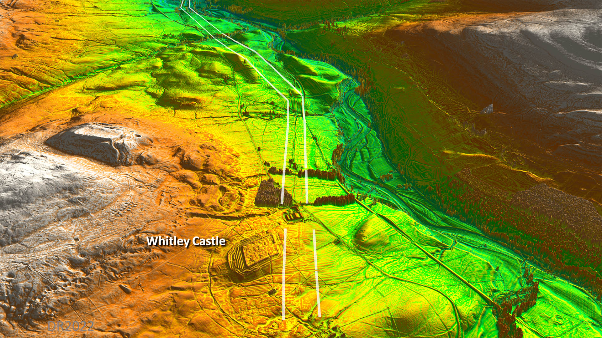
Oblique 3D Lidar Image - Whitley Castle Whitley castle is often referred to as Epiacum but in reality there is not much hard evidence for this association. What is obvious are te numerous defensive ditches especially on the fort's west side. Was there plenty of silver in the lead mined here that needed guarding? The line is very obvious in the Lidar imagery and yet once it crosses the A689 somehow the line plotted on correct OS maps is incorrect - it is too far west. |
Click for larger view |
 |
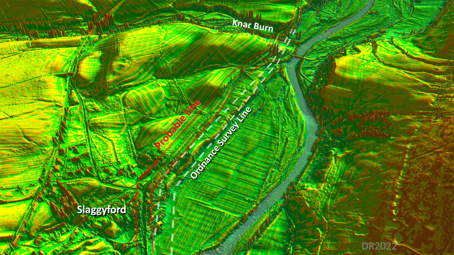
Oblique 3D Lidar Image - Slaggyford Again OS mapping seems to have got the line wrong. The A689 looks to mark the Roman line. The OS seem to have been confused by the top of the river bank presumably thinking it was the Roman agger. |
Click for larger view |
 |
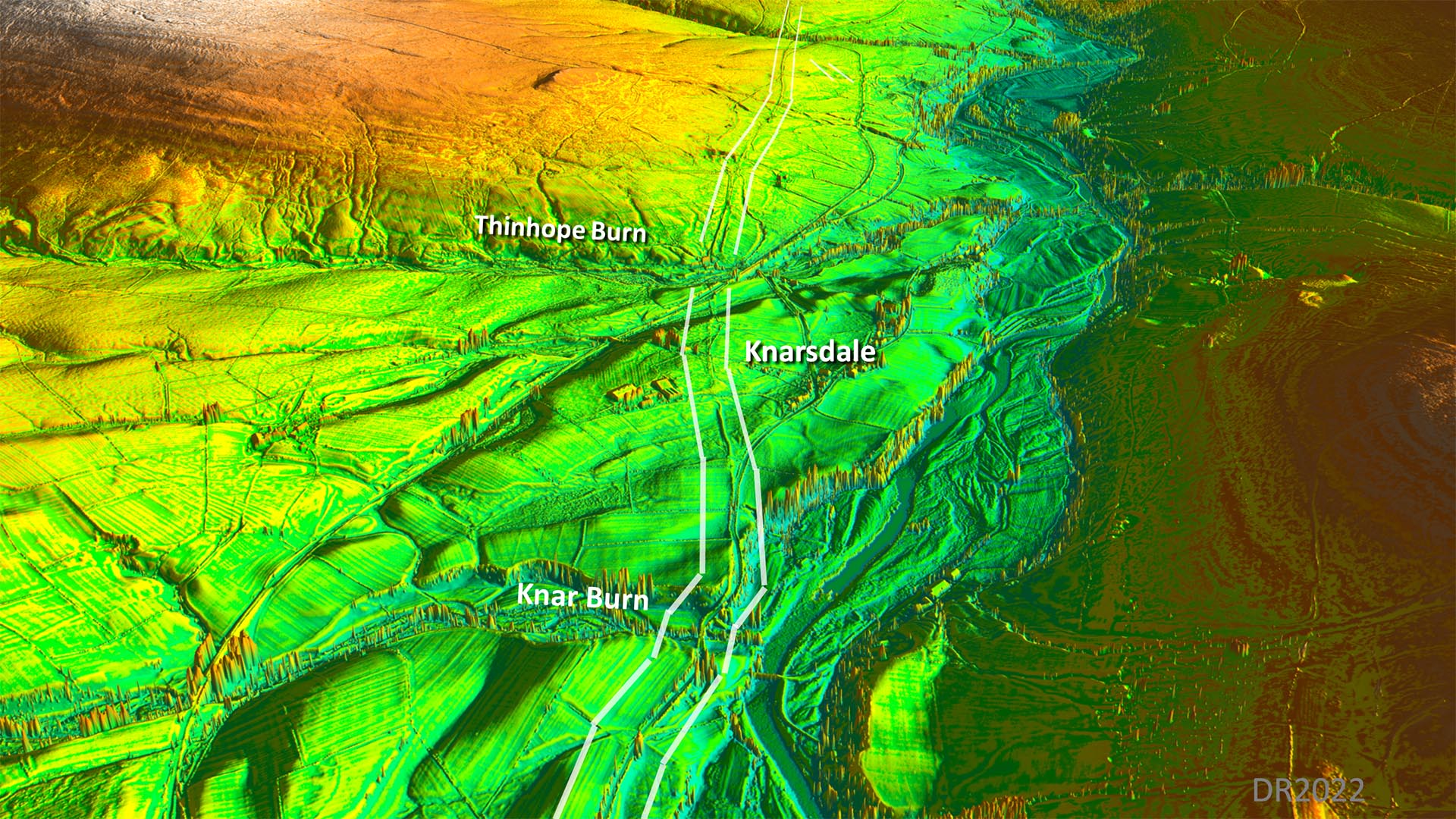
Oblique 3D Lidar Image - Knarsdale This view is a continuation of the above and the Roman line now diverges from the river side and heads for higher ground. |
Click for larger view |
 |
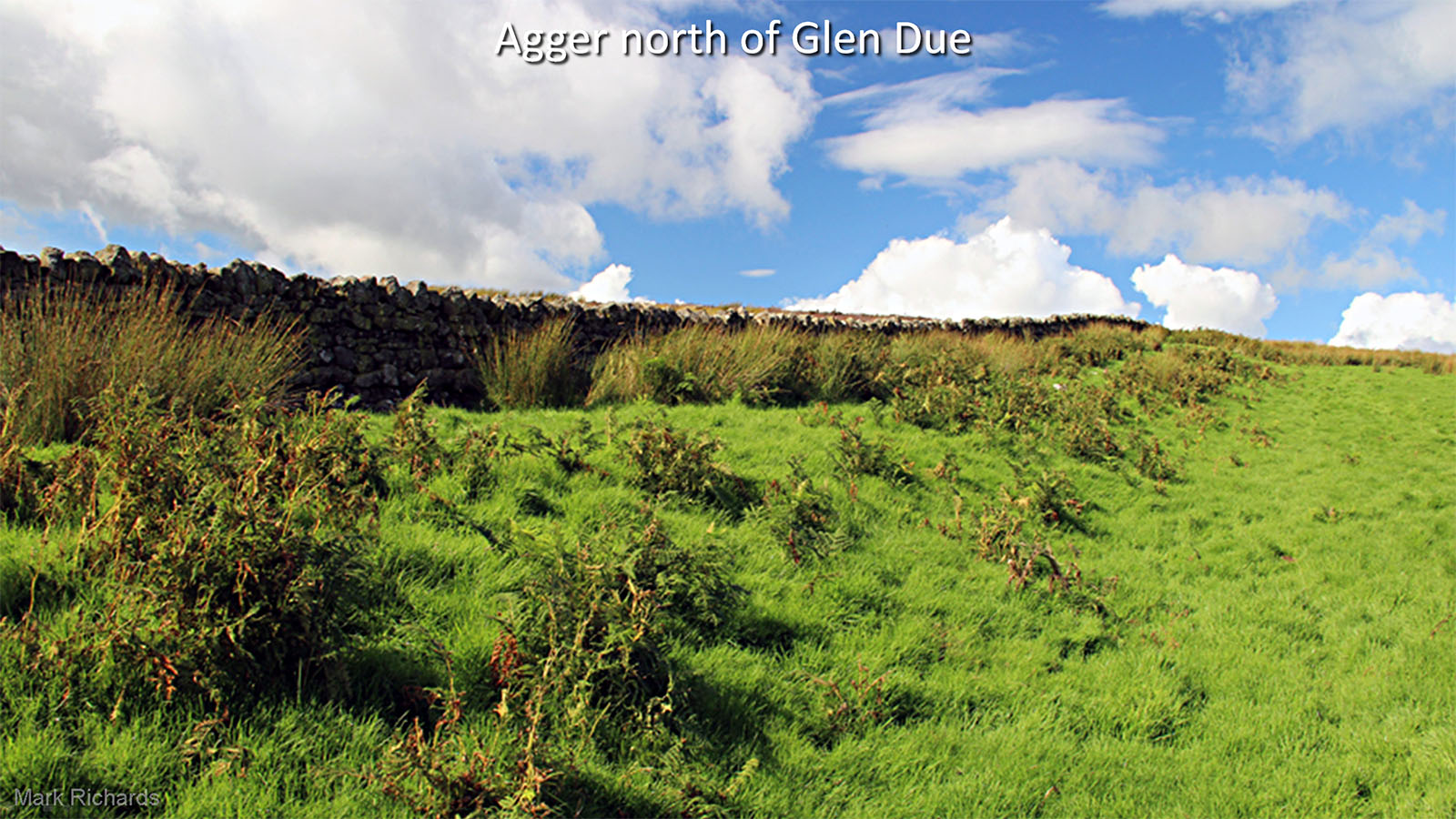
Maiden Way, north of Glen Due Perhaps the best surviving stretch of agger is where the road climbs up from its crossing of the the Due Burn, Thanks to the author Mark Richards for sending me this image. His Hadrian's Highway (Vol.2) walking booklet covers this road. Image: Mark Richards |
Click for larger view |
 |
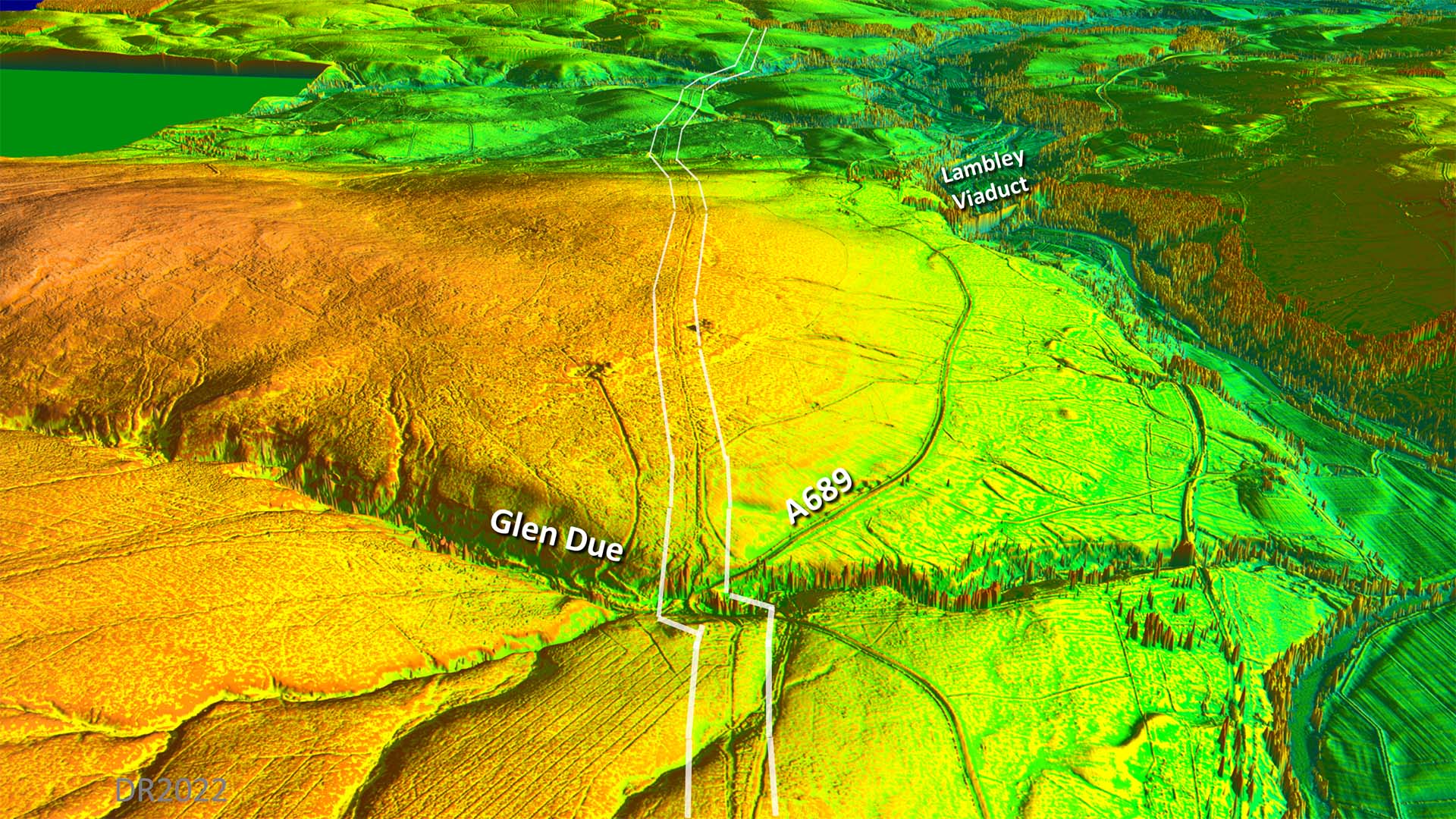
Oblique 3D Lidar Image - Glen Due The agger depicted above is in this view just beyond Glen Due. There the road climbs up, alongside a wall, from the burn crossing. Note the prevalence on Glen and Burn names here denotes a strong Scottish influence. |
Click for larger view |
 |
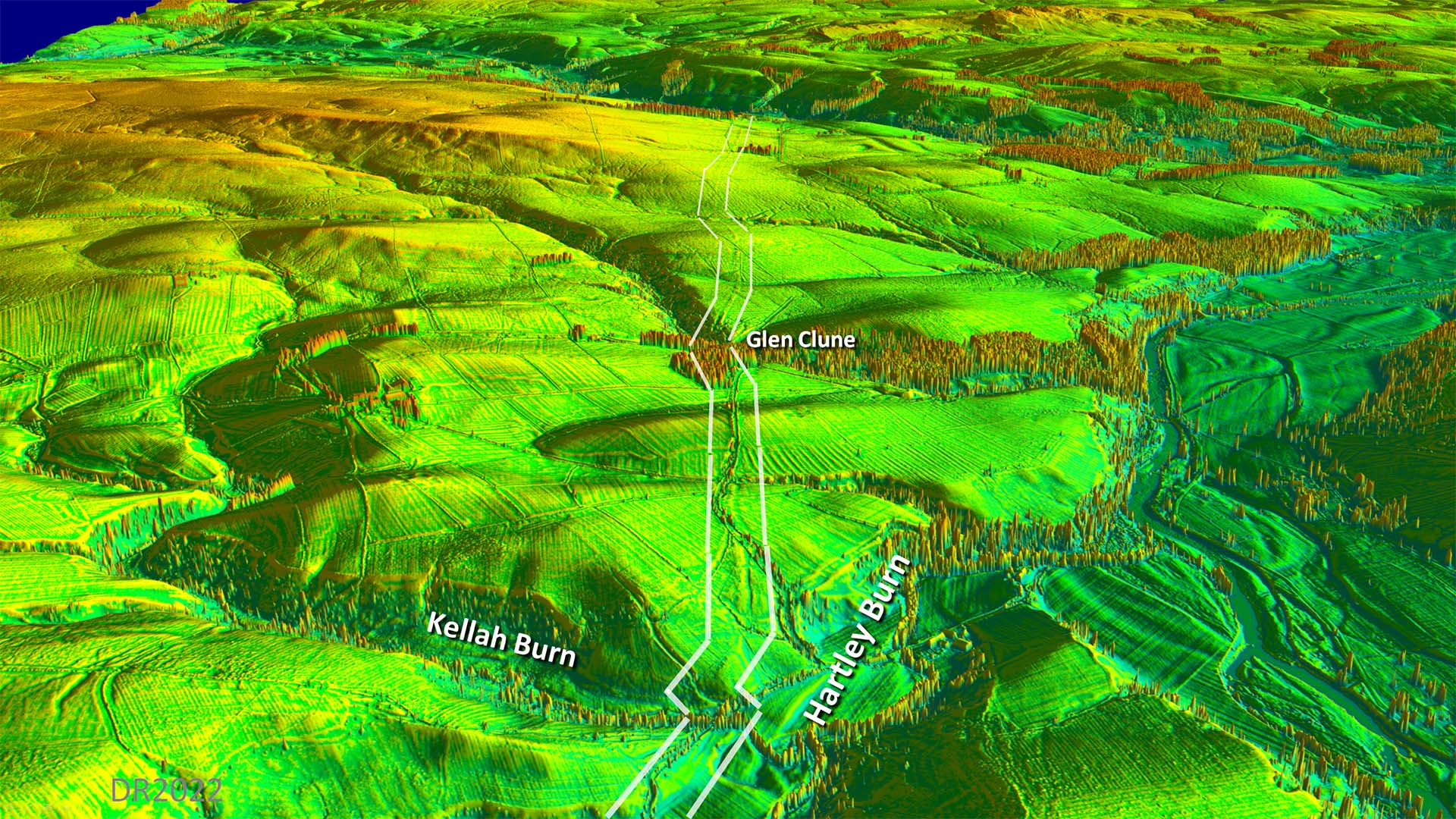
Oblique 3D Lidar Image - Glen Clune For the section here to the Tipault Burn the road adapts to the contours rather than slavishly taking a straight line alignment. - |
Click for larger view |
 |
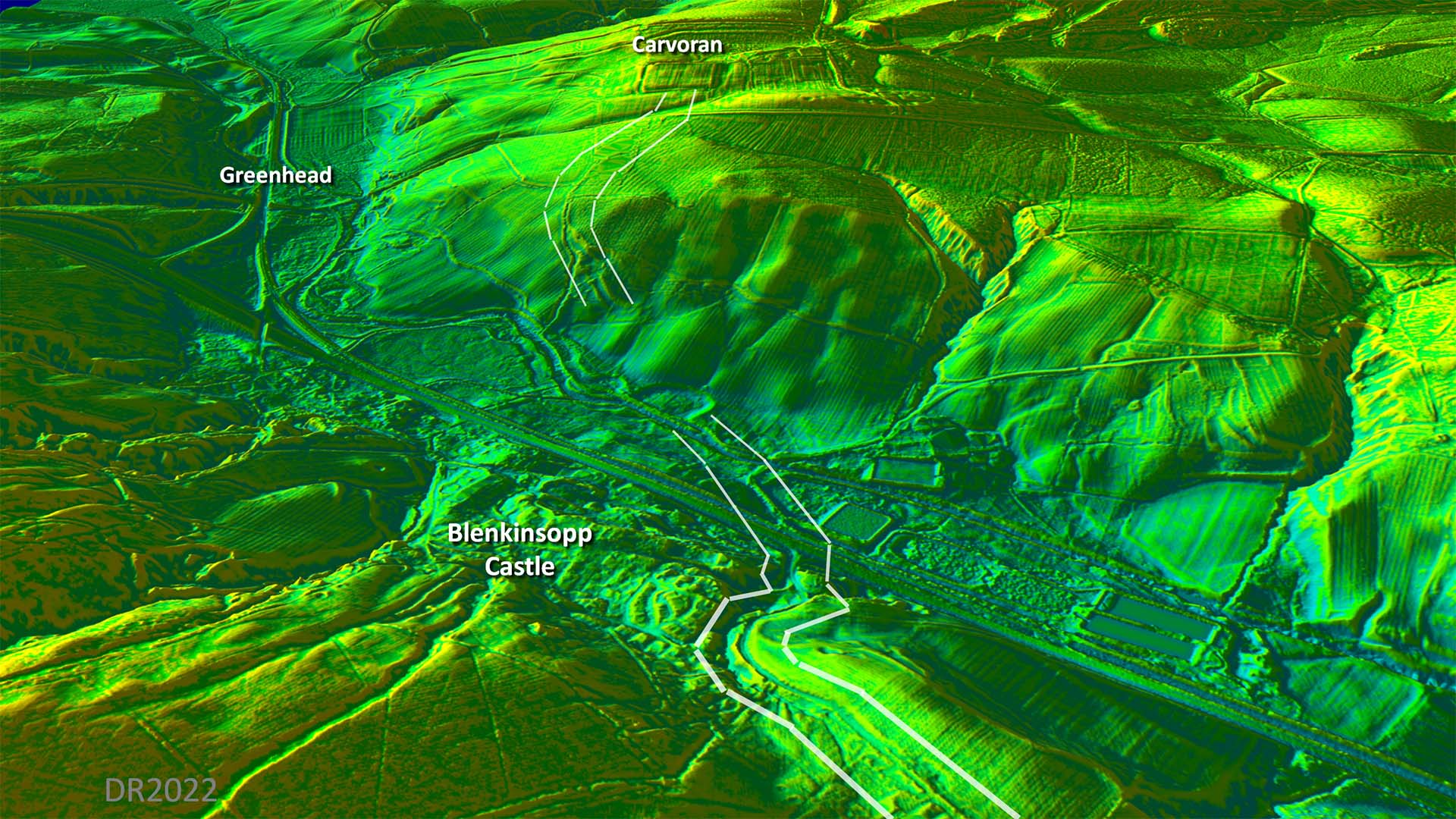
Oblique 3D Lidar Image - Blenkinsopp Castle - Across the Tipault Burn then the lidar evidence is inconclusive. However, the straightline drawn on Os maps is almost certainly not correct. I would suggest a zig-zag up the slope on the far bank. |
Click for larger view |
 |
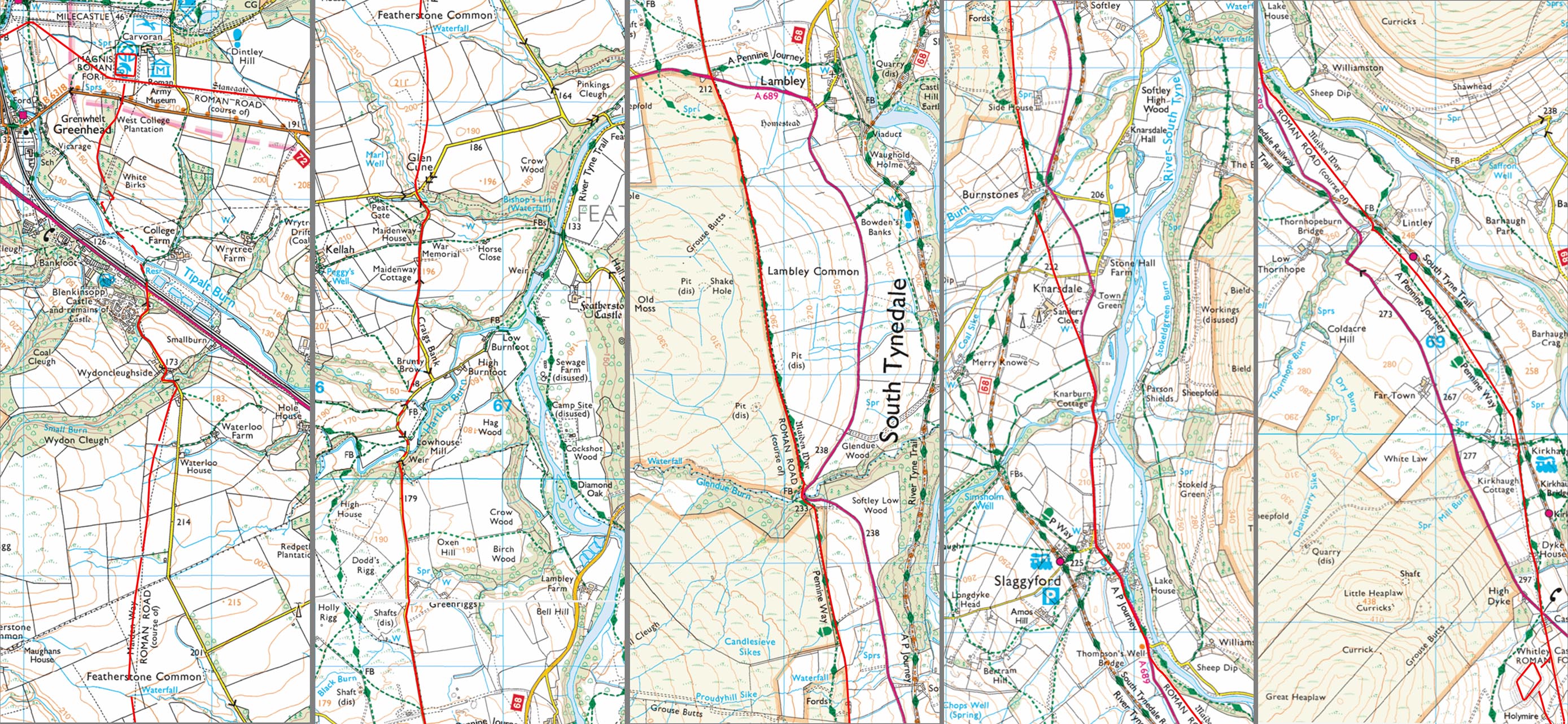
Route Maps Route indicated overlaid on modern OS/Bing mapping showing where the latter is in error. |
Click for larger view |
 |
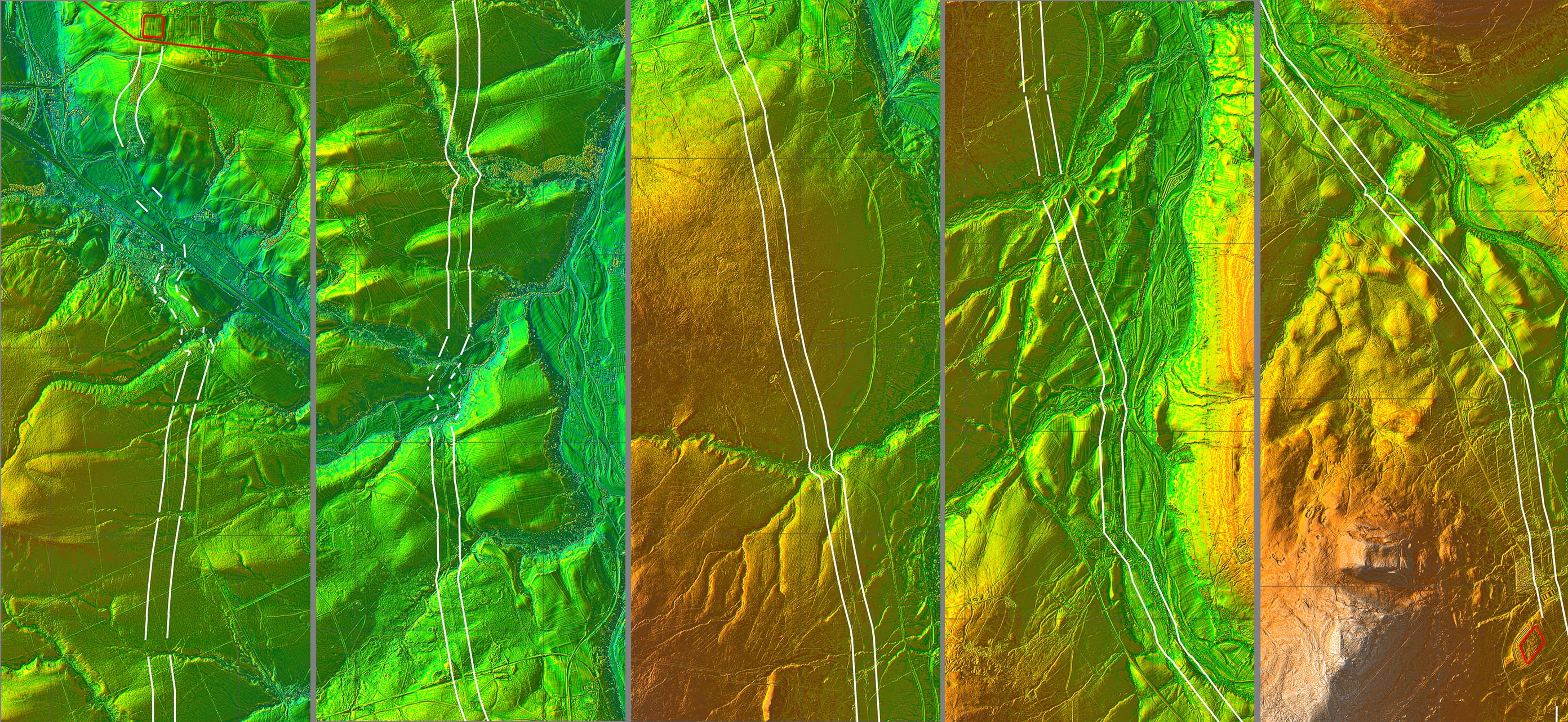
Lidar Maps The route shown between a corridor overlaying the lidar imagery. |
Click for larger view |
 |
|
|
|
Return to Cumbria Roman Roads homepage Last update: October 2022 |
© David Ratledge |