|
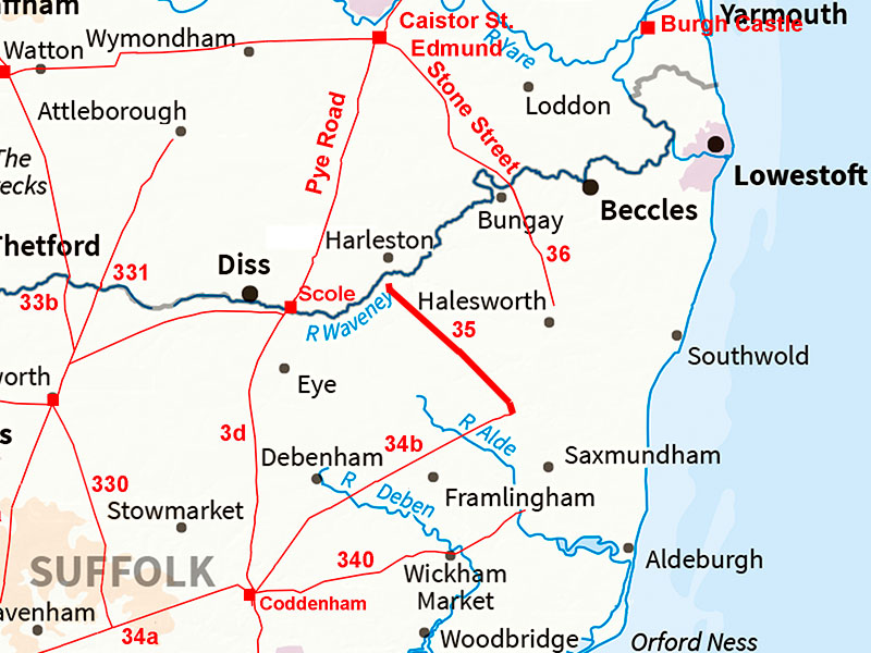
The Roman Road from Peasenhall to Harleston (or Needham?)Margary Number: 35Distance: 10 milesFirst what is certain - we know this road leaves the Coddenham to Peasenhall Roman road at Peasenhall and heads north west. Quite where it originated from is uncertain. The route to just short of Harleston is crystal clear but how it cross the River Waveney and where it then went is a puzzle. How can a road so obvious for 10 miles just disappear? It has generally been assumed it would have continued its alignment and joined the Pye Road and hence on to Caistor st Edmund. There are two options for the river crossing. Either via Haleston or Needham, where there were kilns. |
Historic Counties: Suffolk & Norfolk Current Counties: Suffolk & Norfolk HER: Suffolk & Norfolk
|
|
|
|
|
|
Lidar Image - Full Route A very direct route to nowhere - well not really nowhere it is just we cannot figure out quite where its destination was. See later for some suggestions. |
Click for larger view
|
 |
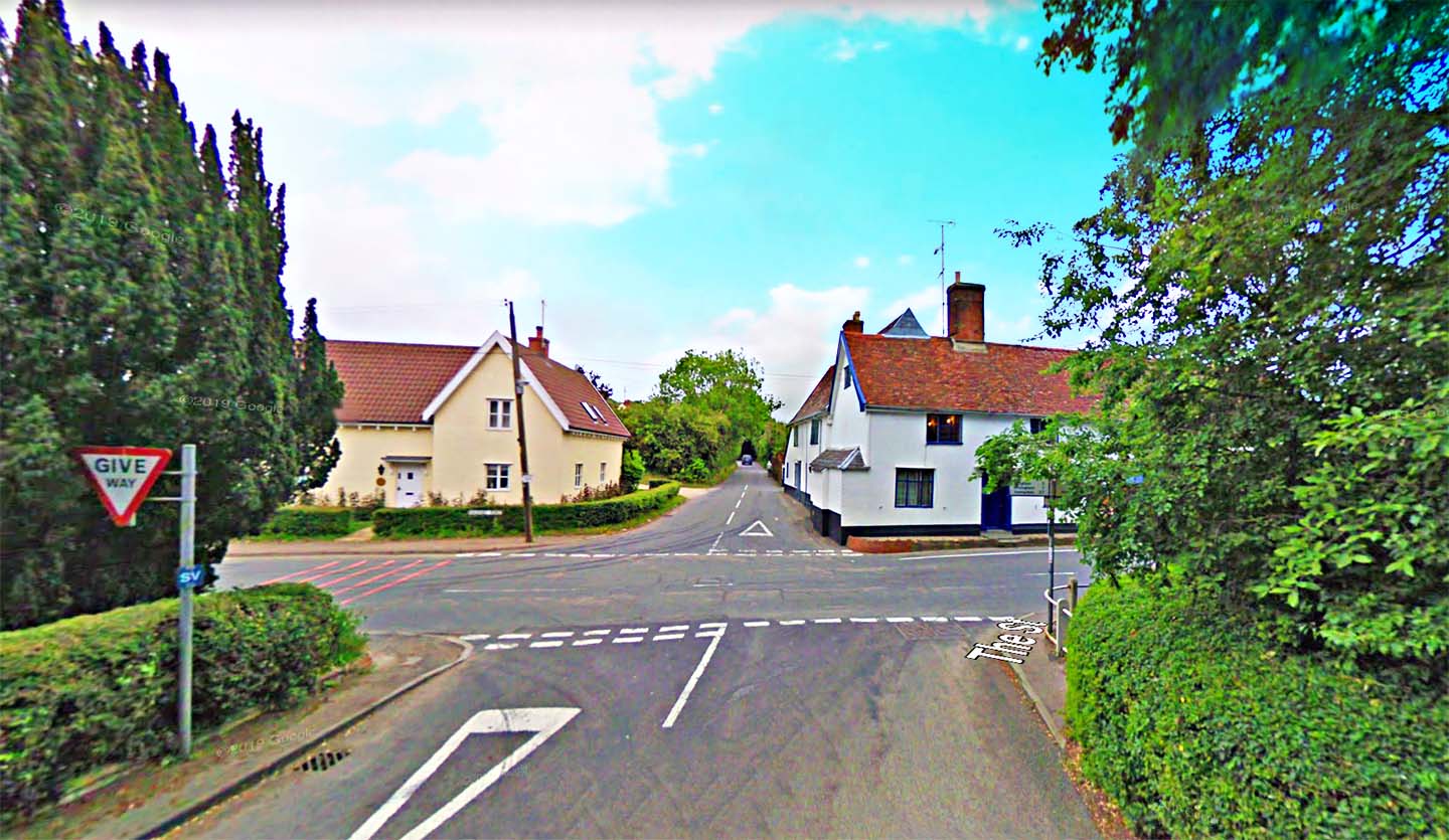
Peasenhall Junction Our road almost certainly headed up Mill Hill between the yellow and white houses. The Roman road from Coddenham crosses left to right heading to.... another mystery. Image: Google Earth |
Click for larger view |
 |
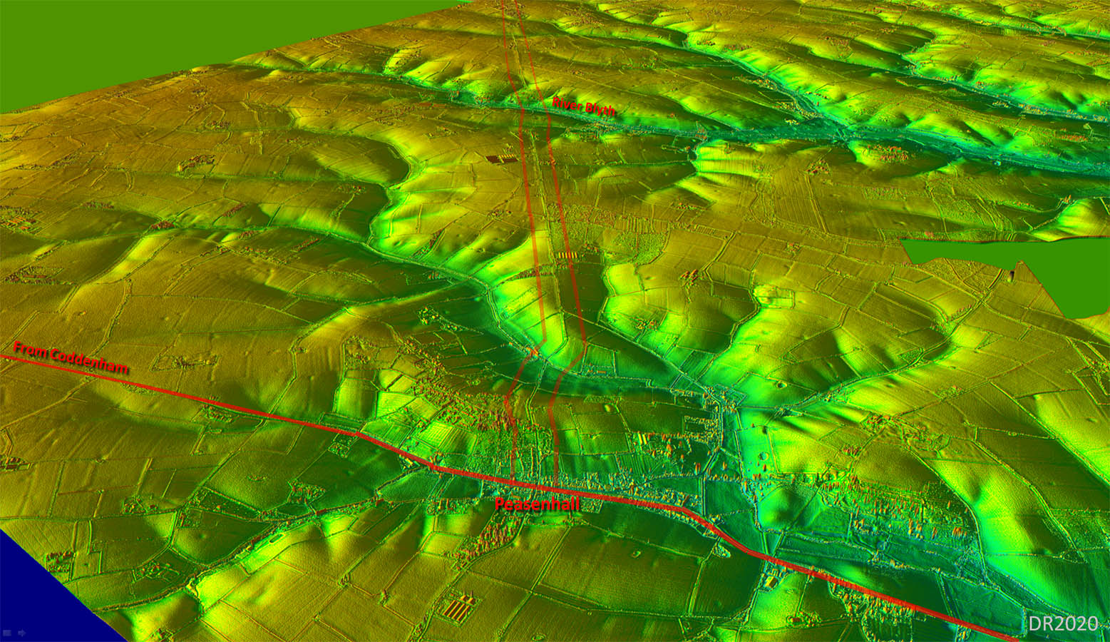
Oblique 3D Lidar Image - Peasenhall The climb up Mill Hill necessitated a somewhat indirect route but once on high ground then the long main straight alignment begins. |
Click for larger view |
 |
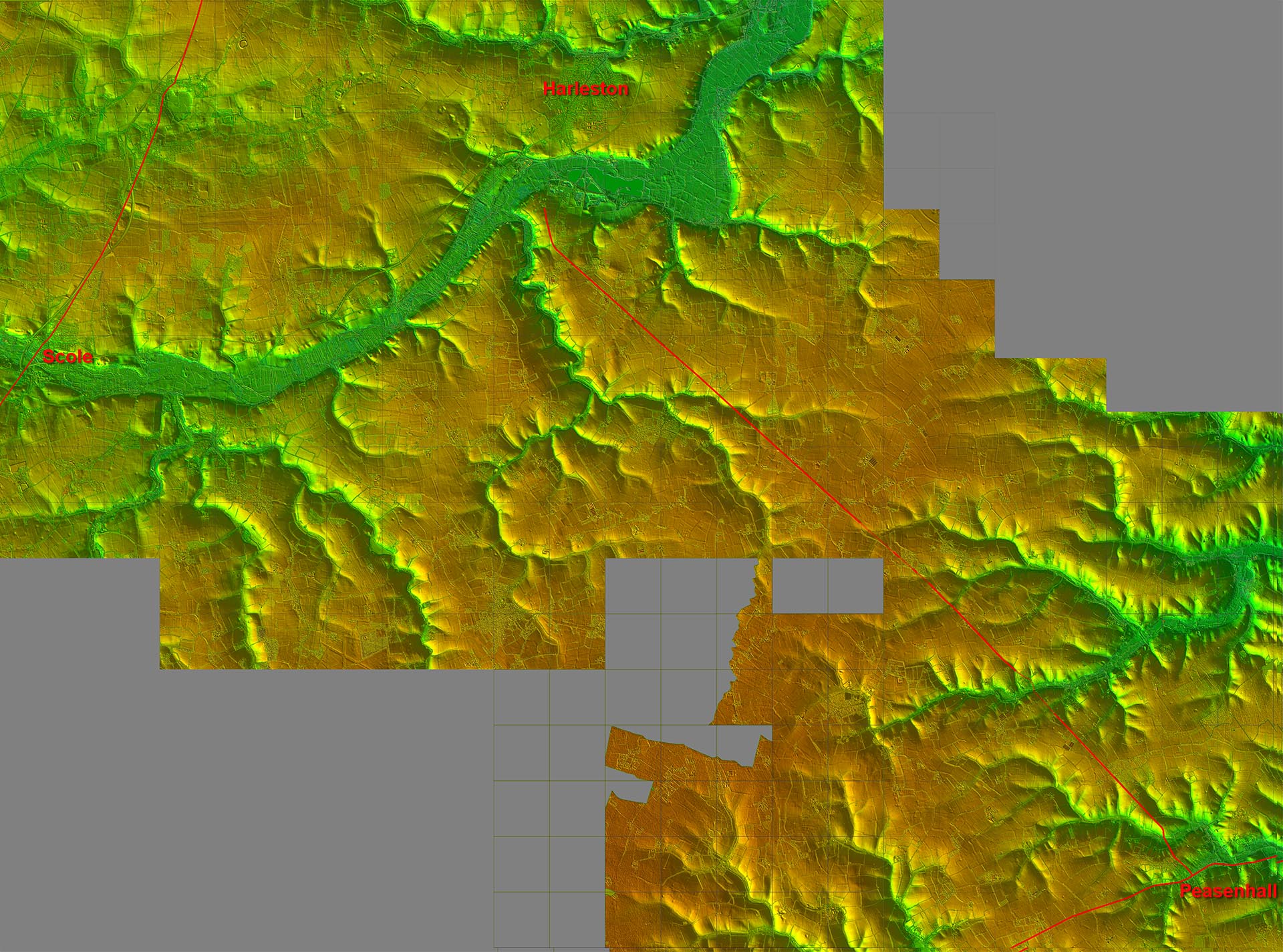
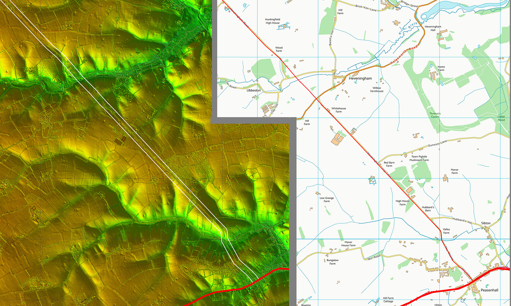
Lidar Image and Route Map 1 There was a bit of a wobble off straight to negotiate the valley of the River Blyth but apart from that little deviation of straight. |
Click for larger view |
 |
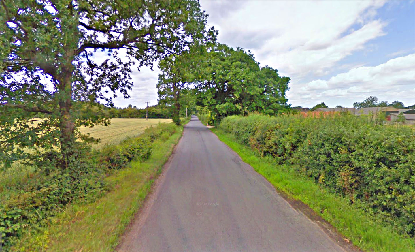
Heveningham Long Lane Having climbed up Mill Hill our road takes on its straight alignment along Long Lane. Image: Google Earth |
Click for larger view |
 |
Lidar Image and Route Map 2 More of the same - unerringly straight. |
Click for larger view |
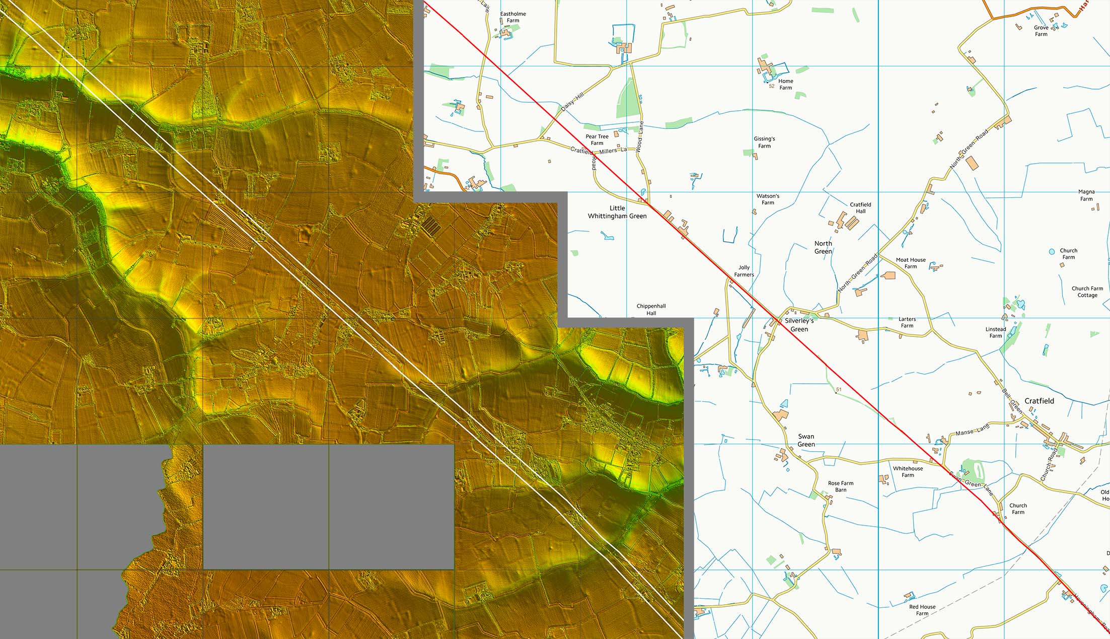 |
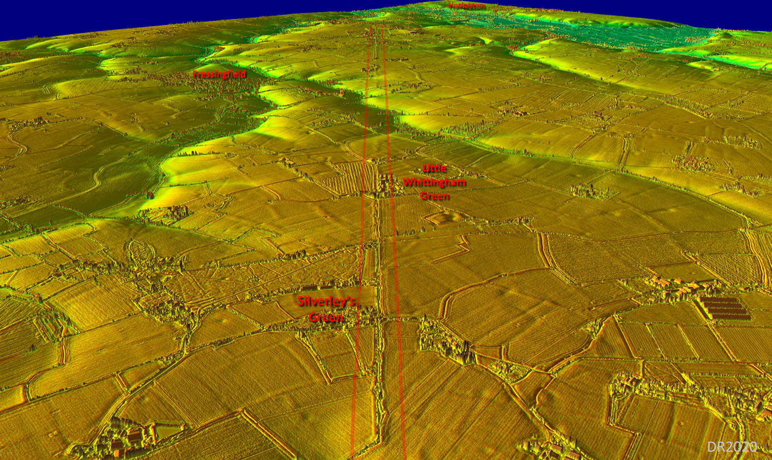
Oblique 3D Lidar Image -Silverley's Green Roman roads don't get much more obvious than this! But how can such an obvious road disappear after the River Waveney? |
Click for larger view |
 |
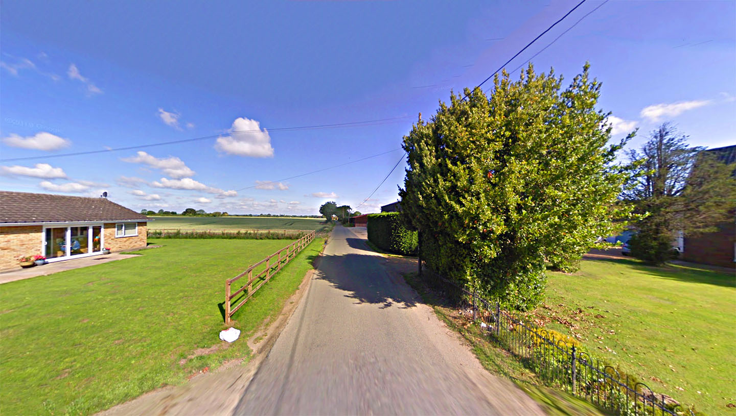
Roman Road, Little Whittingham Green, Fressingfield Aptly named Roman Road at Whittingham Green. Image: Google Earth |
Click for larger view |
 |
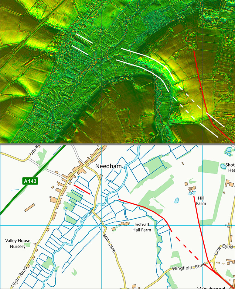
Lidar Image and Route Map 3 The straight alignment ends at Weybread and there is some evidence that it probably turned to the north for a crossing of the River Waveney. But this is where the obvious signs of this road end. Once we have crossed the river we are in Norfolk. |
Click for larger view |
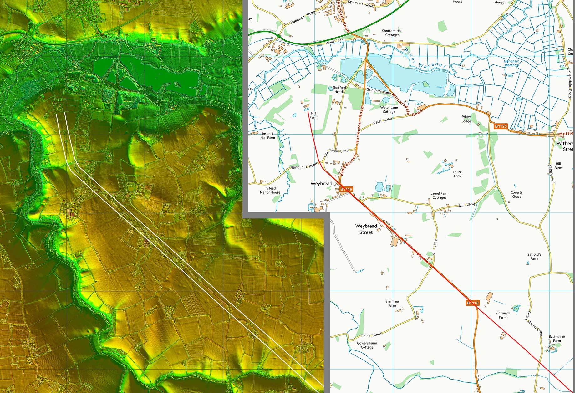 |
Lidar Image and Map - Needham Connection There were Roman kilns at Needham and some Roman finds indicating a possible small settlement. There is some evidence for the road heading down to cross the Wensum at Needham. Even if this is the road its onward continuation is still not resolved. More work needed for Needham. |
Click for larger view |
 |
|
|
|
Last update: August 2025 |
© David Ratledge |