
|
Probable Roman Road from Thetford to StonebridgeMargary Number: noneDistance: 6.2 milesThis is a logical connection between the Icknield Way and Peddar's Way and continues the alignment of the Icknield Way from Icklingham. The evidence is strongest at Ringmere. It was possibly part of Antonine Itinerary V.
|
Historic Counties: Norfolk Current Counties: Norfolk HER: Norfolk
|
|
|
|

|
|
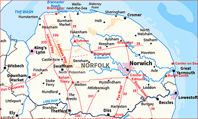
Lidar Image and (Possible) Route Map I have extended the extent of the full route map in order to show the context of this possible link. It demonstrates how this possible road extends the alignment of Icknield Way from Icklingham. |
Click for larger view
|
 |
Lidar Image & Route Map 1 The first section from Thetford is recorded in the Norfolk HER (see below) as a pre-historic gravel road. From Turnpike Cottage the A1075 overlies much of the road. The pre-historic route does align well with Nun's Bridges with which the southern section of the Icknield Way heads towards. NHER Number: 5934 Monument Name: Possible prehistoric trackway Summary A gravel road or trackway is visible on aerial photographs. The feature has been interpreted as a trackway branching off from the Icknield Way (NHER 1398), prompting some 19th century antiquarians to argue (incorrectly) that the Icknield Way went to Norwich. |
Click for larger view |
 |
Lidar Images - Ringmere The original route was clearly left of the mere and the route around its right side most likely a modern upgrade. About a kilometre beyond the mere then there are clear signs of the original road agger. These clues here are the most convincing for this being a Roman road |
Click for larger view |
 |
Lidar Image & Route Map 2 To join Peddar's Way at a bridge (Stonebridge) is typical Roman surveying - share a bridge - no need to build 2 of them.
|
Click for larger view |
 |
|
|
|
Last update: July 2022 |
© David Ratledge |