
|
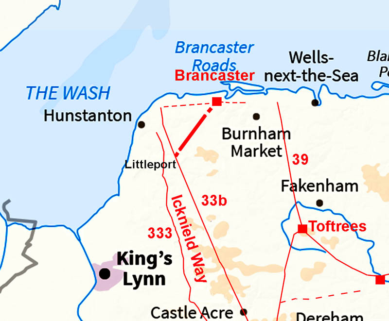
The Roman Road from Littleport to Brancaster (Brancastergate)Margary Number: noneDistance: 5.75 milesIt is logical that a fort as important as Brancaster would have had a link to the Peddars Way. An east-west road along the north coast at Brancaster is likely but a "short-cut" would have been highly desirable. My attention was drawn to the possibility of just such a short-cut road was triggered by Denis Smith who wrote "In the mid-1950s I went with my father to investigate a footpath which headed NE-wards from a place called Littleport where Peddars Way crosses the B1454 between Sedgeford and Docking. I remember that we found that the field had recently been ploughed but there was some evidence of metalling in the furrows." I took a quick look at the Lidar and sure enough there was an old road. How old? Is it Roman? Best categorised as "probable". Note: A feature of this part of Norfolk is ploughing furrows in fields mimicking a envelope pattern. They can give lots of false clues. The features followed in the Lidar do not appear to be any of these. |
Historic Counties: Norfolk Current Counties: Norfolk HER: Norfolk
|
|
|
|
|
|
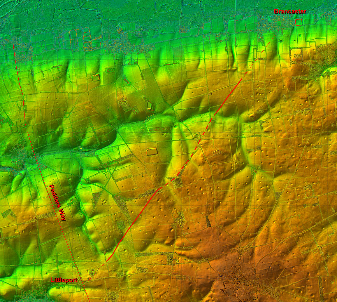
Lidar Image - Full Route The evidence for the existence of this road is strongest in the middle section. Both ends then nothing much is visible. However, in view of the direction of what is visible there is reasonable grounds for believing this was a Roman road to Brancaster. Norfolk HER states it was once known as Brancastergate but suggests a medieval origin.
|
Click for larger view
|
 |
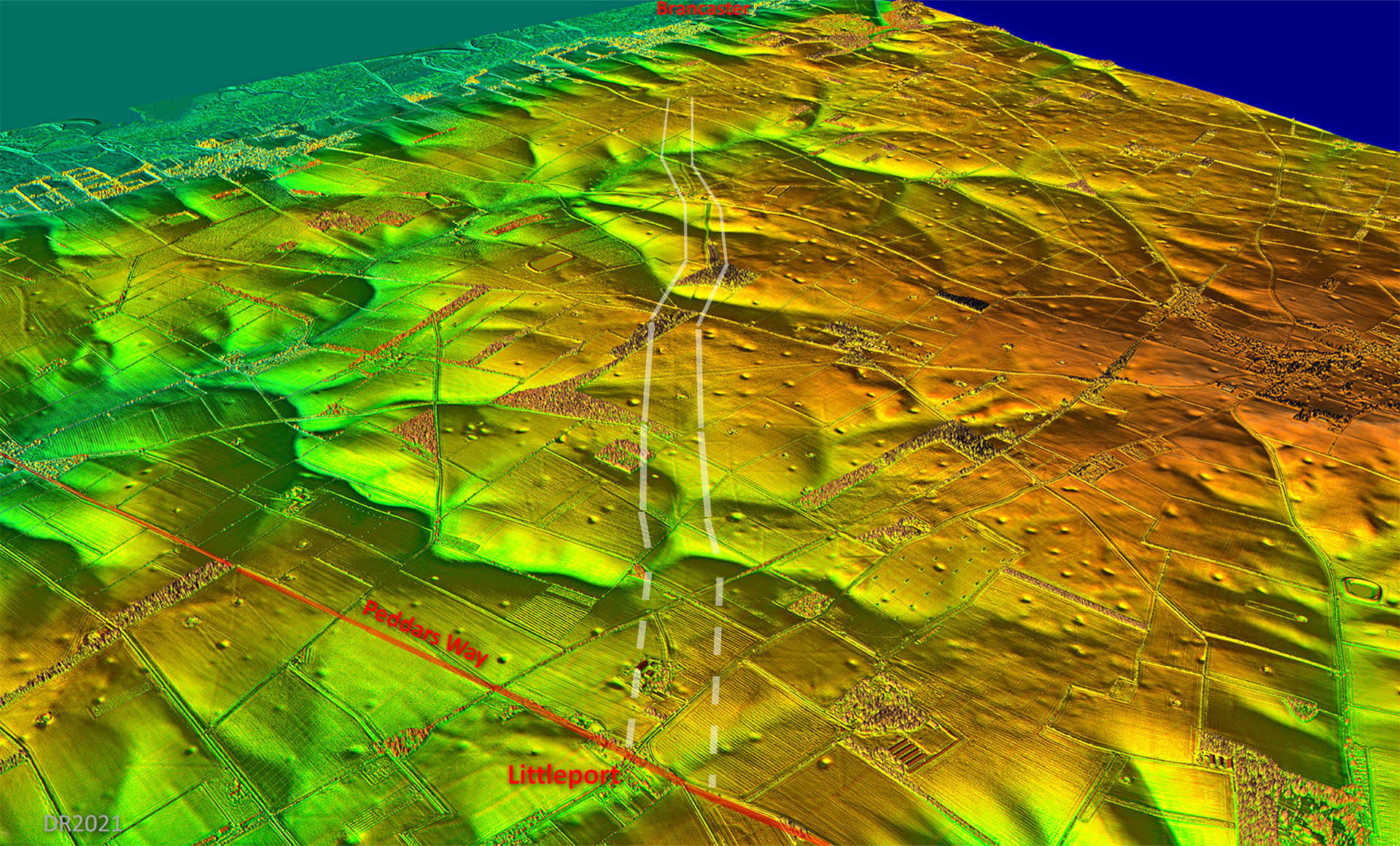
Oblique 3D Lidar image - Littleport to Brancaster Its the direction that really suggests that this is probably a road from Peddars Way to Brancaster. However, both ends are lost. |
Click for larger view |
 |
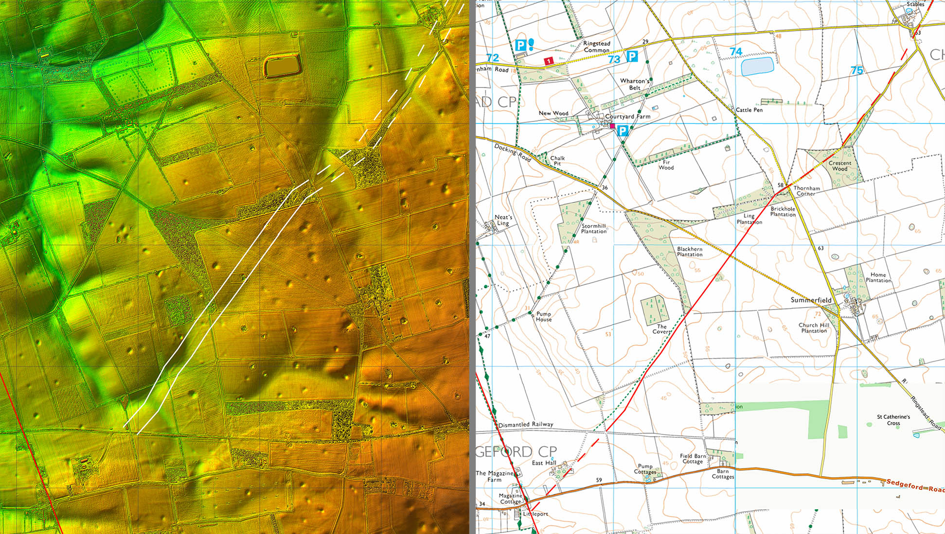
Lidar Image & Route Map 1 The evidence becomes visible north of the abandoned railway and this was the section that Denis Smith walked all those years ago. The definitive footpath however is somewhat off line to begin with. The slight kink at Thornham Corner is explained by the road crossing a valley and is therefore quite a sensible route. |
Click for larger view |
 |
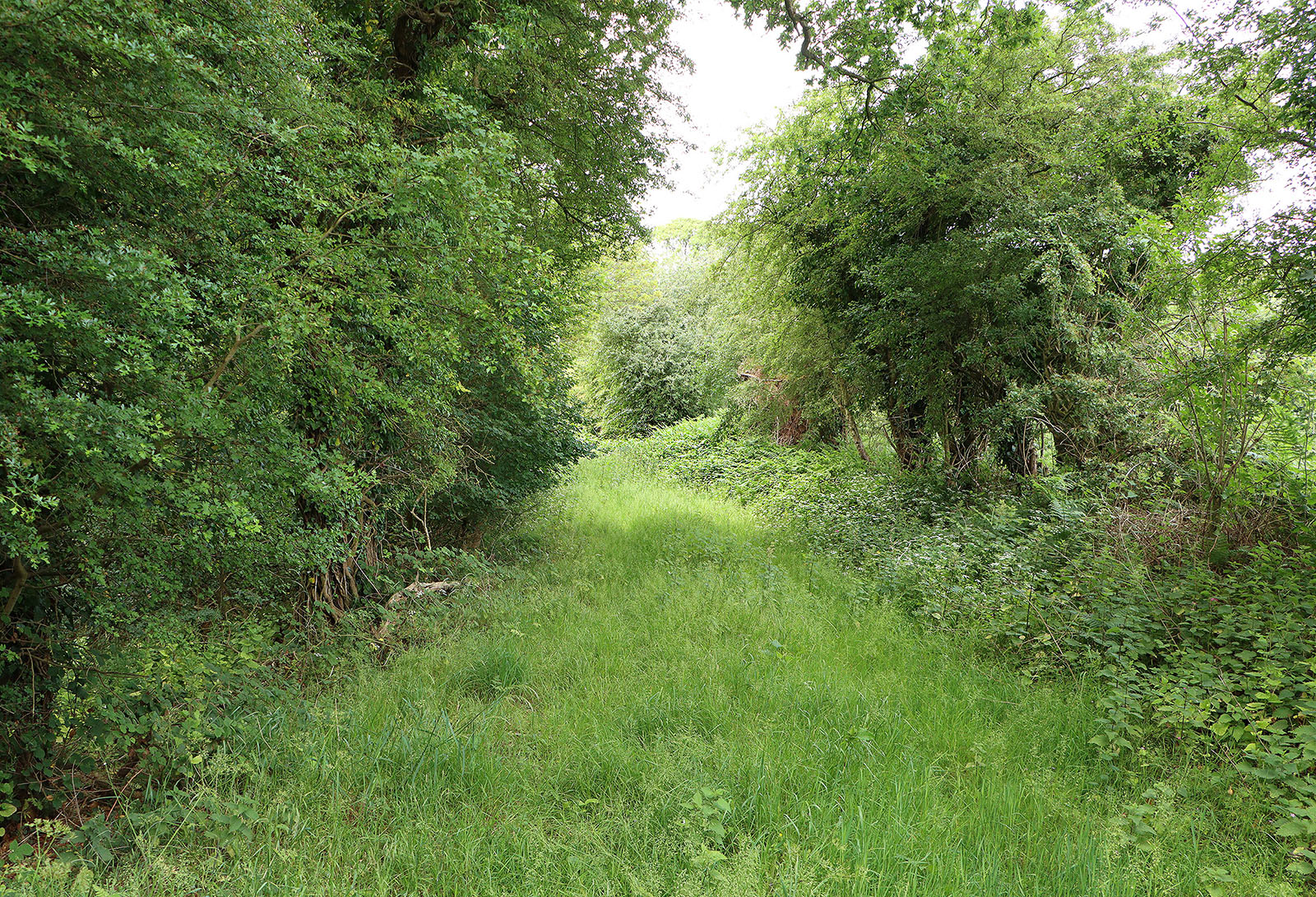
Old Road, Ling Plantation The old road can be followed through Ling Wood and Brickhole Plantation although in summer it is very overgrown. Image: DR |
Click for larger view |
 |
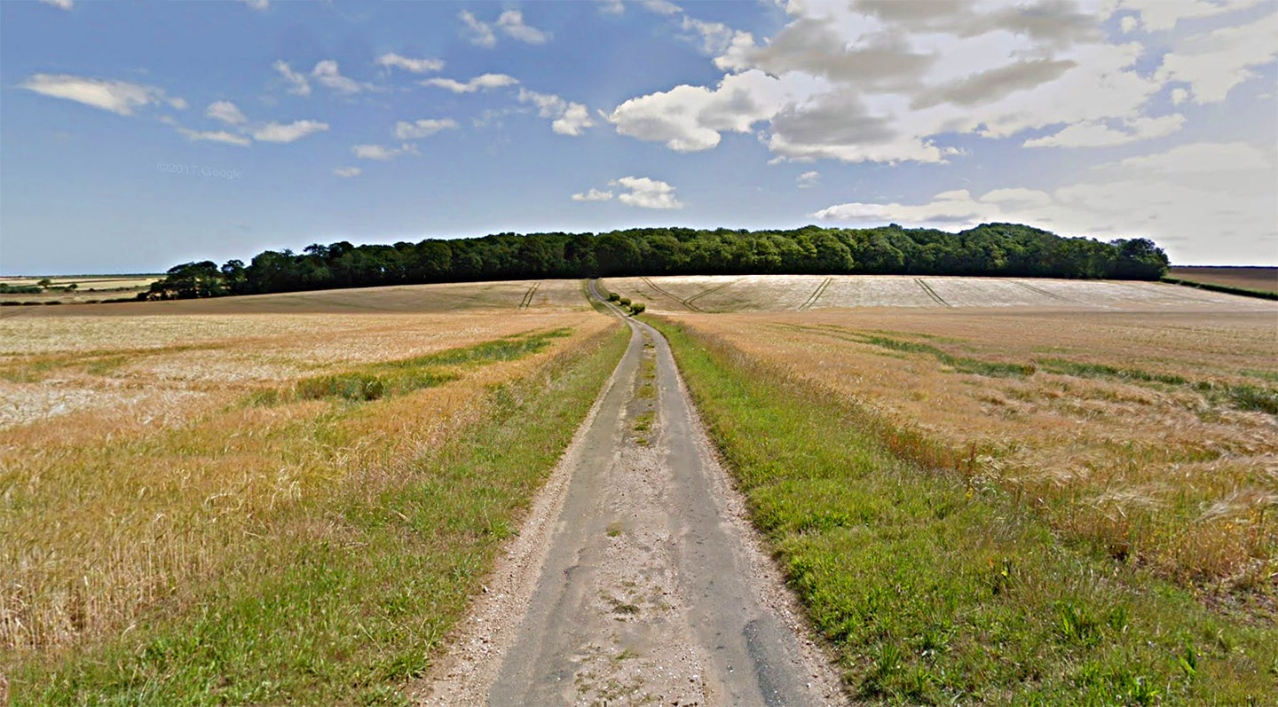
Choseley Lane, Thurnham Corner The overall width of the agger can be just about be made out by the yellower (parched) grass on the verges. Image: DR |
Click for larger view |
 |
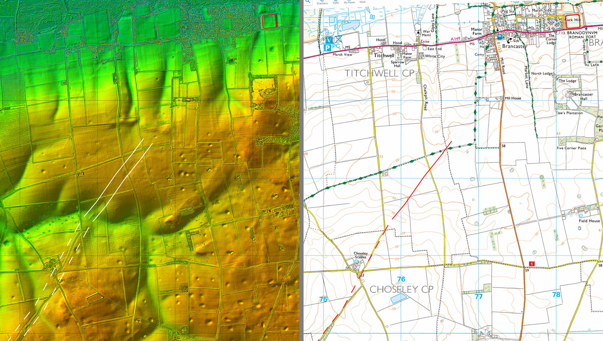
Lidar Image & Route Map 2 About 500 metres beyond Chalkpit Road the agger peters out and the final length to Brancaster is uncertain. Did it carry straight-on or turn north to join a possible east-west road into Brancaster? |
Click for larger view |
 |
|
|
|
Last update: June 2026 |
© David Ratledge |