|
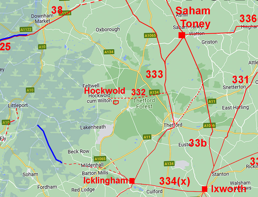
Possible Roman Road, Hockwold to the Icknield WayMargary Number: 332Distance: Approx. 7 milesThere was a large Roman settlement just to the east of Hockwold on the north bank of the Little Ouse River. Running east-west just its north is a straight road and the suspicion has always been that this could be a Roman Road. Margary thought so and made it his 332. He connected the road to Peddars Way but I can find nothing to support that.
|
Historic Counties: Norfolk Current Counties: Norfolk HER: Norfolk
|
|
|
|
|
|
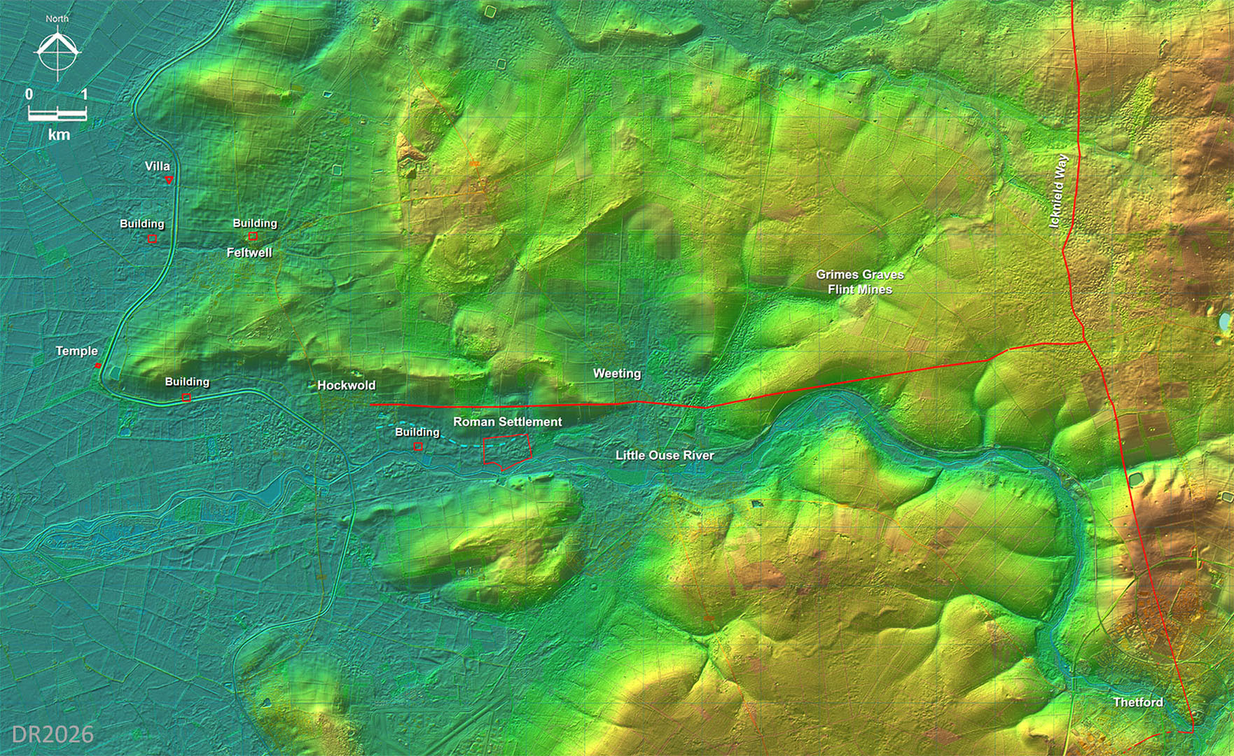
Full Route - Lidar Image and Opendata Map Hockwold settlement covered a large area and is sometimes described as a small town. Investigations have revealed an internal road system. So we have a long stretch of straight road and a large Roman settlement. Seems too much of a coincidence for the road not to be Roman in origin. The eastern extent of the road appears to continue beyond the traditional route for the Icknield Way as far as a possible second course for the Icknield Way. The second course has much more visible evidence.
|
Click for larger view |
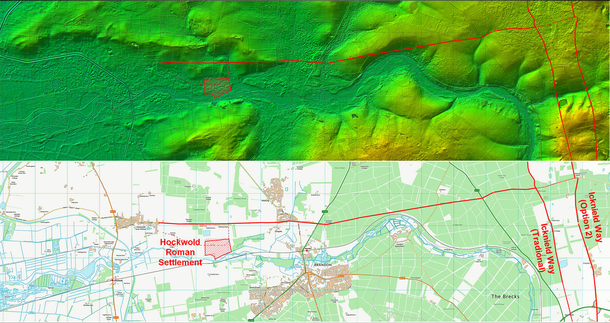 |
Lidar Image - Hockwold Area Two temples are known at Hockwold, one within the settlement and a second right on the edge of the Fens at Sawbench Wood (NHER5367). In addition several Roman buildings are recorded (Gurney, 1986, EEA31) including a villa with bathhouse. Surely there must have been a road serving this area? |
Click for larger view |
 |
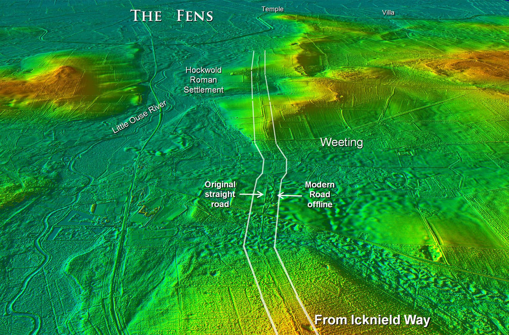
Oblique 3D Lidar Image - Weeting There is just one section where the modern road wanders offline and the original straight road is revealed. |
Click for larger view |
 |
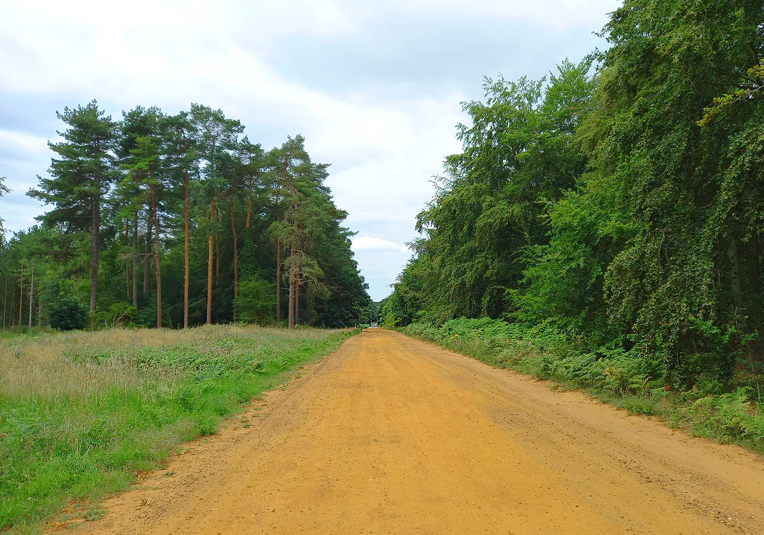
Harling Drove This is the long straight alignment through Thetford Forest known as Harling Drove. Little signs of an agger but it is used by modern traffic despite being unsurfaced. Norfolk HER states this could be of any age from pre-historic to modern - so that narrows it down! Iamge: DR |
Click for larger view |
 |
|
|
|
Last update: June 2026 |
© David Ratledge |