|
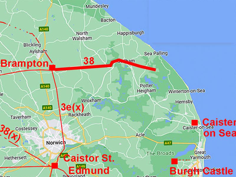
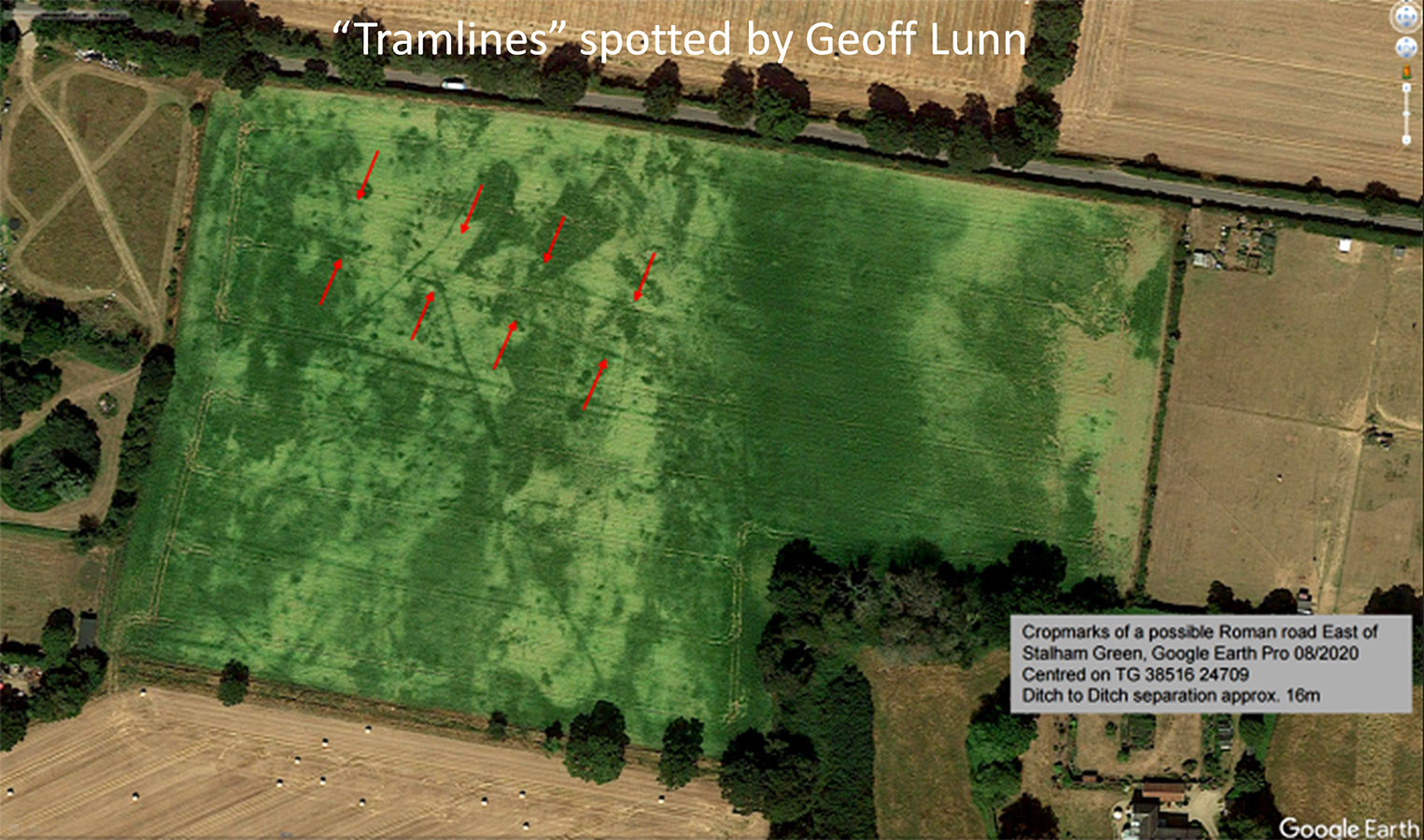
The Roman Road from Brampton to Hickling (Anchor Street)Margary Number: 38Distance: 14 milesThere was no doubt about the existence of the road - just its destination. Brampton was a a major pottery production centre so a connection with the sea for transport would have been highly desirable. The breakthrough came in 2025 when Geoff Lunn spotted “tramlines” in a field at Stalham. The "tramlines" were the tell tale sign of Roman road ditches, 16 metres apart as is normal for East Anglia. These were beyond the known end of RR38 but they did not point to Caister-on-Sea as everyone - me included – thought the RR would target. I was quickly able to extend this in Lidar imagery to Hickling, along what was clearly a Roman-era promontory into the sea (see English Heritage Roman coast map below). At the end of the road was what looks like a man-made harbour - wow! Norfolk HER: 2796 (they regard RR38 as part of the Fen Causeway which is pushing it a bit) |
Historic Counties: Norfolk Current Counties: Norfolk HER: Norfolk
|
|
|
|
|
|
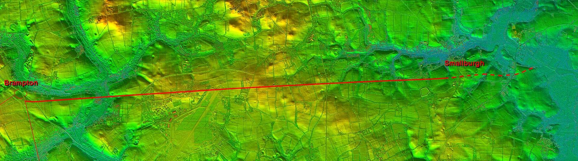
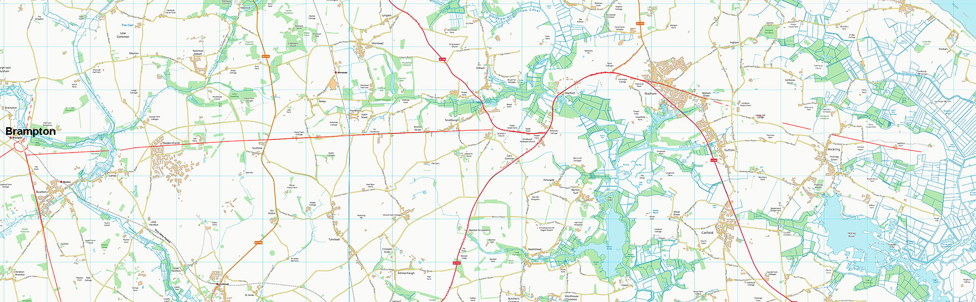
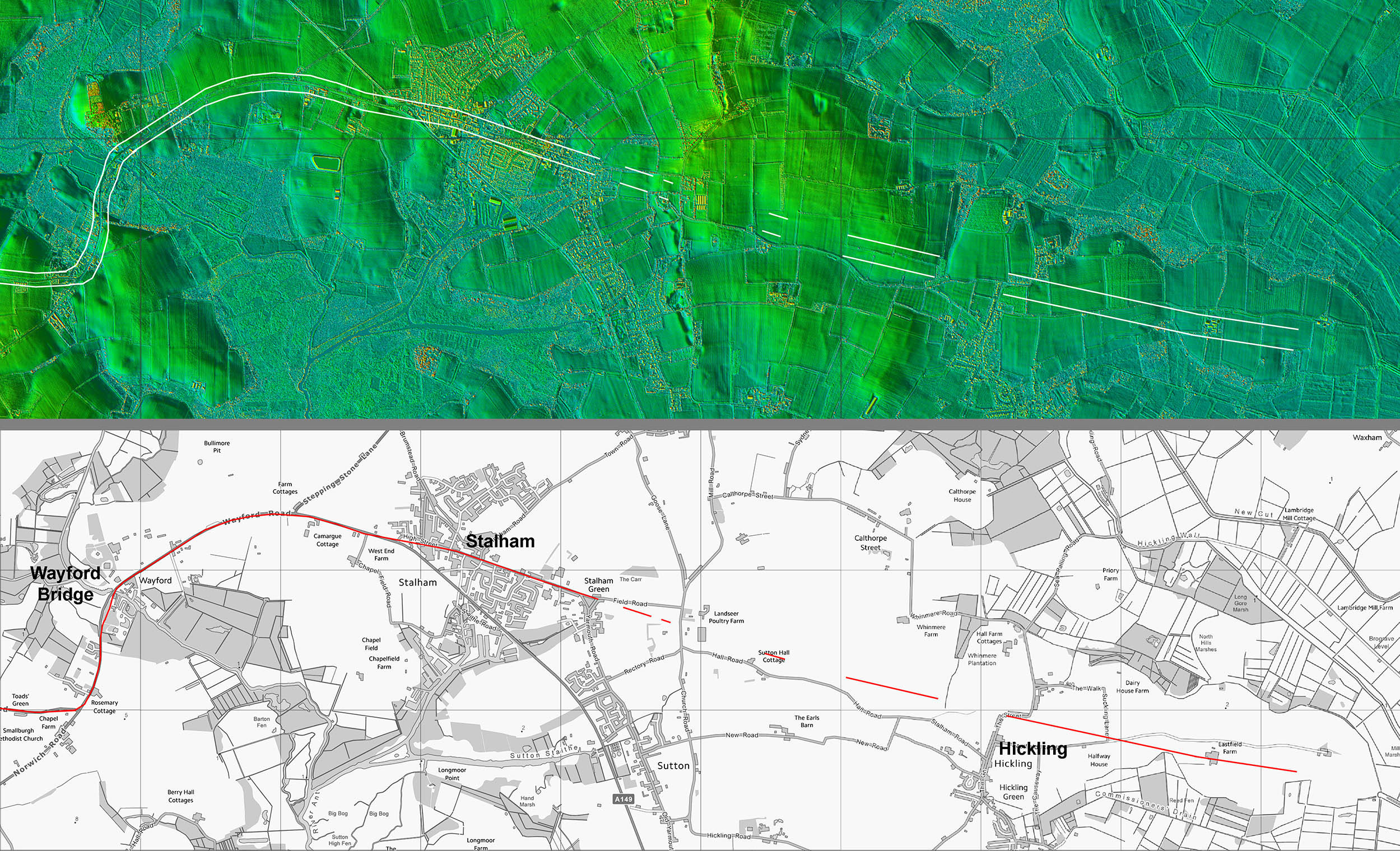
Lidar Image - full route This Lidar image explains the logic behind this road. The name Anchor Street was perhaps always a clue - road heading for an anchorage?.The big swing at Wayford Bridge was perfectly logical given the low lying terrain.
|
Click for larger view
|
 |
VIDEO FlyoverFly the full route in this Lidar video
|
||
Route Map - OS Opendata Equivalent map to above.
|
Click for larger view |
 |
River Bure Crossing - Lamas No sign of a causeway across the marsh but on the east bank is a straight footpath with all the indications of it being a well engineered road. In places - near the big tree - it is built up on its southern side around 1.5 metres. The north side has a ditch but this has been re-dug in place. Out of keeping with the other farm tracks here and as it aligns reasonably well with traces further east there can be little doubt that this is indeed the Roman road. Images: DR |
Click for larger view |
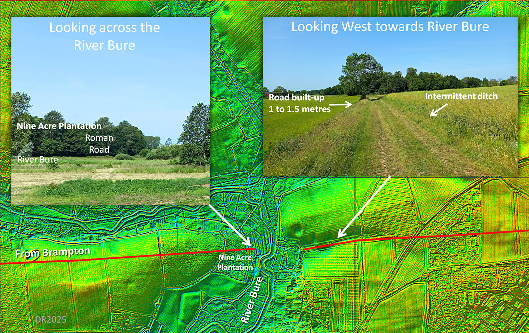 |
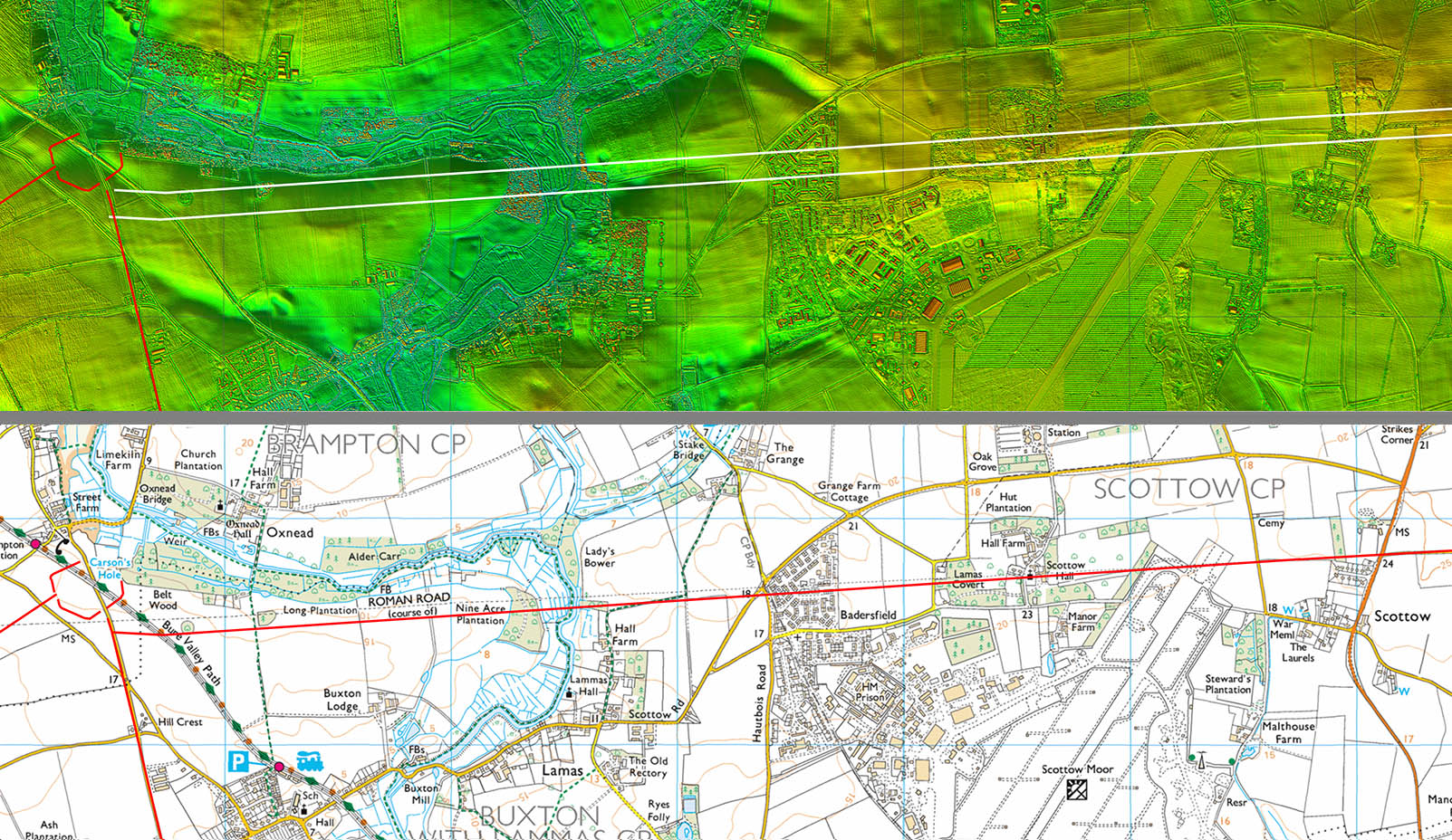
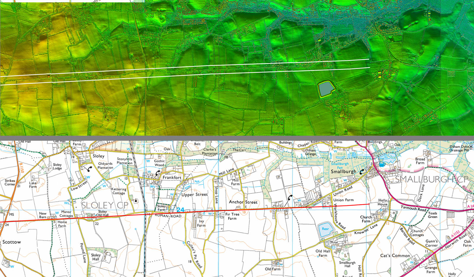
Lidar Image and Route Map 1 - Brampton to Scottow Lidar indicates that the route to the River Bure and Scottow is almost certainly further south than where OS maps show it. Across the River Bure then we head for Anchor Street. |
Click for larger view |
 |
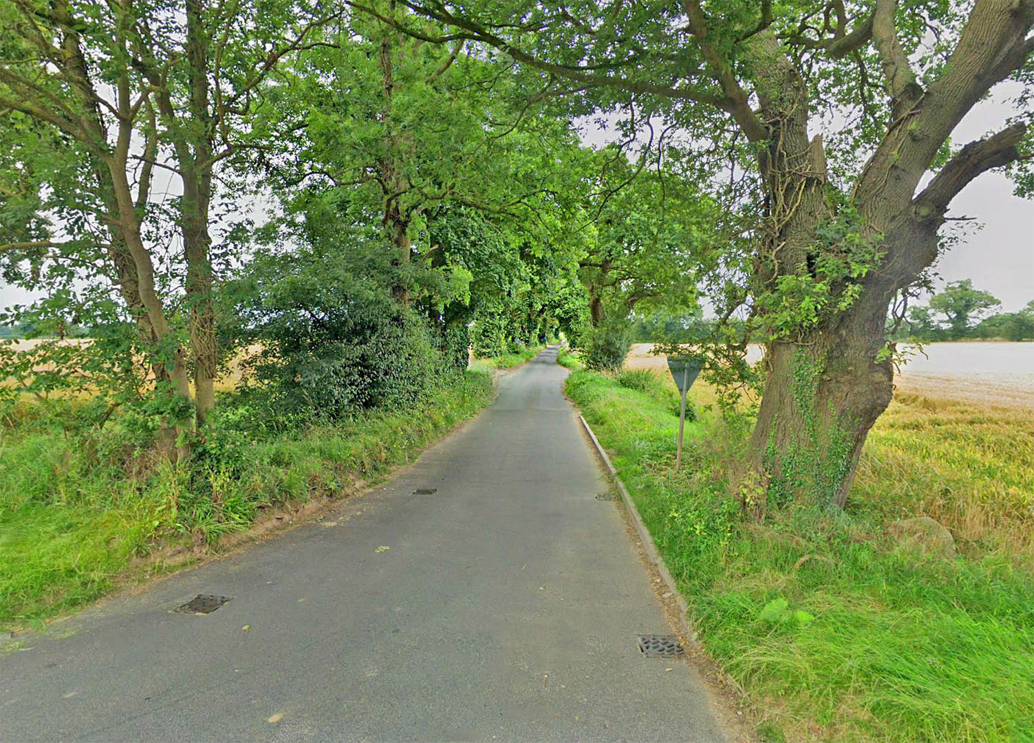
Anchor Street 1 Anchor Street today is relatively narrow compared to what it must have been in Roman times. Don't worry that Anchor Street wanders around a bit. This is typical for 2000 year old roads. Over the centuries little deviations occur. The name is perhaps suggestive the road went to a harbour and guess what - it did.. Image: GoogleEarth |
Click for larger view |
 |
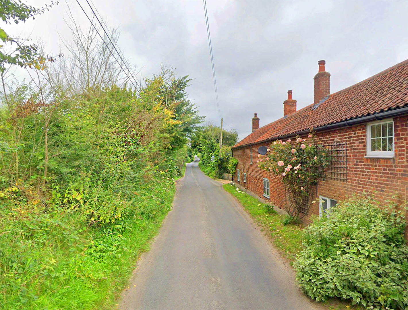
Anchor Street 2 We are nearing Smallburgh here on Anchor Street. Image: GoogleEarth |
Click for larger view |
 |
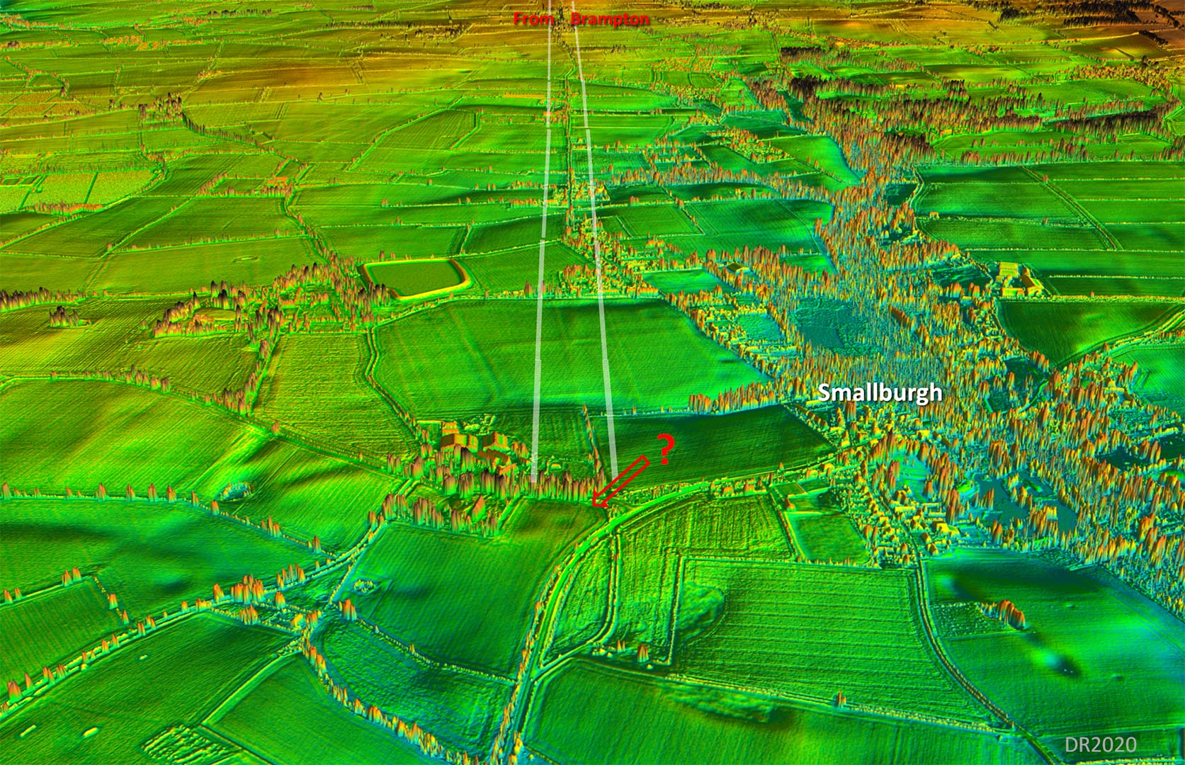
Oblique 3D Lidar Image - Smallburgh looking back Looking back along Anchor Street towards Brampton.
|
Click for larger view |
 |
Lidar Image and Map 2 - Scottow to Smallburgh This stretch is mostly overlaid by the modern Anchor Street but the lidar data carries on to Smallburgh. |
Click for larger view |
 |
Oblique 3D Lidar Image - Smallburgh looking ahead to Stalham Wayford Bridge is the only practical crossing point for the River Ant. Our road had to take a somewhat circuitous route to get to it but perfectly logical. It keeps to high (dry) ground from Brampton for the approach to the bridge. |
Click for larger view |
 |
Old Road to Wayford Bridge Wayford Bridge was rebuild in the 1960s and the road realigned. This is the original road to the bridge, now bypassed. As the older route then this probably represents the Roman line. Image: GoogleEarth |
Click for larger view |
 |
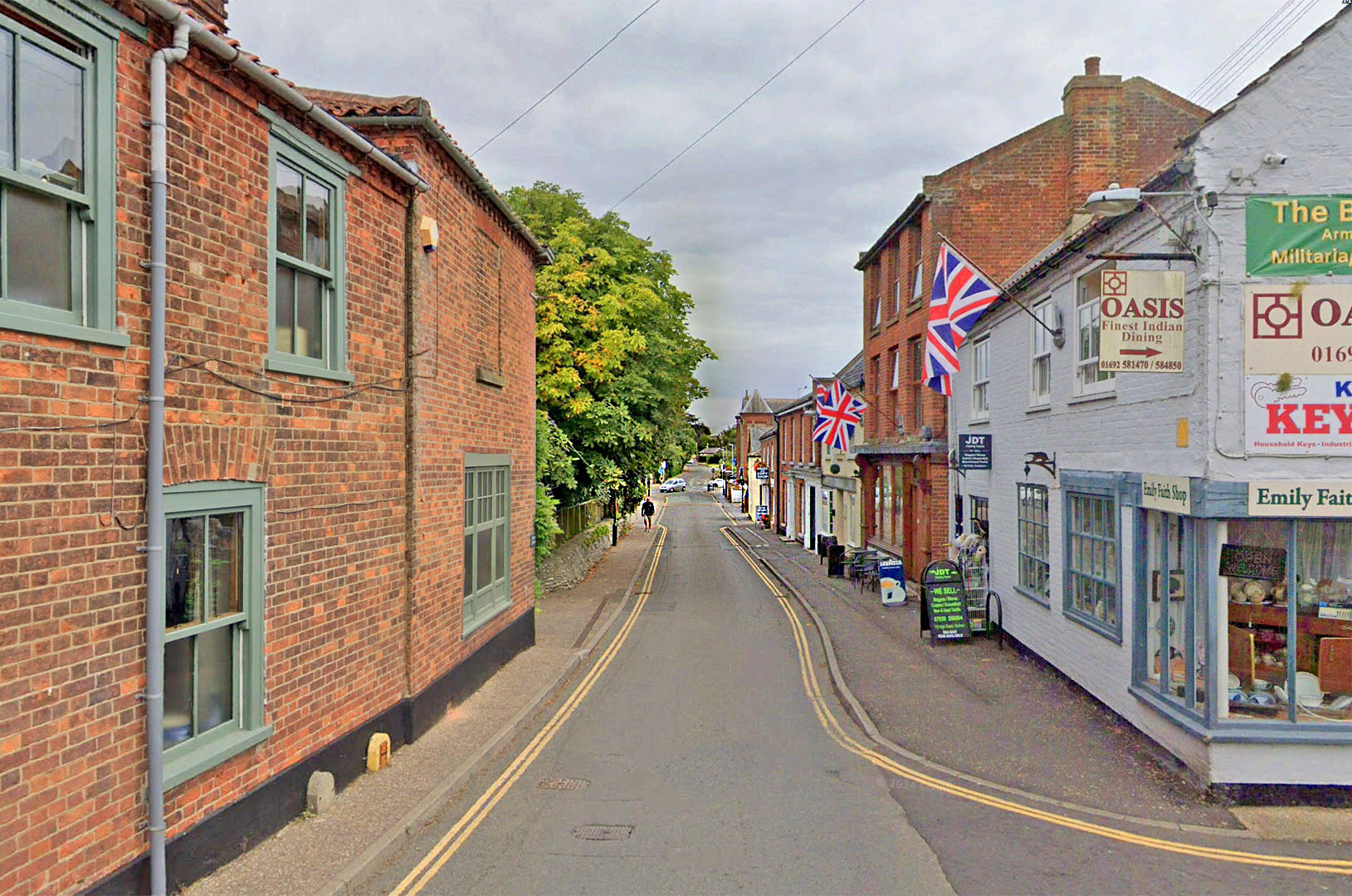
Stalham High Street The main road through Stalham is the Roman road. Image: GoogleEarth
|
Click for larger view |
|
Stalham Green - Roman Road Ditches (tramlines) Just beyond the Stalham was where Geoff Lunn first spotted the tell tale signs of the Roman road crossing a field in aerial photographs. Commonly known as "tramlines" these are the Roman road ditches. This was the big clue that the road was not heading for Caister-on-Sea but to presumably the Roman coastline.
|
Click for larger view |
 |
Oblique 3D Lidar Image - Stalham to Hickling It was relatively easy - if you know what you are looking for - to extend the alignment from Stalham all the way to Eastfield Farm at Hickling. Yes the traces are faint but this is exactly how Roman roads appear in Norfolk. All the bumps line up! |
Click for larger view |
 |
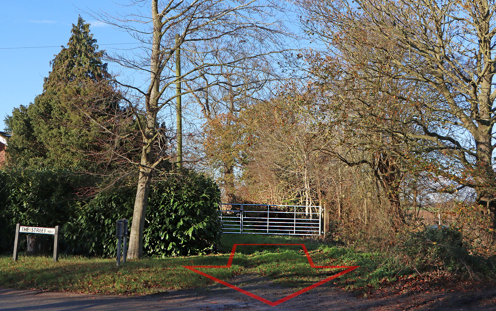
The Street, Hickling The Street in Hickling is not actually the Roman road but at its northern end then the road can be found. Beyond the gate the old track marks the Roman line. Behind us is High Hill (road) which drifts off the line, the Roman road divergies at a shallow angle on its southern side. The area is known as Town Street, presumably named after our road. Image: DR |
Click for larger view |
 |
English Heritage Roman Coastline Map - road network overlaid This English Heritage map of the Roman coastline has had our Roman roads overlaid. This clearly shows the road was heading for a coastal destination - at least on the coast in Roman times. |
Click for larger view |
 |
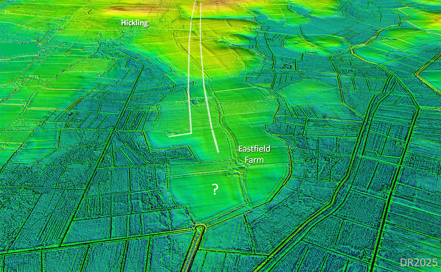
Lidar Image with contours - probable Roman Harbour at Eastfield House, Hickling The road did not head down the centre of the promontory but aimed more to its south side. Sure enough just where it appeared to end were the clear signs of a harbour. This detailed harbour view, with contours added, makes it obvious how regular and man-made this is. Look how even the contours are around the harbour. Note also the branch road down to it The location might seem odd not at the end of the promontory but not when you realise this would give considerable protection from the North Sea and the “beast from the east winds” we get here. Very sensible location. Clearly we have no dating evidence but it is precisely at the end of a Roman road. The roads and the harbour are clearly contemporary. And of course the sea was only here way back then. Note: the end of the road and the harbour are on private land. Please respect this. |
Click for larger view |
 |
Oblique 3D Lidar Image - Eastfield House, Hickling Very clear in this view is a road branching off (to the left) the main Roman road heading down to the harbour. This lends support for the harbour being Roman - their roads link to it. There is also something going on in the field at the end of the promontory (see question mark) – I cannot make my mind up as to what the features represent.. Surely it all has to be a Roman port. |
Click for larger view |
 |
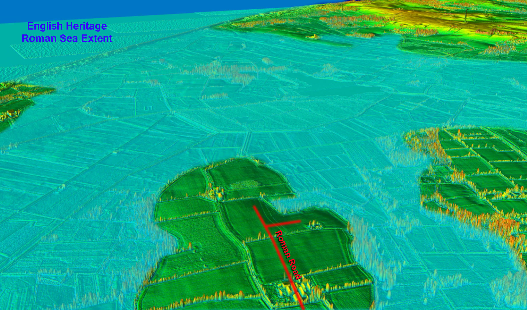
Oblique 3D Lidar Image - Historic England's Roman Sea Extent added I have overlaid English Heritage's Roman coastline. Why did the Romans build a 14 mile road to this promontory? It can only have been for a sea connection. The suggested harbour would therefore make perfect sense. |
Click for larger view |
 |
Lidar Image and Map 3 - Wayford Bridge to Hickling The "new" section crosses the River Ant at Wayford Bridge, heads on through the middle of Stalham and straight on to Hickling, |
Click for larger view |
 |
|
|
|
Last update: November 2025 |
© David Ratledge |