|
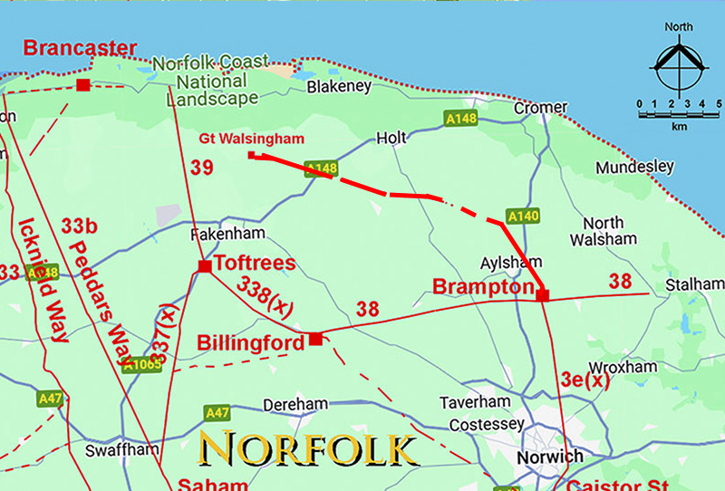
The Roman Road from Brampton to Great WalsinghamMargary Number: NoneDistance: 21 milesA "new" road discovered in 2025 largely by David Staveley. The first alignment was spotted by Geoff Lunn in 2024. So the north of Norfolk was not ignored by the Romans after all. The scale of the roadworks at Hunworth plus the embankments across many valleys indicates this was a road of major importance. Great Walsingham is an enigmatic site, apparently with no surviving building remains although what appears to be the street grid does show up in Lidar - see below. There is a huge scatter of Roman material over a very large area. Many of the finds strongly suggest a religious site. So it would seem Walsingham has been a religious destination for 2000 years! A feature of this road is the large aggers or causeways across valleys, at least 12 of them. I have not come across this before, well at least not to this extent. The Roman road engineer wanted to keep his feet dry! |
Historic Counties: Norfolk Current Counties: Norfolk HER: Norfolk
|
|
|
|
|
|
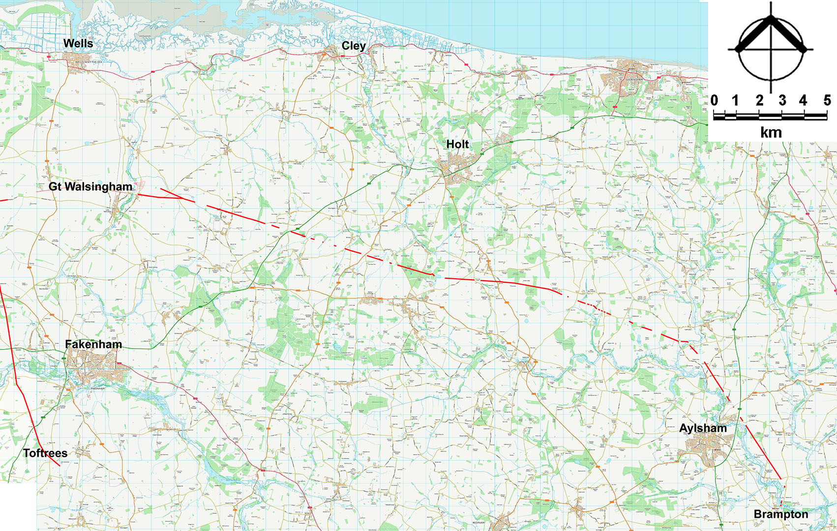
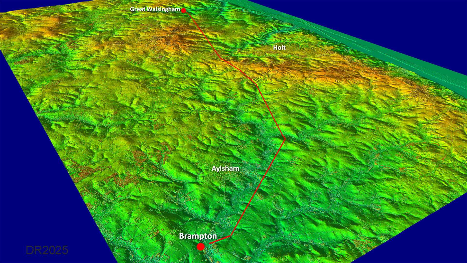
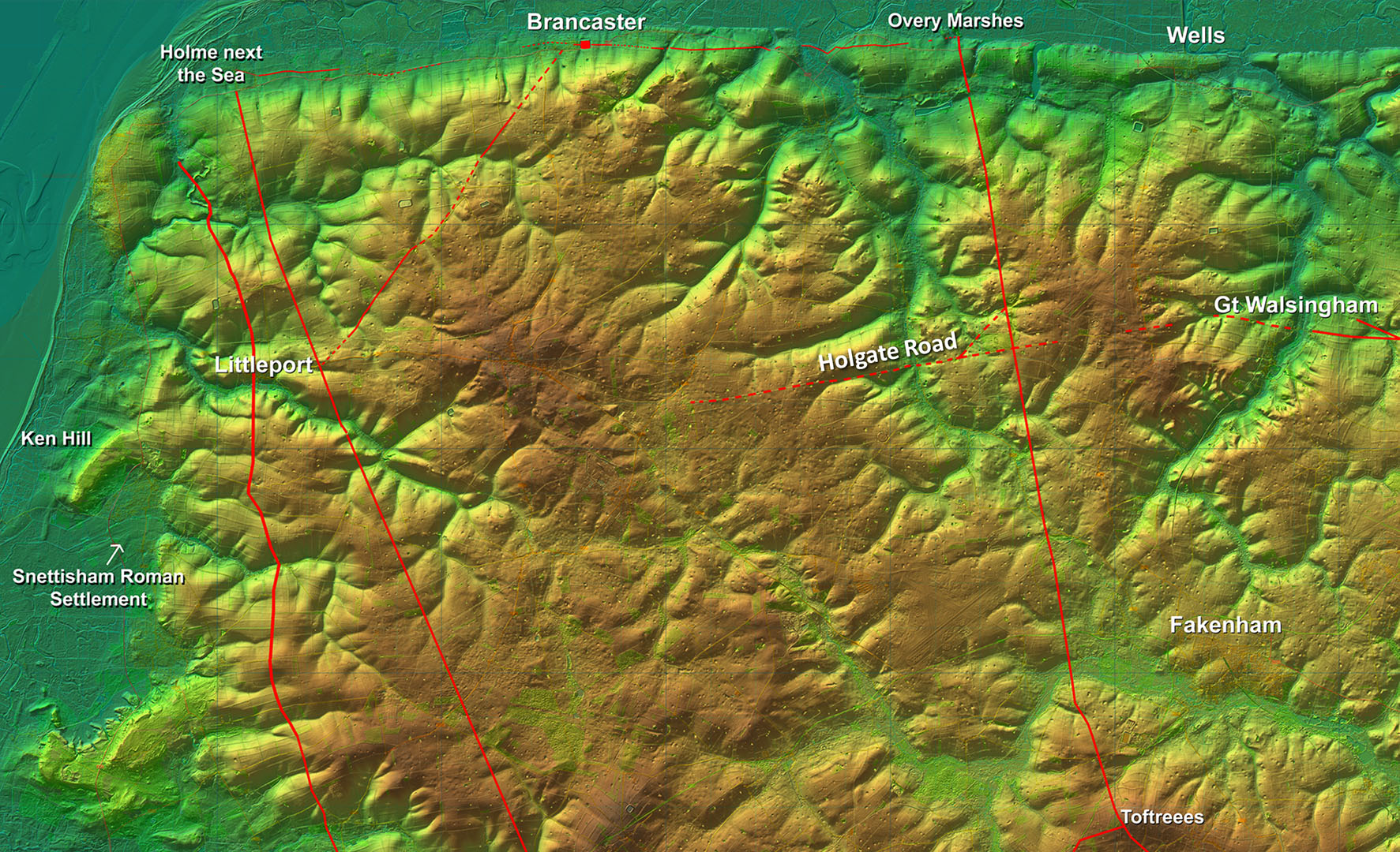
Full Route Map Not a straight line and the route implies it was important to skirt around the Bure Valley. It also could be as a result of the first main alignment targeting the possible Roman settlement at Scarrow Beck. After the latter it is pretty direct to Great Walsingham. Did the first alignment carry onto the north coast? Some clues but more work needed. |
Click for larger view
|
 |
VIDEO FlyoverFly the route in this DTM Lidar video
|
||
Oblique Lidar Image - Full Route Does look like the small settlement(?) at Scarrow Beck was indeed the first target. |
Click for larger view
|
 |
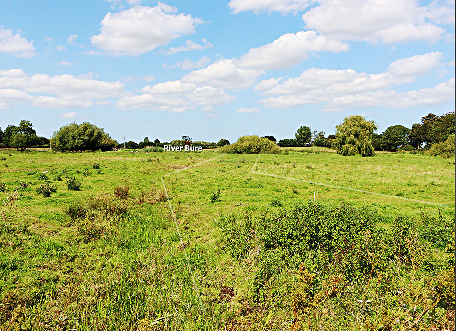
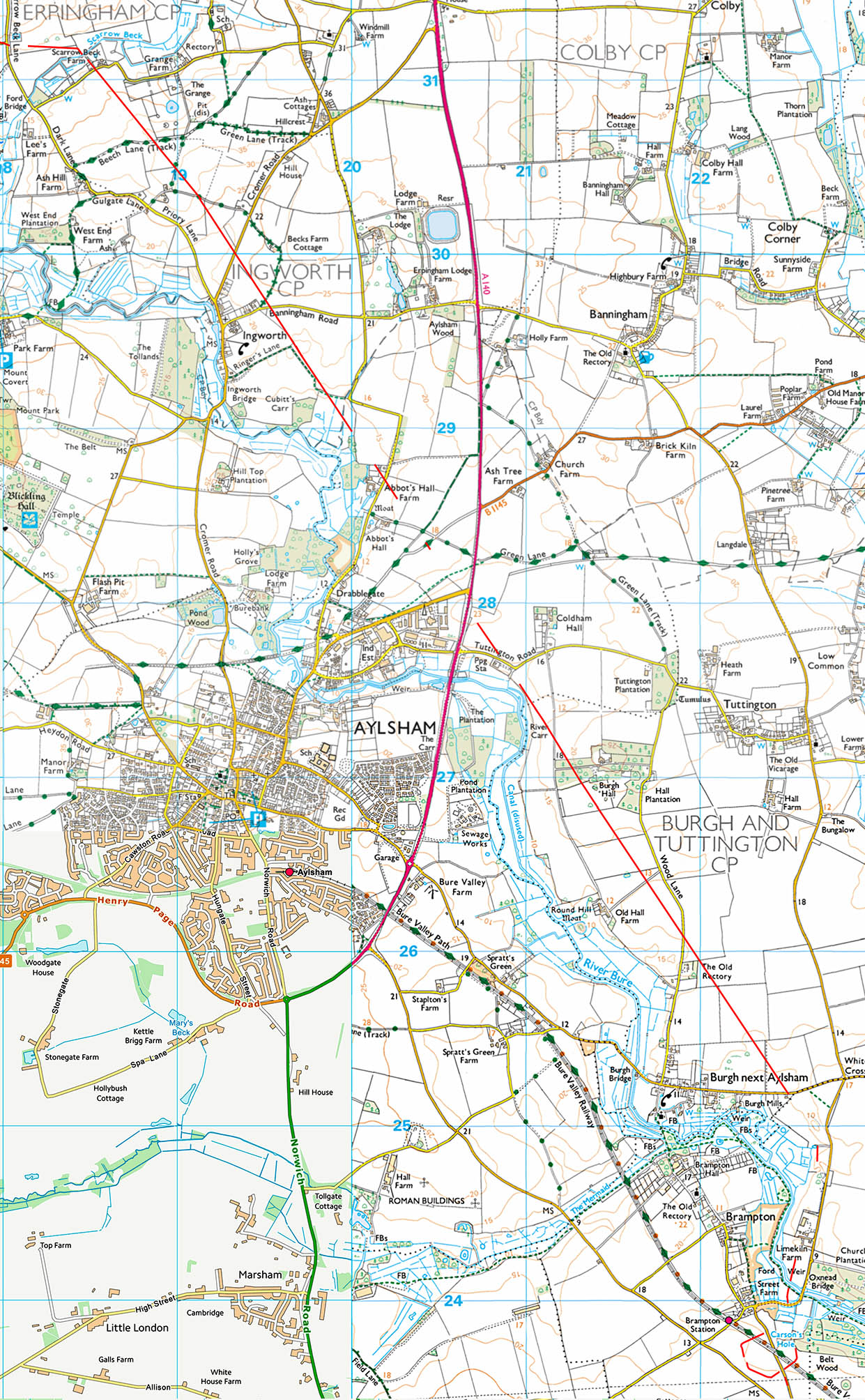
Leaving Brampton Possibly the first visible trace of the road is heading down to the River Bure on the Brampton side. The ditch is probably the Roman west (left) ditch. This field is part of Street Farm. Image: DR |
Click for larger view
|
 |
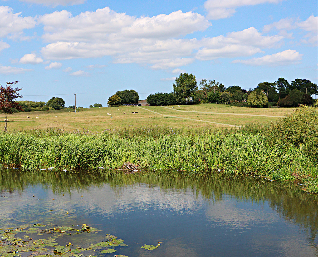
River Bure - looking towards Limekiln Farm, Oxnead Lidar shows a very faint agger here but much too low to notice on the ground. However, the grass over the road is somewhat greener indicating the road's approximate course. Beyond the farm there has been much quarrying, presumably marl for the lime kilns. This has destroyed any evidence for the road. Image: DR |
Click for larger view
|
 |
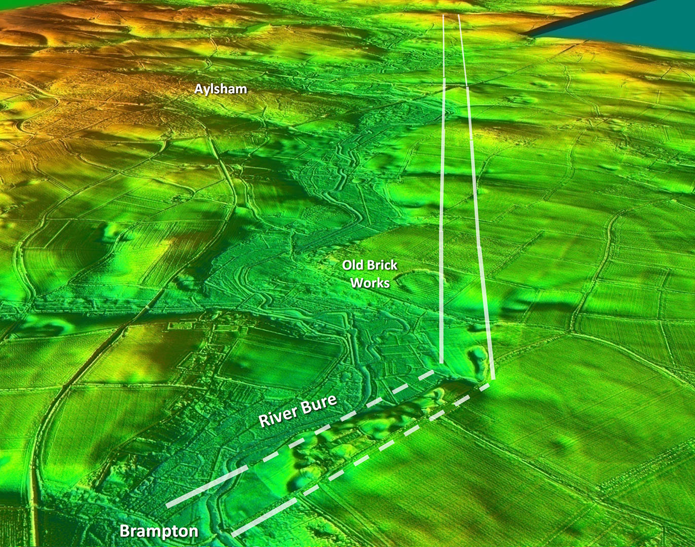
Oblique Lidar Image - Brampton to Scarrow Beck The alignment to Scarrow Beck was first spotted by Geoff Lunn using aerial photographs. He presented his findings to the members of Caistor Roman Project in summer 2024. The route avoids the Bure valley and heads directly to a possible small Roman settlement at Scarrow Beck. |
Click for larger view |
 |
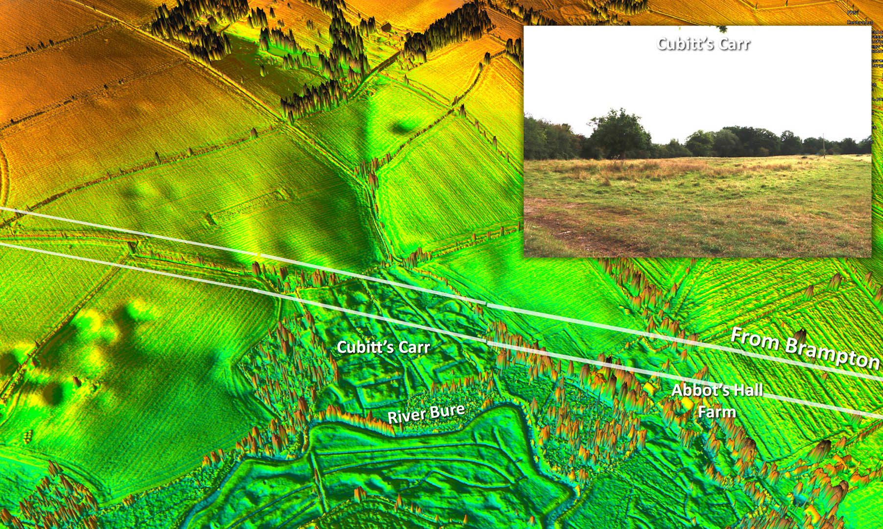
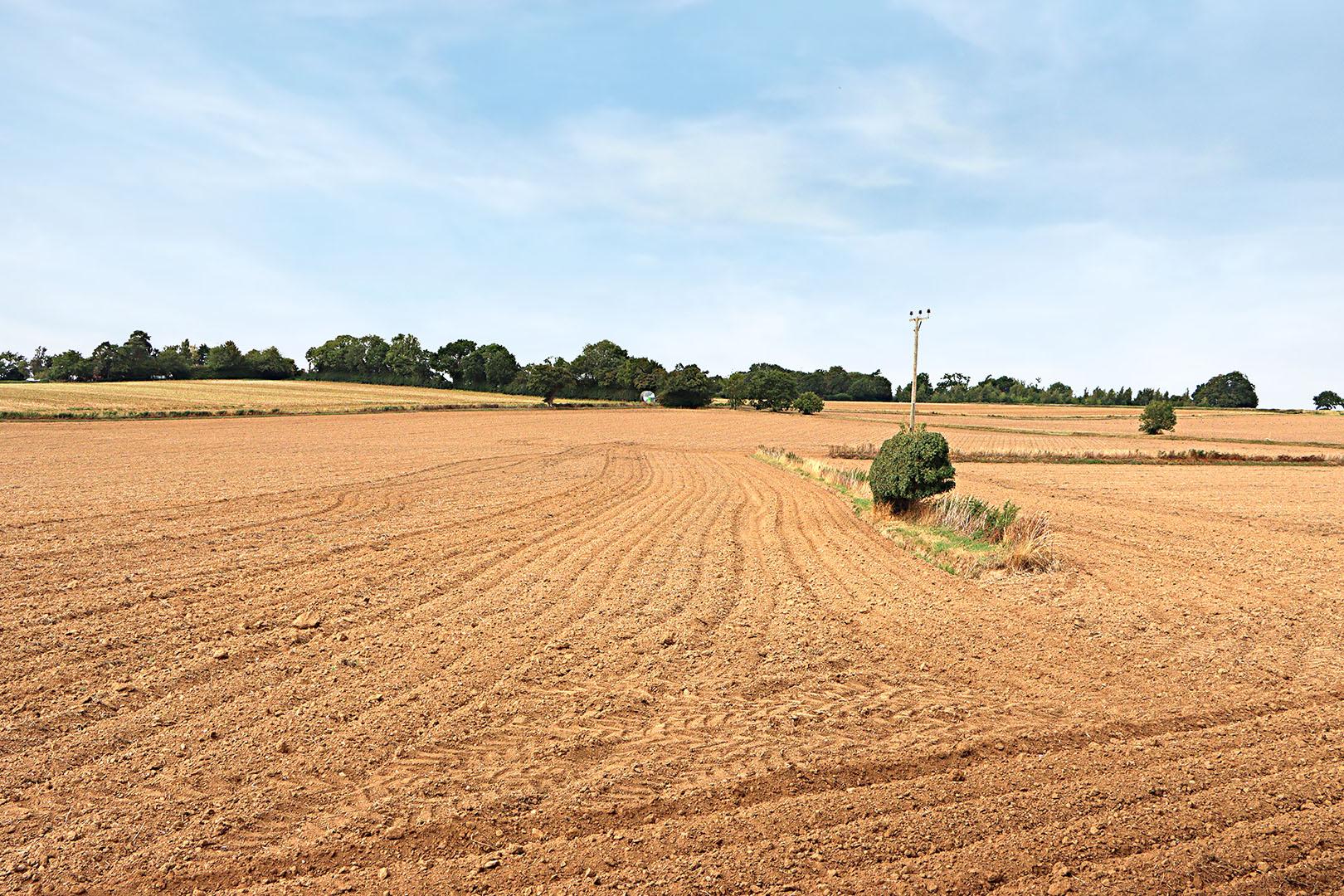
Oblique Lidar Image - Cubitt's Carr The straight alignment of the road crosses Cubitt's Carr, a drained marshy area. I first assumed the road would skirt around it but no, the Romans built an agger straight across it. It is clear, although disturbed, in the Lidar image but difficult to make out on the ground (inset). Inset Image is looking back towards Brampton down the line of the road. Image DR |
Click for larger view |
 |
Ingworth - Stone Scatter by Cromer Road (TG19318 30037) The alignment to Scarrow beck has suffered hugely from ploughing damage. Here at least we can see the stone scatter created by modern ploughing. There is just one big stone surviving - probably an edging stone. The mini hedge is the road's right (east) ditch line. Image: DR |
Click for larger view |
 |
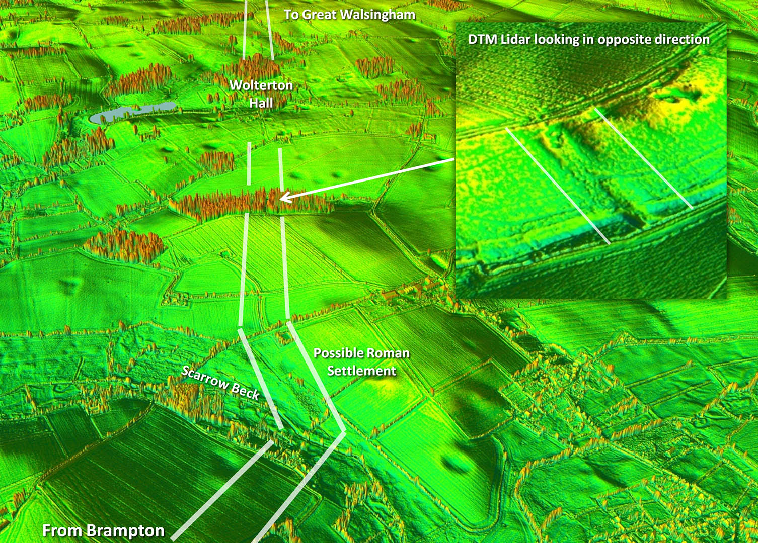
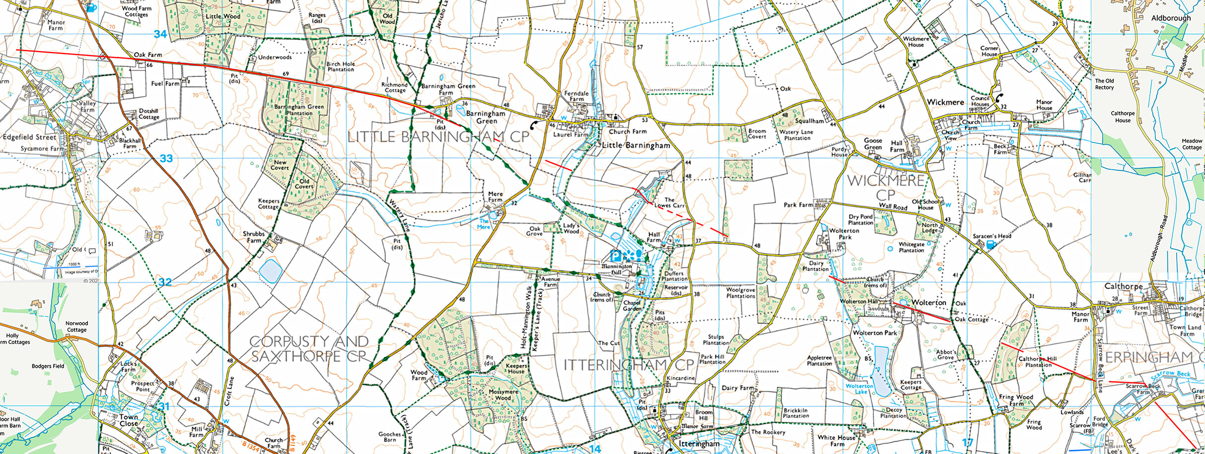
Oblique Lidar Image - Start of Alignment 2 The road turns at Scarrow Beck and passes under Wolterton Hall. Approaching the hall is a lovely cutting and embankment surviving at Calthorpe Hill (inset and see below). |
Click for larger view |
 |
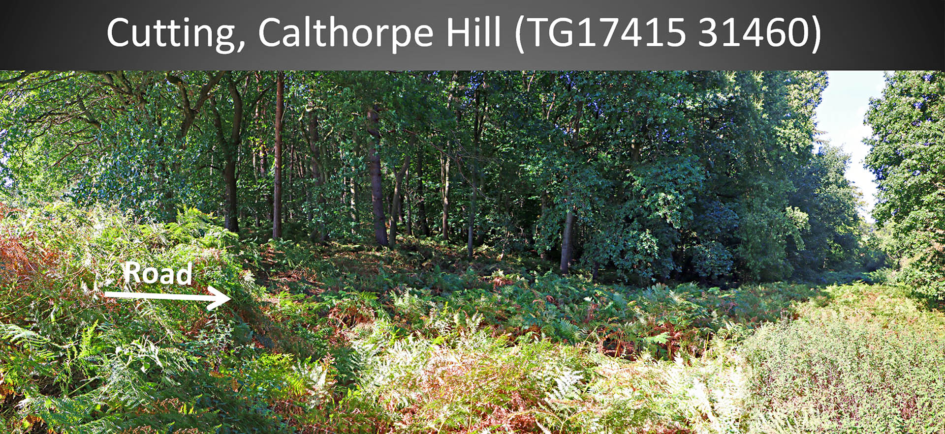
Cutting, Calthorpe Hill Looking down the cutting towards the embankment at the bottom. The undergrowth was impenetrable so couldn't get any further. It was quite a feat to get this far. The cutting is huge and I guess so is the embankment but that was well out of reach. Image: DR |
Click for larger view |
 |
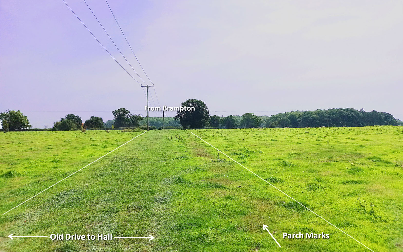
Approaching Wolterton Hall We are looking back to Brampton here with the hall behind us. There was an old drive here still just about evident but to its right (south) is evidence of parch marks, indicating that the road was much wider originally. There is some Lidar support for this so I am pretty certain this is the Roman road. Image: DR |
Click for larger view |
 |
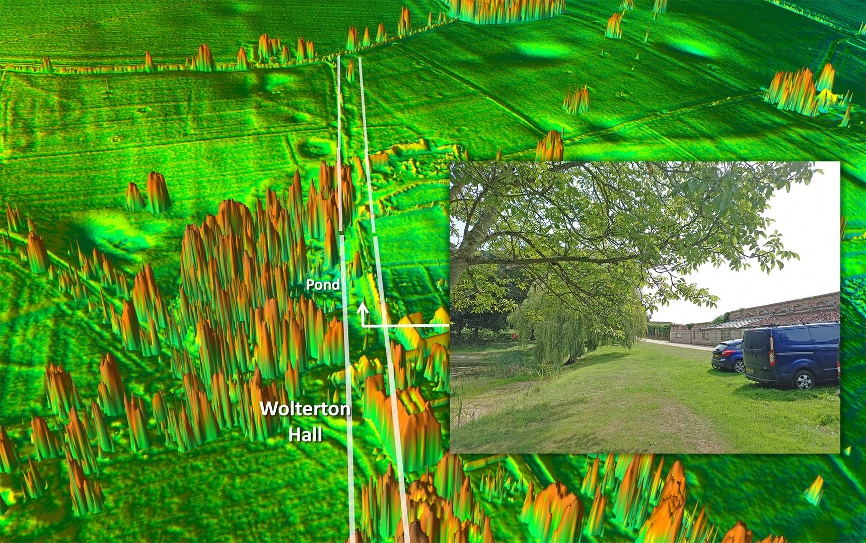
Wolterton Hall - Duck Pond embankment with Parched Agger There was a little valley here with now a duck pond on its northern side. The embankment passing the duck pond is just like the dozen others on this road so pretty certain to be Roman. However, it is much upgraded now for parking on it southern side but by the duck pond we can see the parched remains of the Roman agger. We are looking back towards Brampton in these views. Image: DR |
Click for larger view |
 |
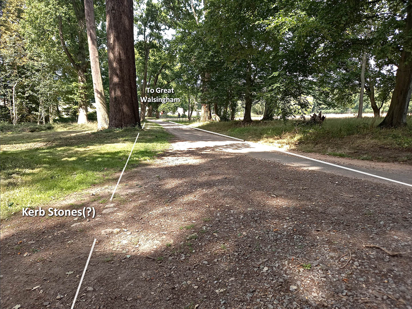
Wolterton Hall - towards the Dairy Pond The road comes out the woods behind the camera and runs along the modern track to the dairy pond. Here are exposed what I take to be original kerb stones. They are the only large stones I saw anywhere and are in the correct position. For Norfolk with little natural stone I would guess the Roman road would comprise kerb stones with river gravel for the road between them forming the agger. Image: DR |
Click for larger view |
 |
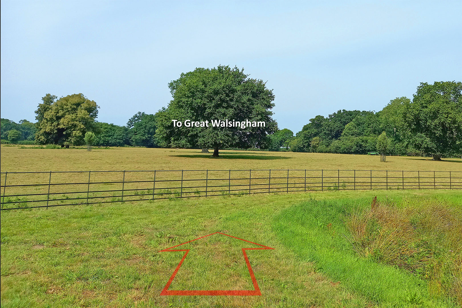
Wolterton Hall - beyond the Dairy Pond Having passed the Dairy Pond the road leaves Wolterton across this field. I had hoped to see parch marks given the hot summer but nothing was visible. All we have is a slight swell in the metal fence as it rises and falls over the road. A bit subtle I admit. Image: DR |
Click for larger view |
 |
Oblique Lidar Image - Beyond Wolterton Hall Some of those large aggers/causeways mentioned in the introduction. The inset example could have been the Roman road agger made into a dam for a mill(?). See below for the significance of this spot. |
Click for larger view |
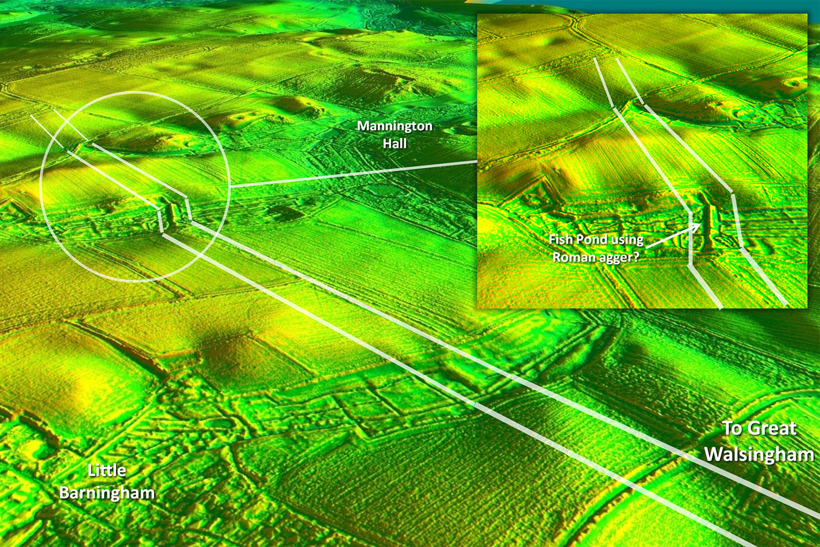 |
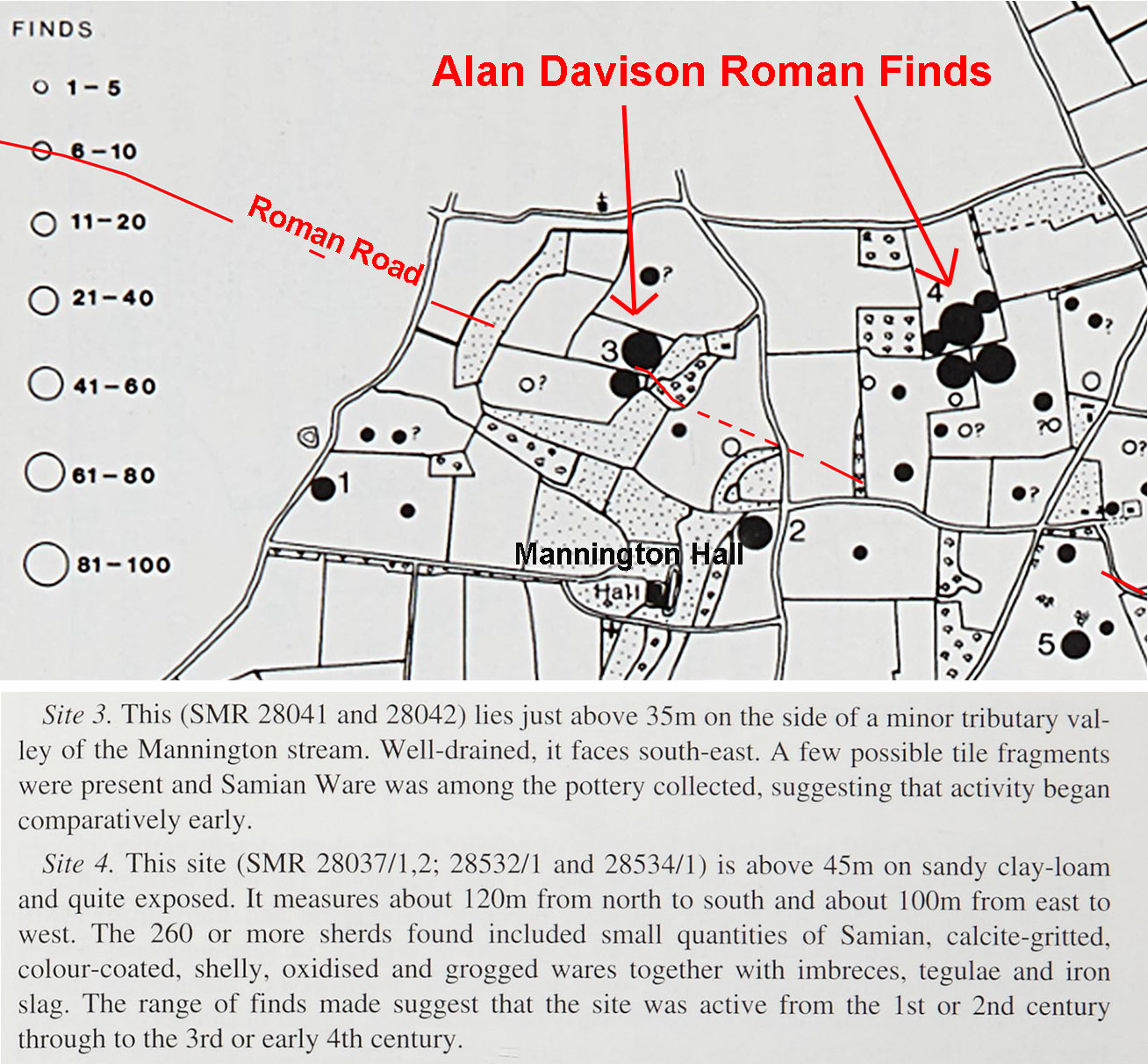
Roman Sites alongside the Roman Road near Mannington Hall Fieldwalking in the early 1990s by Alan Davison revealed several Roman sites alongside the road. He was unaware of the Roman road of course.. Probably the most significant were sites 3 and 4. The finds recorded are listed below. Site 3 is where the road crosses a stream valley. The Norfolk HER paints a very confused picture for this spot with several theories - none of them convincing and none of them Roman. In fact Davison's finds are not even mentioned. In view of the substantial Roman finds at site 3 there can be little doubt the agger across the valley was Roman in origin, perhaps adapted later for a dam. Site 4 is off the road line, perhaps where you would expect a villa to be - just a guess. Those finds there include Roman roofing tiles so a building of some sort at least. Reference: Alan Davison, The Field Archaeology of the Mannington and Wolterton Estates, Norfolk Archaeology, Vol.42, p160-184.
|
Click for larger view |
 |
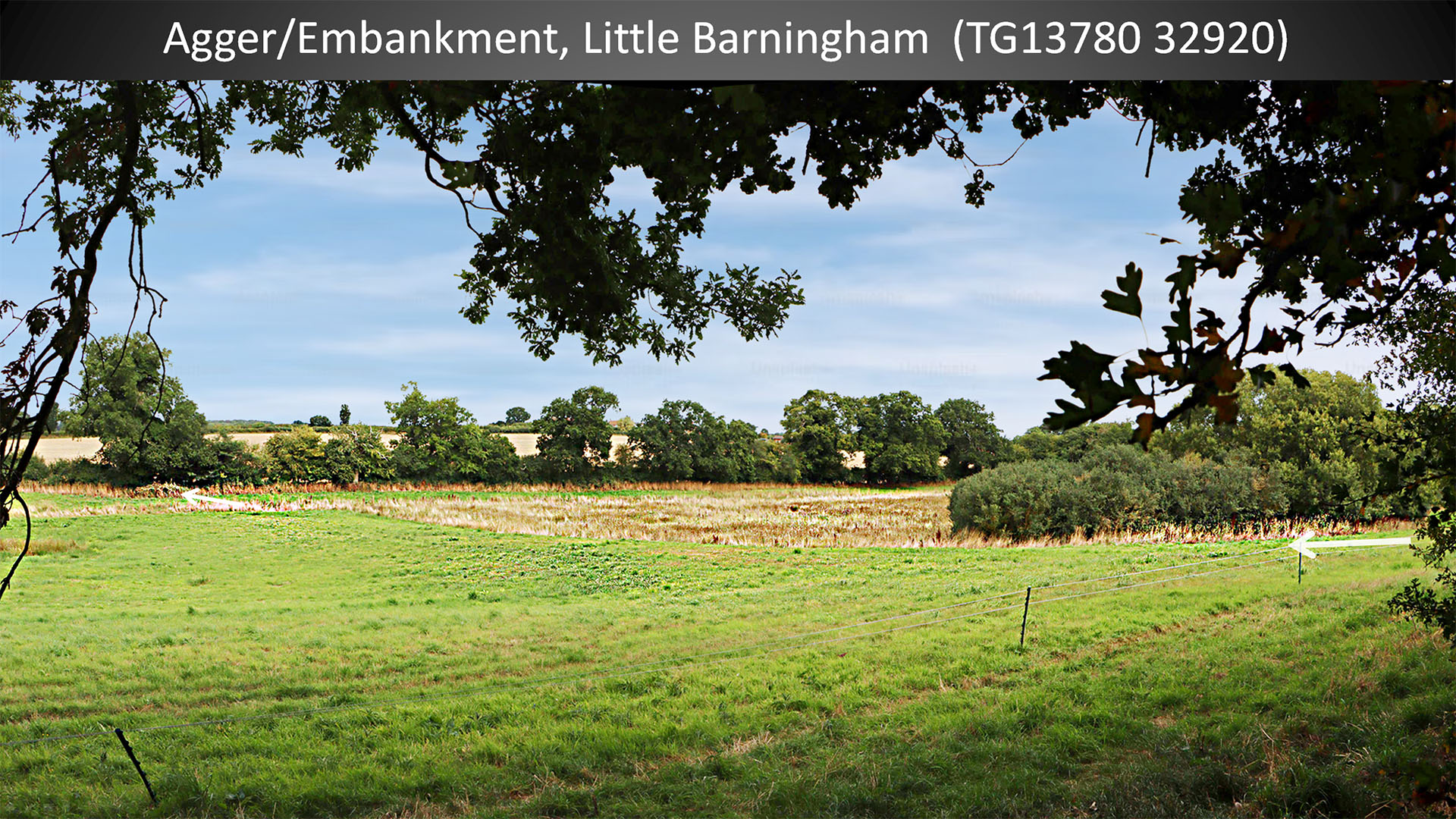
Agger/Embankment - Little Barningham This was the next embankment across a valley I was able to get access to and I wasn't disappointed. You can see how it has formed a low dam and the ground beyond it is covered in marsh grass. There even looks to be a bit of parched ground on the line too. Image DR
|
Click for larger view |
 |
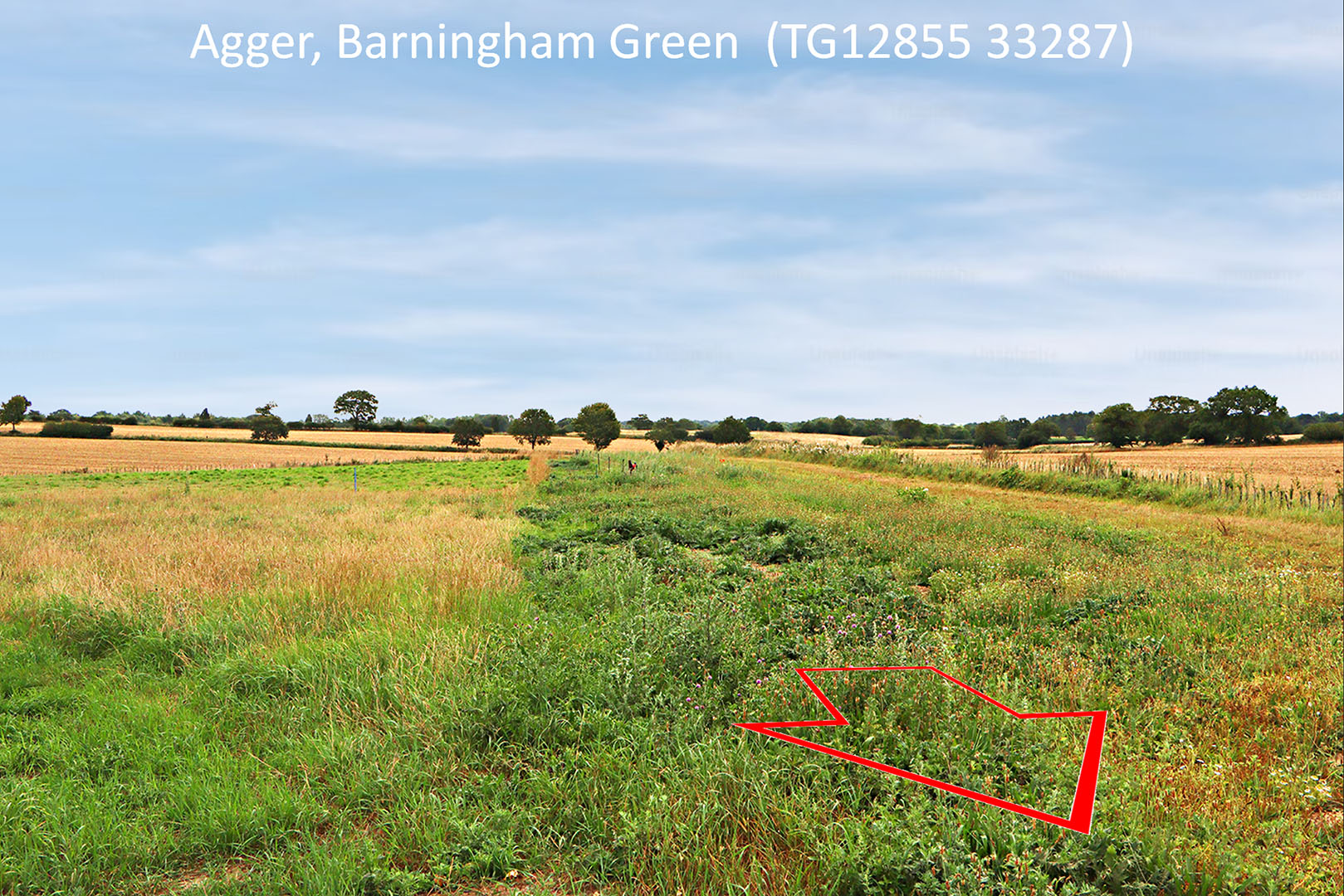
Agger - Barningham Green Looks like the agger has been used to dump manure - hence the very green growth on the agger. Perhaps the stony agger was not suitable for cultivation? Image: DR
|
Click for larger view |
 |
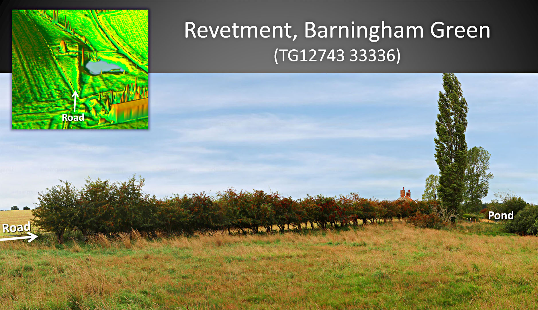
Revetment - Barningham Green This is next to the above image at Barningham Green. Here the road passes a pond and the north edge has been built up i.e. a revetment. The hedge is on top of the revetment with the Roman road on its other side. The Lidar inset shows it a bit more obviously. Image: DR
|
Click for larger view |
 |
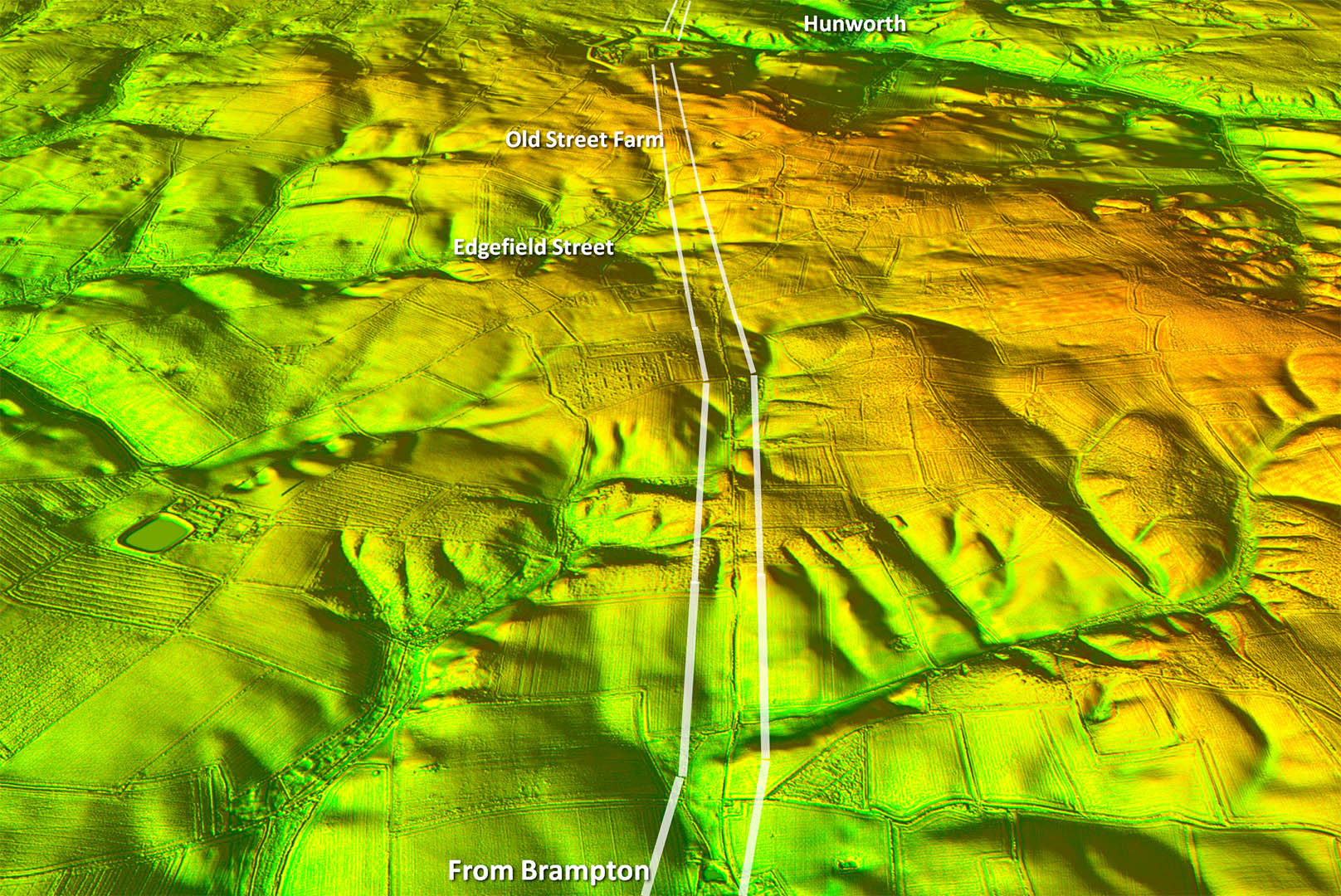
Oblique Lidar Image - Alignment 3 Clues become much clearer now on this section. In reality it probably comprises two alignments with a small change of direction. Note the very relevant Old Street Farm (see below). That was a big clue we all missed.
|
Click for larger view |
 |
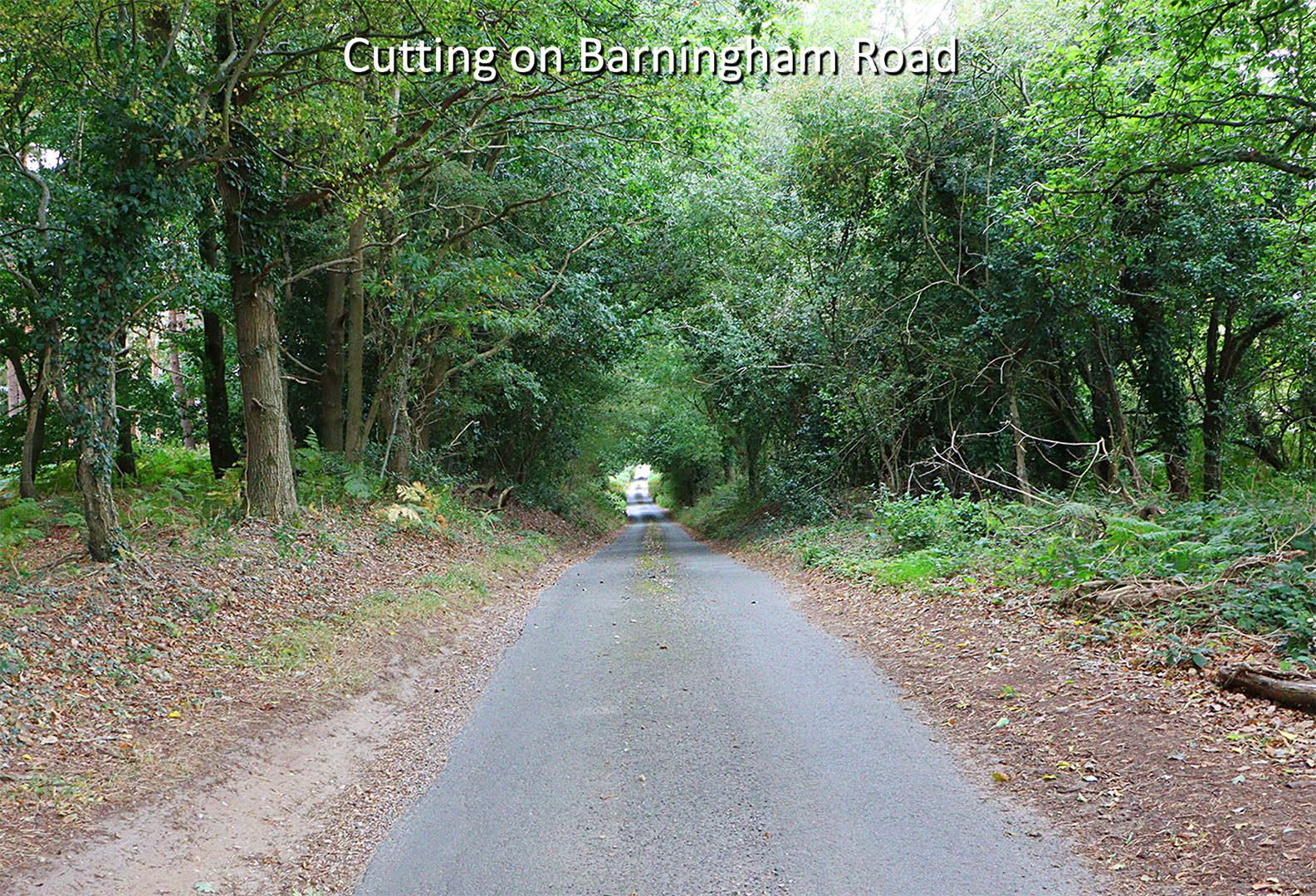
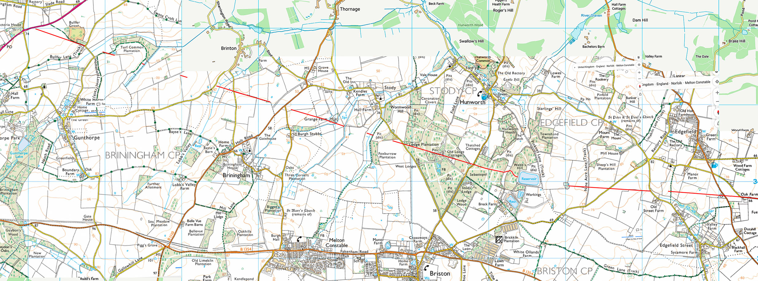
Cutting and Descent to Underwoods, Barningham Road The modern lane (Barningham Road) that overlays the Roman road at Barningham Green is pretty straight for over a mile but very narrow so presumably that is why no one ever considered it to be Roman. However, this section does have considerable engineering with a long cutting as it goes over a crest and descends towards Underwoods, where it is on a considerable built up terrace way. Image: DR
|
Click for larger view |
 |
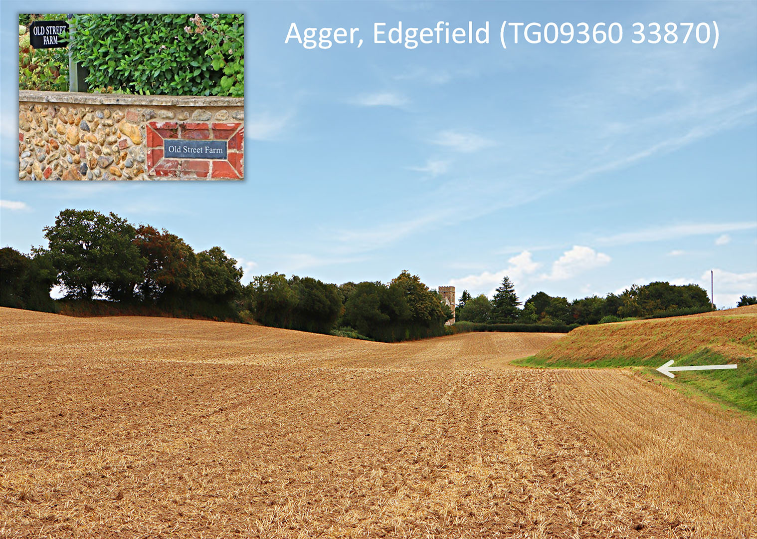
Agger - Edgefield Just about surviving agger between Old Street Farm, Edgefield Street and Edgefield Church. Edgefield village is in two halves with the church midway between them. The northern half, Edgefield Green, is beyond the church in my picture. Behind us is Edgefield Street - no doubt named after the road despite its very existence being lost in time. Image: DR
|
Click for larger view |
 |
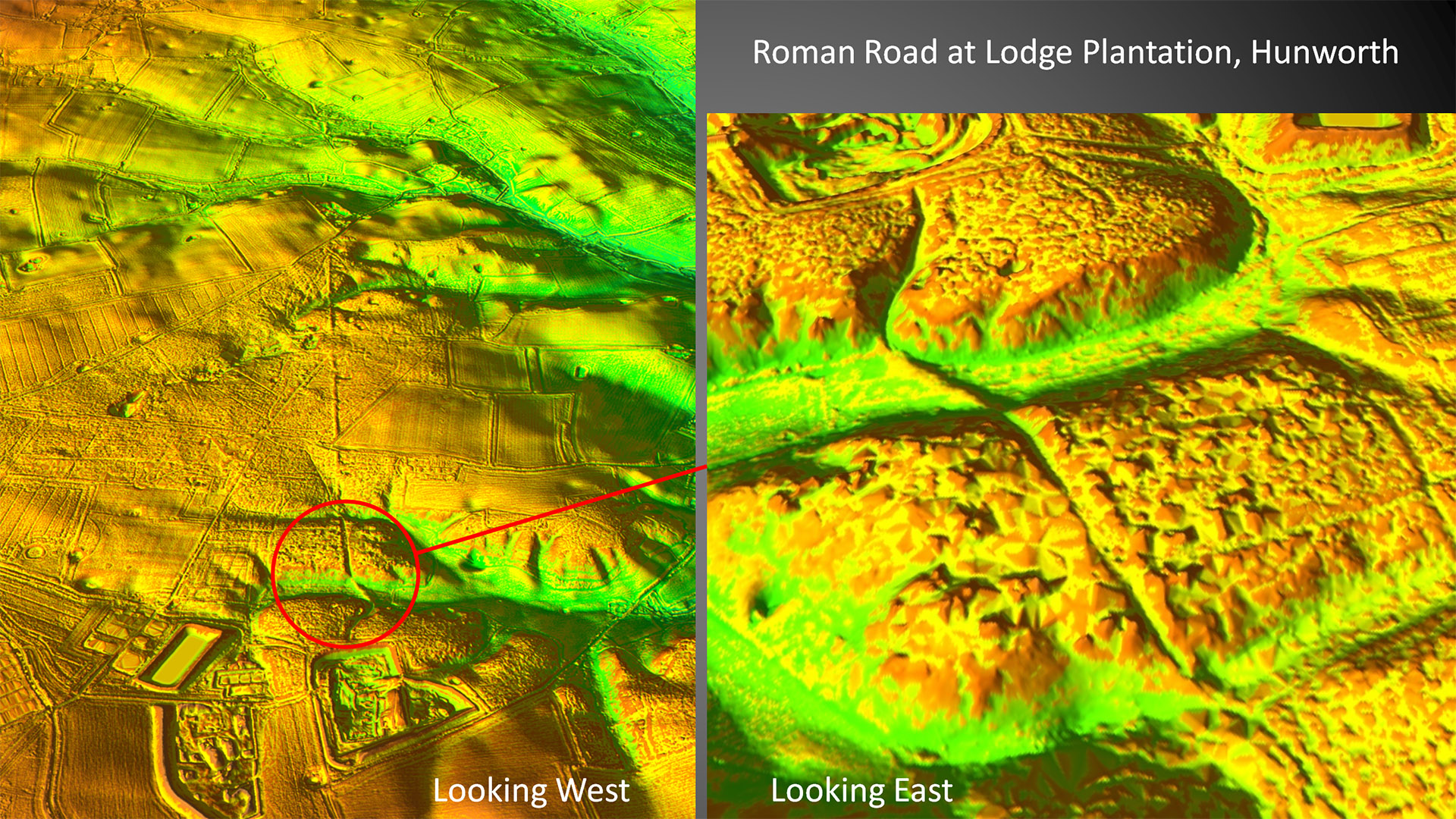
Oblique Lidar Image - Hunworth (Stody Parish) Is this the finest example of Roman highway engineering in East Anglia? It is certainly impressive and demonstrates that this road was not grade 2 - it was a high quality major undertaking. |
Click for larger view |
 |
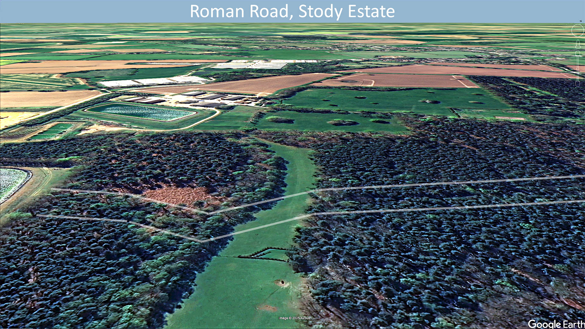
Google Earth View - Stody Estate The road here is in the private Stody Estate with no access so this Google Earth view looking from the north is the best we have. The causeway/agger across the valley can be faintly made out. |
Click for larger view |
 |
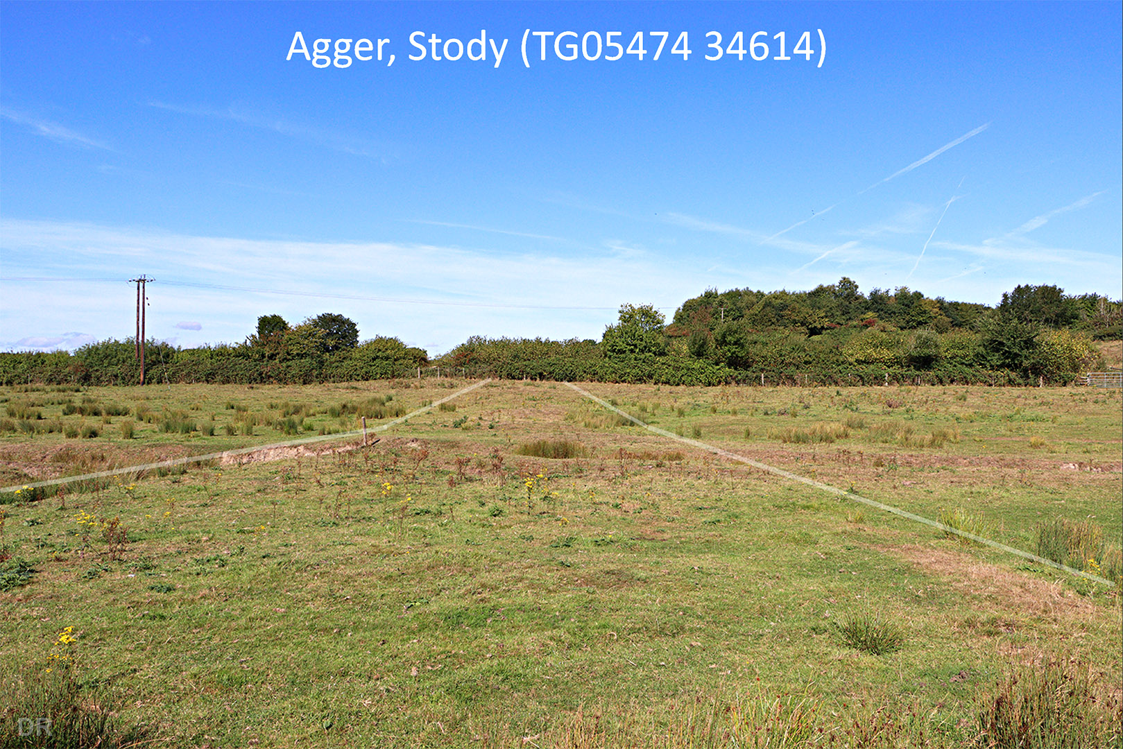
Agger near Stody Village Another valley to cross and another built-up agger. This time though much disturbed. I did look for any signs of a Roman culvert but the stream has been excavated/recut and nothing has survived there. This site is accessible from a public footpath. Image: DR |
Click for larger view |
 |
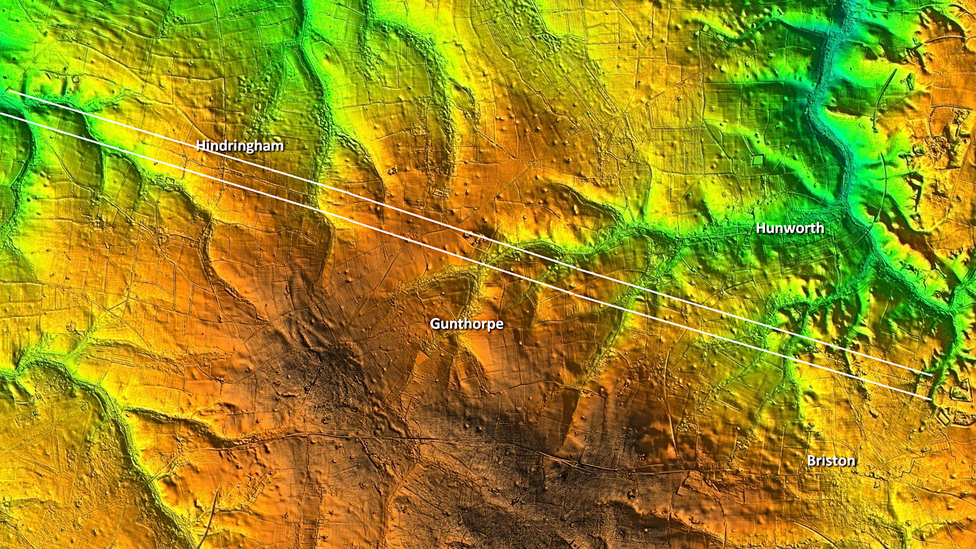
Lidar Image - Route from Hunworth to beyond Hindringham Very straight and very obvious on this alignment. |
Click for larger view |
 |
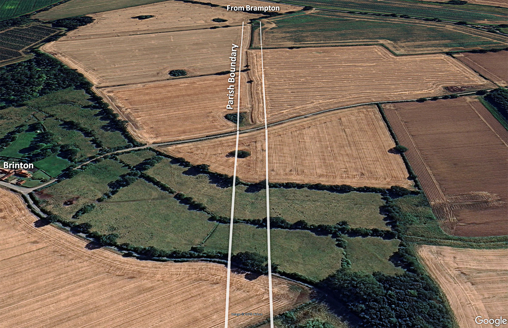
Brinton - looking East A rarity for this road is a parish boundary adopting it but passing Brinton we do have such a case. Again another valley to cross but with no access so again a Google image will have to suffice Image: Google Earth |
Click for larger view |
 |
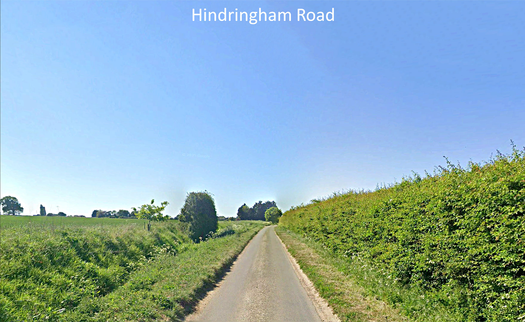
Hindringham Road - approaching Hindringham Modern road overlaying the Roman agger. The right ditch (north) is somewhat obscured but the big left (south) ditch is very obvious. Image: Google |
Click for larger view |
 |
Oblique Lidar Image - Hindringham Meadows There appears to be a fork in the road just before the Great Walsingham Roman site. The northern branch was the one recorded by David Staveley but the straight connection to Walsingham was not. This today is mostly covered by the modern road but its initial section, marked by a cutting, is is clear in this view. |
Click for larger view |
 |
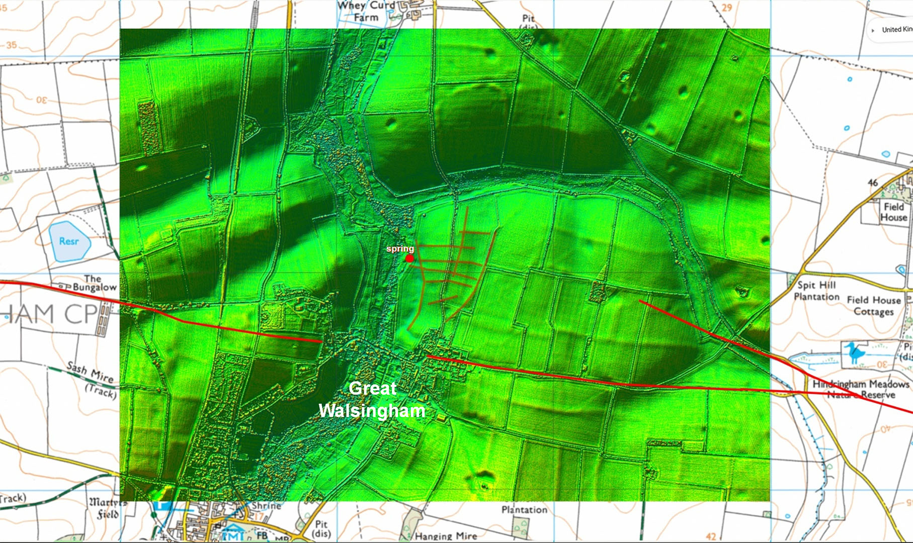
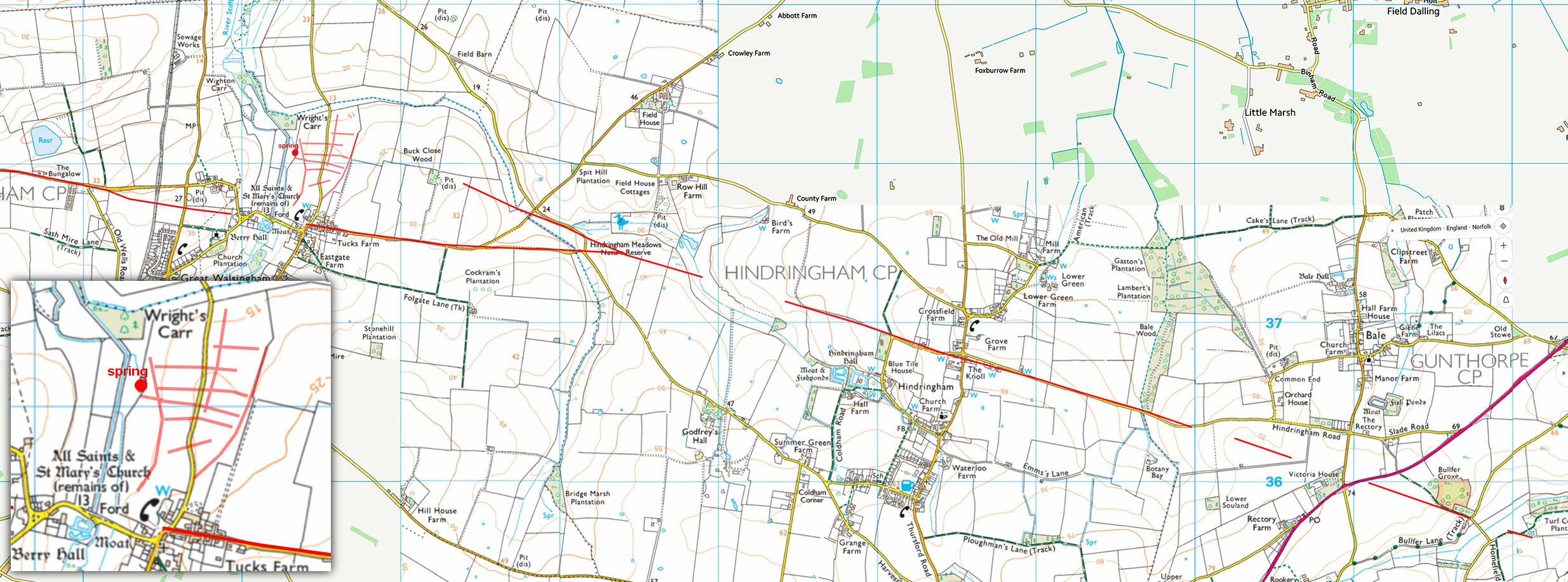
Oblique Lidar Image - Great Walsingham Also not recorded before was the street grid pattern visible in the Lidar imagery. The existence of the spring(s) can hardly be a coincidence to the location of the Roman settlement here. It perhaps explains the large number of Roman religious artifacts found across the site. North of the settlement is a horseshoe shaped enclosure in the field across the little valley, which had been previously recorded but its function is unknown. It is almost like a protected annex.. For more confirmation of internal road(s) see aerial photo below. There is some evidence the road continued beyond the River Stiffkey and Roman road 39 is only 4 miles away so it seems likely. See later. |
Click for larger view |
 |
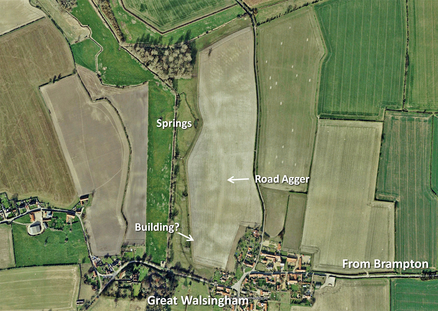
Aerial Photograph - Great Walsingham In this GoogleEarth aerial photo the road in the west field shows up very clearly confirming what Lidar is showing above. It also seems to link the springs to a building at the south end. Could this be a temple? Aerial Photo: GoogleEarth 2017 |
Click for larger view |
 |
Lidar Image - Great Walsingham West West of Great Walsingham then there are some suggestions that there may have been a road towards Snettisham but the clues are not overly convincing. A connection to Brancaster would seem logical and there are some straight modern roads that could overlie a Roman route. |
Click for larger view |
 |
Routemap 1 - Alignment to Scarrow Beck The route from the Roman town of Brampton is just to the west of the modern road at Oxnead. Most of the Roman road at Oxnead though has been destroyed by quarrying.Once the corner is turned then there is visible lidar evidence with it all aligning plus long lengths of the road's side ditches are visible in aerial photographs. |
Click for larger view |
 |
Routemap 2 Second alignment passing under Wolterton Hall and features several of those aggers/causeways across the little valleys.
|
Click for larger view |
 |
Routemap 3 This is the route passing Hunworth with the magnificent cuttings and big agger/causeway. |
Click for larger view |
 |
Routemap 4 The Great Walsingham section with the inset showing the probable settlement street plan. |
Click for larger view |
 |
|
|
|
Last update: September 2025 |
© David Ratledge |