|
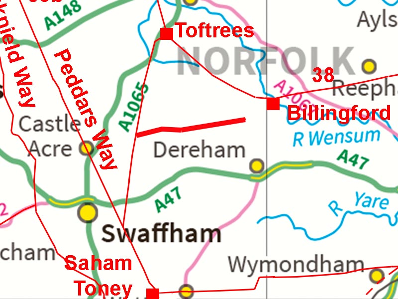
The (Probable) Roman Road from Billingford to KempstoneMargary Number: 38Distance: 9.5 milesKempstone appears to have been a small, mostly industrial, Roman site. According to Wade-Martins(1980) “In the north-west corner of the parish …..on the slope overlooking the east to west Roman road, is a spread of Roman pottery, tiles and iron slag covering c.12 ha. The extent and quantity of the slag demonstrates that there was considerable industrial activity in this area. The sherds are difficult to date, but may span the first to at least the third centuries”. A direct connection to the large Roman settlement at Billingford and, as we now know, with an onwards connection to Caistor St. Edmund, seems likely and logical. Around halfway between the two Roman settlements of Billingford and Kempstone at Bittering is Salters Lane, a straight modern road often assumed to be Roman. It is marked as such on Ordnance Survey maps and the Norfolk HER also includes this road (NHER2796) but regards as being part of the Fen Causeway (RR38), although that link is far from proven. However, there was very little other evidence. What has changed is Lidar coverage and now, in addition to Salters Lane in the middle, at each end there does appear to be visible signs of a Roman road.
|
Historic Counties: Norfolk Current Counties: Norfolk HER: Norfolk
|
|
|
|
|
|
Aerial Photos and Route Map The alignment of the road is clearly aimed to the south of Billingford. As we shall see this appears to have been to approach the settlement there using the known Roman bridge over the River Wensum. |
Click for larger view
|
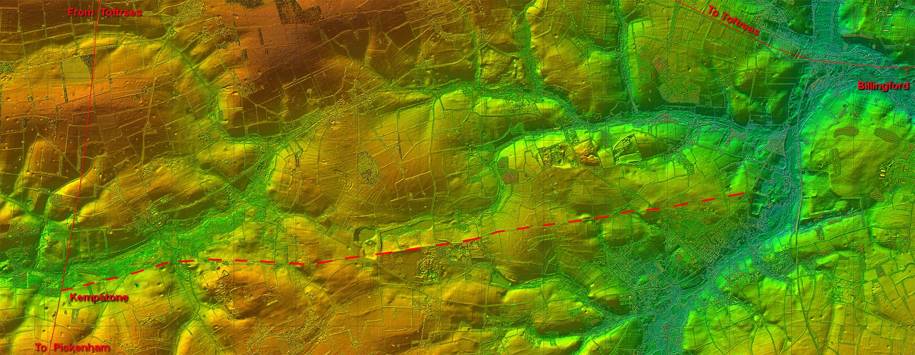 |
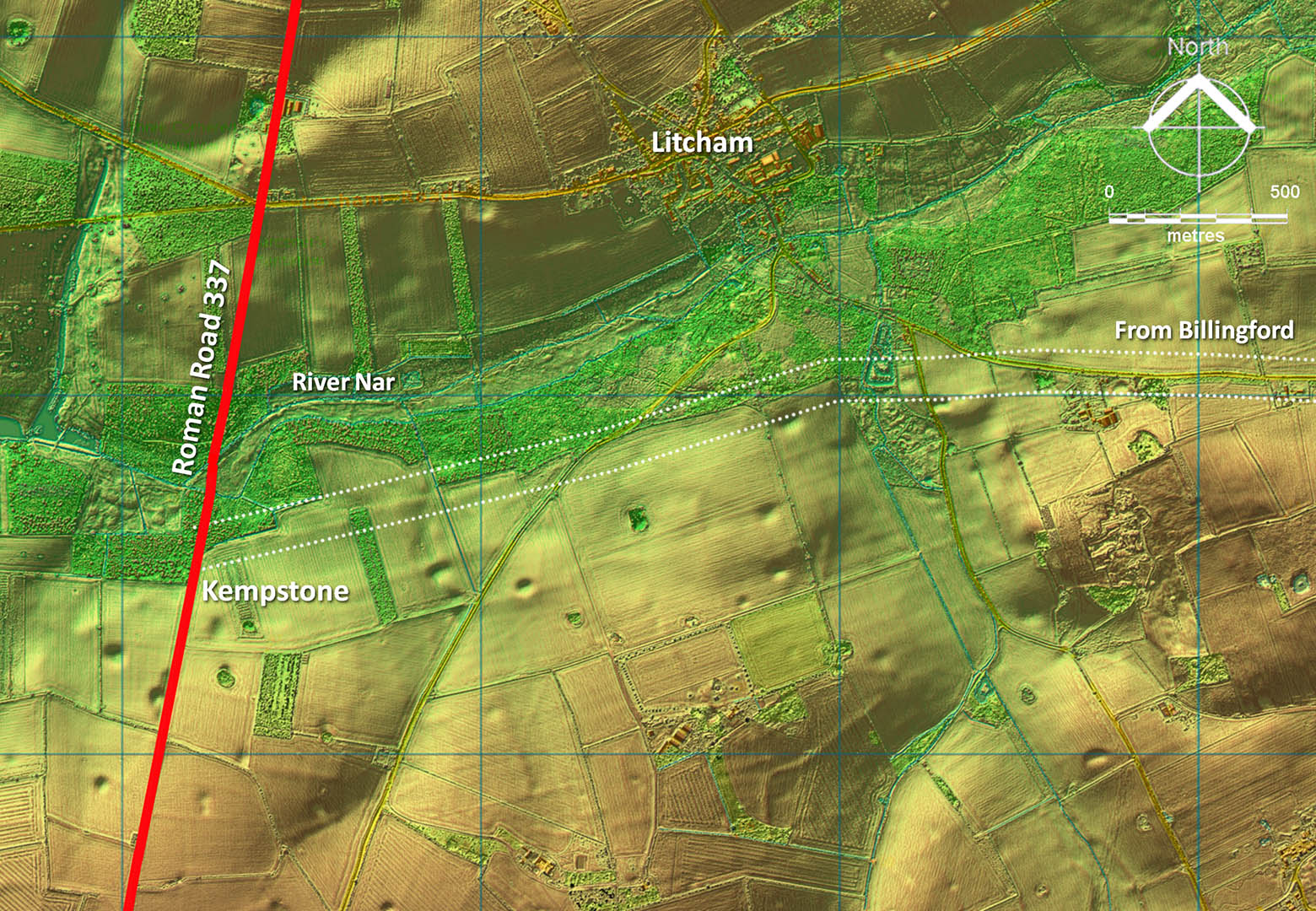
Lidar Image - Kempstone There does appear to be Lidar evidence of our road on the south side of the River Nar just where the Kempstone Roman settlement was located. |
Click for larger view |
 |
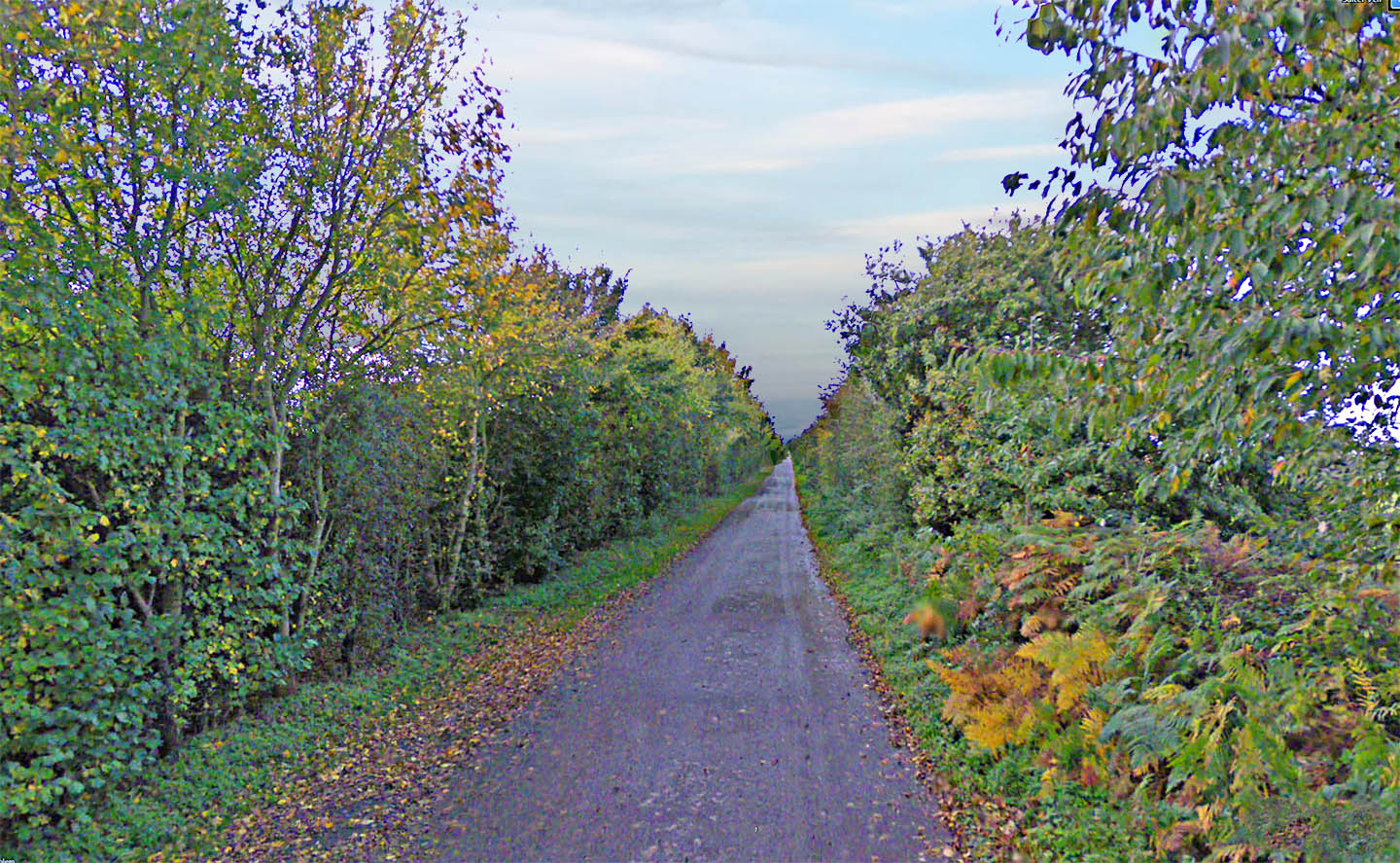
Salter's Lane, Bittering Yes it does look Roman which is probably the reason everyone believed it was a real one. |
Click for larger view |
 |
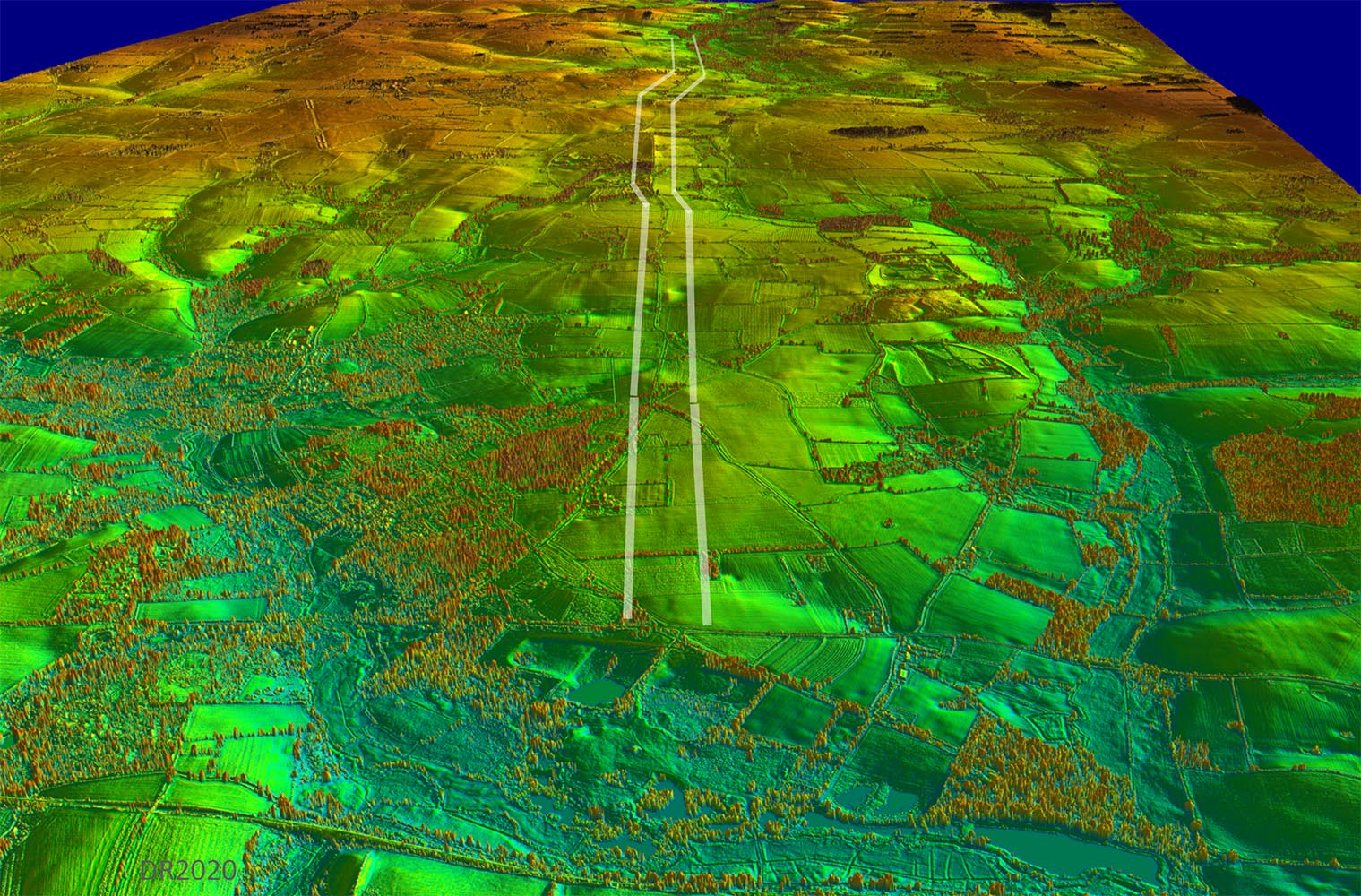
Oblique 3D Lidar Image - looking back from Black Water towards Kempstone We are looking down the line of the Roman road towards Salter's Lane and Kempstone. |
Click for larger view |
 |
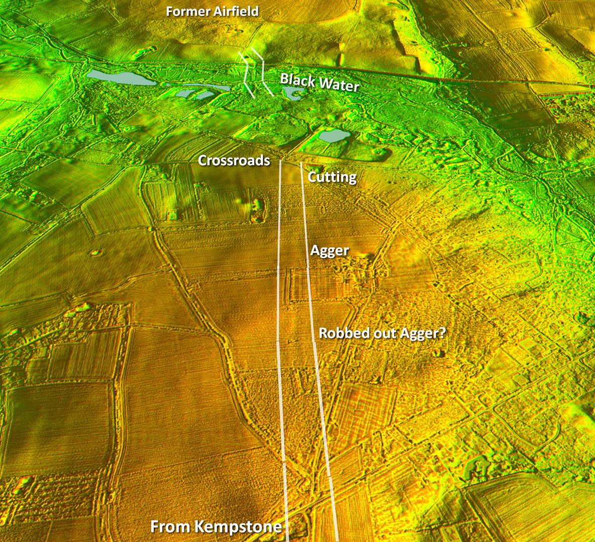
Oblique 3D Lidar Image - Beetley to Black Water Reverse view to the above. The course of the road can be made out heading to the old crossroads. Note the crossing of Black Water too. It all makes sense. |
Click for larger view |
 |
Oblique 3D Lidar Image - Black Water to Billingford Reverse view to the above. Despite much gravel extraction there are clear signs of an old crossing of the river Black Water surviving. First edition Ordnance Survey mapping also depicts this as a field boundary. This would take our road across the valley to where a turn towards Billingford and the Roman bridge is evident. Unfortunately the route from here to Billingford would have been via the Swanton Morley former airfield. This has been totally re-landscaped with not even the former runways now being visible. There is therefore absolutely nothing visible across the airfield supporting such a course to Billingford. However, in view of the road’s last visible stretch as it climbs up from Black Water being directly aligned on the known Roman bridge at Billingford this seems very likely to have been the route. |
Click for larger view |
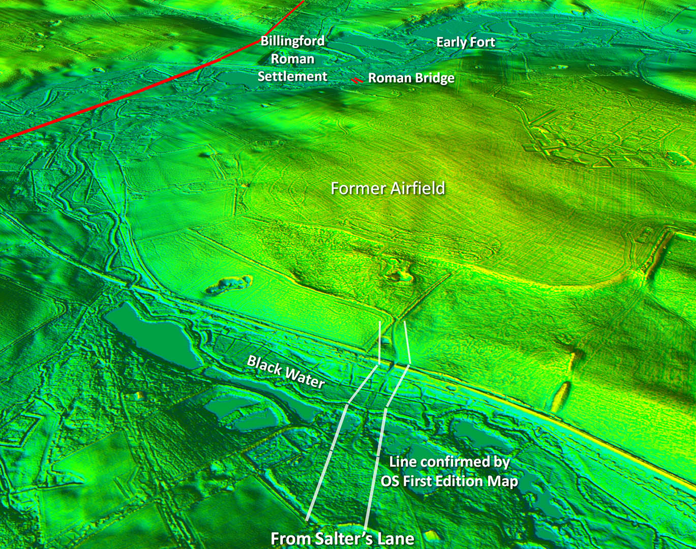 |
Lidar Image and Route Map 1 It surely went across where the airfield was. The Black Water crossing lines up perfectly with the Roman bridge. |
Click for larger view |
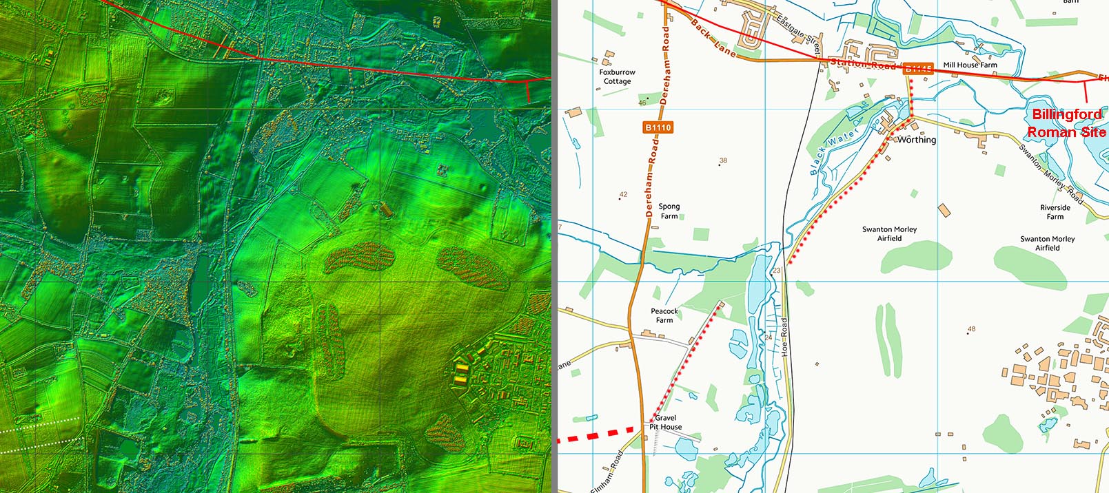 |
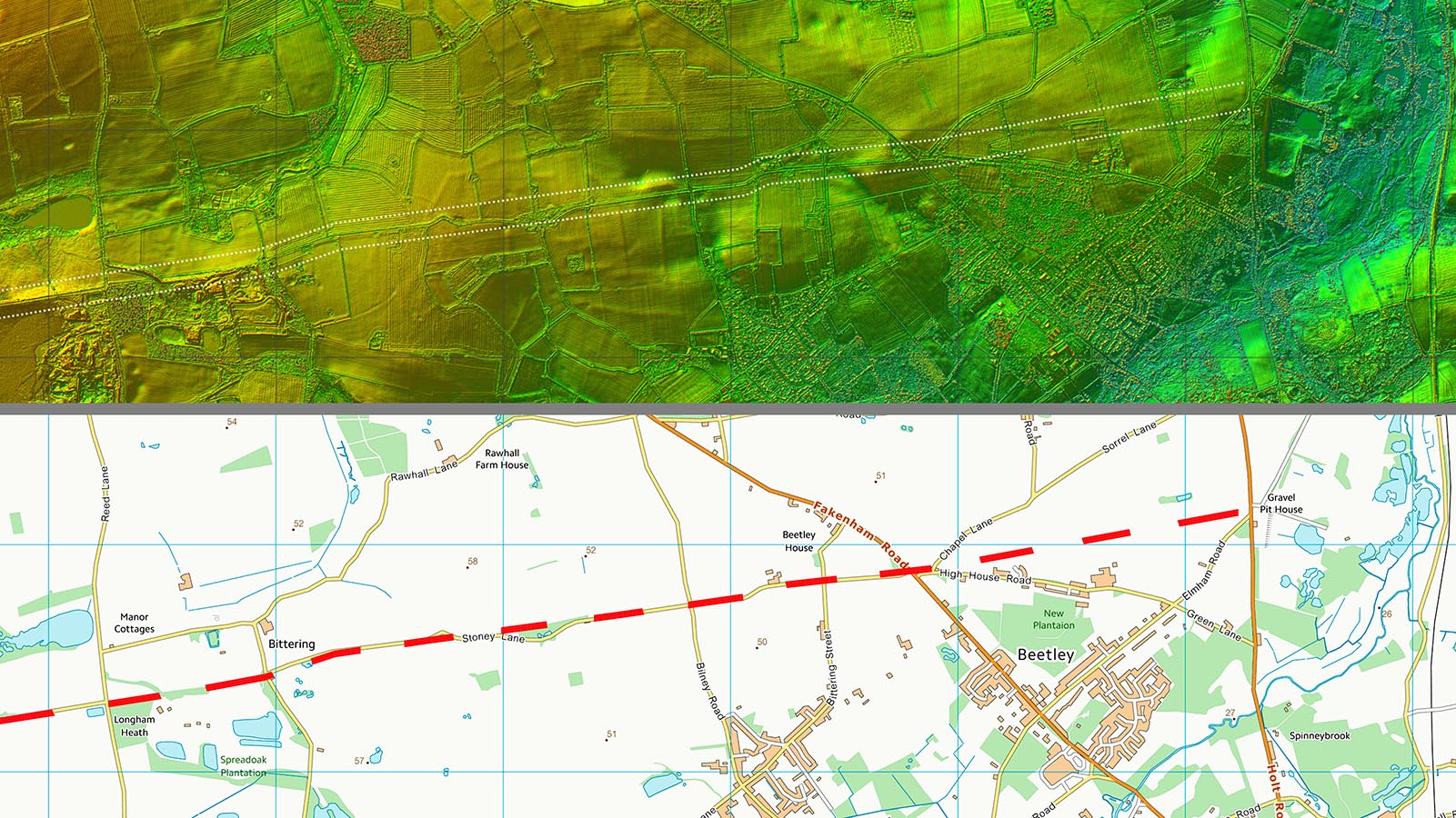
Lidar Image and Route Map 2 Stony Lane to the river Black Water. The Stony Lane name is another clue. |
Click for larger view |
 |
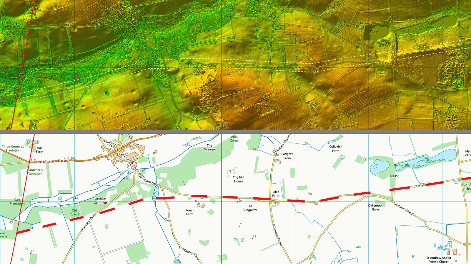
Lidar Image and Route Map 3 The final stage to the junction with the Toftrees to North Pickenham Roman road. Does not appear to be much evidence for an onward continuation to the west. |
Click for larger view |
 |
|
|
|
Last update: August 2026 |
© David Ratledge |