
|
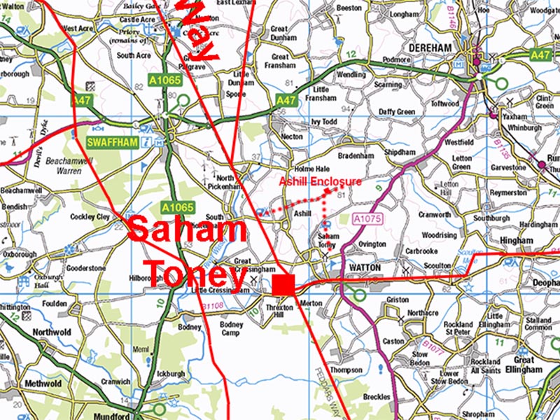
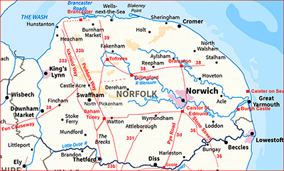
Possible Roman Roads near Ashill Roman EnclosureMargary Number: noneDistance: NA milesThe probable Roman "enclosure" or "earthwork" at Ashill (North of Saham Toney & Watton) does have one round corner with its east side seemingly the best surviving. The site is listed in the Norfolk HER as 8712. There are three possible roads around it - an east-west one, one heading south towards Saham Toney and a third heading north-east.
|
Historic Counties: Norfolk Current Counties: Norfolk HER: Norfolk
|
|
|
|
|
|
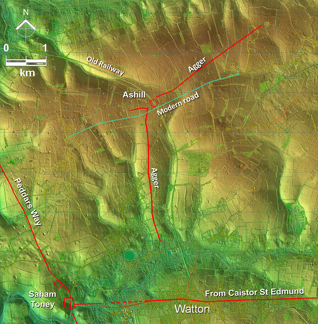
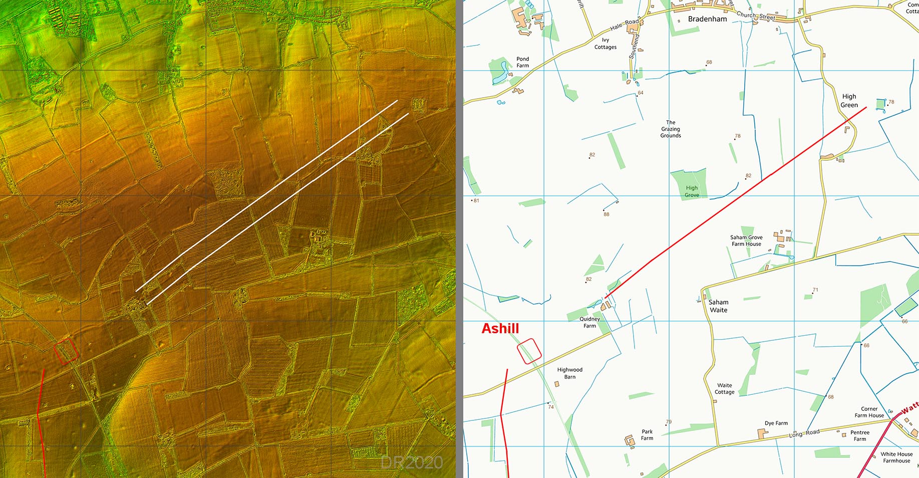
Lidar Image and (Possible) Route Map The possible road to the south does register prominently in the Lidar data with its agger clear. However, I could not link it up to the road at Watton at its southern end. Thanks to John Newton I now know that south of the last trace were brickworks which removed any possible remains. The road north-east from Ashill is also clear with prominent agger all the way to just beyond High Green. The east-west road is based on the straight modern road passing the enclosure and the fact that it runs parallel to its southern side. But as we shall see later it appears to be a later - non Roman - road. |
Click for larger view
|
 |
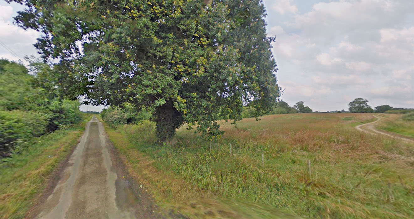
Enclosure Site An old railway line goes through the middle of the enclosure and lies in the trees with the eastern half of the enclosure to the right here. The track is the possible east-west road - it crossed the old railway line on a bridge. A well was discovered in the railway construction, which contained much Roman material. Image: Google |
Click for larger view |
 |
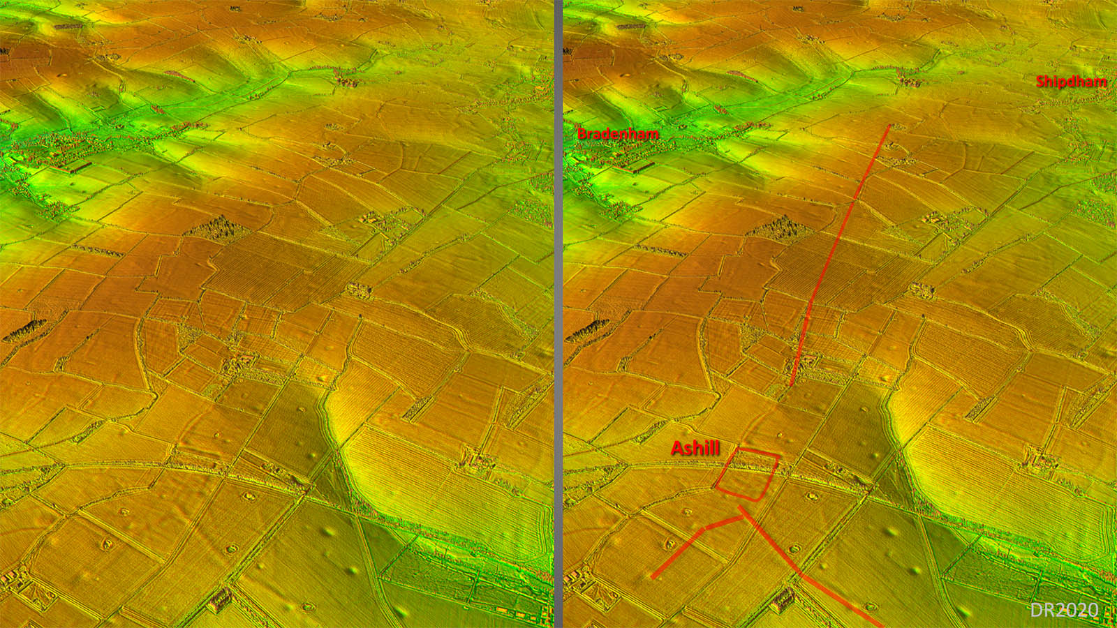
Oblique 3D Lidar Images - Ashill The roads/aggers leading to the Ashill enclosure are very clear in this 3D lidar view. The north-south road is also clear approaching the site. It does appear to have a short branch off it. However, the big take from this image is that the previously assumed Roman east-west road passes over the agger of the road to the south towards Watton. It must therefore be later. The so-called Ashill enclosure is very odd. There does not seem to be a western equivalent of the eastern ditch. Instead we have a grid of roads(?) indicating presumably a settlement. |
Click for larger view |
 |
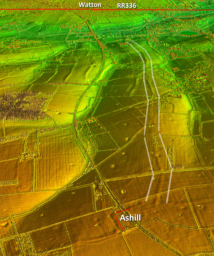
Oblique 3D Lidar Image - Southern Road The agger leaving the enclosure looks reasonably certain but perhaps a bit wobbly in the direction towards Watton.
|
Click for larger view |
 |
Lidar Image & Map - North East Road A very typically Roman-like agger heading to the north-east from Ashill. Billingford would be a logical destination but so far I have been unable to make the connection.
|
Click for larger view |
 |
|
|
|
Last update: August 2026 |
© David Ratledge |