
|
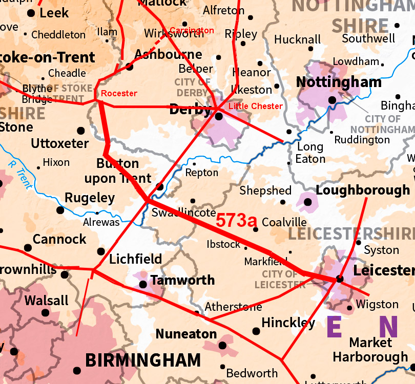
The Roman Road from Leicester to RocesterMargary Number: 573aDistance: 40 miles Part of the fabled Via Devana although that name is somewhat discredited these days. We will meet though on its route some references to the Via Devana so the tradition lives on. Leicester was connected to Watling Street by the known Roman road Margary 57b. However, this road is not directed on Leicester but instead aims well to its west. This strongly implies that RR 57b was likely to be a branch off another Roman road heading more westerly. There had been suggestions of just such a road heading north-west from Leicester (Liddle & Hartley, 1994) and was locally referred as perhaps a continuation of the Via Devana. There had been, in a few isolated spots, excavations/watching briefs where traces of just such a possible road had been revealed (Browning, 1999). In addition there were some unpublished reports in the Leicestershire HER, which also gave credence to the road’s existence. There is even a new housing estate in Moira with its road named Via Devana, although in reality this modern one runs at right angles to the Roman line. However, with Lidar I was able to confirm the road’s existence and located the majority of its very direct route to Ryknield Street, to the south of Burton upon Trent in Derbyshire . The onward continuation to Rocester was also mostly determined although some part are vague..
|
Historic Counties: Leicestershire, Derbyshire & Staffordshire Current Counties: Leicestershire, Derbyshire & Staffordshire HER: Leicestershire, Derbyshire & Staffordshire
|
|
|
|
|
|
Lidar Image - Full Route Not arrow straight for Rocester but probably the best route keeping to high ground and avoiding as much as possible valley travel. At a distance of 40 miles an intermediate stop would have been necessary and Walton o Trent could have fulfilled that requirement. |
Click for larger view |
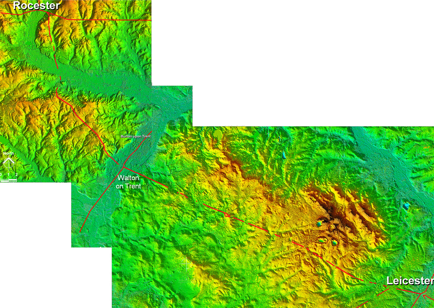 |
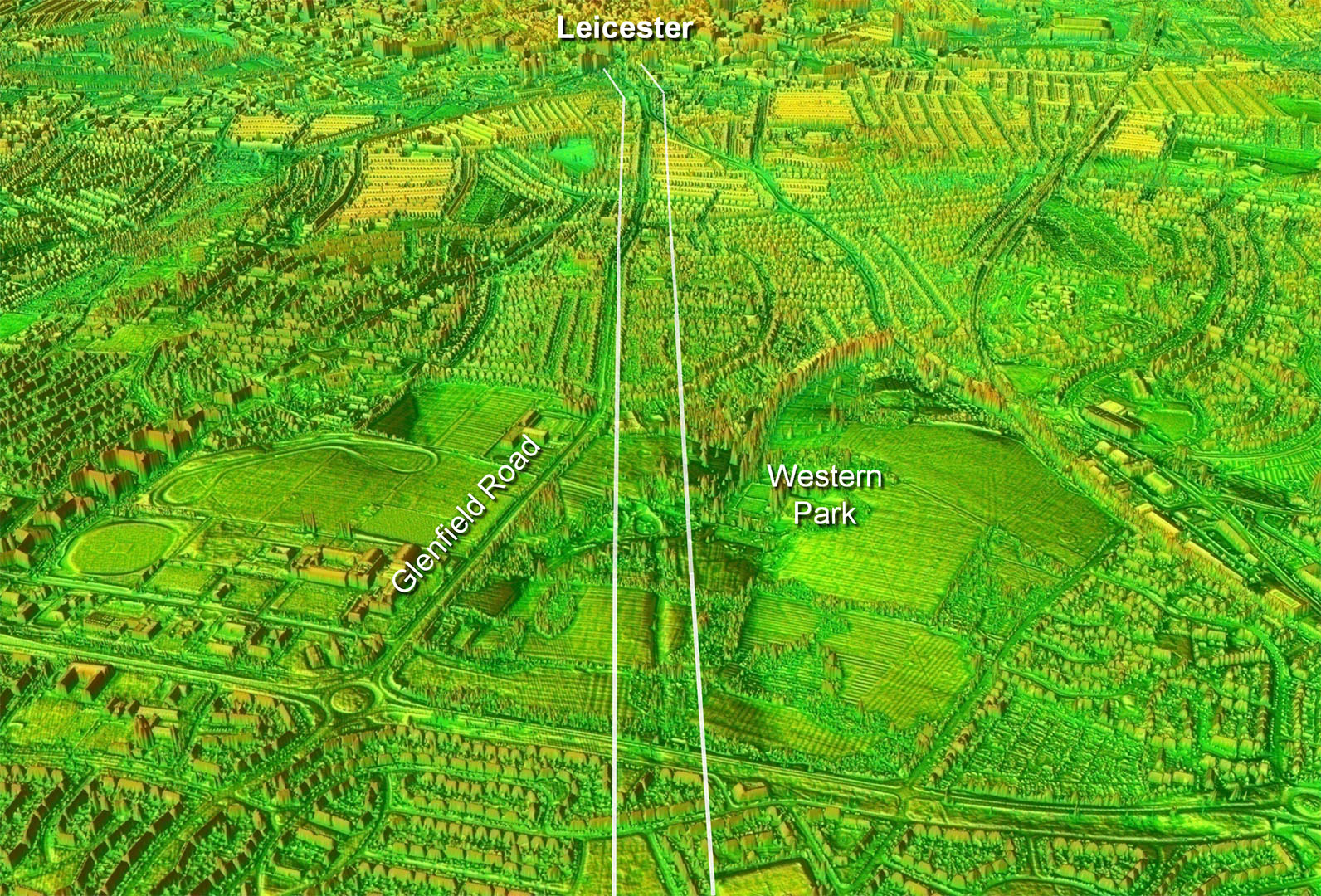
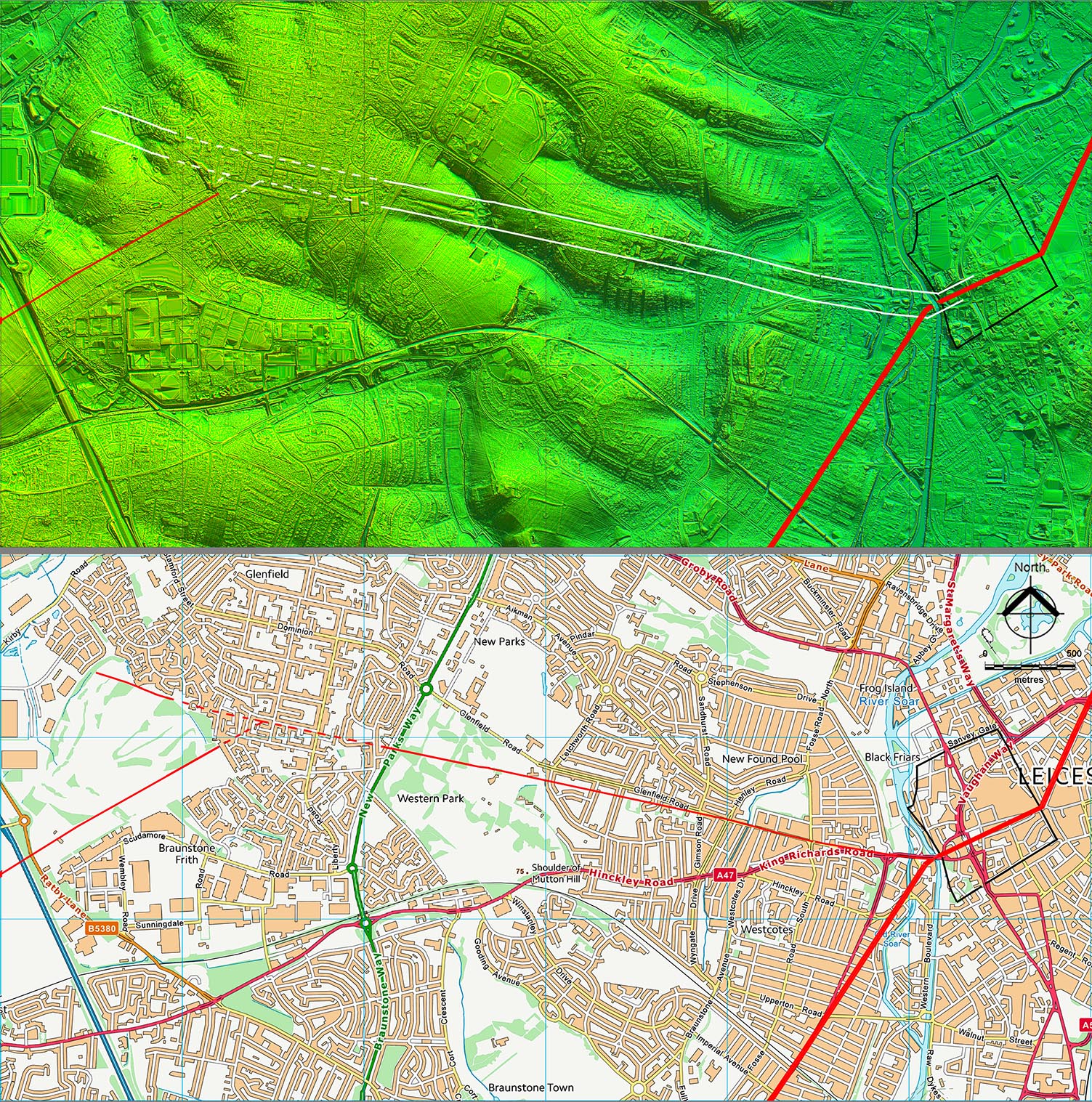
Oblique 3D Lidar Image - Route to Walton on Trent The route leaves Leicester over Bow Bridge and heads at first along King Richard’s Road and Glenfield Road. This initial section was believed to be part of RR57b but is now better regarded as part of this road to Ryknield Street. It first becomes extant in Western Park (fig. 2) descending (SK55724 04834) and ascending via a very prominent cutting (SK55548 04854). The junction, where RR57b branched off, can be located by interpolation with reasonable confidence at around SK54440 05090.
|
Click for larger view
|
 |
Oblique 3D Lidar Image - Looking back to Leicester The Western Park section is an amazing survivor. It was previously suspected of being Roman but part of Roman road 57b. |
Click for larger view
|
 |
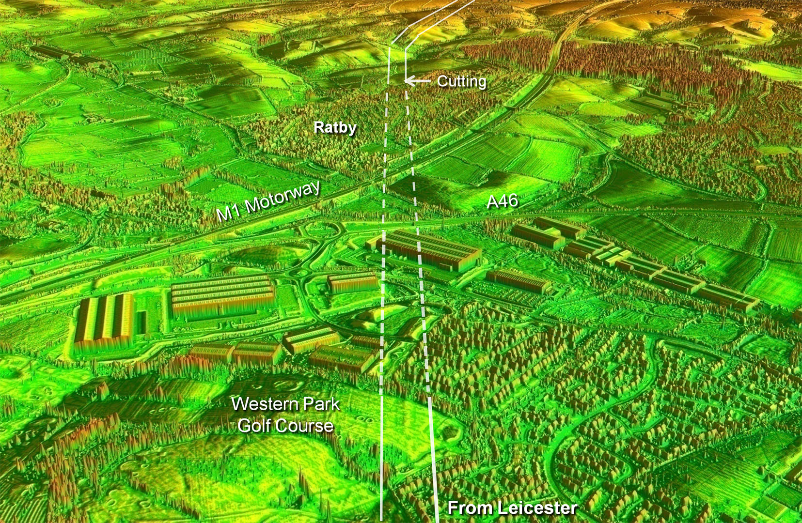
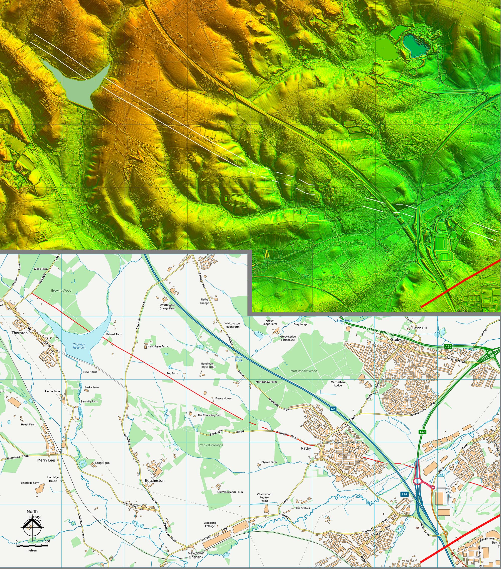
Oblique 3D Lidar Image - The next evidence visible is across Western Park golf course where an agger is evident (SK53585 05342). The motorway and Ratby then intervene but Ferndale Drive in Ratby is on or close to the Roman alignment. However, the next certain indication is just beyond Ratby with a faint cutting on line (SK50949 06028). The road then shares a short section with Burroughs Road (SK50607 06117) before diverging off to begin a major alignment towards Ibstock (SK49886 06353). |
Click for larger view
|
 |
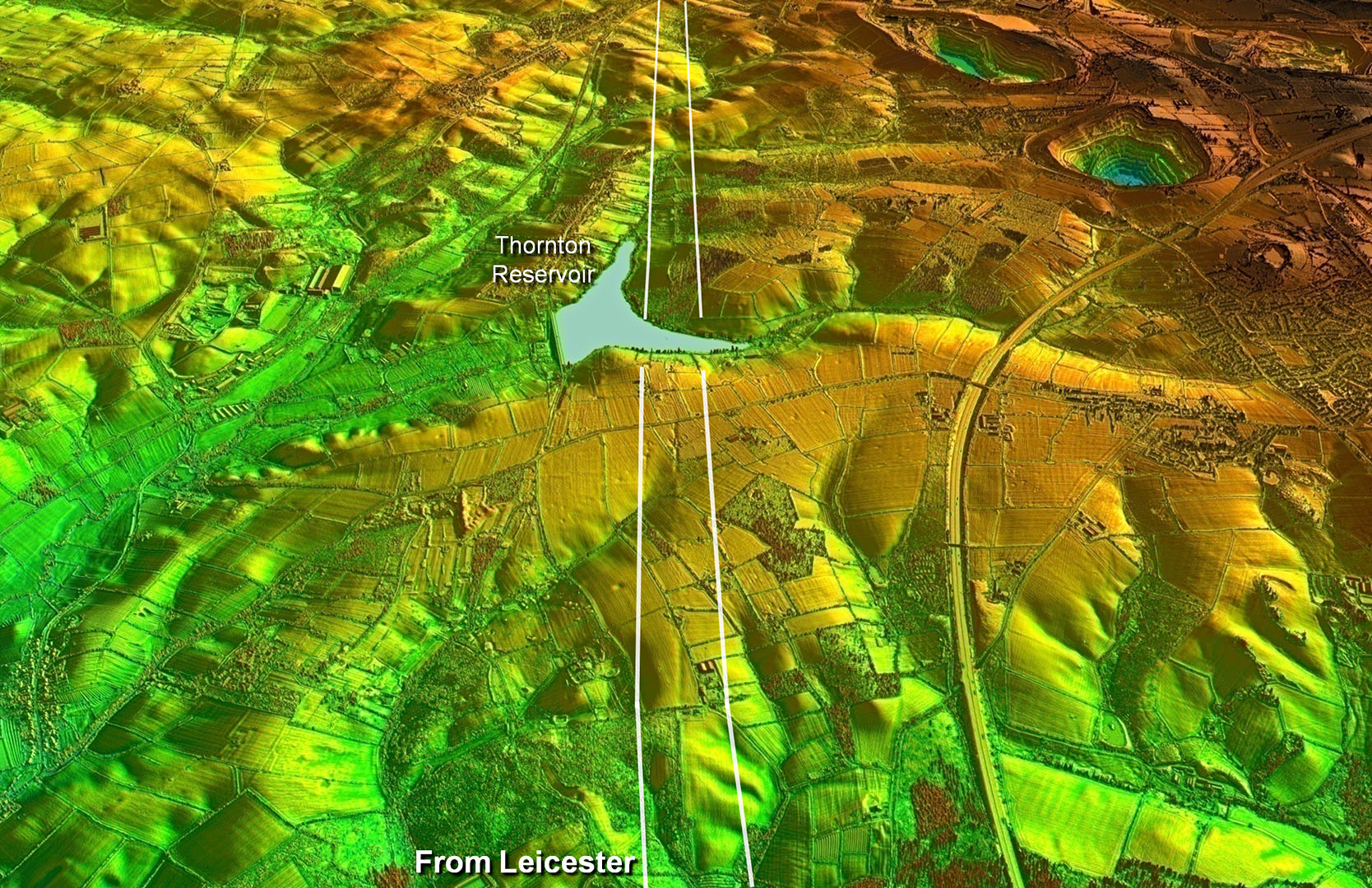
Oblique 3D Lidar Image - This new alignment aiming for Ibstock has survived remarkably well and comprises a series of cuttings and aggers. This is interrupted by Thornton Reservoir (SK47675 07659) but evidence resumes west of the reservoir although a little less obviously (SK47411 07815). |
Click for larger view
|
 |
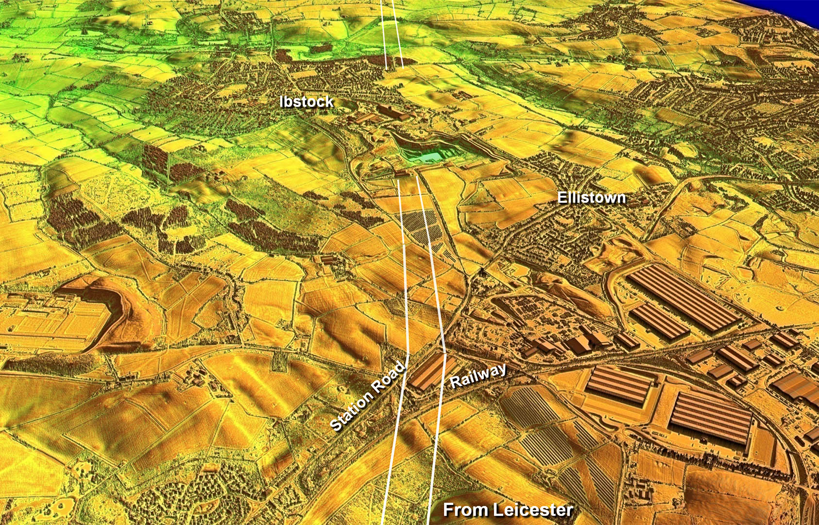
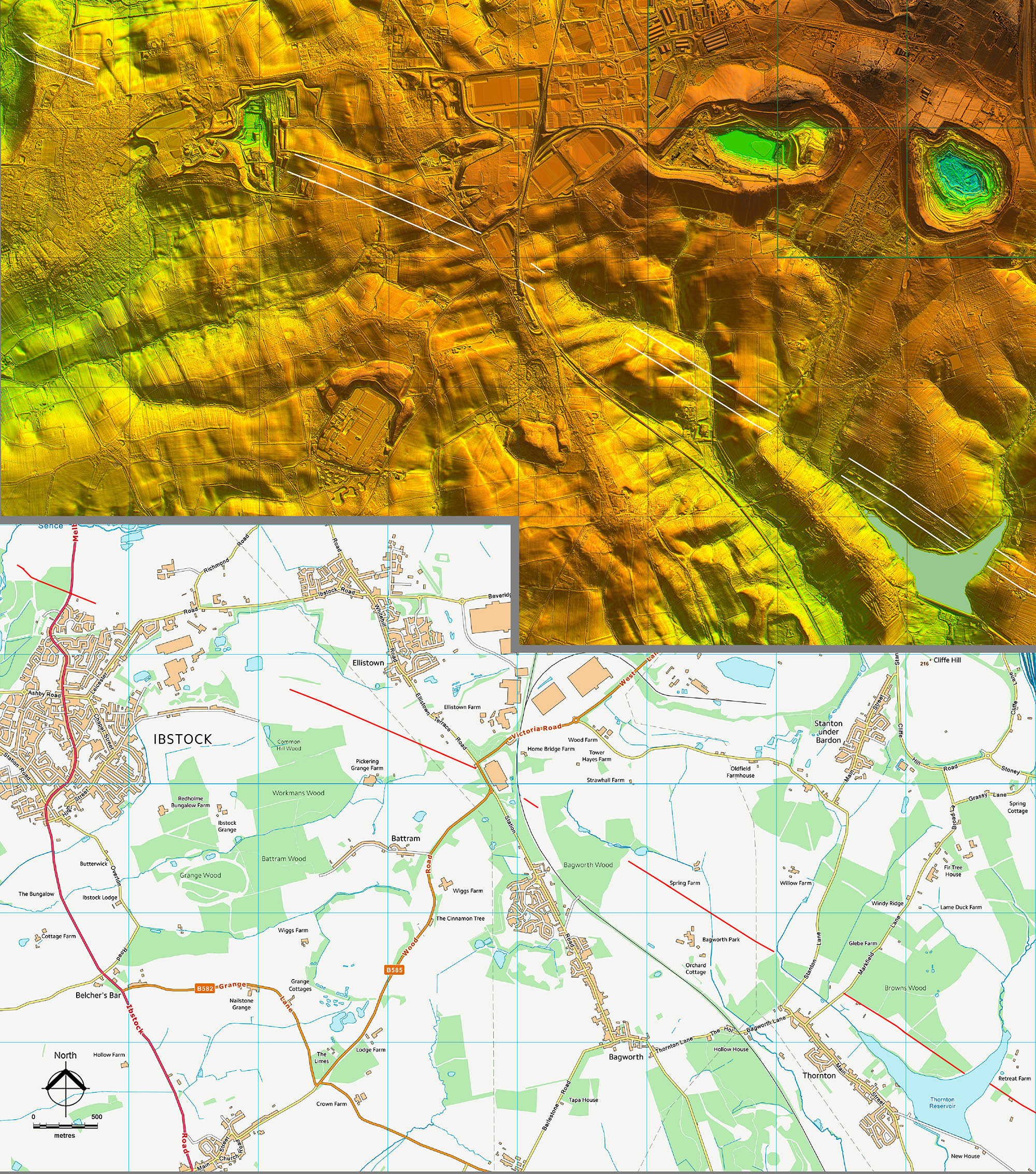
Oblique 3D Lidar Image - Approaching Ibstock The alignment can be seen continuing initially faintly and then more prominently as a cutting at SK45547 08957 plus as a definite agger just before a railway line (SK44097 09858). Hereabouts, between the railway line and Station Road, was a change of direction. On the latter’s western side evidence resumes (SK43601 10149) and another faint agger is visible (SK42293 10707) before disappearing under a large quarry at Ibstock. From Ibstock westwards then some visible evidence does reappear beyond the A447, Melbourne Road (SK40415 11523) and again beyond Ravenstone Road (SK39235 12073), where a bridle way in Sence Valley Forest Park marks the route. Ahead now is a ridge of high ground at Normanton le Heath and the alignment to this begins just west of a pond on Bower’s Brook (SK39290 12026). Today the course is approximated, but not exactly, by a footpath through Queen Elizabeth Diamond Jubilee Wood, which takes us towards Normanton le Heath. |
Click for larger view
|
 |
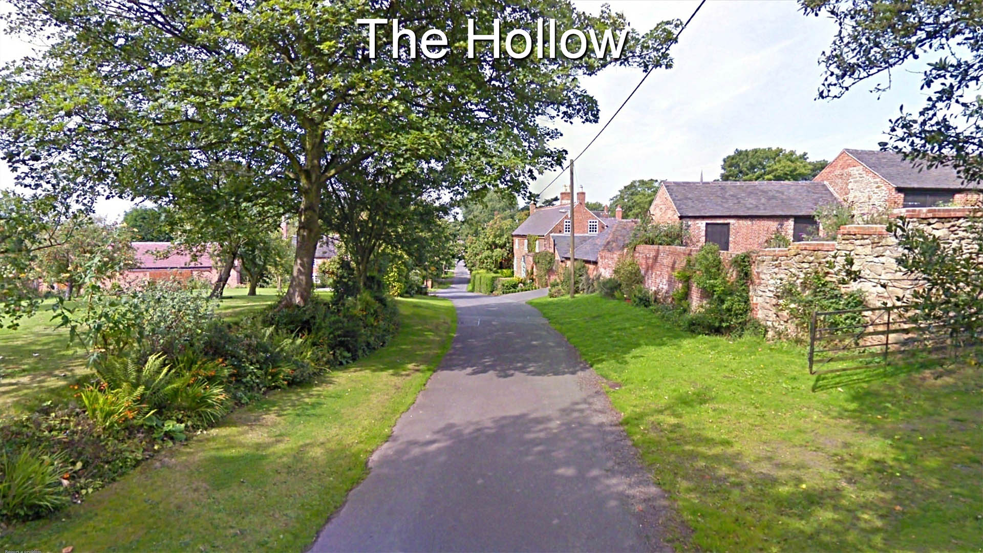
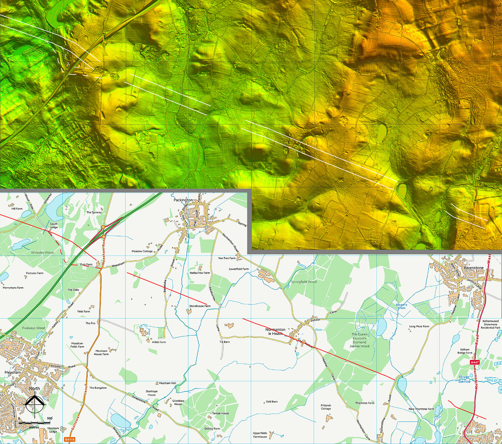
The Hollow The road drops down and then rises on the approach to Normanton le Heath. This is a very pretty section and is aptly named “The Hollow” (SK37855 12613). The modern road here is generally narrow compared to the overall width of the highway indicating the Roman land-take was much wider |
Click for larger view |
 |
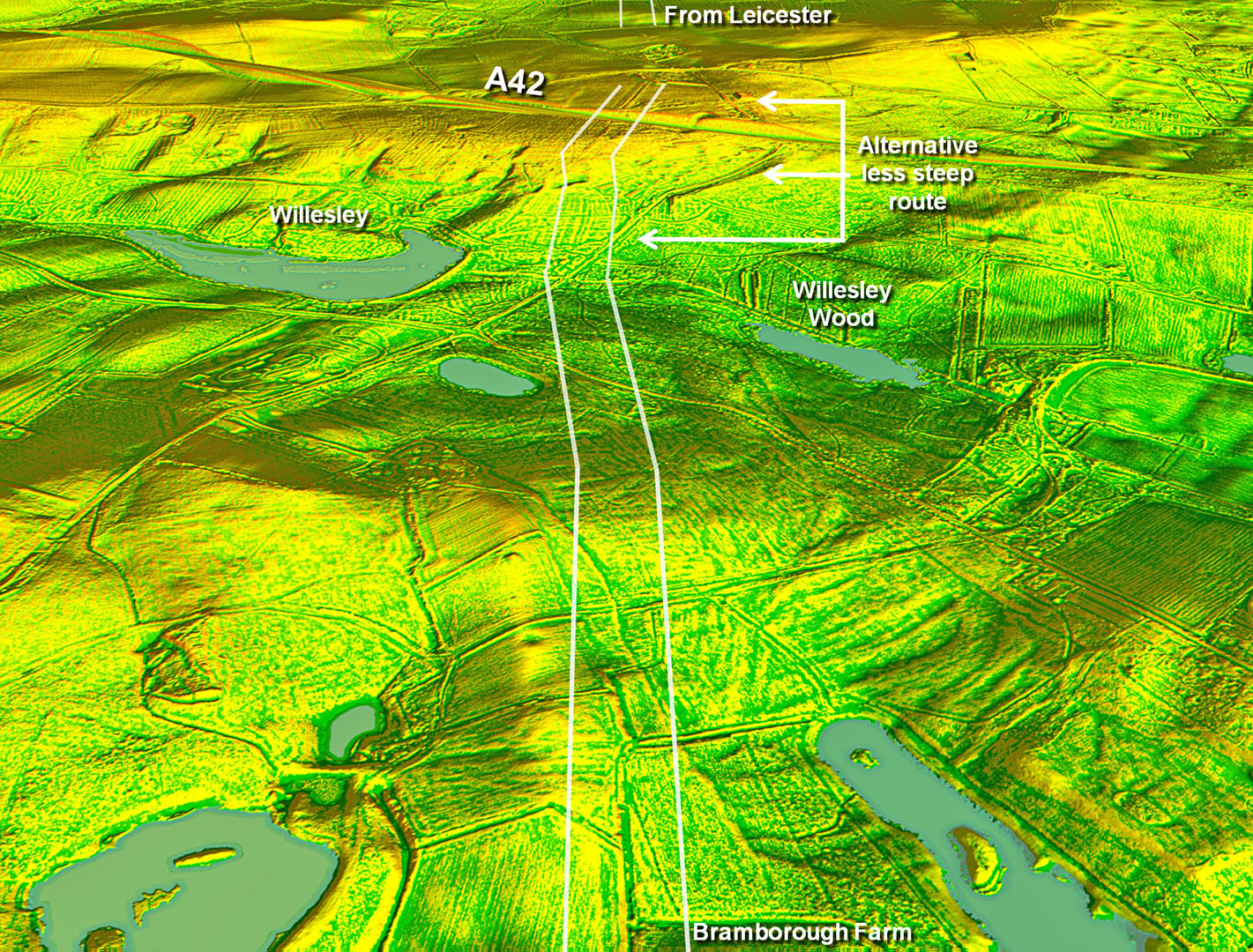
Oblique 3D Lidar Image - Beyond Normanton a very obvious agger is then visible in the lidar imagery (SK37088 12917) followed further on by a much fainter one (SK35542 13518). The route then has to negotiate a steep drop just the west of the A42 and there are two possibilities as to how it did this. The last agger on the common route is faintly visible just east of the junction between Ashby Road and Measham Road (SK35180 13670).
|
Click for larger view
|
 |
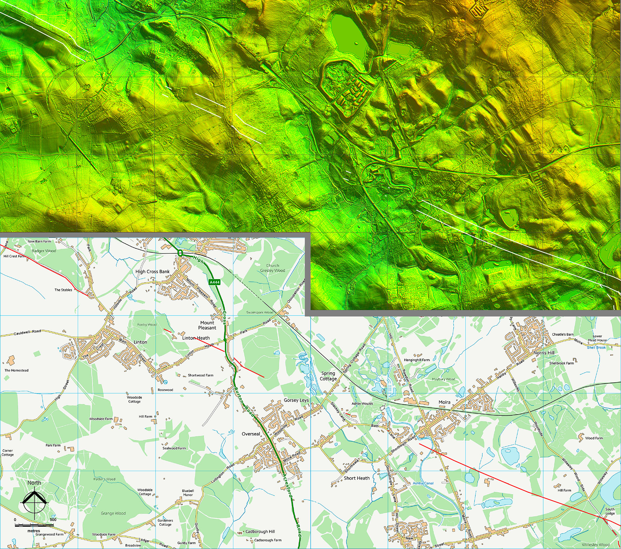
Moira Continuing on from Bramborough Farm there are prominent aggers either side of Ashby Canal at Moira (SK31859 15144 & SK31452 15334). A short section of the road was revealed alongside Bath Lane in 1998 (Browning, 1999), which matches the alignment from the east side of Moira. The last visible agger in Leicestershire is very short length just east of Slackey Lane (SK30576 15671) and is only really recognisable as it is still on the same alignment. |
Click for larger view |
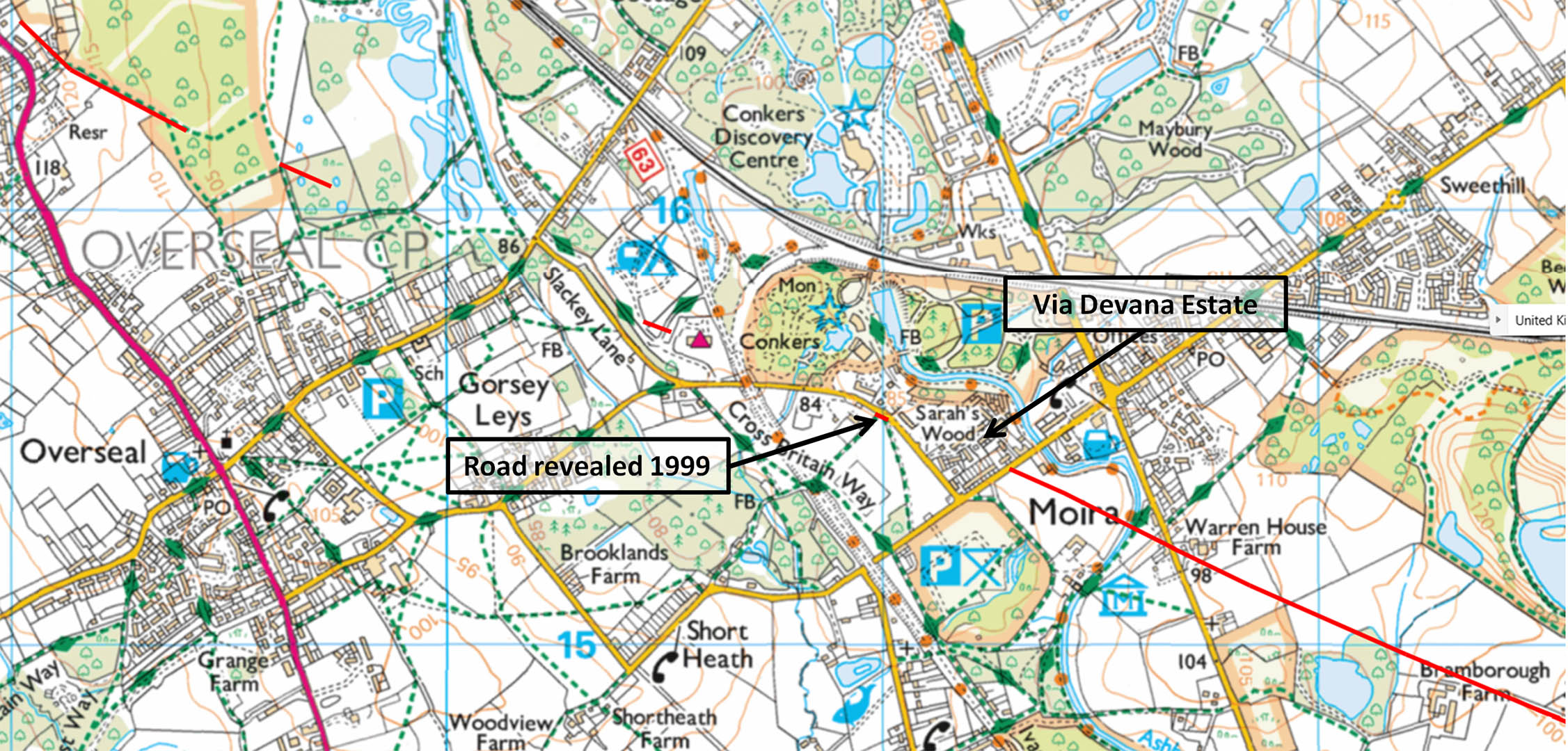 |
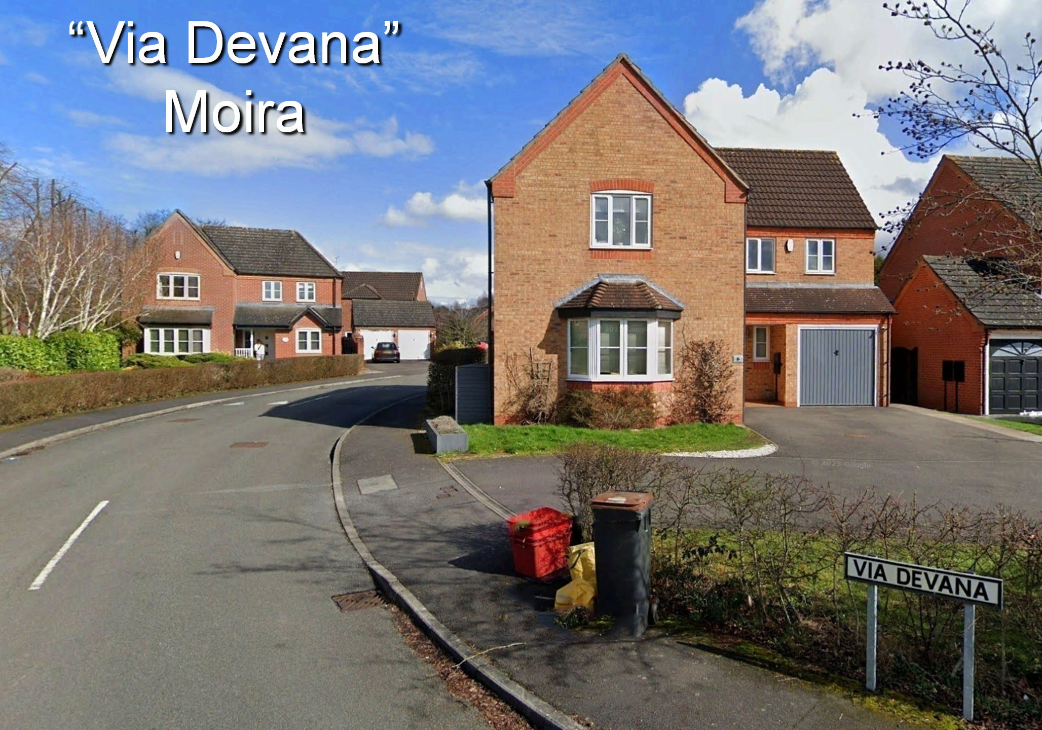
"Via Devana", Moira The fabled name lives on! The Roman road does actually cross the estate road here but ar right angles to the modern Via Devana shown here |
Click for larger view |
 |
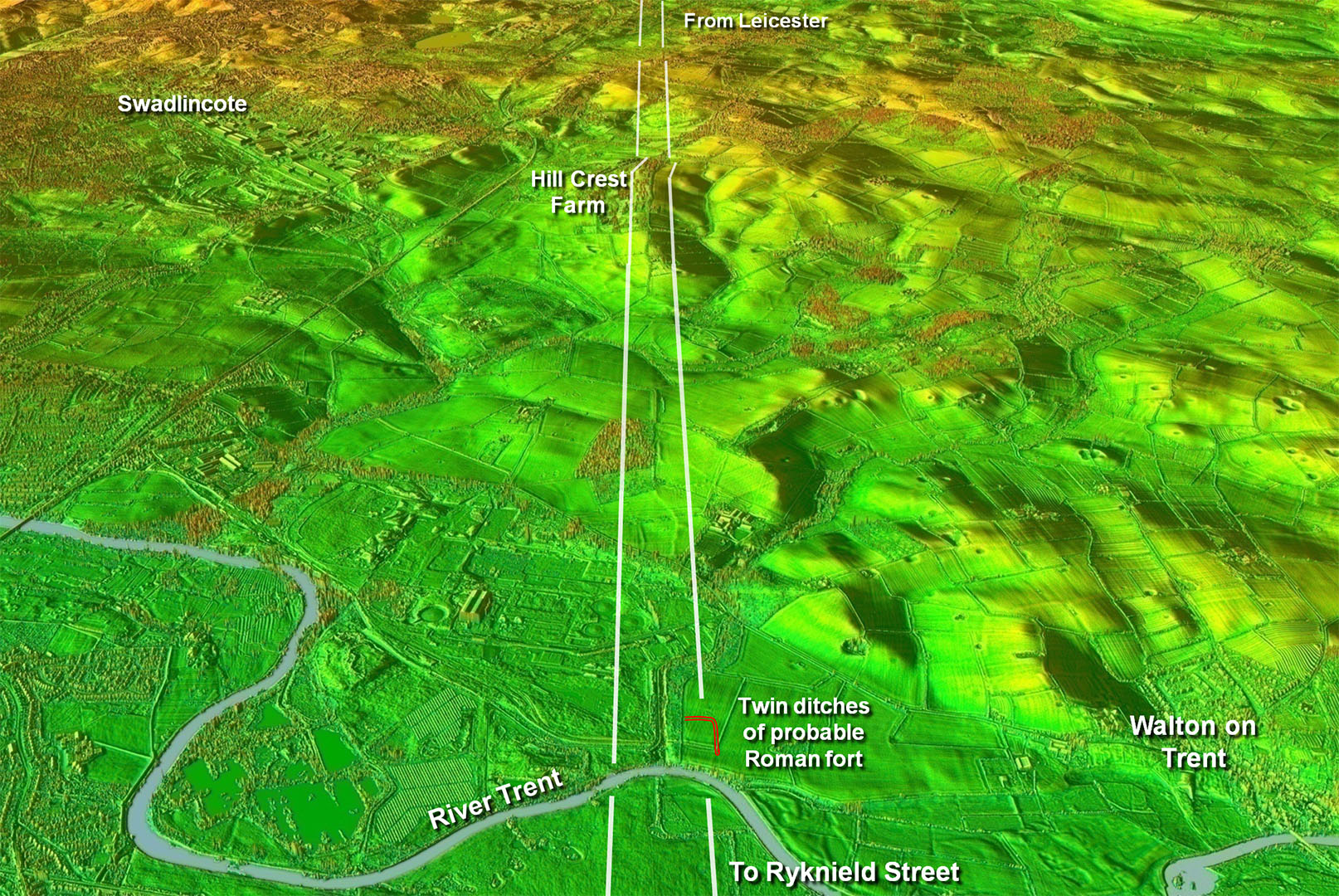
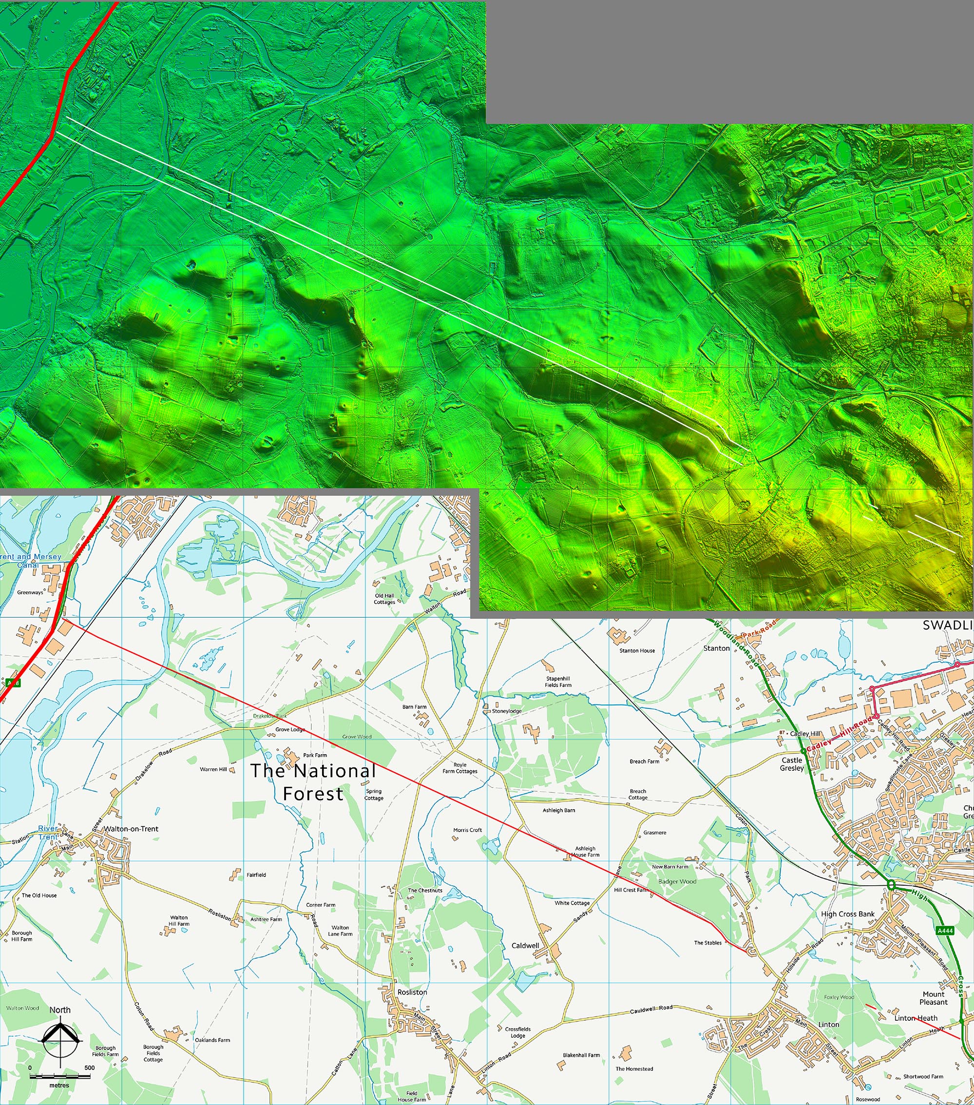
Oblique 3D Lidar Image - Walton on Trent looking back Heading onwards lidar imagery reveals the road in Derbyshire at Mount Pleasant either side of Burton Road (SK29151 16312 & SK28790 16592), with the west side the clearer. There follows a short gap before the road zig-zags slightly to climb a ridge near The Stables (SK27001 17328). Once the height of the ridge is gained (SK26789 17533) then the final alignment begins that will take the road to the River Trent (SK22396 19591). It passes the aptly named Hill Crest and is very obvious in several sections (SK25340 18227 & SK24406 18641). This alignment from Hill Crest is recorded (at the time of writing) in the Derbyshire HER as “conjectural” but we can now be certain that it is indeed part of a Roman road from Leicester to Ryknield Street. There was a fort or fortlet at Walton, perhaps oddly on the east bank rather on the west bank alongside the junction with Ryknield Street. |
Click for larger view
|
 |
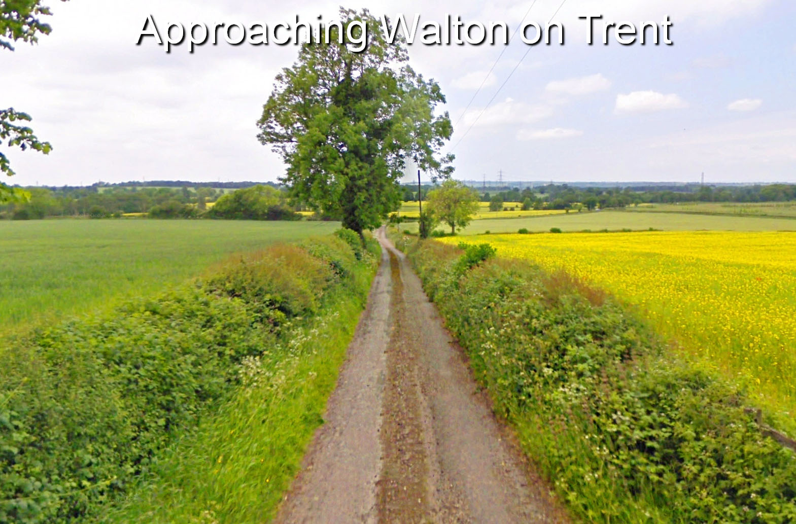
Approaching Walton on Trent From Hill Crest a track follows the Roman road towards Walton on Trent. |
Click for larger view |
 |
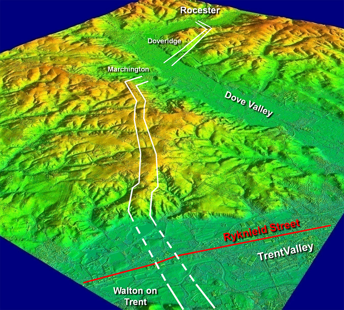
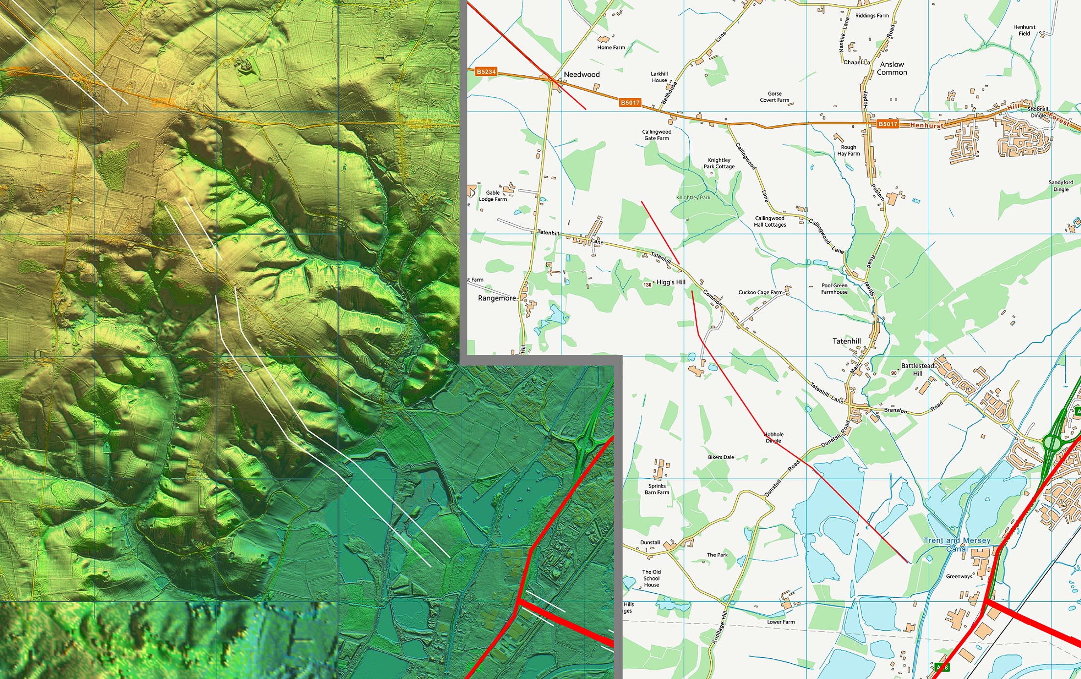
Oblique 3D Lidar Image - Walton on Trent to Rocester Sensible route with the Dove Valley forcing an indirect route to Rocester. |
Click for larger view
|
 |
Oblique 3D Lidar Image - Climb up from the Trent Valley This was the big clue that the road continued onwards - it all lines up with the road at Walton on Trent with the evidence continuing up the valley and then over the top of the hills. |
Click for larger view
|
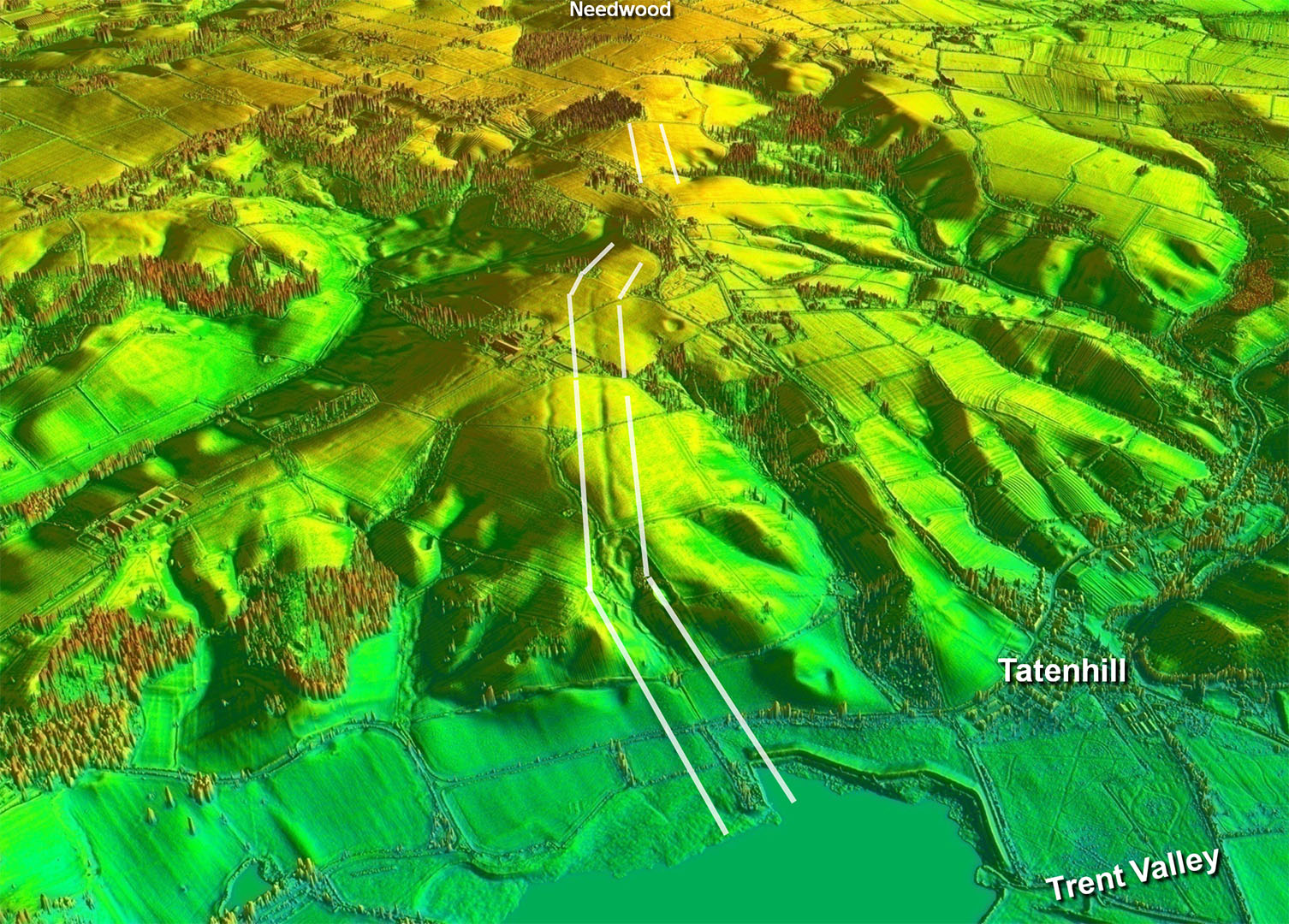 |
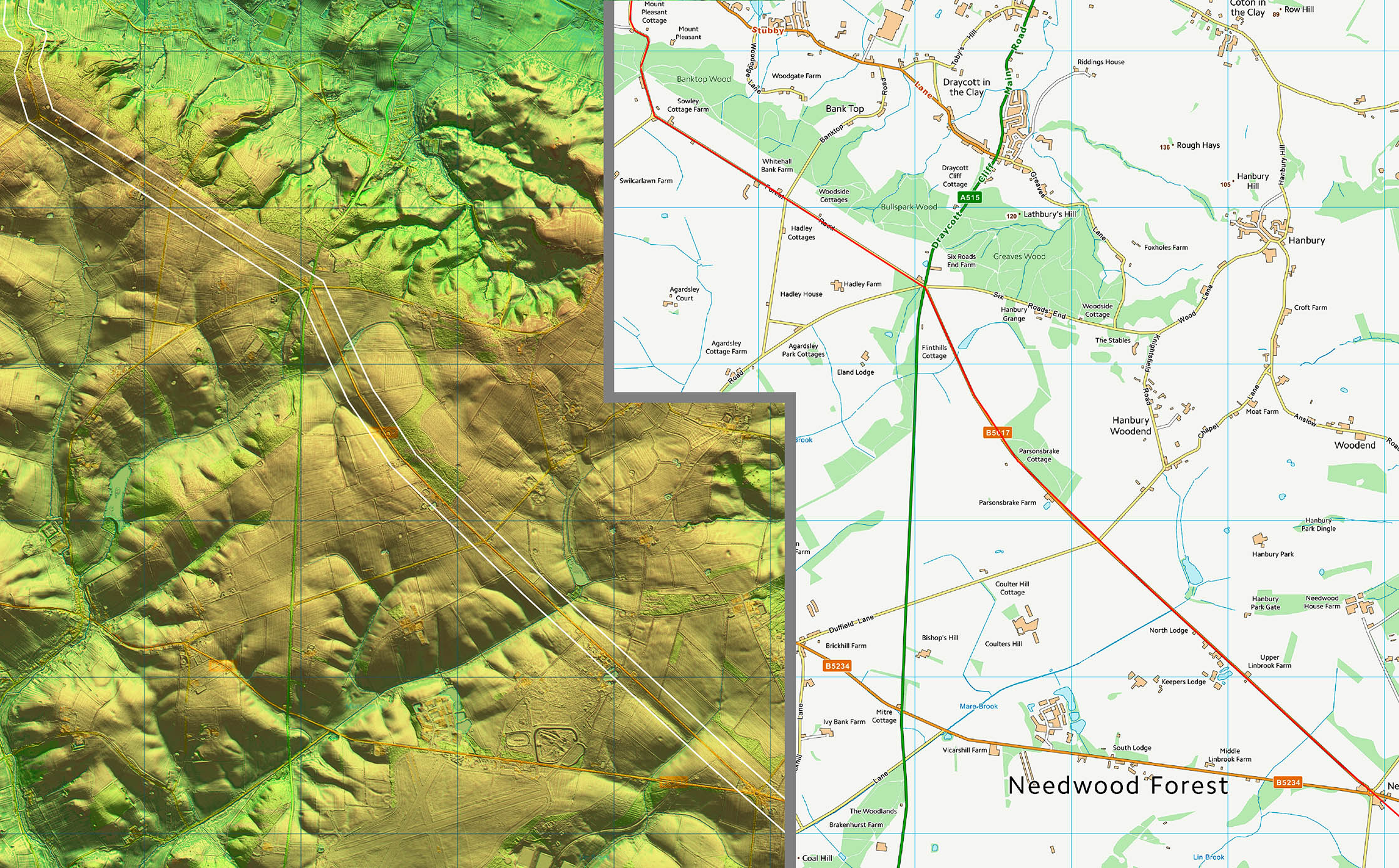
Oblique 3D Lidar Image - Approaching Needwood Heading to Needwod there appears to have been a side-step. |
Click for larger view
|
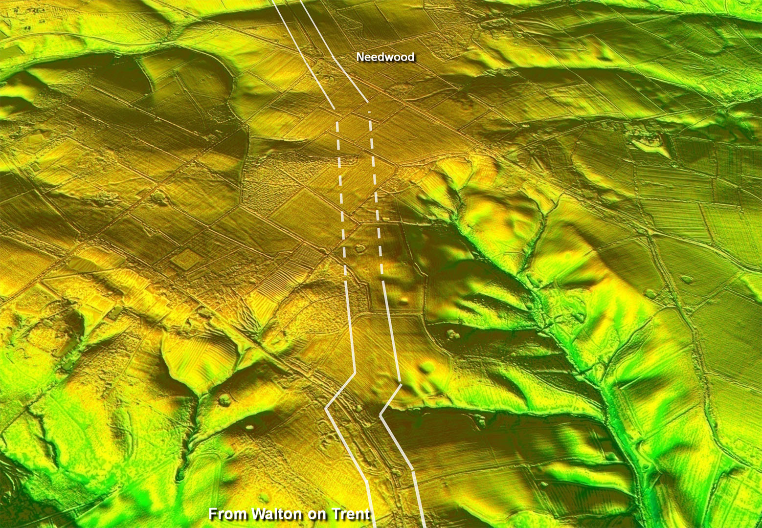 |
Needwood Straight You wouldn't have difficulty suggesting this must be a Roman road. |
Click for larger view
|
 |
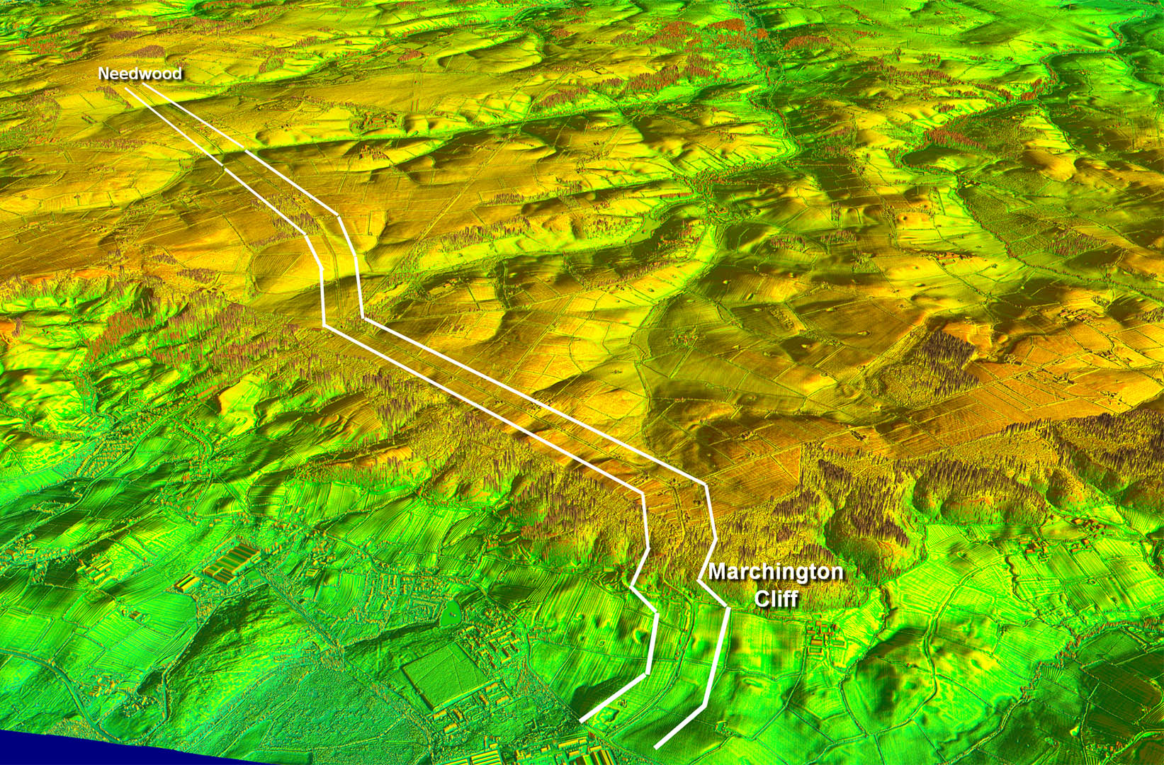
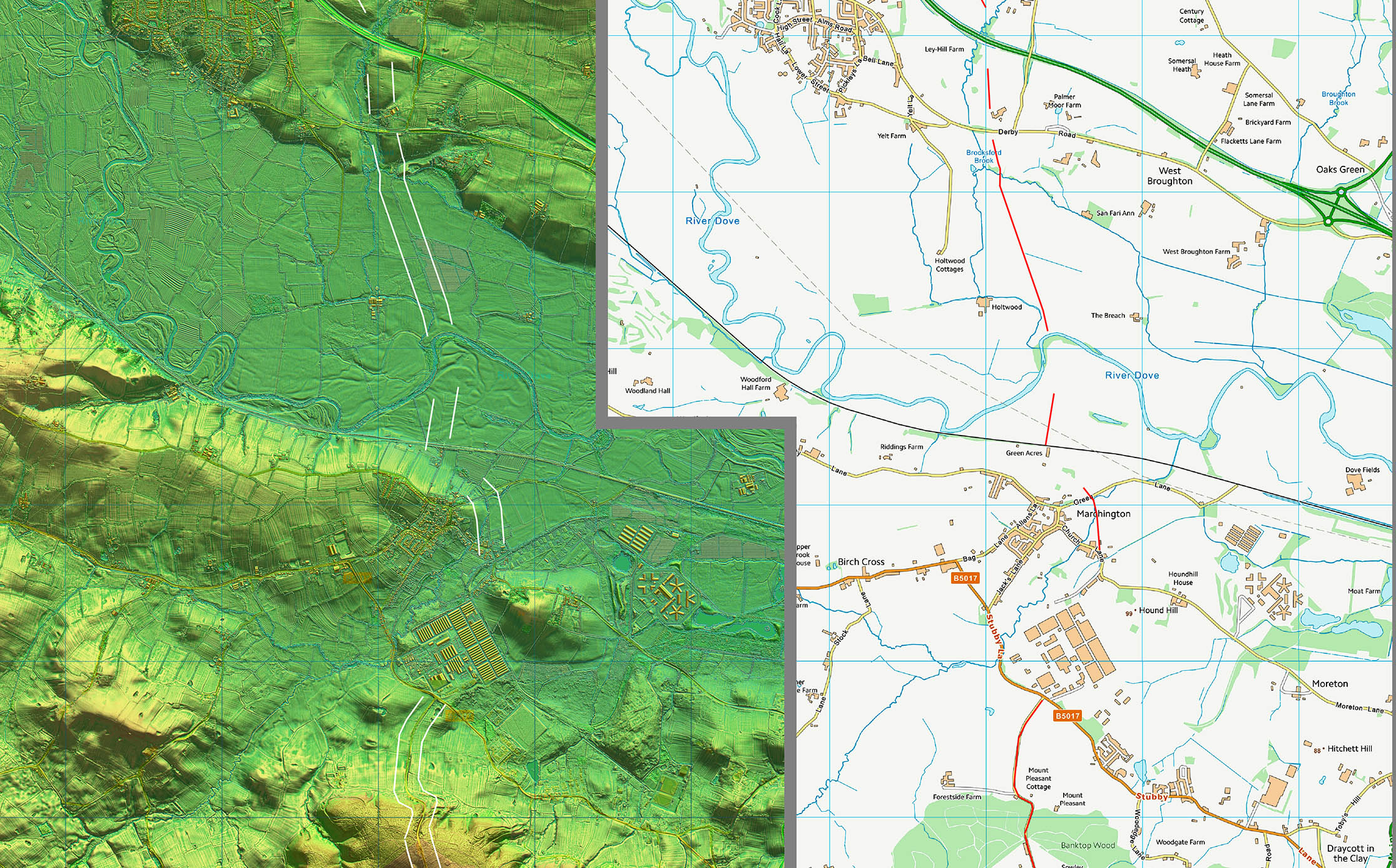
Oblique 3D Lidar Image - Descent via Marchington Cliff Classic Roman-style alignments from Needwood followed by a classic zig-zag descent down to the Dove Valley. |
Click for larger view
|
 |
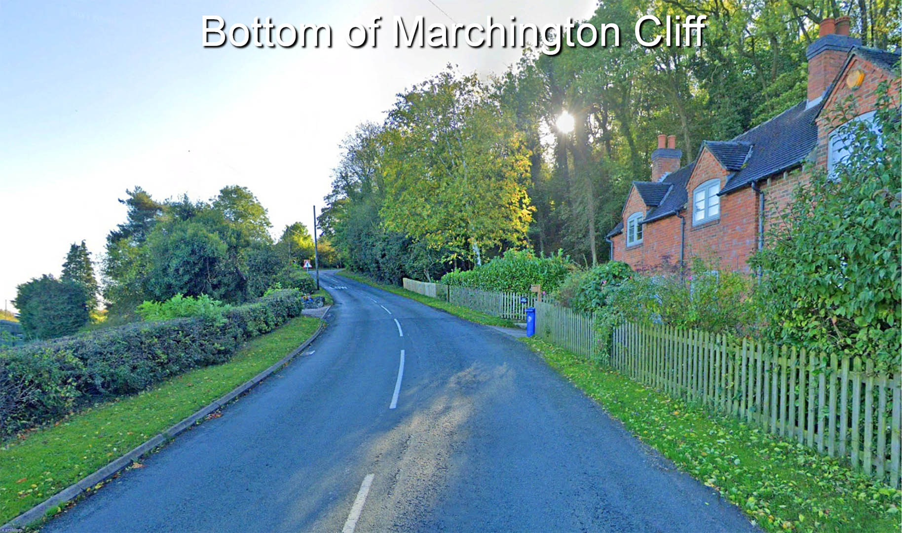
Bottom of Marchington Cliff Descent Big descent made easy by zig-zags. |
Click for larger view |
 |
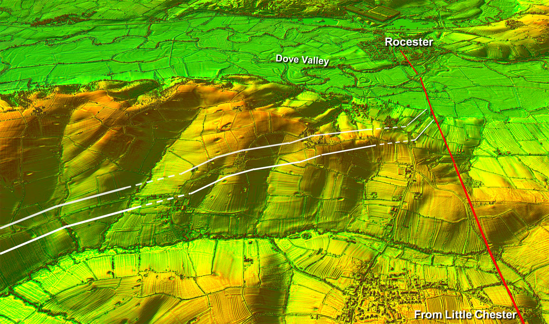
Oblique Lidar Image - Approaching Rocester Some signs of a possible route over to join the Roman road from Little Chester |
Click for larger view |
 |
Route Map - Leicester
|
Click for larger view |
 |
Route Map I
|
Click for larger view |
 |
Route Map 2
|
Click for larger view |
 |
Route Map 3
|
Click for larger view |
 |
Route Map 4
|
Click for larger view |
 |
Route Map 5
|
Click for larger view |
 |
Route Map 6
|
Click for larger view |
 |
Route Map 7
|
Click for larger view |
 |
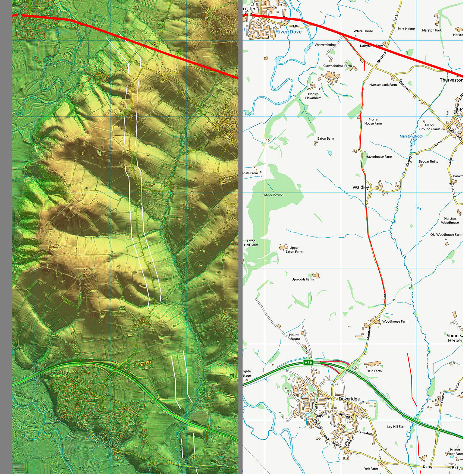
Route Map 8 Across the Dove Valley very very subjective. |
Click for larger view |
 |
Route Map 9
|
Click for larger view |
 |
|
Last update: March 2026 |
© David Ratledge |