|
Possible Roman Road Lancaster to Quernmore KilnsMargary Number: NADistance: unknownOften suggested as a possible Roman road to the Kilns at Quernmore (and even on through the Trough of Bowland) this road certainly has several Roman characteristics which lends support this supposition. Those characteristics continue beyond Quernmore and seem to head directly into what looks like a long abandoned quarry. Beyond there I am not convinced the road went any further. Details of this possible road have been published:- Lancater's Roman Roads; Some Recent Developments, David Ratledge, Contrebis Volume 40, 2022. |
Historic County: Lancashire Current County: Lancashire HER: Lancashire
|
|
|
|
|
|
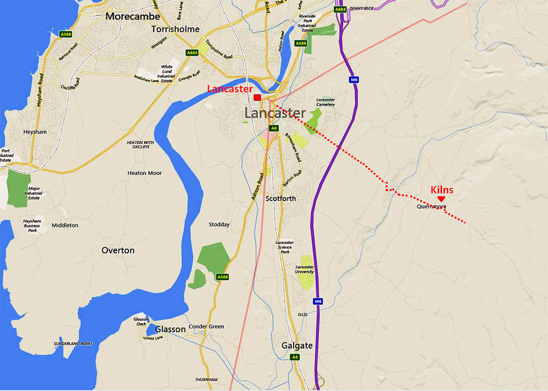
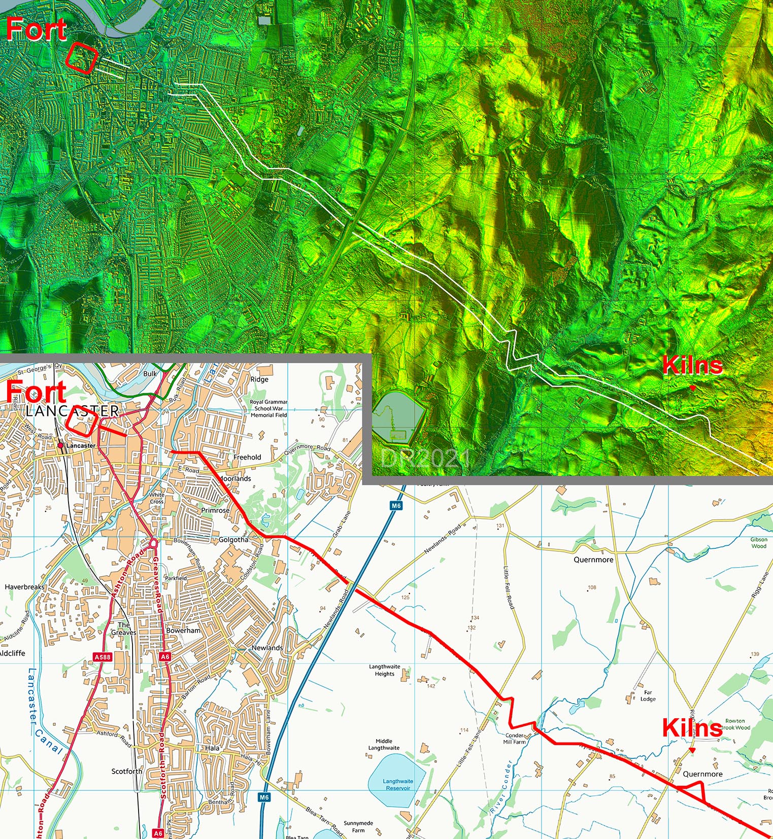
Full Route - Lancaster to Quernmore & Grizedale The route follows modern roads entirely but these do have all the characteristics of a Roman route to Quernmore and the Roman kilns there.The route appears to continue to what seems to be a natural land-slipped quarry at Grizedale. |
Click for larger view |
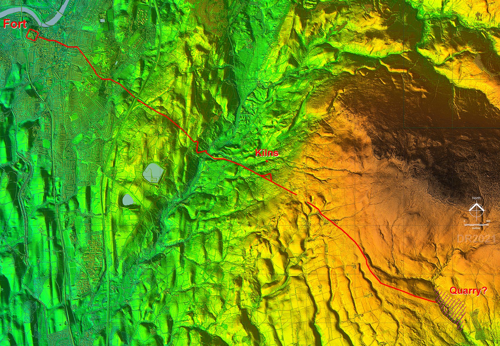 |
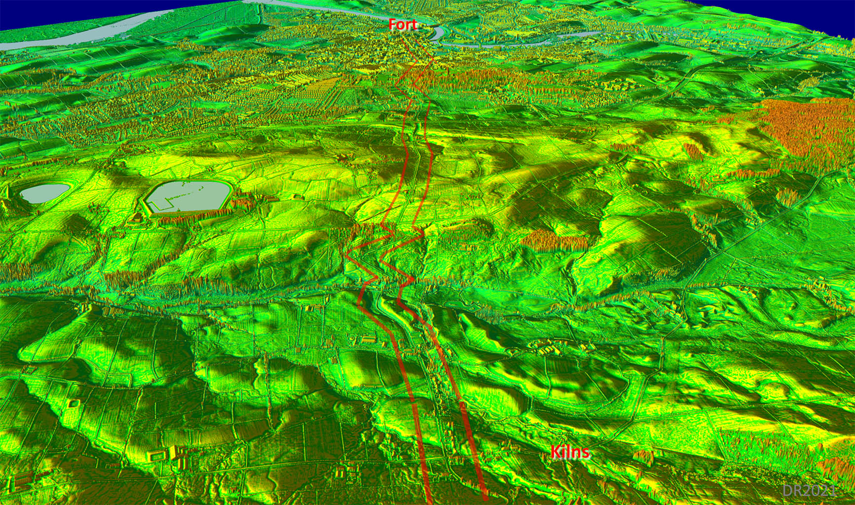
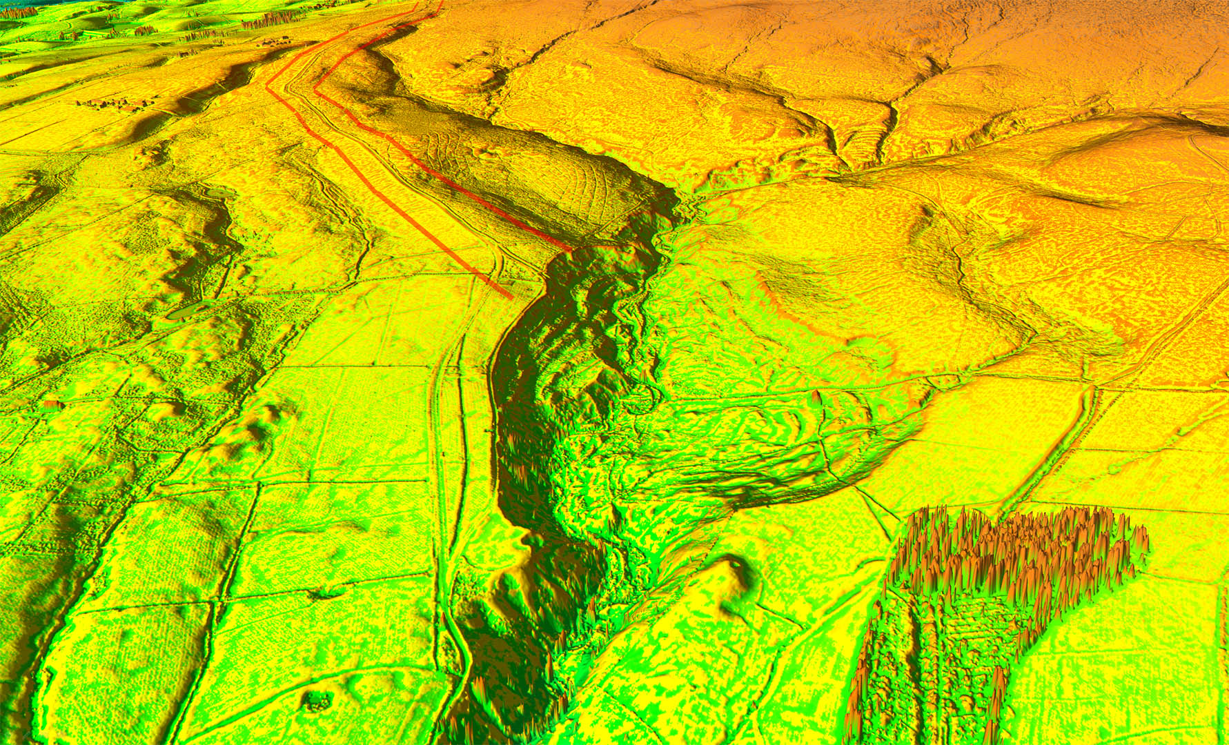
Oblique 3D Lidar Image - Lancaster to Quernmore The route is very direct and those zig-zags to negotiate the hills are certainly how a Roman engineer would have designed the road. It does look convincing. |
Click for larger view |
 |
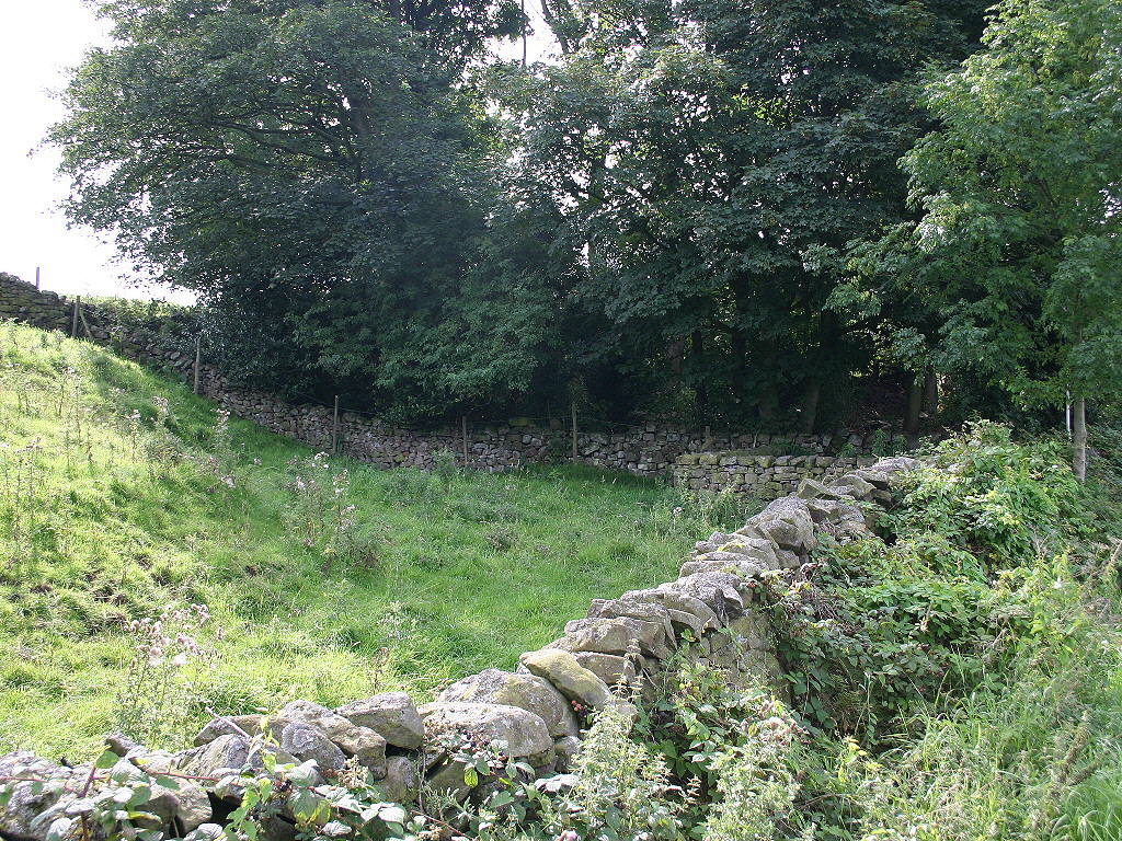
Quernmore - Roman Kilns SIte Not actually on the possible Roman road but just off it to the north-east of Quernmore village. Image: DR |
Click for larger view |
 |
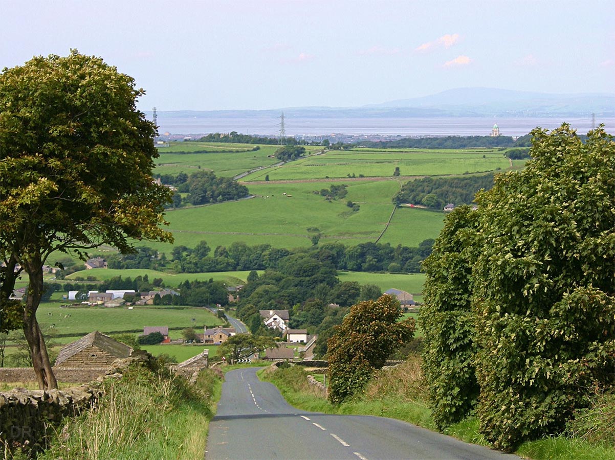
Quernmore - looking back to Lancaster From just beyond Quernmore, above the last zig-zag. Lancaster Castle (and fort site) can be made out fractionally right of centre. The Roman characteristics of this road continue on beyond Quernmore and the kilns. Image: DR |
Click for larger view |
 |
Route Map 1 - Lancaster to Quernmore First section of the road with those typically Roman zig-zags. |
Click for larger view |
 |
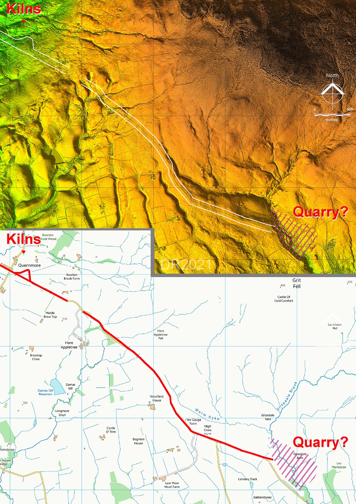
Oblique 3D Lidar Image - Grizedale Natural Quarry(?) The road can be traced onwards passing Jubilee Tower and appears to head directly into what looks like a very large land-slipped area by the River Grizedale. Thanks are due to Mike Derbyshire who inspected this area and reported his findings. The original road can be seen disappeariong over a cliff edge, clearly due to a modern landslip. The landslip clearly truncated the original road which has now been diverted. Was this spot a natural quarry for the Romans? It is certainly a large much disturbed area. |
Click for larger view |
 |
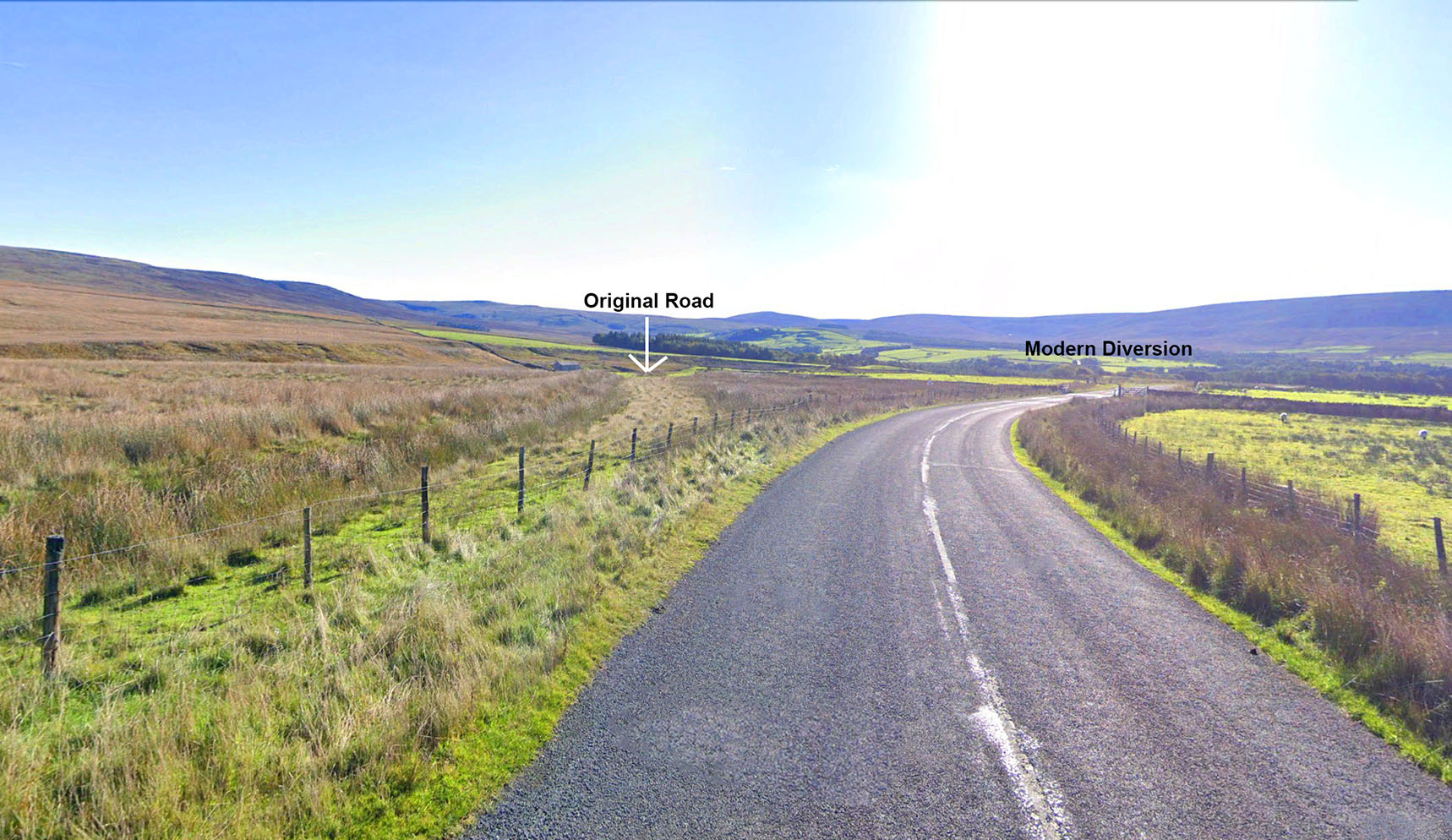
Grizedale - Original Road Course The original course of the the road heading over the lanslip is still evident today. It has an obvious ditch on its left hand side. Image: Google |
Click for larger view |
 |
Route Map 2 - Quernmore to Grizedale Pretty direct route to Grizedale heading to a large landslipped area. Were these landslips caused by Roman quarrying?
|
Click for larger view |
 |
|
|
|
Last update: March 2026 |
© David Ratledge |