Full Route - St Albans to Silchester
A route that has been a puzzle for many years but the logic of where the Roman road surveyor chose to route the road is impeccable and, with hindsight, obvious. The best crossing point of the River Thames was at Caversham. The further upstream you bridge the river the easier it becomes. |
|
 |
Leaving Verulamium
Lidar is not much help in locating the road leaving the city as many of the roads have been robbed of their stone. However, the first 400 metres was recorded by Stead & Rigby in their excavations of 1989.
Beyond there then aerials photographs do appear to show the surviving twin ditches of the road - see below for more detail. |
Click for larger view |
 |
Aerial Photograph - passing Windridge Farm
In two fields the parallel road ditches seem to have survived. These match reasonably well with the first 400 metres know from Verulamium. |
Click for larger view |
 |
Oblique 3D Lidar Images - M1 to Kings Langley
Beyond the M1 motorway then there is some Lidar evidence - not the best but probably the line as far as Kings Langley. |
Click for larger view |
 |
Oblique 3D Lidar Image - Commonwood
Evidence resumes west of Langley Lodge heading for Commonwood and the River Chess. |
Click for larger view |
 |
Oblique 3D Lidar Image - River Chess
On the west side of the River Chess the road has to climb 50 metres so we would expect the road to dog-leg or angle across the slope. This appears to what has happened here. At first i wasn't so sure but the inset I thinks shows this was the probable route. the road negotiates the contours perfectly. |
Click for larger view |
 |
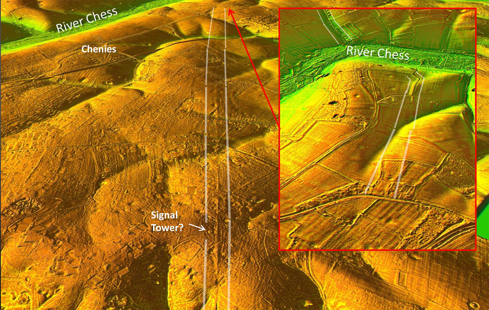
Oblique 3D Lidar Image - West of River Chess
Looking back to the River then the agger is crystal clear. There is also a signal tower alongside the road. |
Click for larger view |
 |
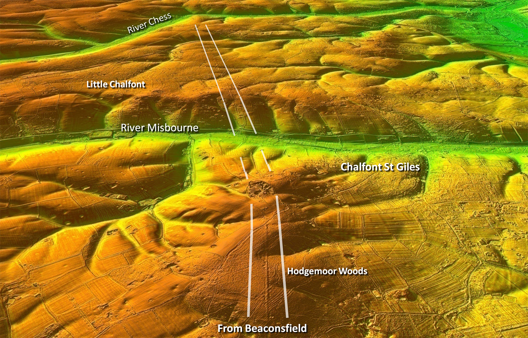
Oblique 3D Lidar Image - Crossing the River Misbourne Valley
Looking back from over the famous section in Hodgemoor Woods |
Click for larger view |
 |
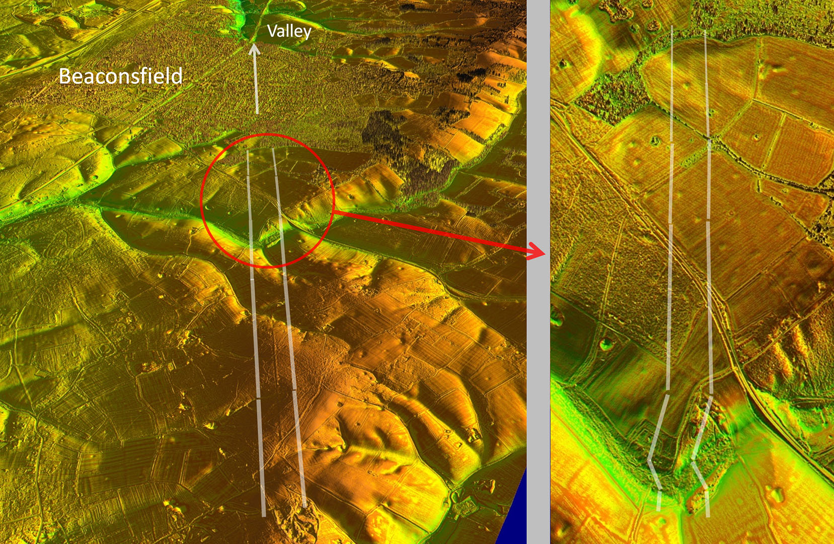
Oblique 3D Lidar Images - Heading into Beaconsfield
Route is clear and certain although a little faint heading into Beaconsfield. The alignment was obviously aiming for the natural valley ahead. |
Click for larger view |
 |
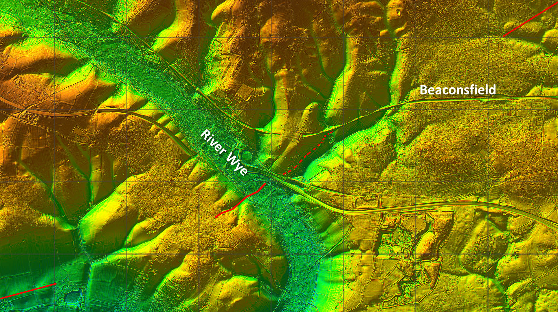
Lidar Image - Beaconsfield & River Wye
West of Beaconsfield then the evidence is very intermittent. Just the climb out of the Wye Valley on its west side is visible. |
Click for larger view |
 |
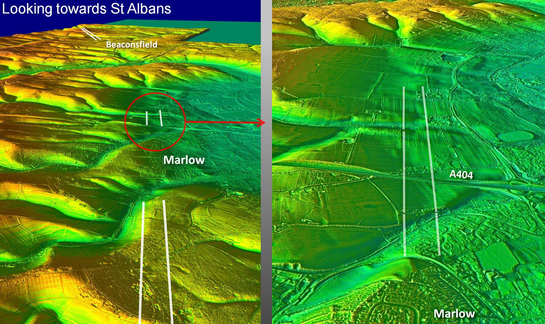
Oblique 3D Lidar Images - Passing Marlow
Looks faint but the section approaching Malow also records in aerial photos. |
Click for larger view |
 |
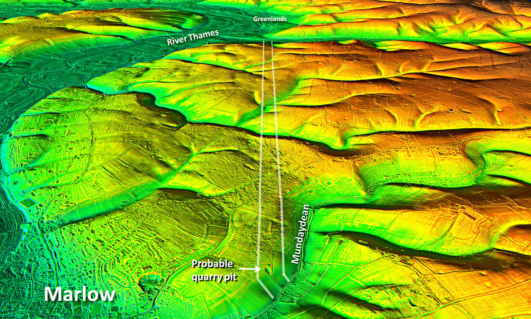
Oblique 3D Lidar Image - Marlow to Greenlands
Looking ahead from Marlow towards Greenlands and we have a perfectly straight alignment to Greenlands. |
Click for larger view |
 |
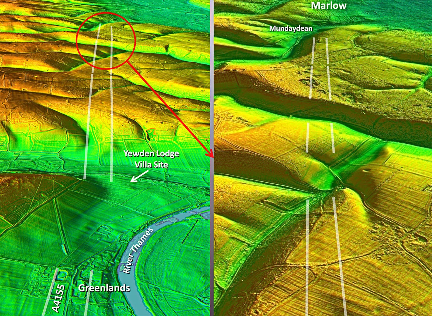
Oblique 3D Lidar Images - Looking back from Greenlands
Reverse view to above. |
Click for larger view |
 |
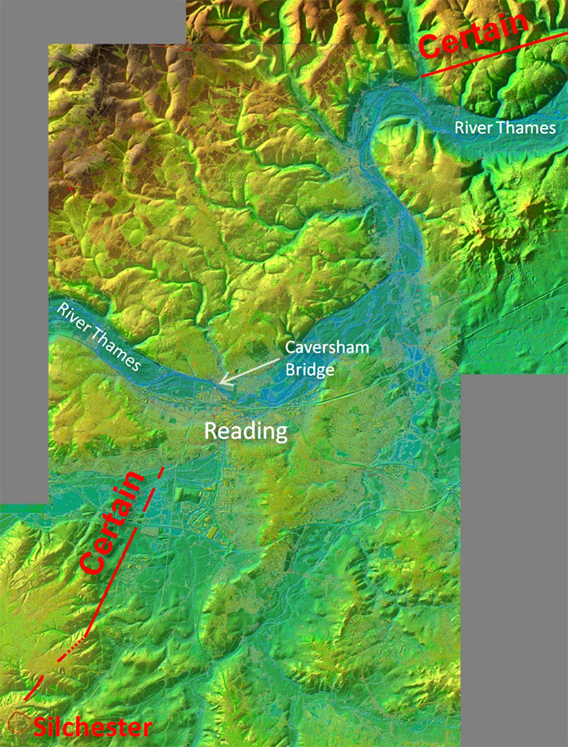
Lidar Image - Certain Alignments
We have followed the route to Greenlands which is at the top of this image. We shall see later the route from Silchester. Both routes are absolutely certain so how would a road surveyor connect these two sections? Pretty obvious isn't it!
The route from St Albans was clearly aiming to pass around the River Thames at Greenlands. The route from Silchester which I had found 10 years ago was clearly aiming to cross the Thames at Caversham, a long established crossing point. .
Of course the Romans just extended the two straight alignments and hey presto a logical route. Despite being so obvious various suggestions over the years have instead crossed the Thames at Greenlands and wandered down the east side of the river This makes no sense at all.
The Romans kept it simple - straight alignments around the bend in the Thames and utilise the best crossing point at Caversham. |
Click for larger view |
 |
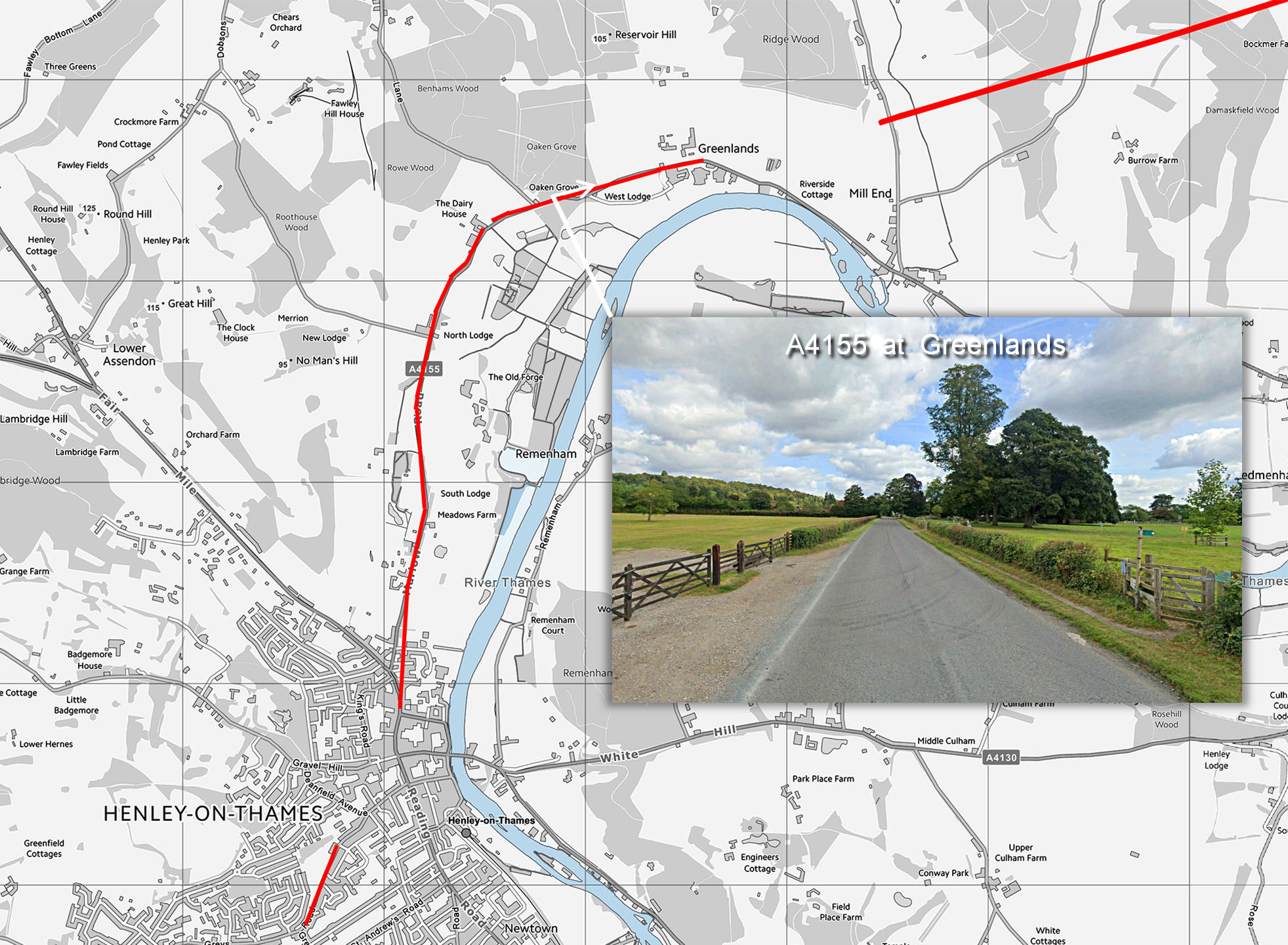
Map - Greenlands to Henley
The A4155 at Greenland aligns well the Lidar alignment so we can be confident it represents the Roman line and onwards through Henley-on-Thames.
Inset: Greenlands looking back towards St Albans. |
Click for larger view |
 |
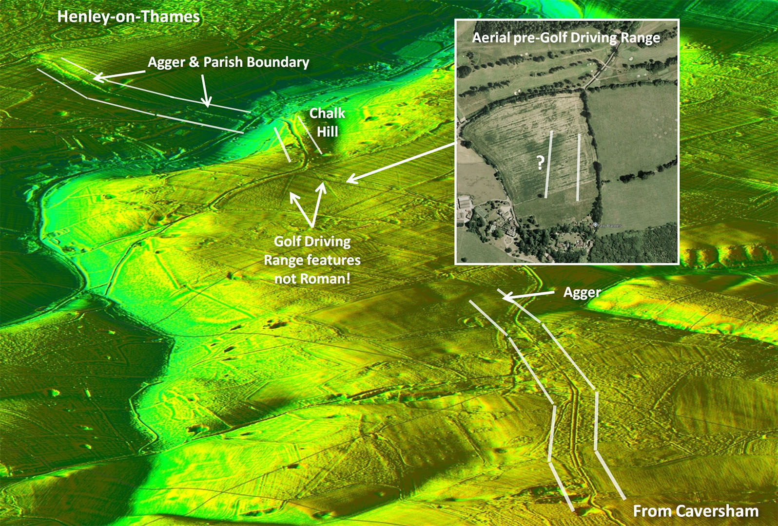
Oblique 3D Lidar Image - Chalk Hill
There is enough evidence I believe to confirm this is the genuine route.
First - from Henley those agger features plus a parish boundary.
Second - the Chalk Hill terrace-way (see next image).
Third - probable aerial view of the agger (inset).
Fourth - agger onto straight modern road. |
Click for larger view |
 |
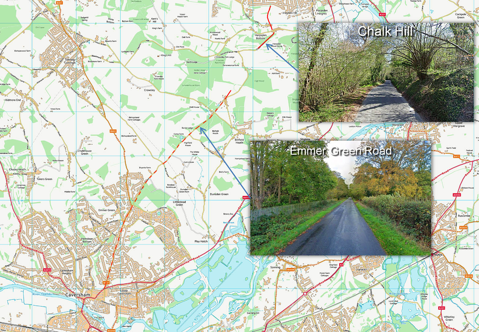
Map - Henley to Caversham
The modern road to Caversham is very direct and no doubt represents the Roman line.
Chalk Hill is an excellently engineering terrace-way down the hillside - typical Roman construction.
Emmer Green Road looks Roman! |
Click for larger view |
 |
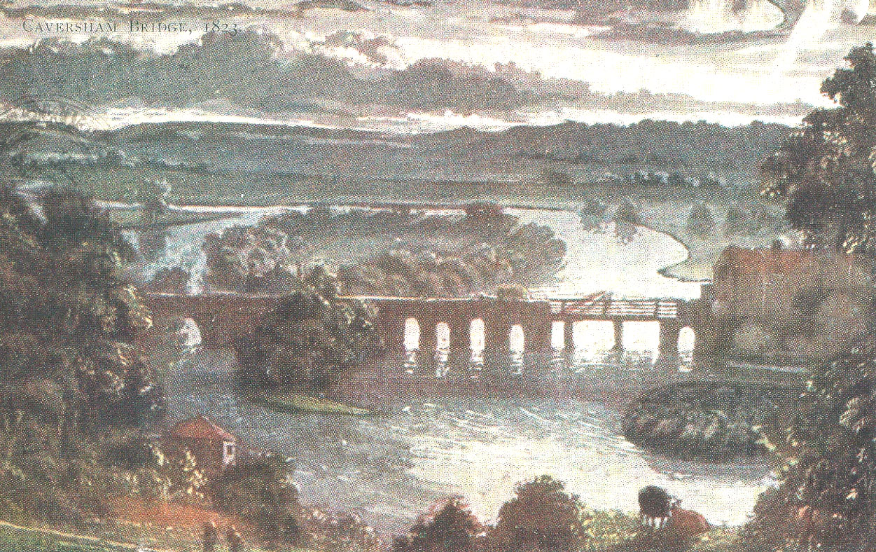
Caversham Old Bridge, 1823
This old postcard view of Caversham Bridge shows why it was a popular crossing point over the centuries. A convenient island meant that instead of one long bridge, two shorter ones could be constructed. The Romans may have used Fry's Island as it aligns well with the road north of the river- see below.
Image: thames.me.uk |
Click for larger view |
 |
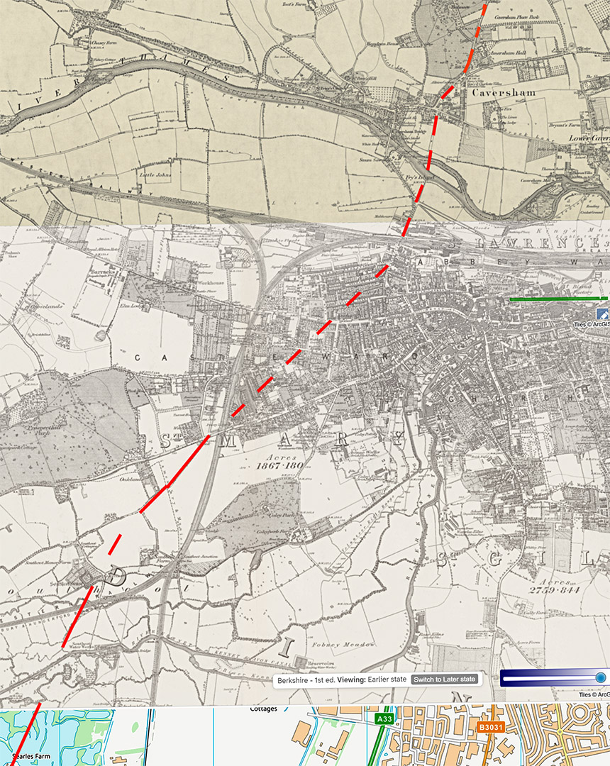
Reading - OS First Edition Map with possible route
This is very much a best guess. There are some clues and it would be a practical course. Fry's Island would have provided an easier bridging point.
|
Click for larger view |
 |
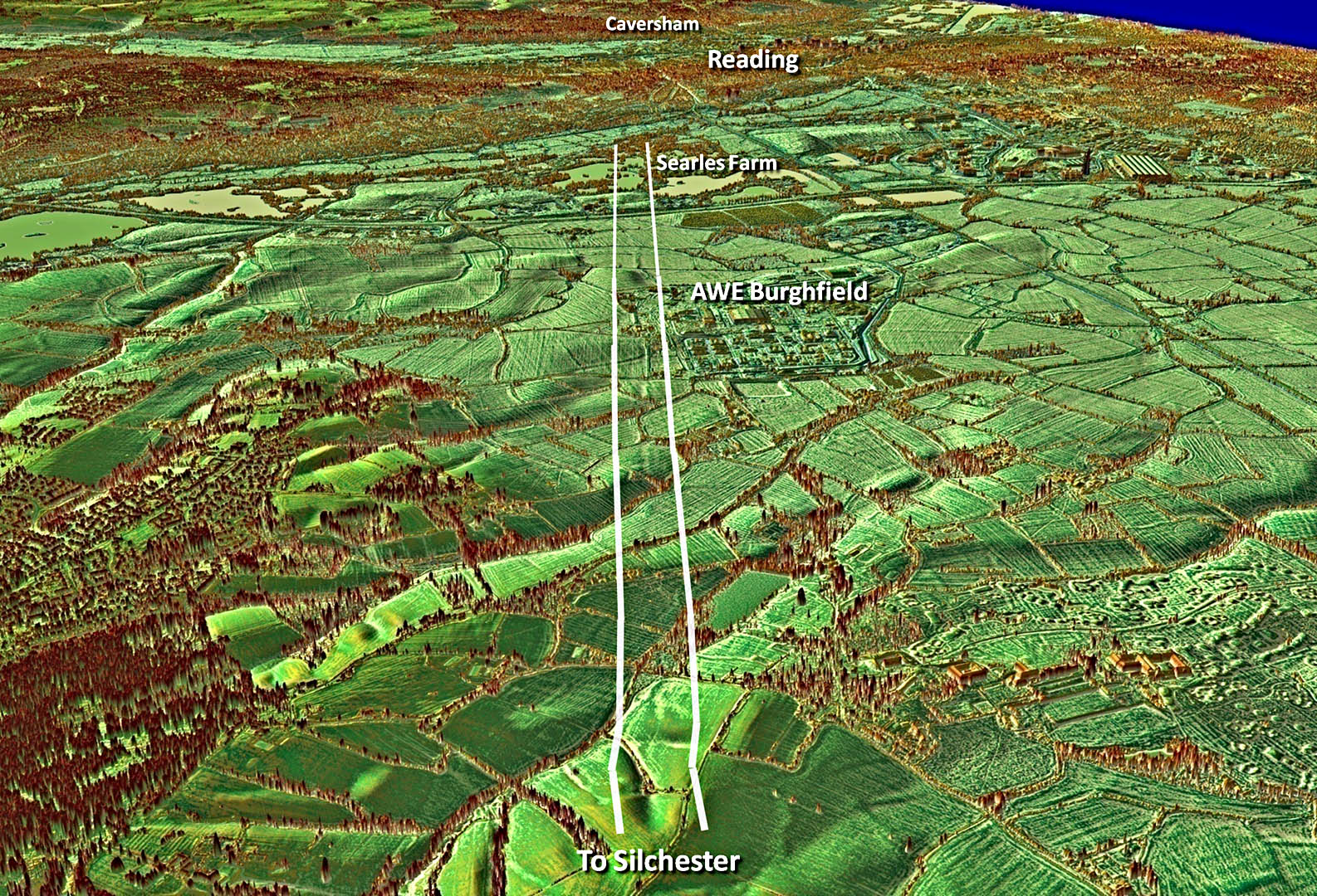
Oblique 3D Lidar Image - Caversham to Mortimer
North of Mortimer, the agger is visible from the head of a little valley and sufficient survives of the main alignment all the way to the M4, north of Burghfield. This was what I had spotted 11 years ago. At the latter location then cropmarks had been seen in aerial photos immediately south of the M4 and again north of it at Searles Farm (Fenner and Dyer, 1994, p.64). This formerly detached section fits perfectly with the alignment from Mortimer.
|
Click for larger view |
 |
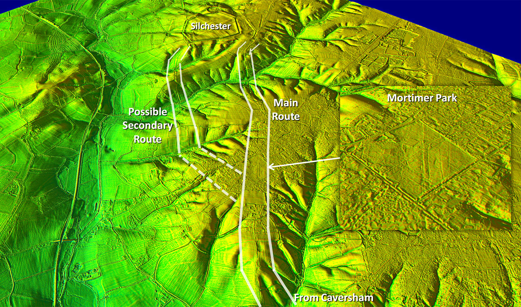
Oblique 3D Lidar Image - Silchester Approach
The main route is via Mortimer to Silchester’s northern gate. It is very clear crossing The Fairground (Park) in the centre of Mortimer (SU65566 64781) - see inset.
There is a second possible route which actually aligns with the alignment from Reading. Part of this was dated as a pre-Roman boundary but there is continuous evidence continuing the line that is consistent with a second route. I would class this as probable. |
Click for larger view |
 |
Route Map 1
I have depicted the route dashed as the evidence is intermittent but it is probably the most likely course of the road. Beyond Kings Langley then nothing certain is visible until Langley Lodge. |
Click for larger view |
 |
Route Map 2
At the River Chess the road leaves Hertfordshire.
|
Click for larger view |
 |
Route Map 3
The route is clearly targetting going around the bend in the River Thames north of Henley.
|
Click for larger view |
 |
Route Map 4
Around the bend in the River Thames, down through Henley over Caversham Bridge and on to Silchester.
|
Click for larger view |
 |