
|
The Roman Roads from Colchester to the South-EastMargary Number: NoneDistance: ?? miles Fairly high confidence that there are two roads heading to the south-east from Colchester. However in both cases their ultimate destinations are unknown. The lidar clues simply run out. 2026 Update: Thanks to Geoff Lunn we now know there was a roadside settlement on the northern route. |
Historic Counties: Essex Current Counties: Essex HER: Essex
|
|
|
|

|
|
Lidar Image - Full Route The more southerly road probably has a destination somewhere in the vicinity of Brightlingsea or St Osyth. perhaps more likely the latter where there have been Roman finds. The other, more easterly route, then perhaps somewhere on the Naze. |
Click for larger view
|
 |
Map - Full Route I have included a modern map showing the routes but more work is needed to resolve the issues here. |
Click for larger view |
 |
Elmstead Market Both routes go through the centre of Elmstead Market (A133) before they diverge. |
Click for larger view |
 |
Lidar Image and Route Map 1 This is the common section for both routes. Initially it could have shared a common road with the Lawford House road. Beyond Greenstead our roads probably are overlaid by the A133 to just beyond Elmstead Market. |
Click for larger view |
 |
Lidar Image and Route Map 2 Just before Tenpenny Brook our routes split. The Lidar evidence is reasonable as far as just to the north of Weeley. |
Click for larger view |
 |
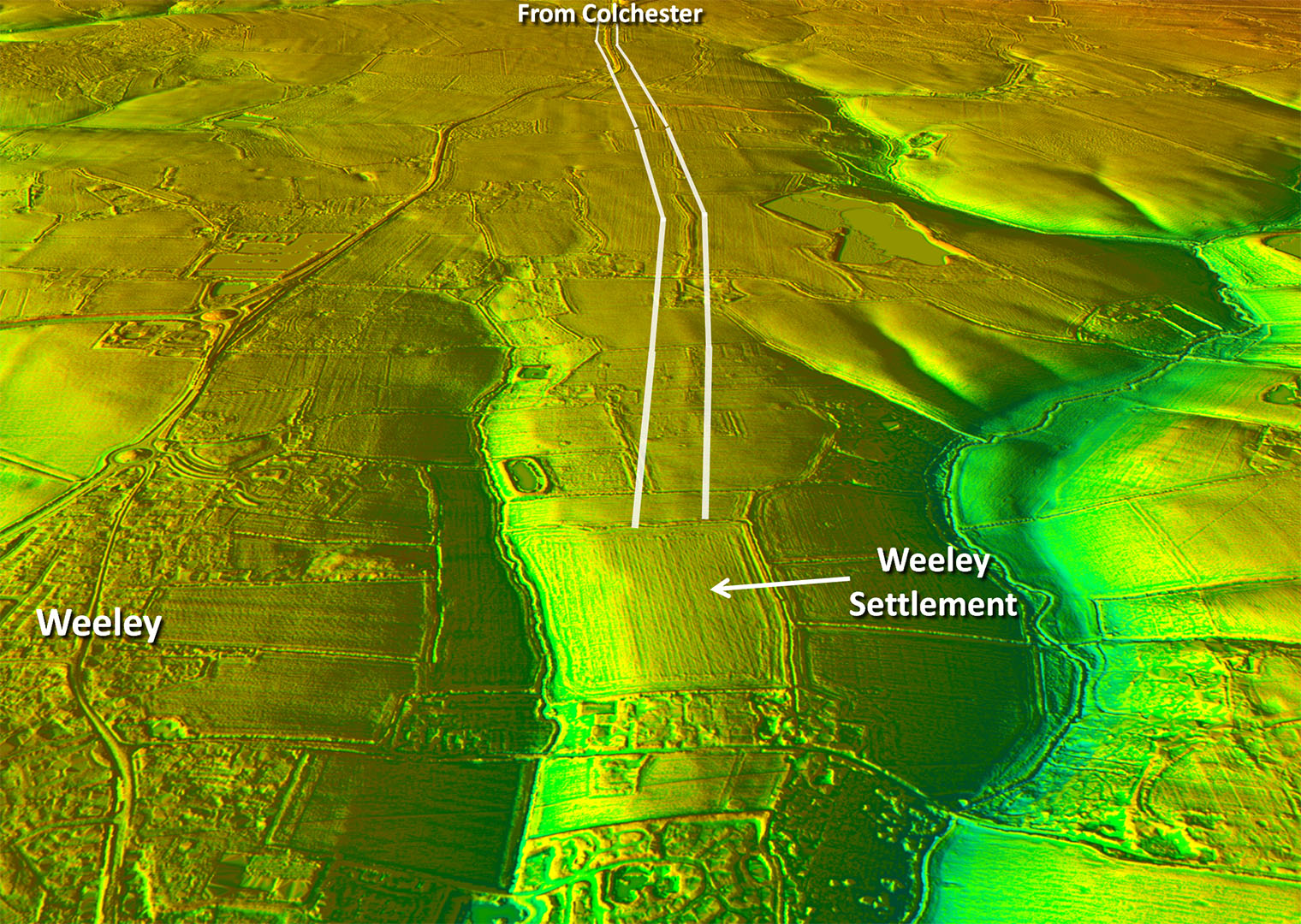
Oblique 3D Lidar Image - Weeley 2026 Update: Thanks to Geoff Lunn we now know there was almost certainly a Roman roadside settlement at Weeley - see below. |
Click for larger view |
 |
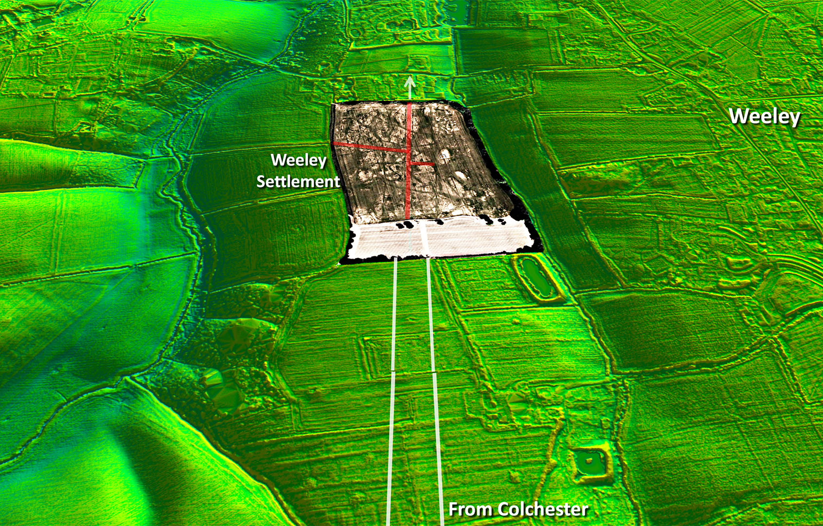
Lidar Image - Weeley Settlement 2026 Update: This is the location of Geoff's aerial photograph - see next image for full resolution. The settlement local roads are shown in red. |
Click for larger view |
 |
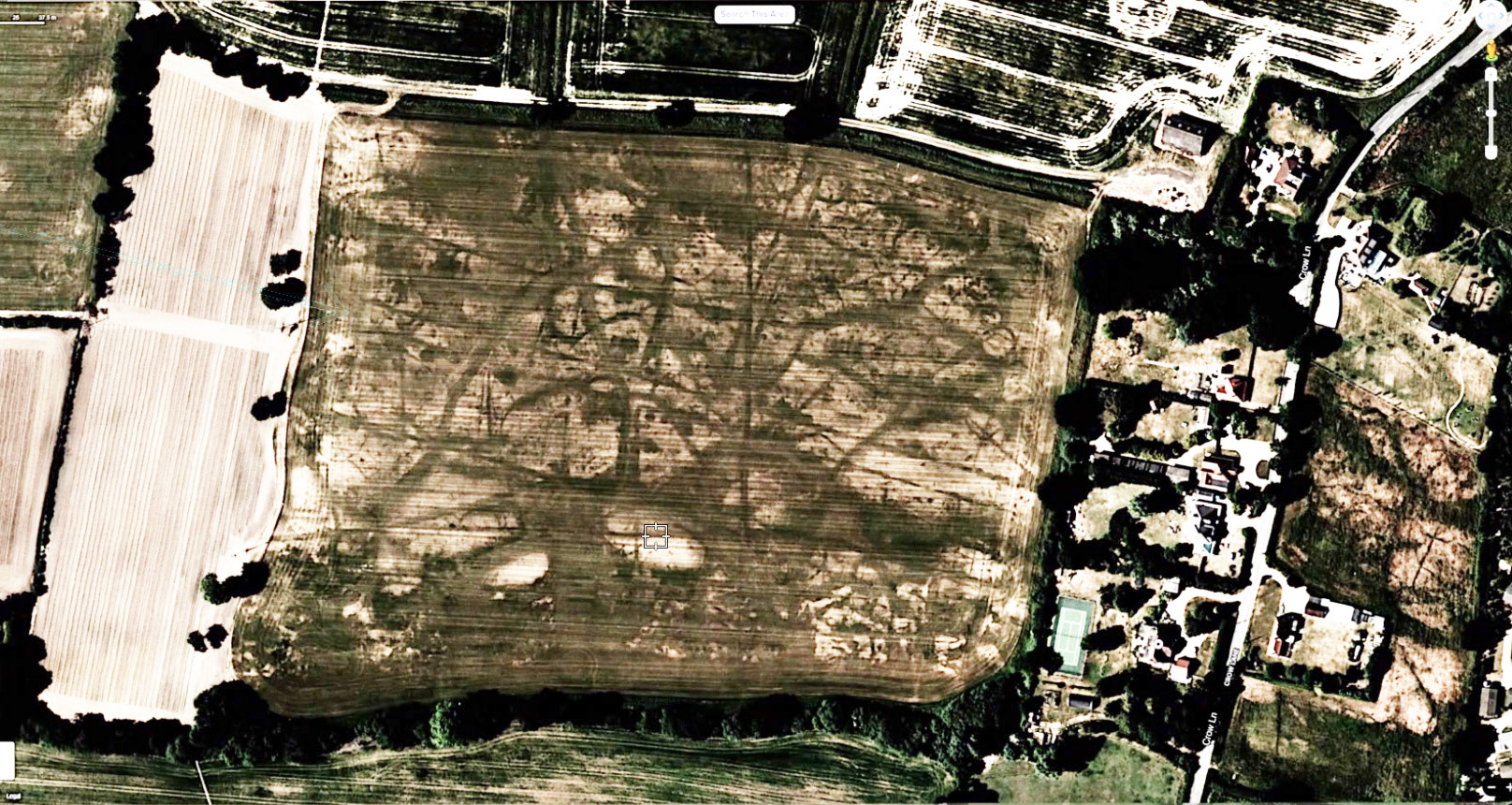
Aerial Photograph - Weeley Settlement 2026 Update:The "tramlines" of the Roman Road are clear across this field extending the line I had previously found with Lidar. Great to have independent confirmation. Not all of what is visible can be Roman and much crosses the Roman road but there does appear to be a branch road off the main road to the south - it clearly connects. There is almost certainly a second road branching off to the NNE. Aerial Photo: Processed by Geoff Lunn from an Apple Maps aerial photo. |
Click for larger view |
 |
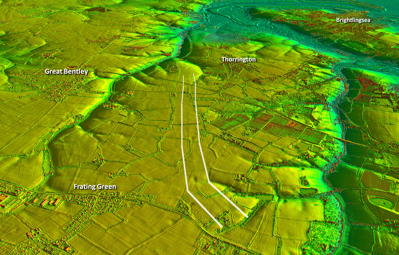
Oblique Lidar Image - south road towards Thorrington Very very clear agger heading south towards Thorrington but then where? A coastal connection seems obvious but needs more work to locate the destination. |
Click for larger view |
 |
Lidar Image and Route Map 3 Again reasonable lidar evidence, this time just beyond the railway line at Thorrington. projecting the direction onwards would suggest perhaps St Osyth is the likely destination. |
Click for larger view |
 |
|
|
|
Last update: January 2026 |
© David Ratledge |