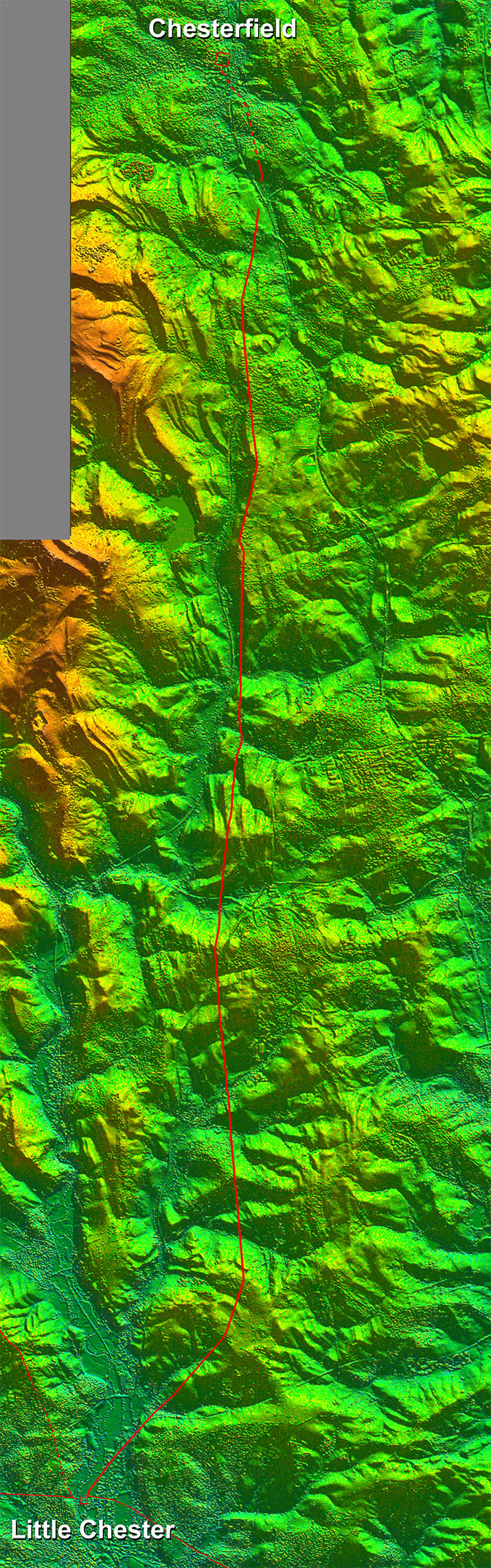
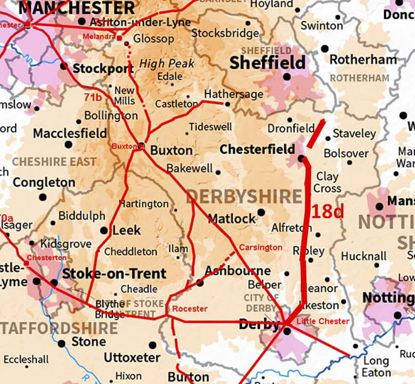
Lidar Image - Full Route
Pretty direct and pretty much due north.
|
Click for larger view |
 |
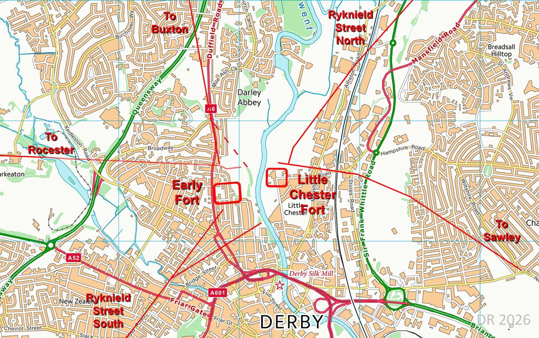
Little Chester Roman Road Network
No less than 5 Roman roads met at Little Chester. Ryknield Street and the Buxton road were clearly contemporary with the early fort. The roads to Rocester and Sawley were aligned with the later fort. |
Click for larger view |
 |
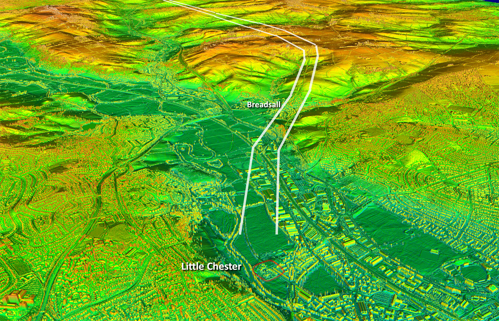
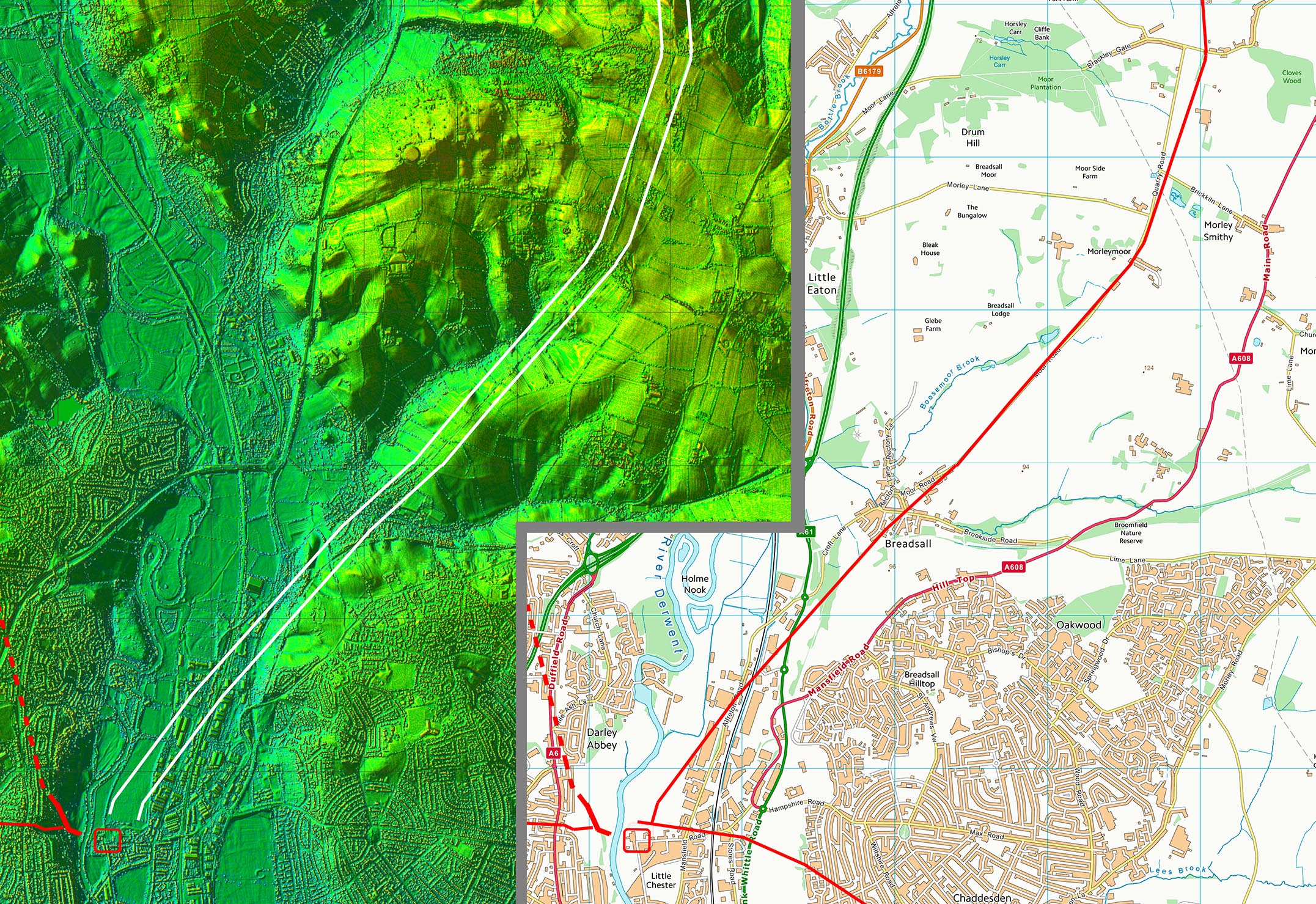
Oblique 3D Lidar Image - Leaving Little Chester
First priority appears to have been to leave the valley bottom and head for high ground from where it would head north. Nothing much visible in the valley bottom as would to be expected.
|
|
 |
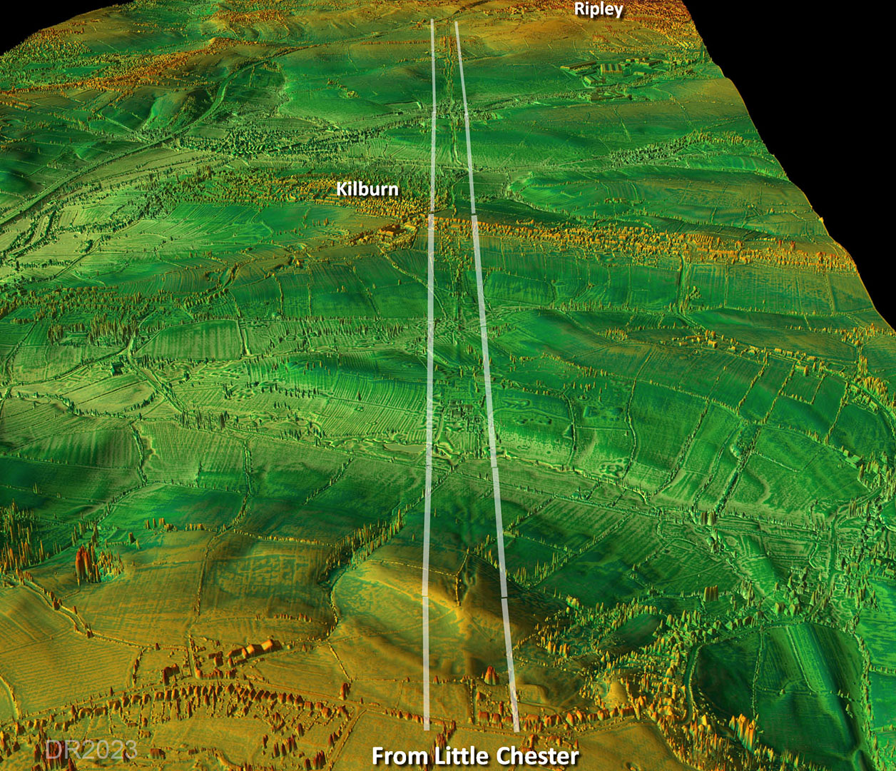
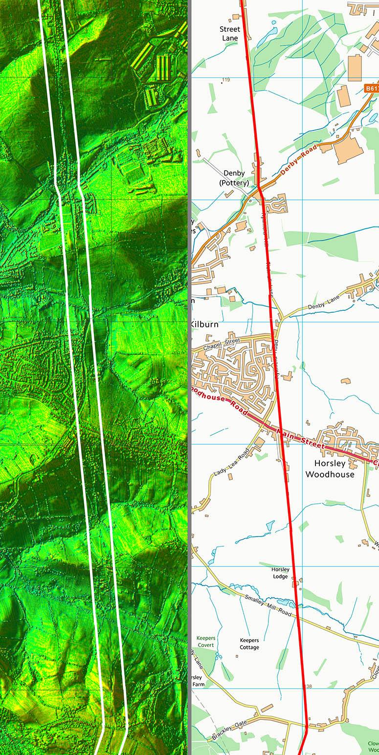
Oblique 3D Lidar Image - North Alignment, Kilburn
Long straight alignment passing Kilburn. Beyond Kilburn a modern road called Street Lane, through the village of Street Lane, marks the course of Rynield Street.
|
|
 |
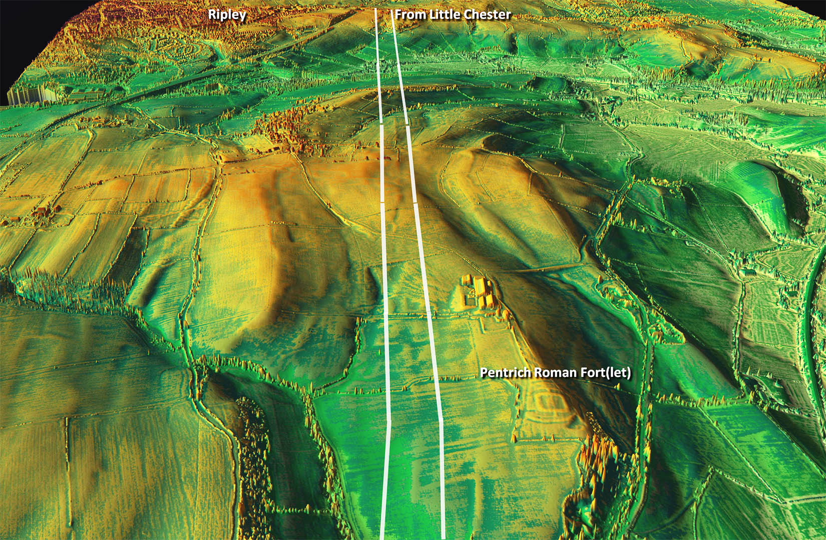
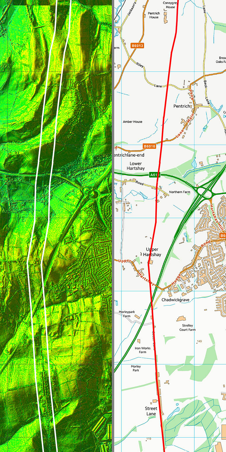
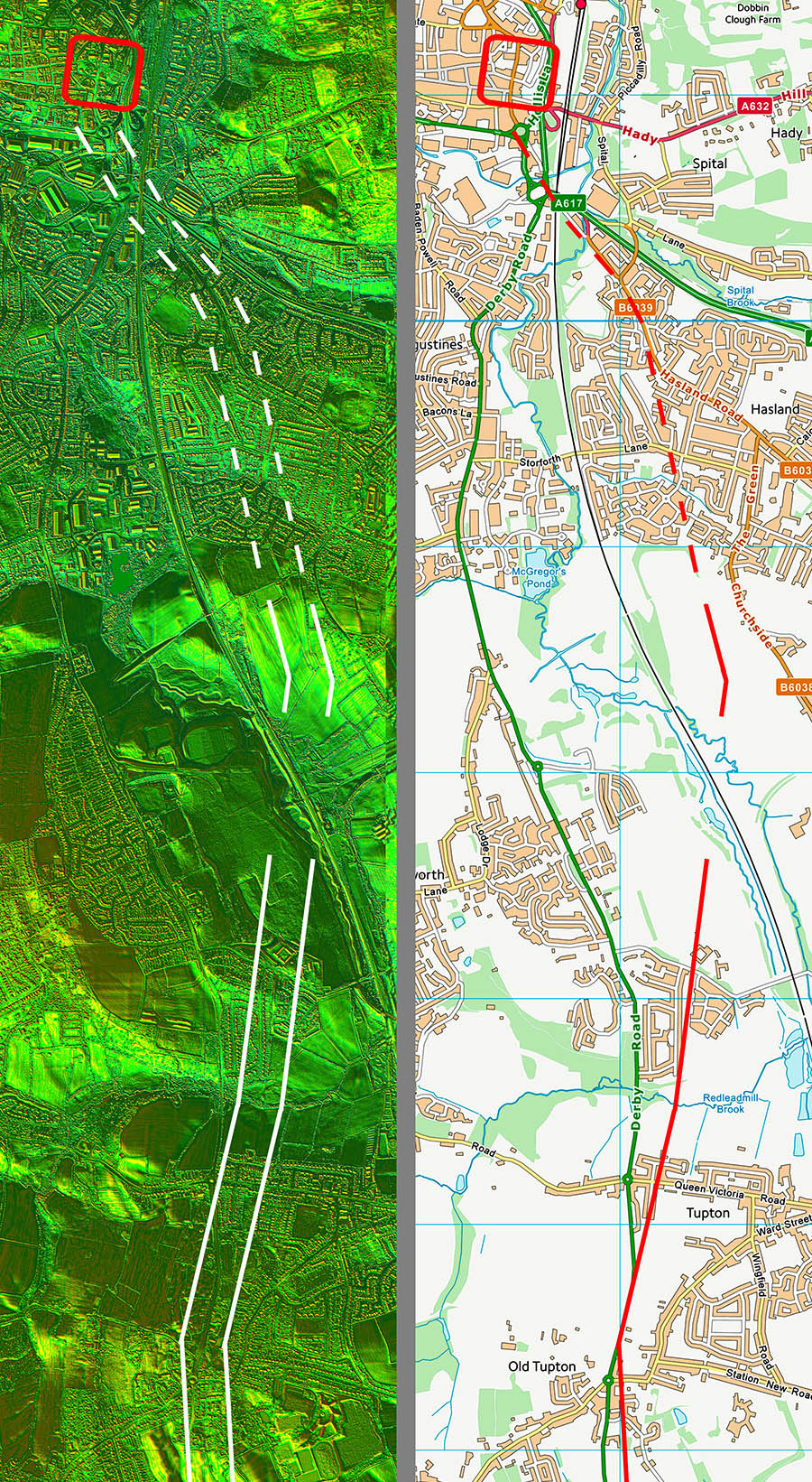
Oblique 3D Lidar Image Passing Pentrich Roman Fort(let)
HER: Scheduled Monument record MDR4950 - Castle Hill Roman Fort, Pentrich
At Pentrich (SK 386541) … an almost square earthwork (150 ft. from north to south by 135 ft.) lies in a commanding position on a ridge-top. Both the rampart and the hollow over the ditch system are about 30 ft. wide. There is a gate in the centre of each of the north and south sides, where a gap occurs in the rampart and a causeway leads across the ditch. This earthwork is certainly in the fashion of Roman work, while the position is a good one from which to watch a considerable length of the road [Ryknield Street] so that the site has good claims to be identified as a small Roman fort. The earthwork stands centrally within a larger enclosure about 300 by 240 ft. in size, the nature of which remains un established, but which may, be an earlier Roman work'. |
|
 |
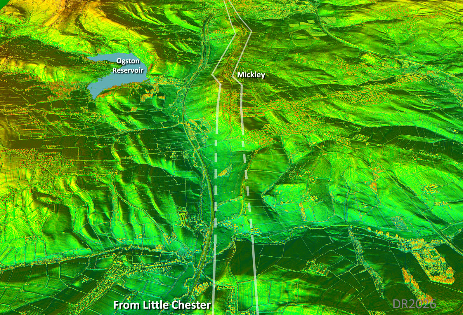
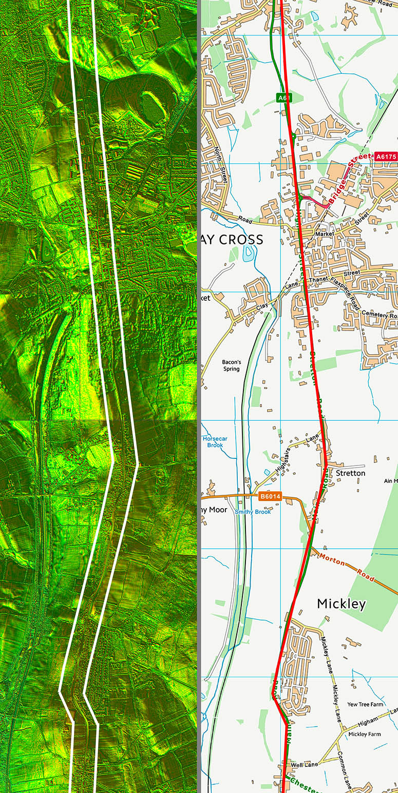
Oblique 3D Lidar Image - Mickley
Did the road follow the ridge or did it take a short-cut? On balance the straight alignment here followed by a little side-step at Mickley looks the most logical but evidence is somewhat lacking., hence my dashed line.
|
|
 |
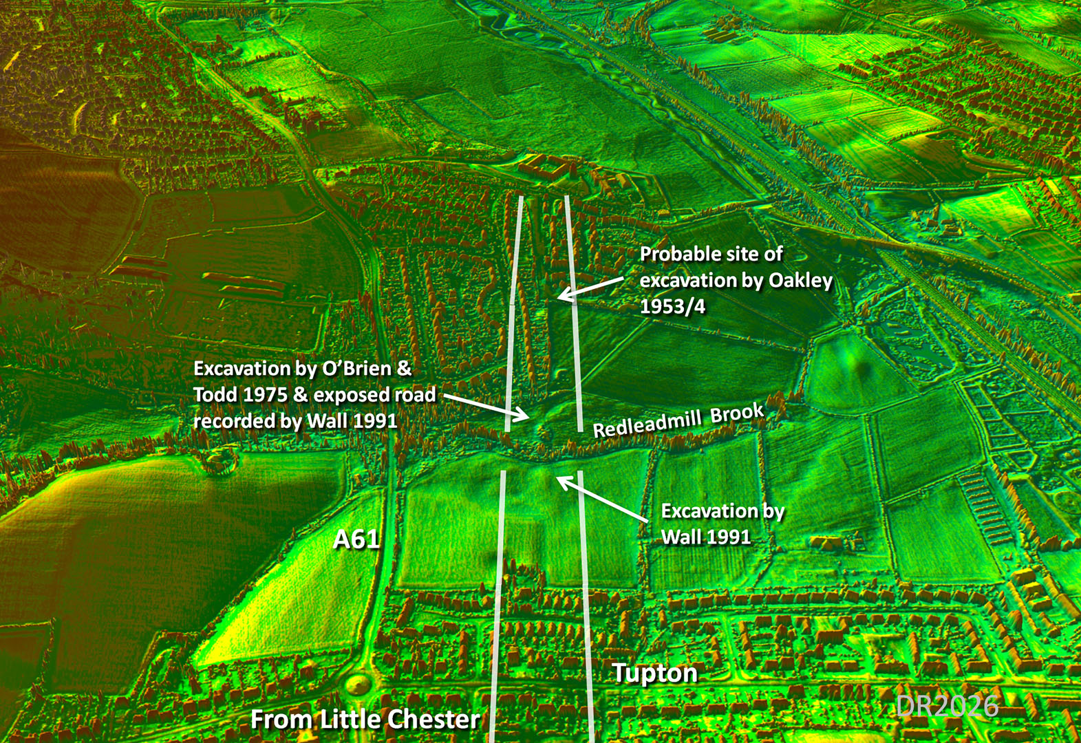
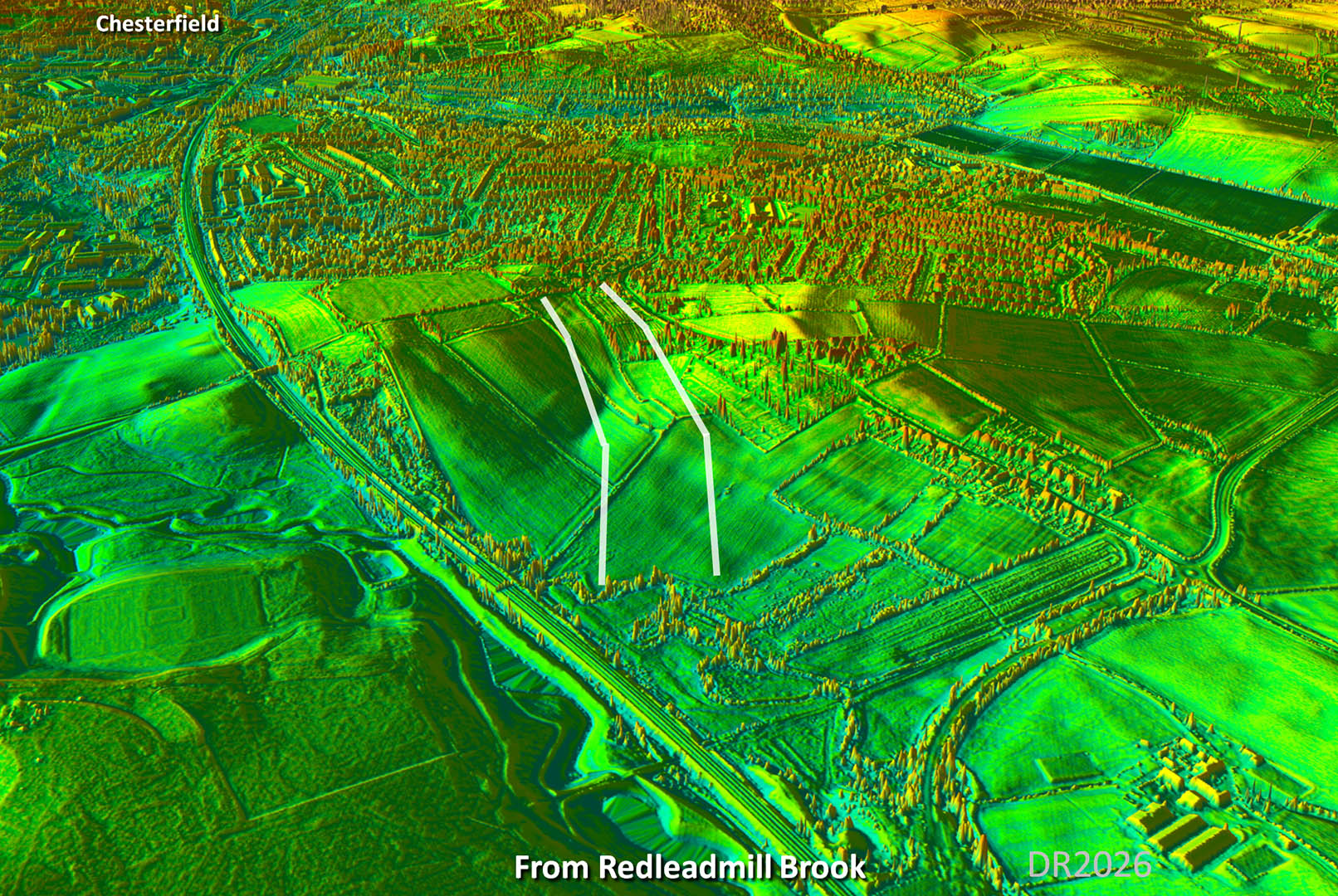
Oblique 3D Lidar Image - Redleadmill Brook
This spot alongside Redleadmill Brook has been the subject of no less than three separate excavations! Not only that but lidar shows the road clearly too. So definitely not in doubt!
The following below are the excavations in chronological order. |
|
 |
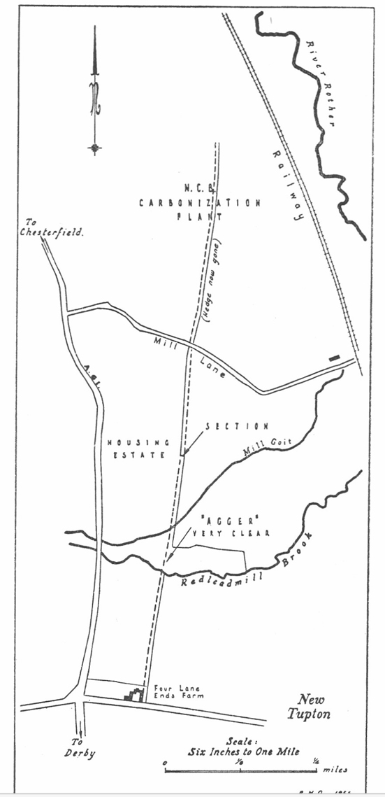
Oakley's Map - 1953/4
Oakley's map of his excavation site does not match his grid reference. His grid reference places the excavation nearer Redleadmill Brook. His route though is probably the best we have to go on.
Grid Ref: SK393 668 - probably incorrect with his map position more likely to be correct.
Reference: EXCAVATIONS ON RYKNIELD STREET NEAR CHESTERFIELD, 1953 AND 1954. By R. H. Oakley, M.A. |
Click for larger view |
 |
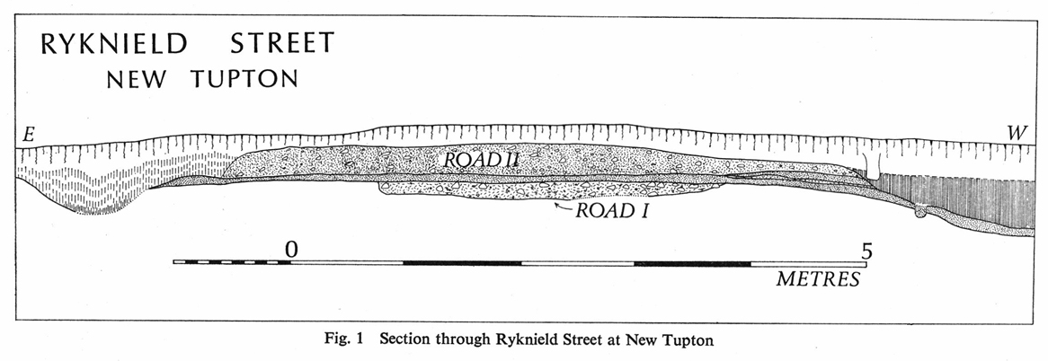
Ryknield Street Cross Section - New Tupton, 1975
O'Brien and Todd's excavation (services trench) was just north of Redleadmill Brook and does coincide with the modern Lidar evidence - see below..
Grid Ref: SK392 664
Reference: Reference: A SECTION ACROSS RYKNIELD STREET AT NEW TUPTON Bv C. F. O'Brien (Trent Valley Archaeological Research Committee) and Malcolm Todd (Department of Classical and Archaeological Studies, University of Nottingham), Derbyshire AS, 1955. |
Click for larger view |
 |
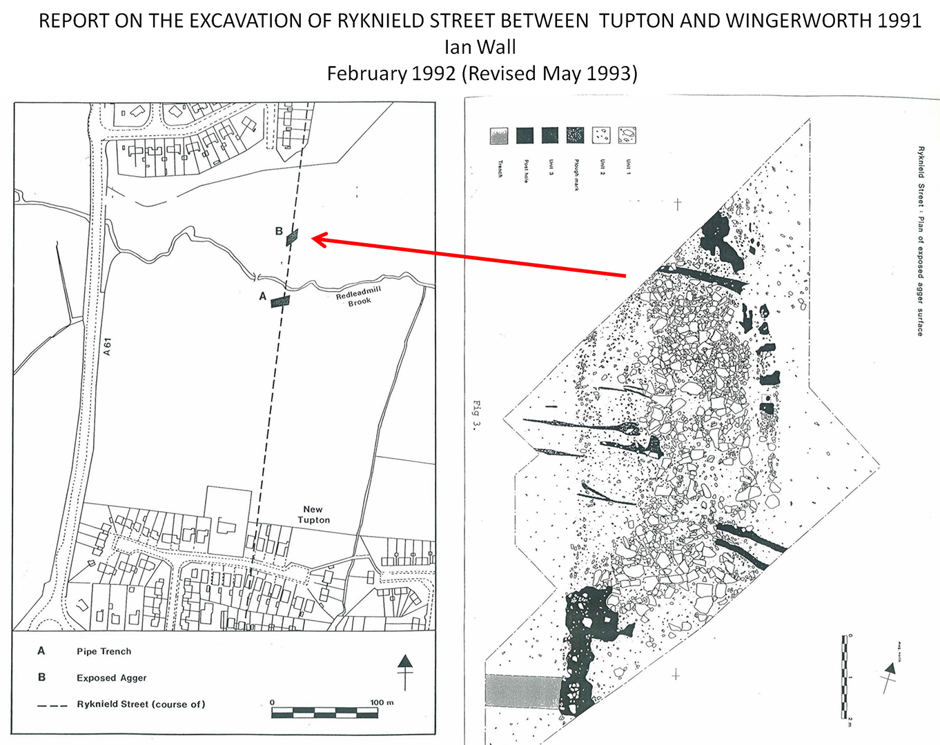
Ryknield Street Excavation 1991
Ian Wall - "Two with locations were investigated, a dissection of the Roman road at GR 39256651 in advance of a pipeline development to the south of Redleadmill Brook in addition to an already exposed section of the well preserved Roman agger 60 metres to the north at GR 39266658"
Wall also recorded a timber pile in his excavation. Romans were adept at supporting structures with piles so we can conclude that this would have been supporting a bridge here. Wall thought a timber bridge but the pile(s) could have been supporting masonry abutments. More likely just a timber deck.
Reference: REPORT ON THE EXCAVATION OF RYKNIELD STREET BETWEEN TUPTON AND WINGERWORTH 1991, Ian Wall, February 1992 (Revised May 1993) |
Click for larger view |
 |
Oblique 3D Lidar Image - New Suggestion approaching Chesterfield
If we project the alignment from Redleadmill Brook then on the opposite bank there is a faint agger that does align so is probably our road. The feature then turns more towards Chesterfield as expected.
The River Rother seems to have be moved when the railway was construction so the exact crossing point now impossible to determine.
Heading into Chesterfield then the lower section of Hasland Road (B6039) could well preserve the Roman course. |
|
 |
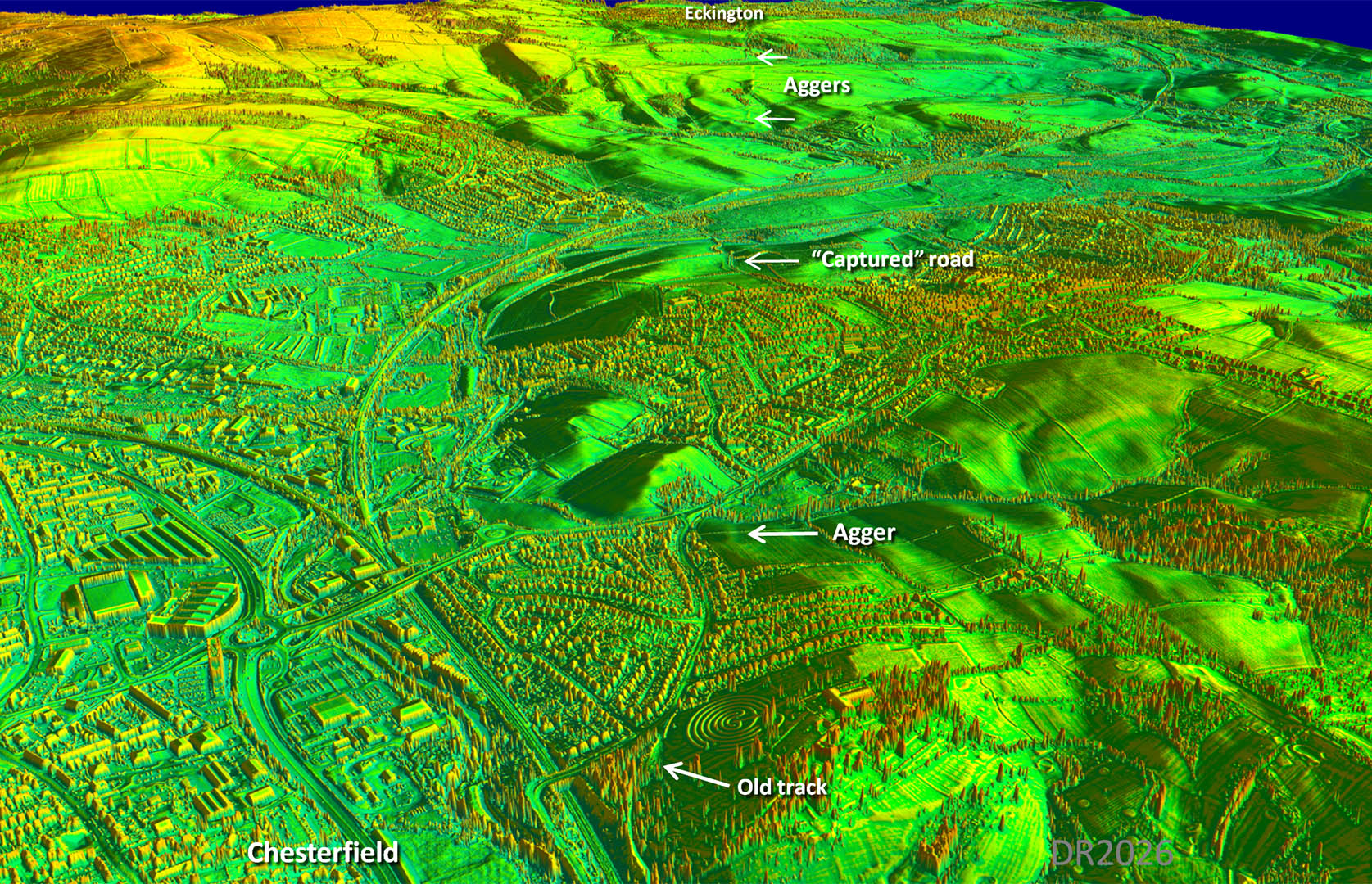
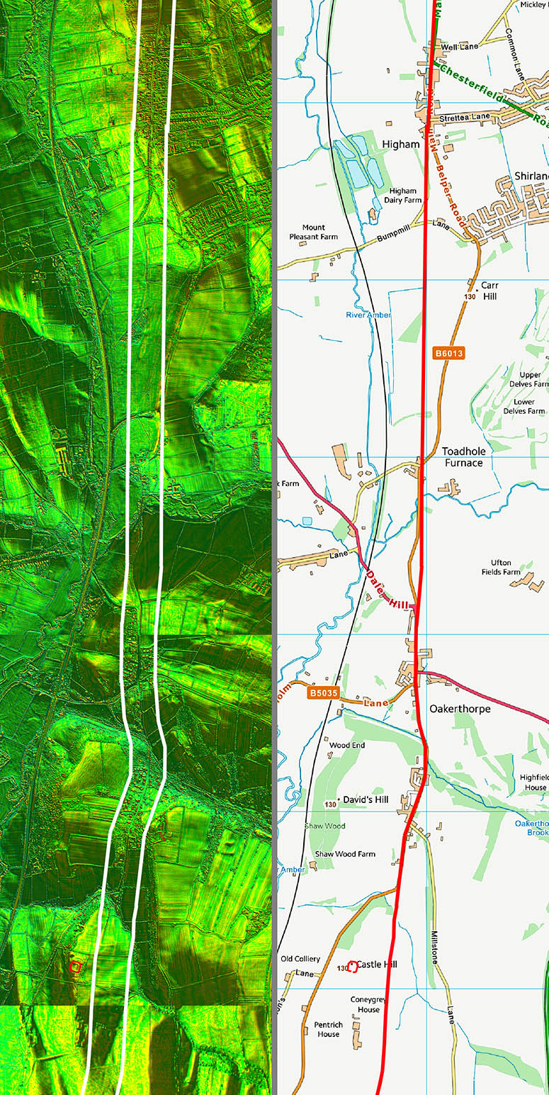
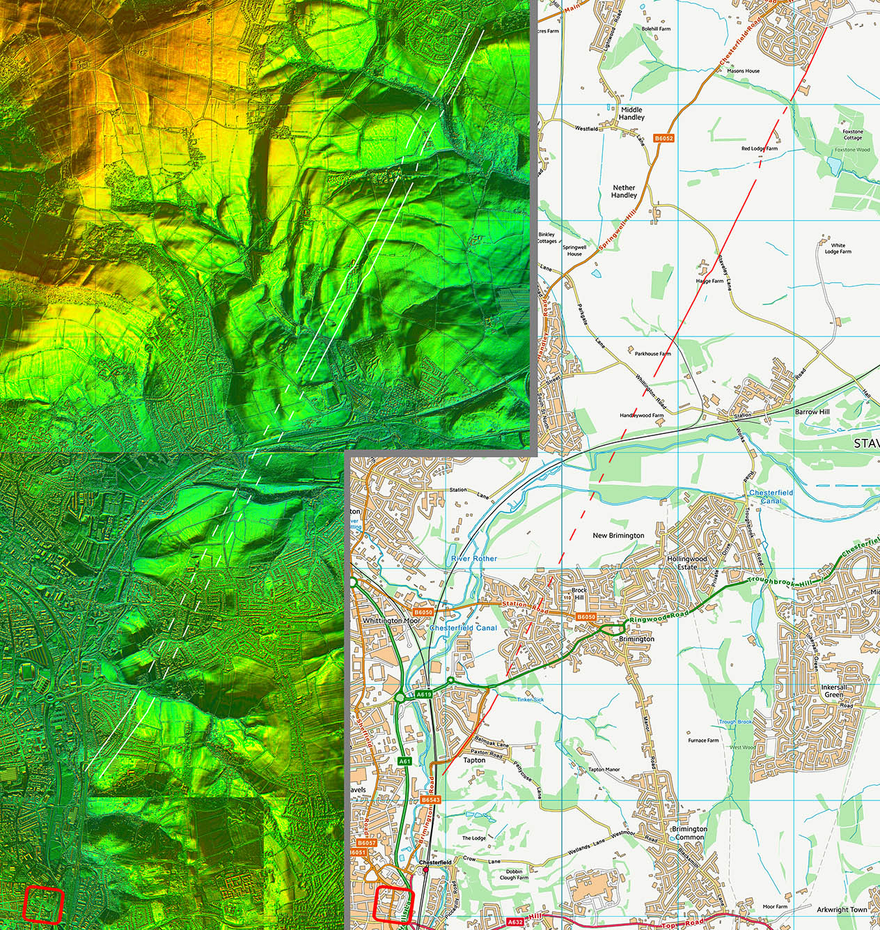
Oblique 3D Lidar Image - Chesterfield to Eckington
A change of direction north of Chesterfield. Enough clues to be able to fix the route although there are some gaps. However, there is no reason for the road not to have kept to a straight course in between. Over the county bondary then the road's course is uncertain.
|
|
 |
Route Map 1
|
|
 |
Route Map 2
|
|
 |
Route Map 3
|
|
 |
Route Map 4
|
|
 |
Route Map 5
|
|
 |
Route Map 6
|
|
 |
Route Map7
|
|  |
