|
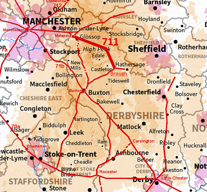
The Roman Road from Melandra to Brough (Probable?)Margary Number: 711Distance: 18 miles (depending on route) A very puzzling route with no definite conclusion. Today's route is the A57, Snake Pass. This road is notorious for getting blocked in winter snows. The first half of the route then we have the various options. The second half is where they all converge with just a few variations. Reference: Peter Wroe, ROMAN ROADS IN THE PEAK DISTRICT, 1984. |
Historic Counties: Derbyshire Current Counties: Derbyshire HER: Derbyshire
|
|
|
|
|
|
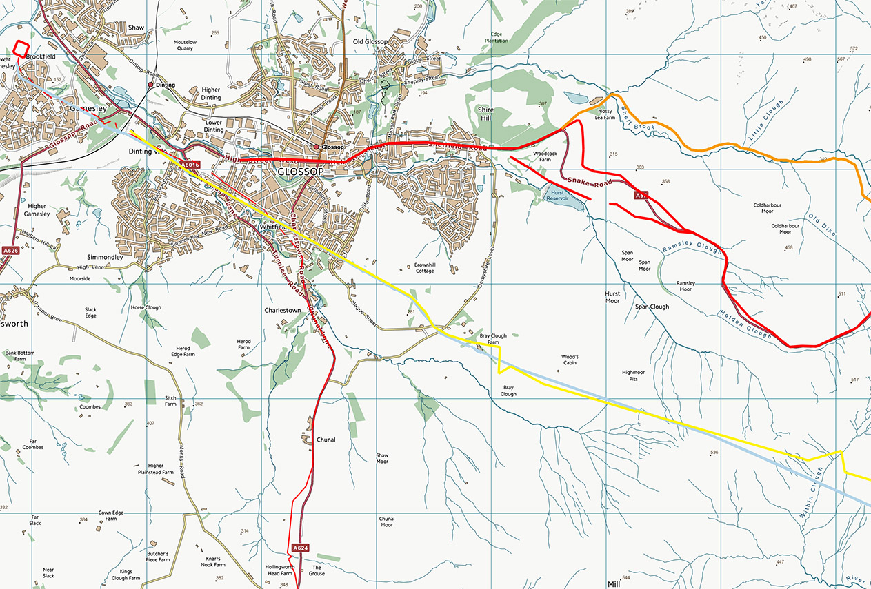
Lidar Image - Various Route Options The various suggested routes:- Orange - Doctor's Gate. Almost certainly a packhorse track |
Click for larger view |
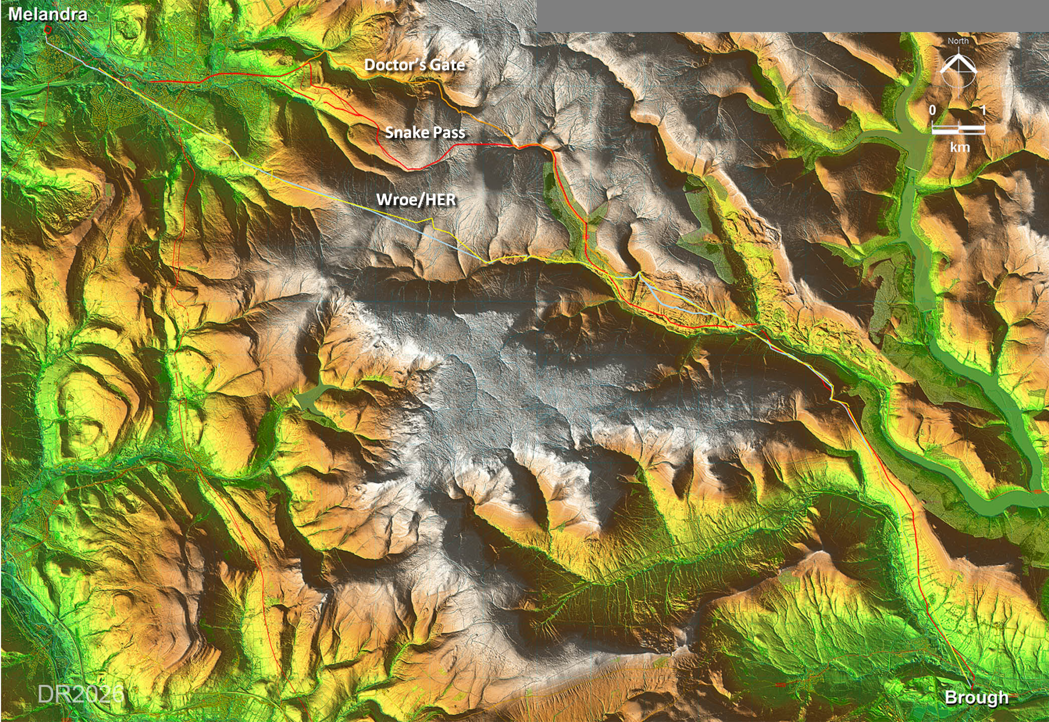 |
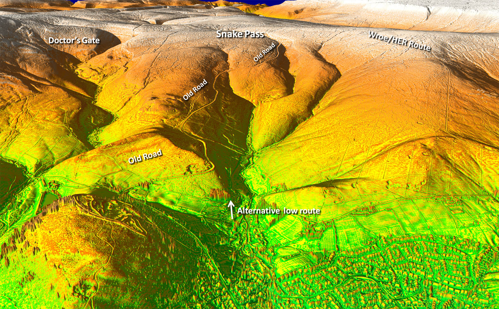
Option 1 - Doctor's Gate
|
||
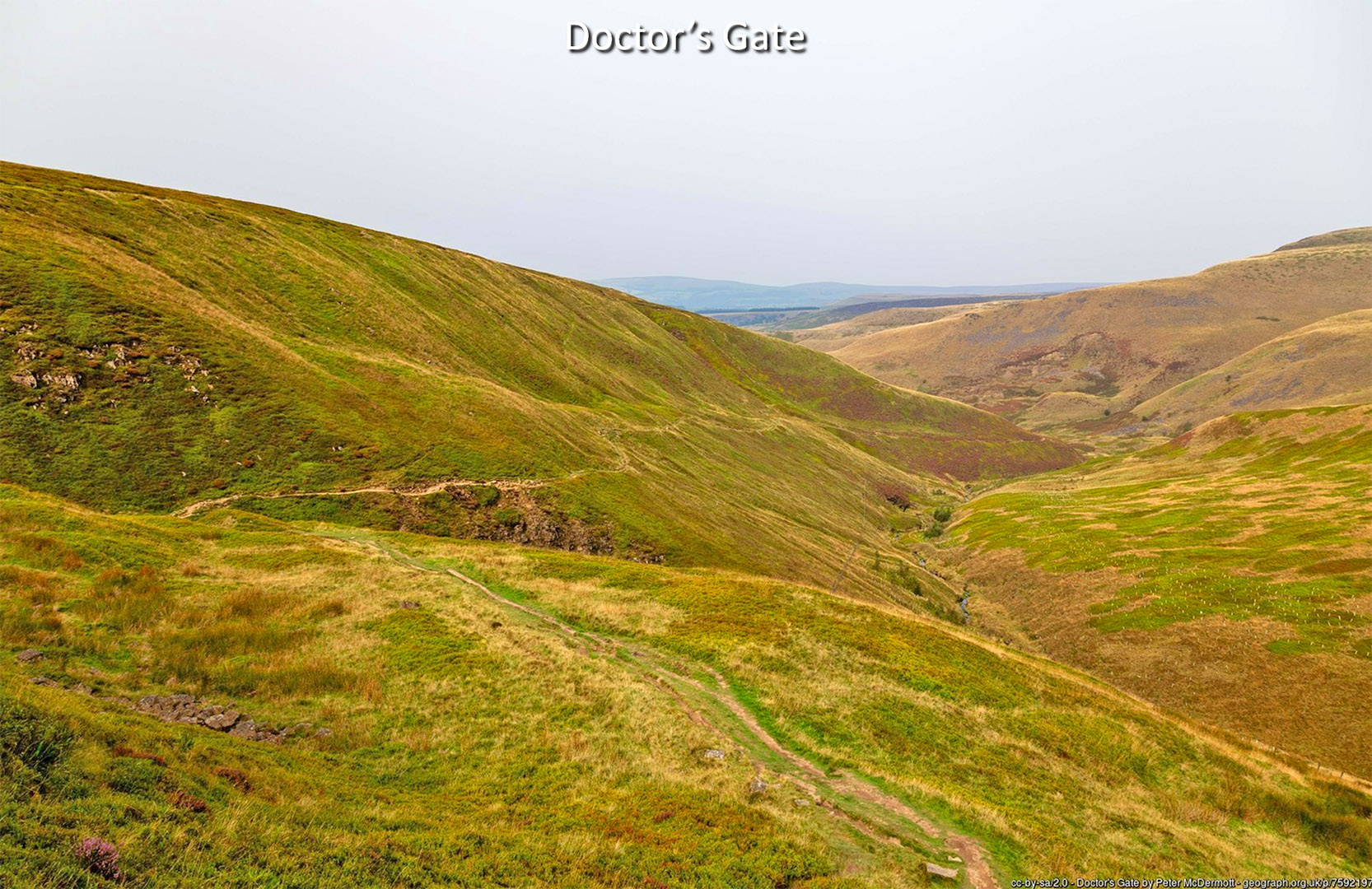
Oblique 3D Lidar Image - Doctor's Gate A packhorse track attributed to Dr Talbot, vicar of Glossop from 1494 to 1535. See Glossop Heritage
|
Click for larger view
|
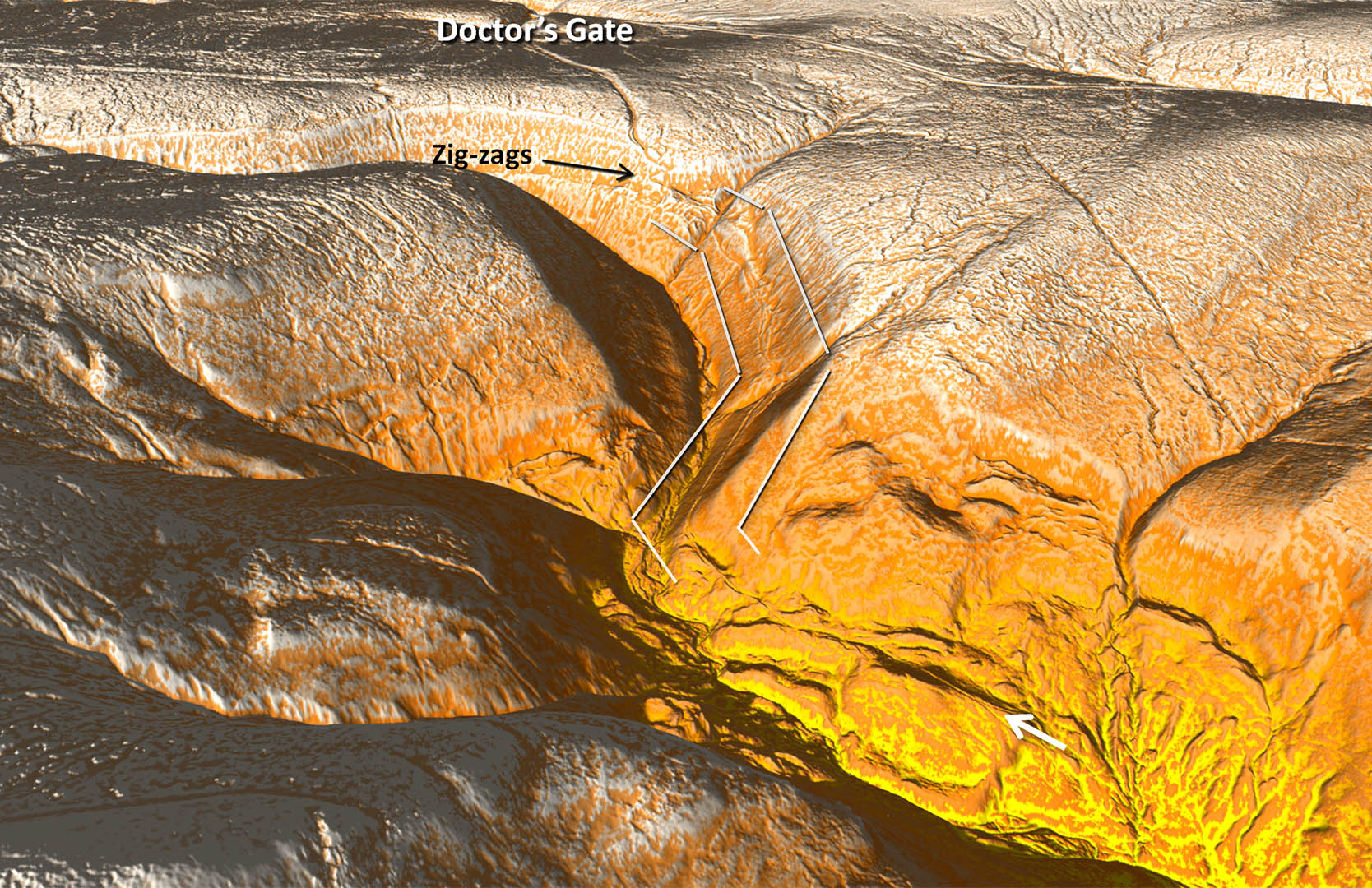 |
Doctor's Gate looking back We are looking back from below the zig-zags shown in the above image. It does look like a packhorse track at best. Certainly not a Roman road. Image: Creative Commons - Peter McDermott |
Click for larger view
|
 |
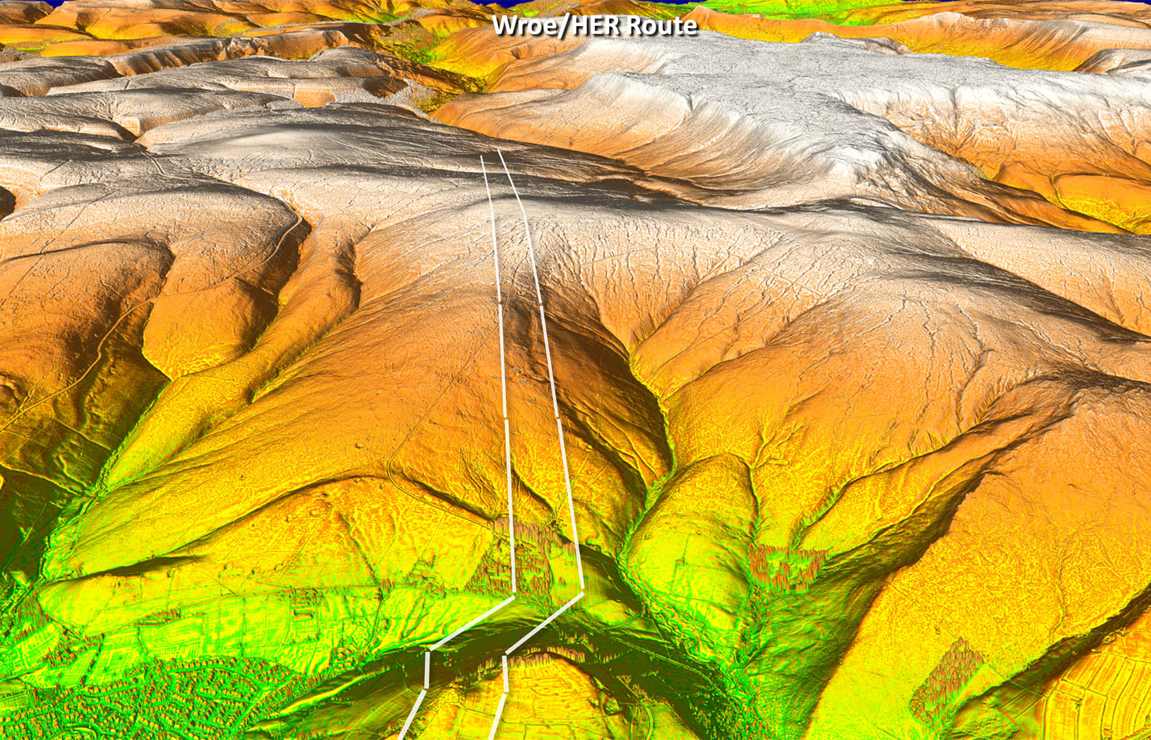
Option 2 - Peter Wroe/HER Route
|
||
Oblique 3D Lidar Image - Peter Wroe & HER route Wow - that's an ambitious route! Yes it is direct and doesn't shirk at climbing. However, there is virtually nothing visible at all over the high ground. The almost total lack of evidence must surely rule this one out. |
Click for larger view
|
 |
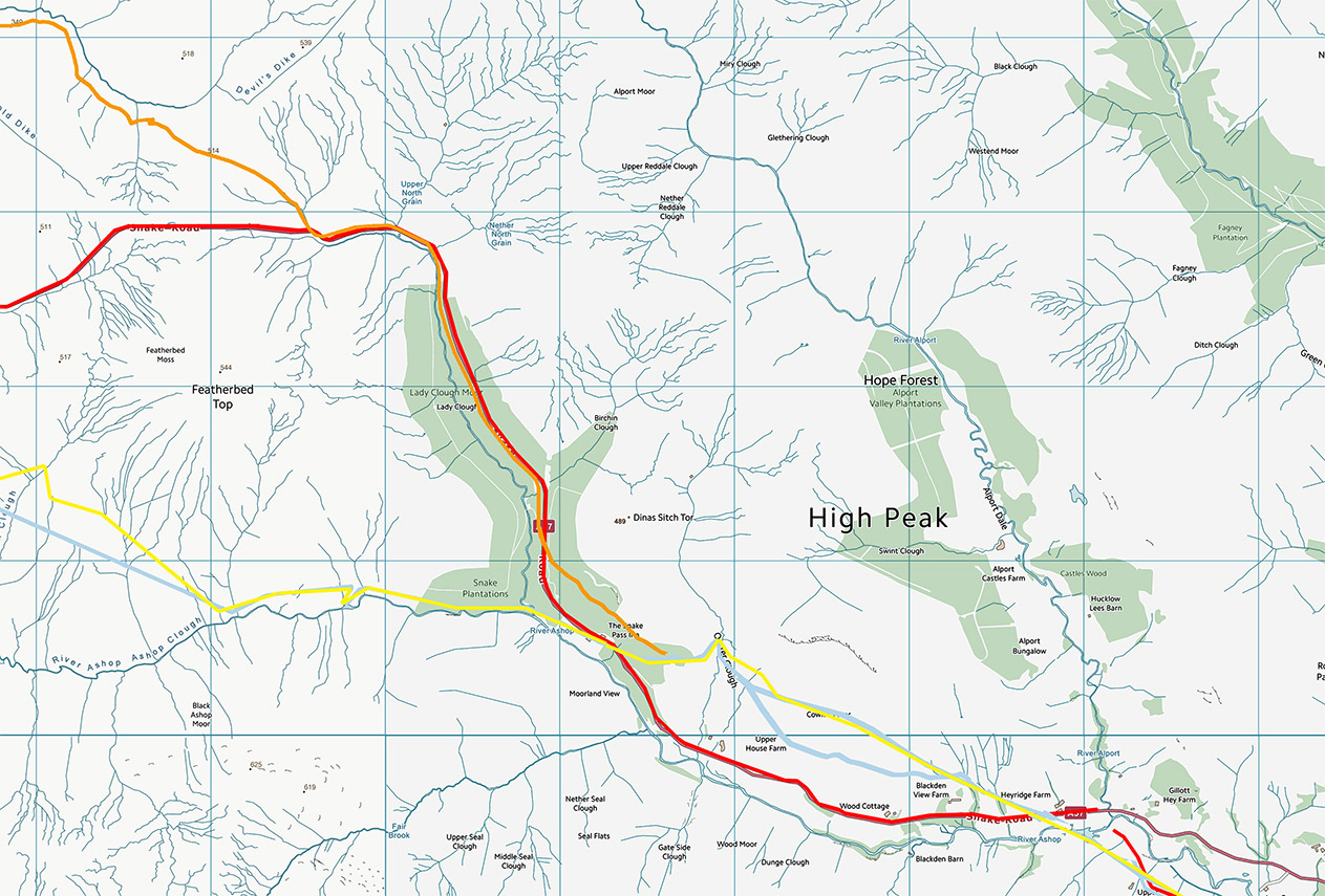
Option 3 - Snake Pass
|
||
Oblique 3D Lidar Image - Snake Pass We are left with the infamous Snake Pass. Several instances of an older road visible alongside the modern road. There are also faint traces of a possible alternative straighter route but but not overly convincing ones - at least to me. Overall though it is the most practical route and that is why the modern A57 goes that way. |
Click for larger view
|
 |
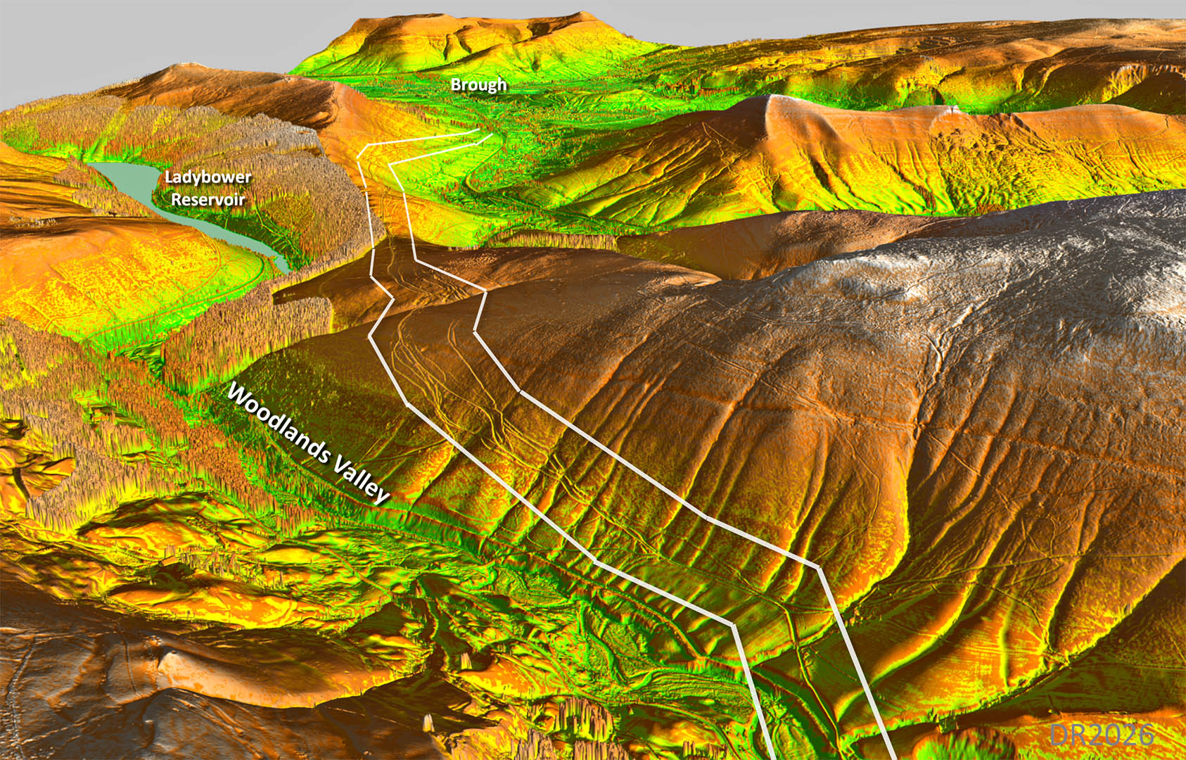
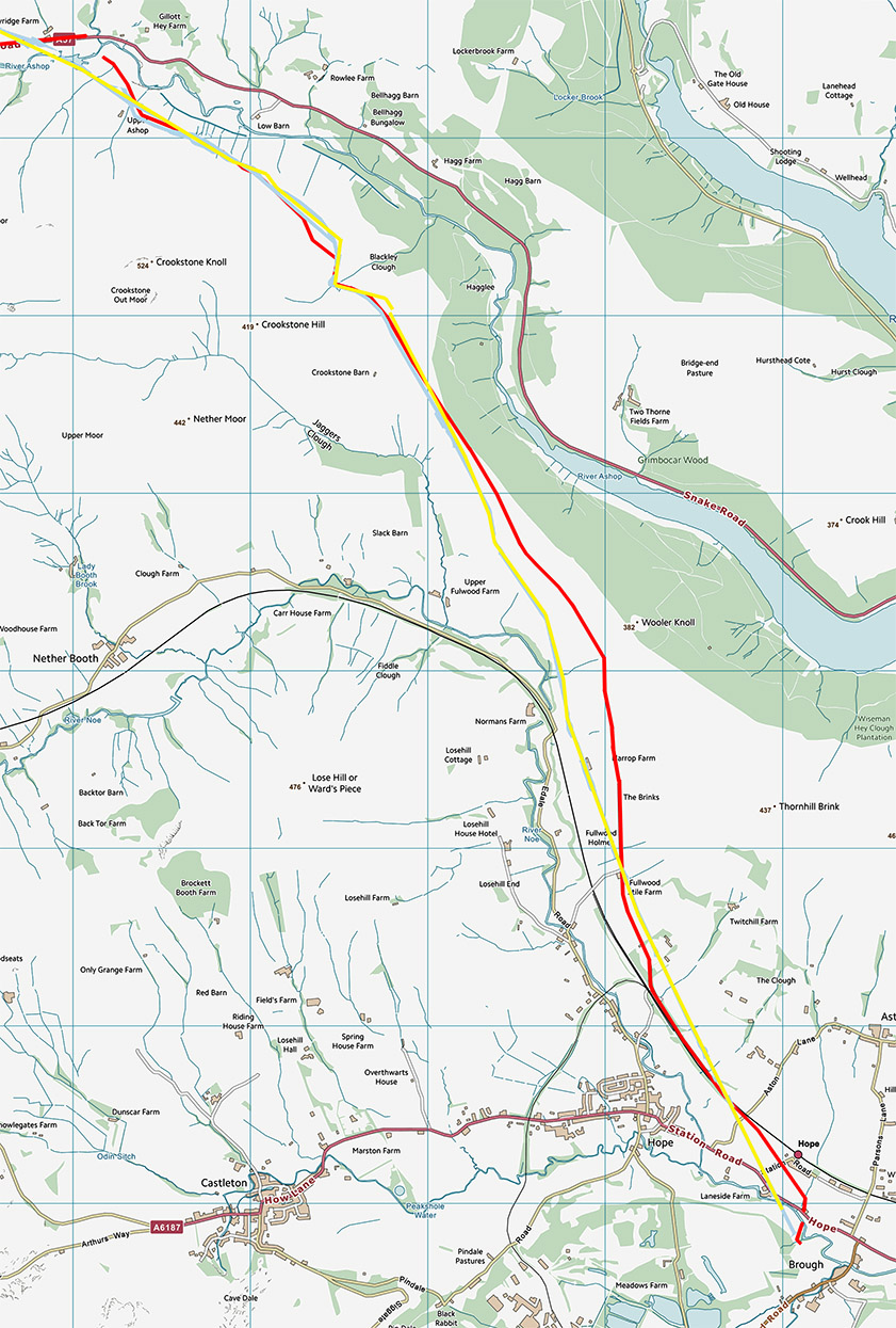
Common Section
|
||
Oblique 3D Lidar Image - Woodlands Valley to Brough The various route options converge here although with several braided tracks difficult to say which was the earliest. Descending to the fort then a couple of variations for this. I prefer the higher one. |
Click for larger view
|
 |
Lidar Image & Route Map 1 The various suggested routes Orange - Doctor's Gate |
Click for larger view |
 |
Lidar Image & Route Map 2 The various suggested routes Orange - Doctor's Gate |
Click for larger view |
 |
Lidar Image & Route Map 3 The various suggested routes
Note HER and Wroe route overlie here |
Click for larger view |
 |
|
Last update: March 2026 |
© David Ratledge |