|
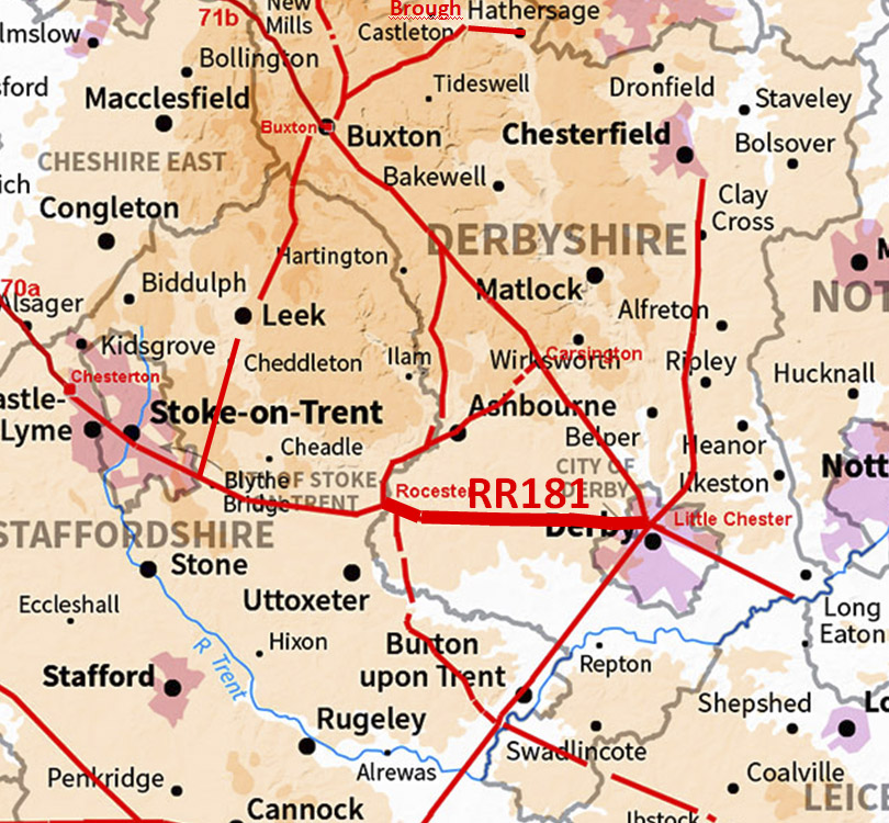
The Roman Road from Little Chester to RocesterMargary Number: 181Distance: 15 miles Very direct road heading almost due west from Little Chester. There was finally a turn to reach Rocester in the Dove Valley. Along the way there might just be a previously unknown Roman fort - see later.
|
Historic Counties: Derbyshire & Staffordshire Current Counties: Derbyshire & Staffordshire HER: Derbyshire & Staffordshire
|
|
|
|
|
|
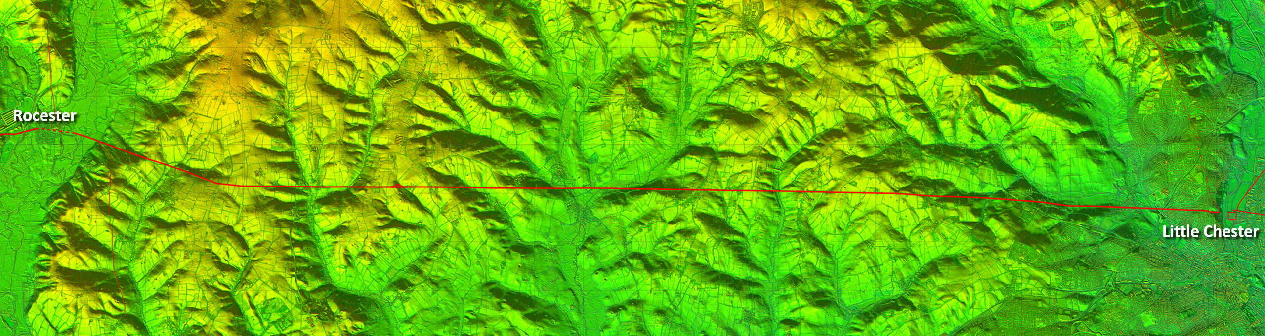
Lidar Image - Full Route With few obstacles in the way a very direct alignment was achieved. Just a small turn was needed when reaching the Dove Valley. |
Click for larger view |
 |
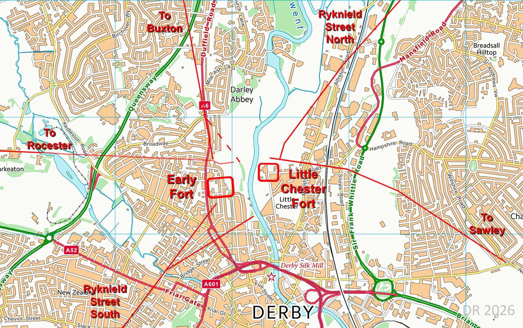
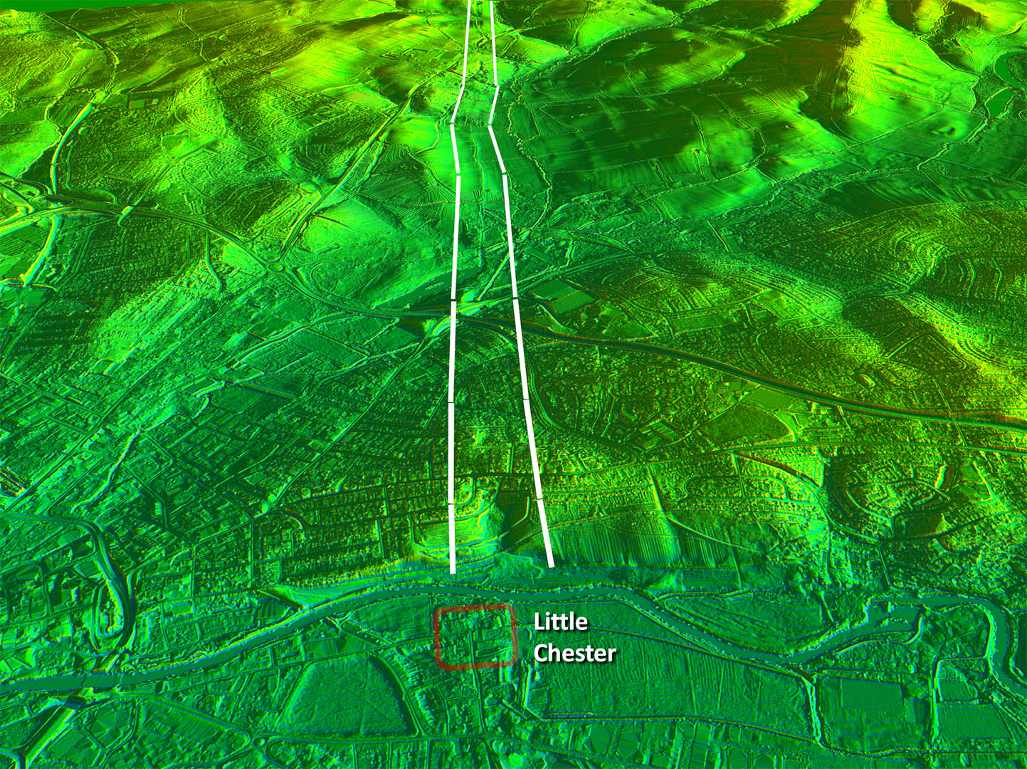
Little Chester Roman Road Network No less than 5 Roman roads met at Little Chester. Ryknield Street and the Buxton road were clearly contemporary with the early fort. Our road to Rocester and the one to Sawley were aligned with the later fort. |
Click for larger view |
 |
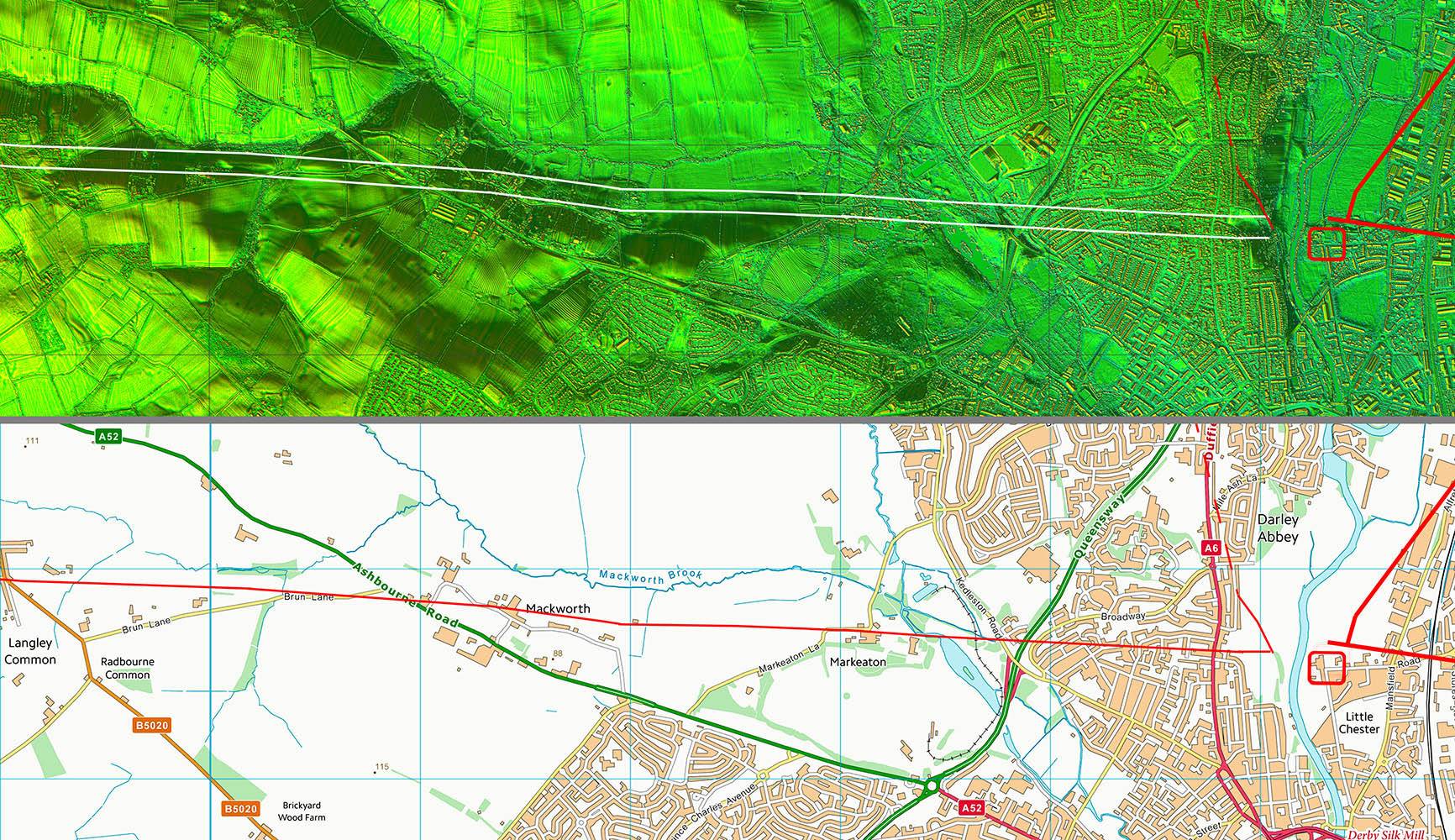
Oblique 3D Lidar Image - Leaving Little Chester Very convenient side valley for our road to head west. Was it convenient or well chosen?
|
Click for larger view
|
 |
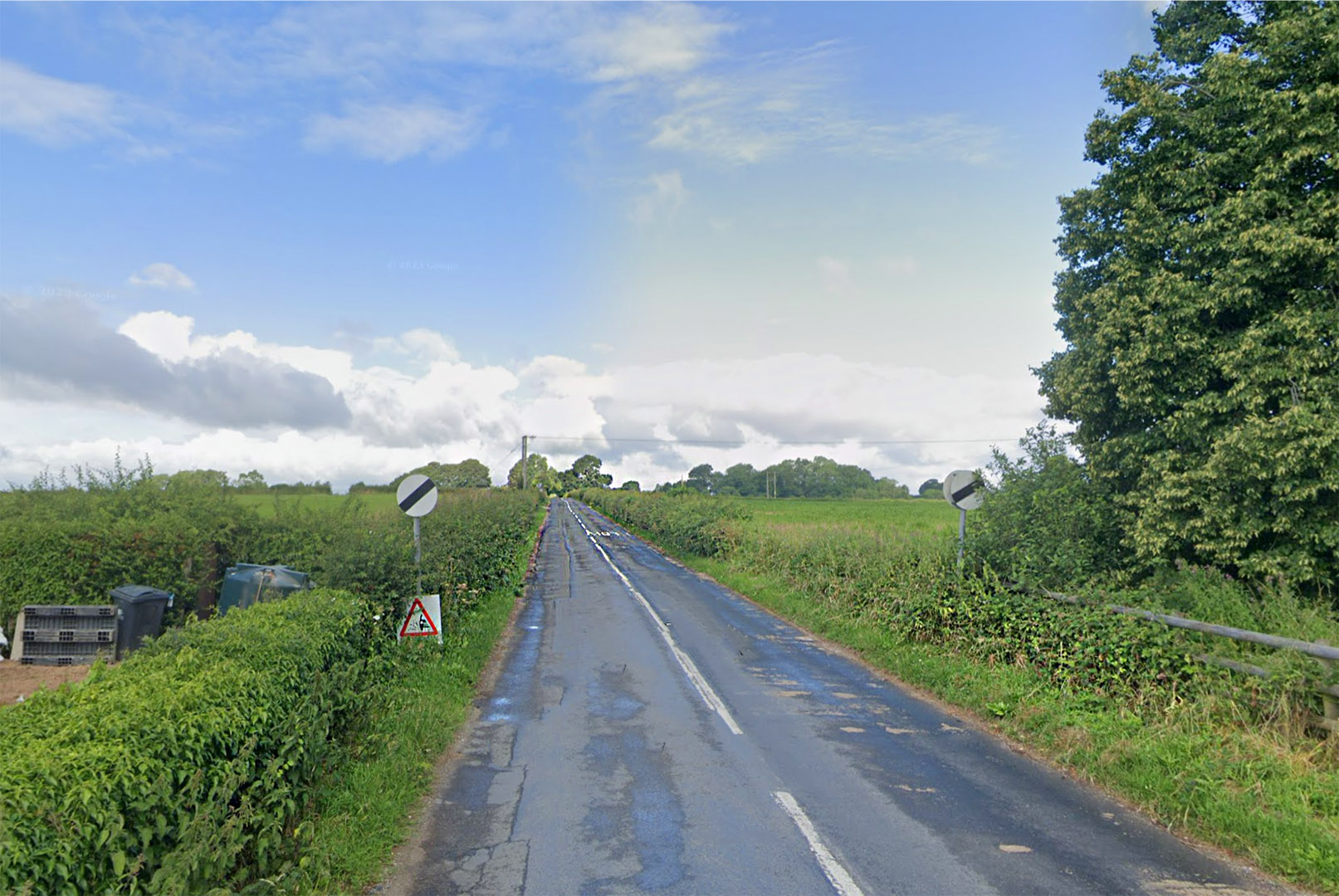
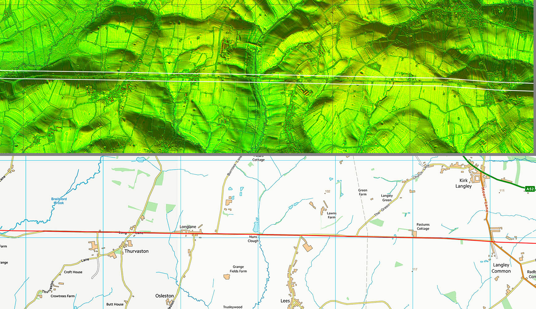
Start of Long Lane The aptly named minor road, Long Lane, follows the Roman line for around 4 miles.
|
Click for larger view
|
 |
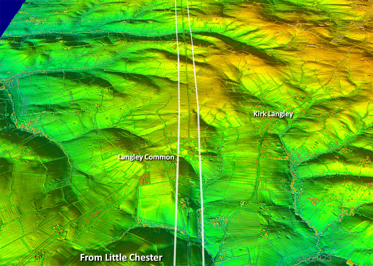
Oblique 3D Lidar Image - Langley Common The straight alignment continues along Long Lane.
|
Click for larger view
|
 |
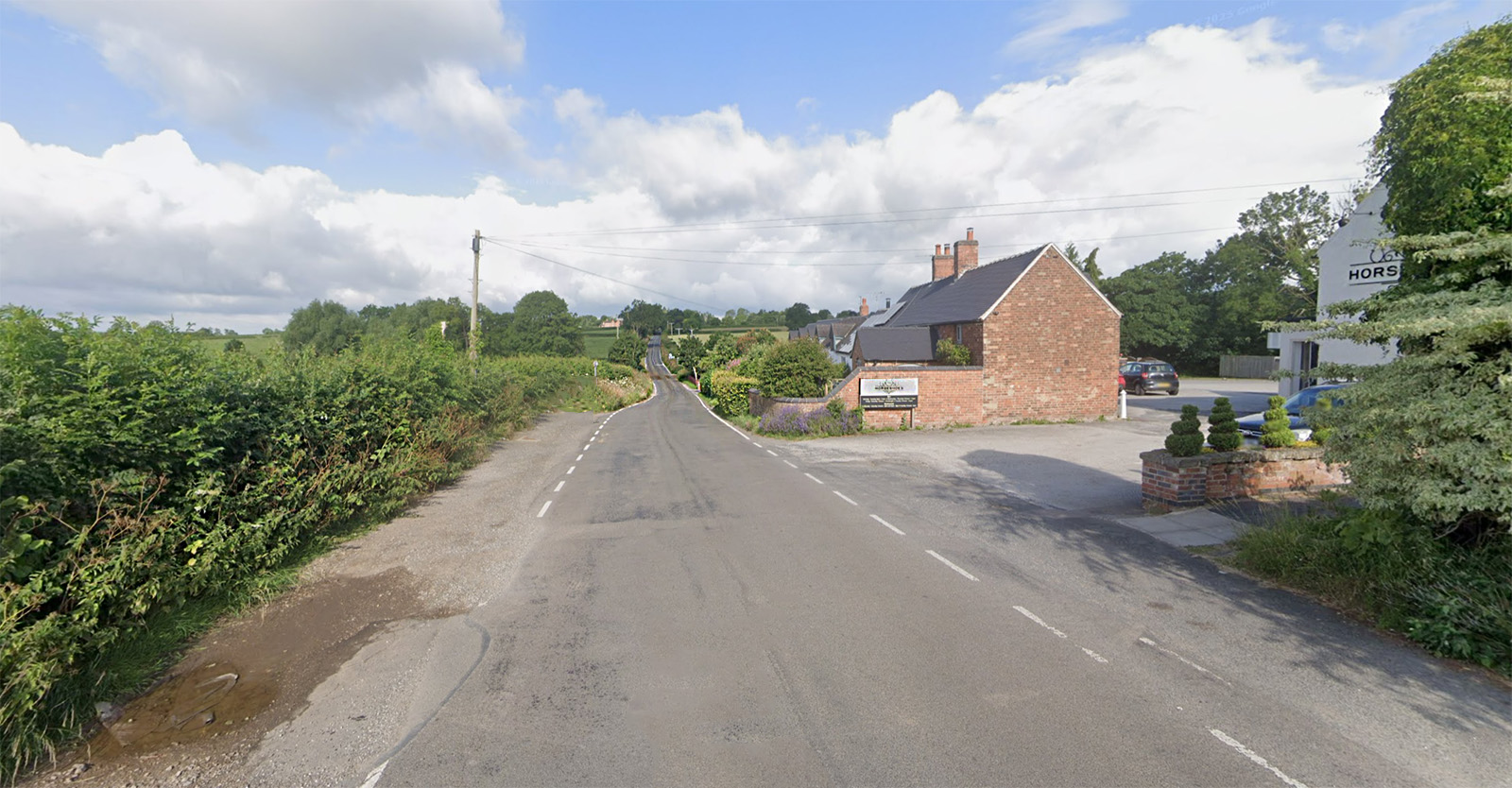
Horseshoes, Long Lane Further along Long Lane we pass the Horseshoes pub.
|
Click for larger view
|
 |
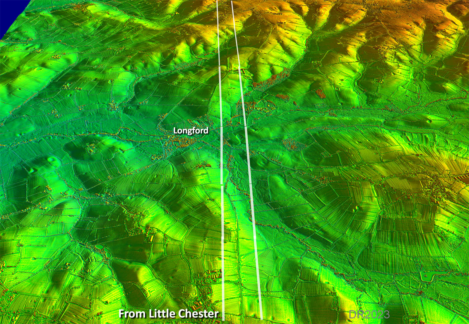
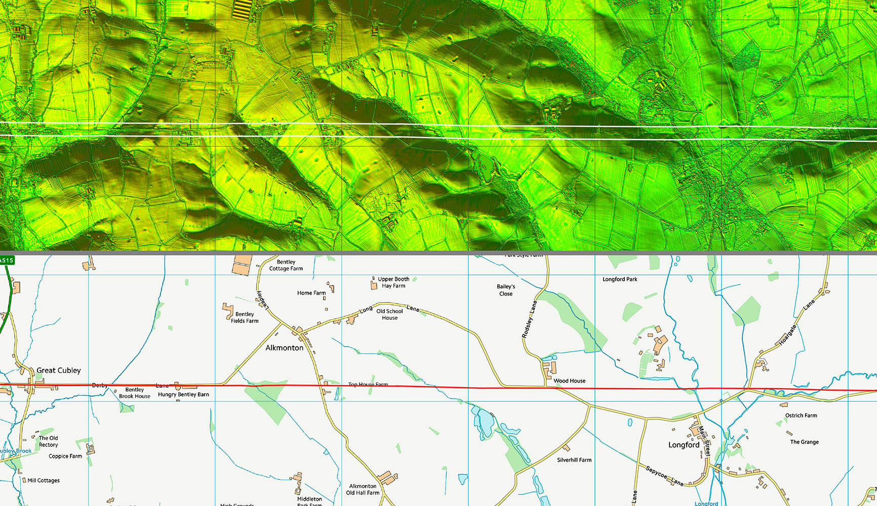
Oblique 3D Lidar Image - Longford Surprising the road didn't deviate away from the stream but appears to have continued on its straight course.
|
Click for larger view
|
 |
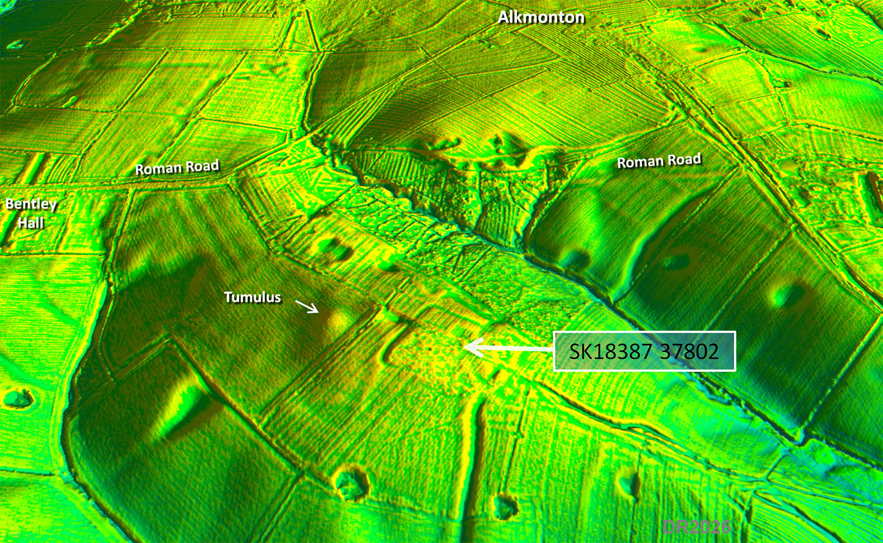
Oblique 3D Lidar Image - Alkmonton Was there a zig-zag to the north? There is some evidence for a diagonal course but I don't think so. The straight line seems to have been kept to. See below regarding the "?" |
Click for larger view
|
 |
Oblique 3D Lidar Image - Alkmonton view from South I spotted this when tracing the road here. There are curved corners, a ditch and rampart. Is it a Roman fort? Could well be and I have reported it to Derbyshire HER, who have included it. |
Click for larger view
|
 |
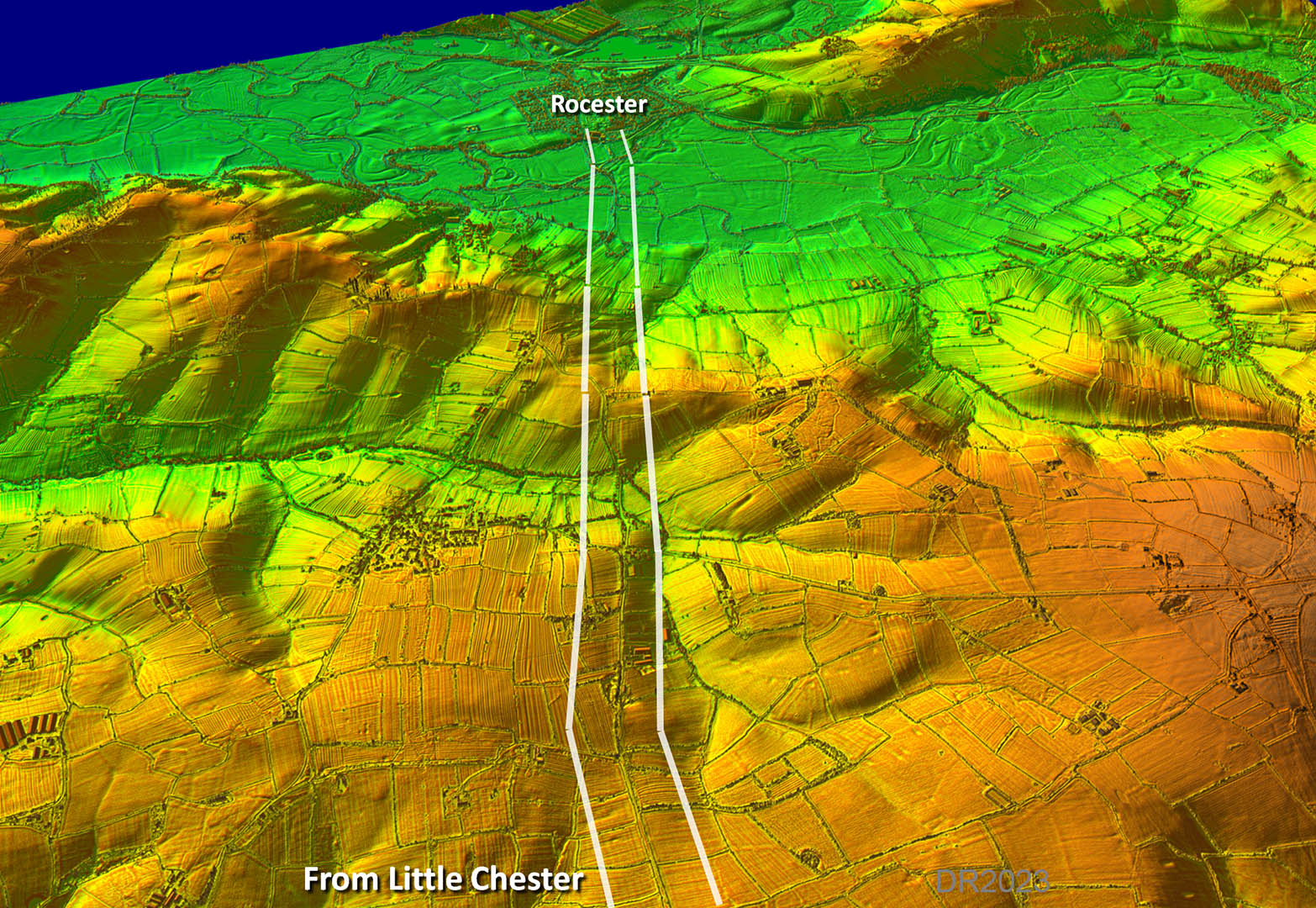
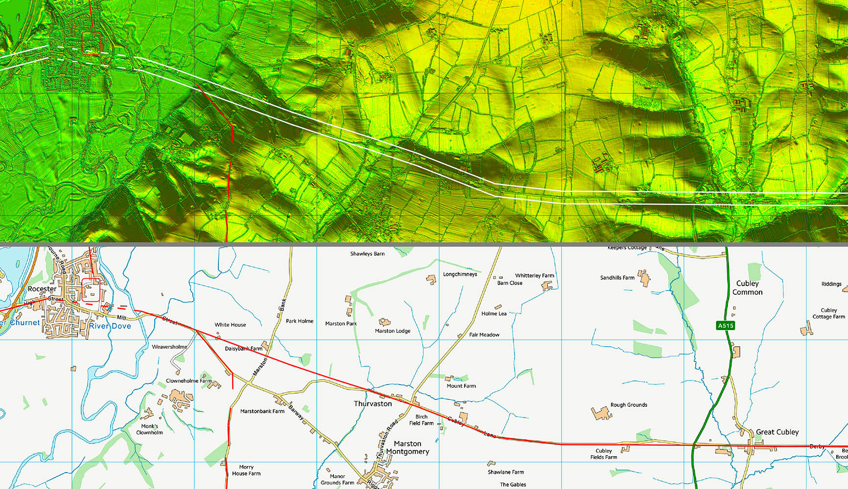
Oblique 3D Lidar Image - Approaching Rocester Excitement here as we finally make a turn off the alignment for the approach to Rocester (in Staffordshire).
|
Click for larger view
|
 |
Route Map 1
|
Click for larger view |
 |
Route Map 2
|
Click for larger view |
 |
Route Map 3
|
Click for larger view |
 |
Route Map 4
|
Click for larger view |
 |
|
Last update: March 2026 |
© David Ratledge |