|
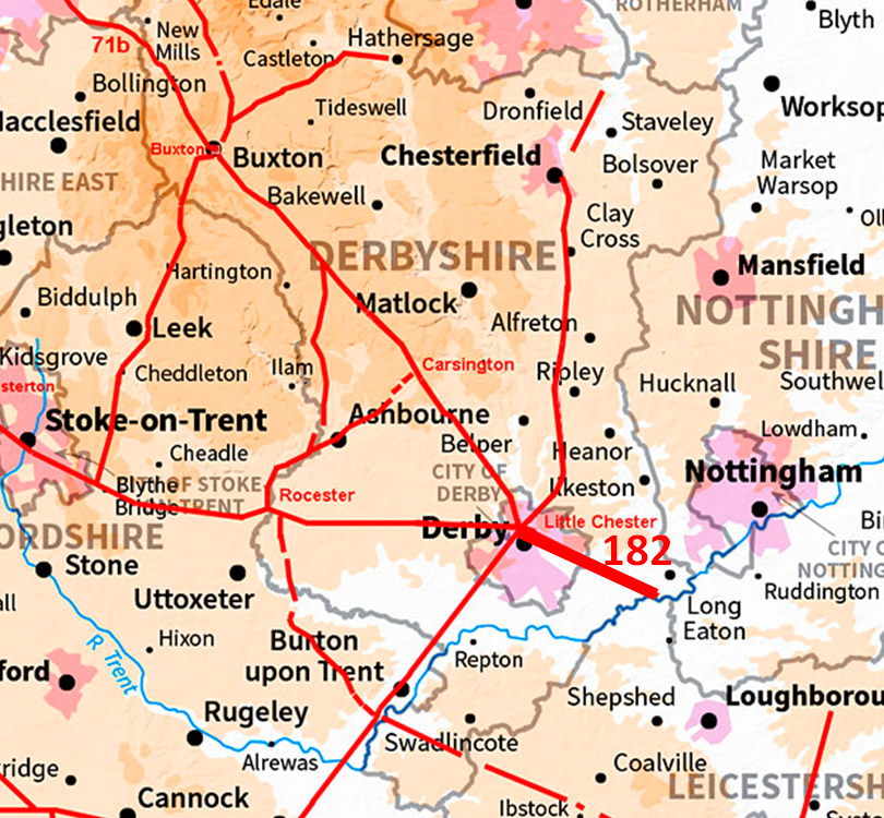
The Roman Road from Little Chester to Sawley, Long EatonMargary Number: 182Distance: 8.5 miles Almost certainly a road connecting Little Chester to a port on the River Trent at Sawley. Lead pigs from Carsington (Lutudarum) could have been transported via this road and out via the Trent - see later. There was a continuation Roman road on the south side of the River Trent starting at Red Hills and heading down the east bank of the River Soar to the Fosse Way. This road is in Nottinghamshire and Leicestershire. |
Historic Counties: Derbyshire Current Counties: Derbyshire HER: Derbyshire
|
|
|
|
|
|
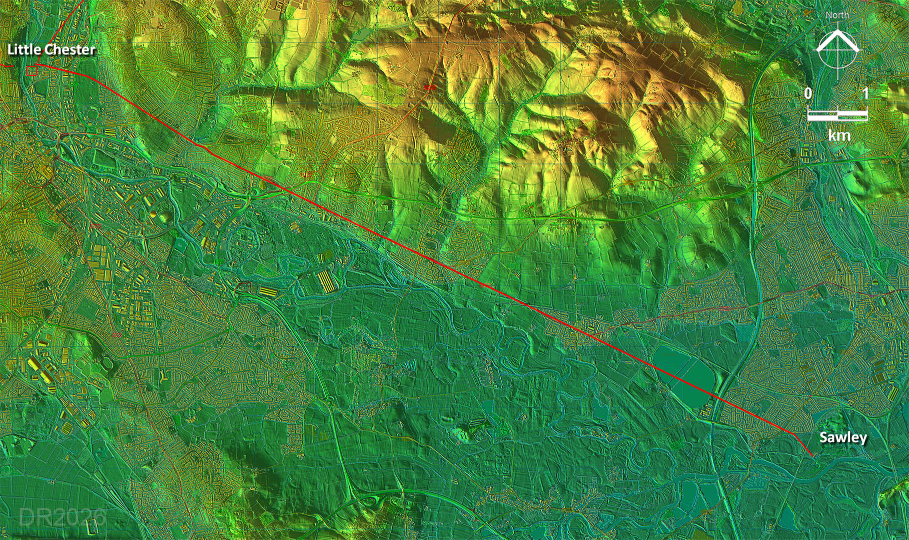
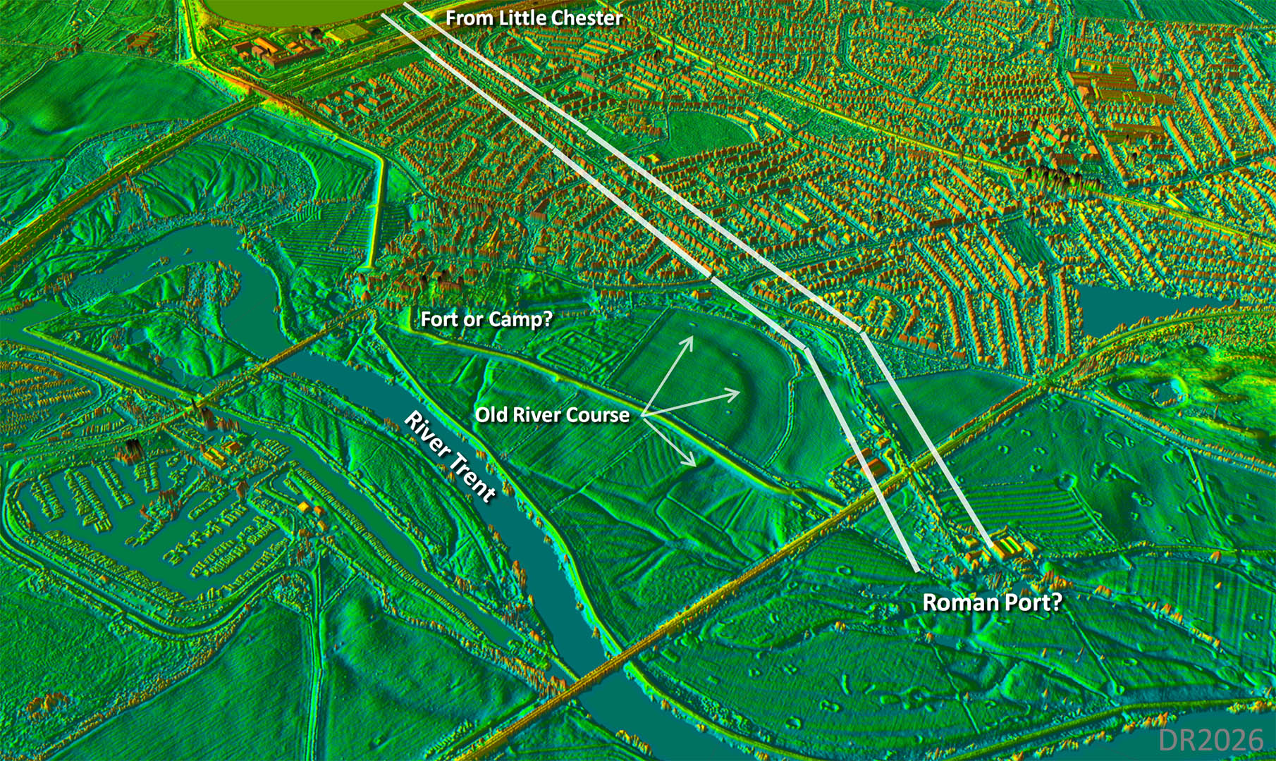
Lidar Image - Full Route Very direct and its exact aiming point appears to have been around a bend in the former course of the River Trent. It then turned to a probable harbour location - now a golf course. |
Click for larger view |
 |
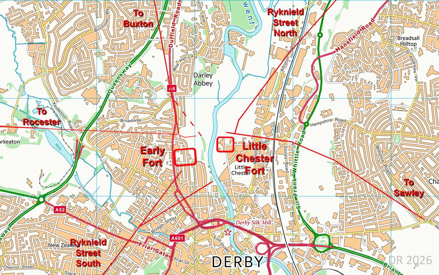
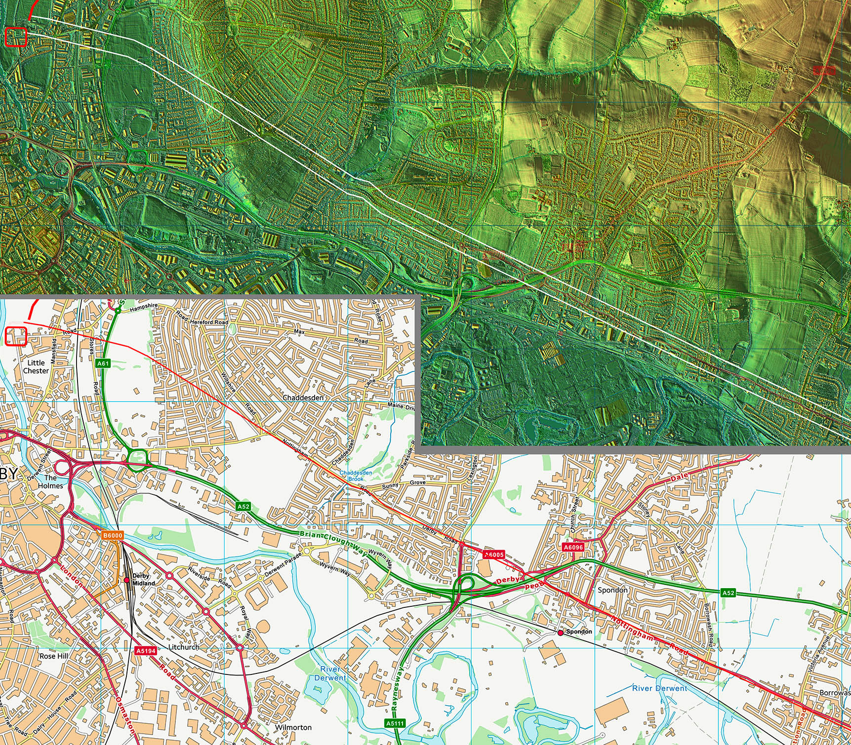
Little Chester Roman Road Network No less than 5 Roman roads met at Little Chester. Ryknield Street and the Buxton road were clearly contemporary with the early fort. The roads to Rocester and Sawley were aligned with the later fort. |
Click for larger view |
 |
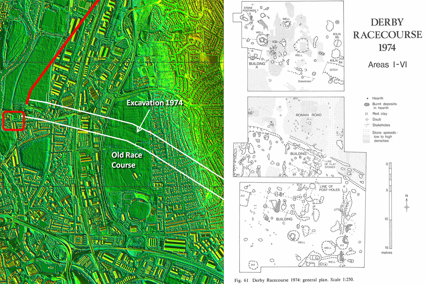
Old Racecourse Excavations 1974 Lidar shows clearly the surviving agger of the road crossing the old racecourse. This is where Josephine Dool excavated the road in 1974. She found the road was initially 4.5 metres wide but later extended to 8 metres wide. Either side of the road were Roman buildings indicating the settlement extended around 1km form Little Chester fort. Reference: Josephine DooL Roman Derby: Derby Racecourse: Excavations on the Roman Industrial Settlement, 1974, Derbyshire Archaeological Journal, Volume: 105, p155 - 221, 1985
|
Click for larger view |
 |
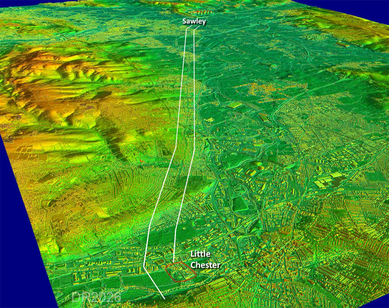
Oblique 3D Lidar Image - Little Chester to Sawley Not quite dead straight but not far off.
|
Click for larger view
|
 |
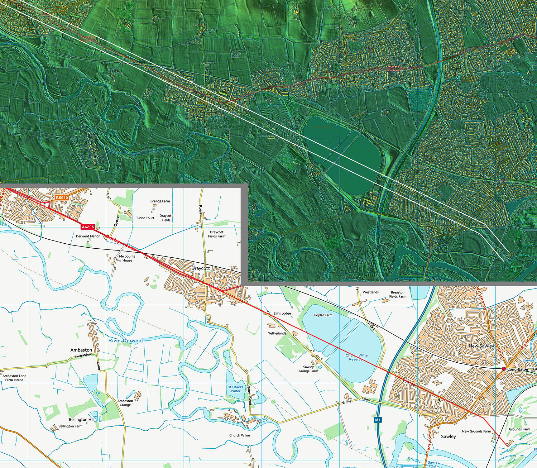
Oblique 3D Lidar Image - Sawley The road appears to aimed for skirting around the old river course before turning to get alongside the old position of the River Trent. There is no evidence for the road crossing the river so a port on the Trent is the obvious conclusion. The nine lead pigs (ingots) from Lutudarum (Carsington) found at Brough on Humber could easily have been shipped from here down the Trent to the Humber. It all fits nicely. The Roman fort or camp is odd. It lies inside an old bend in the Trent so was probably on the opposite bank to the road. Is it fort of camp? Looks substantial like a fort but has a titulus outside its entrance indicative of a camp. |
Click for larger view
|
 |
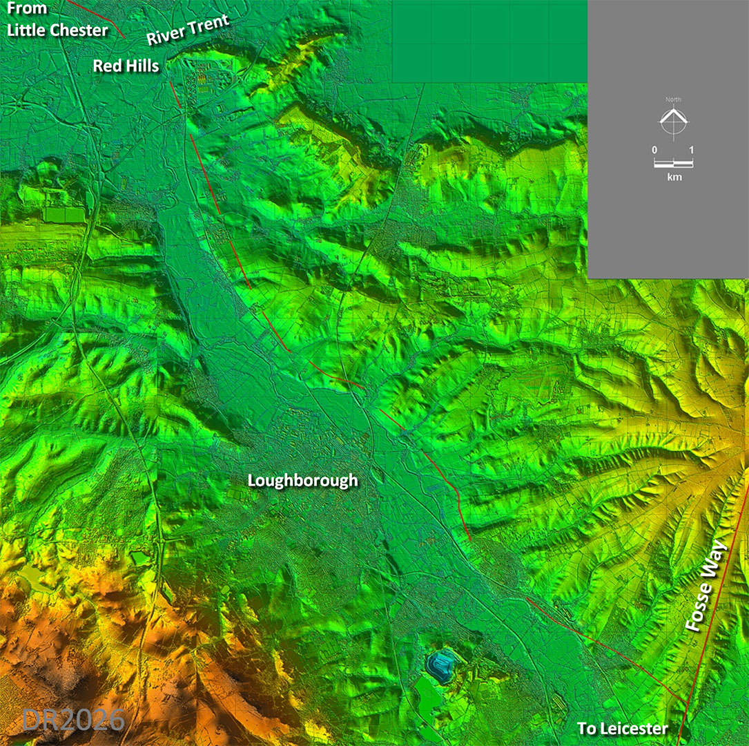
Continuation of the road to the Fosse Way Strictly outside the county but this was the onward continuation to the Fosse Way for Leicester. My guess is that it was a ferry from Sawley to Red Hills using the Rivers Trent and Soar. Northern parts of this road were probably first spotted by Mike Haken although not exactly where I show it. The southern half connecting to the Fosse Way is down to me. |
Click for larger view
|
 |
Lidar Image & Route Map 1
|
Click for larger view |
 |
Lidar Image & Route Map 2
|
Click for larger view |
 |
|
Last update: March 2026 |
© David Ratledge |