|
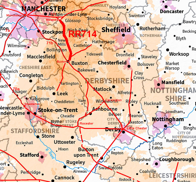
The Roman Road from Buxton to Melandra Castle, RR714Margary Number: 714Distance: 16 miles (depending on route) The Roman road from Buxton to Melandra Castle in Derbyshire is well recorded over most of its length, apart from the last northernmost section from Hollingworth Head to Melandra Castle itself. However, modern published routes (Rowe, 1999, Hargreaves 2017 and Mike Haken, 2025) all agree that having reached the summit of the pass at Hollingworth Head, rather than then descending, the route climbed even higher alongside Monk’s Road to just beyond Sitch, before descending to the fort. Rowe and Hargreaves descend via Horse Clough whereas Mike Haken takes the road down via Slack Edge. However, there is a viable low level alternative via Glossop, which avoids extra climbing and would connect to a high confidence section of a Roman road in Dinting Vale. For the roads around Melandra, these have been researched for over 7 years in conjunction with Neil Buckley, whose assistance is gratefully acknowledged.
|
Historic Counties: Derbyshire Current Counties: Derbyshire HER: Derbyshire
|
|
|
|
|
|
Lidar Flyover Video - Buxton to Melandra Castle
|
||
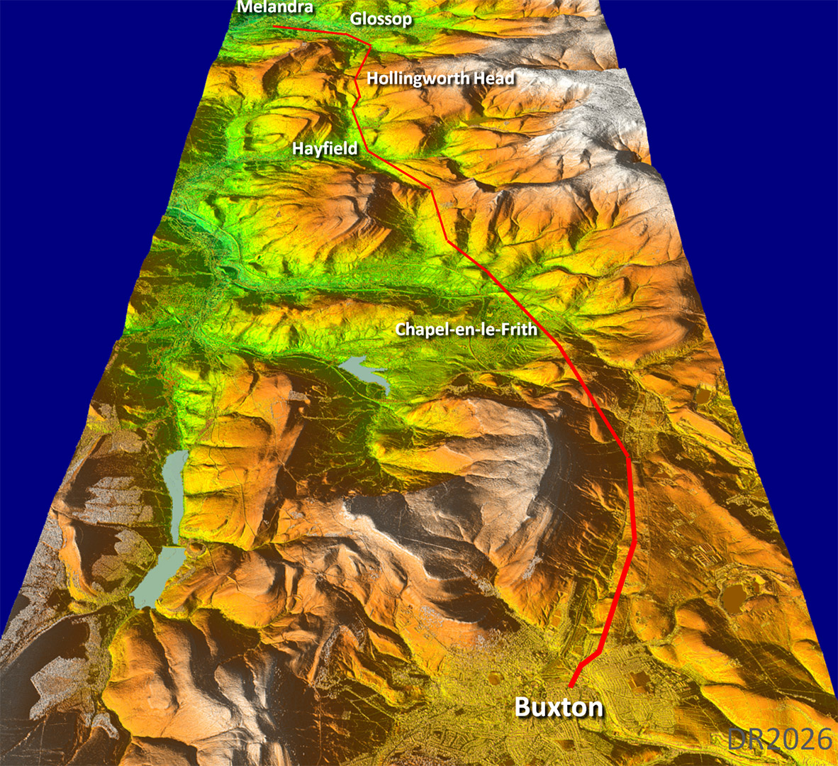
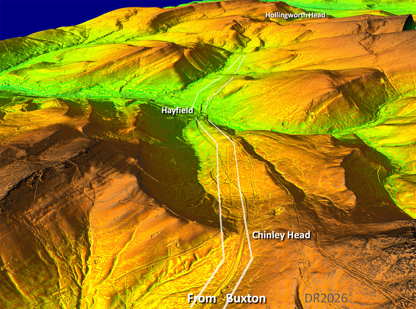
Oblique 3D Lidar Image - Full Route Picks its way through the valleys to minimise the amount of climbing. No problem with the course of this road until just before Hollingworth Head. That is where the various options begin - three high level and now one low level. The latter route is shown in red here as, to me, it has the most supporting evidence. |
Click for larger view |
 |
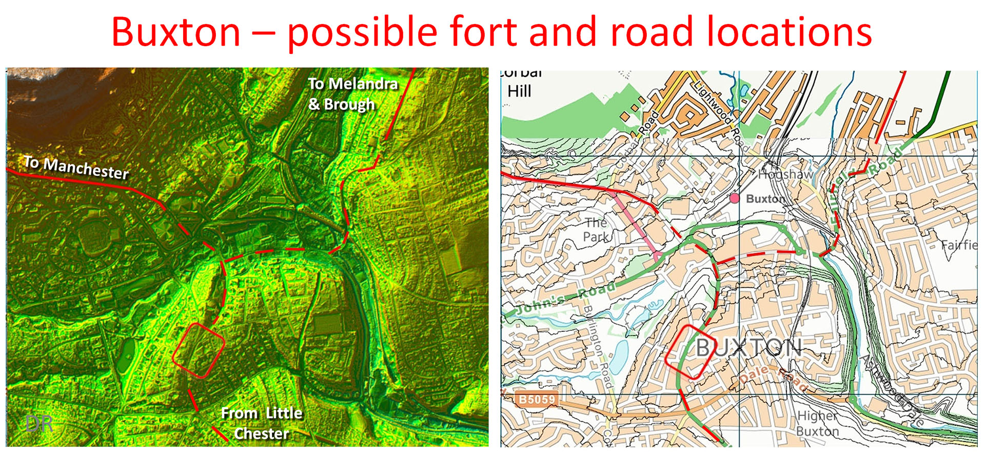
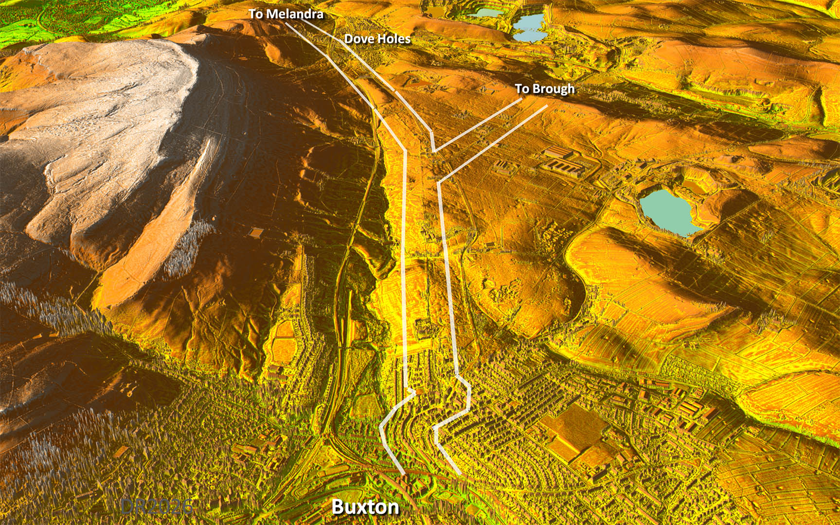
Buxton, Lidar & Map - Possible Fort site and routes The location of the fort in Buxton is unknown. Based on the Lidar imagery the position shown looks the most strategic. Today it is the Market Place in front of th Town Hall. In hilly Buxton here are not many flat alternatives plus it would provide a very commanding position no doubt why it ended up as the market place too... |
Click for larger view |
 |
Oblique 3D Lidar Image - leaving Buxton The routes to Melandra and Brough shared a common route for the first mile or so. However, it is clear the route to Brough must have been a later road as it is a branch off the Melandra road.
|
Click for larger view
|
 |
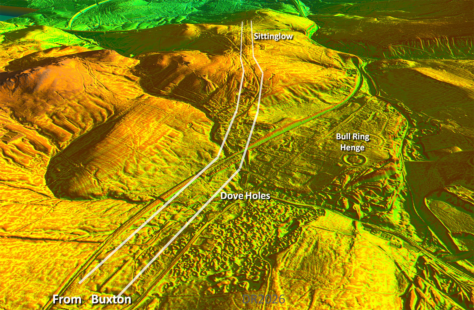
Oblique 3D Lidar Image- - passing Doveholes & the Bull Ring (Henge) We are on the second alignment here as the road passes through Doveholes. It then has to climb over Sitting Low as there was not really a realistic alternative. The railway needed two tunnels here. |
Click for larger view
|
 |
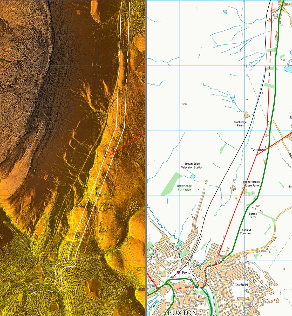
Lidar Image & Route Map 1 Buxton to Doveholes |
Click for larger view |
 |
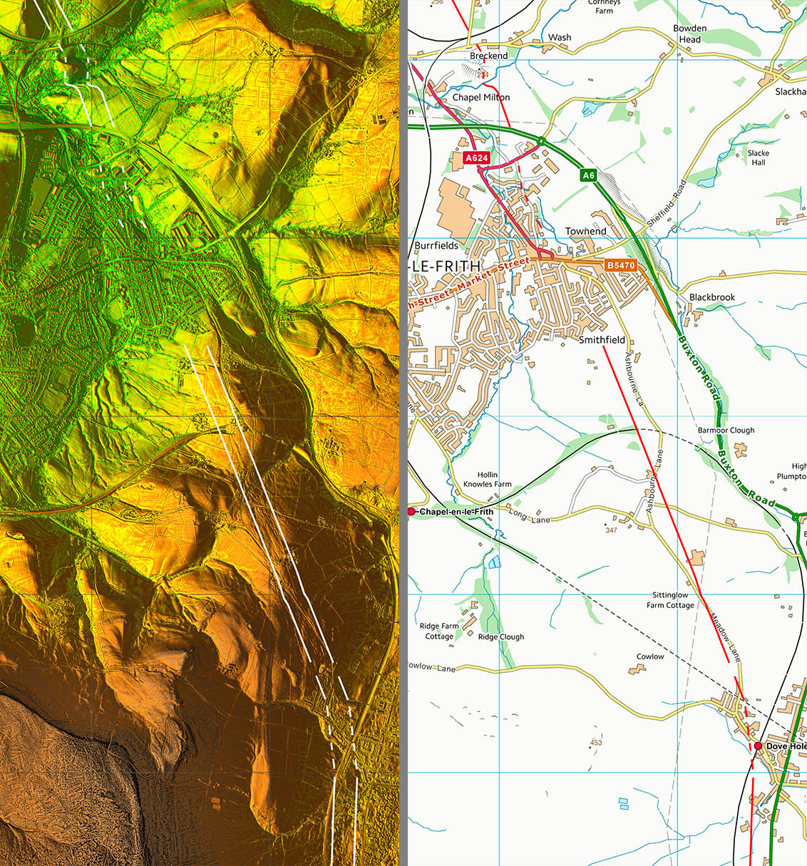
Lidar Image & Route Map 2 Doveholes to Chapel-en-le-Frith |
Click for larger view |
 |
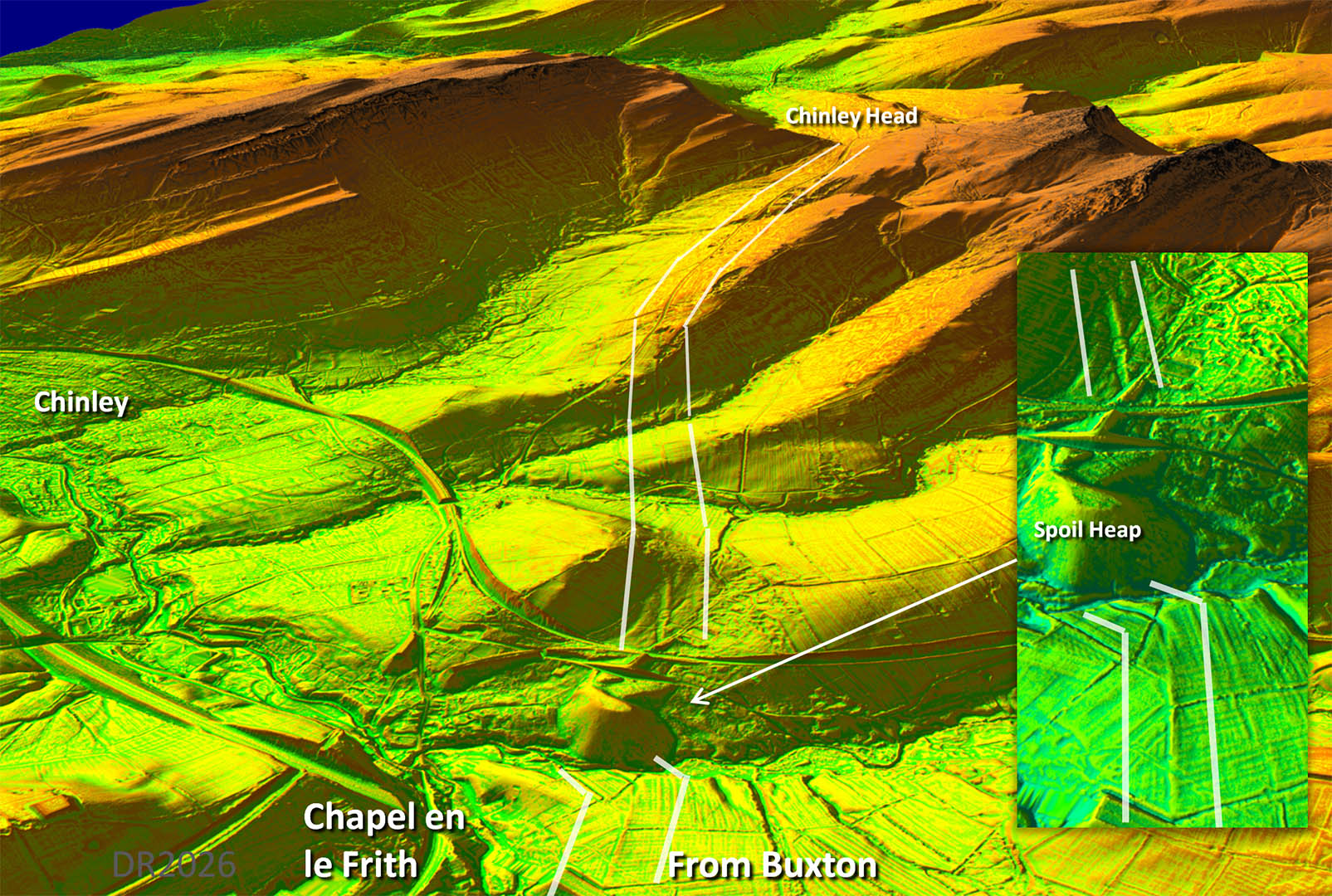
Oblique 3D Lidar Image- Chapel-en-le-Frith The road has to drop down to cross a stream (Black Brook?) and does so with a typical dog-leg. The northern bank zig-zag has been buried by a modern spoil heap - probably from Cowburn Tunnel (railway). Our road then continues and merges with the modern road up to Chinley Head. |
Click for larger view
|
 |
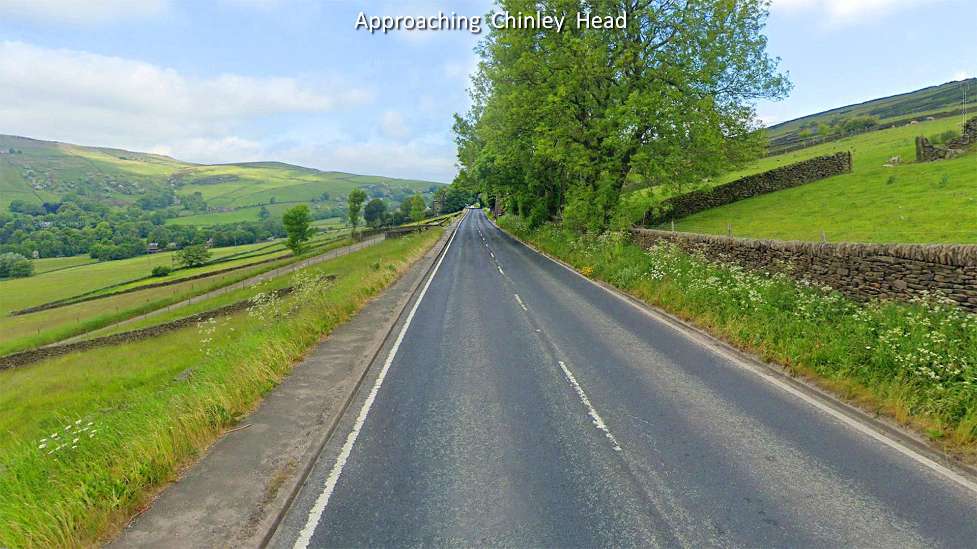
Approaching Chinley Head, A624 Our road has merged with the A624 for the ascent to Chinley Head. Well engineered with a gently gradient as you would expect from the Romans. Image: Google |
Click for larger view
|
 |
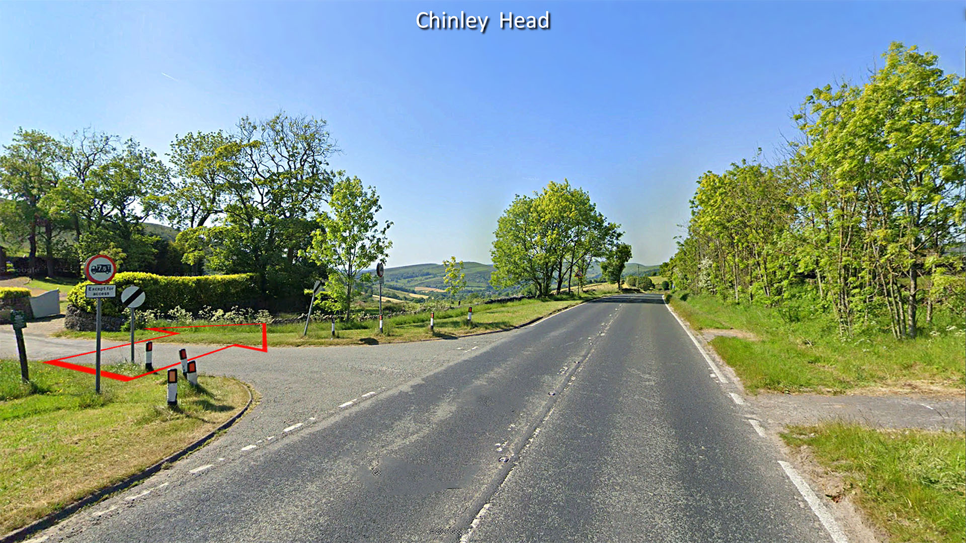
Chinley Head, A624 At the summit the modern road swings off the Roman line shown by the red arrow. Image: Google |
Click for larger view
|
 |
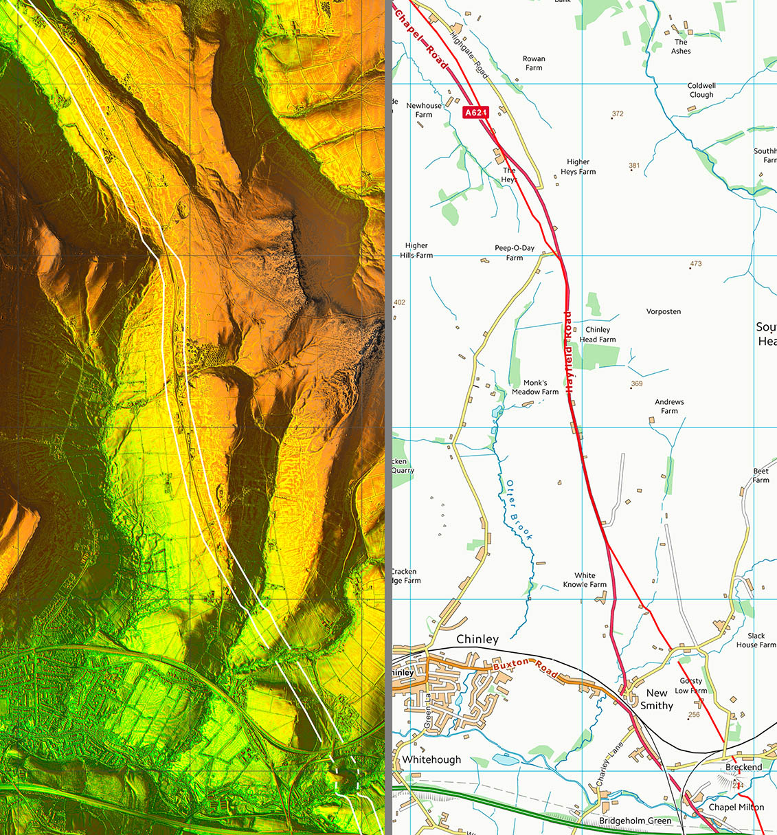
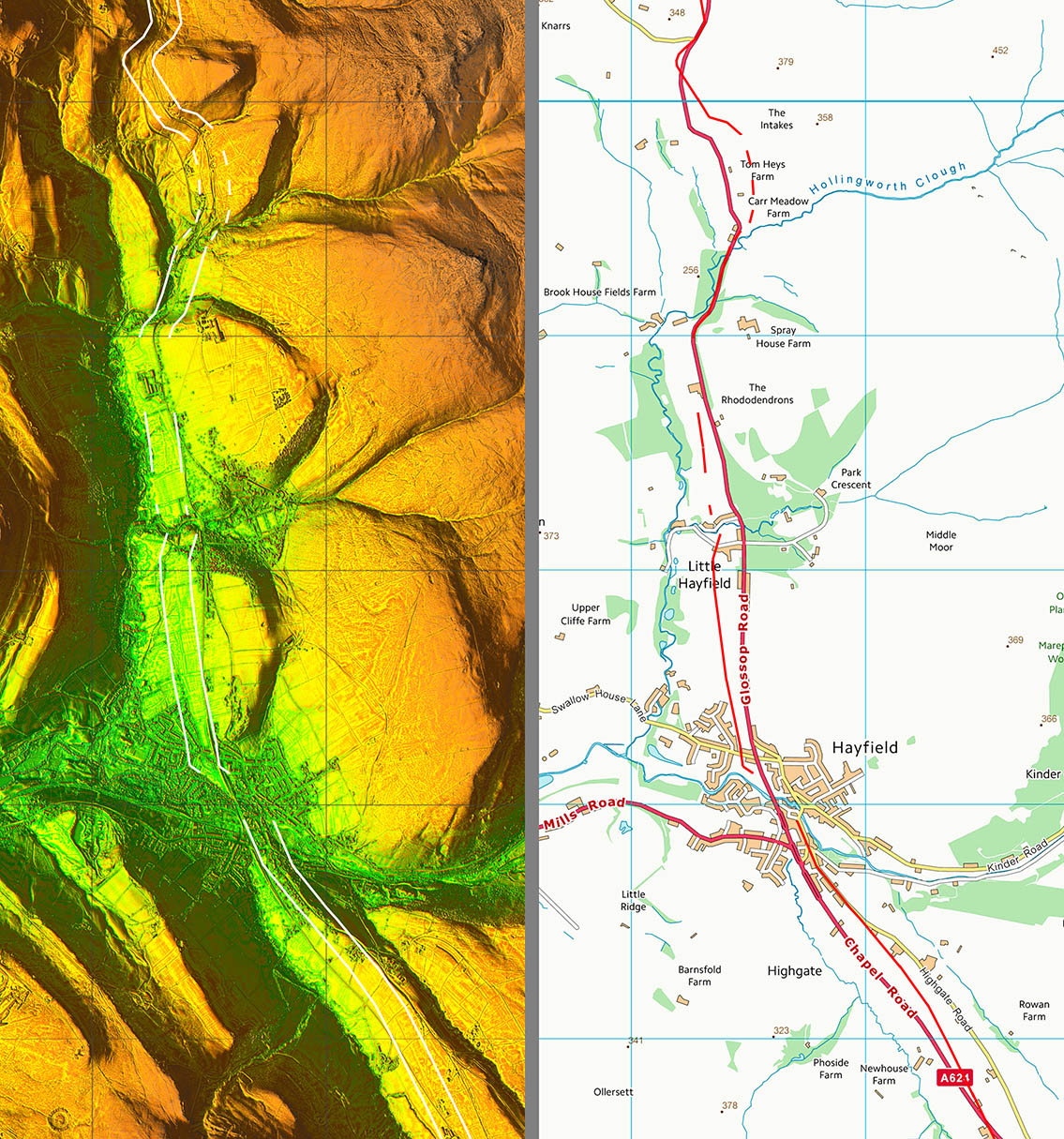
Lidar Image & Route Map 3 North of Chapel-en-le-Frith then the A624 and the Roman road are never far apart. The A624 was turnpiked (see later) and the modern wanderings off the original Roman line are no doubt due to that. |
Click for larger view |
 |
Oblique 3D Lidar Image- Hayfield At Chinley Head our road diverges from the modern road and takes a more direct course to Hayfield |
Click for larger view
|
 |
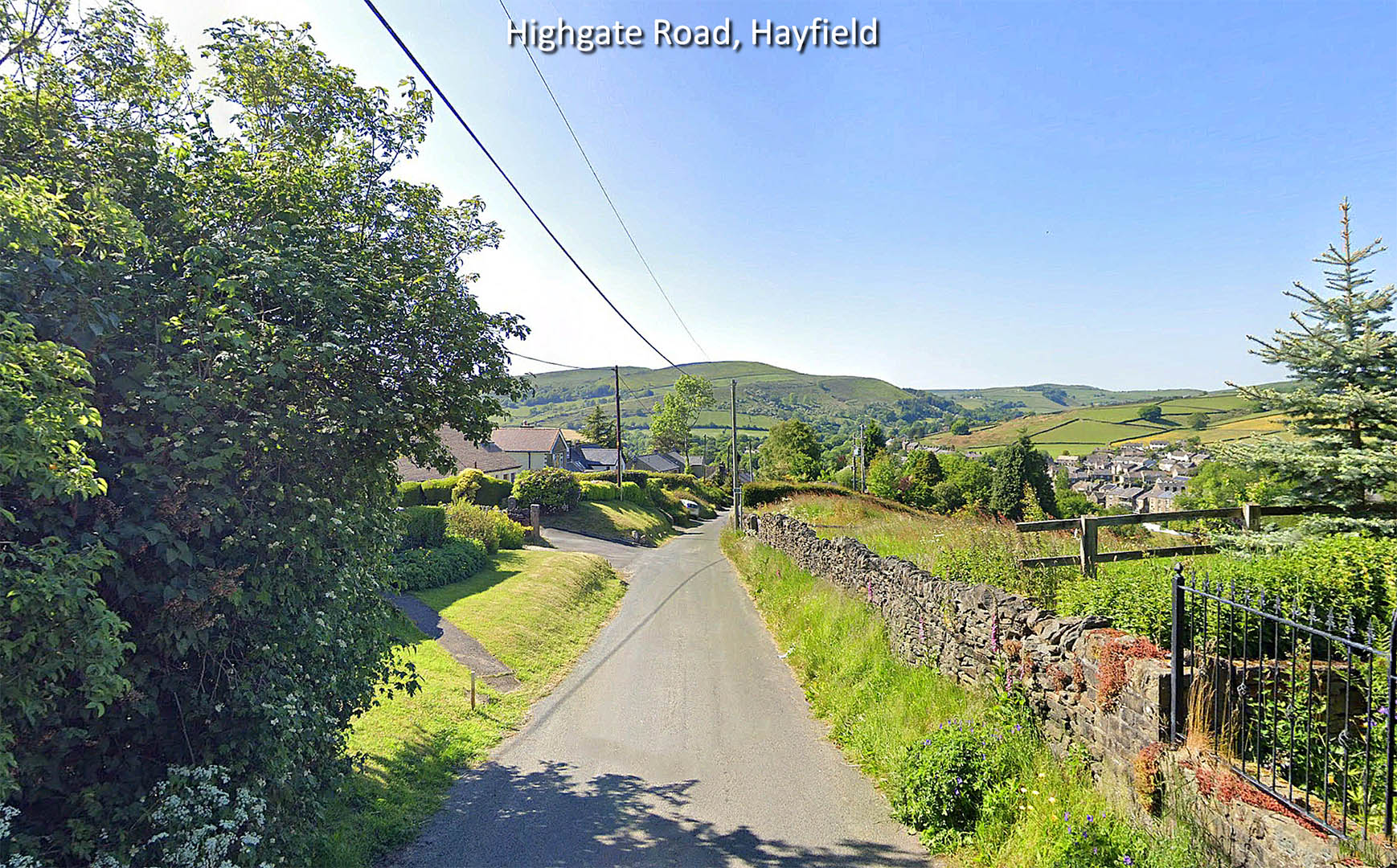
Highgate Road, Hayfield Big clue in the name with the old Highgate Road marking the Roman line into Hayfield. Image: Google |
Click for larger view
|
 |
Lidar Image & Route Map 4 The A624 was turnpiked following the 1792 Turnpike Act. The latter has several references to the turnpike being built alongside the “old road” e.g. “the road from Hollingworth Head to Enterclough Bridge, be made and carried on the North side of the old road near the plantation, continuing that road by certain stakes now on the common and so through the village of Churnal”. The village of Churnal is about halfway between Hollingworth Head and Glossop. That description covers the section heading north from Hollingworth Head but the old road is also visible south of the head. So we have an old road over Hollingworth Head to Glossop, predating the turnpike and one that would fit well with the last certain stretch of Roman road coming from Buxton. |
Click for larger view |
 |
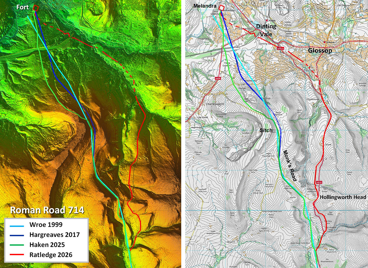
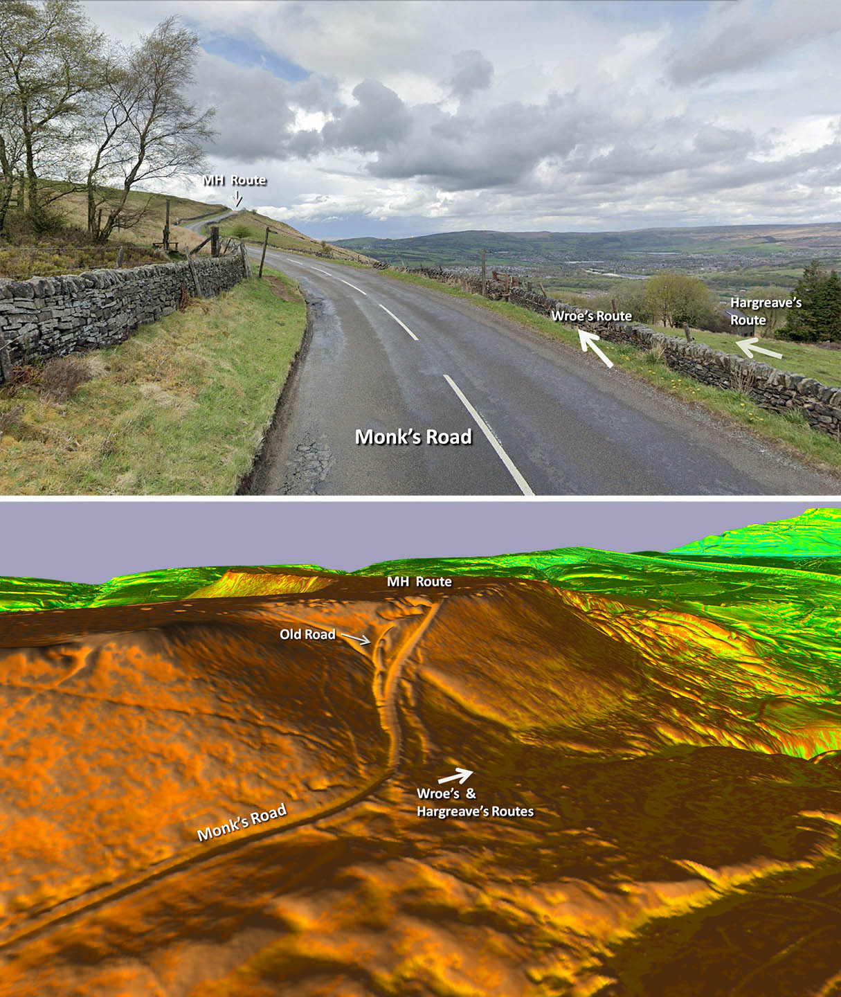
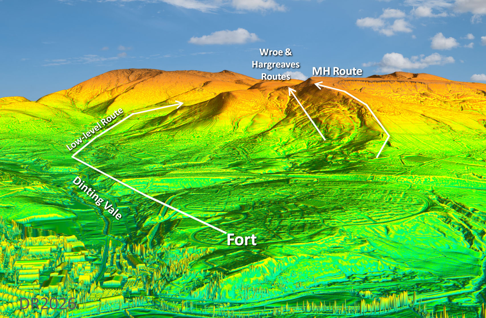
Hollingworth Head to Melandra - Route Options These are the four routes from Hollingworth Head to Melandra. Rowe, Hargreaves and Haken take the high route whereas I suggest a low level alternative. All three high level routes are depicted, initially alongside Monk’s Road on its south side, and there are certainly signs of an old road at that point. All three though have not finished climbing. Rowe and Hargreaves routes are ultimately slightly lower (less high) but would still have to climb to 370m AOD. These both then descend via Horse Clough although on different courses. Horse Clough though is really impracticable. It comprises very rough disturbed ground with no trace of a road and gradients of around 1 in 4.5. It can surely be discounted. Mike’s more logical route via Slack Edge though would need to climb even higher to around 380m AOD, i.e. 50 metres higher than the low level route. |
Click for larger view |
 |
High and Low Routes - Google and Lidar Wroe and Hargeaves routes are lower than Mike's but have to negoiate Horse Clough, which is very much disturbed ground with initially that very steep gradient. Hardly practical at all. If you look closely at Mike's route (MH Route) the older road is to the left of the modern Monk's Lane approaching the summit. The modern road eases the gradient. Top Image: Google |
Click for larger view |
 |
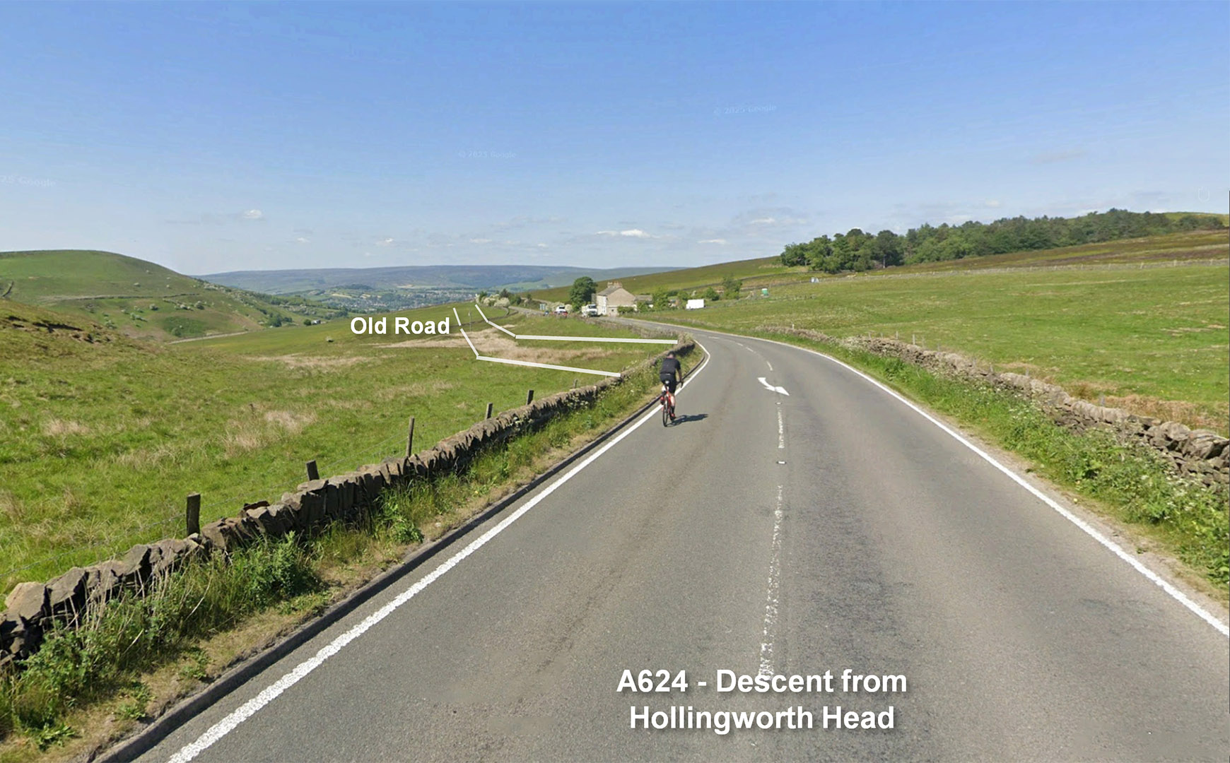
Descent from Hollingworth Head I am with the cyclist! Why climb even higher when you can freewheel down hill? The old road (Roman?) looks to descend then climb but that is not the case. It is a gradual descent all the way to Glossop. Again here the modern A624 wanders off the original Roman line - that turnpike act again. Across Glossop then suburbia masks any evidence but Pike's Lane is straight and would fit very well with the descent from Hollingworth Head and the next section through Dinting Vale - see below. Image: Google |
Click for larger view |
 |
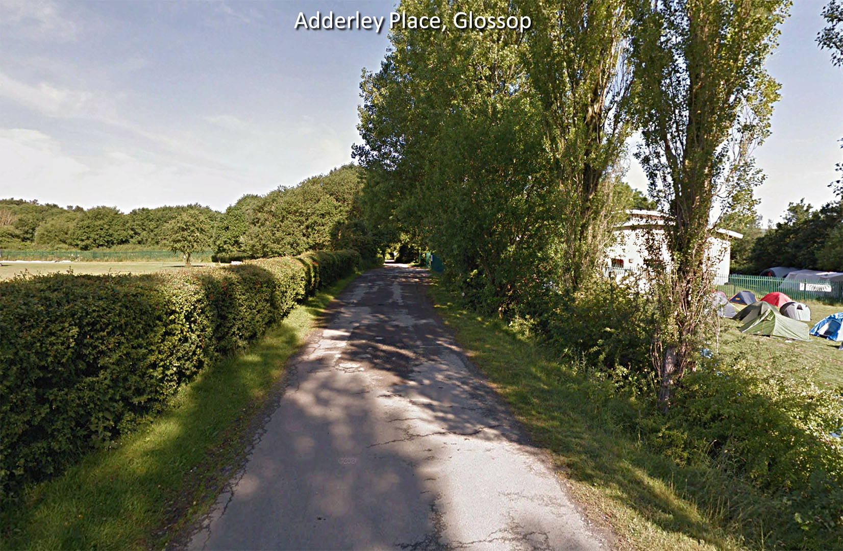
Adderley Place, Glossop We are leaving Glossop heading west past the cricket ground towards the railway. Minor modern track on a very much built-up Roman agger. Image: Google |
Click for larger view |
 |
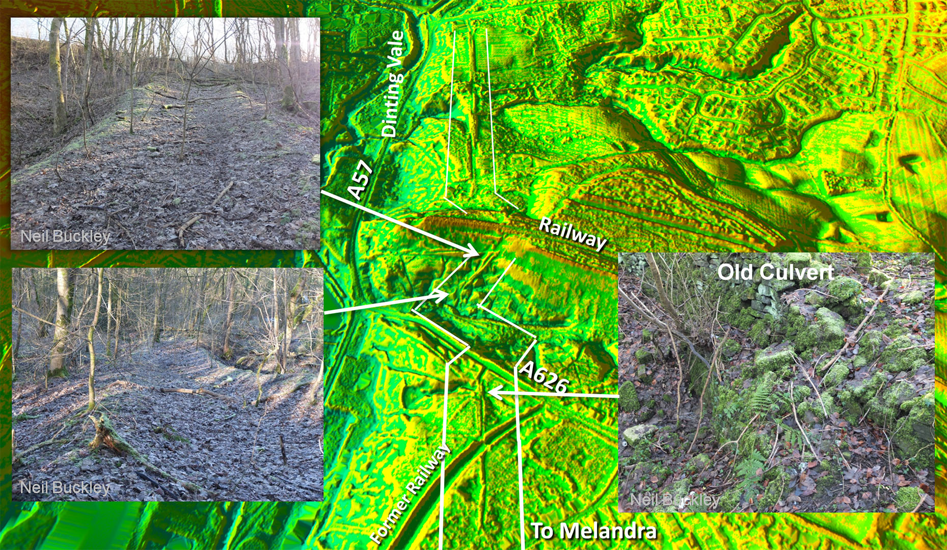
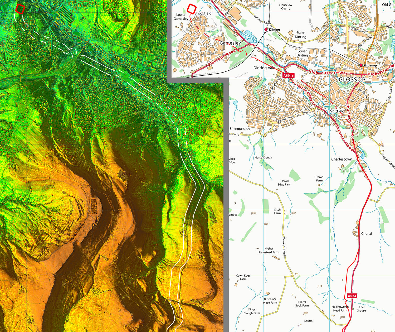
Oblique 3D Lidar Image - Low Level Route in Dinting Vale Very obvious Roman road comprising several surviving agger sections plus azig-zags to negotiate a deep valley west of the railway. Neil Buckley visited this spot in 2022 recorded the surviving agger on the west side of the railway.. The agger has been worn down in the middle of the road indicating use after the Romans but the railway ended it as a through route. Inset Images: Neil Buckley
|
Click for larger view |
 |
Oblique 3D Lidar Image - Mleandra Fort looking back Routes shown are approximate but do indicate the terain they would have to negotiate. Fierce climbs for all 3 high level routes. Mike's route is the only real option but for the descent from Slack Edge then its steepness over a long distance is a worry. It averages around 1 in 8 for well over 1 km with some parts approaching 1 in 6. It would represent a formidable climb coming from Melandra. There are some signs of an old track on the higher part of Slack Edge but nothing I could see aiming for Melandra.
|
Click for larger view |
 |
Lidar Image & Route Map 5 Low Level Route via Glossop and Dinting Vale. Yes it is certainly less direct but that stretch from Melandra to Glossop was likely shared with the road to Brough then, despite being longer, it would need less overall construction. It is obviously makes good sense to share a road. It is also a lot easier road (gradients and lowver altitude) and spends the absolute minimum at high level. |
Click for larger view |
 |
|
Last update: March 2026 |
© David Ratledge |