|
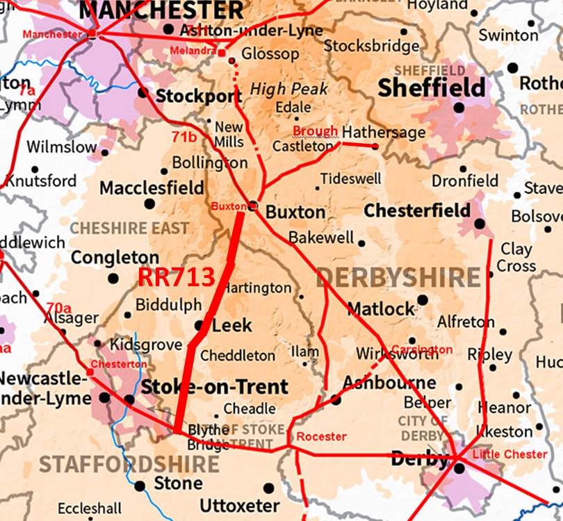
The Roman Road from Buxton to Leek & Blythe BridgeMargary Number: 713Distance: 28 miles (to Blythe Bridge) Mostly based on the modern A53, this road has long been suspected of being a Roman road due to its several long straight sections. Its ultimate destination was almost certainly Blythe Bridge where it formed a junction with RR181. A large proportion of this road is in Staffordshire but we will follow its course to Blythe Bridge as this is largely unrecorded..
|
Historic Counties: Derbyshire & Staffordshire Current Counties: Derbyshire & Staffordshire HER: Derbyshire & Staffordshire
|
|
|
|
|
|
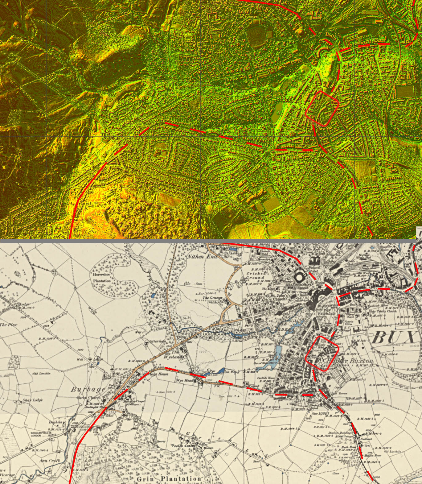
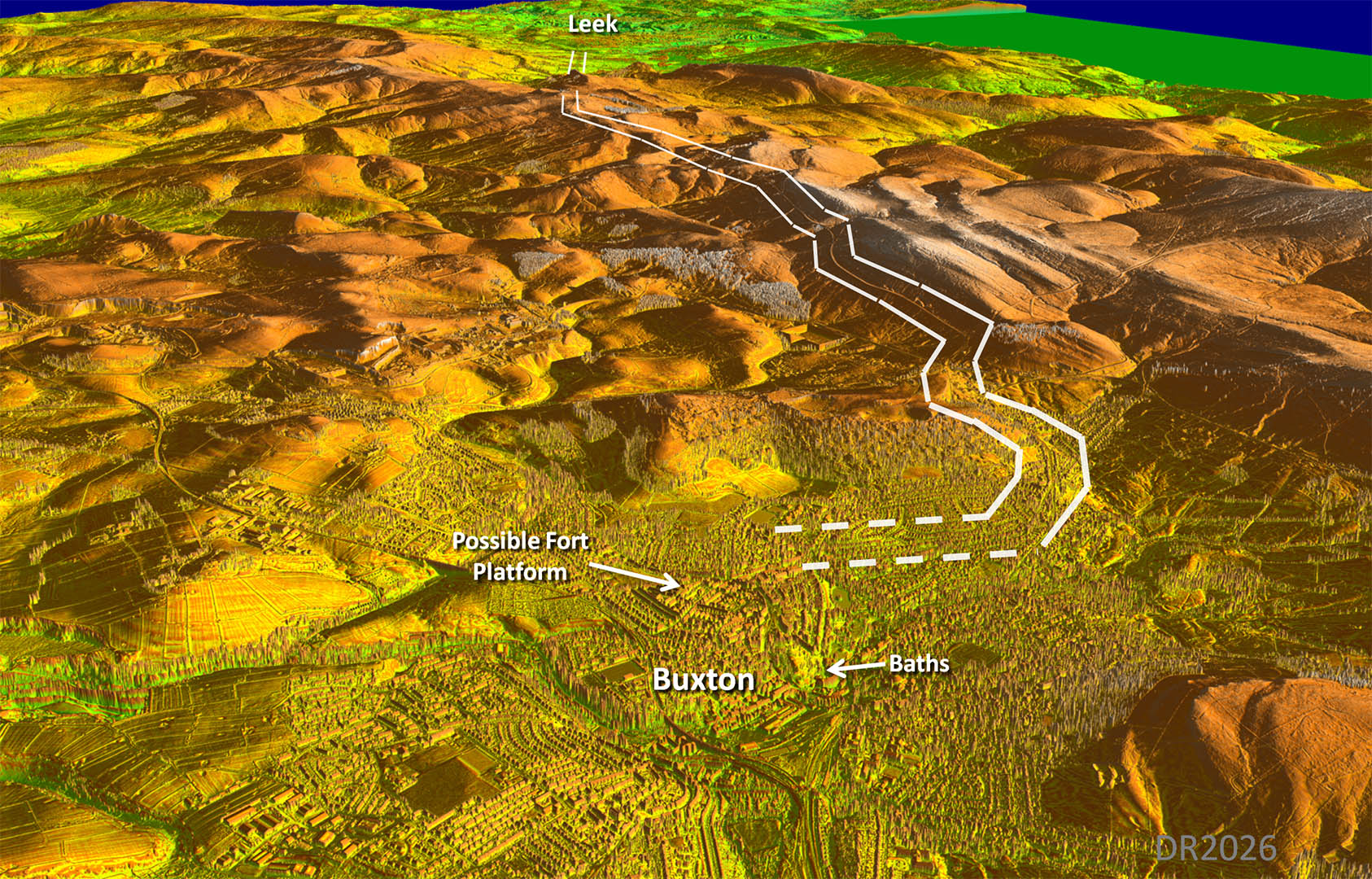
Lidar Image - Section 1, Buxton to Leek I be live the road most likely headed towards Axe Edge out of Buxton. This is by the best way to negotiate the high terrain. At Leek it seems to have bypassed the modern town on its eastern side. |
Click for larger view |
 |
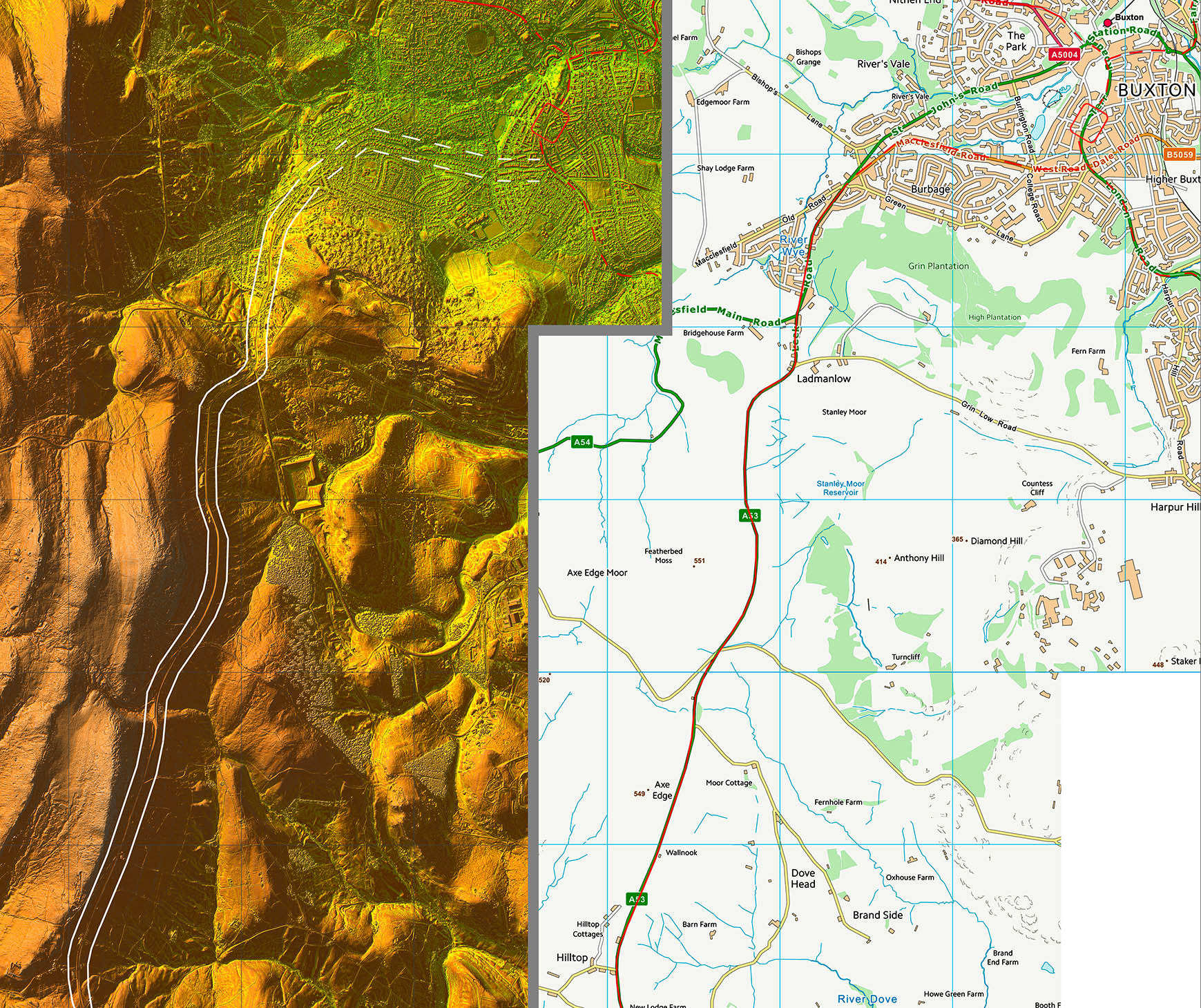
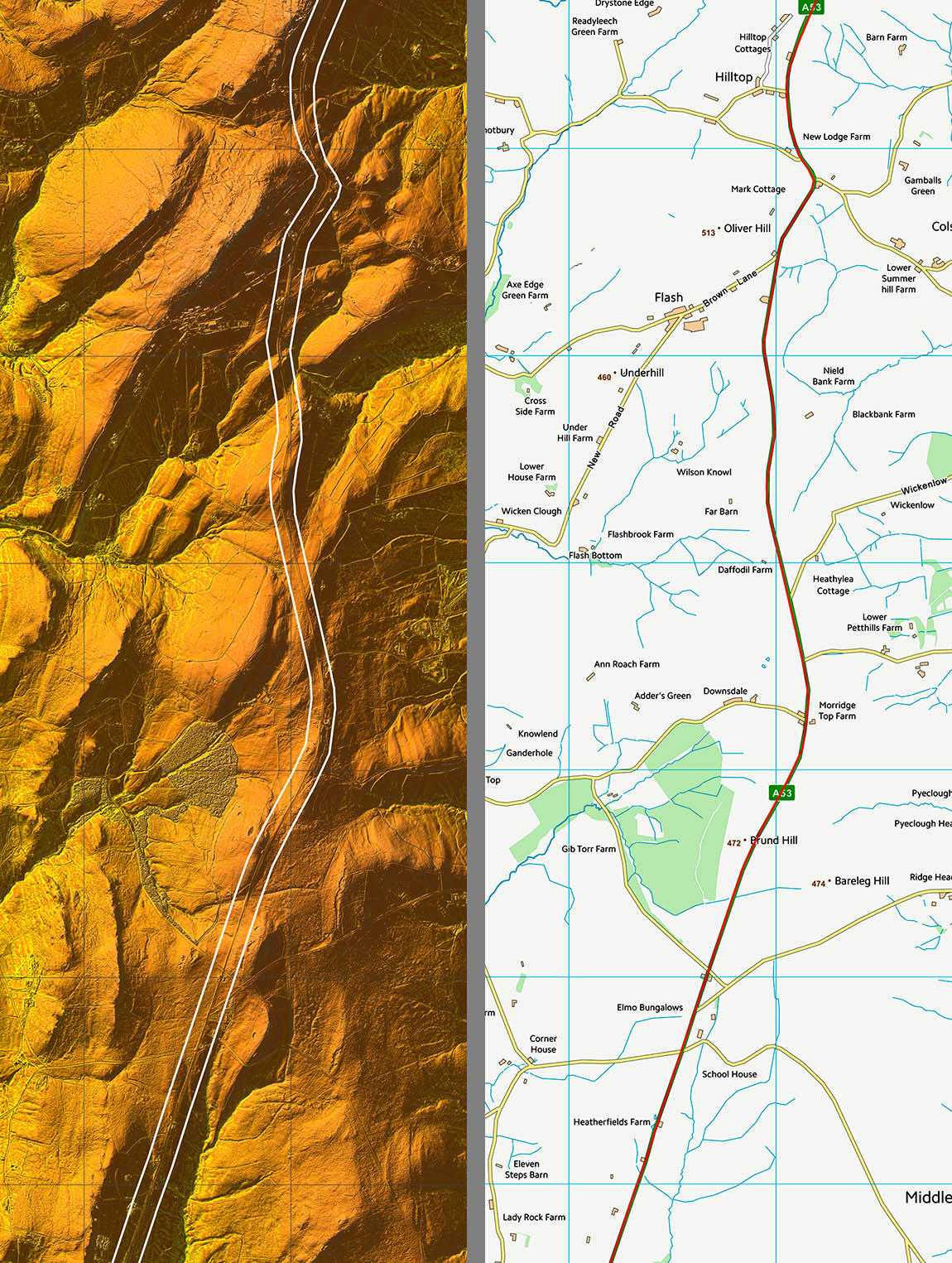
Buxton - Possible route to Roman site Modern Lidar compared to Ordnance Survey First Edition mapping.The route shown is an intelligent(?) guess as to the best route but with little available evidence. Just a former highway engineer's view! |
Click for larger view |
 |
Oblique 3D Lidar Image - Full Route to Leek The reason for initially aiming west (right) of a straight line is obvious in this view. Heading straight for Leek would involve a lot of big ups and downs - totally impractical - see Peter Wroe's suggested route below.. |
Click for larger view
|
 |
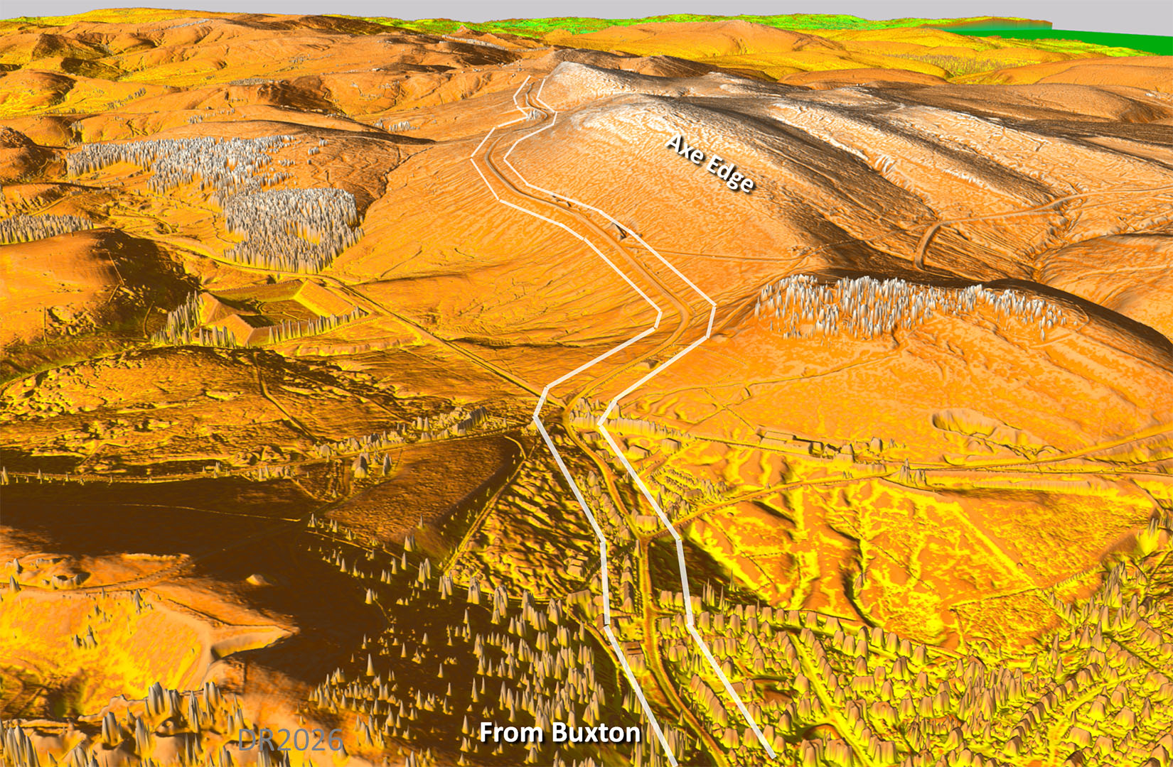
Oblique 3D Lidar Image - Axe Edge The climb up alongside Axe Edge is gentle. This is by far the best route to Leek.
|
Click for larger view
|
 |
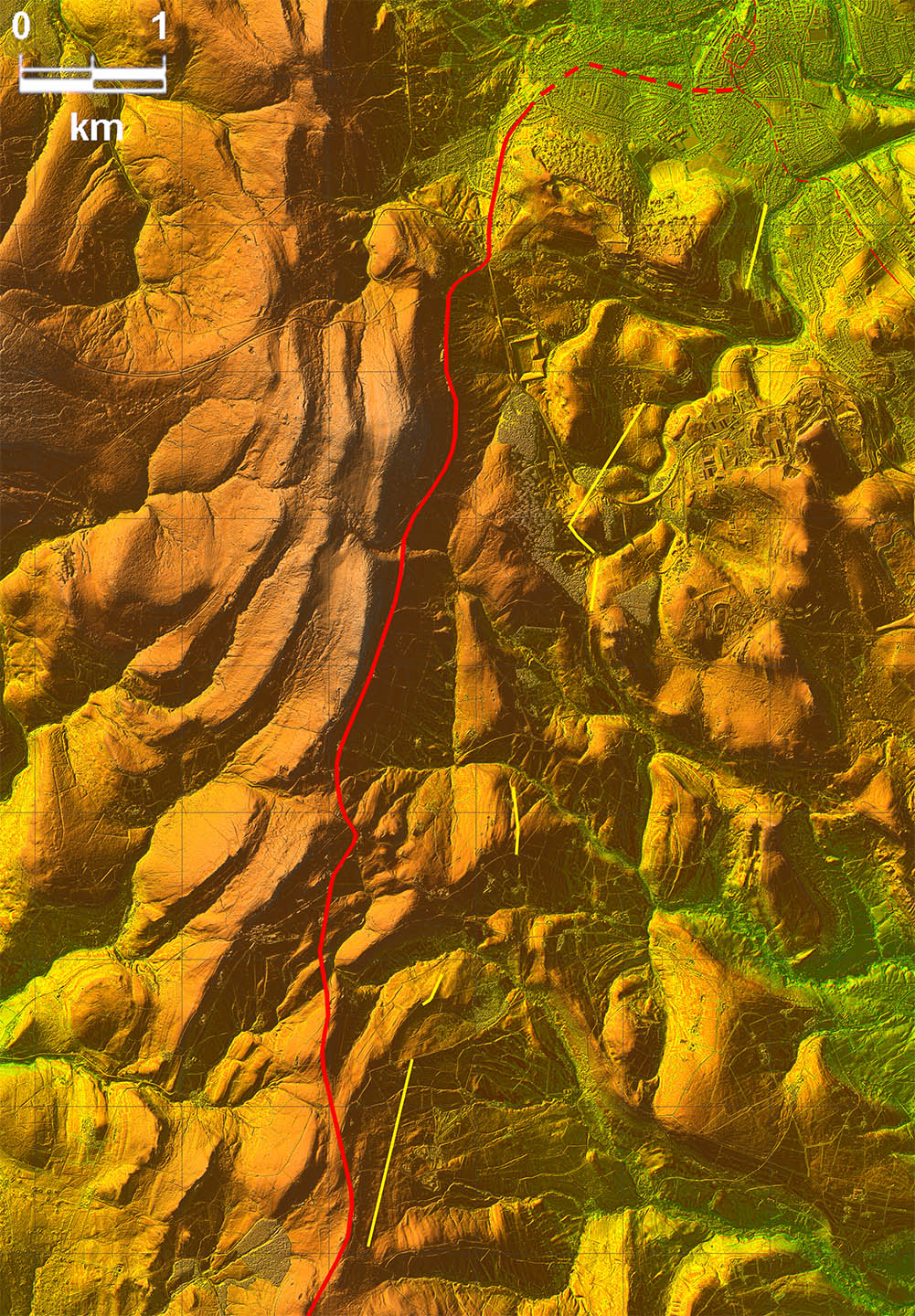
Lidar Image - Peter Wroe's Route Peter Wroe's suggested route is shown in yellow. Overall it appears more direct but add in the numerous zig-zags that would be needed to get up and own all those steep hills and skirting around others then it would likely be longer - and certainly much more onerous. Axe Edge is by far the more practical route and adapts to the contours rather than fighting them (shown in red).
|
Click for larger view
|
 |
Route Map 1
|
Click for larger view |
 |
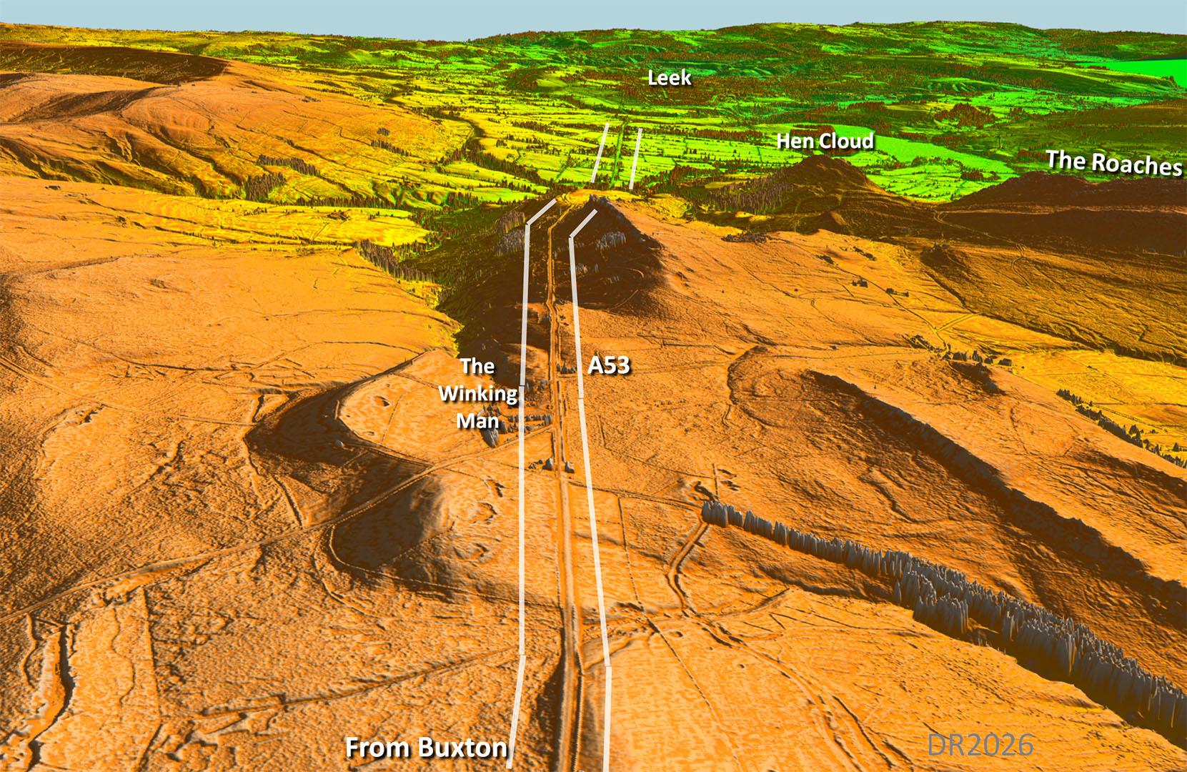
Oblique Lidar Image - The Winking Man Passing the Winking Man pub where is will soon drop off the High Peak. |
Click for larger view |
 |
Route Map 2
|
Click for larger view |
 |
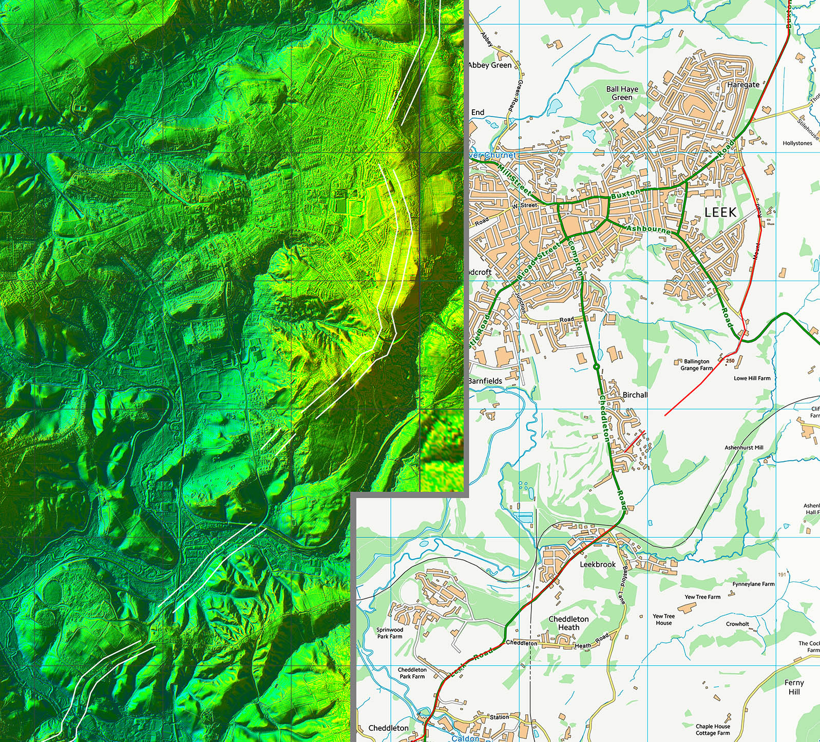
Oblique Lidar Image - Approaching Leek The road clearly was targeted Leek. If Blythe Bridge was the only interest then Leek could have been bypassed and shortened the distance. |
Click for larger view |
 |
Route Map 3
|
Click for larger view |
 |
Section 2 - Leek to Blythe bridge
| ||
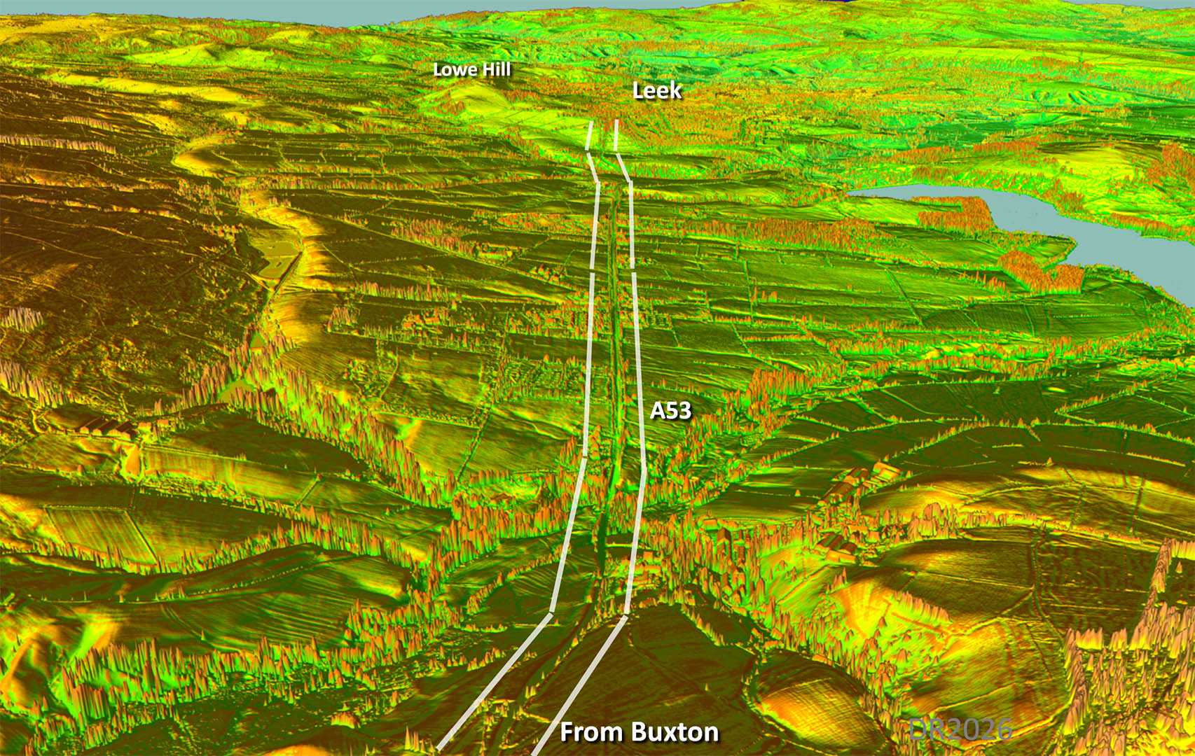
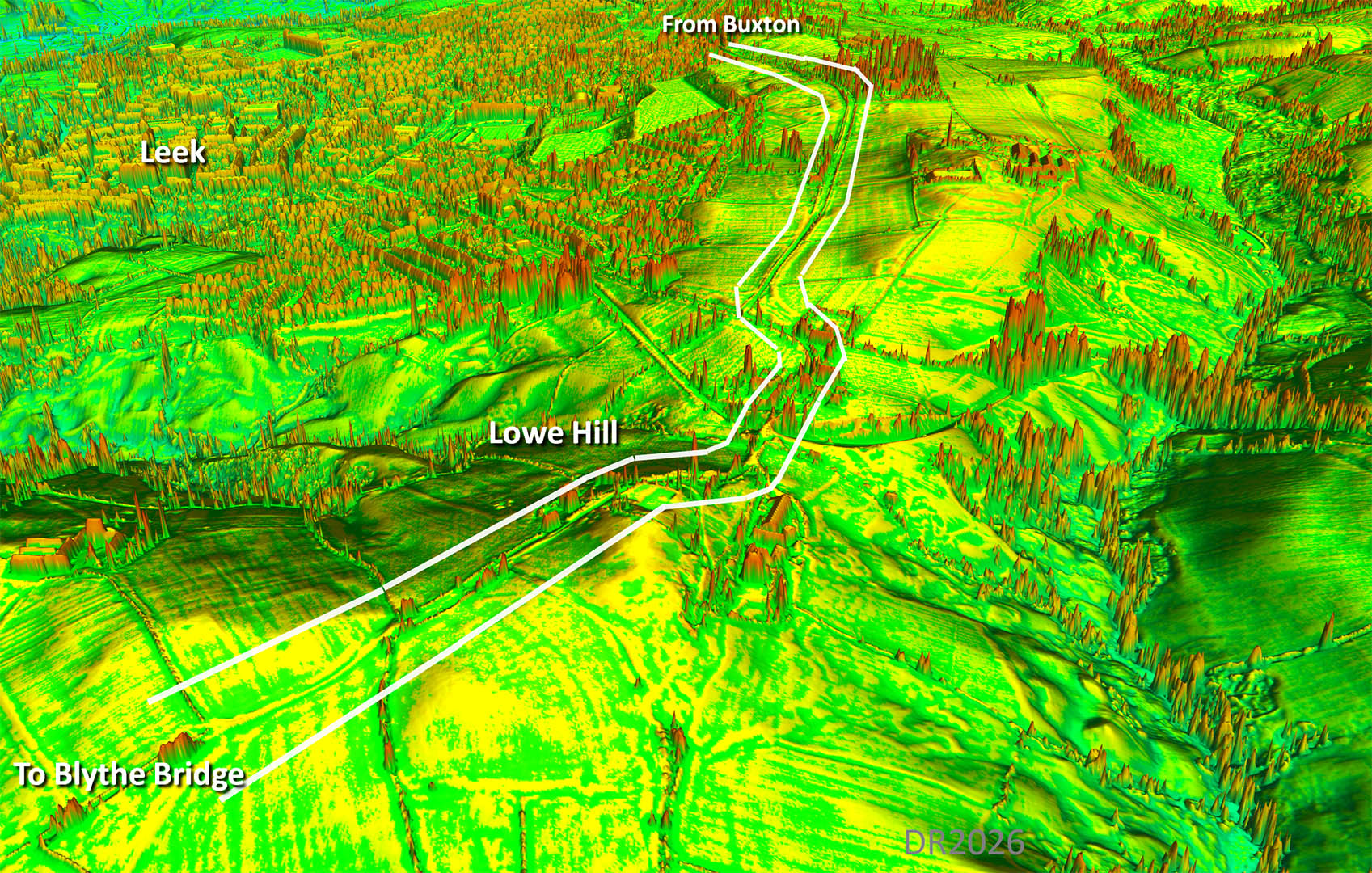
Oblique Lidar Image - Lowe Hill, Leek Across Leek the road would have either have had to branch west or east. East has the best evidence where the line uses a watershed at Lowe Hill to cross adjacent high ridges. I have come across this before for the Romans using a watershed to do just that. |
Click for larger view |
 |
Route Map 4 Skirting eastwards around Leek to reach the final straight(ish) alignment to Blythe Bridge.
|
Click for larger view |
 |
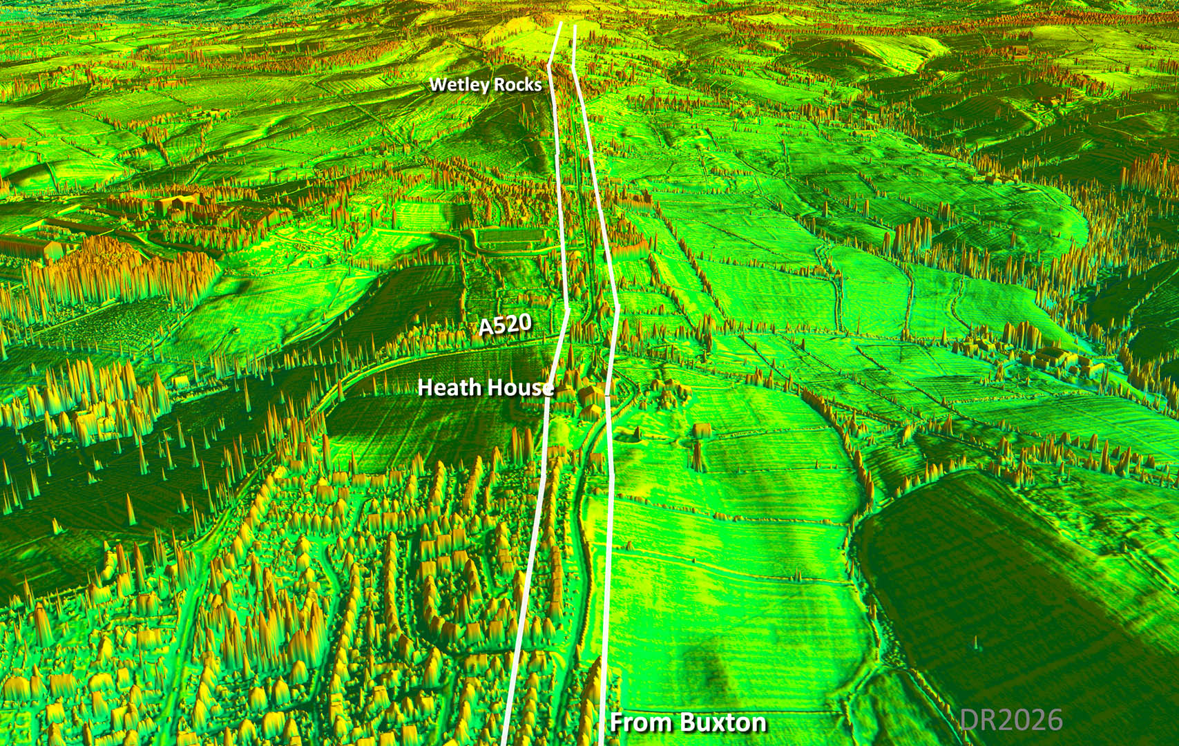
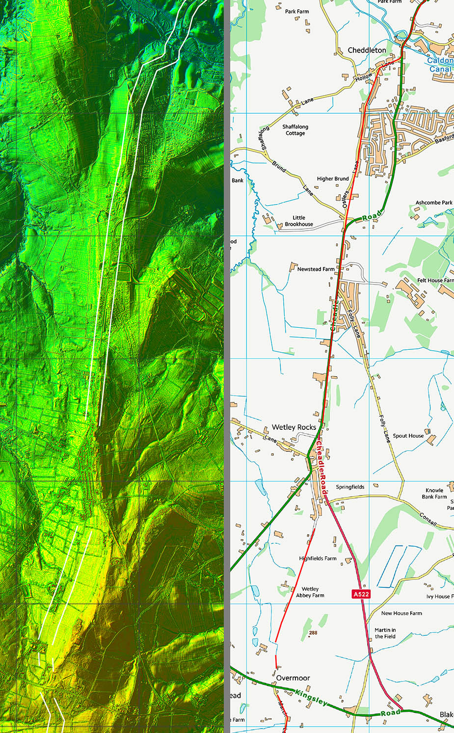
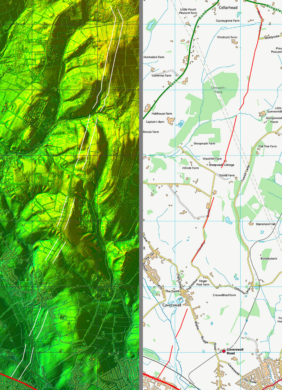
Oblique Lidar Image - Heath House Heath House has been built on top of the old road but either side there are traces of original route. Straight alignment from there on towards Wetley Rocks. |
Click for larger view |
 |
Route Map 5 the Wetley Rocks alignment.
|
Click for larger view |
 |
Route Map 6 Continuing very direct until we finally we reach a junction with RR181 at Blythe Bridge.
|
Click for larger view |
 |
|
Last update: March 2026 |
© David Ratledge |