|
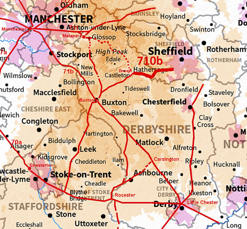
Batham Gate: Brough to Burbage MoorMargary Number: 710bDistance: 17 miles (approximate distance to Templeborough) The route is fairly clear as far as Hathersage but from there on it has to climb over Burbage Moor and the problems begin. There are so many tracks/roads over the moor to decide which is the Roman one is just about impossible to decipher. We will look at the main options across the moor and offer an alternative. The destination of the road was almost certainly the Roman fort at Templeborough.
|
Historic Counties: Derbyshire & Yorkshire Current Counties: Derbyshire & South Yorkshire HER: Derbyshire & South Yorkshire
|
|
|
|
|
|
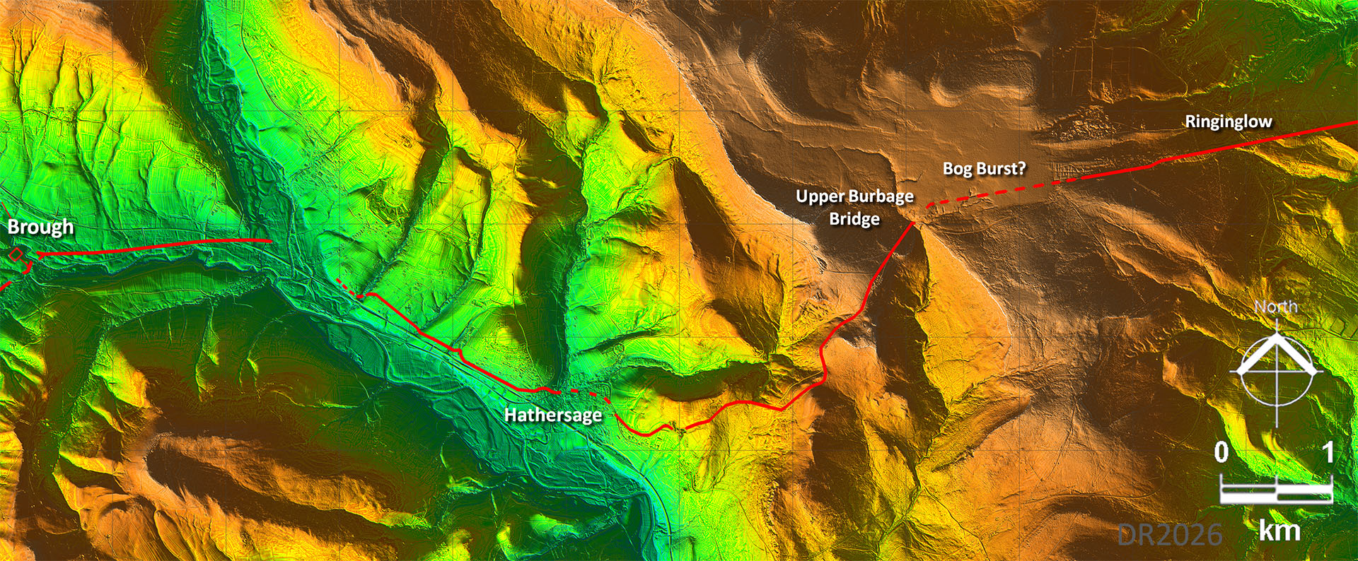
Route Brough to Ringinglow - Lidar Image What I have shown is the route I would have chosen (as a former highway engineer) via Upper Burbage Bridge. There has clearly been a bog burst up there smothering part of the route. To me it is the best compromise on directness and amount of climbing. Derbyshire HER shows a different route over the Moor further to the south of mine and is described as "possible" - see later. We are all guessing somewhat but I offer mine as a viable alternative. |
Click for larger view |
|
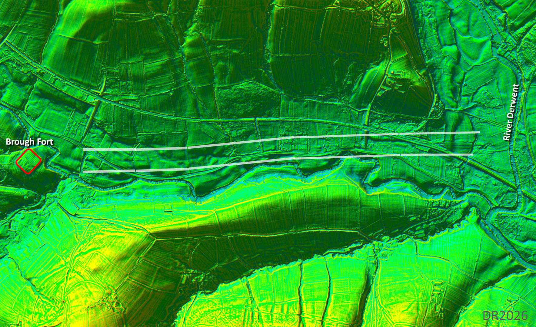
Brough to River Derwent - Lidar It's faint and it's intermittent but sufficient to be certain. This section was probably that spotted by Peter Wroe back in the 1980s. The crossing of the Derwent has obviously long been washed away.
|
Click for larger view |
 |
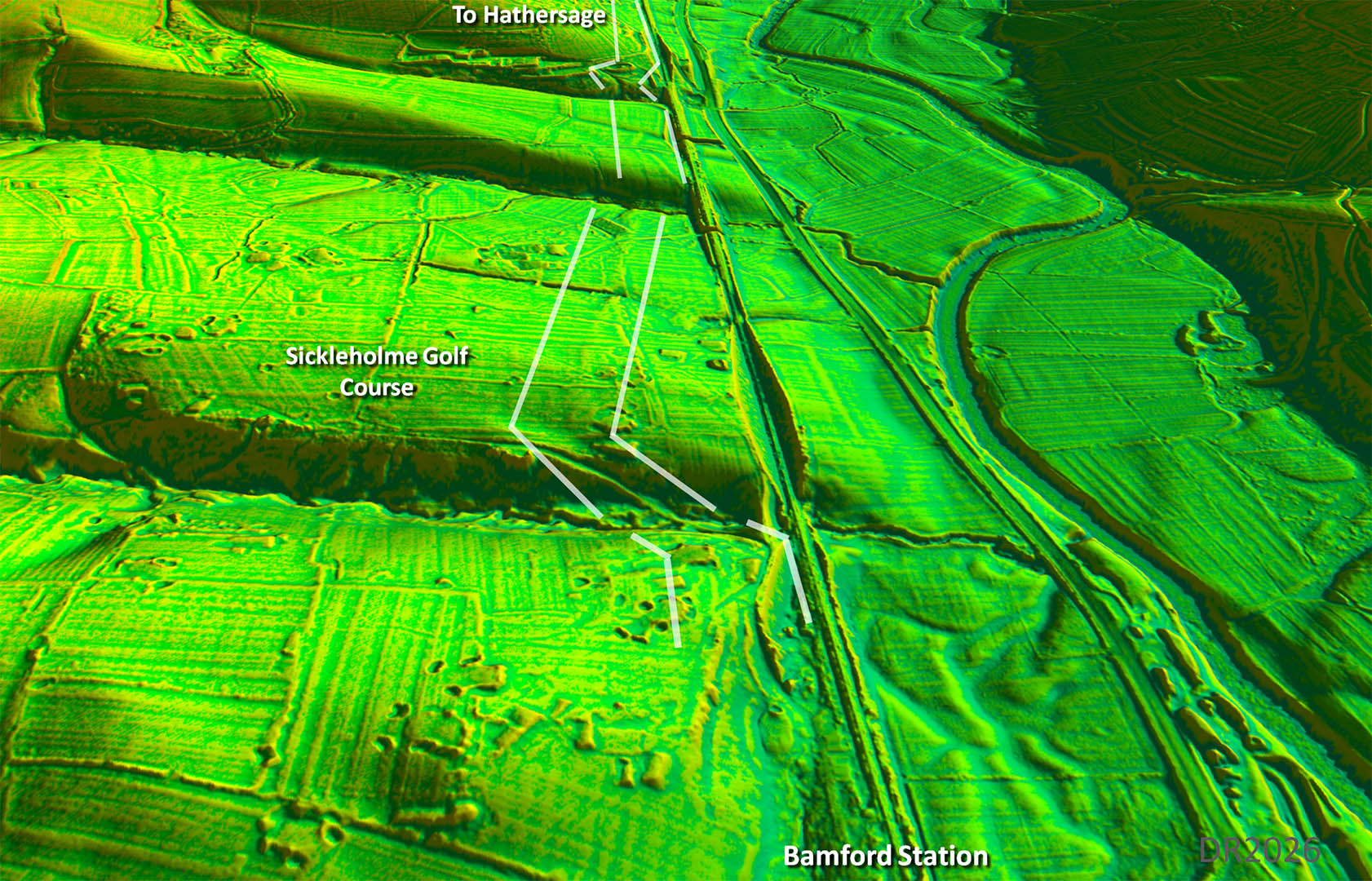
Oblique 3D Lidar - Sickleholme Golf Course Still intermittent clues after we crossed the River Derwent but there is a fine surviving agger section across the golf course plus a diagonal up the slope of the little valley. We are reaching Hathersasge now. We can now be certain our road went to Hathersage. This would rule out a suggested route onwards via the Long Causeway at Stanage and Stanedge Pole. Too much of a diversion. |
Click for larger view |
 |
Oblique 3D Lidar - Which Route to Ringinglow? General agreement that the routes converge near Ringinglow but which was the route the Romans took to get there? The convential route is via Winyards Nick - both the HER and Mike Haken take that route. The drawback is it then has to drop to cross Burbage Brook. The evidence for the last section to Ringinglow is also vague. My suggestion is rather than going via Winyards Nick turn left (north) and head to Upper Burbage Bridge and then take the straight road to Ringinglow. Yes it is bit longer but does not have a descent (and subsequent climb). In reality all routes have issues, all have problems. |
Click for larger view |
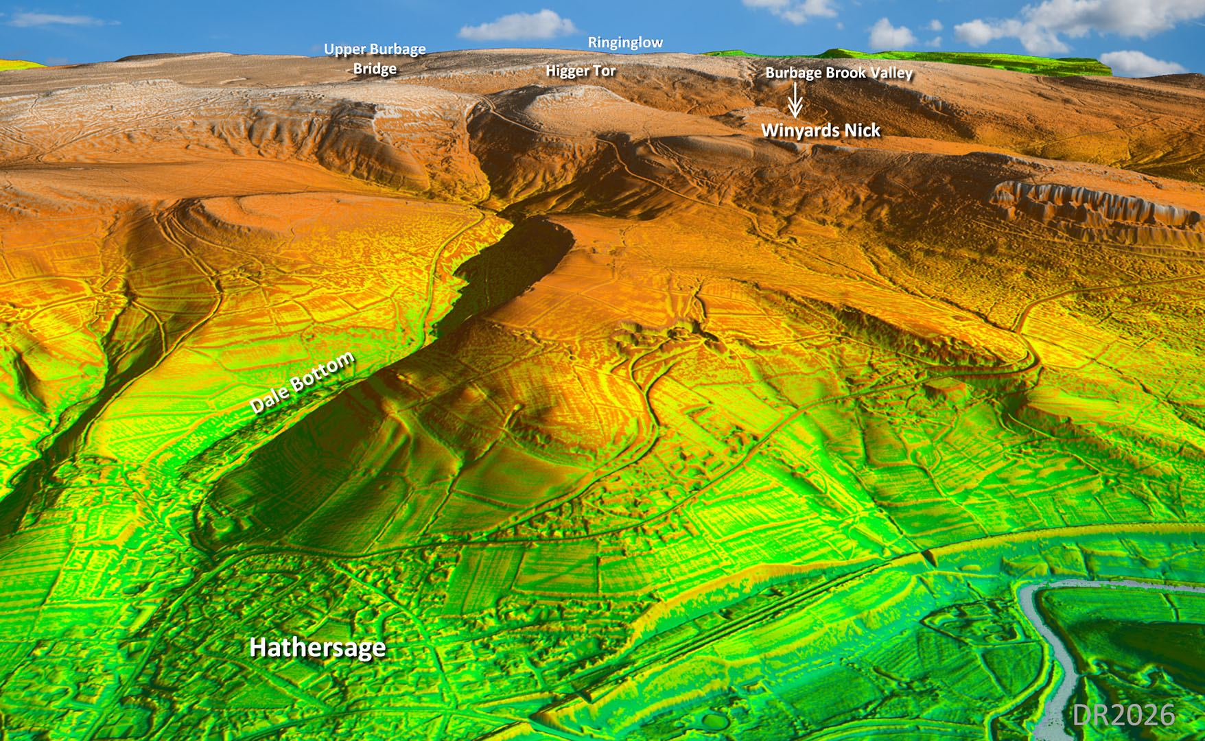 |
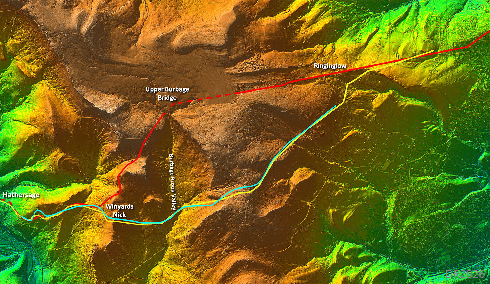
Oblique 3D Lidar - Burbage Moor There are probably more options but perhaps these are the most likely ones. The HER and Mike's route are obviously the same with some minor adjustments here and there. They do have to descend and ascend in the Burbage Brook Valley. The red route avoids this by crossing that stream further north at Upper Bubage Bridge. Key to Routes:- Blue: Derbyshire HER |
Click for larger view |
 |
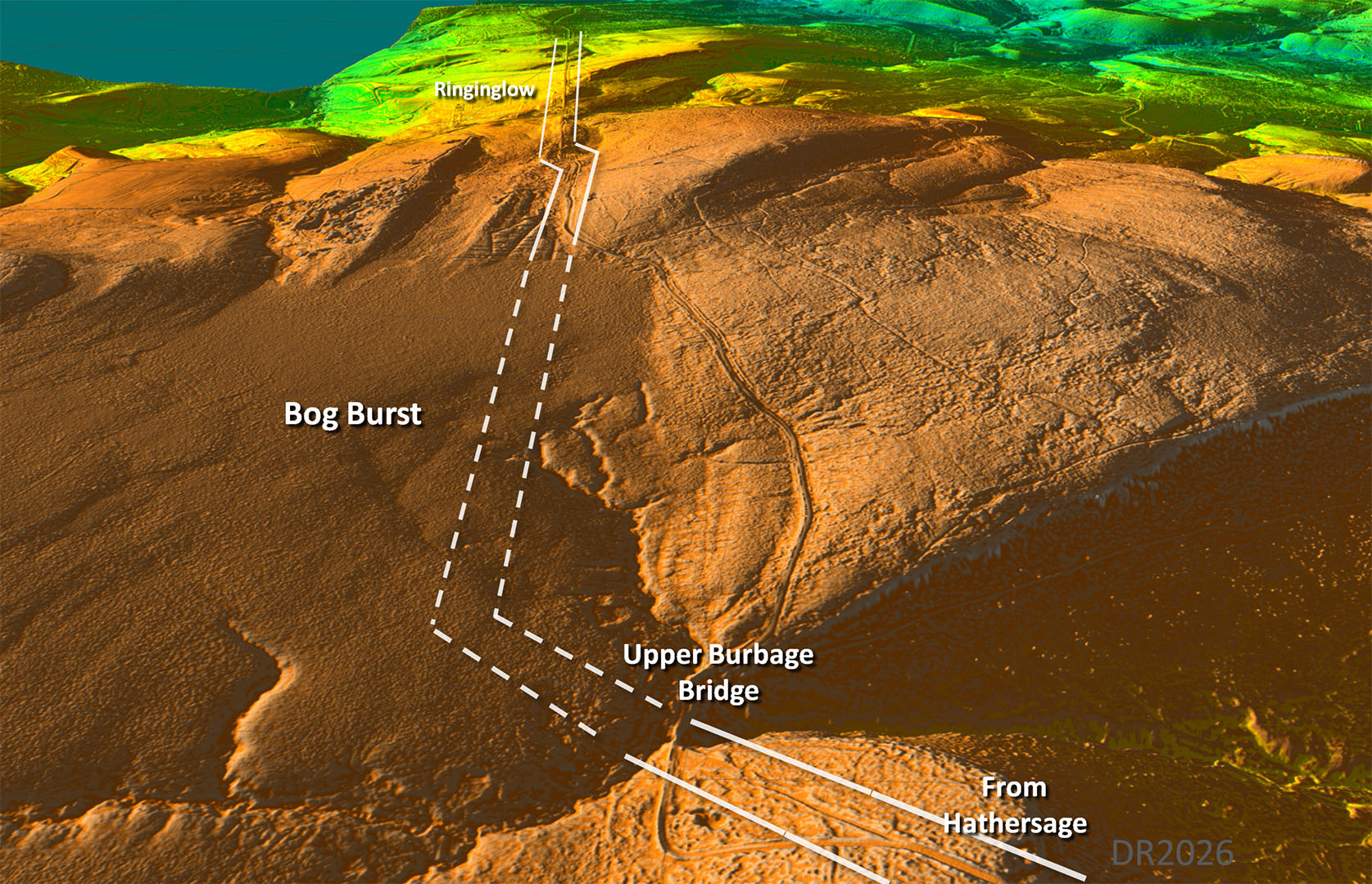
Oblique 3D Lidar - Upper Burbage Bridge An old route can be followed to Upper Burbage Bridge. This spot would fit well with the long straight road heading through Ringinglow. A huge bog burst has clearly smothered the first section of the direct line.That surely indicates that the straight connected (dashed lines) must be old. The later diversion around the bog is visible. |
Click for larger view |
 |
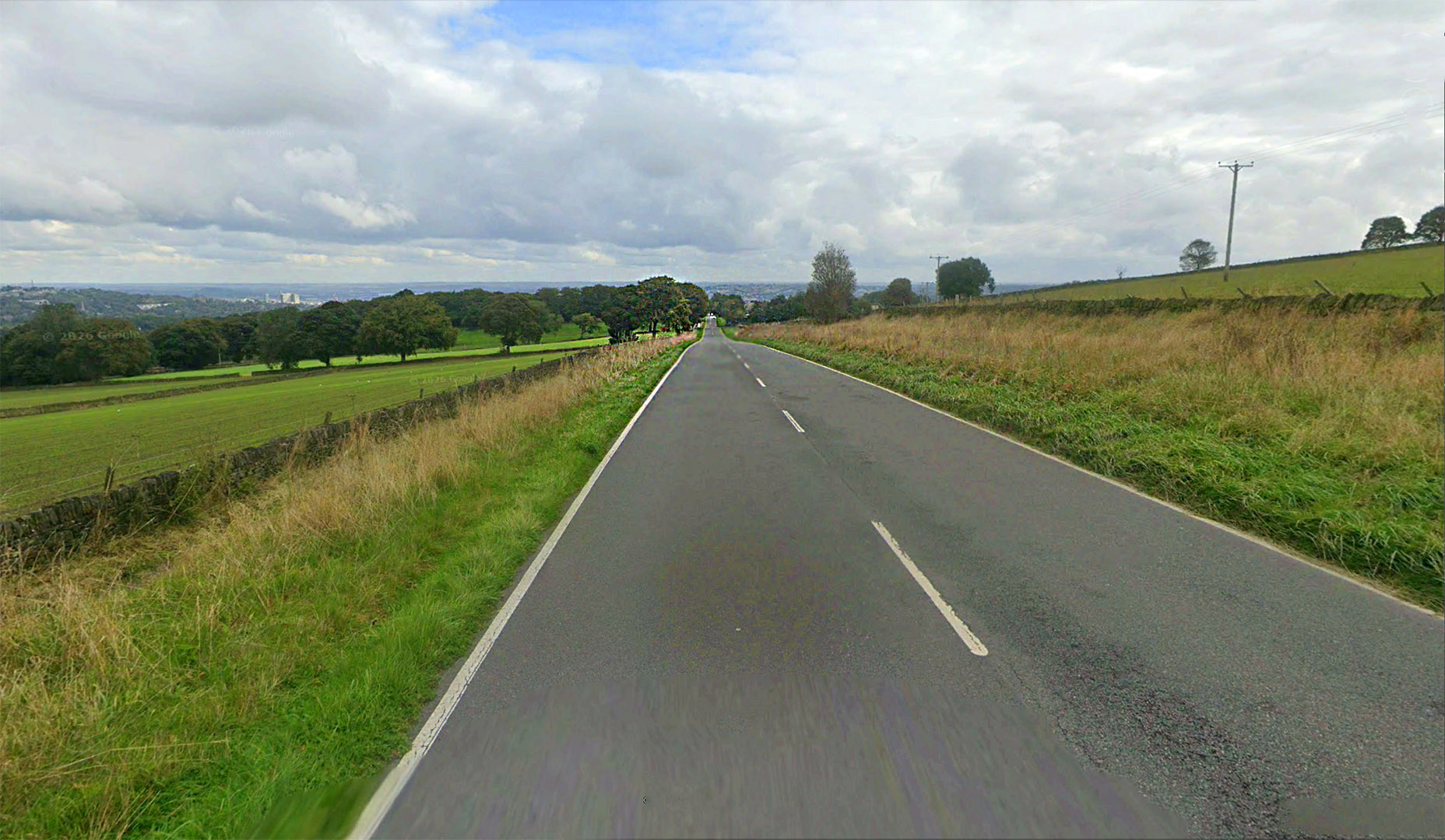
Ringinglow Road Very straight for around 2 miles, wide and built up on the north (left) side. If it looks Roman............. Image: Google |
Click for larger view |
 |
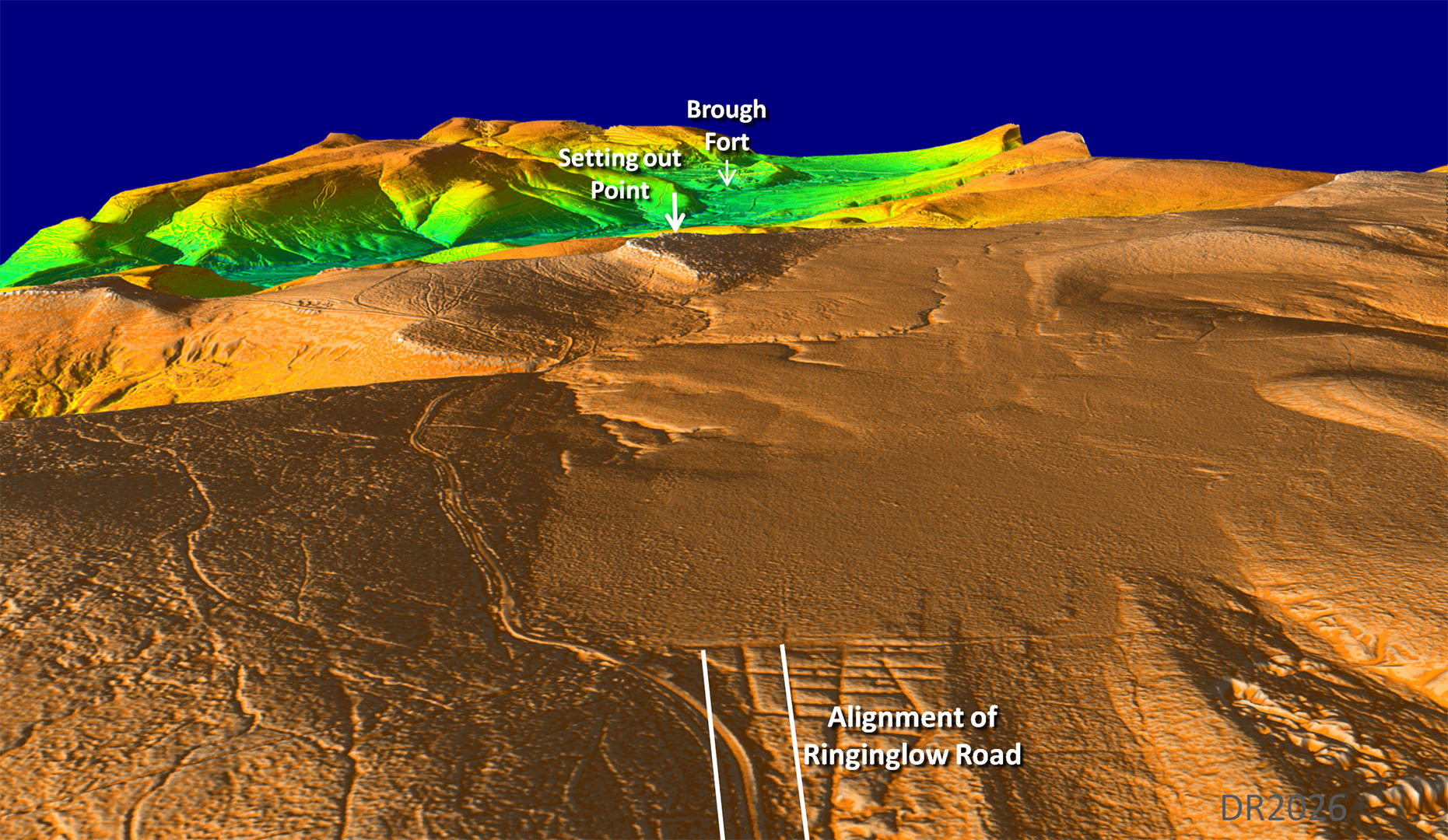
Setting out the Road 1 - Oblique 3D Lidar Roman road surveyors made use of high points to set out their roads. Ringinglow Road aligns with a summit which also has a clear view of Brough Fort. This summit at 457m does not appear to have a name but it does have a commanding view down the Hope Valley and, in the opposite direction, along Ringinglow Road. From that summit view point the road surveyor would have been able to work out the route for the road. A perfect setting out point. To me, this is strongly suggestive that the upper route via Upper Burbage Bridge and Ringinglow Road is the Roman road. Ringinglow Road aiming for that summit which has a clear view of the fort is too much of a coincidence not to be.
|
Click for larger view |
|
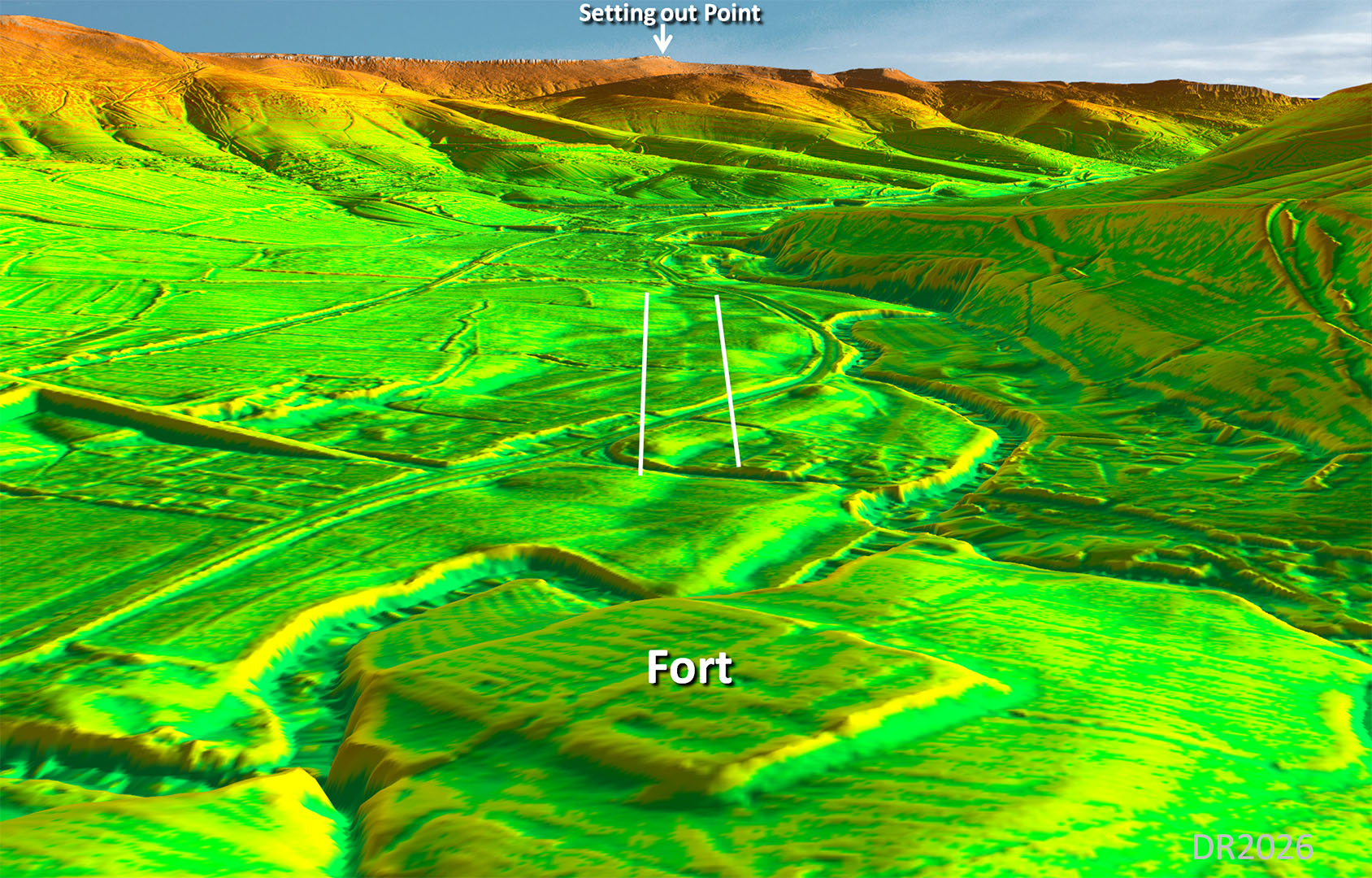
Setting out the Road 2- Oblique 3D Lidar The reverse view to above looking from over the fort to the (suggested) setting out point. It is so obvious that it must be how they set the road out and decided its onward course down Ringinglow Road.
|
Click for larger view |
|
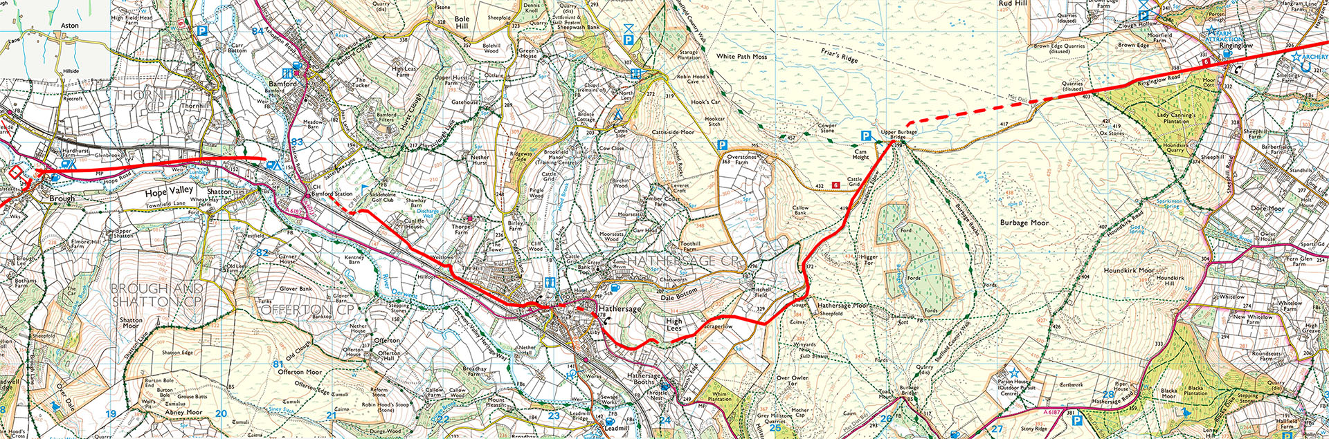
Route-map Brough to Ringinglow - OS Map There is a shorter route via Chatsworth/Dale Bottom but it involves a long steep 1 in 5 climb. This was the Sparrowpite Gate Turnpike so relatively modern. The Turnpike was later upgraded with a big loop to avoid that 1 in 5 climb. The the onward course across Sheffield is unclear but Templeborough (Sheffield/Rotherham) is the obvious destination.
|
Click for larger view |
 |
|
Last update: March 2026 |
© David Ratledge |