|
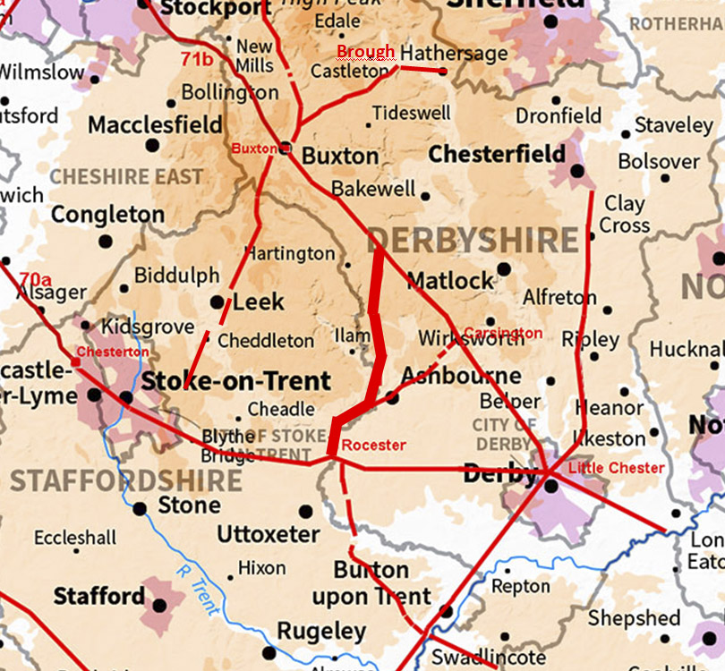
The Roman Road from Arbor Low to RocesterMargary Number: 716xDistance: 18 miles A relatively recently discovered road branching off "The Street" adjacent to Arbor Low, a Neolithic henge monument, and then heading for Mayfield near Ashbourne. From there it continues to Rocester possibly sharing a route with a Roman road from Rocester to Carsington. The roads around Derbyshire have been researched for over 7 years in conjunction with Neil Buckley, whose assistance is gratefully acknowledged. This road has been written up by Neil, reference "The Case For A Possible Roman Road Between Rocester, Staffordshire And Mapleton Derbyshire. The Staffordshire Section Of RR716(x)", RRRA Newsletter 2026 (forthcoming). As is Neil's style there is a huge amount of background information so please check it out when it becomes available.
|
Historic Counties: Derbyshire & Staffordshire Current Counties: Derbyshire & Staffordshire HER: Derbyshire & Staffordshire
|
|
|
|
|
|
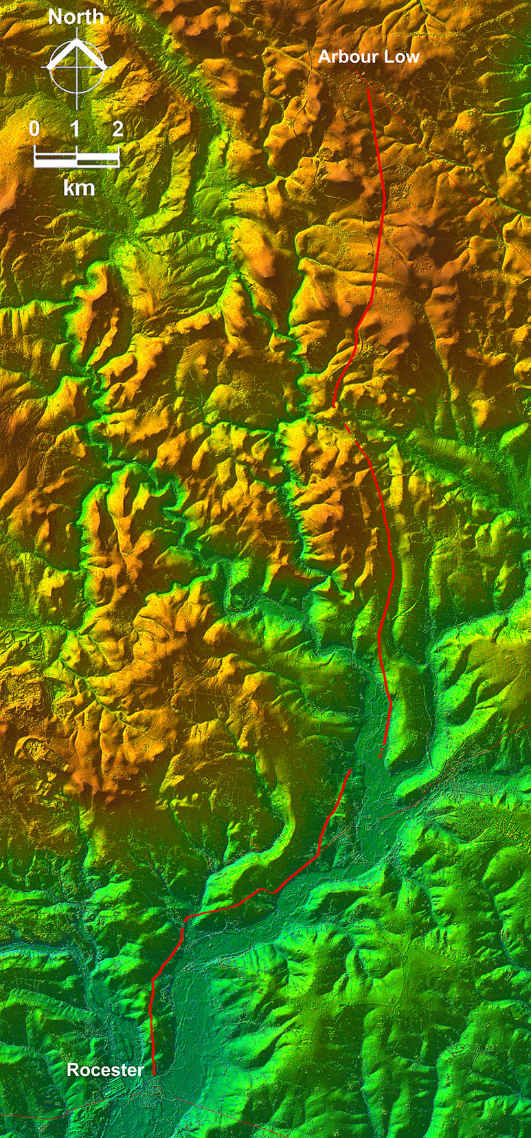
Lidar Image - Full Route The route from "The Street" is fairly direct as far as Mayfield, given the Peak District terrain. From the latter it follows the west side of the Dove Valley to Rocester Roman site and as a result is less direct. Overall a very logical route though. As is the case for The Street Roman road, it survives best on the high Peak where little or no ploughing has taken place. |
Click for larger view |
 |
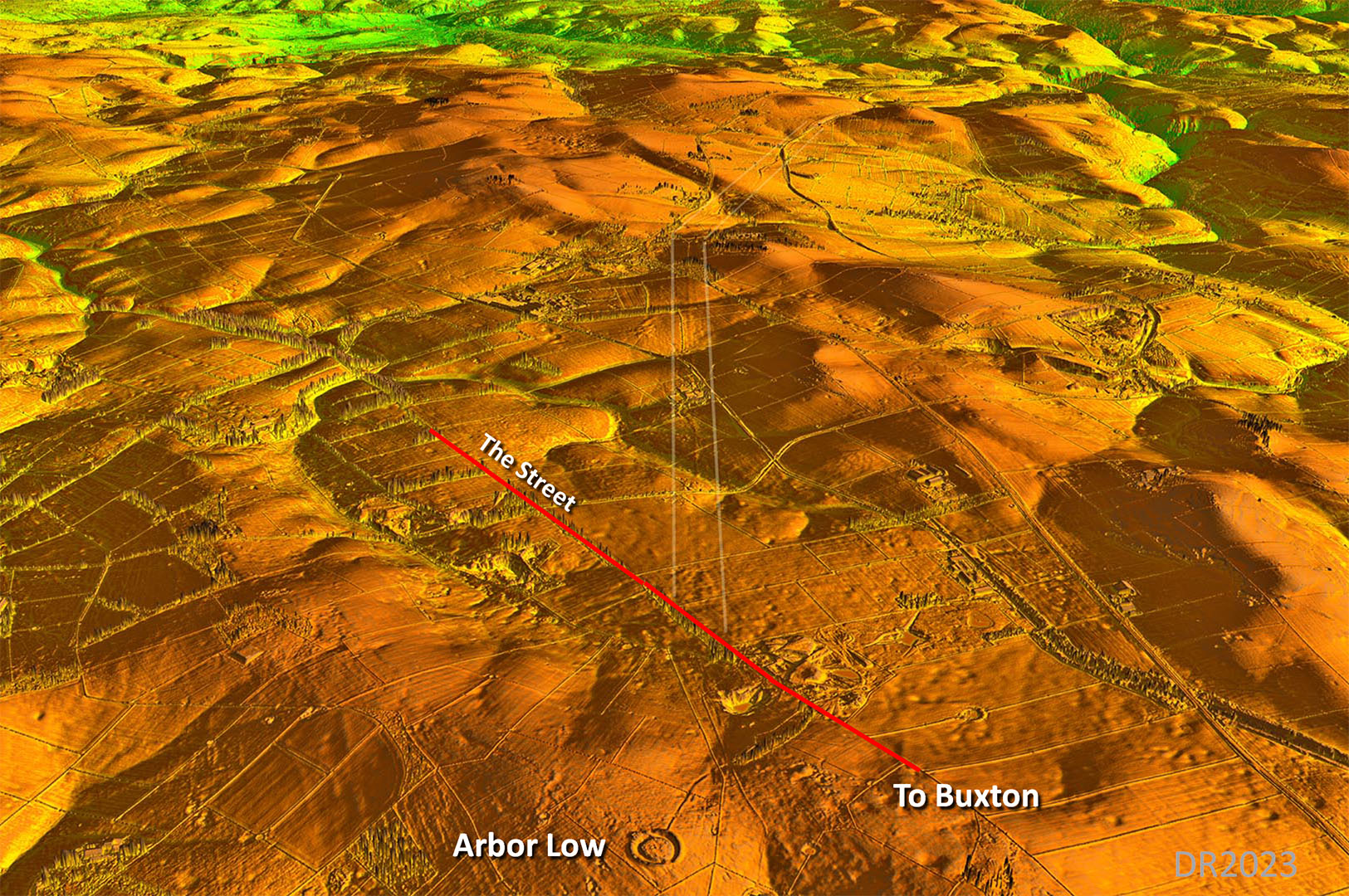
Oblique 3D Lidar Image - Arbor Low Is the juxtaposition of Arbor Low a coincidence? Not exactly aligned but then they could have set up their alignment tower for setting the road out on its side - just like they did at Minninglow respecting the monument.
|
Click for larger view
|
 |
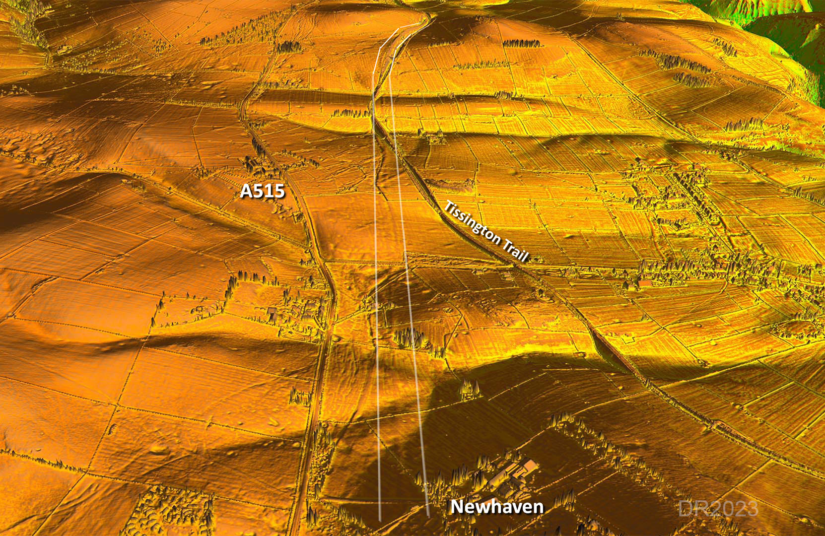
Oblique 3D Lidar Image - Newhaven Change of alignment at Newhaven and for the next stretch the Tissington Trail has destroyed some lsections but it does provide easy access to look at the road. |
Click for larger view
|
 |
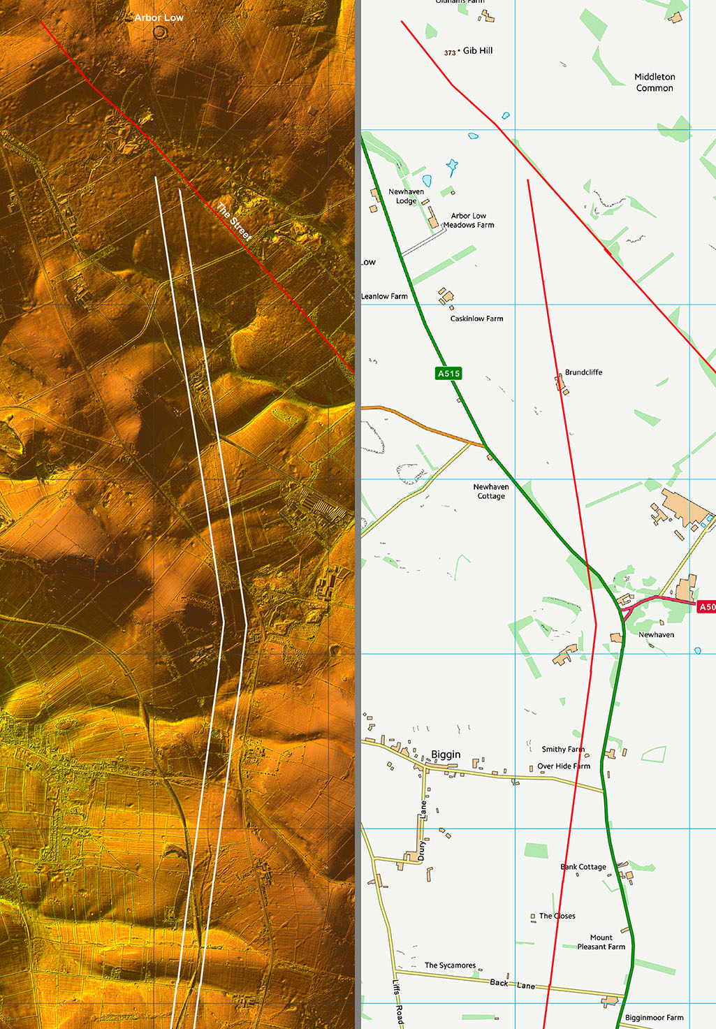
Lidar Image & Route Map 1 First two alignments are obvious and the agger has survived well. |
Click for larger view |
 |
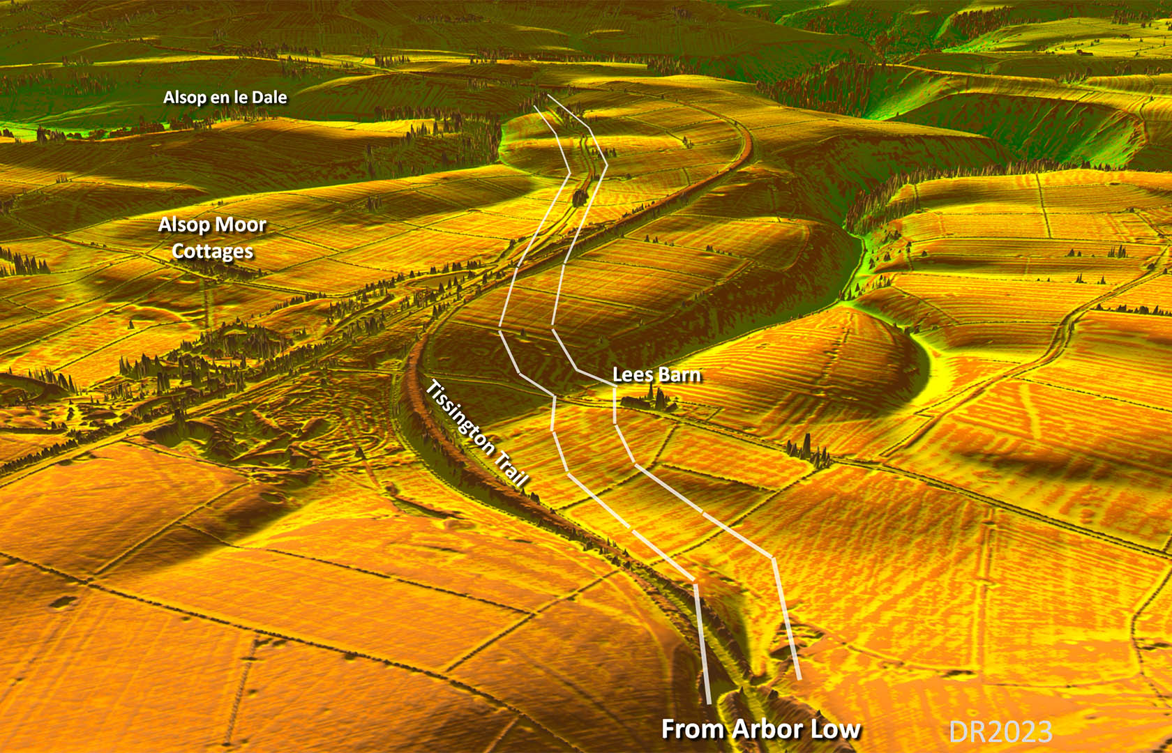
Oblique 3D Lidar Image - Lees Barn to Alsop en le Dale The railway, now the Tissington Trail, has destroyed a section of the road but across one of its bends then the course of the road can be faintly made out. |
Click for larger view
|
 |
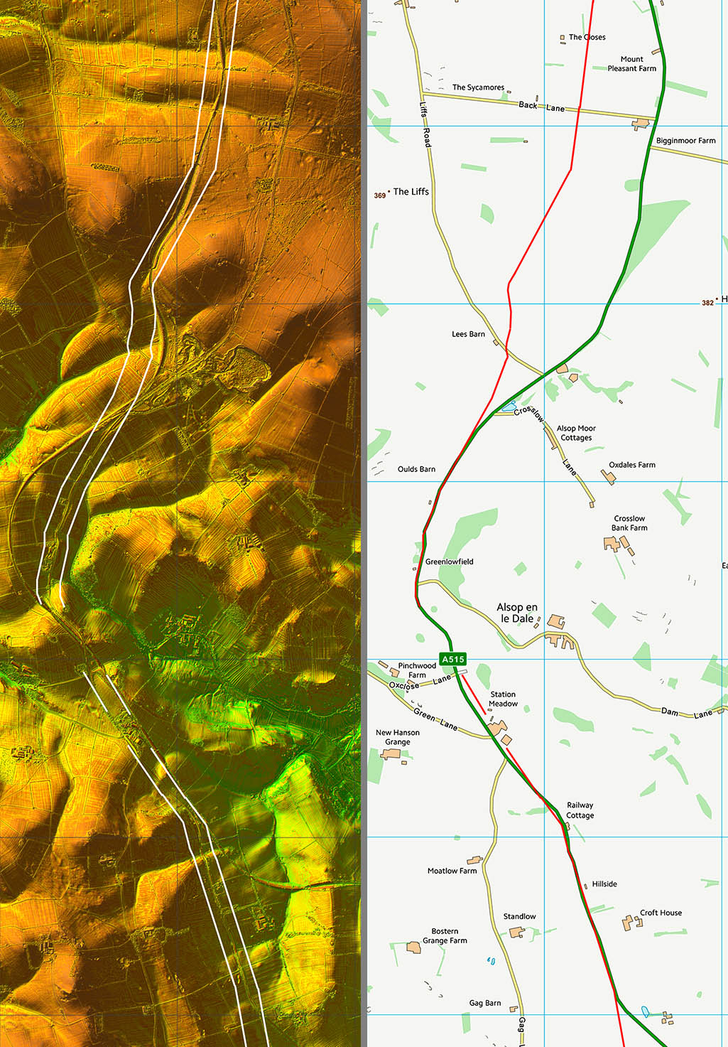
Lidar Image & Route Map 2 Starting to drop to lower land where the road has not survived as well |
Click for larger view |
 |
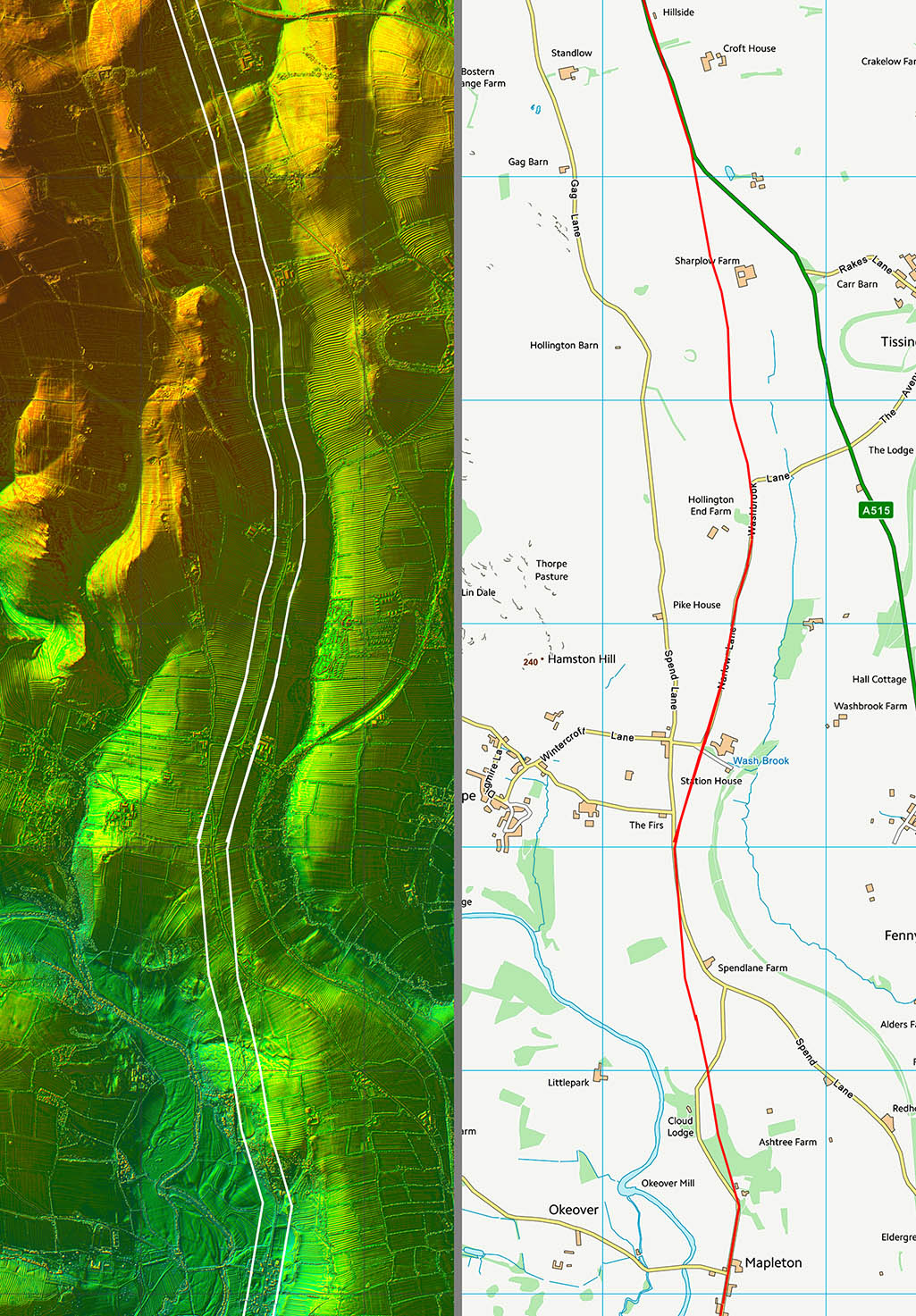
Lidar Image & Route Map 3 Logical route down the Wash Brook valley heading towards Mapleton and the Dove Valley |
Click for larger view |
 |
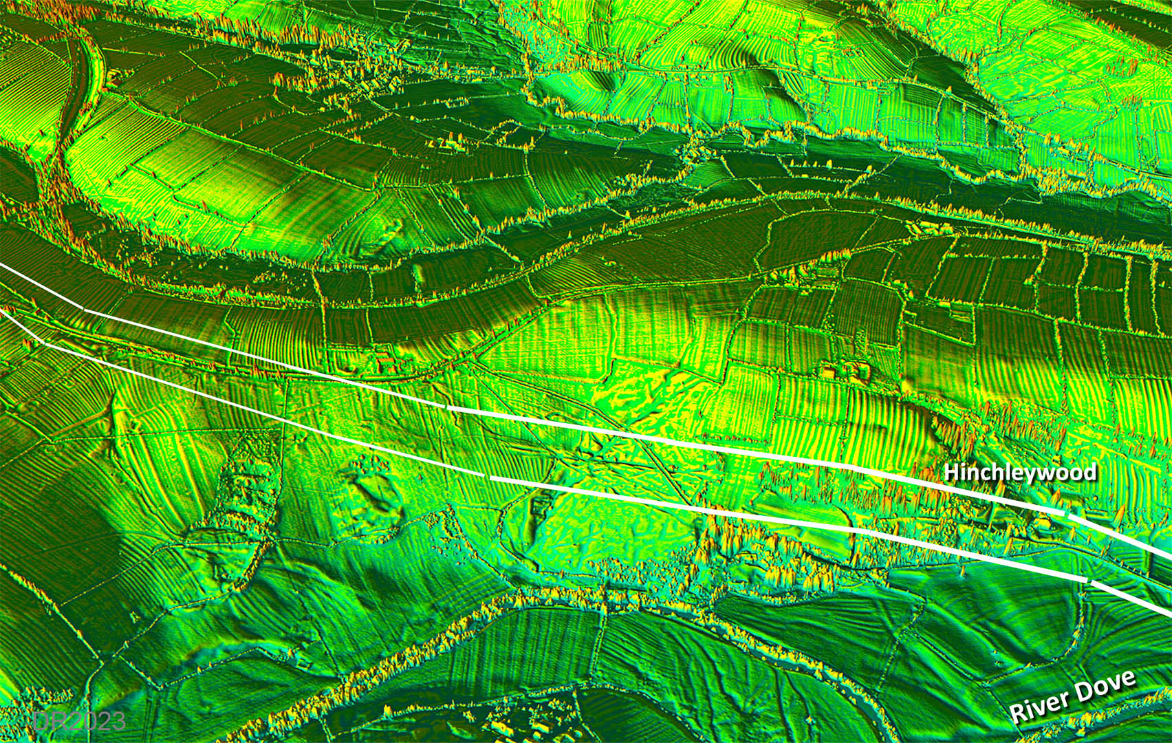
Oblique 3D Lidar Image - Descent to Dove Valley Just traceable is the descent down into the Dove Valley. |
Click for larger view
|
 |
Oblique 3D Lidar Image - River Dove Crossing All trace of the actual crossing of the River Dove appears to have been completely washed away. To be expected of course after nearly 2000 years. |
Click for larger view
|
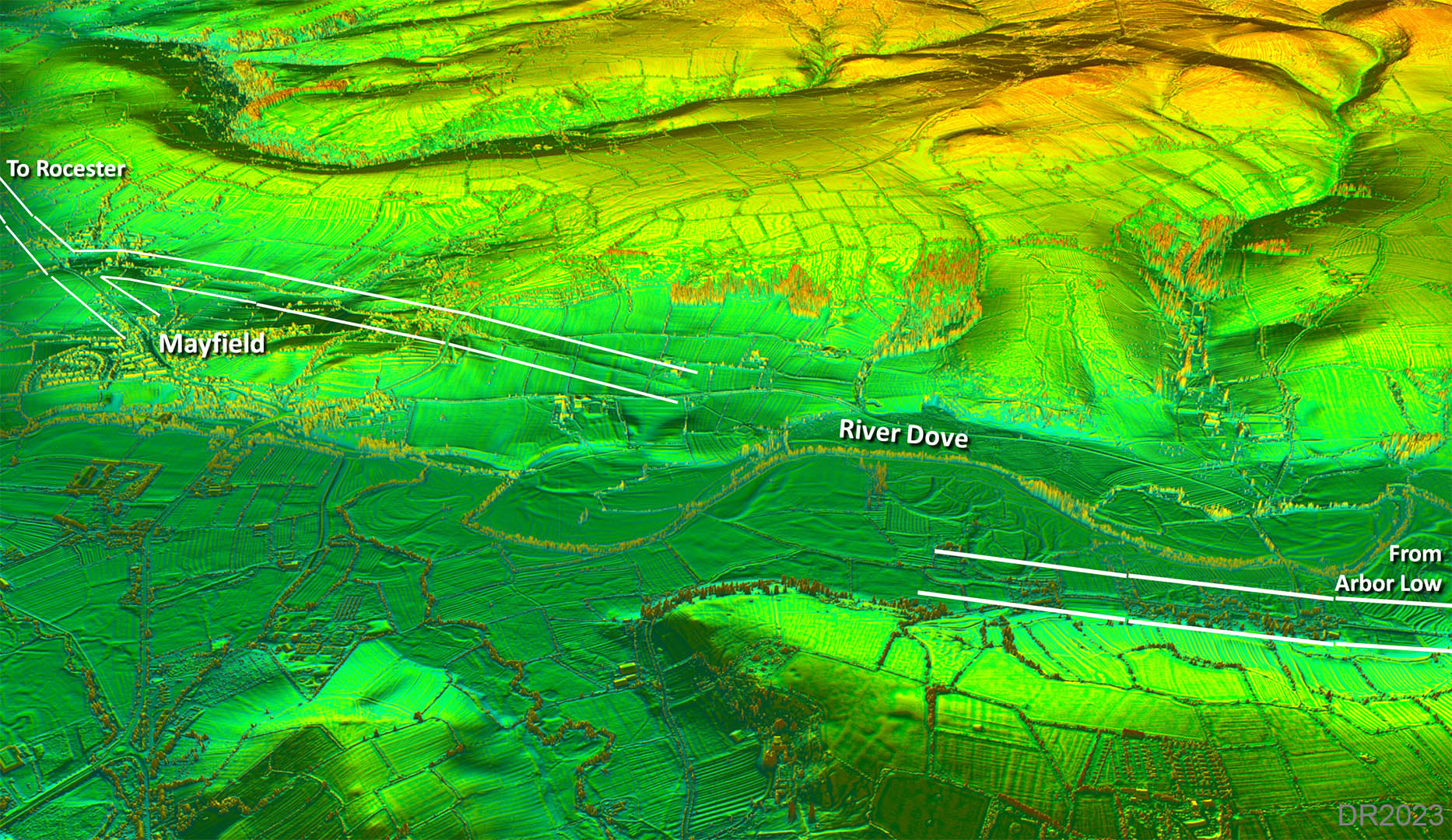 |
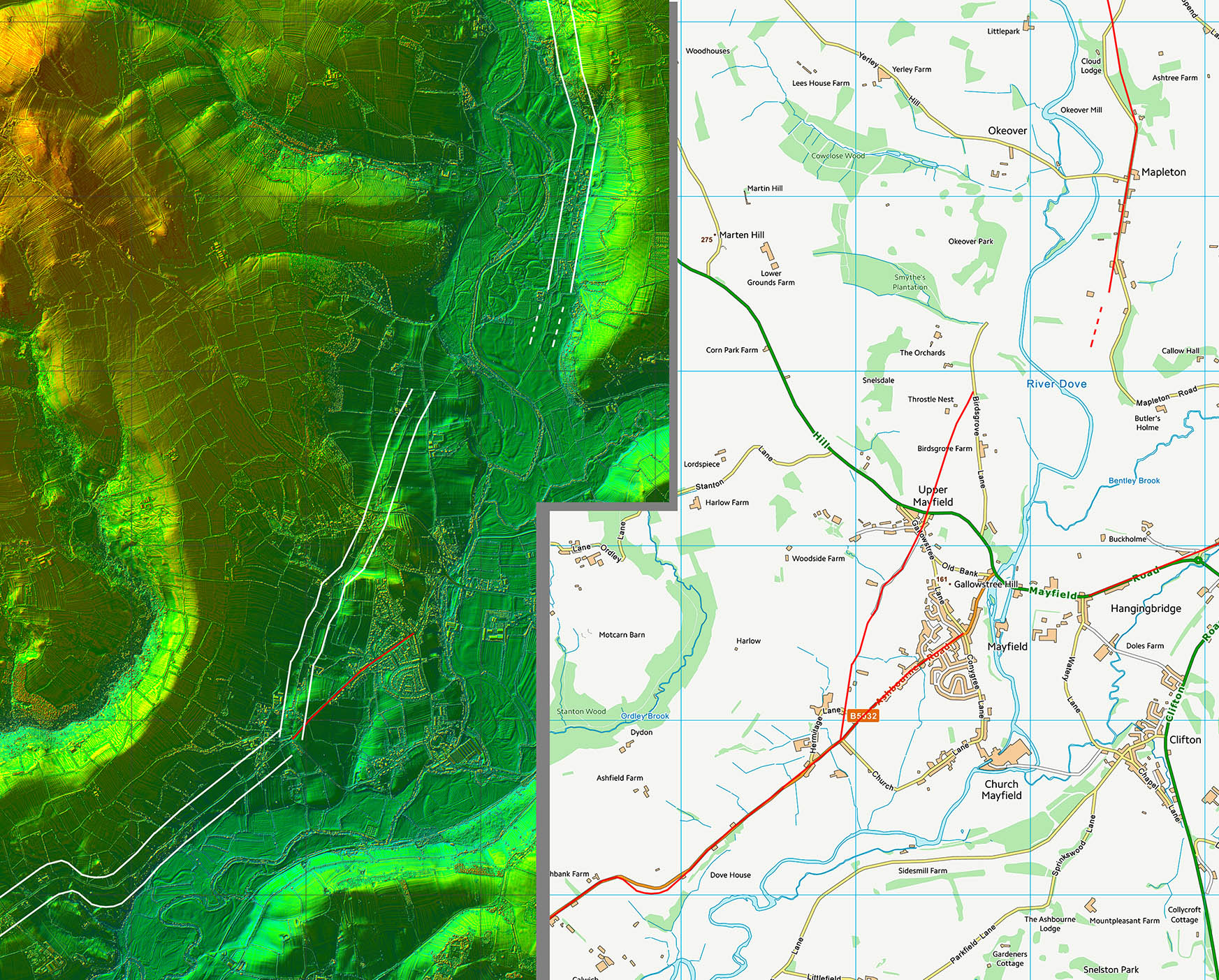
Oblique 3D Lidar Image - Mayfield Junction The arrangement west of Mayfield is strongly suggestive of a junction. |
Click for larger view
|
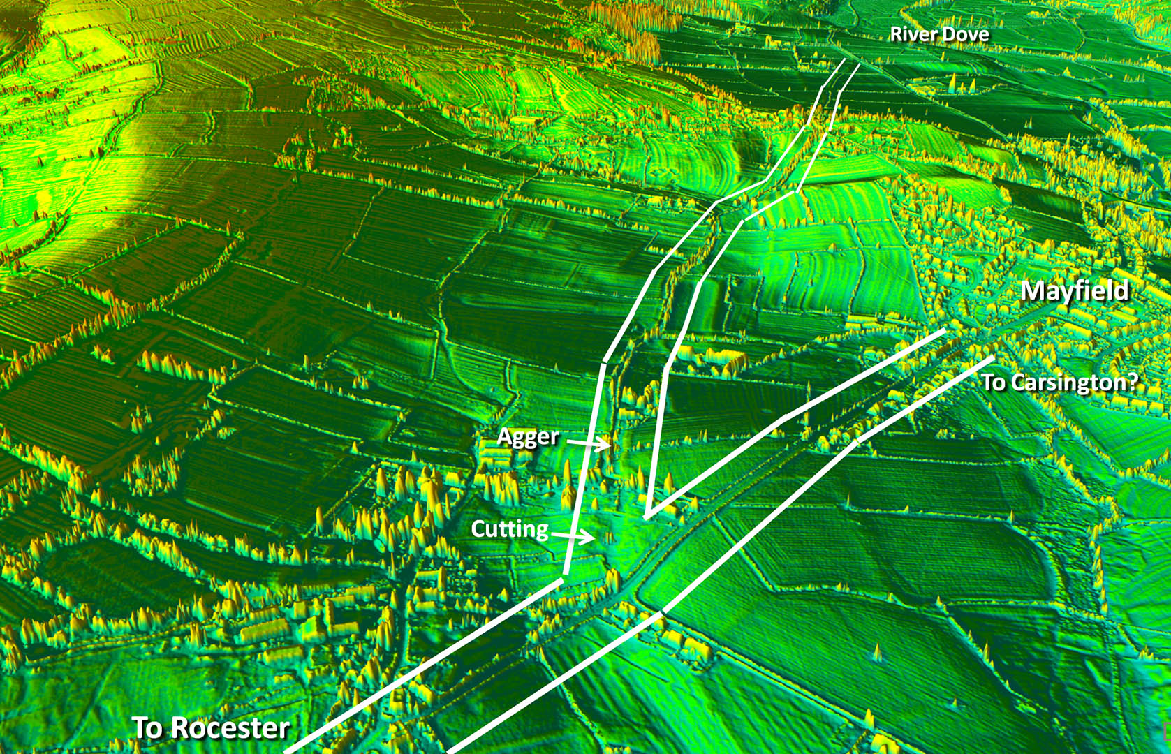 |
Lidar Image & Route Map 4 For the suggested road to Carsington see Rocester to Carsington. |
Click for larger view |
 |
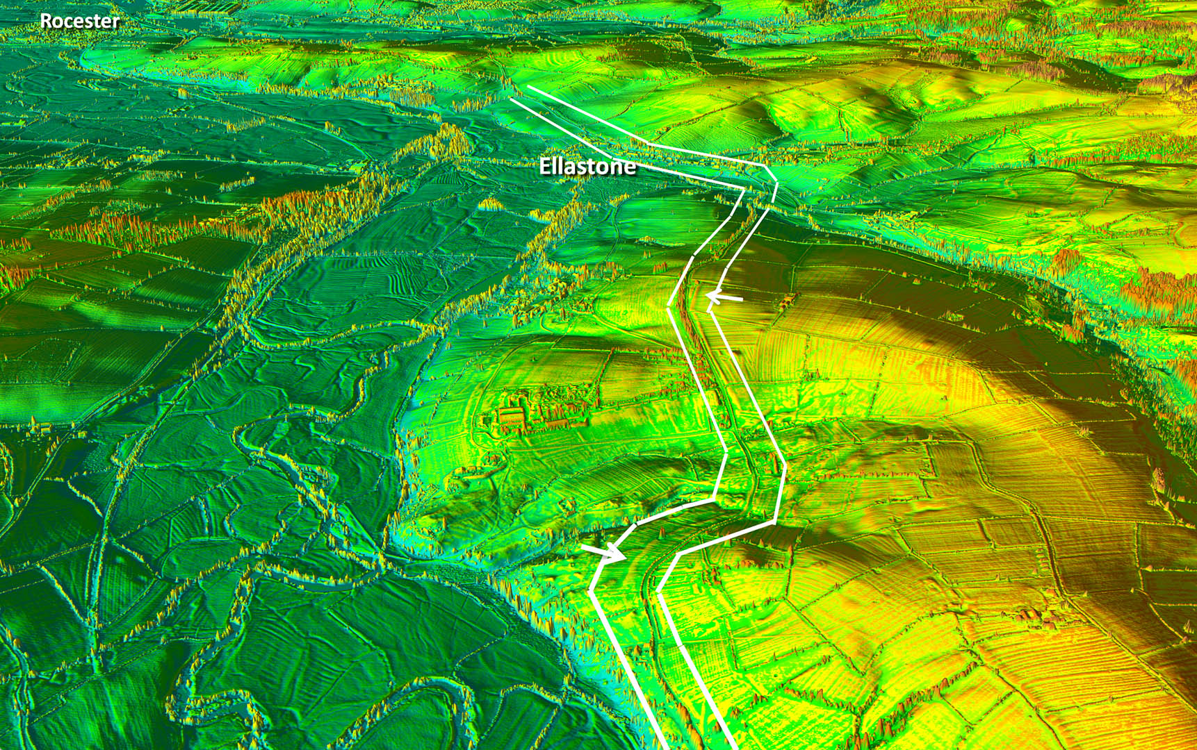
Oblique 3D Lidar Image - Ellastone Just a few surviving sections of the Roman road where the modern one has wandered off-line. |
Click for larger view
|
 |
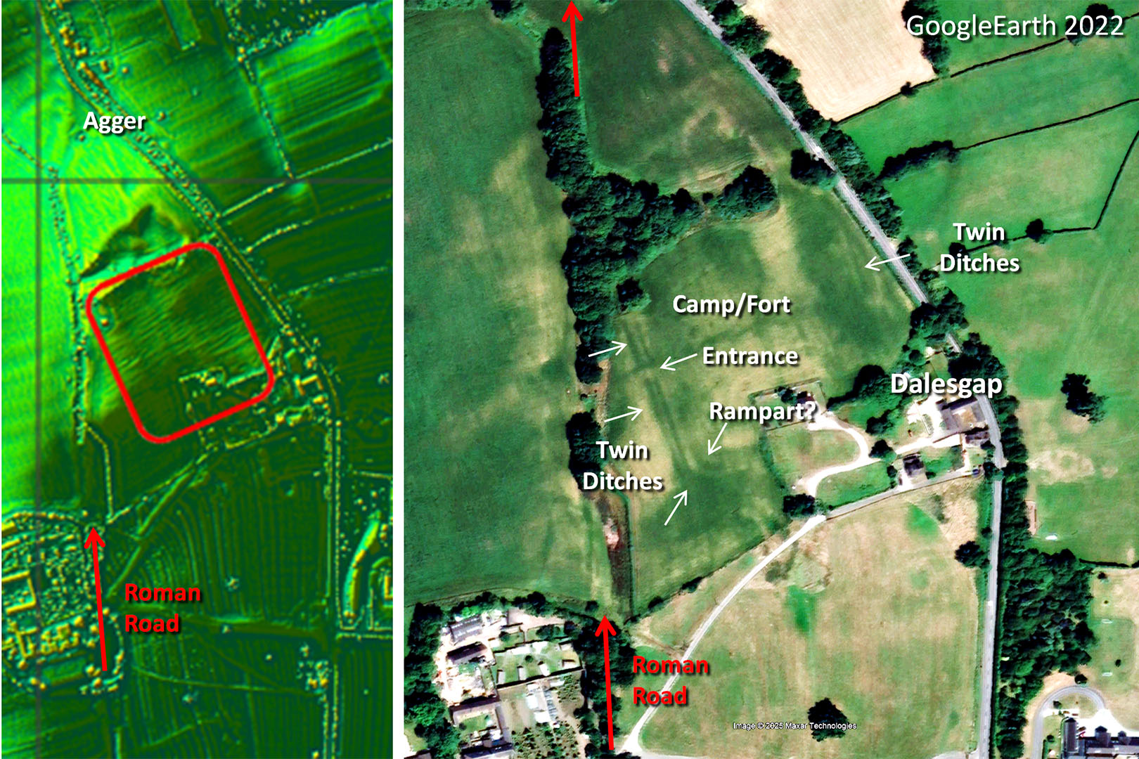
Lidar Image & Aerial Photo - Dalesgap Camp/Fort Approaching Rocester on a local high point there was a Roman camp, presumably earlier than the main site in Rocester. It is called a camp but the aerial photo, to me, indicates a fort. There are twin ditches and an rampart visible - certainly more fort-like than camp. There are also signs of a road out of the entrance linking to the main Roman road. Aerial: GoogleEarth Pro 2022 |
Click for larger view
|
 |
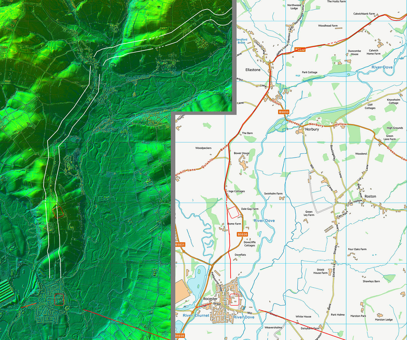
Lidar Image & Route Map 5 At least 3 Roman roads (probably 4) met at Rocester but the exact extent of the fort is unclear. What I have shown is my best guess. |
Click for larger view |
 |
|
Last update: March 2026 |
© David Ratledge |