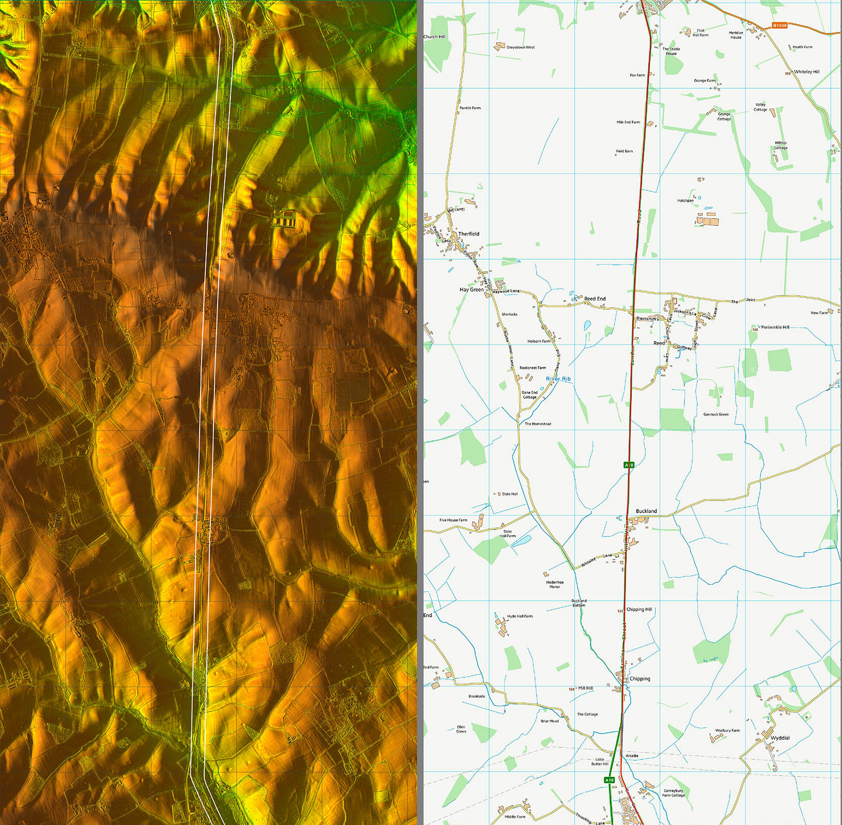
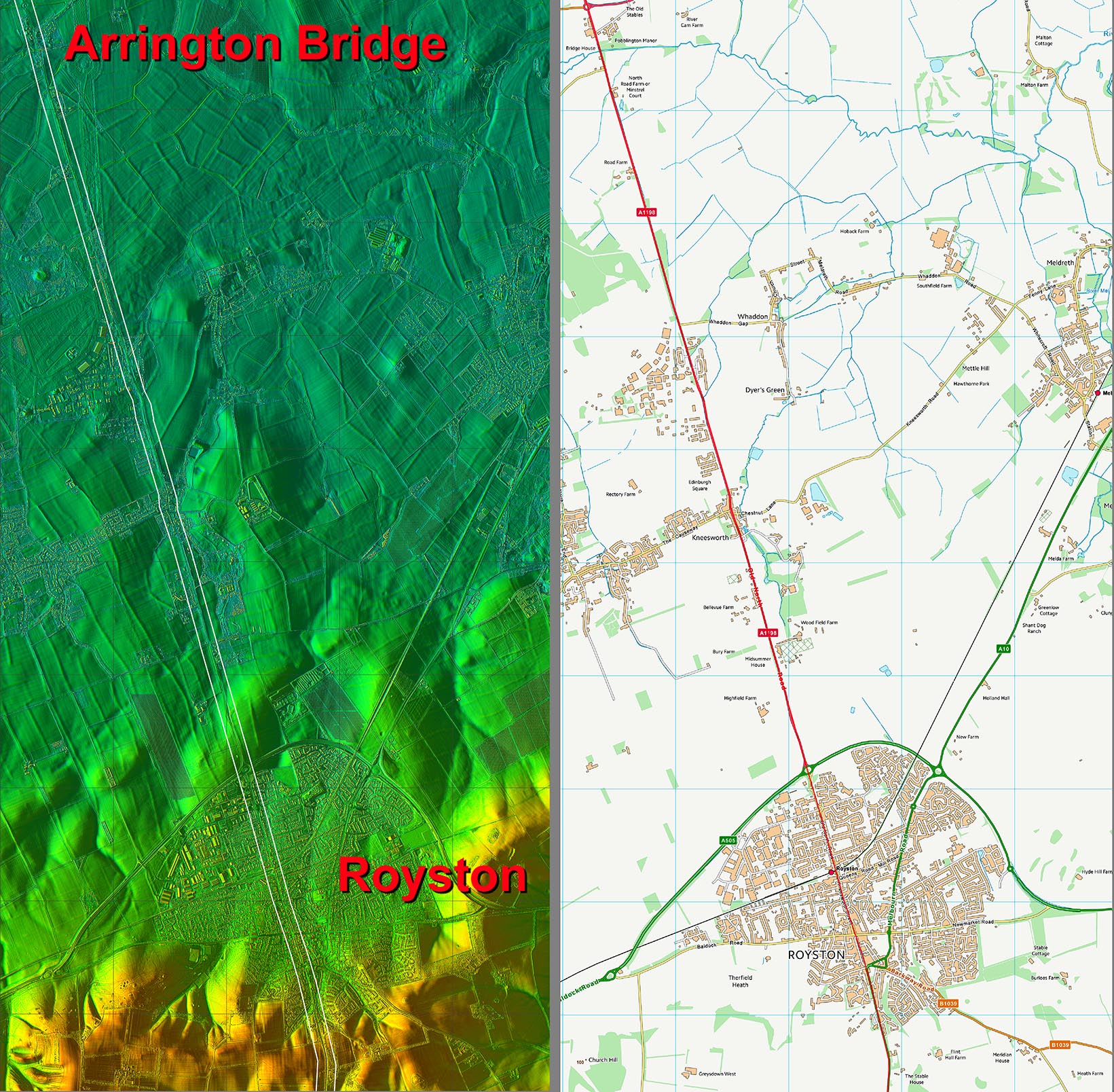
Lidar Image - Full Route
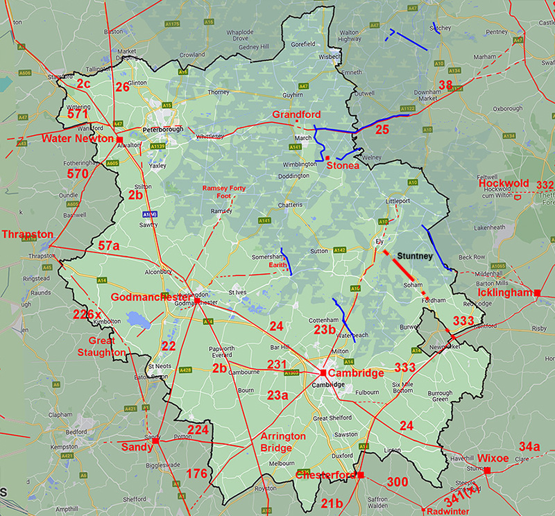
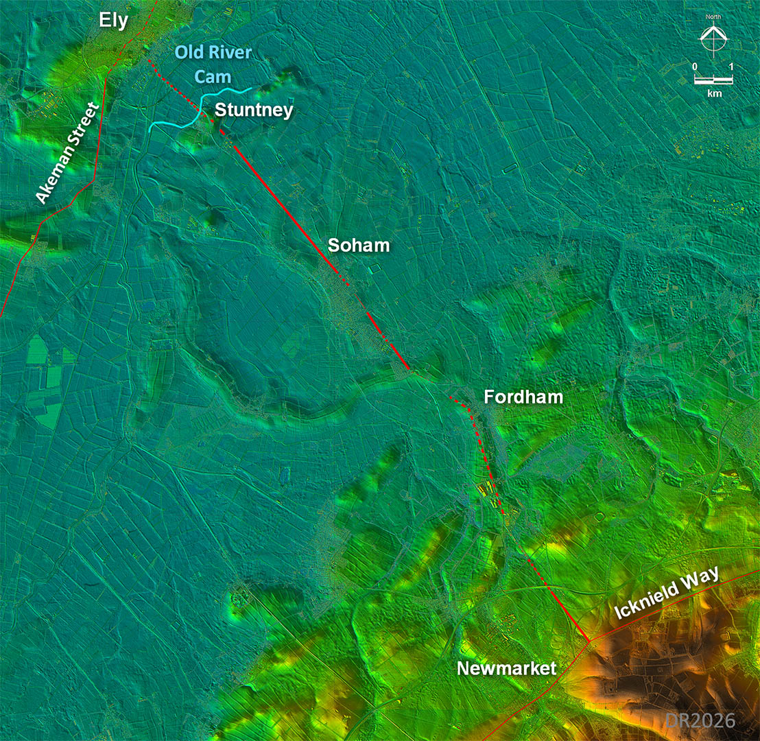
A very direct route mostly on what would be dry ground apart from the Ely to Stuntney section, which would have required a built-up causeway and bridge. |
|
 |
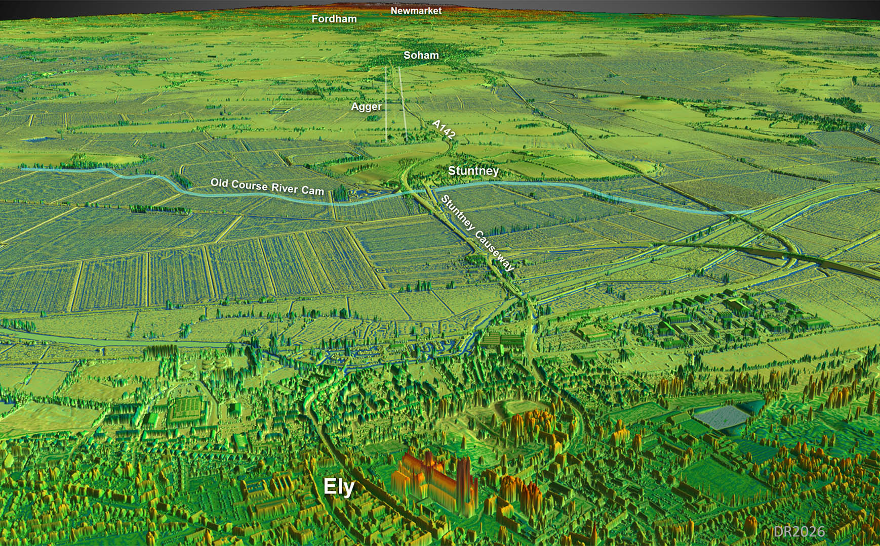
Oblique 3D Lidar Image - Ely Cathedral towards Stuntney
The finger of dry land at Stuntney-Soham-Fordham could only be reached by constructing a causeway from below Ely. Compared to the Fen Causeway this would have been a much less onerous task for the Romans.
|
Click for larger view |
 |
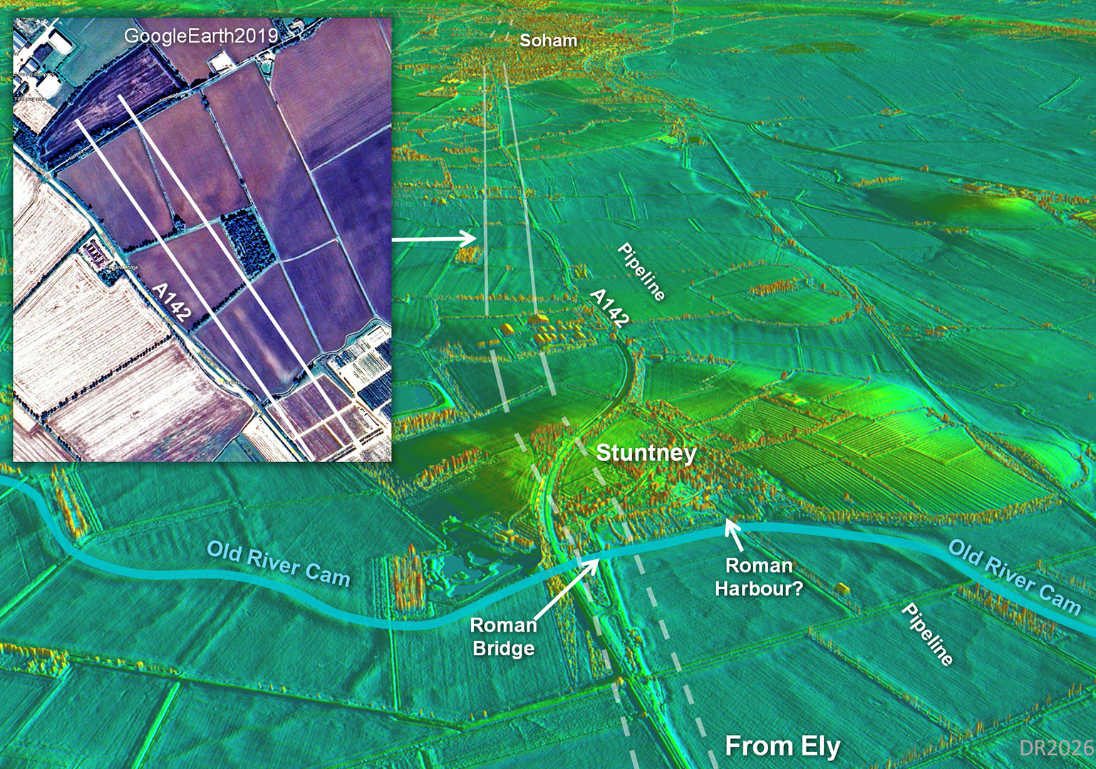
Oblique 3D Lidar Image - Looking over Stuntney towards Soham
This is by far the best evidence for this road. Between Stuntney to Soham then the agger is very clear in the fields east of the A142. This is not to be confused with the pipeline running on the west side of the A142. This is support by the GoogeEarth aerial photo. Absolutely no doubt we have a Roman road here.
In the Roman era the River Cam flowed passed Stuntney and there is a suggested harbour. To reach Ely and the Akeman Way a bridge would have been required but not a problem for the Romans. Cambridgeshire HER reprts a possible bridge at this spot too. The old Stuntney Causeway probably represents the route from Ely. |
Click for larger view |
 |
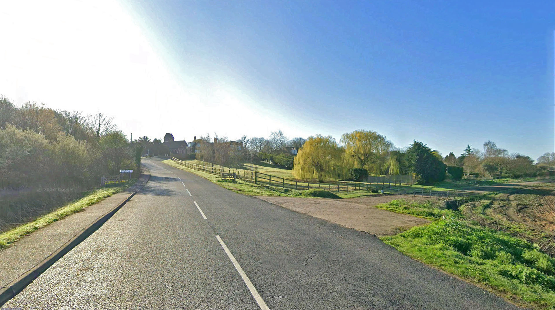
Stuntney Causeway
Hard to believe but 2000 years ago this is where the River Cam (Old Croft River) flowed! The causeway is built up about one metre above field level and there would have been a Roman bridge here. Cambridgeshire HER records evidence of a possible bridge here too (CHER07371).
The higher (dry) ground of Stuntney is also obvious. |
Click for larger view |
 |
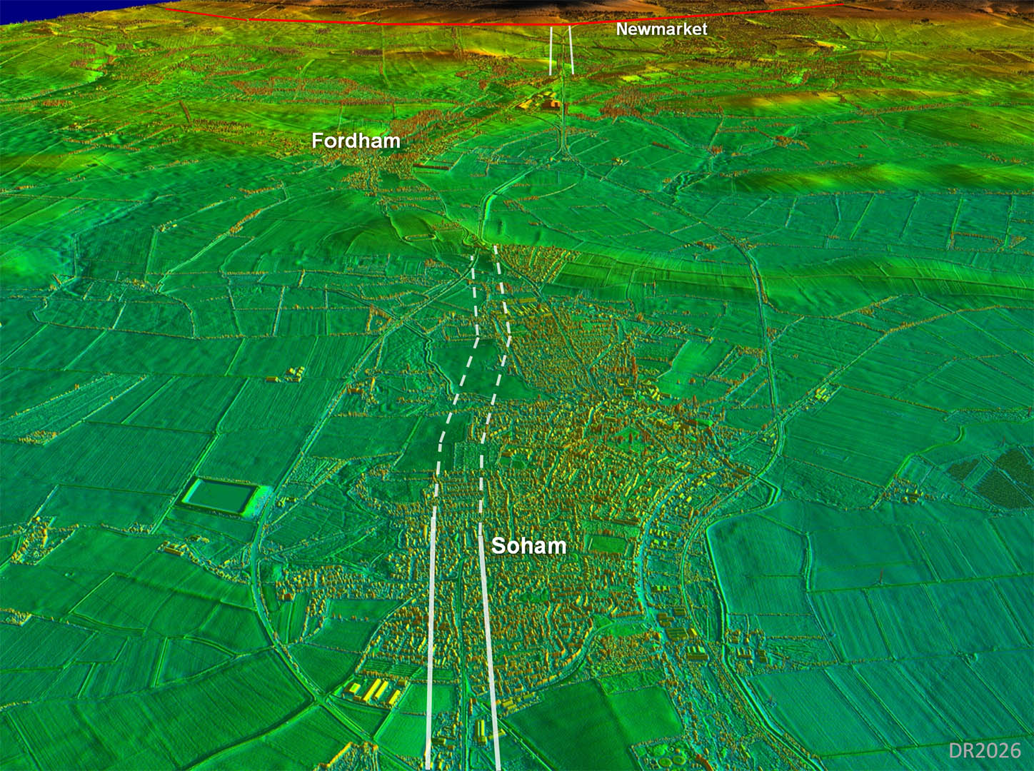
Oblique 3D Lidar Image - Soham to Fordham
The alignment appears to have continued straight through Soham before a slight turn with a possible agger visible across open ground.
Beyond Soham did the road bend left to get to Fordham for that ridge of high ground? Seems a sensible route. |
Click for larger view |
 |
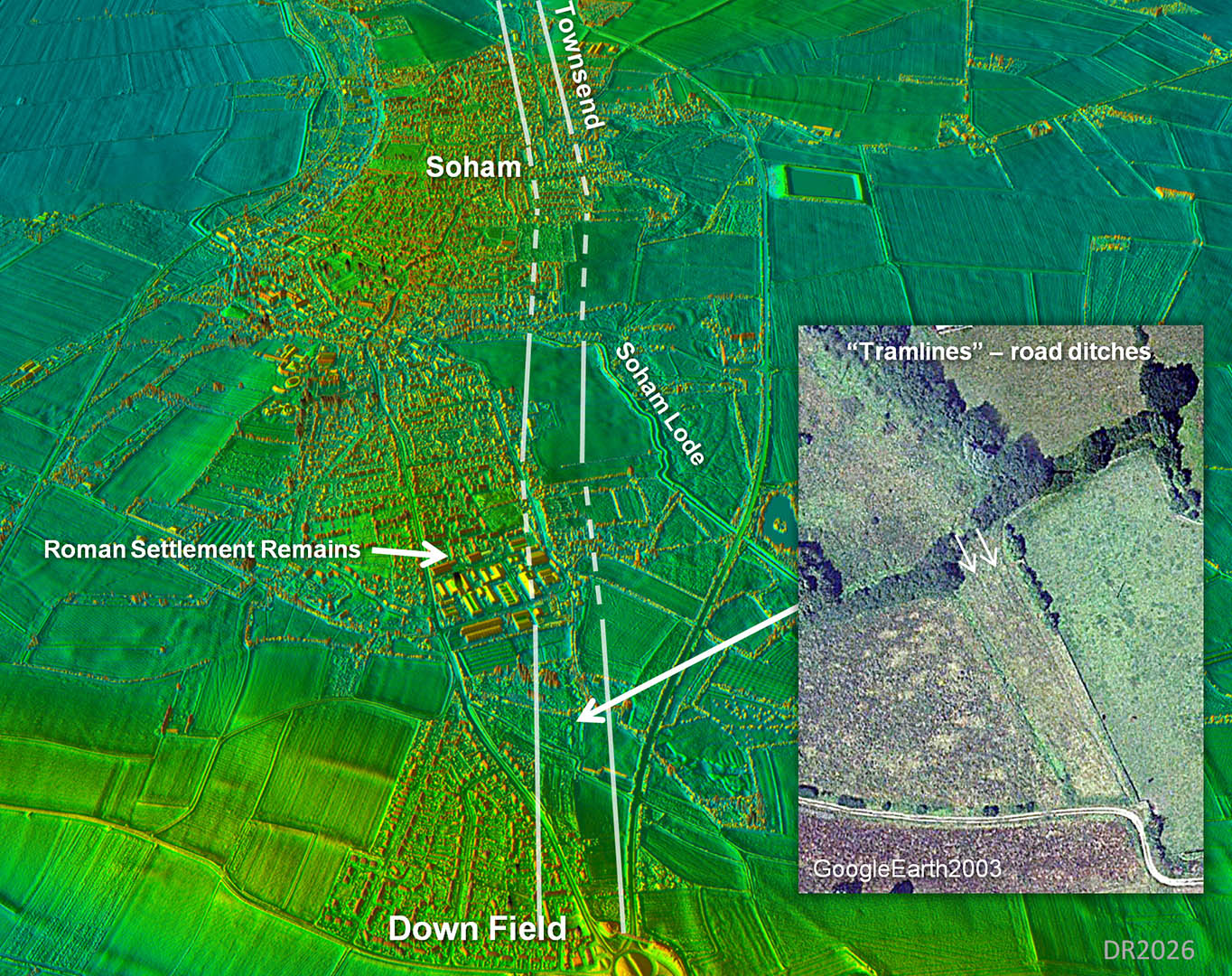
Oblique 3D Lidar Image - Soham Roman Settlement and Road Ditches (inset aerial photo)
We are looking back here. On the near (east) side of Soham Lode there looks like a hump of a bridge approach. However, I would guess the lode has been "improved" over the years as an aid to drainage so little chance of the bridge itself leaving any trace.
Further on towards Downfield are the tell-tale sign of tramlines - the road ditches (inset GoogleEarth). We can be pretty sure of the route here as a result |
Click for larger view |
 |
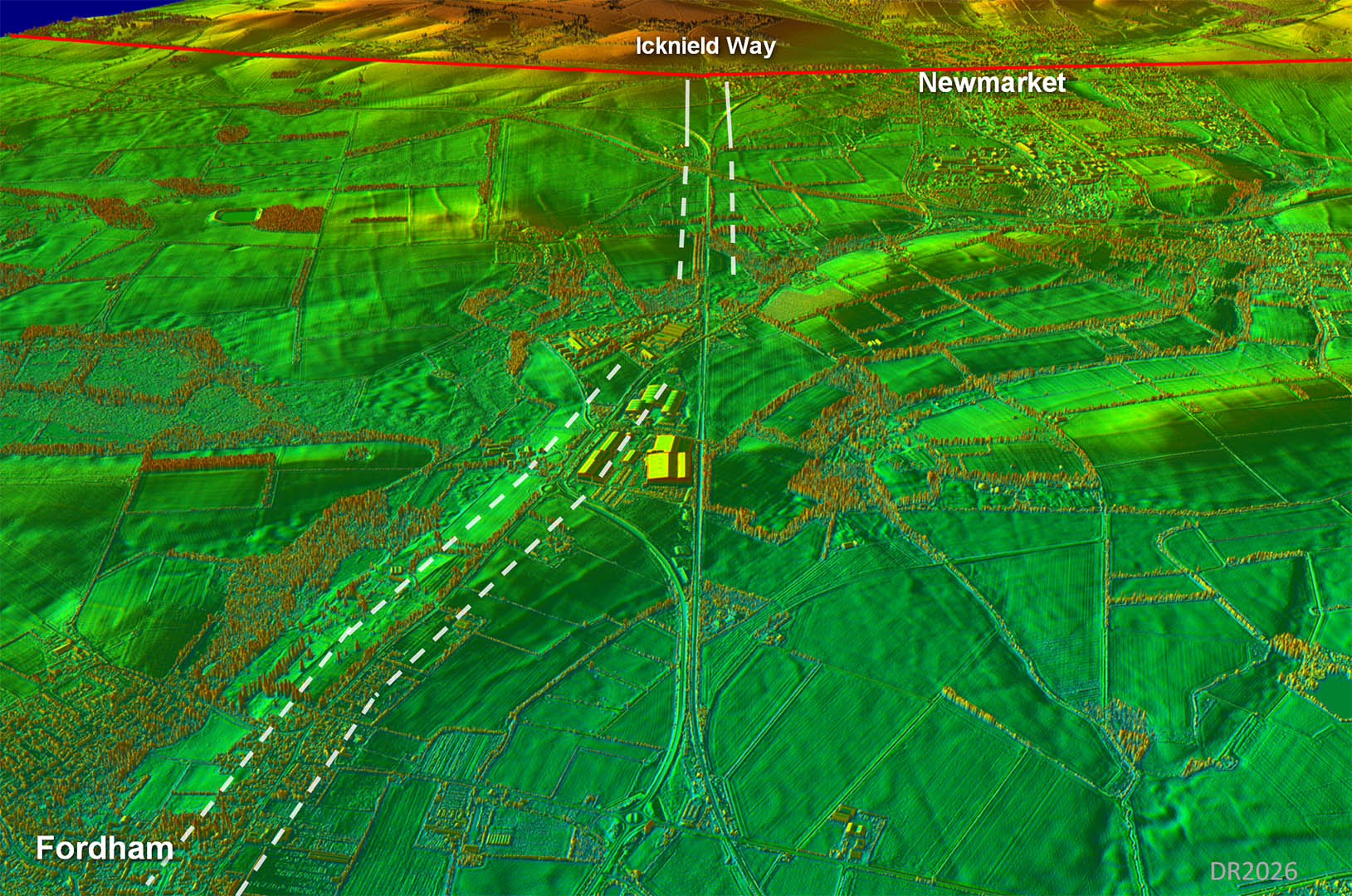
Oblique 3D Lidar Image - Fordham to Newmarket
Newmarket Road from Fordham is a ridge route of dry land and the Romans were never going to miss that! Newmarket Road probably overlies the Roman line.
|
Click for larger view |
 |
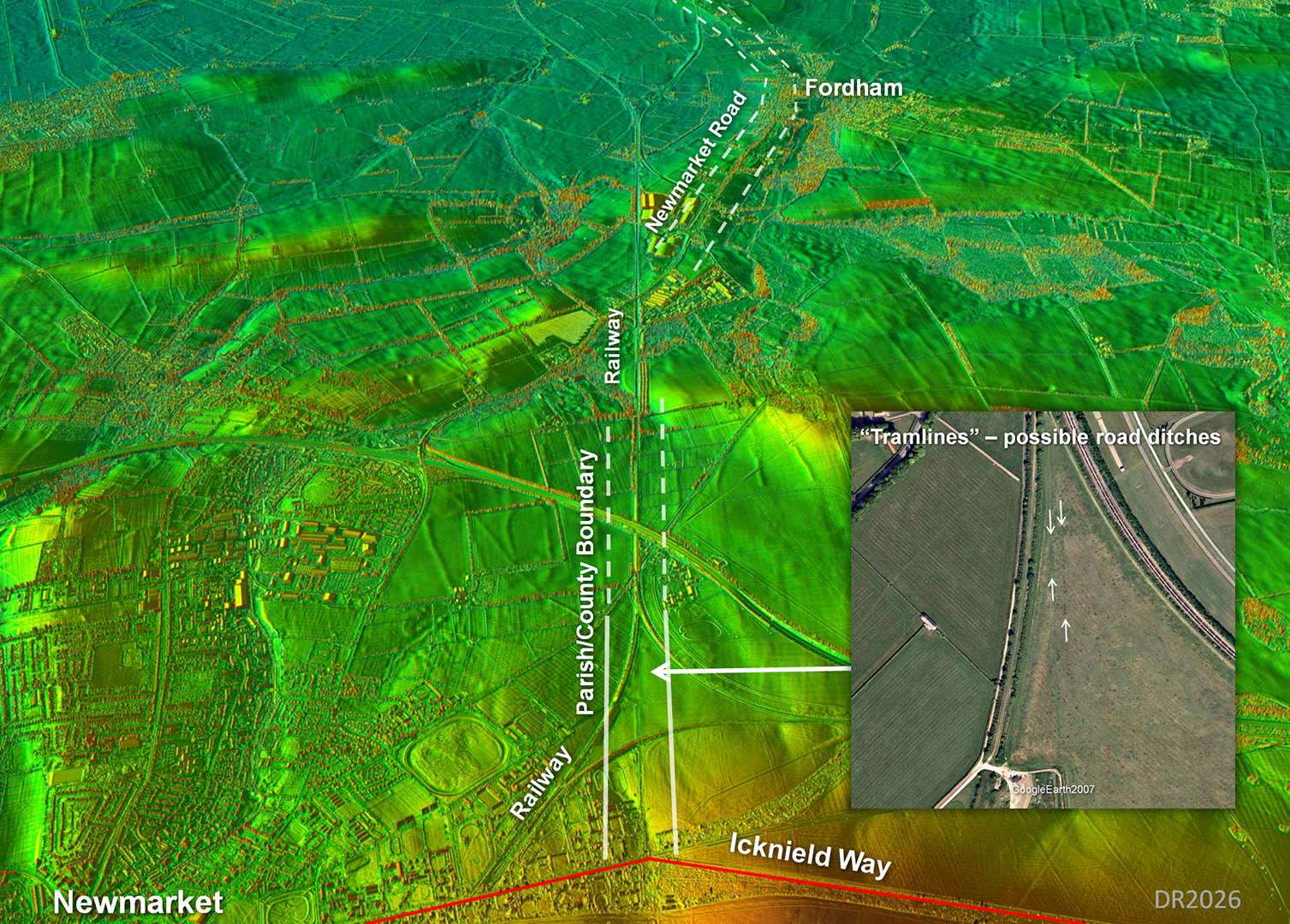
Oblique 3D Lidar Image - Newmarket to Fordham
Reverse view to above.
Working back from the Icknield Way there is an agger visible between the railways. There are also probable road ditches visible on this GoogleEarth aerial photo (inset).
This line is an old parish boundary, now a (strange shaped) county boundary. It appears the railway line was built on the Roman agger and the way both railways curve to get on this alignment is surely confirmation that there must have been a firm foundation for them to target. |
Click for larger view |
 |
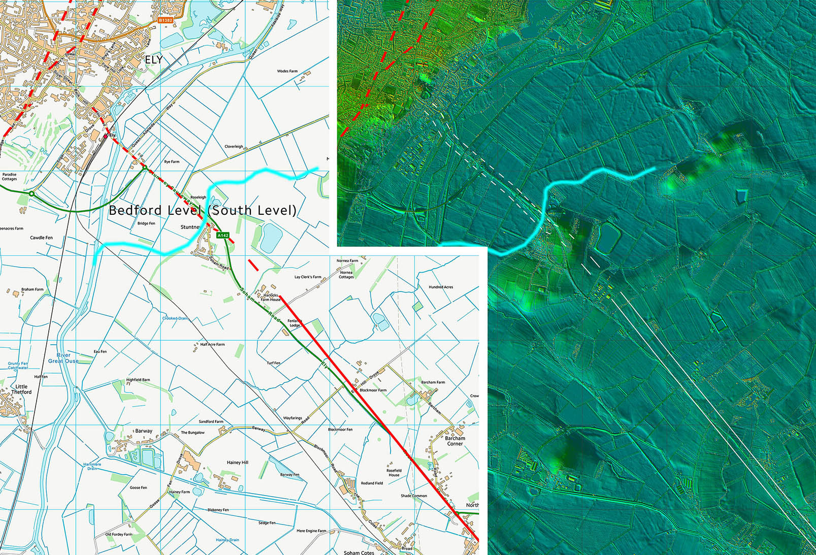
Lidar Image and Route Map 1
Ely to Soham |
Click for larger view |
 |
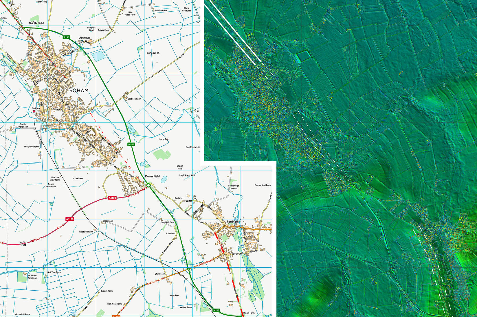
Lidar Image and Route Map 2
Fordham |
Click for larger view |
 |
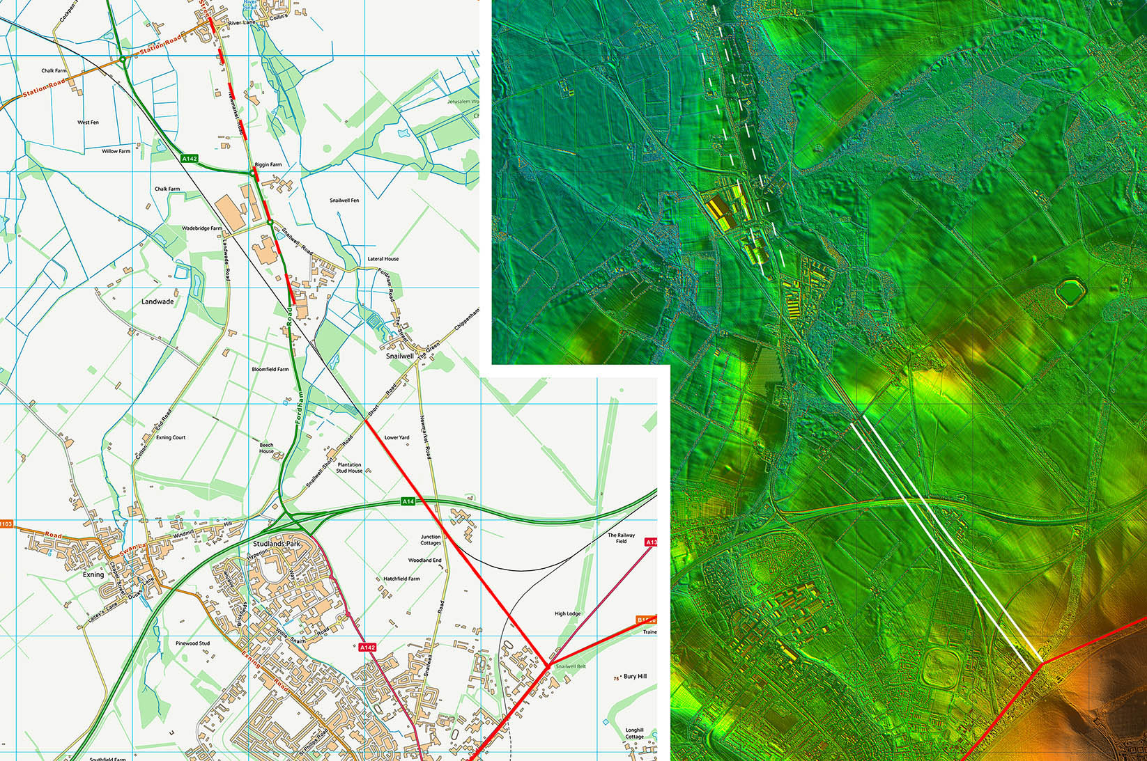
Lidar Image and Route Map 3
Fordham to the Icknield Way |
Click for larger view |
 |