|
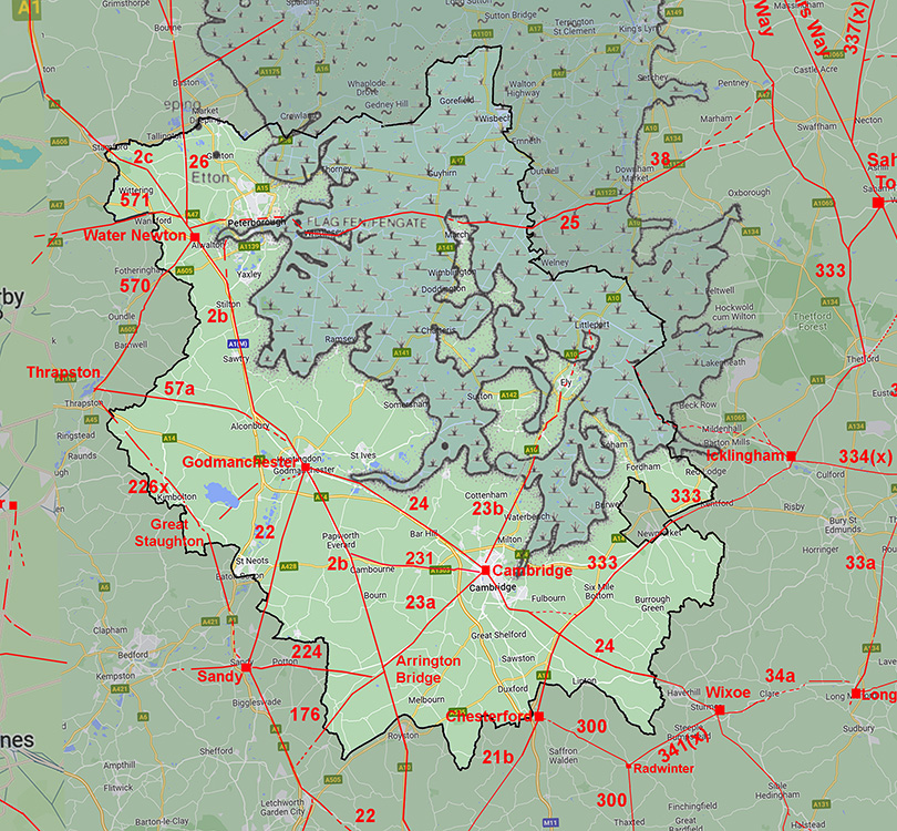
Roman Road from Great Stukeley (Godmanchester) to Ramsey Forty FootMargary Number: NoneDistance: 11 Miles Great Stukeley to Ramsey Forty Foot A road I missed and first spotted by Mike Haken running from Grange Farm to Little Raveley. I was able to link it back to Ermine Street and extend it onwards to almost certainly Ramsey Forty Foot on the fen edge. Recorded at Ramsey Forty Foot are various Roman pottery fragments. There is also some unofficial reports that. the hoard known as the "Muddy Hoard" of over 9,000 coins approximately dated to 274AD could have been found in the vicinity. Secrecy around the actual find location makes this connection very speculative. But taking the presence of pottery fragments then this probably indicates occupation and suggests Roman settlement here. Whilst Ramsey Forty Foot has yielded finds, Roman material in the nearby town of Ramsey is on the other hand apparently comparatively sparse. All a bit vague but it would appear Ramsey Fort Foot was a Roman site. |
Historic Counties: Cambridgeshire Current Counties: Cambridgeshire HER: Cambridgeshire
|
|
|
|
|
|
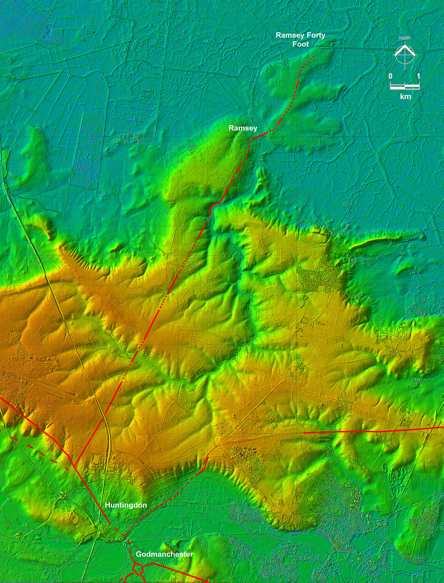
Lidar Image - Full Route from Great Stukeley (Godmanchester) to Ramsey Forty Foot When viewed on Lidar imagery the logic of the route becomes apparent. It is extremely direct to Ramsey High Street, which is a raised causeway across to The Ramsey Fort Foot "island". Once across the causeway then the route is more adapted to dry land and not as direct. At Ramsey Forty Foot was the edge of the Fens and an old river roddon can be seen close by indicating there would have been a river course connecting to other sites in the Fens. The Fens were clearly an important resource - not a wilderness. |
Click for larger view
|
 |
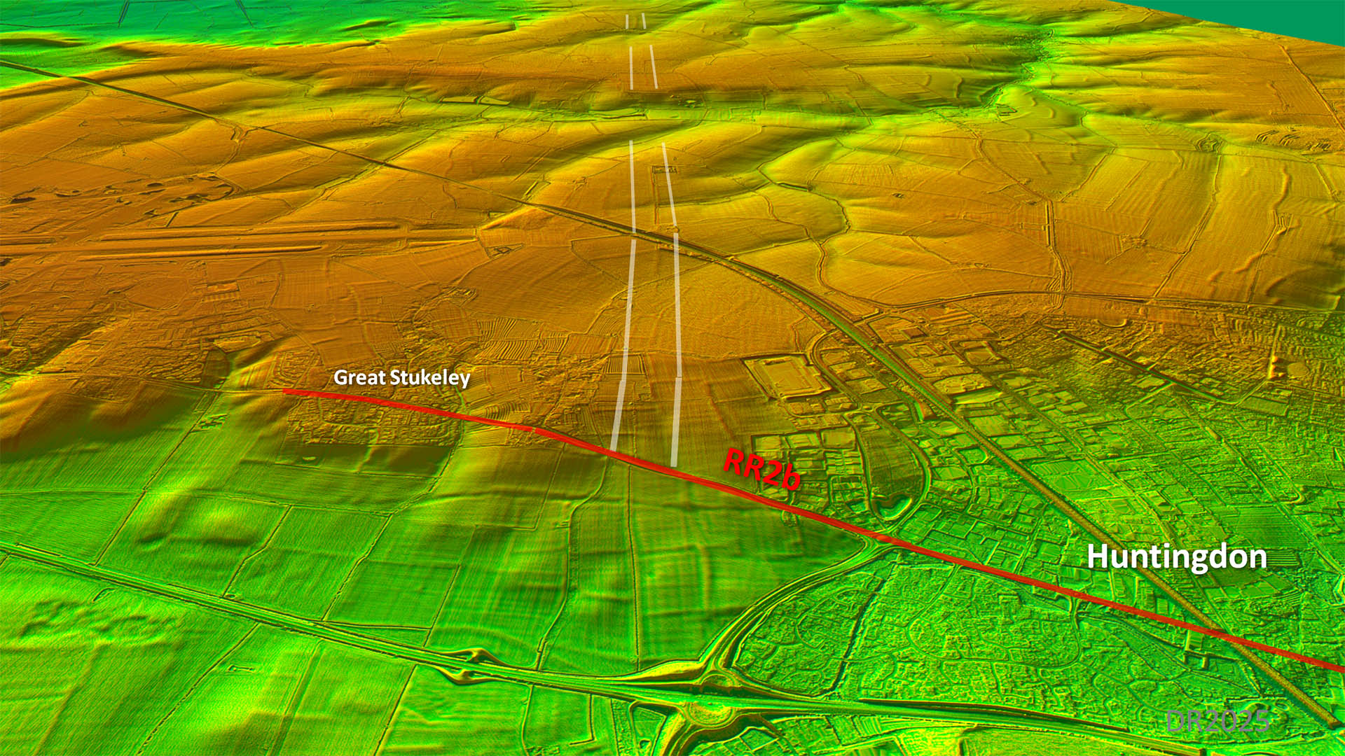
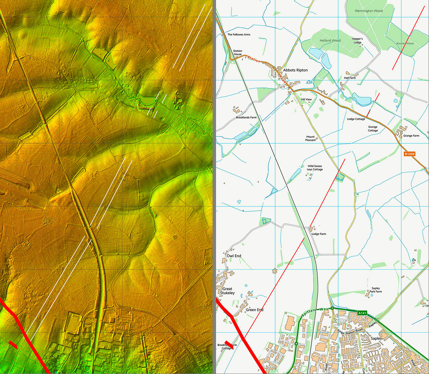
Oblique 3D Lidar Image - View across Ermine Street at Great Stukeley The connection to Ermine Street is very faint but as it aligns with the section spotted by Mike Haken then we can be confident it marks the Roman line |
Click for larger view |
 |
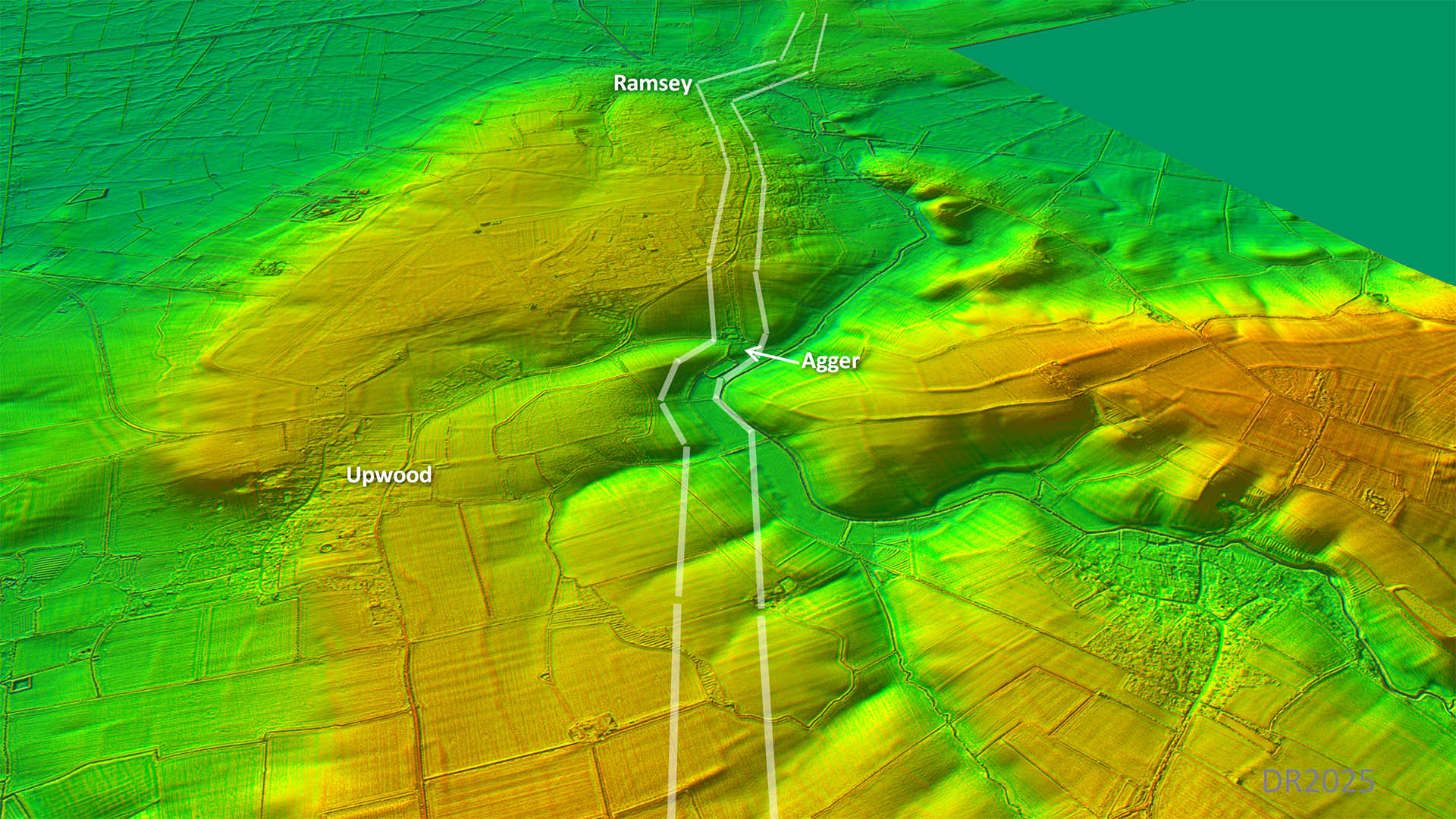
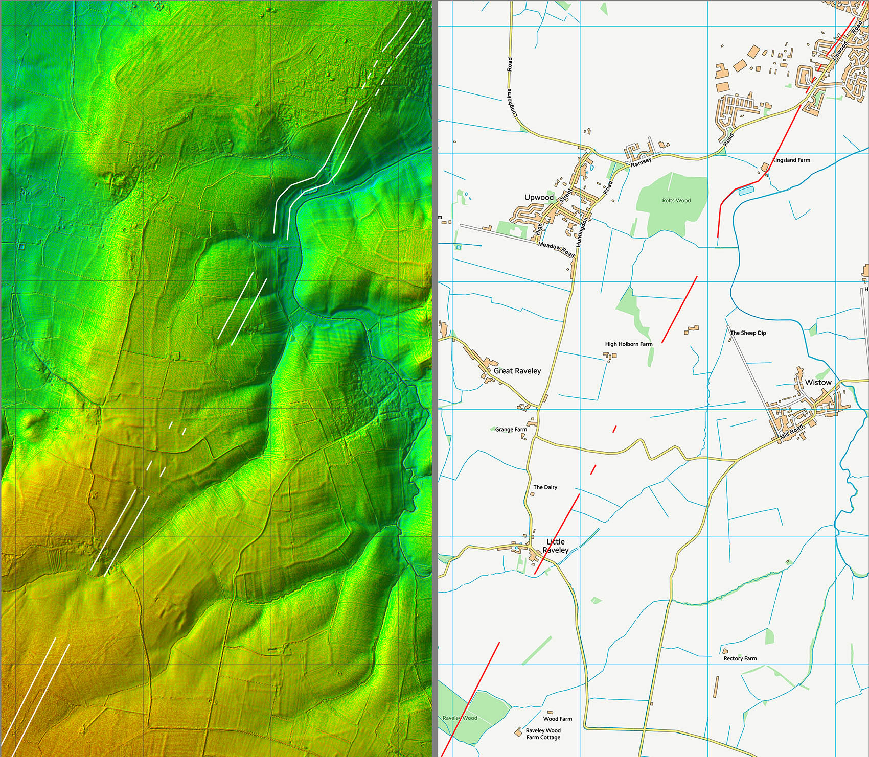
Oblique 3D Lidar Image - Approaching Ramsey Obviously heading for Ramsey High Street but a chicane was necessary to negotiate a valley. As is usual, once the valley was passed then the alignment was resumed. |
Click for larger view |
 |
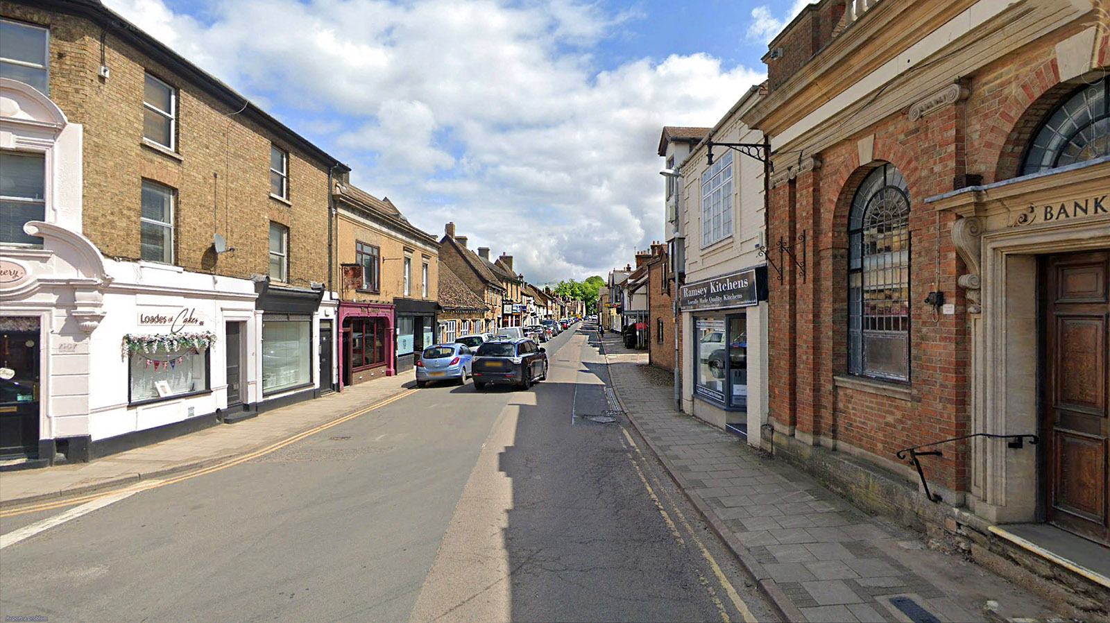
Ramsey High Street Not as direct but as direct as practically possible, keeping to high dry ground. The modern road mostly overlies the Roman road but there are a couple of instances where the Roman agger is visible. The old River roddon can be made out beyond Ramsey Forty Foot and would have provided onward communications in Roman times. Image: GoogleEarth |
Click for larger view |
 |
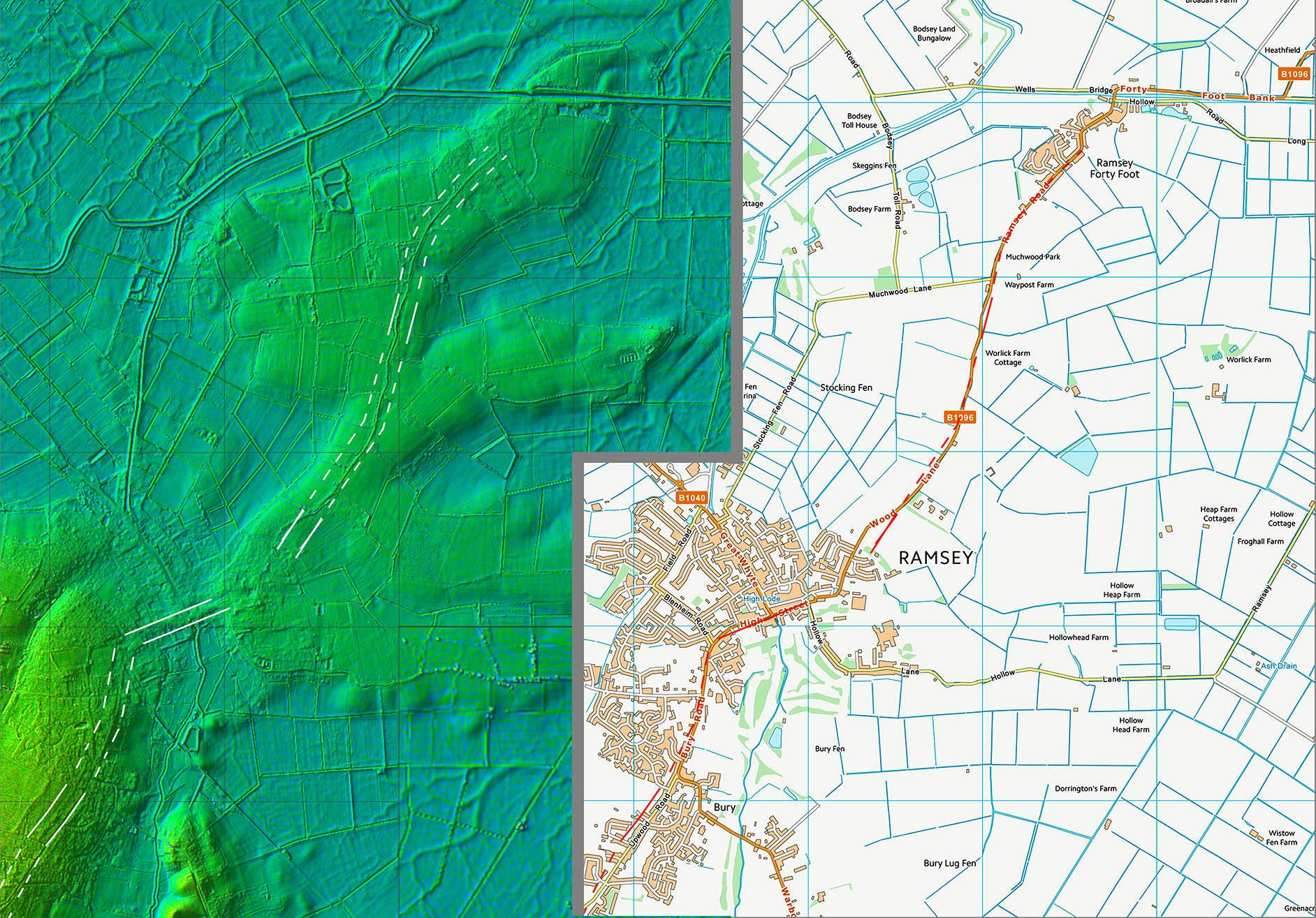
Oblique 3D Lidar Image - Ramsey to Ramsey Forty Foot Not as direct but as direct as practically possible, keeping to high dry ground. The modern road mostly overlies the Roman road but there are a couple of instances where the Roman agger is visible. The old River roddon can be made out beyond Ramsey Forty Foot and would have provided onward communications in Roman times - see below. Inset: GoogleEarth Historical Aerials (2006) |
Click for larger view |
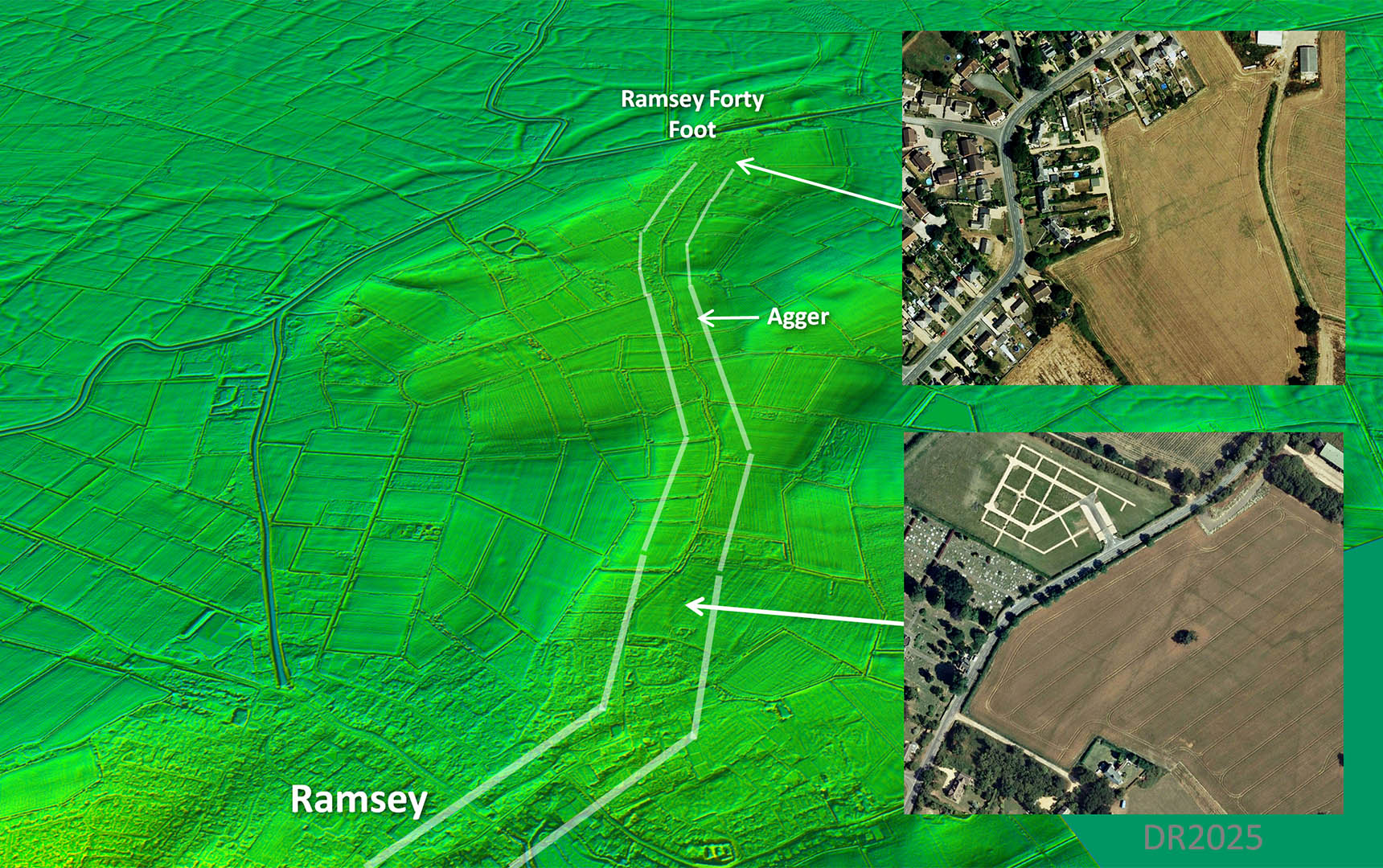 |
Ramsey Forty Foot It is a big wide road - even built up on an agger! This is the last trace - did the Roman road carry straight-on or turn left as the modern road does? The aerial above perhaps could indicate its onward course but I am not sure. Image: GoogleEarth |
Click for larger view |
 |
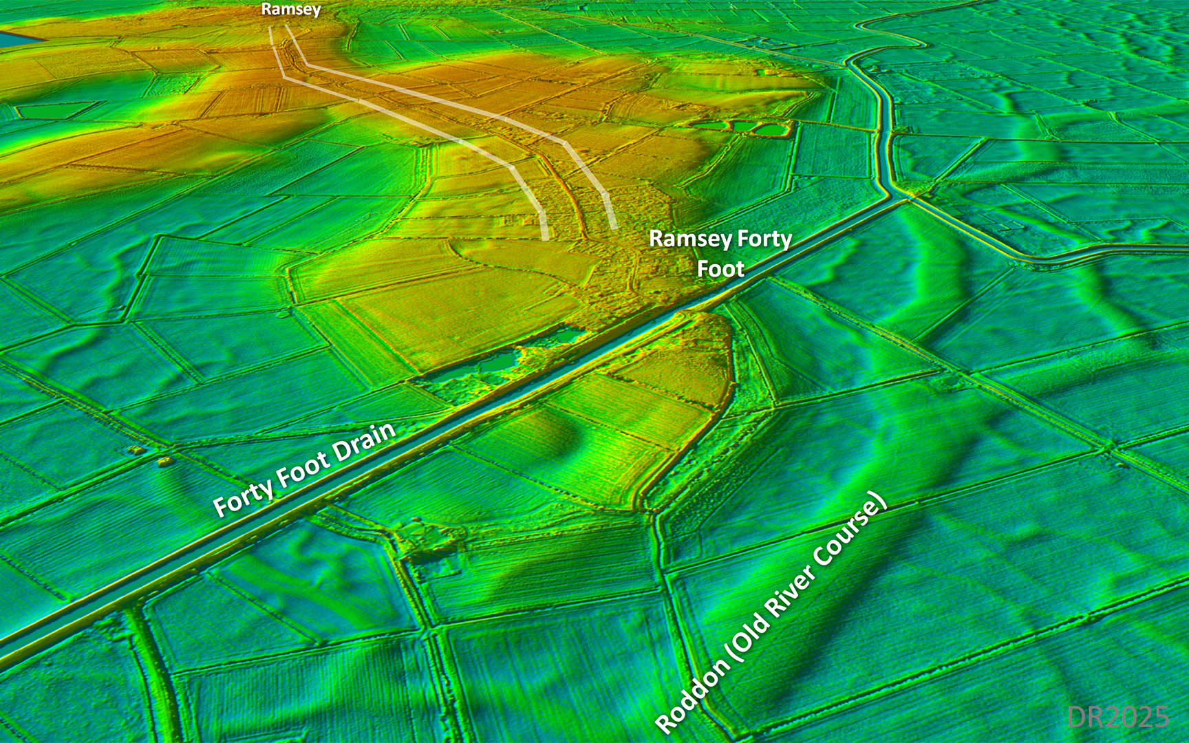
Oblique 3D Lidar Image - Ramsey Forty Foot We are looking back in this view. What is evident is the old river course, now a roddon, passing the end of Ramsey Fort Foot headland. This was the old course of the River Nene giving connections to Peterborough and the Fen Causeway. There surely would have been a Roman harbour or mooring site here but exactly where is hard to pin down. The modern (Vermulen) 40 foot drain, which would have taken the old river's water away, has just bulldozed its way through the headland. |
Click for larger view |
 |
Lidar Image and Route Map 1
|
Click for larger view |
 |
Lidar Image and Route Map 2
|
Click for larger view |
 |
Lidar Image and Route Map 3
|
Click for larger view |
 |
|
Last update: December 2025 |
© David Ratledge |