|
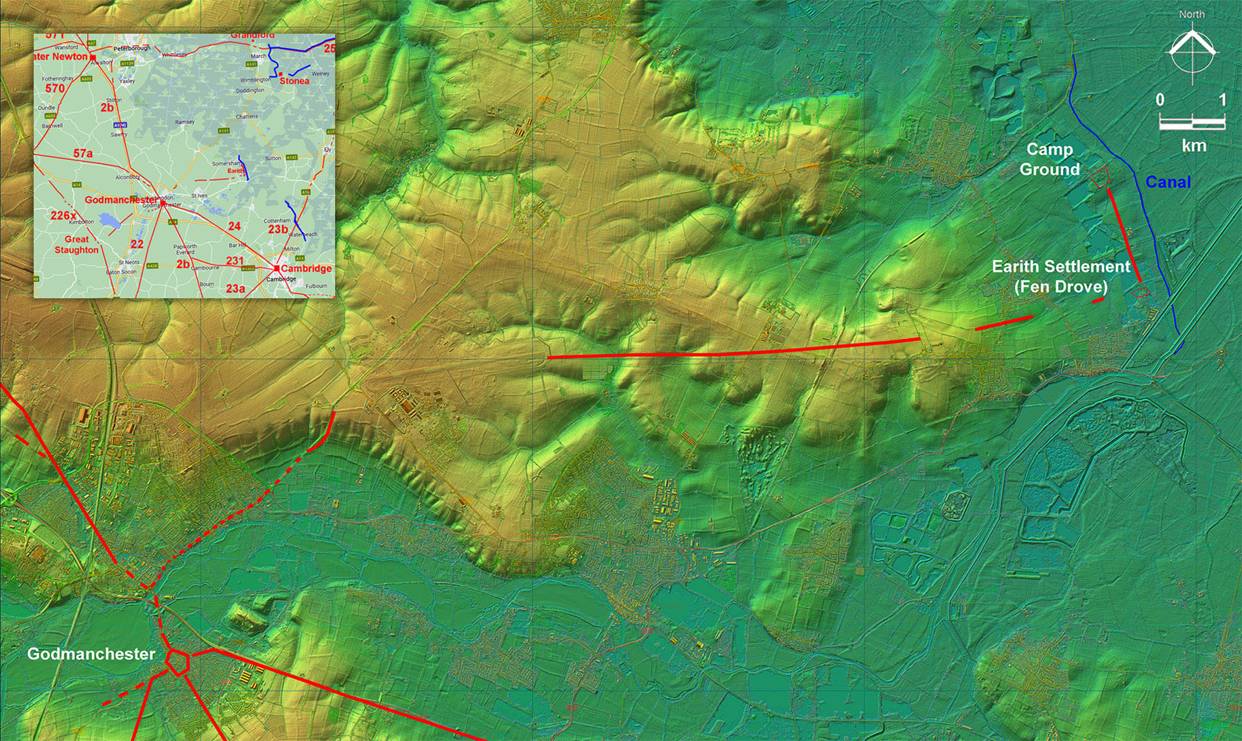
Roman Road from Godmanchester to EarithMargary Number: NoneDistance: 11 Miles to Earith Fen Drove. ( +1 mile to Camp Ground) There were two largish settlements Earith, Fen Drove & Camp Ground, on the western edge of the Fens. It was natural for them therefore to have a road connection to their nearest major Roman town at Godmanchester. An airfield looks to have used the Roman agger as a foundation for its runway! For details of the Earith settlements see Stonea and the Roman Fens, Tim Malim, p160-162, 2005. |
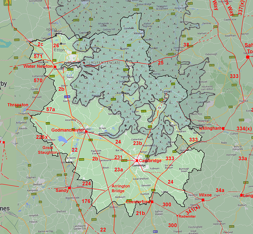
Historic Counties: Cambridgeshire Current Counties: Cambridgeshire HER: Cambridgeshire
|
|
|
|
|
|
Lidar Image - Full Route from Godmanchester to Earith The first section is really guesswork as the modern road probably overlies most of it - apart perhaps for the climb up to an old airfield. The latter has destroyed much of the route. Was this a case of utilising the Roman agger for the runway? Fortunately east of the airfield we have a long clear section almost to the southern of the two settlement, Fen Drove. Connecting the two settlements was a simple straight road. |
Click for larger view
|
 |
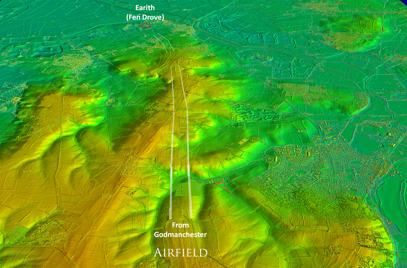
Oblique 3D Lidar Image - Airfield to Earith This is the best surviving stretch of the road. When I first spotted this there was no doubt that it was a Roman road. |
Click for larger view |
 |
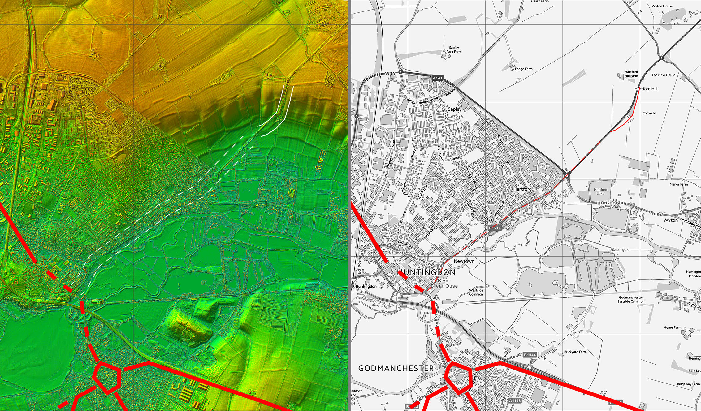
Lidar Image and Route Map 1 Just that old cutting up the climb visible on this stretch |
Click for larger view |
 |
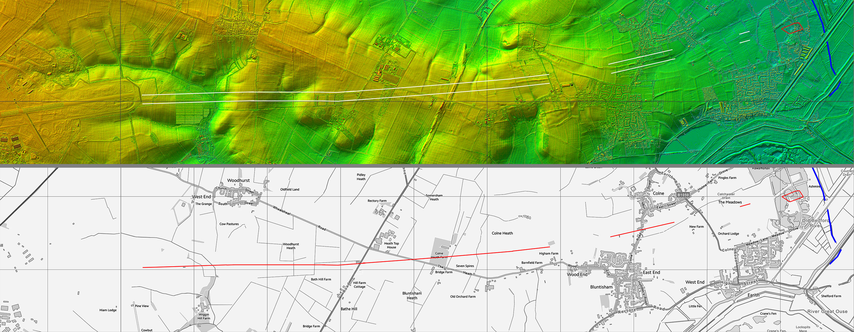
Lidar Image and Route Map 2 This is the long section east of the airfield |
Click for larger view |
 |
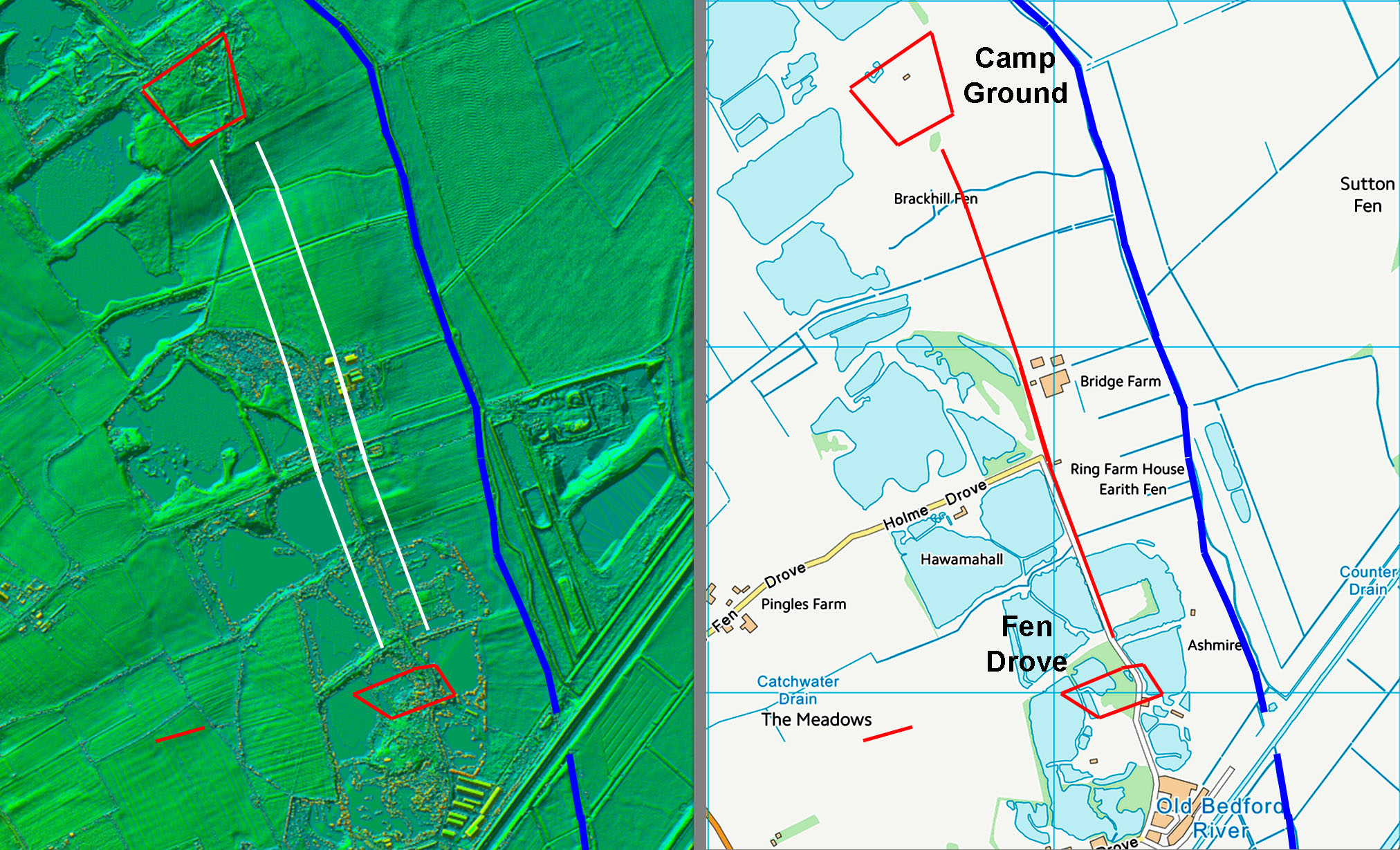
Lidar Image and Route Map 3 Simple connection between the two sites. The canal (shown in blue) is more likely a cut-off drain as it runs along the edge of dry land and the fens. It could of course have been both but cut-off drain seems favourite. |
Click for larger view |
 |
|
Last update: July 2025 |
© David Ratledge |