
|
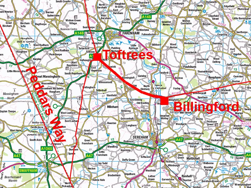
The Roman Road from Toftrees to BillingfordMargary Number: NoneDistance: 8 milesA very short road which in reality could be considered as a continuation of the Brampton to Billingford Roman road. However, Margary numbered the latter road as being part of an extended Fen Causeway, which does not appear to be the case. This road has therefore been treated as a separate road. Norfolk HER: 11358 |
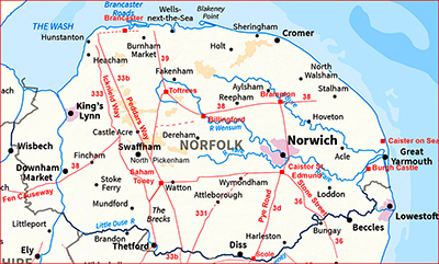
Historic Counties: Norfolk Current Counties: Norfolk HER: Norfolk
|
|
|
|
|
|
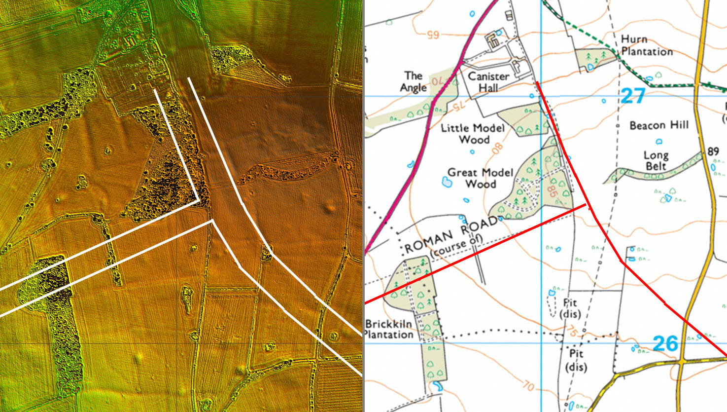
Lidar Image and Route Map Before Lidar Series 2 data became available the roads here were plotted from aerial photos. Following the release of Series 2 data the lines are now confirmed. The Toftrees Roman settlement appears to have been at the road junction. Faint faint traces of strip properties on the east of the road at right angles to it are visible on aerial photos. The road heading to the left (wrongly positioned on the OS map) is the Roman road to North Pickenham. This only appears on the aerial phot not Lidar. This implies a lesser construction so was probably just a link road. |
Click for larger view
|
 |
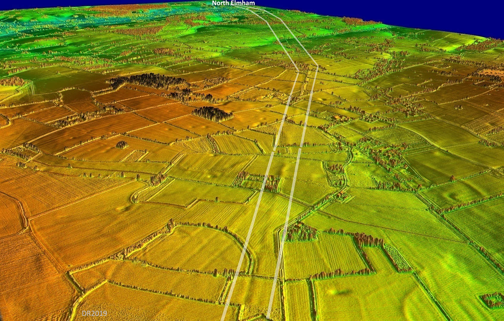
Oblique 3D Lidar Image - looking towards North Elmham Looking along the line of the Roman road from Hamrow House towards North Elmham and Billingford. The major turn of direction is at Harper's Green with a second one approaching North Elmham. |
Click for larger view |
 |
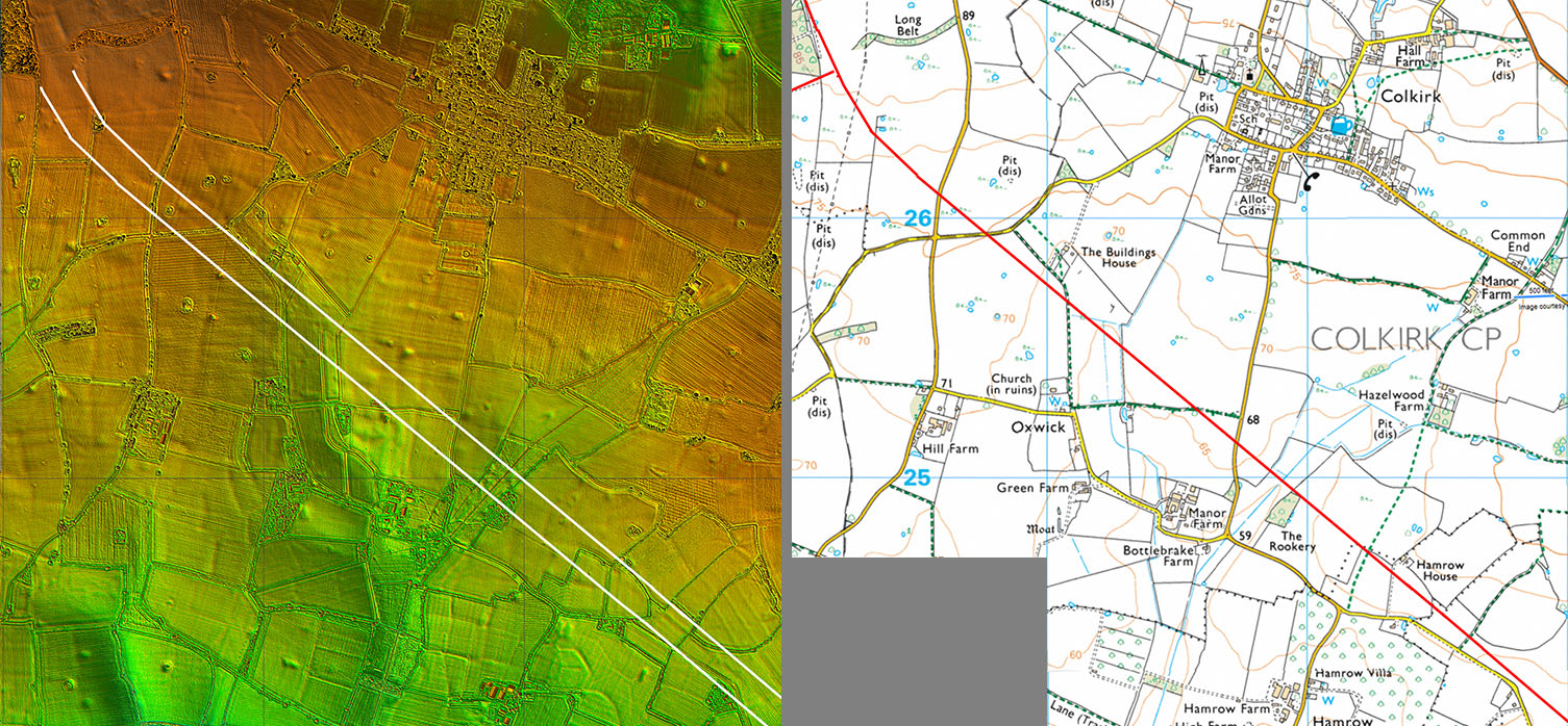
Lidar Image and Route Map 1 Series 2 Lidar has completed the route at Toftrees. From Hamrow House the route is more evident in the Lidar data. |
Click for larger view |
 |
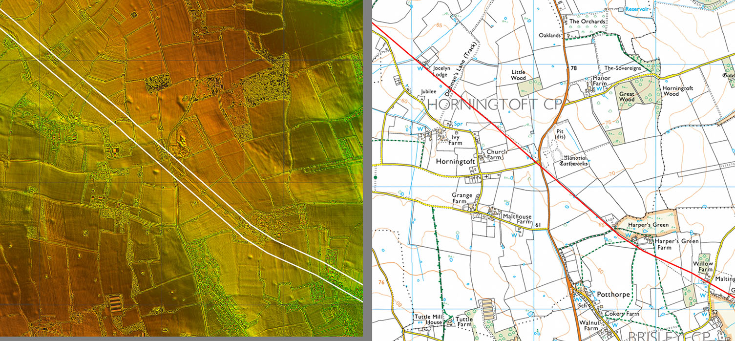
Lidar Image and Route Map 2 We are now on firmer ground with the lidar showing the route extremely well. It had been previously mostly worked out using aerial photos (EAA Report No.5) in the 1970s and Lidar has offered a few minor corrections. |
Click for larger view |
 |
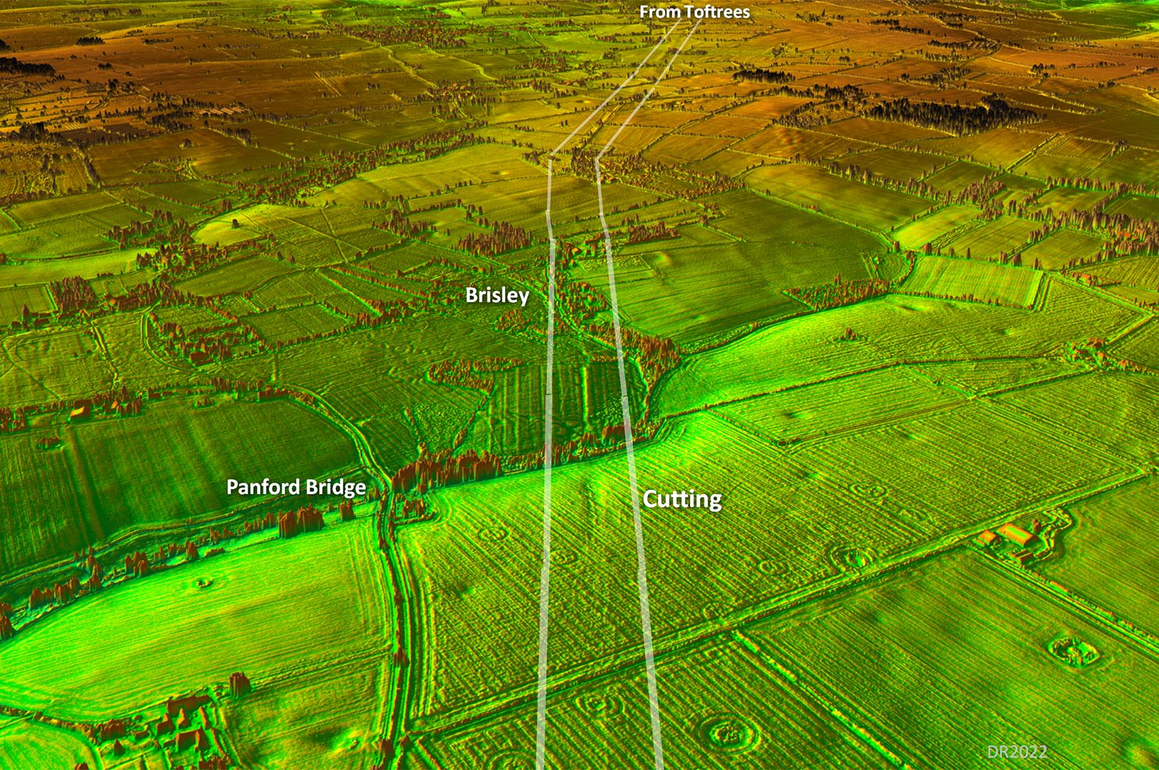
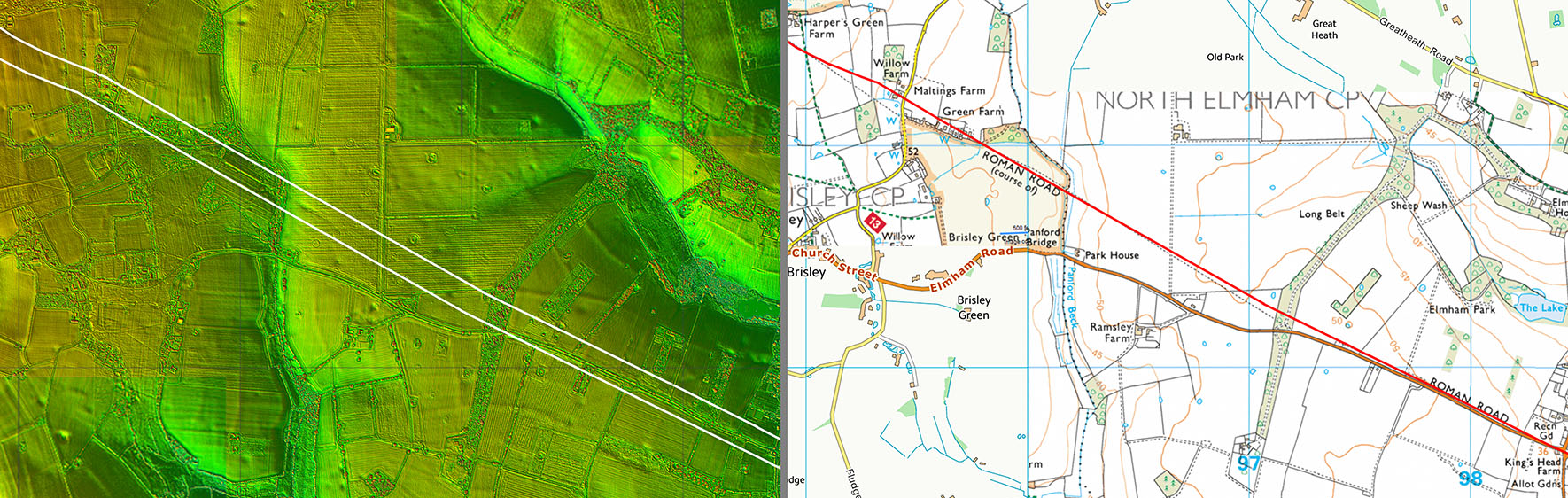
Oblique 3D Lidar Image - Brisley The OS/HER line at Brisley appears incorrect with the road only deviating slightly off the straight alignment. Near Panford Bridge there is a rarity for Norfolk - a Roman cutting. They are common in hillier parts of the country but I am struggling to think of another in Norfolk.
|
Click for larger view |
 |
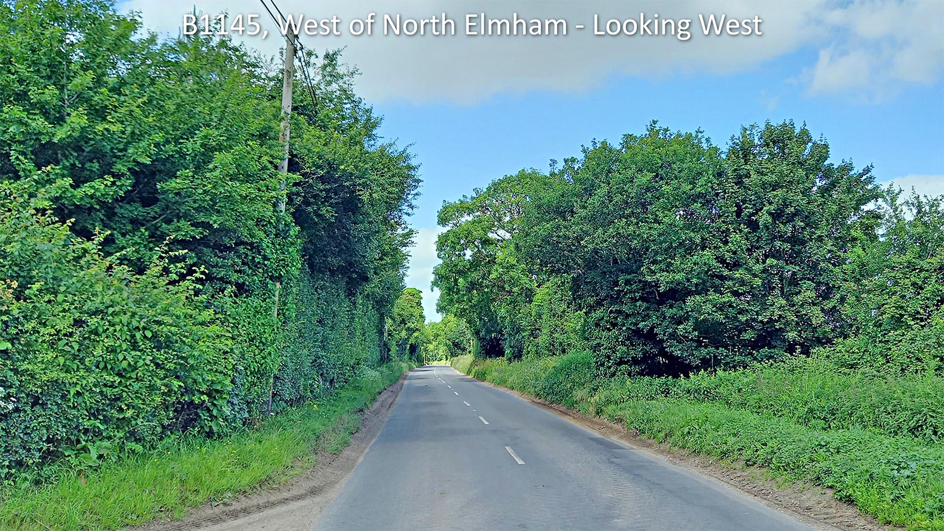
B1145, West of North Elmham - looking back towards Toftrees Moot point here as to whether the modern road is the Roman line or if it is just to the right (north) of it in that undergrowth. Lidar (below) shows something alongside the modern road but is perhaps not clear enough to decide unambiguously. Image: DR |
Click for larger view |
 |
Lidar Image and Route Map 3 Lidar has corrected the line at Maltings Farm/Brisley Common. From here on the modern road down to North Elmham is on or very close to the Roman Line. Perhaps some slight evidence it is first just inside the field. |
Click for larger view |
 |
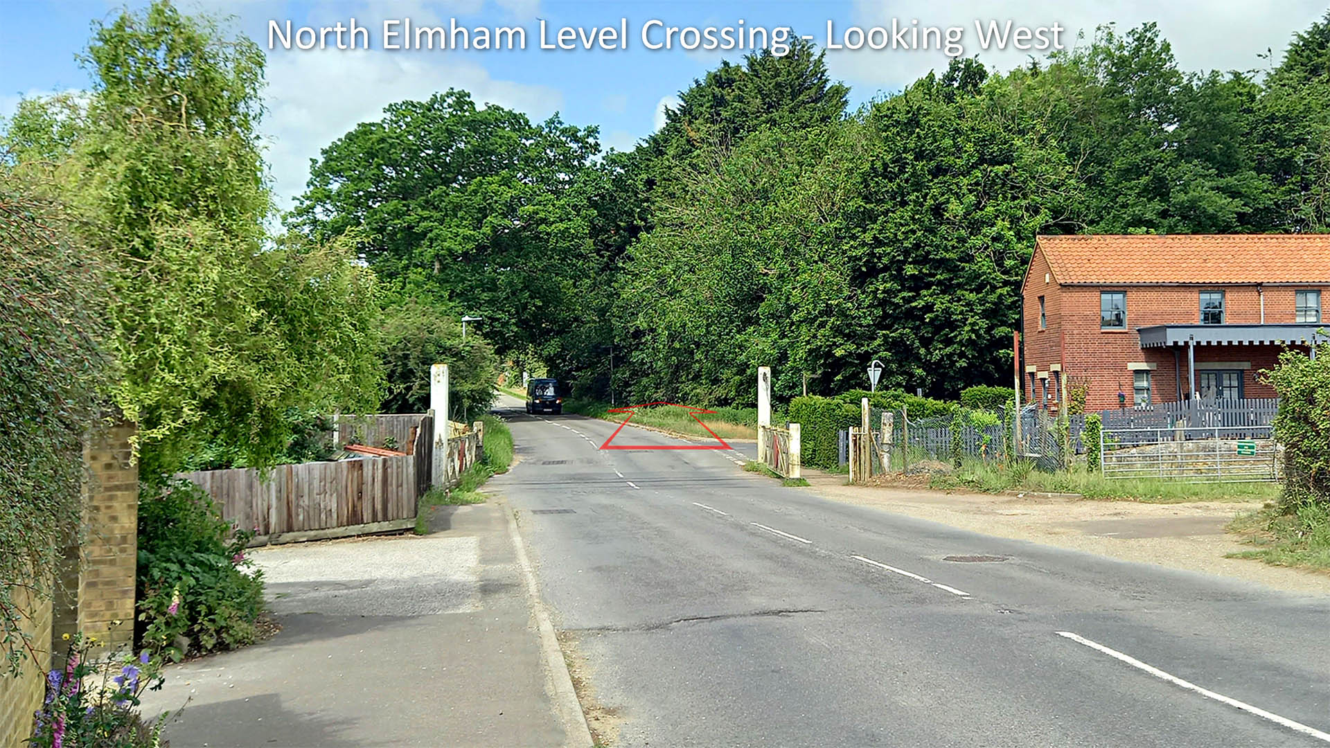
Billingford Road (B1145), North Elmham - looking West The Roman alignment carried straight-on here. Beyond the level crossing the B1145 is a modern road, the North Elmham village bypass. Image: DR |
Click for larger view |
 |
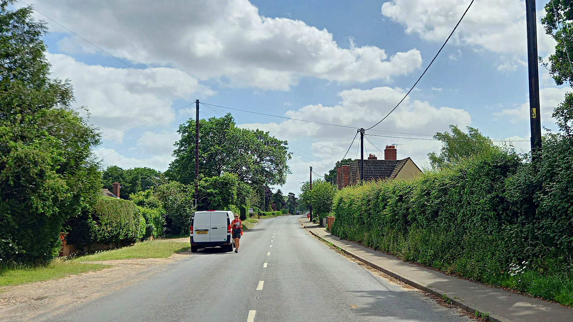
Billingford Road (B1145), North Elmham - looking towards Billingford Appropriately named Biilingford Road leads directly to the Roman site at Billingford. North Elmham level crossing is behind us. Image: DR |
Click for larger view |
 |
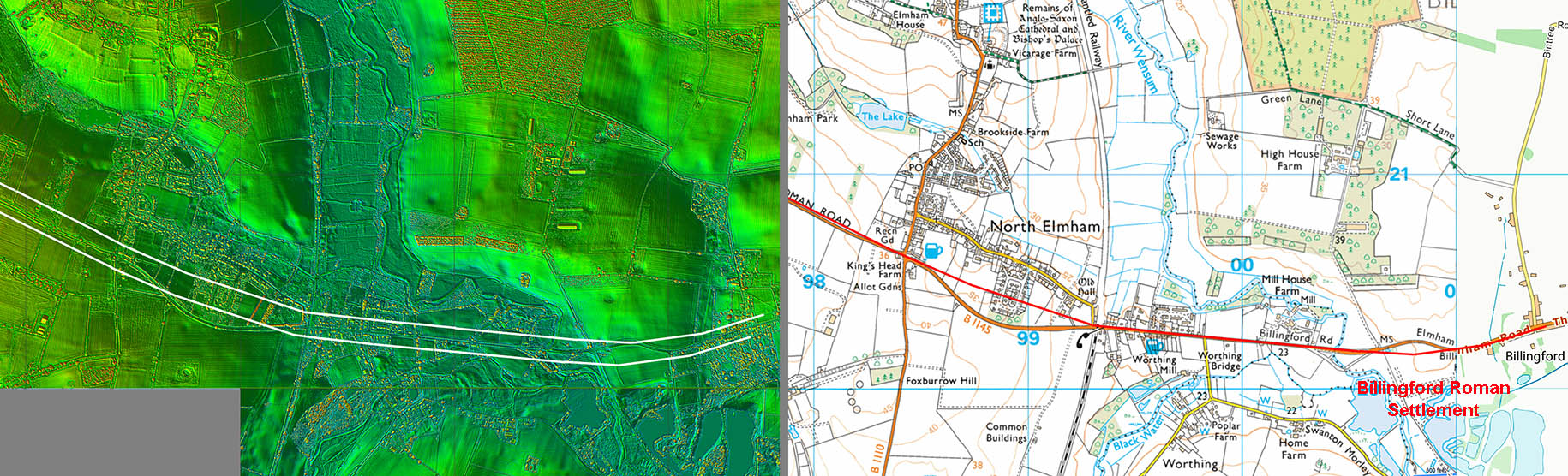
Lidar Image and Route Map 4 This road is clearly an extension of the road to Brampton but Margary didn't number them as such. |
Click for larger view |
 |
|
|
|
Last update: June 2022 |
© David Ratledge |