
|
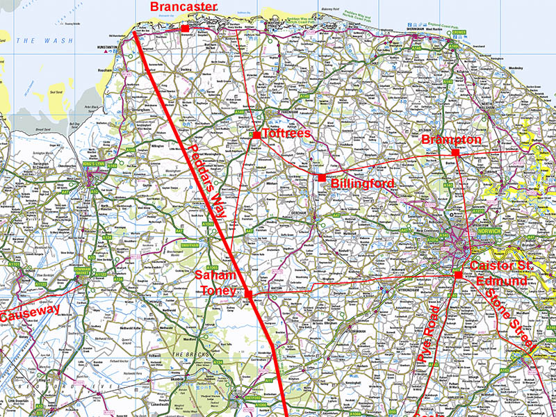
Peddars Way Roman RoadSection 1: Holme next the Sea to Great MassinghamMargary Number: 33bDistance: 42 miles (total in Norfolk)Norfolk's longest Roman road and today survives as a fabulous long distance footpath. If follows a similar route to, but east of, the pre-Roman track, the Icknield Way, and was presumably the Roman replacement for it. Its Roman purpose was clearly a very direct route to what must have been an important port - almost certainly for a ferry across the Wash to Lincolnshire (ref. Albone). The road has all the characteristics of a Roman military highway with basically just two main alignments. That one change of direction was at the high (for Norfolk) point of Galley Hill, Hockham. Saham Toney was the major Roman settlement in Norfolk along this road and appears to have been established early in the Roman conquest. Norfolk HER reference; 1289 |
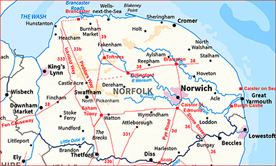
Historic Counties: Norfolk Current Counties: Norfolk HER: Norfolk
|
|
|
|
|
|
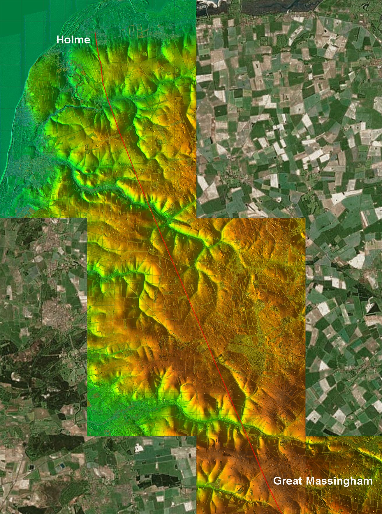
Lidar/Aerial Composite - Full Route (to Great Massingham) The course of the road is well established and almost all of it is still in use as a road, track or footpath. The main doubts about its course are at Holme next the Sea but there are few other short lengths where its course in uncertain.
|
Click for larger view
|
 |
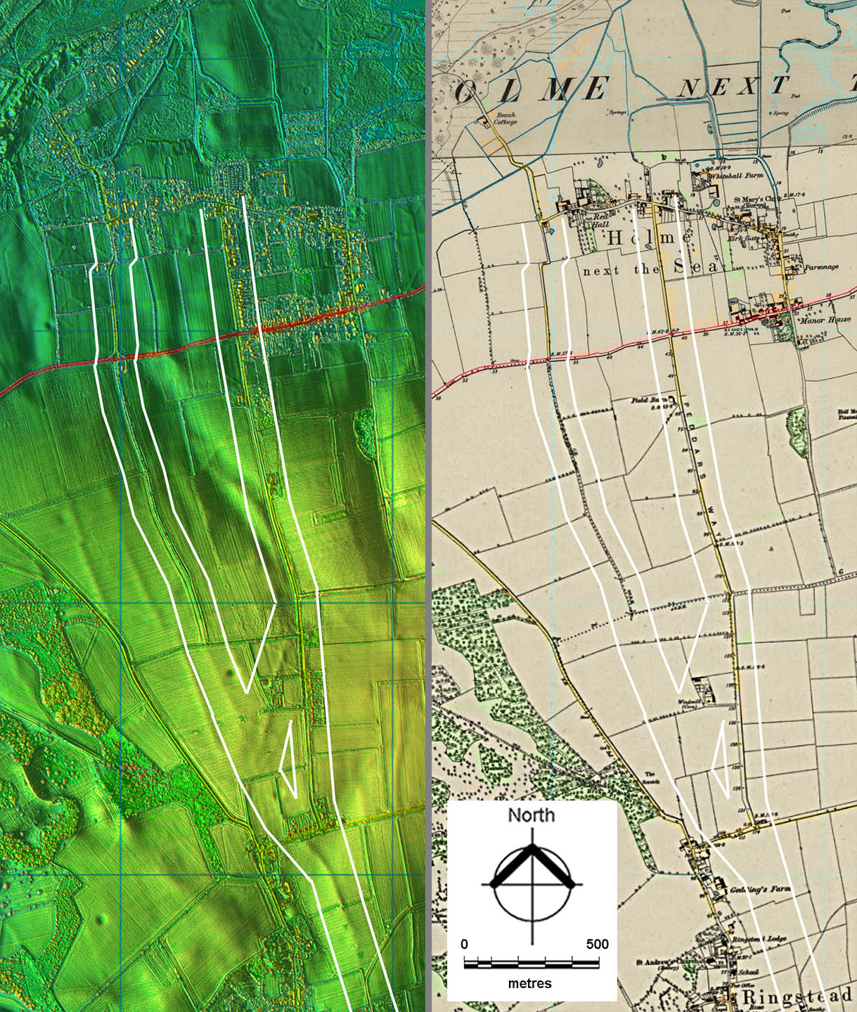
Lidar Image and OS First Edition Map at Holme next the Sea - Route Map 1 There are two competing options for the route at Holme - the west and east. Robinson & Rose (Norfolk Origins 2) were quite definite that the western option was the correct one. Both roads are shown on Faden's Map so they are not recent. The Ordnance Survey first edition 1-inch map marks the easterly route as Peddars Way. I think at last with Lidar we are able to resolve the situation. The LiDAR evidence seems to indicate it was not either/or but more likely both. Just north of Ringstead there is a definite dog-leg but this is followed by what looks like a junction with two routes to the coast – with the easterly one, now officially called Peddars Way, looking like a later branch off the westerly original. .
|
Click for larger view |
 |
Holme next the Sea - East Route The south looking image is down the road called Peddars Way and the property on the right has the impressive address of number 1 Peddars Way. Images: Google |
Click for larger view |
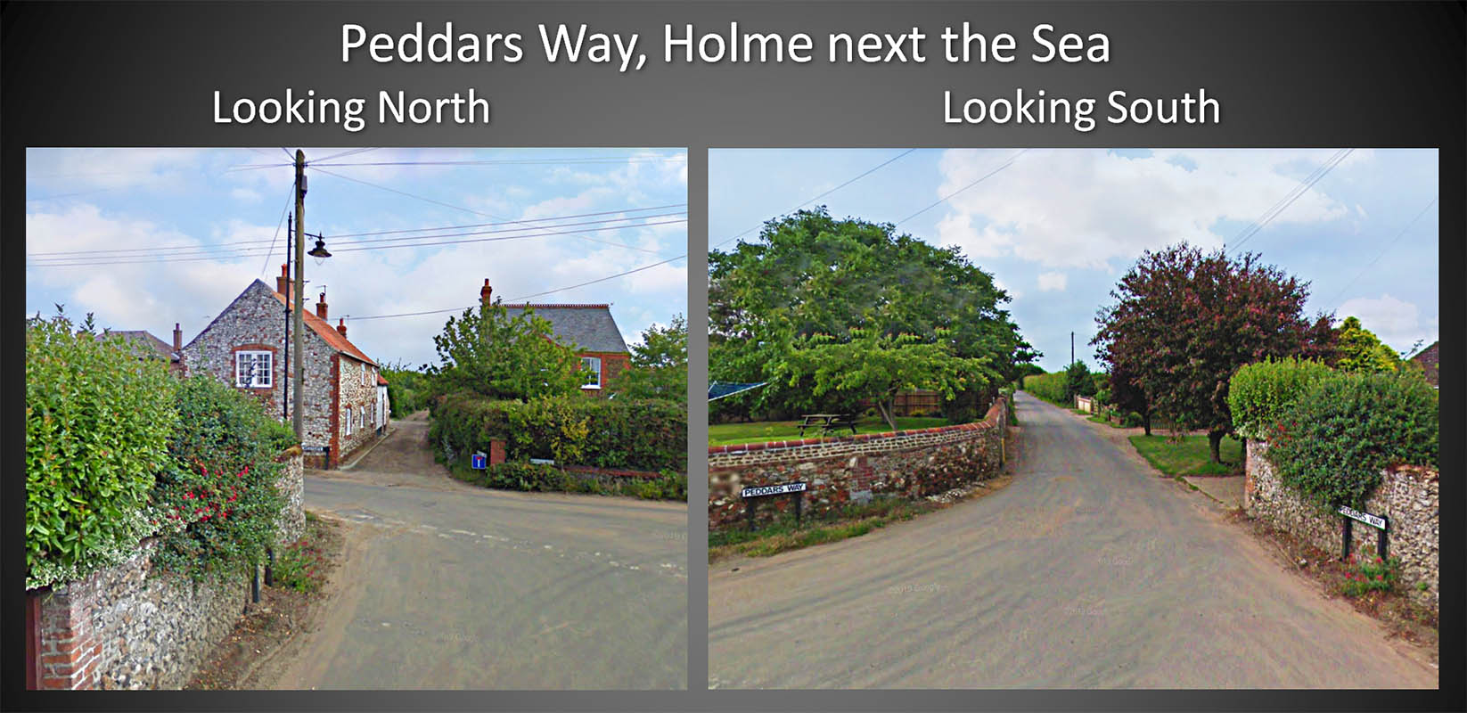 |
Holme next the Sea - West Route This is appropriately called Beach Road as that is exactly where it goes. Yes on this stretch it is wide and looks Roman-like but elsewhere this is not generally the case. Image: Google |
Click for larger view |
 |
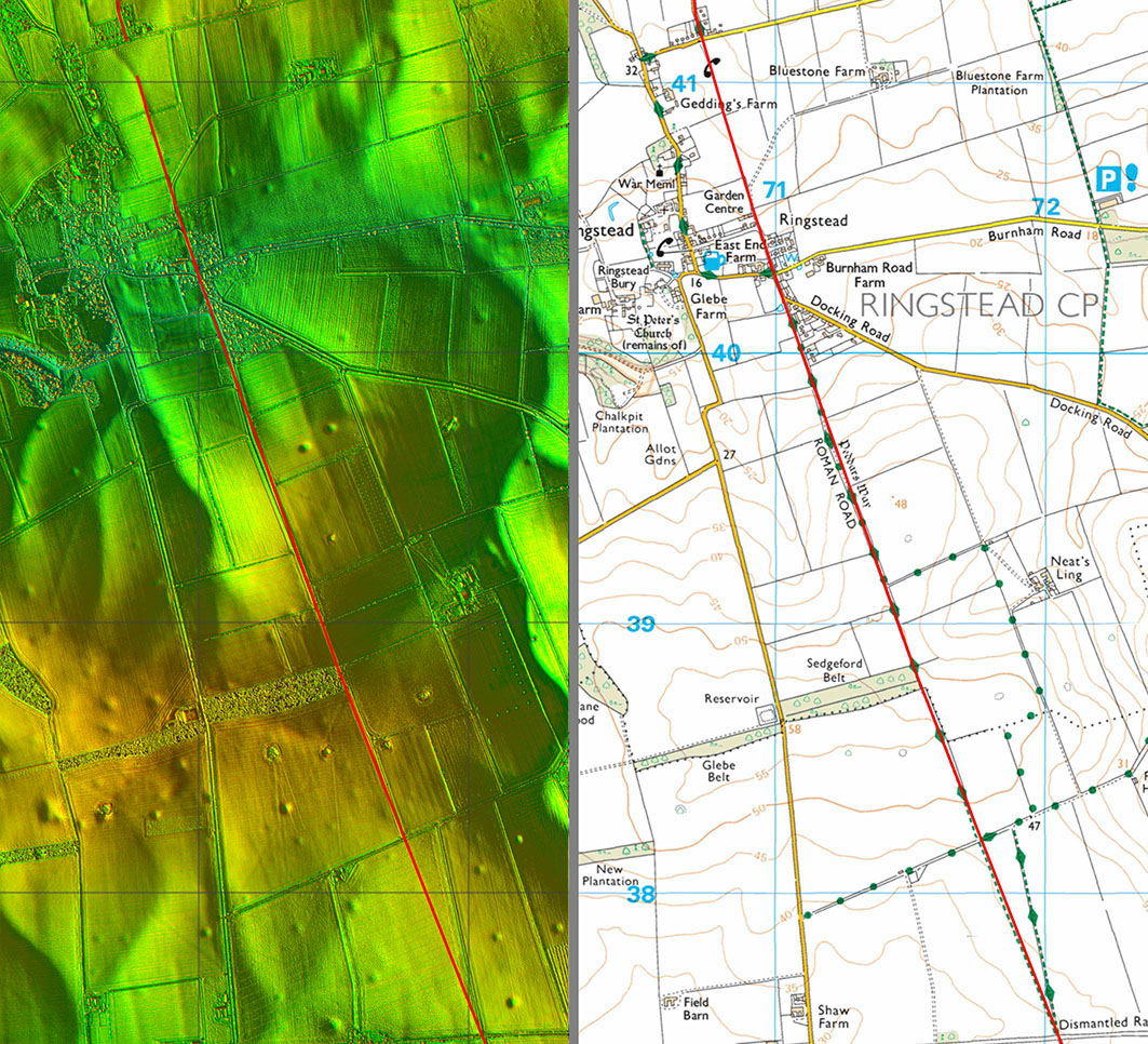
Lidar Image and Route Map 2 We are on firmer ground now and the route is not really in question passing Ringstead. |
Click for larger view |
 |
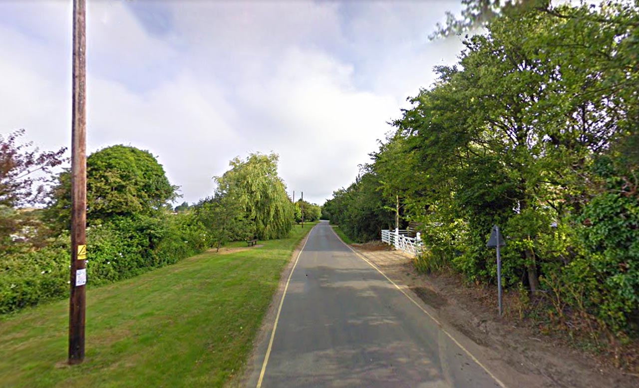
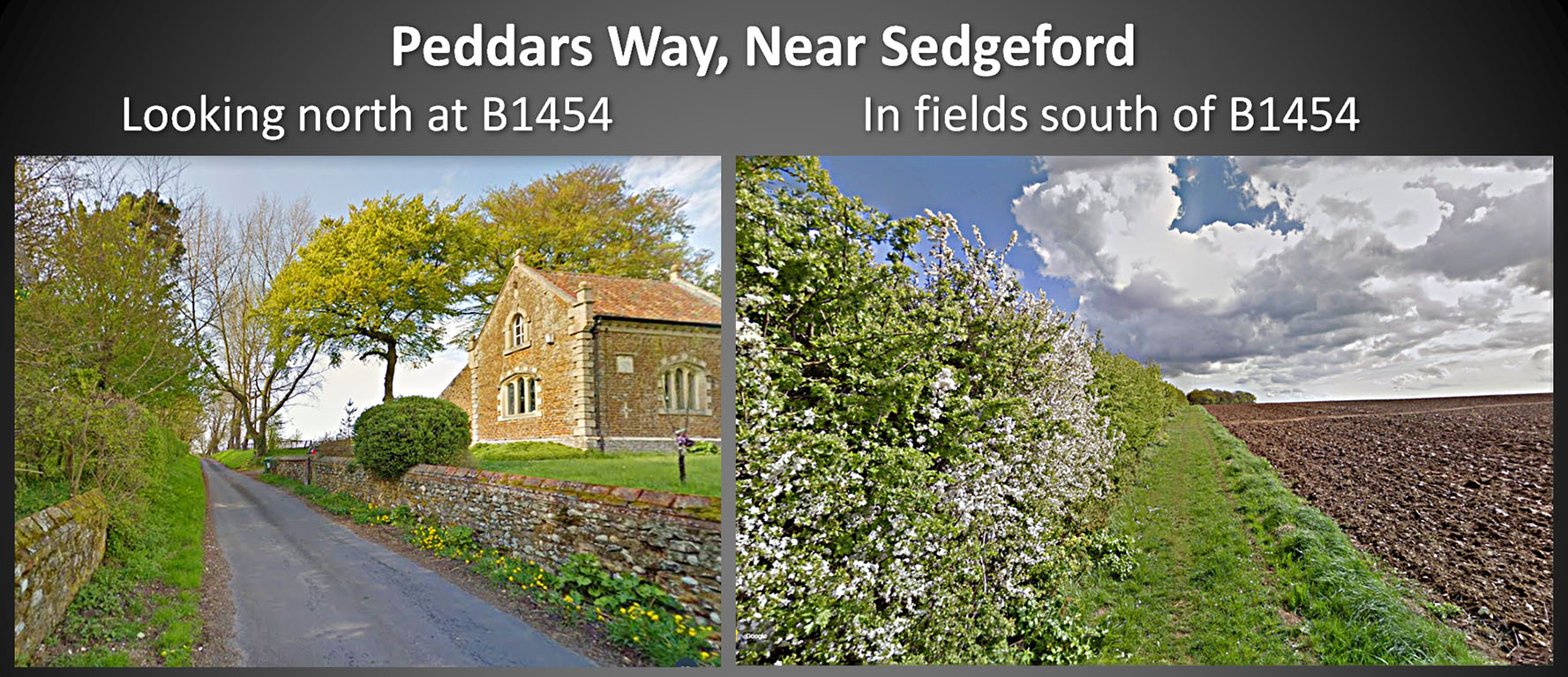
Peddars Way either side of Docking Road (B1454) Picturesque spot with a slight downhill length to the B1454. The right view is fairly typical of the Peddars Way in north Norfolk. Images: Google |
Click for larger view |
 |
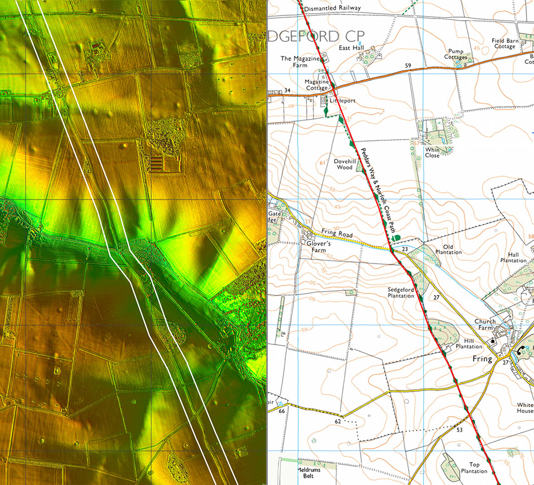
Lidar Image and Route Map 3 Bit of a wobble off straight passing Fring to cross the valley. |
Click for larger view |
 |
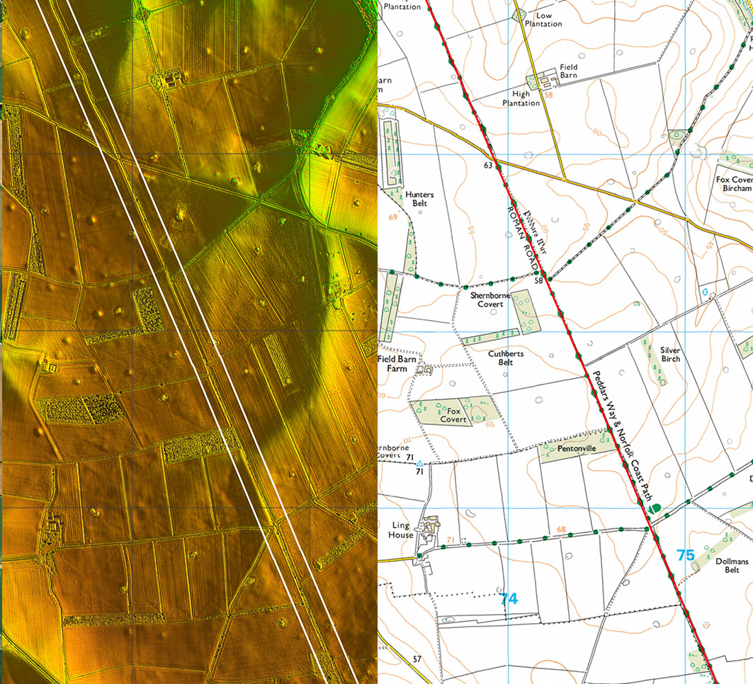
Lidar Image and Route Map 4 Dead straight on this section.The road crossing Peddars Way near the top is called Roman Road and runs to Great Bircham off the map to the right. For a photo of this junction see later. |
Click for larger view |
 |
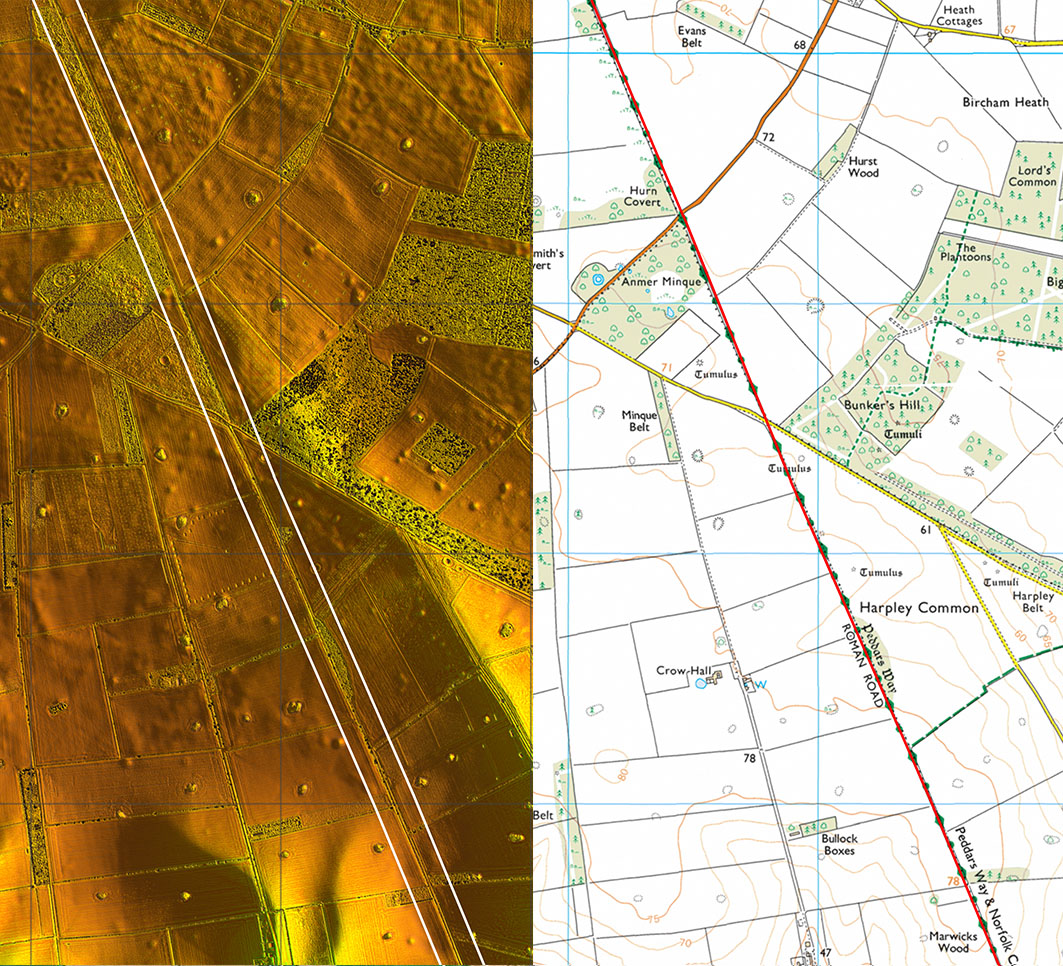
Lidar Image and Route Map 5 More of the same with the straight alignment continuing. |
Click for larger view |
 |
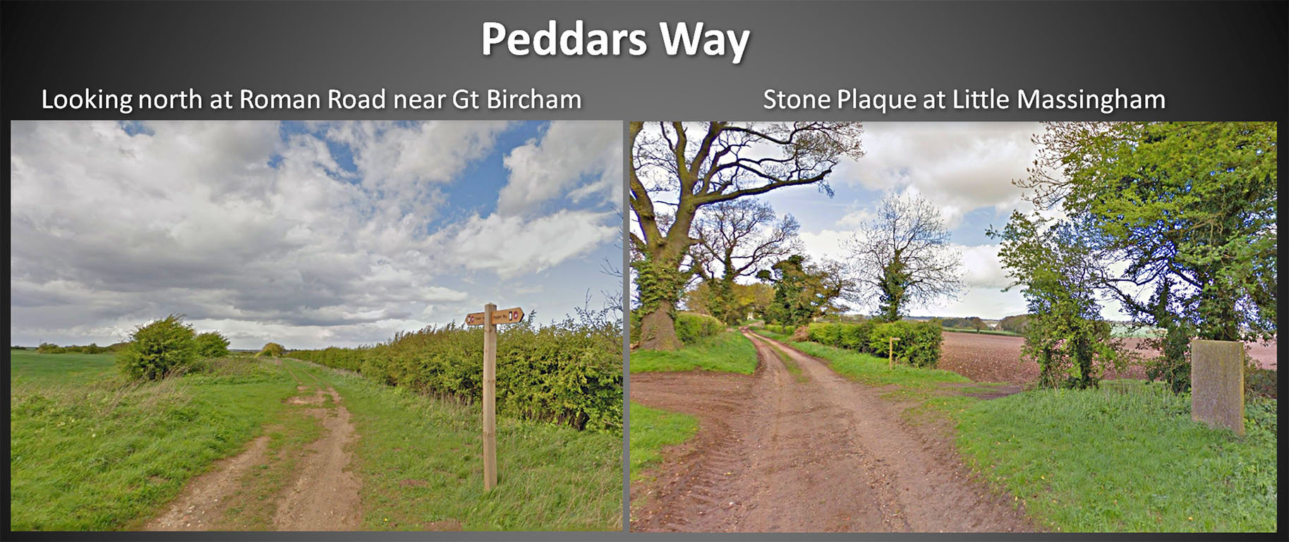
Peddars Way - 2 views The left view is at Roman Road west of Great Bircham - see above. The right hand view is of the Norfolk Songline Stone near Great Massingham. The inscription reads: From Blackwater Carr to Seagate Since the plough first broke the bread of land Pightles and pieces plots & pastures To every man his stony acre. Images: Google
|
Click for larger view |
 |
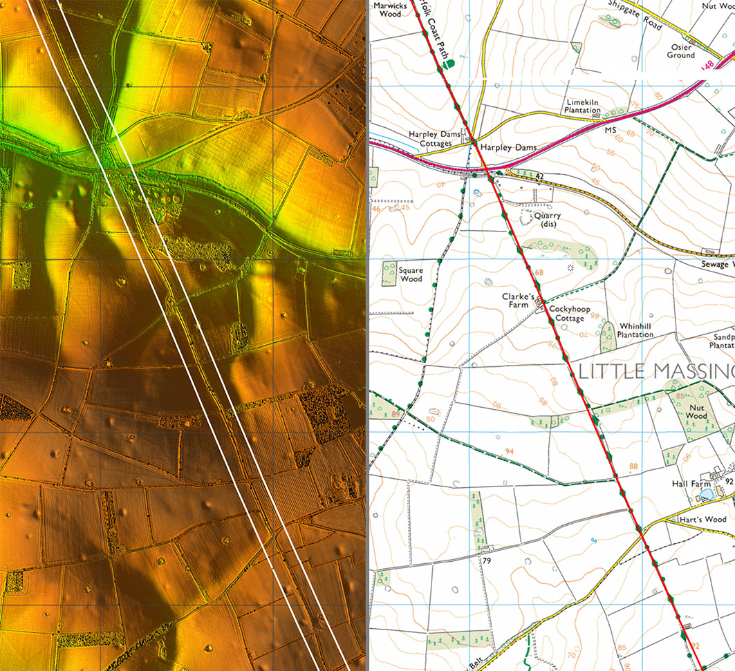
Lidar Image & Route Map 6 This time there was no need for a wobble crossing the valley approaching Little Masingham.
|
Click for larger view |
 |
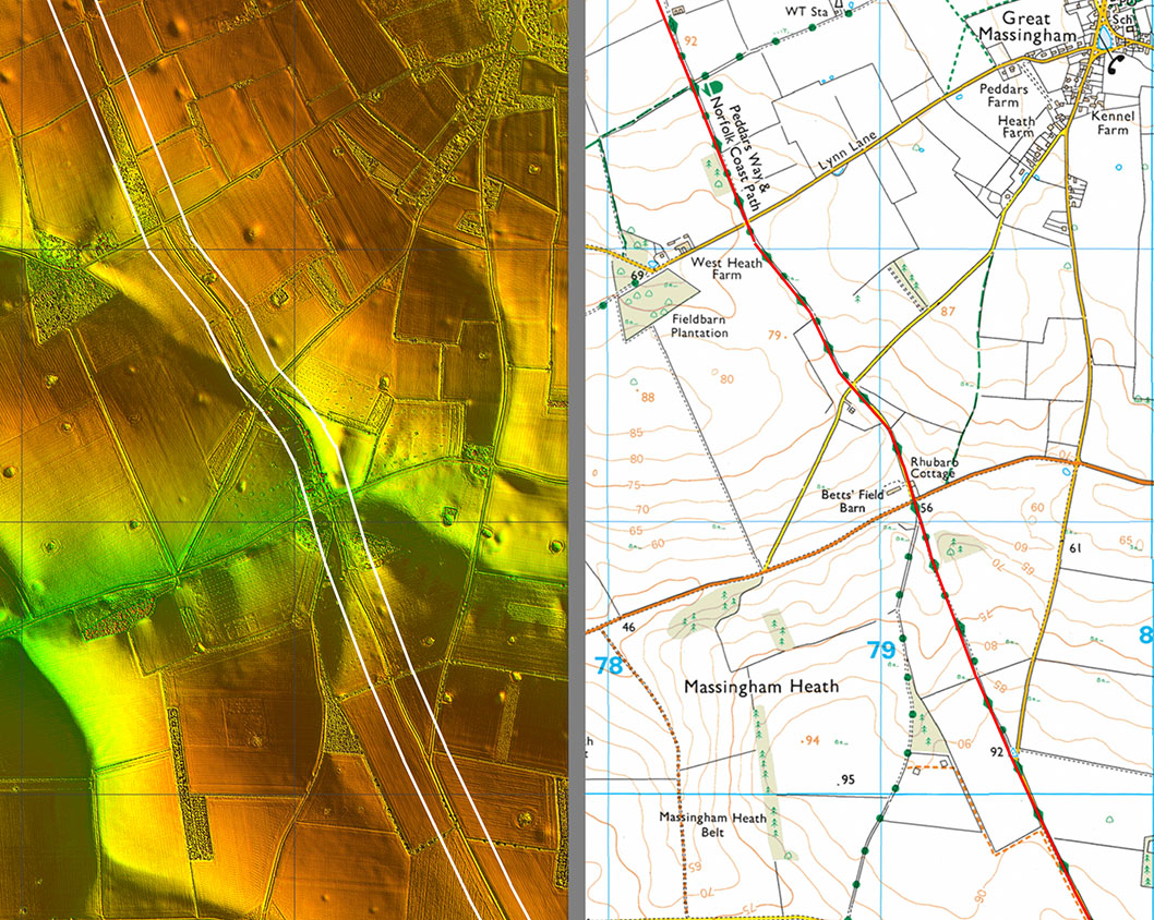
Lidar Image & Map 7 There does seem a sensible reason for the Roman alignment not being dead straight here as it negotiates another little valley. Route continued in Section 2 |
Click for larger view |
 |
|
|
|
Last update: January 2020 |
© David Ratledge |