
|
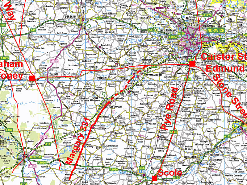
The Roman Road from Gasthorpe to Wymondham(?)Margary Number: 331Distance: 18.5 miles (in Norfolk)Believed by Margary to be a logical extension of his road 33 from Ixworth and to be fair a route to Caistor St Edmund would be expected. The first stretch in the county with the long straight road known as The Street is a huge clue. However, the further north we get then the harder it becomes to trace the road. Haverscroft Street is another big clue and surely indicates the road was hereabouts. However, Robinson and Rose quote Davison as having proved the modern road there as being just that i.e. modern. But I have come across elsewhere in the country instances of modern roads adopting abandoned Roman roads as their foundation so perhaps not conclusive evidence one way or the other. However, just north-west of the modern road at Haverscroft is another possible feature visible in the Lidar that could represent the Roman line. Both have been shown on the mapping below. Beyond Attleborough then evidence is scarce but modern roads perhaps mask the course of the road towards Wymondham and on to a possible junction with the Saham to Caistor Roman road. Many Roman road maps of Norfolk show this road going to Crownthorpe. However, I can see nothing in the lidar that supports this. Nothing is visible heading south from Crownthorpe and bear in mind the east-west Roman road has survived well there and is obvious. That leaves 2 possibilities:- the Roman line is mostly covered by modern roads which would imply a route via Wymondham (as shown dashed) or the road only went as far as Attleborough.
|
Historic Counties: Norfolk Current Counties: Norfolk HER: Norfolk
|
|
|
|
|
|
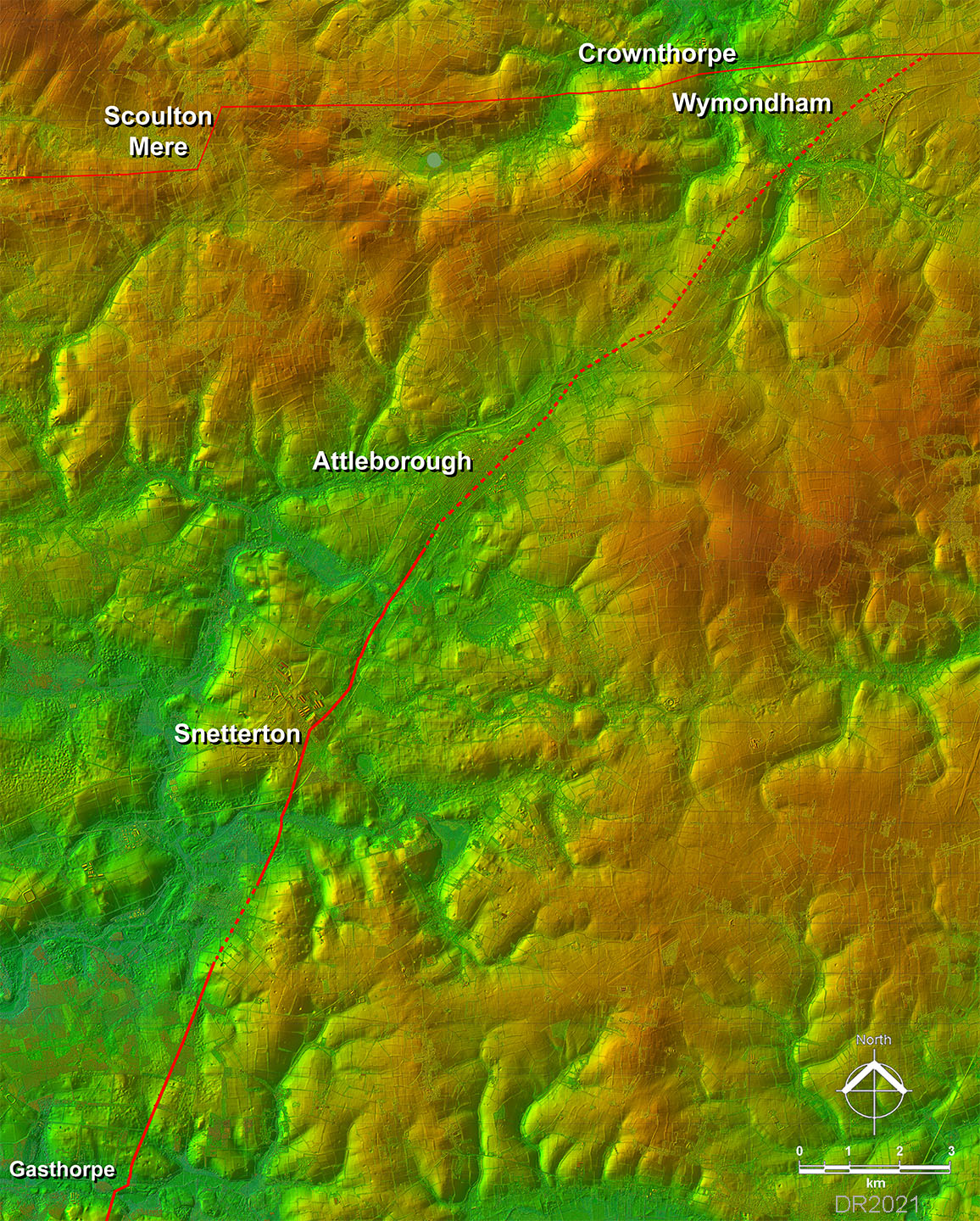
Lidar Image - Full Route The release of Series 2 Lidar has enabled the full route to be overliad on a lidar backdrop. I say full route but as above beyond Attleborough then it very subjective. |
Click for larger view
|
 |
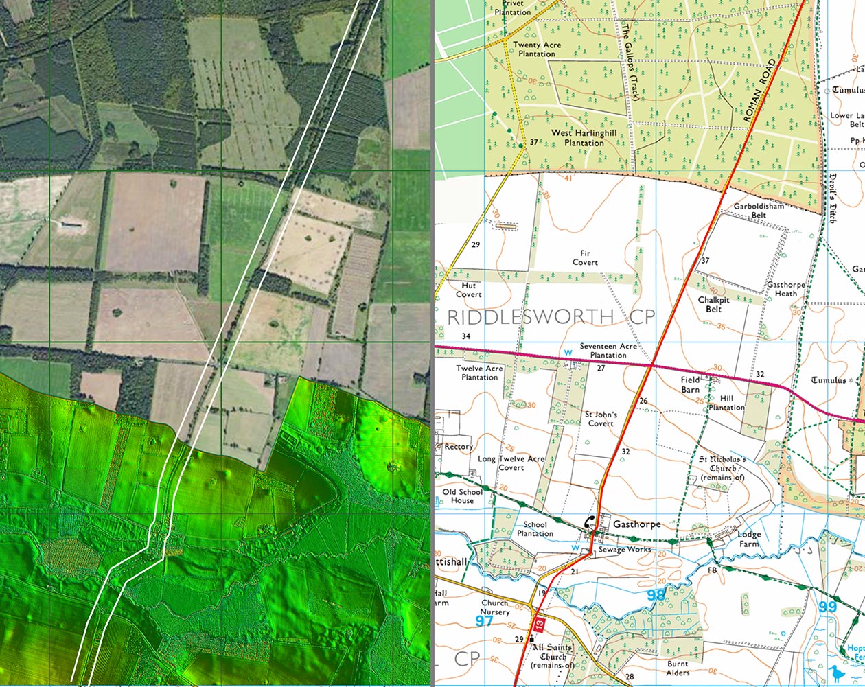
Lidar Image & Route Map 1 - Gasthorpe There doesn't appear to be any supporting Lidar evidence for the Ordnance Survey straight line coming into the county from Suffolk. I have examined several aerial photos too - some taken in draught but nothing is visible. So their straight-line approach looks unlikely and the Lidar evidence supports the route shown. It is after all typical of a river crossing to a have dog-leg to the best crossing point. |
Click for larger view
|
 |
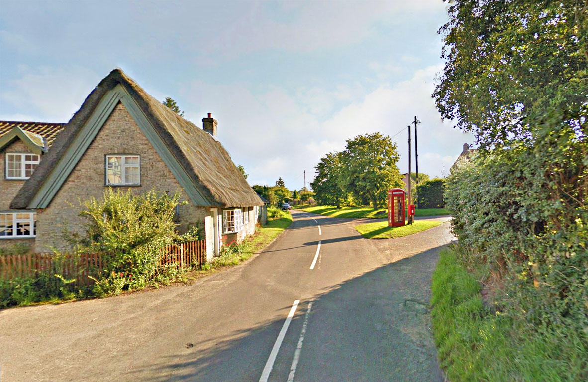
The Street, Gasthorpe Village The road name of "The Street" begins in Suffolk and continues through the pretty village of Gasthorpe. Image: Google |
Click for larger view
|
 |
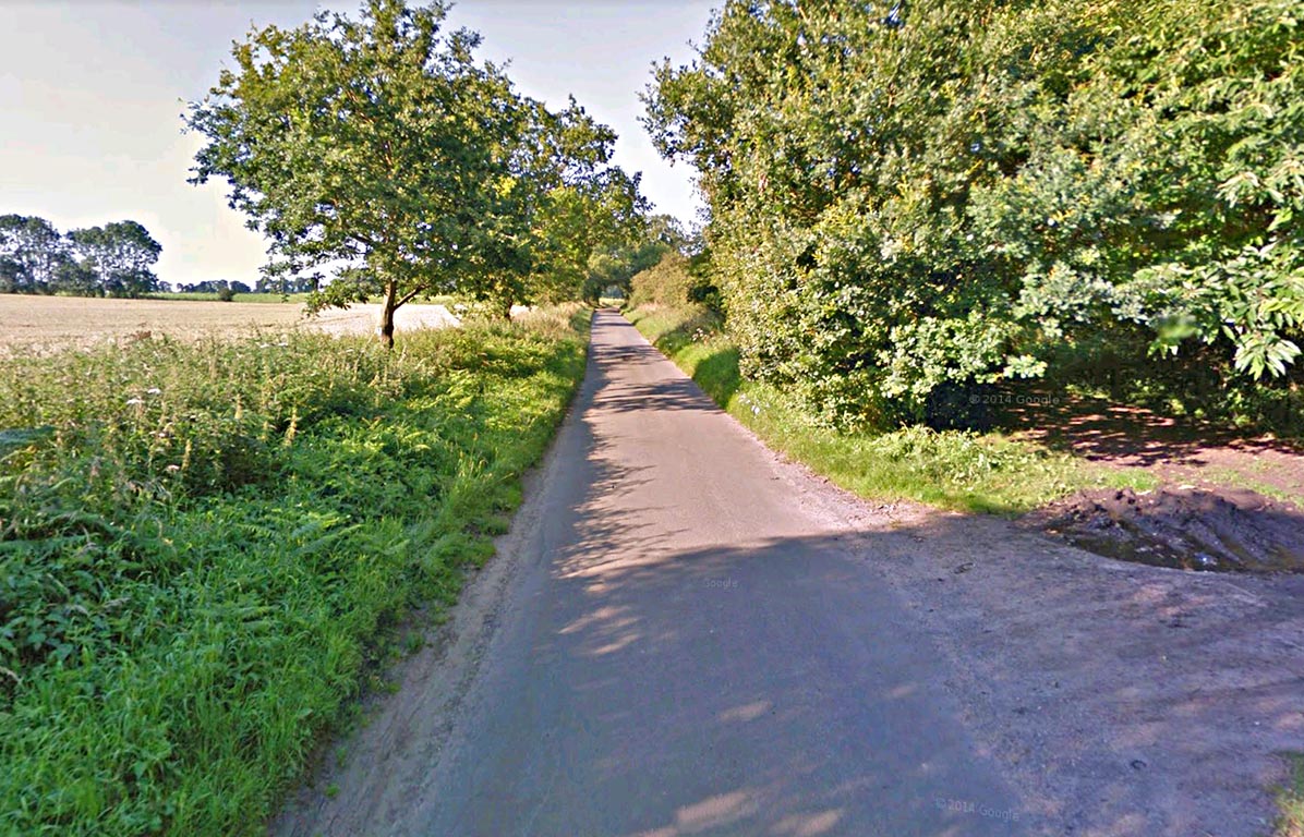
The Street, North of Gasthorpe Village The Street north of Gasthorpe is virtually straight all the way to the outskirts of East Harling. This view is typical of the road. Image: Google |
Click for larger view
|
 |
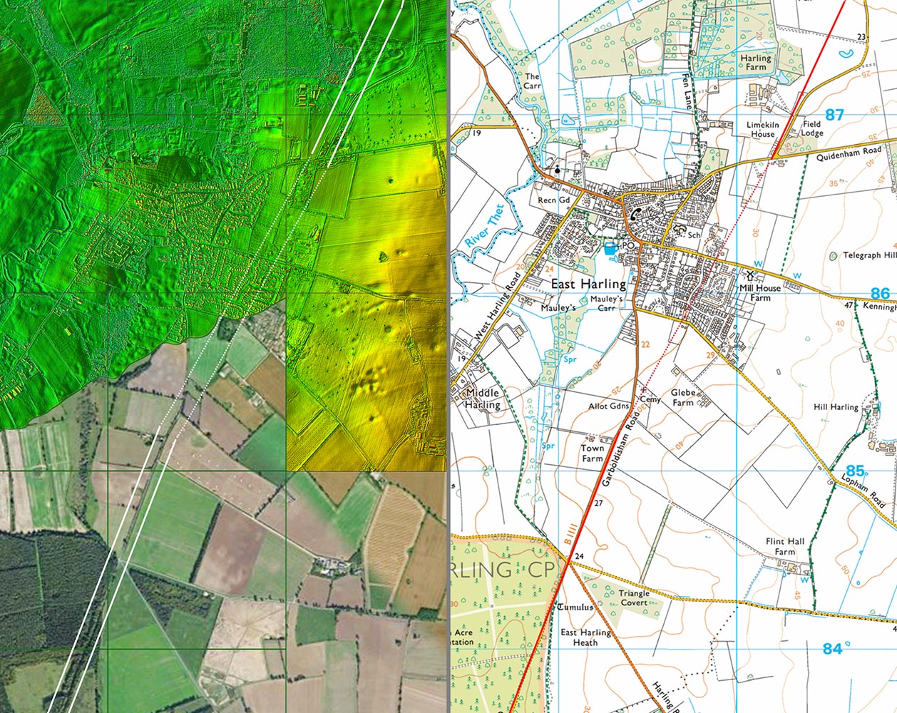
Lidar Image & Route Map 2 - East Harling The route across East Harling is a bit interpolated but there are some Lidar indications north-east of the village near Limekiln House. |
Click for larger view
|
 |
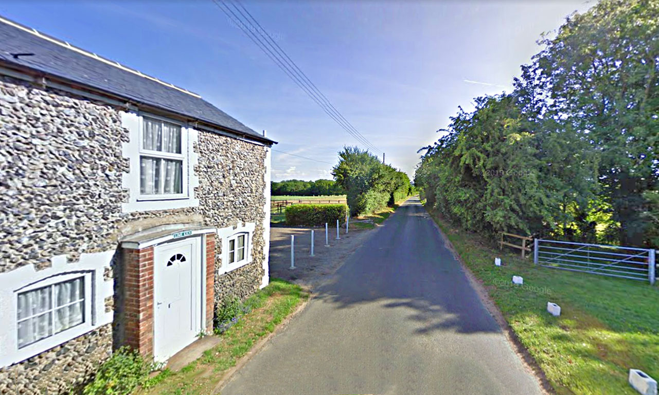
Linekiln House, East Harling Possibly the line of our road or perhaps just to left of the hedge in the field. This stretch does line in reasonably well with the route south of East Harling. Image: Google |
Click for larger view
|
 |
Lidar Image & Route Map 3 - Snetterton Just to the east of the road passing the race course at Eccles Heath are indications of a possible agger. Another piece of possible agger is visible near Gallows Hill - obviously an old road and perhaps old enough to be Roman? At the top of this map are where the two options for Haverscroft Street begin. |
Click for larger view
|
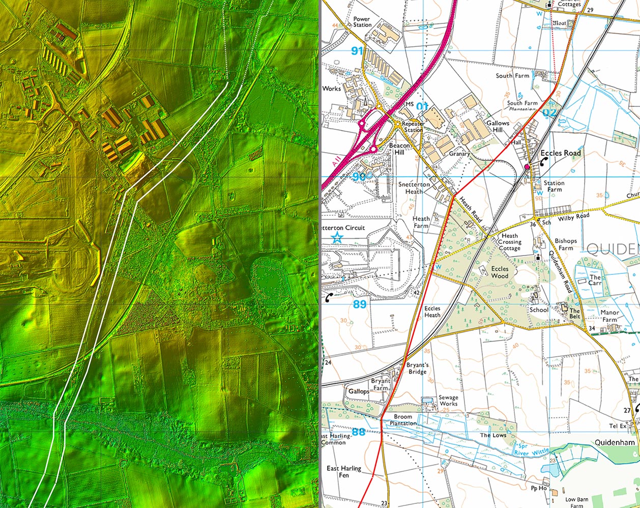 |
Lidar Image & Route Map 4 - Haverscroft Street I have shown two possible routes at Haverscroft Street and surely the name indicates a road here somewhere. I have also plotted two options across Attleborough but both are best regarded as speculative. |
Click for larger view
|
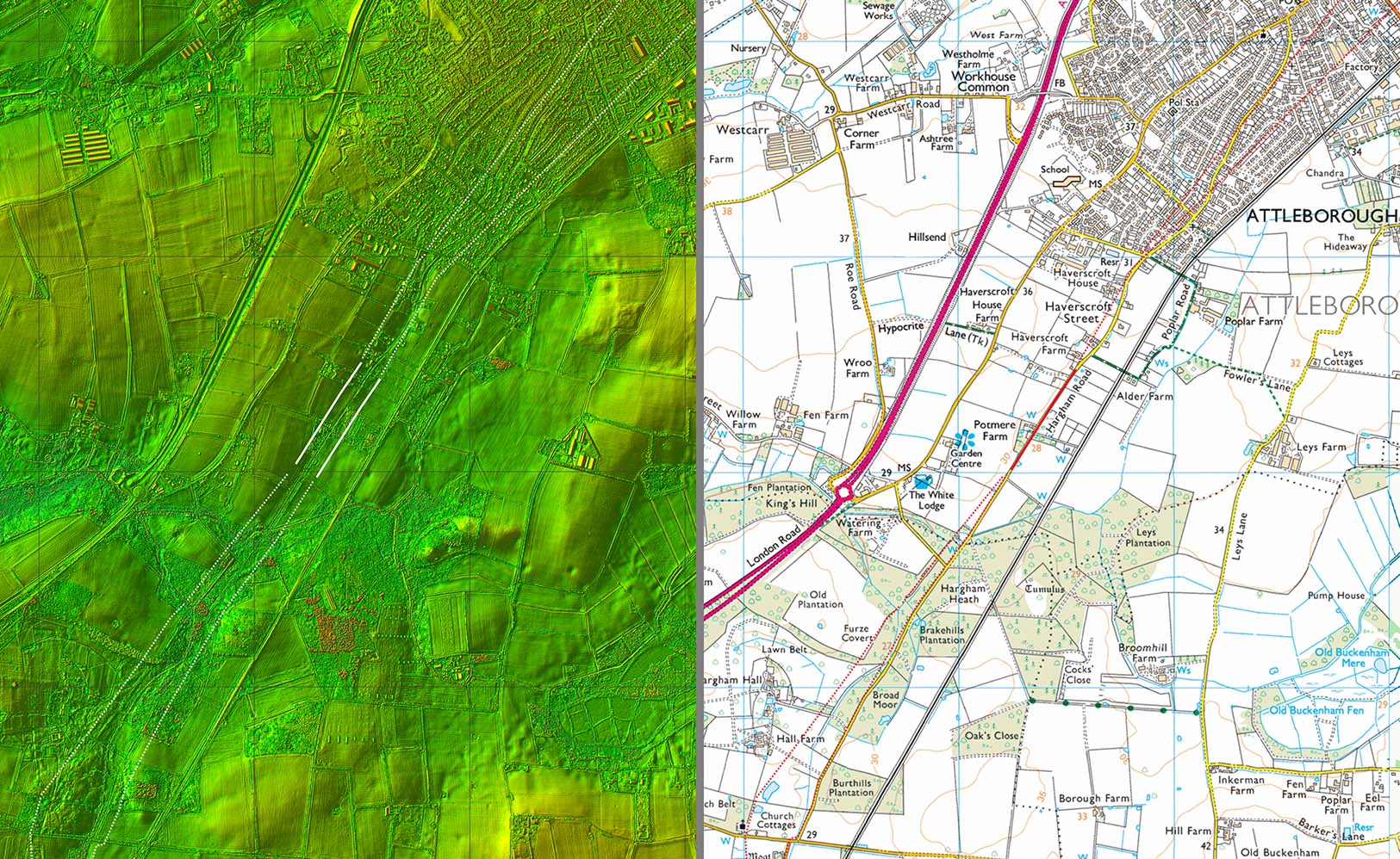 |
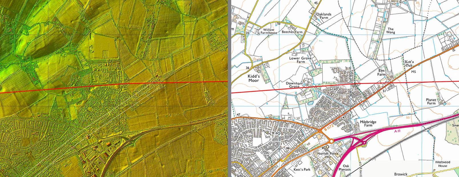
Lidar Image & Route Map 5 - Attleborough North of Attleborough the two line options merge and head for the old Norwich Road. |
Click for larger view
|
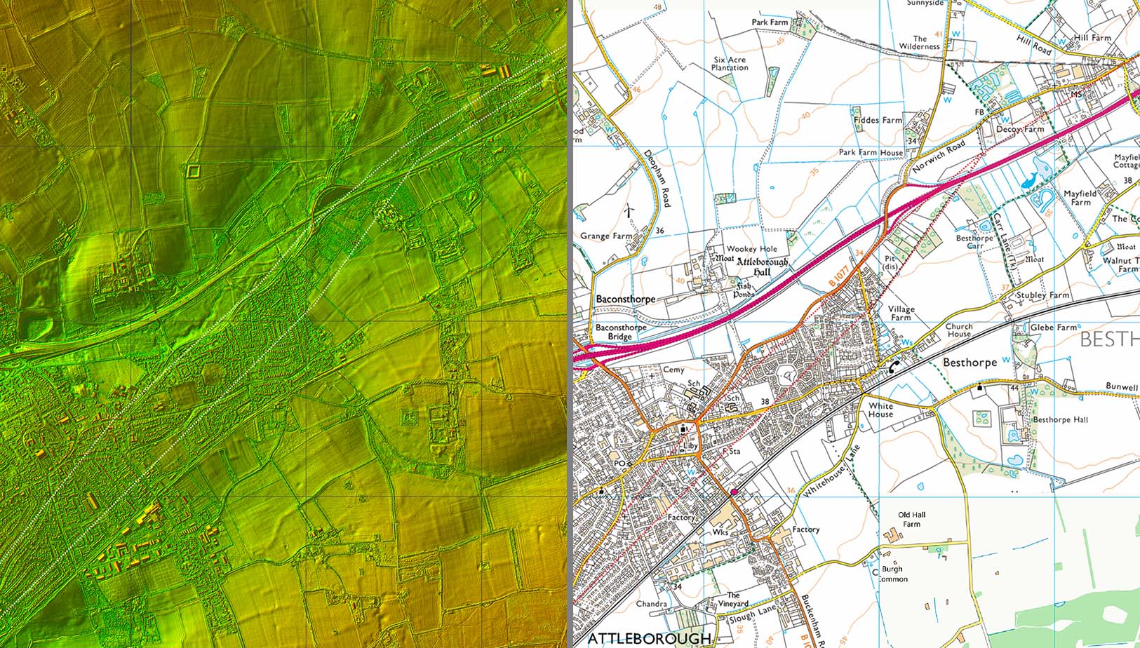 |
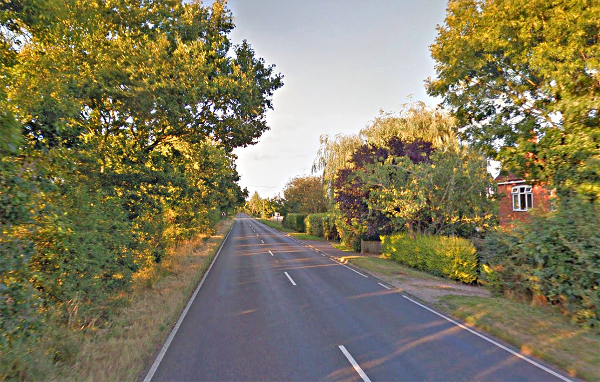
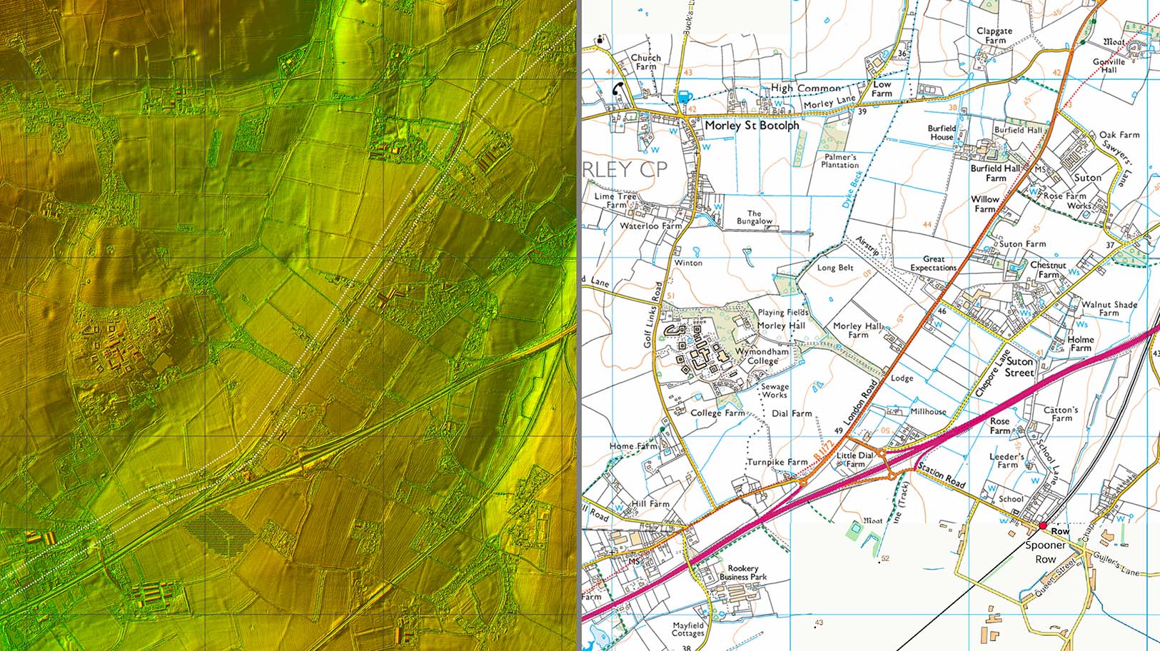
London Road, Sutton Street Old London Road at Sutton Street - it is nice and straight so is probably the best candidate for our road north of Attleborough Image: Google |
Click for larger view
|
 |
Lidar Image & Route Map 6 - Sutton Street This is the map of the London Road view above. |
Click for larger view
|
 |
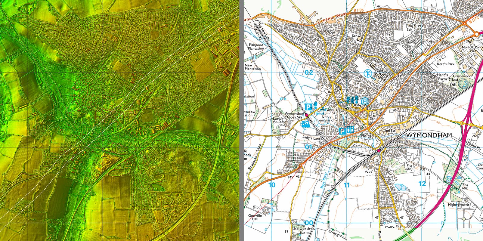
Lidar Image & Route Map 7 - Wymondham Across Wymondham the existing road system does seem a sensible option for the route of the Roman road. |
Click for larger view
|
 |
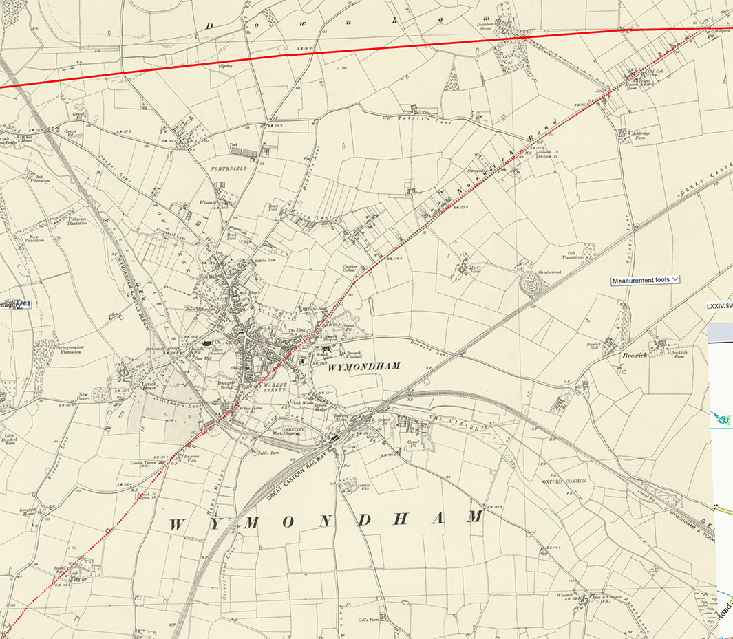
OS First Edition Map, Wymondham Again the route is somewhat speculative but it does look a logical course for the road. |
Click for larger view
|
 |
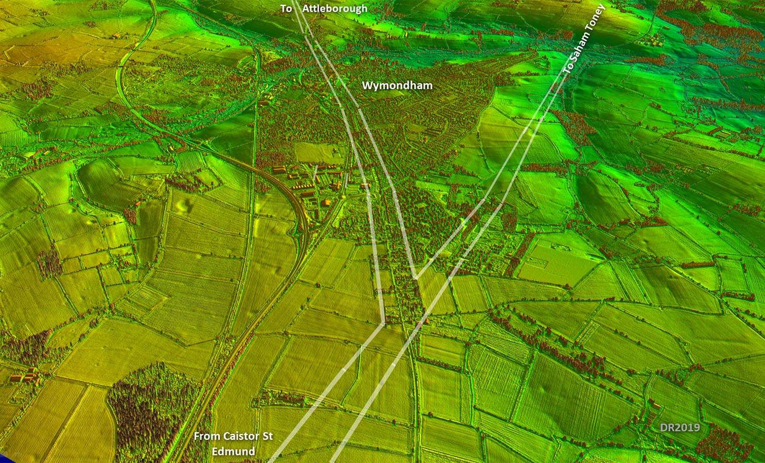
Oblique Lidar Image - Possible Junction north-east of Wymondham It would be a sensible location for joining the Saham Toney to Caistor road but not really any Lidar evidence to support it. |
Click for larger view
|
 |
Lidar Image & Route Map 8 - North-East of Wymondham The possible junction site. |
Click for larger view
|
 |
|
|
|
Last update: May 2021 |
© David Ratledge |