|
The Fen CausewayMargary Number: 25 & 38Distance: 31 miles (Water Newton to Denver)A road of 2 halves. The first half across the Fens i.e. the Fen Causeway is well established at least as far as Denver. East of here then its route and destination has been the subject of much speculation. Margary and the Norfolk HER suggested it continued via Billingford & Brampton and on to Smallburgh. This was dismissed by Albone and the latest information would suggest its target was not Smallburgh - or at least not directly. We will treat it in 2 sections - first to Denver and second east of Denver, the dry land part Although the Fen Causeway (across the Fens) is well researched and located it is a complex structure comprising a canal and, at least in some places, two roads one on either side of the canal (ref. Wallis). The southern road would appear to be the main road and that is what is depicted in Route Maps 1 & 2. The two roads and the canal are plotted on an additional map for Nordelph - these are based on Wallis's map with a few minor adjustments based on the Lidar data. Ref: Roman Routeways across the Fens, Heather Wallis, EAA Occasional Paper 10 (2002) HER 2796 |
Historic Counties: Norfolk & Cambridgeshire Current Counties: Norfolk & Cambridgeshire HER: Norfolk & Cambridgeshire
|
|
|
|
|
|
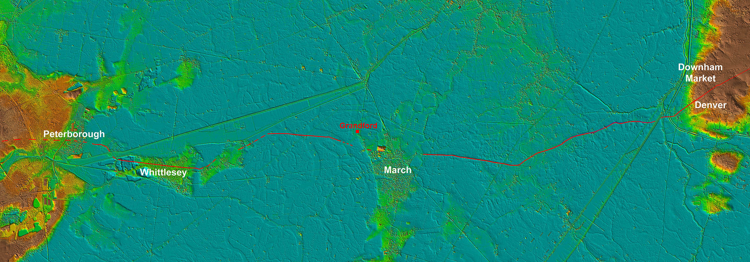
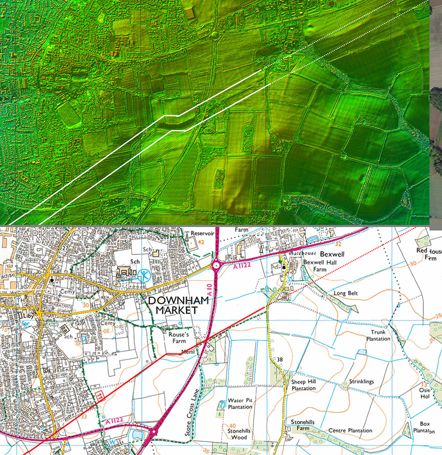
Lidar Image - Peterborough to Denver The logic of the Roman route becomes obvious when the lidar image of the Fens is examined. Coming from the dry land at Peterborough the route exploited the "islands" at Whittlesey and March. East of March it would have been even more onerous and this section incorporated a canal as well as a road. My guess is the canal would have been primarily as a drainage cut-off. |
Click for larger view
|
 |
Cambridge Section |
||
Oblique Lidar Image - Durobrivae looking East Durobrivae (Water Newton) was located alongside Ermine Street on the south bank of the River Nene. It was clearly an important road junction and there was even another road not depicted heading out form the town's south-west gate (Margary 570). The route of the Fen Causeway shown is that indicated by Lidar rather than the one depicted on modern OS mapping. |
Click for larger view |
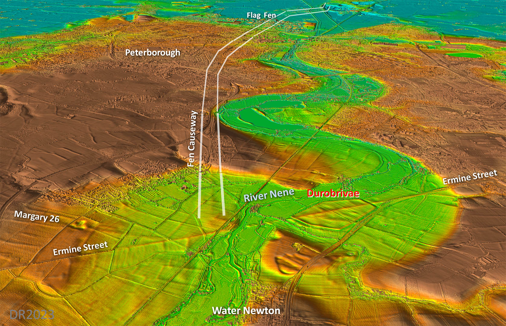 |
Cambridge Section - Route Map 1 The route from Durobrivae shown is what Lidar inicates as the most likely route of the Fen Causeway. This differs from the traditional route which went further to the north. There does not seem to be anything supporting that route so I have gone with what the Lidar is showing. |
Click for larger view |
 |
Oblique Lidar Image - Flag Fen Once out of Peterborough evidence returns although somewhat faintly. It looks like the road respected Flag Fen and skirted around it before heading for the (relatively) high ground of Whittlesey. |
Click for larger view |
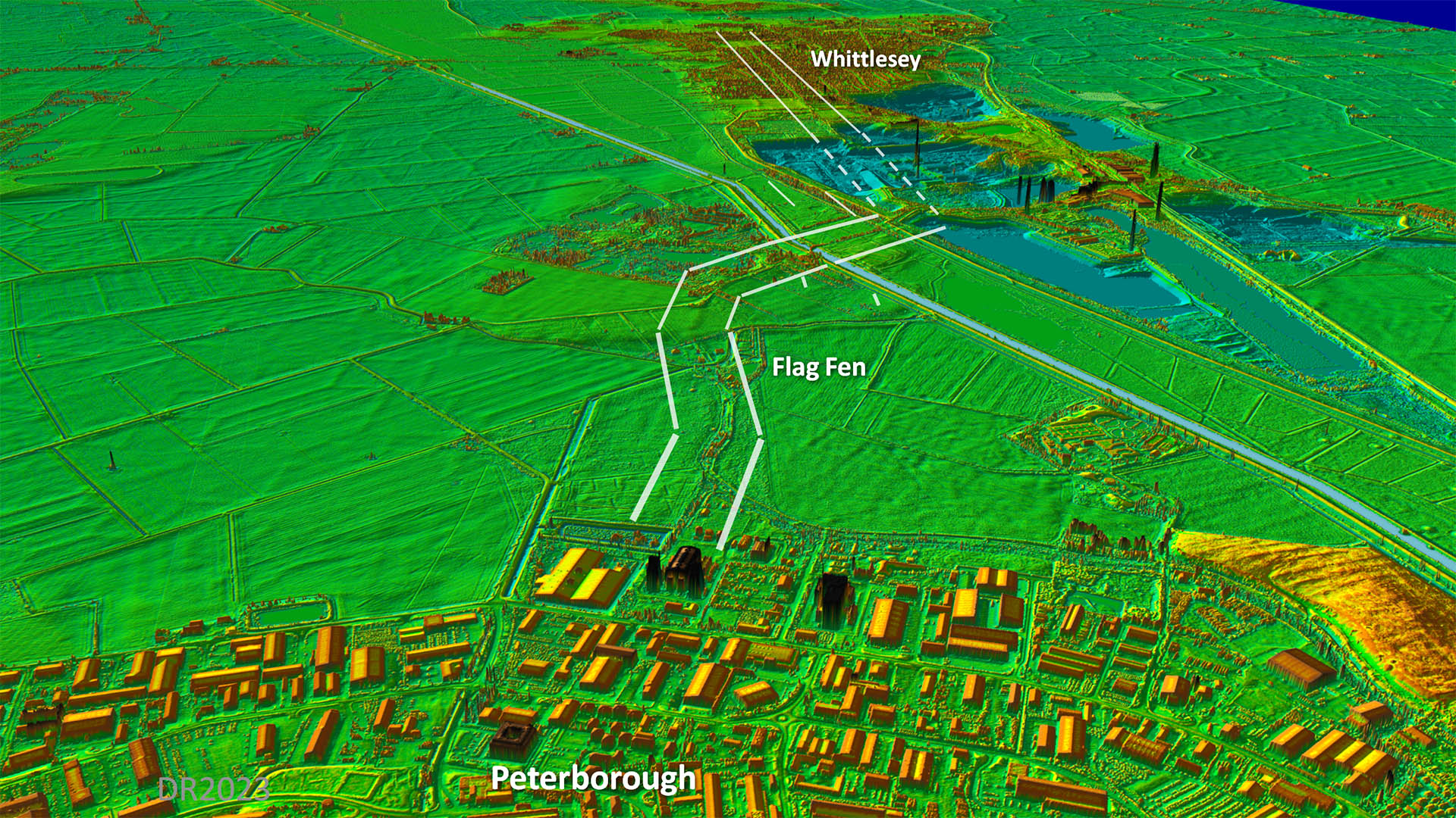 |
Cambridge Section - Route Map 2 The route across Peterborough is speculative but the district of Fengate is a big clue at least to its approximate course. |
Click for larger view |
 |
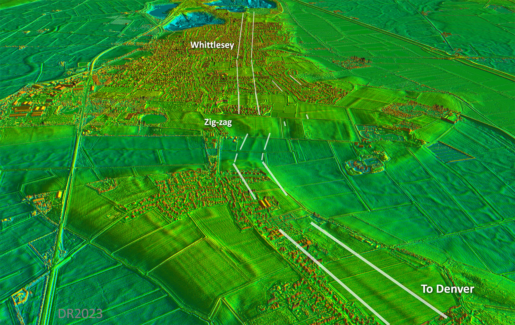
Oblique Lidar Image - Looking back to Whittlesey Enough has survived across Whittlesey to be confident in the route here. Looks like a lovely classic zig-zag down to an old river course. |
Click for larger view |
 |
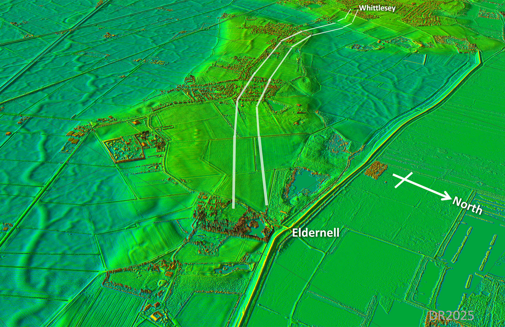
Oblique Lidar Image - Eldernell Again looking back towards Whittlesey but slighly further along at Eldernell The road clearly targets Eldernell where there was a small Roman settlement. |
Click for larger view |
 |
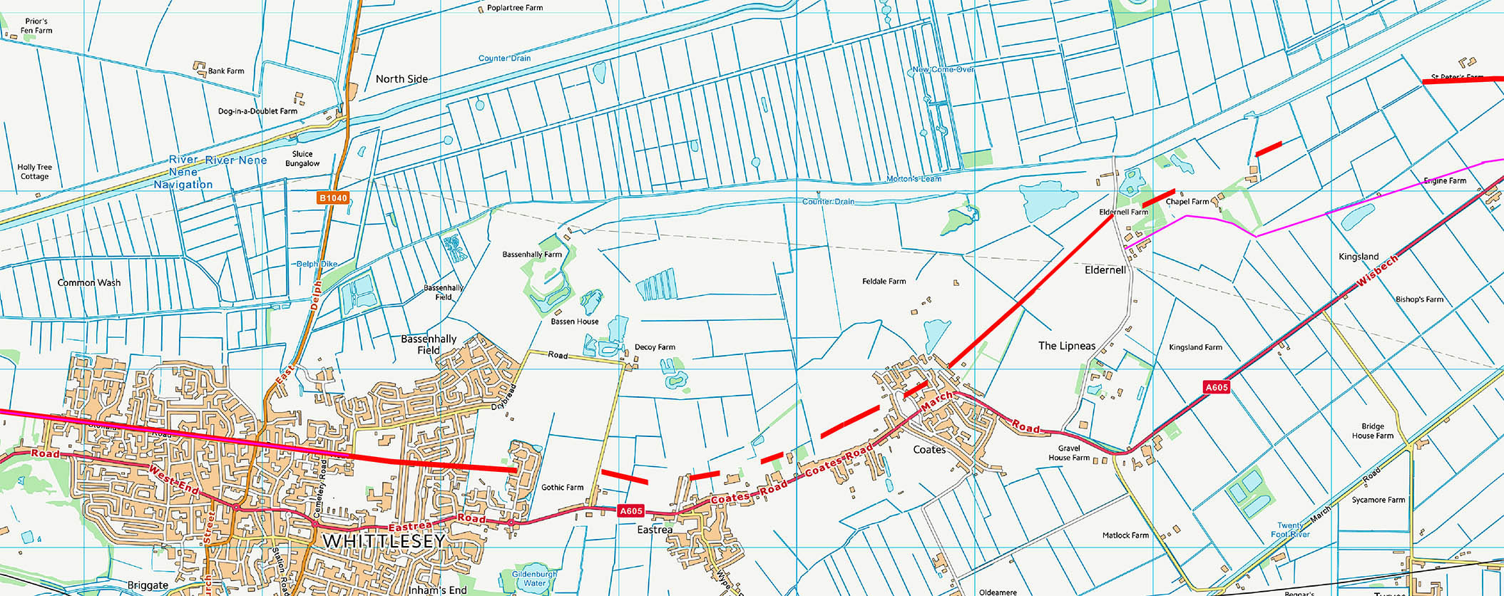
Cambridge Section - Route Map 3 Across Whittlesey the route is marked by the modern road but towards Coates then it becomes more tenuous. |
Click for larger view |
 |
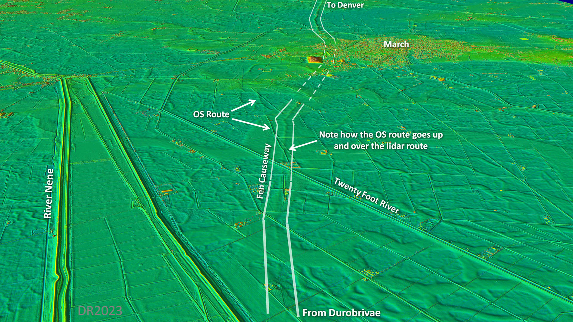
Oblique Lidar Image - Approaching March The route indicated by Lidar is obvious and very sensible heading over an old roddon. It keeps to the highest ridge of the roddon whereas the traditional route depicted on OS maps heads for low ground. There can be little doubt that the route over the roddon is the correct course for the Fen Causeway - it does also align much better with the route east of March. |
Click for larger view |
 |
Cambridge Section - Route Map 4 The section towards March is obvious and logical - it follows the high ridge of a roddon. The OS line (magenta) is actually on lower ground and does not seem a very sensible route at all. |
Click for larger view |
 |
Lidar Image - March Across March it is a puzzle. The sudden stop of the west side of March is very odd. The old river roddon it has been following swings north and the course is heading for what looks like low marsh land. A straight on course doesn't look sensible. Another issue is where was the was the River Nene in Roman times? Is it where the Old River Nene is now going through March?. |
Click for larger view |
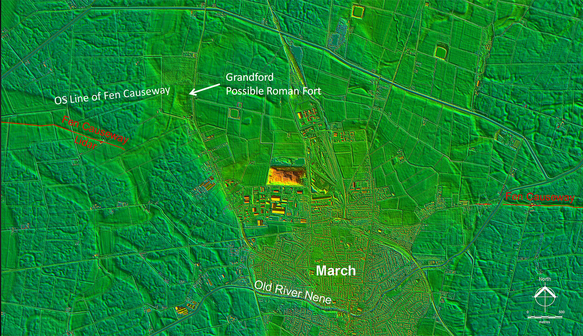 |
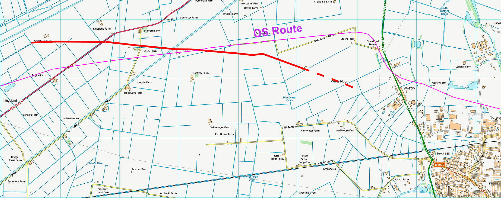
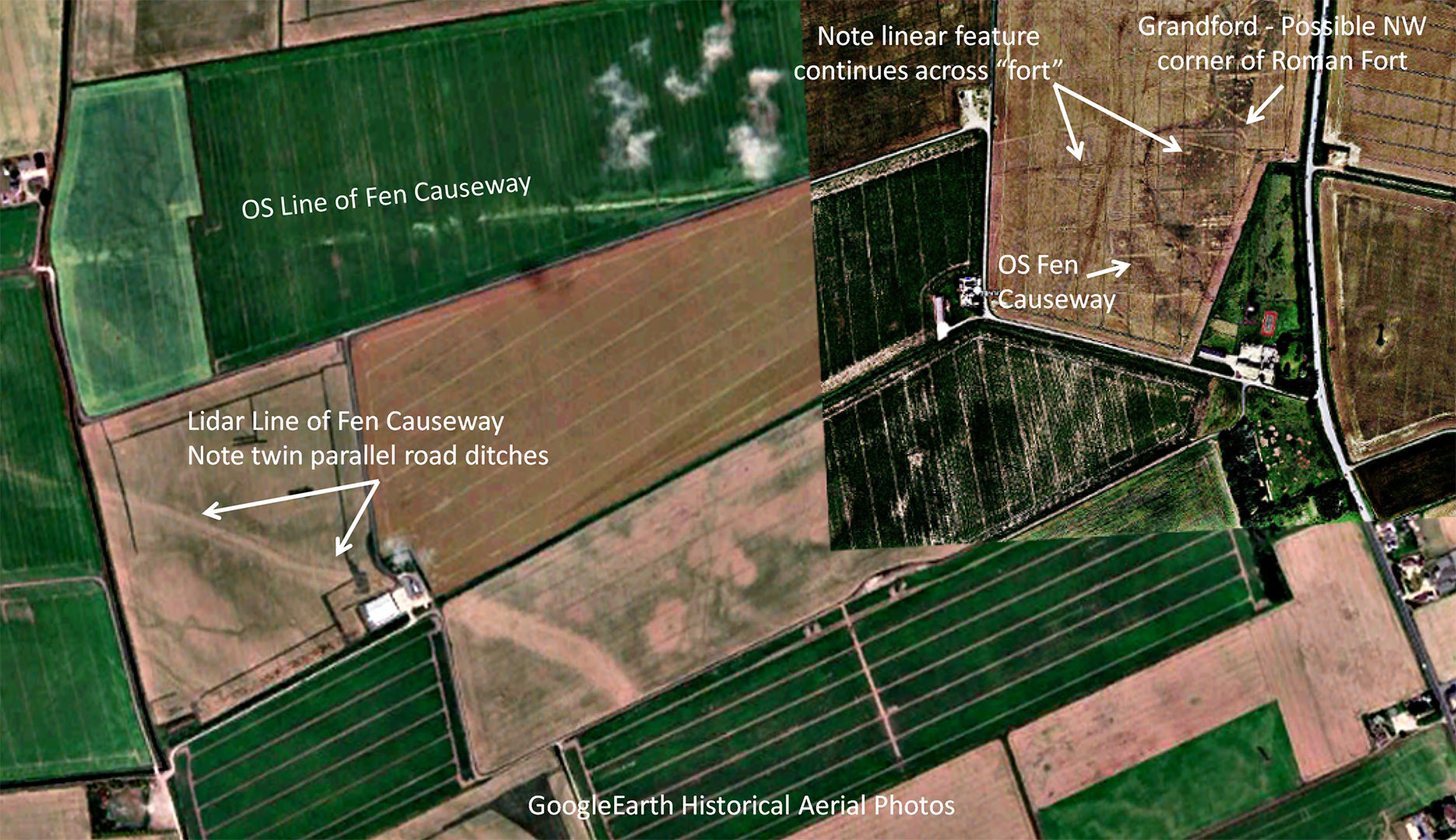
Aerial Photography - Approaching March Trying to resolve the route across March then I was made aware of a possible Roman fort at Grandford by David Staveley's video. It is a logical postion - half way across the Fens and is actually on the highest point here - at the dizzy height of 3.5metres AOD. The linear feature the OS plot as the route for the Fen Causeway actually continues across the fort rather than turning south as they show for their route. It certainly is a feature - lidar confirms it - but I am not convinced it is the road line. It is not uncommon for Roman forts not to be located on the road. In this case choosing the hightest poit around was common snese. In addition the Lidar route has what appears to be surviving parallel road ditches - very supportive of a Roman road. |
Click for larger view |
 |
Cambridge Section - Route Map 5 Across March I have not depicted a route for the reasons above. East of March then the line becomes very obvious and very straight - a typical Roman alignment. This section does not follow an old roddon so must have been a constructed causeway by the Romans - a huge undertaking.. |
Click for larger view |
 |
Norfolk Section 1 - Across the Norfolk Fens to Denver |
||
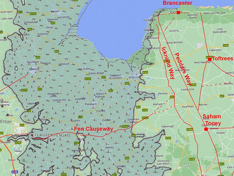
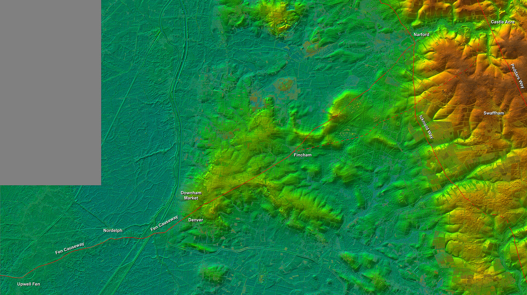
Norfolk Section - Lidar Image The crossing of the Fens only makes sense if the road then coonnected into the Norfolk road network - surely the Icknield Way and Peddars Way. |
Click for larger view
|
 |
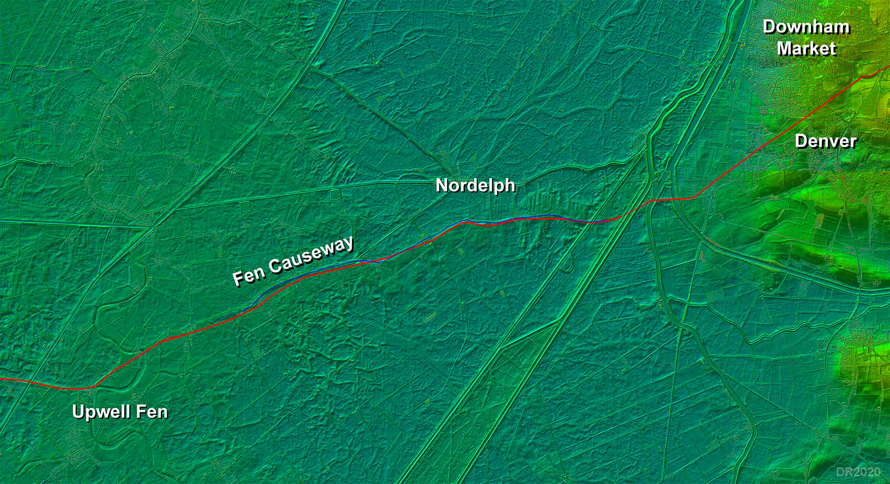
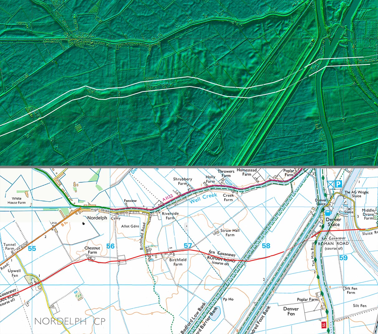
Lidar Image - Route Upwell to Denver The Fens stretch of the road and canal (shown in blue). At Denver it is on dry land and using the name The Fen Causeway seems a bit in appropriate. The causeway enters the county in Upwell Parish crossing the Old Croft River. The actual course it follows is un-Roman like taking a very sinuous course along old roddons (old natural watercourses). Having said that, it does manage to keep reasonably direct. |
Click for larger view
|
 |
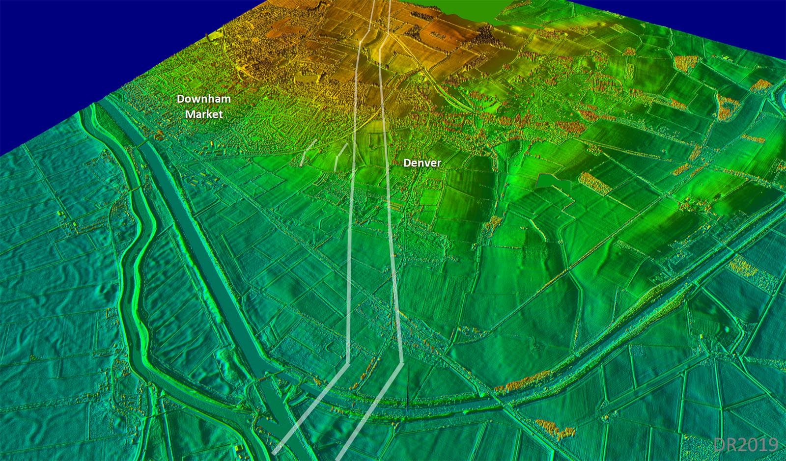
Oblique 3D Lidar Image - Fen Causeway across the Fens Why would you follow an old river course? Amazingly old river courses end up as higher ground when the peat based land around them sinks lower. Draining the fens only makes this worse. |
Click for larger view
|
 |
Lidar Image and Route Map 1 (Southern Road) The southern road (ie the one south side of the canal) is depicted here as this appears to be the final continuous through route. See later for the canal and northern route. |
Click for larger view |
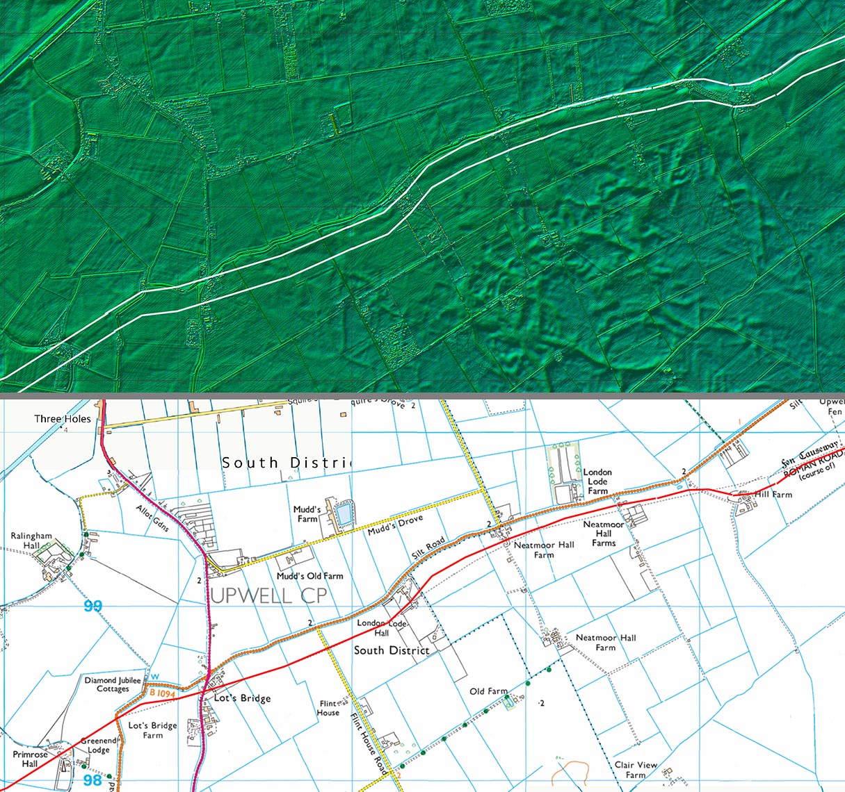 |
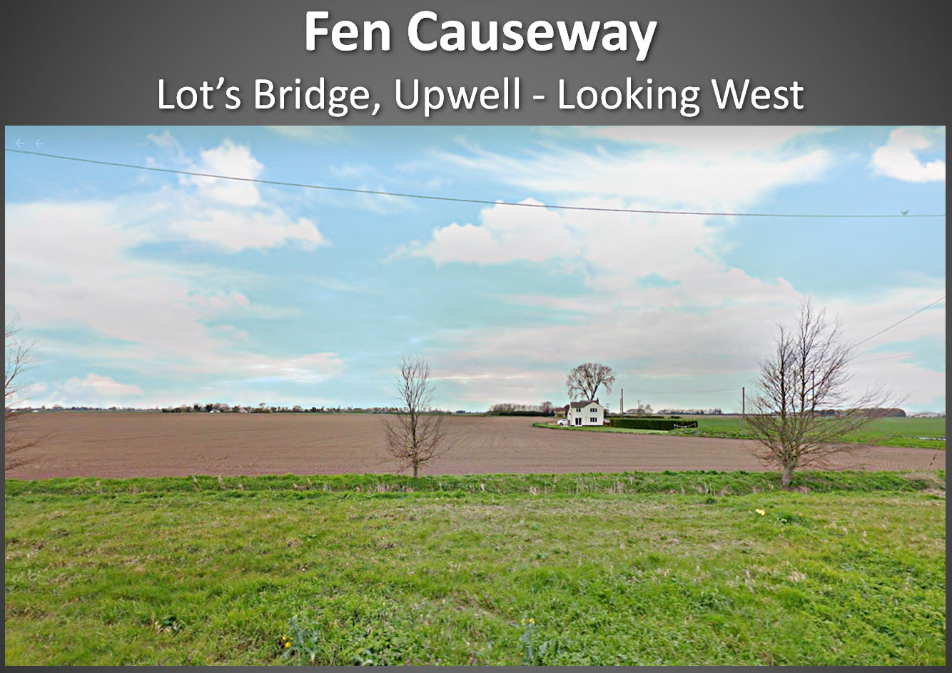
Lot's Bridge, Upwell We are looking down the line of the Canal and Roman road(s) but where have they gone? They passed to the left of the white house approximately on the line of the little tree but nothing is obvious today. Image: Google |
Click for larger view |
 |
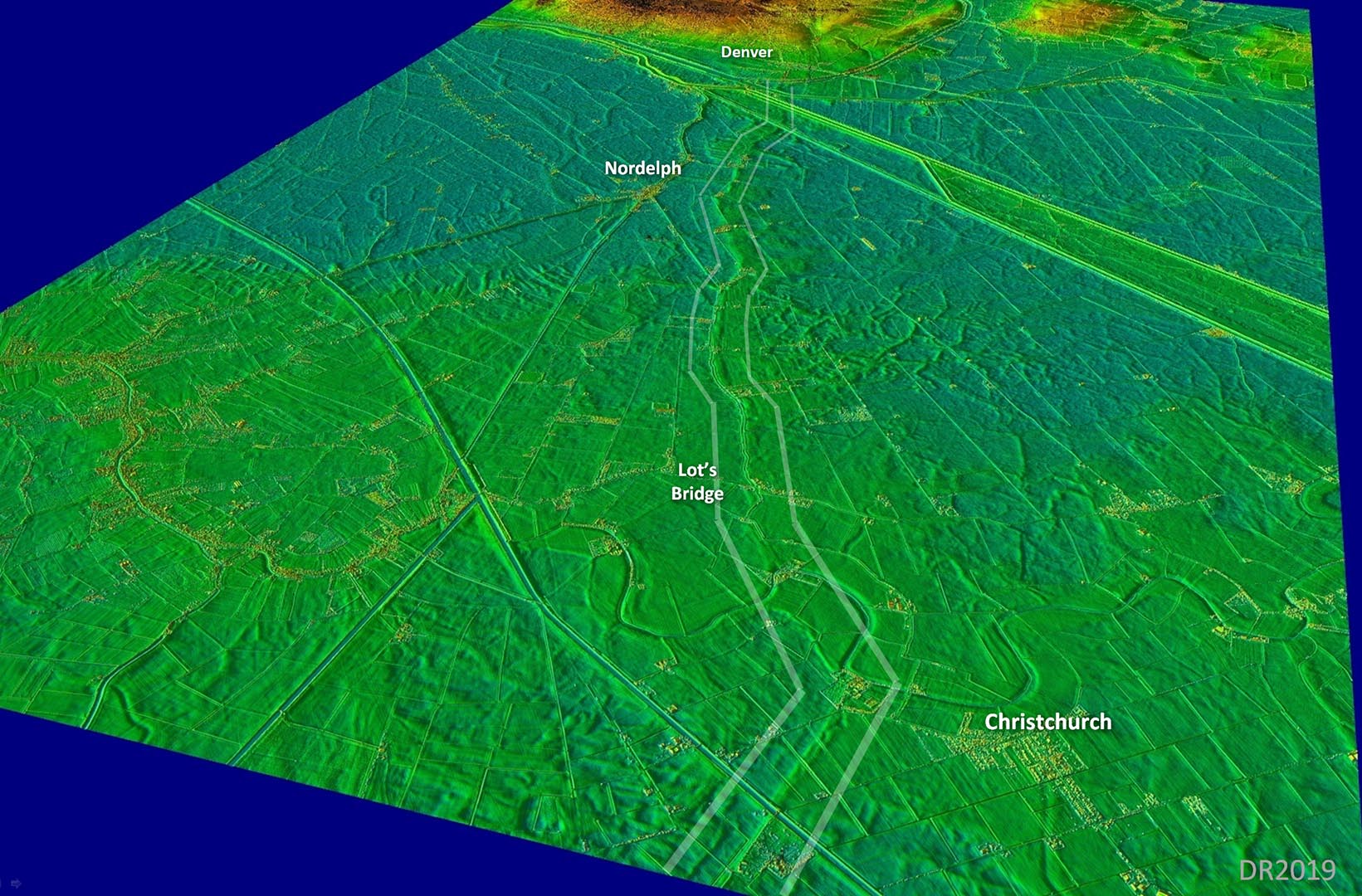
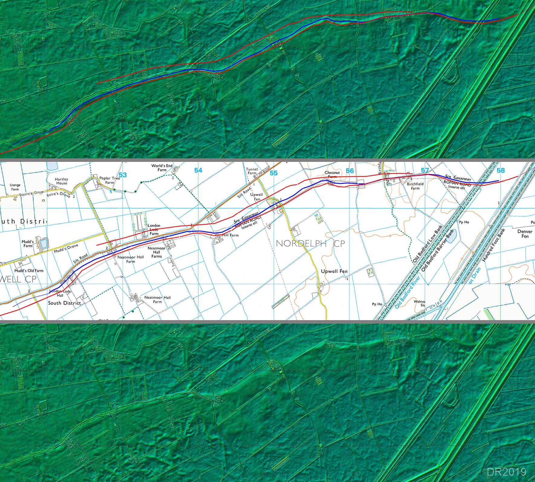
Nordelph - Northern Road, Canal and Southern Road The routes are based on Helen Wallis's map for the Nordelph area. Just a few minor adjustments where the lidar indicates the road might have actually been on a slightly different alignment. Wallis dates the northern road to be the earlier one. It surely made more sense for the road to be located on the inland more protected side and so the southern road is most likely the final route. |
Click for larger view |
 |
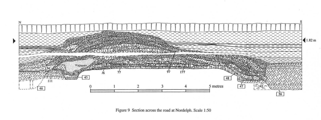
Southern Road Cross Section (Heather Wallis Figure 9) A section through the southern road was excavated in 1992. This was at site reference 2796 (TL523 990). The road had a graveled surface with ditches both sides. However, it was multi-phased with a later dump of material forming a new higher gravelled surface. From: Roman Routeways across the Fens, Heather Wallis, EAA Occasional Paper 10 (2002) |
Click for larger view |
 |
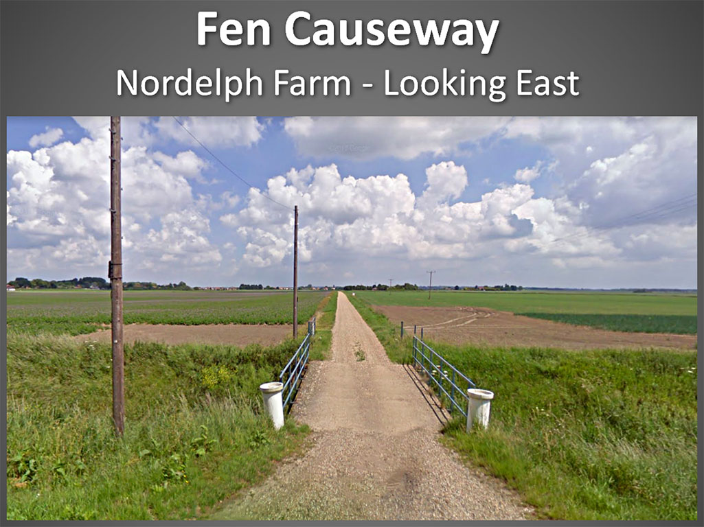
Southern Road - Nordelph Farm At Nordelph Farm this modern track follows the line of the southern road. The bridge crosses a later ditch cut through the Roman canal and roads. Image: Google |
Click for larger view |
 |
Lidar Image and Route Map 2 (Southern Road) Again just the southern road is depicted here. The canal and northern road have been omitted for clarity. |
Click for larger view |
 |
Oblique 3D Lidar Image - Denver Sluice Canal and road diverge at Denver Sluice. The road was recorded by Gurney, 1986, and his position matches exactly the alignment heading onwards. Great confirmation that the Lidar route is correct here. |
Click for larger view |
 |
Norfolk Section 2 - Denver Eastwards |
||
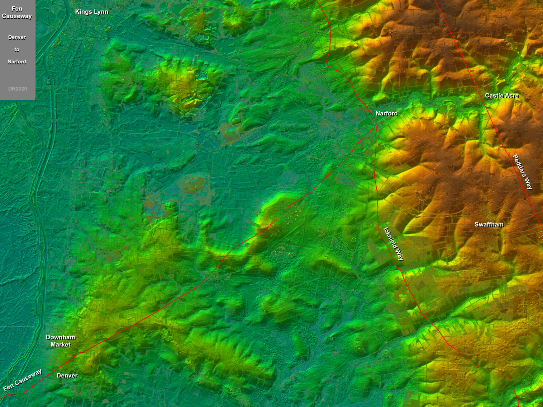
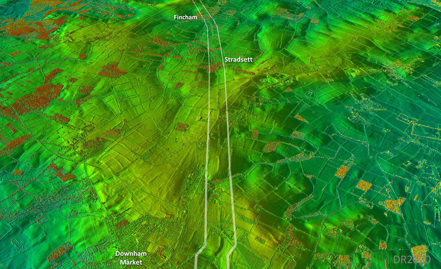
Lidar Image - Route Map Denver to the Icknield Way (and perhaps Peddars Way) It starts to make sense when viewed relative to the topography revealed in this lidar plot. The target appears to be Narford on the Icknield Way and it skillfully manages to follow dry ground to get there. |
Click for larger view |
 |
Lidar Image and Route Map 3 We are now literally on firmer ground but for this section the route is not as obvious now.
The direct line shown is based on the 3D Lidar view below and this matches Gurney's 1986 excavation exactly.. |
Click for larger view |
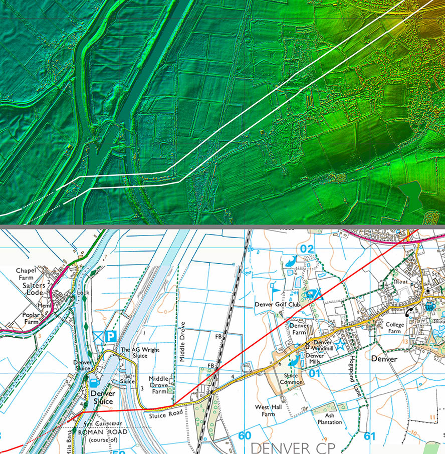 |
Oblique 3D Lidar Image - Denver Just the faintest of suspicions that the Roman alignment was north of the modern road through Denver but given Gurney's excavation matches this alignment we can be certain it is correct. |
Click for larger view |
 |
Lidar Image and Route Map 4 A little dog-leg up the little valley looks likely. Beyond this there are more definite Lidar traces so we can be confident in this stretch. |
Click for larger view |
 |
Oblique 3D Lidar Image - Stradsett No mistaking it here - typically Roman. The name Stradsett is another big clue - see later. |
Click for larger view |
 |
Lidar Image and Route Map 5 A very direct section - probably the straightest on the whole road. |
Click for larger view |
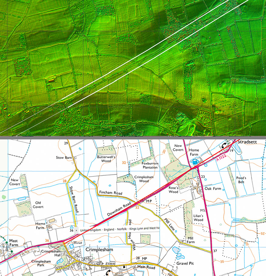 |
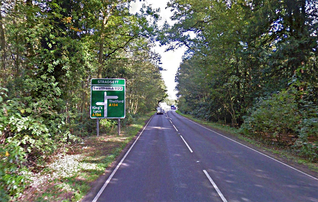
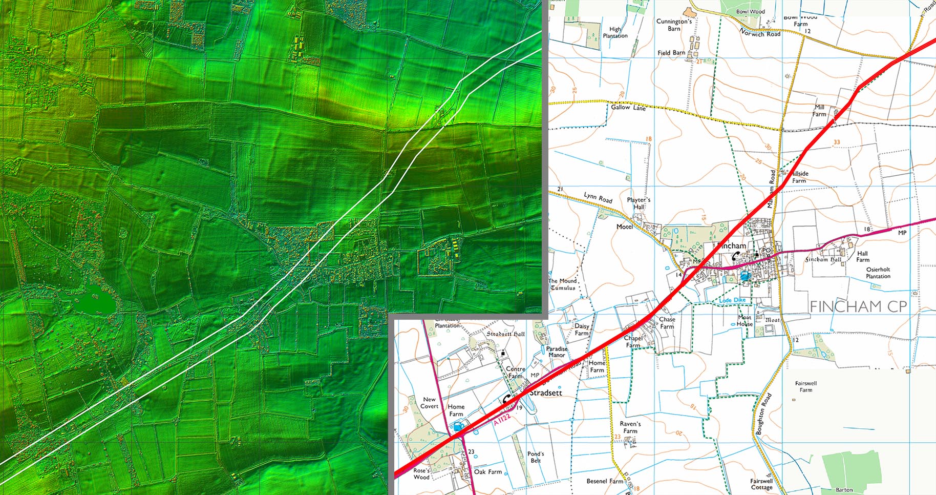
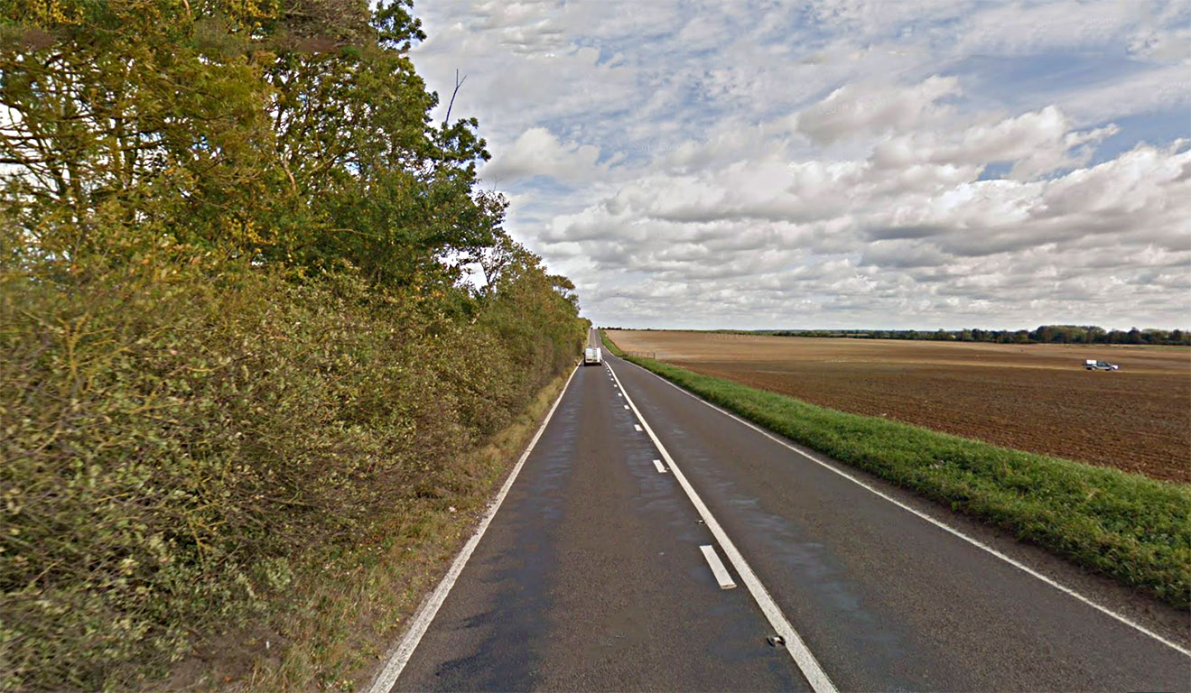
A1122 - Stradsett (Looking East) The significance of the name Stradsett has been explained by James Albone (quoting Watts): "The place-name Stradsett, which is recorded in the Domesday survey as Strateseta meaning ‘the place on the Roman road’ (Watts 2004, 584), provides firm evidence for a Roman road passing somewhere through the parish." There can be little doubt that the road that its name derives from is the Fen Causeway, today approximated by the A1122. |
Click for larger view |
 |
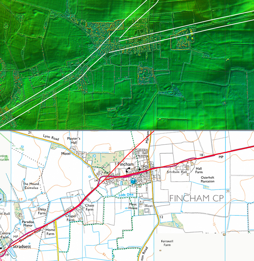
Lidar Image - Possible Roads at Fincham At Fincham there is the possibility that that there was a junction with a second more southerly route to the Icknield Way by Swaffham. This was very much dismissed by Albone. It is described at the bottom. We will continue here on the north-easterly route of Fen Causway towards Narford. |
Click for larger view |
 |
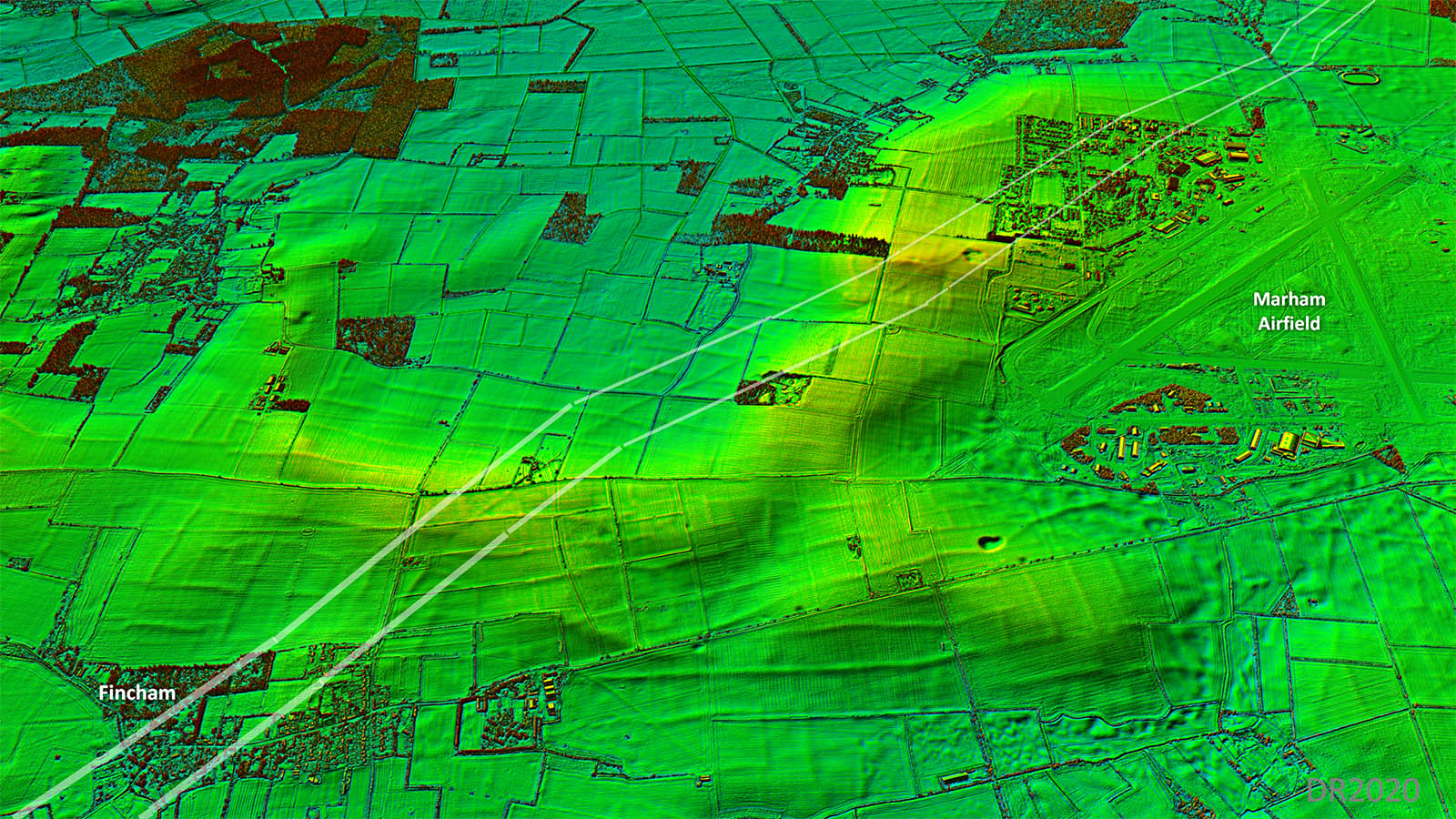
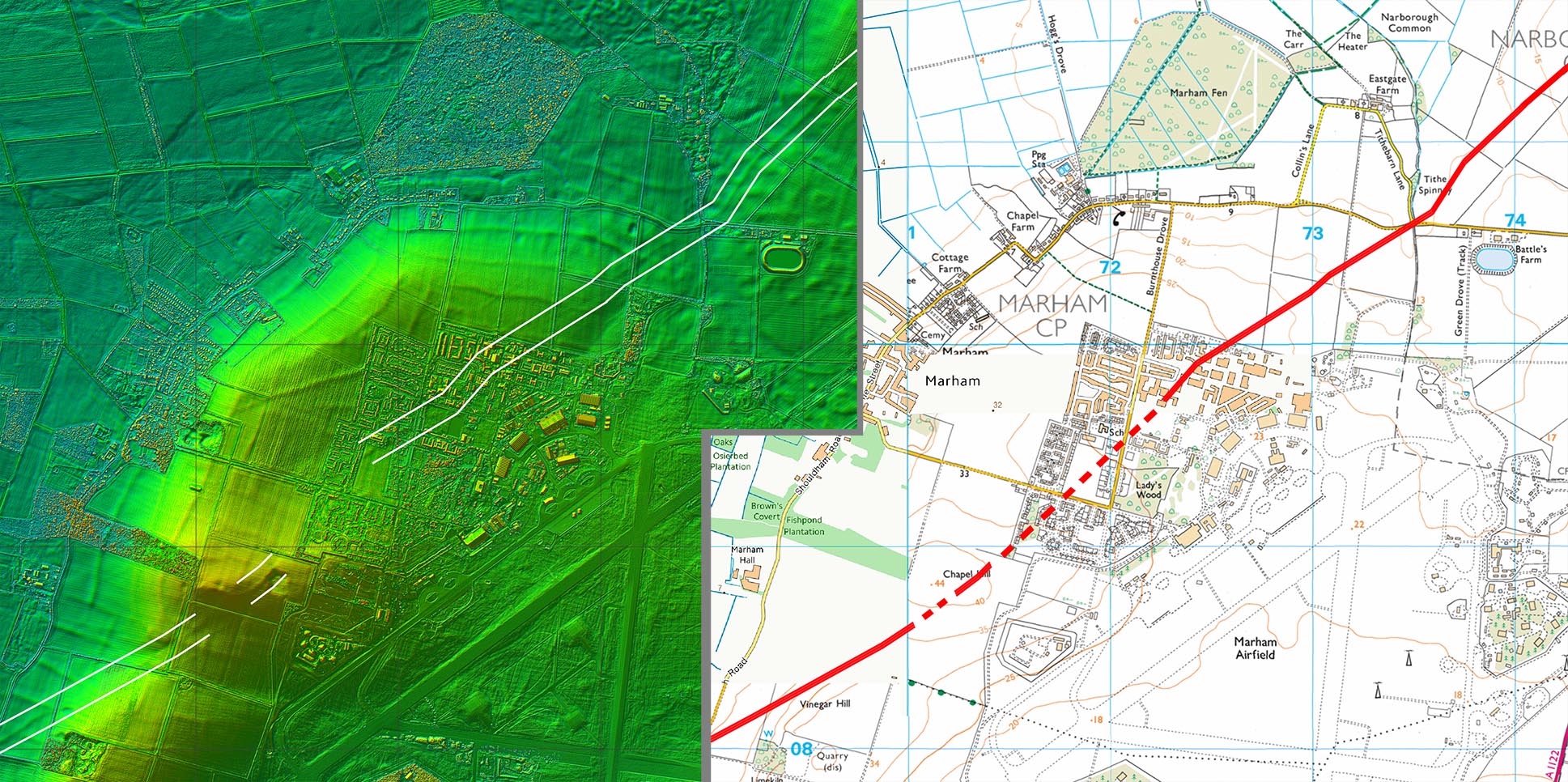
Oblique 3D Lidar Image - Marham Airfield From Fincham the direct alignment we have been following through Stradsett changes slightly and from here to Narford, although reasonably direct, the road does start to wander a little. This is slightly worrying but perhaps it was based on a pre-Roman route? |
Click for larger view |
 |
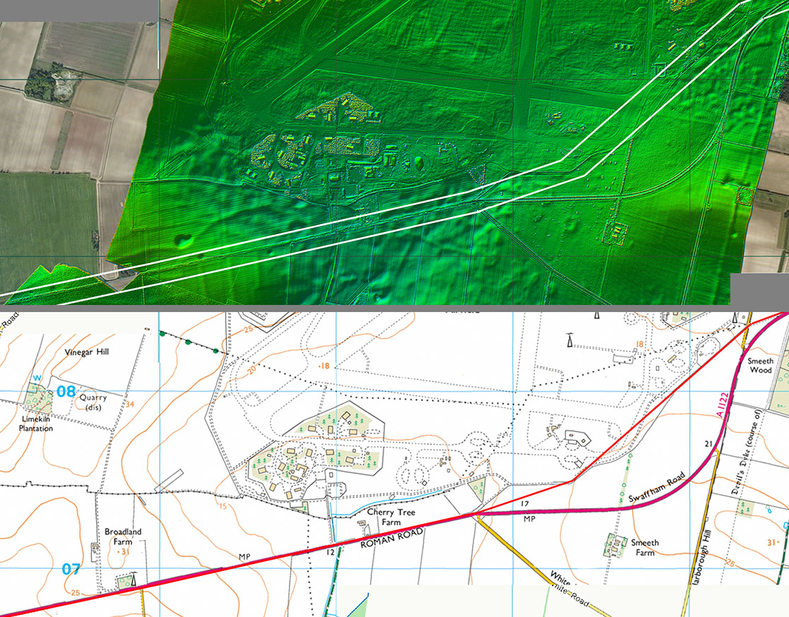
Lidar Image and Route Map 6 At Fincham our road continues more or less straight on whereas the modern A1122 swings due east. The latter looks very Roman-like but is a turnpike road. Research by Albone found that the turnpike was a new road with no predecessor. The Ordnance Survey however do label it as Roman Road.. |
Click for larger view |
 |
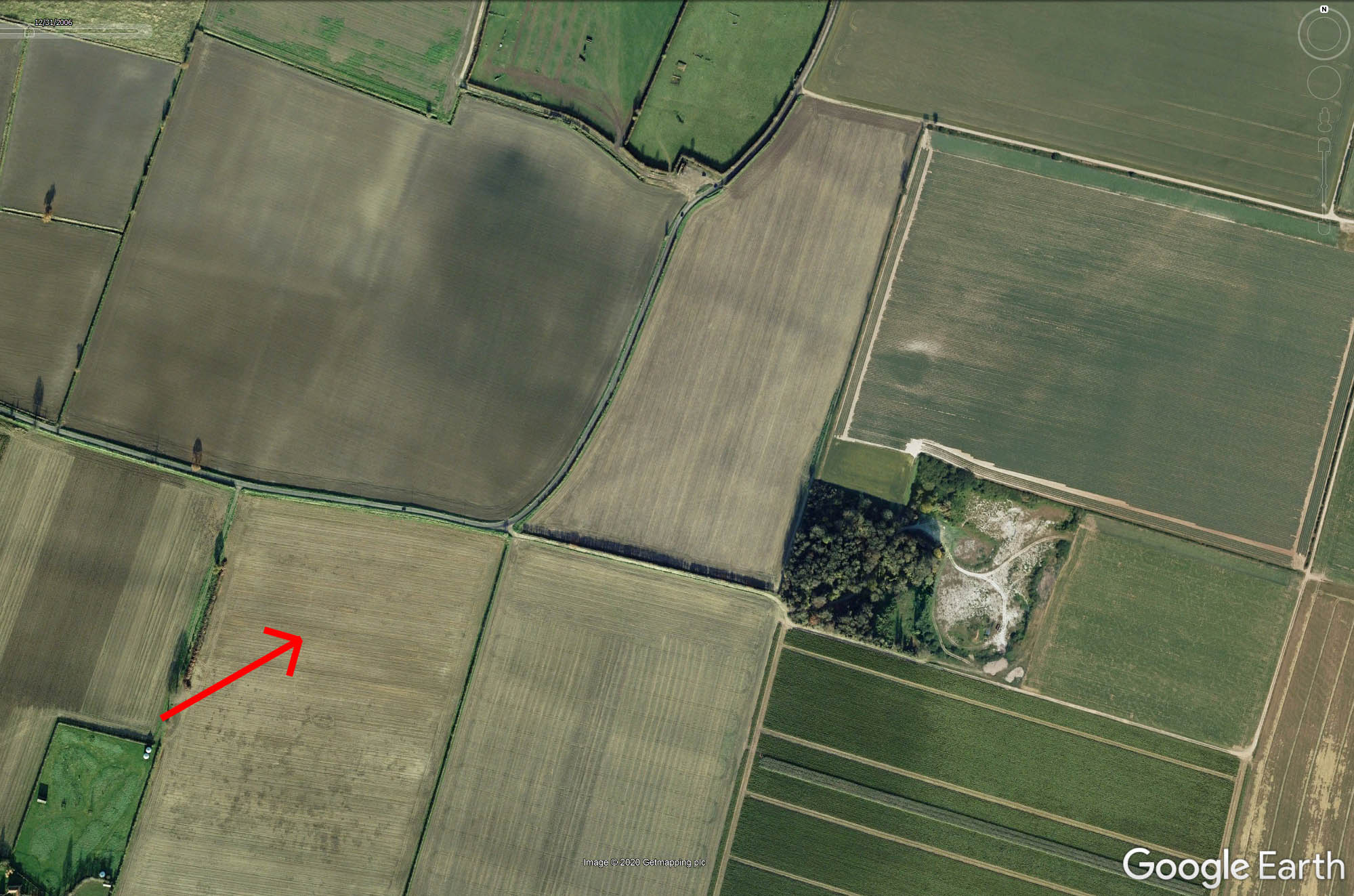
Vinegar Hill - Google Earth Image The line of the road shows well in this Google Earth historical aerial photograph.
|
Click for larger view |
 |
Lidar Image and Route Map 7 The airfield has destroyed any trace of the assumed change of alignment here so we are reliant on interpolation here. |
Click for larger view |
 |
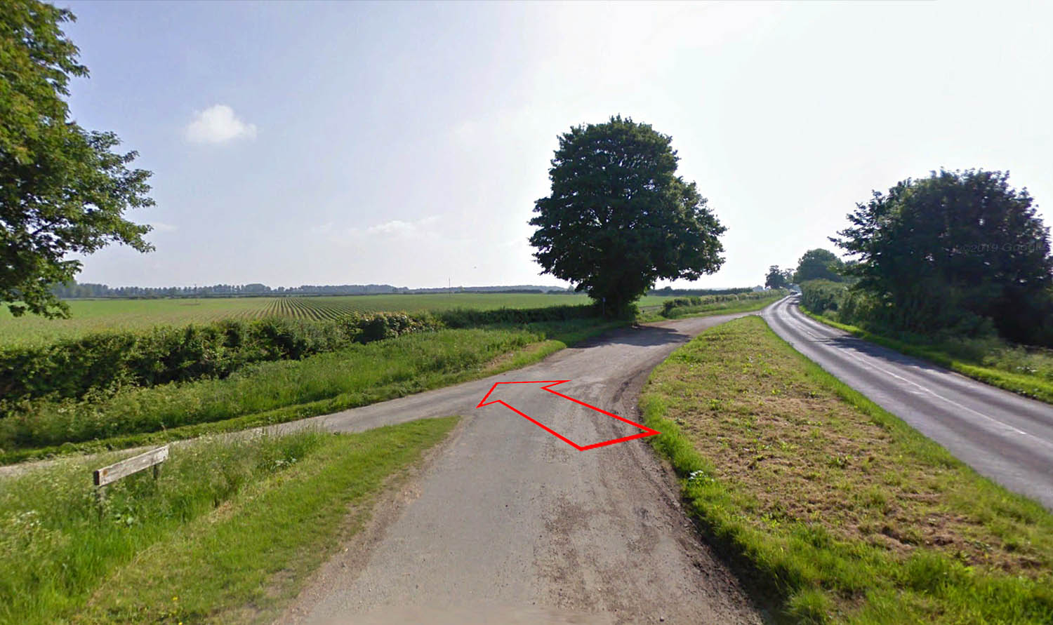
Tithebarn Lane We cross the Narborough parish boundary at the bottom of Tithebarn Lane. Not a lot to see but at least there is not a red and white post marking an underground pipeline. Every Roman road hunter's nightmare!
|
Click for larger view |
 |
Lidar Image and Route Map 8 The junction with the Icknield Way is a bit subjective. There a few faint traces on the line I show but the modern Narford Road could also be the line. |
Click for larger view |
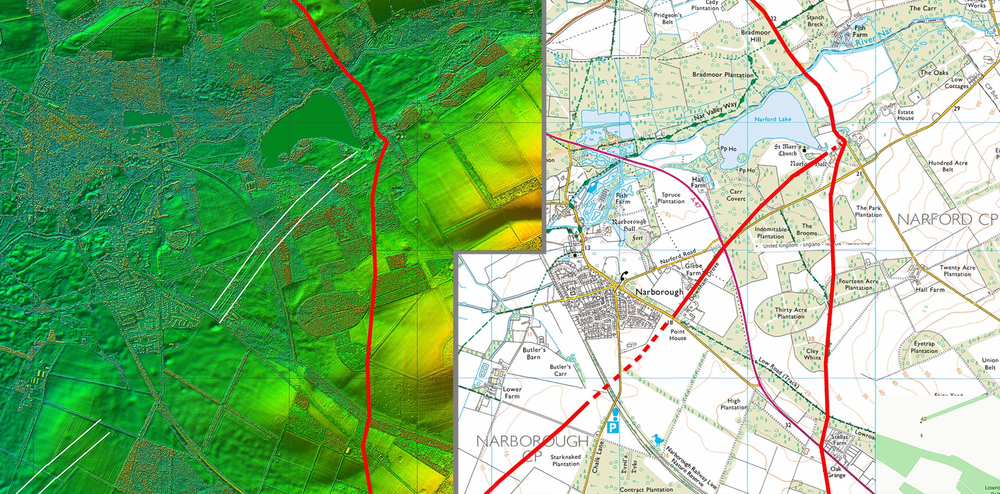 |
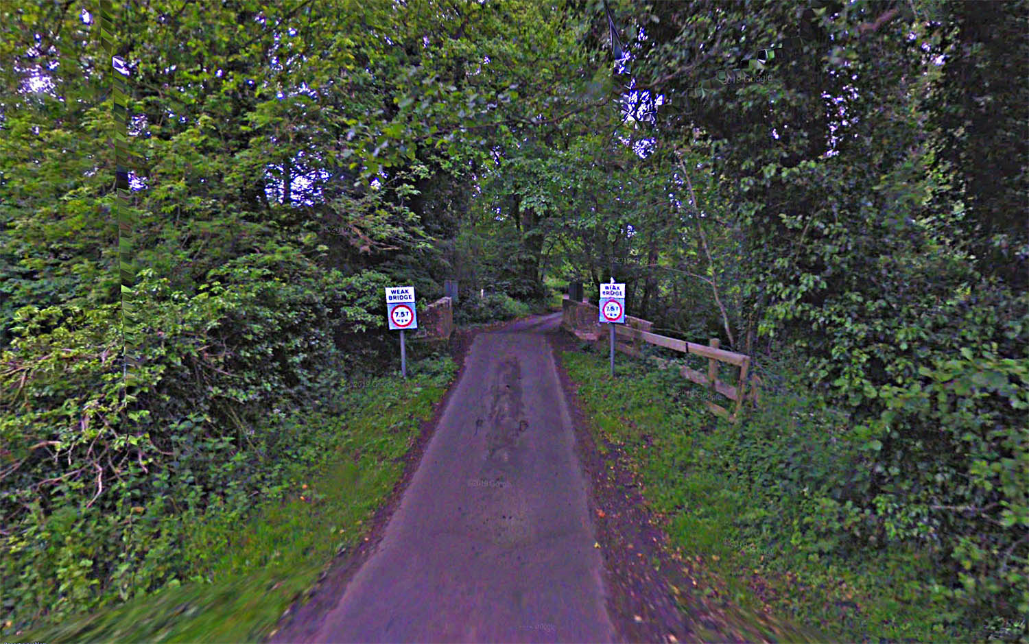
Nar Lane Bridge, Narford Is this where the road was aiming for? The Nar crossing today is pretty insignificant but before drainage then this was probably a very important spot for both the Fen Causeway and the Icknield Way. Whether there was a connection from here to Kempstone and Billingford is yet to be resolved.
|
Click for larger view |
 |
Possible Route from Fincham to the Icknield Way near Swaffham The A1122 beyond Fincham does look like a Roman alignment (and is shown as such by the OS) but research by Albone found that this is a Turnpike road with no apparent predecessor. There are instances elsewhere in the country where a Roman road has gone out of use for centuries but its agger has been re-adopted as a foundation for a later modern road. Is this the case here - an abandoned Roman road being re-instated? It would not be the first time. In addition, as we shall see below, approaching the Icknield Way there does indeed appear to be a predecessor to the turnpike. |
||
A1122 - Fincham (Looking East) Heading out of Fincham it is a very straight and a Roman-like alignment. Was this a turnpike built on top of an abandoined Roman agger? |
Click for larger view |
 |
Lidar Image and Route Map The airfield has destroyed any trace of the assumed change of alignment here so the OS first edition mapping was consulted (see next image). The route shown is based on the line of the road pre the airfield. |
Click for larger view |
 |
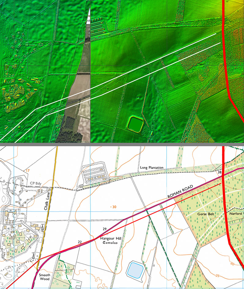
First Edition Ordnance Survey Map When consulting the OS first edition map for the original line of the road prior to the airfield, it was noticed that approaching the Icknield Way there was a former parish boundary running parallel to modern road on its south side. This boundary ends abruptly at the Icknield Way. Lidar also gives some credence to this being the original (pre-turnpike) line of the road here plus it does align better with the turn of the road at the airfield. The significance of this is that, here at least, there was a pre-existing fore-runner to the turnpike. The fact that the parish boundary follows what appears to be an original road puts it back at least as far the medieval period when parish boundaries were generally established.
|
Click for larger view |
 |
Lidar Image and Route Map
It is suggested therefore that the modern road marked as "Roman Road" on modern OS mapping at this point is not actually the true Roman line but a much later turnpike. The Norfolk HER and the Ordnance Survey continue our road (Fen Causeway) along Fincham Drove (position marked on First Edition map above). This road/track doesn't seem to connect directly to our road and appears to have the important Norman centre of Castle Acre as its destination.
|
Click for larger view |
 |
|
|
|
Last update: March 2025 |
© David Ratledge |