|
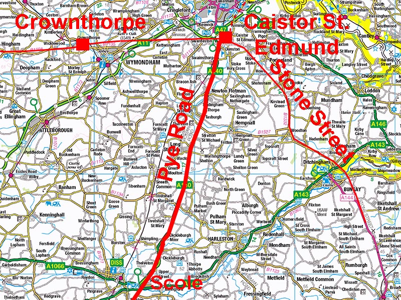
The Roman Road from Caistor St Edmund to Scole (The Pye Road)Margary Number: 3dDistance: 16.5 milesThis was the major route into Norfolk and to Caistor St Edmund from Colchester and London. Today it is mostly overlain by the Norwich to Ipswich main road, A140. There were Roman roadside settlements at Long Stratton and Scole. The name "Stratton" is a big clue - meaning street tun/town. The name Pye road appears to derive from the Magpie or Pie Inn in Suffolk, which was depicted on Ogilby’s 1675 road map for Ipswich to Norwich. Ogilby uses the name Pye (with a "y") Road in the text. Norfolk HER: 7947 |
Historic Counties: Norfolk Current Counties: Norfolk HER: Norfolk
|
|
|
|
|
|
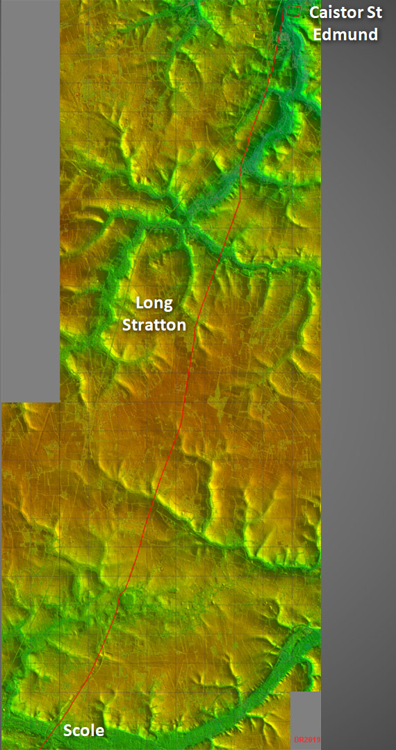
Lidar Image - full route A very direct alignment was chosen with just a few minor adjustments to negotiate one or two valleys. Scole is on the Norfolk side of boundary with Suffolk. |
Click for larger view
|
 |
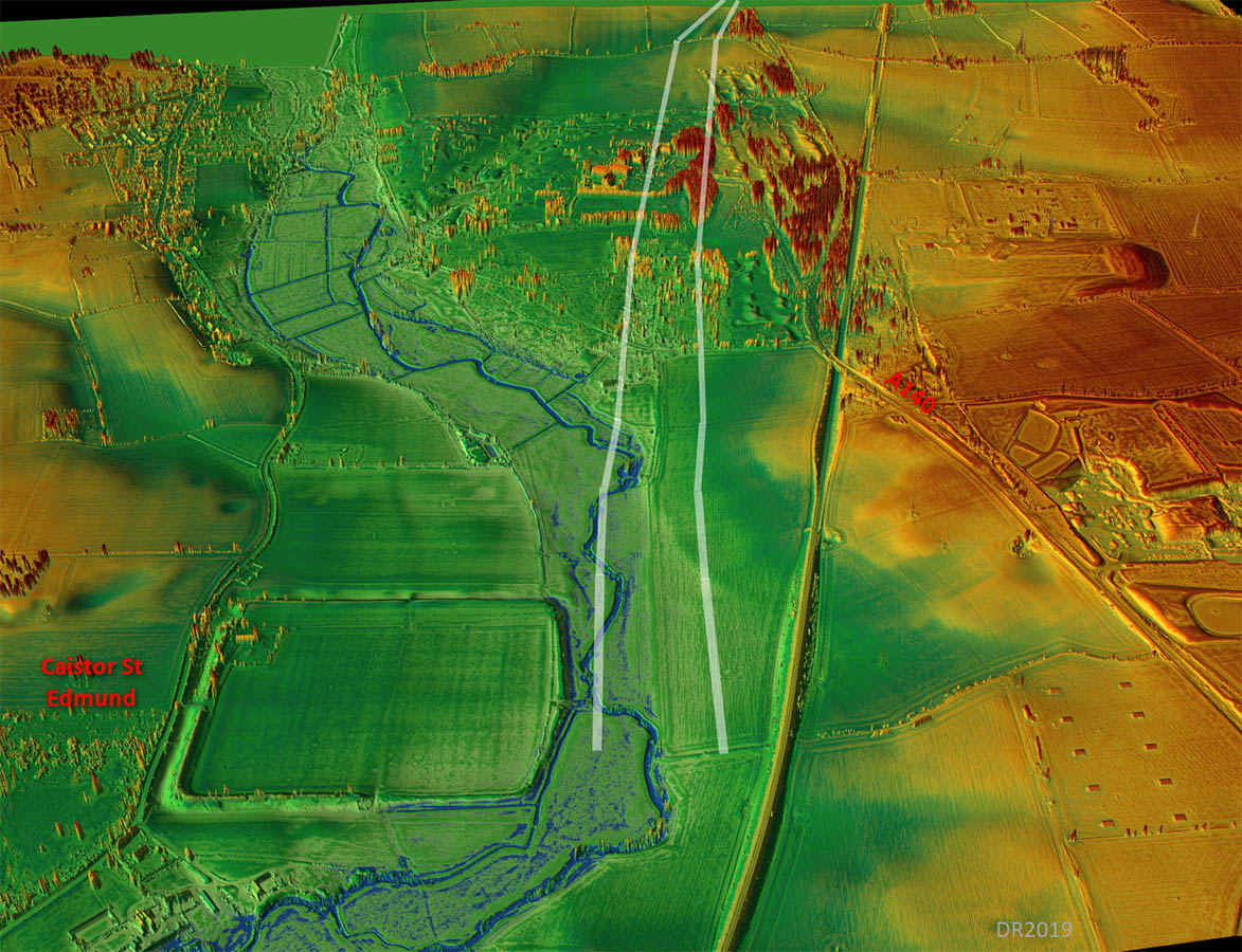
Oblique 3D Lidar Image - Caistor There would have been a bridge opposite the west gate of Caistor. The road then turned south and is very obvious in our Lidar image. |
Click for larger view |
 |
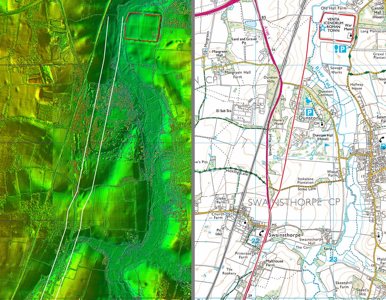
Lidar Image and Route Map 1 The initial route is via the grounds of Dunston Hall before it merges with the modern A140. |
Click for larger view |
 |
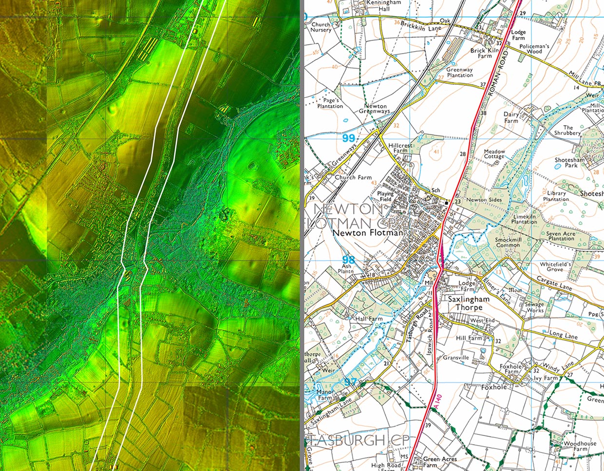
Lidar Image and Route Map 2 At Newton Flotman in order to negotiate the valley of the River Tas the route deviates from its generally straight course to adapt to the contours. |
Click for larger view |
 |
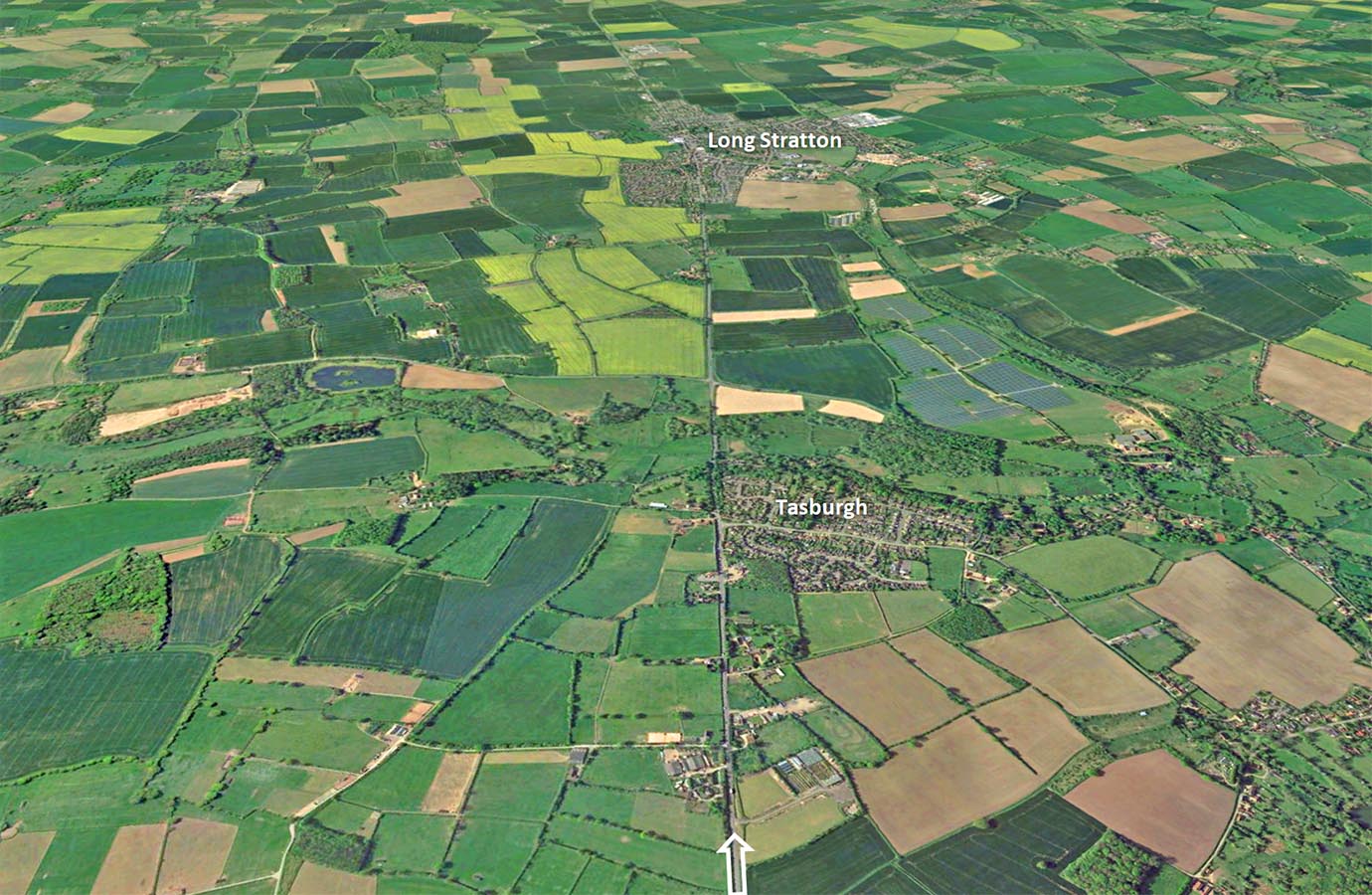
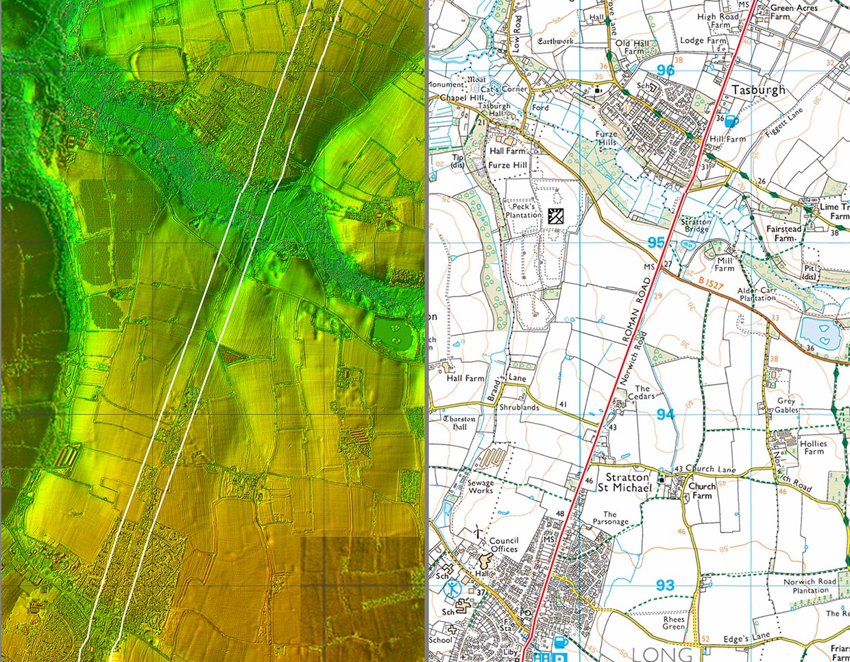
Google Earth Image - Tasburgh The alignments to Long Stratton and the next one beyond it are obvious in the view looking south. |
Click for larger view |
 |
Lidar Image and Route Map 3 After Newton Flotman, the road resumes a long straight alignment through Tasburgh to Long Stratton. Excavations on the line of Long Stratton Bypass encountered many finds from the Roman settlement there HER39671. The bypass has not yet been built and so does not appear on our map - it will be on the east of the village. |
Click for larger view |
 |
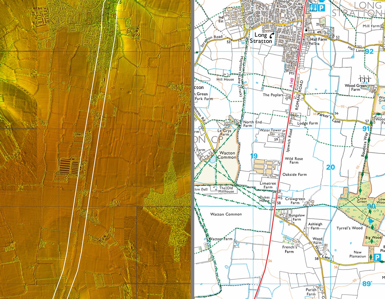
Lidar Image and Route Map 4 This is the highest point on the route to Scole at around 60 metres AOD - pretty much a mountain for Norfolk. |
Click for larger view |
 |
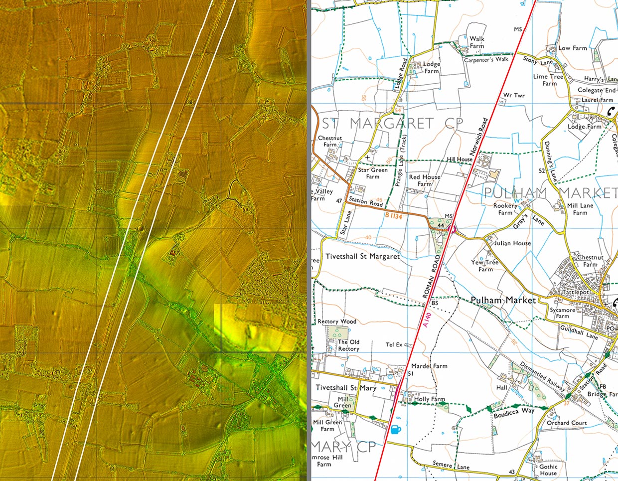
Lidar Image and Route Map 5 The A140 is a bit of a race track on this straight stretch. |
Click for larger view |
 |
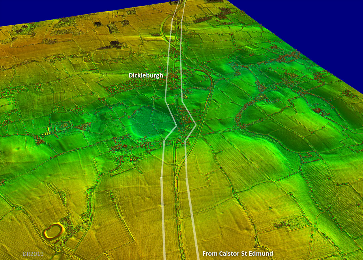
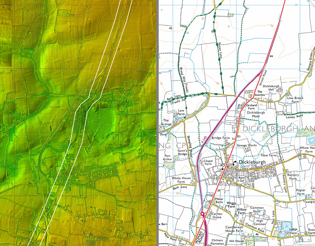
Oblique 3D Lidar Image - Dickleburgh Approaching Dickleburgh the dog-leg to avoid Dickleburgh Moor - surely a former mere - shows up particularly well. This is not the only Roman road in Norfolk that seemingly targeted passing a mere. |
Click for larger view |
 |
Lidar Image and Route Map 6 - Dickleburgh Plan version of the above 3D view of Dickleburgh, which is now bypassed. |
Click for larger view |
 |
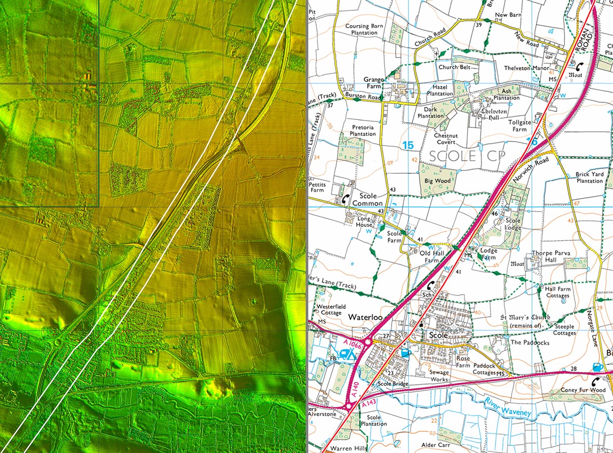
Lidar Image and Route Map 7 Modern road improvements means the A140 now leaves the Roman alignment at Scole. |
Click for larger view |
 |
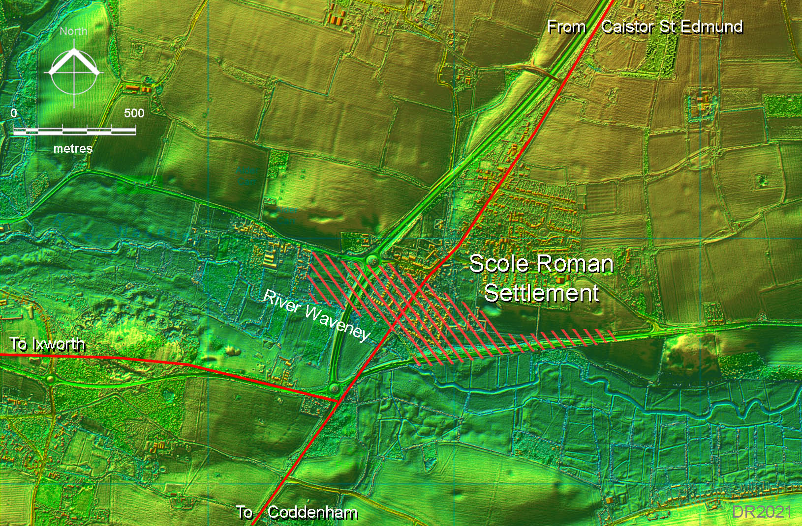
Lidar Image - Scole The riverside/roadside Roman settlement of Scole appears to have been quite extensive and probably more correctly should be referred to as a town. It even could perhaps be the lost site of Villa Faustini although a location over the border into Suffolk would fit the mileages better.. The settlement area is taken from HER1007 although this is somewhat skewed by excavations for roadworks The Roman road to Ixworth is a recent discovery and confirms Ixworth as Sitomagus.. |
Click for larger view |
 |
|
|
|
Last update: February 2021 |
© David Ratledge |