|
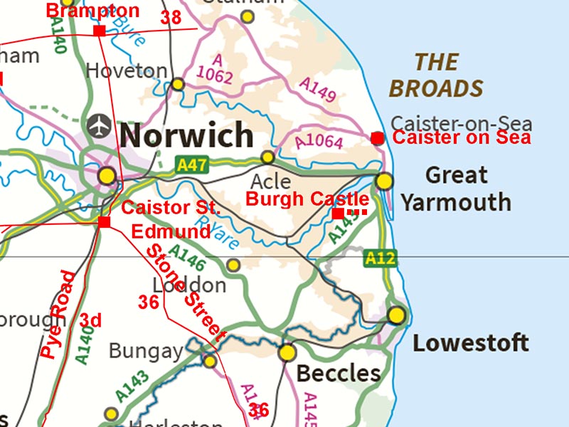
Possible Roman Road at Burgh CastleMargary Number: noneDistance: NABurgh Castle Roman Fort is classed as a Saxon Shore Fort built late into the Roman occupation c. 300AD. As such it would post date the main road system. However, there does appear to be the possibility of a road running east from the fort. This might be explained by the fort's location overlooking the inland Yare estuary rather than out to sea. Perhaps there was a road to the east where the open sea could be observed. For further details of Burgh Castle including some geophys results visit Norfolk Archaeological Trust
|
Historic Counties: Norfolk Current Counties: Norfolk HER: Norfolk
|
|
|
|
|
|
Lidar Image - Yare Estuary The location of the fort guarding the Yare estuary makes it obvious that this must have been its priority. It is often suggested that there could have been a light-house at Reedham on the basis of Roman material incorporated into the fabric of the Church there. It is also obvious that robbing material from Burgh would have only required a short boat journey.
|
Click for larger view |
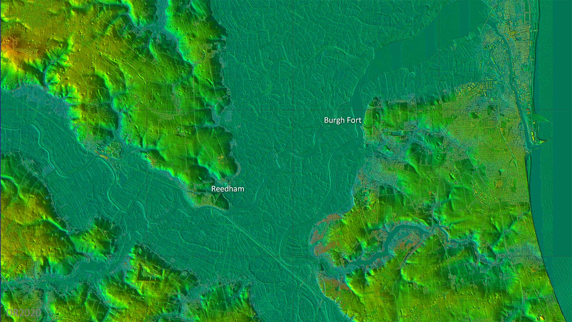 |
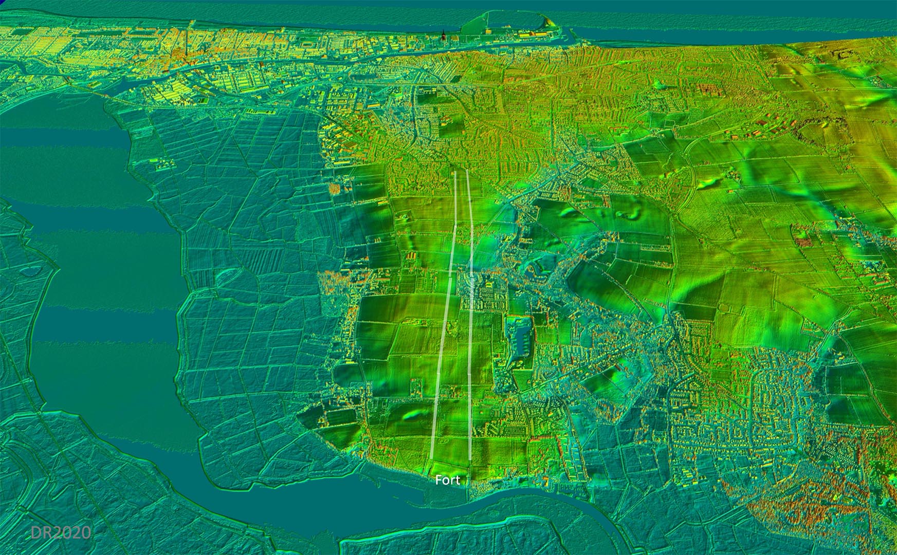
Oblique 3D Lidar Image - Burgh Castle looking East It is clear that the fort is poorly located to spot any approach from the open sea. There is some evidence for a road heading eastward to a point where the open sea could be watched.
|
Click for larger view |
 |
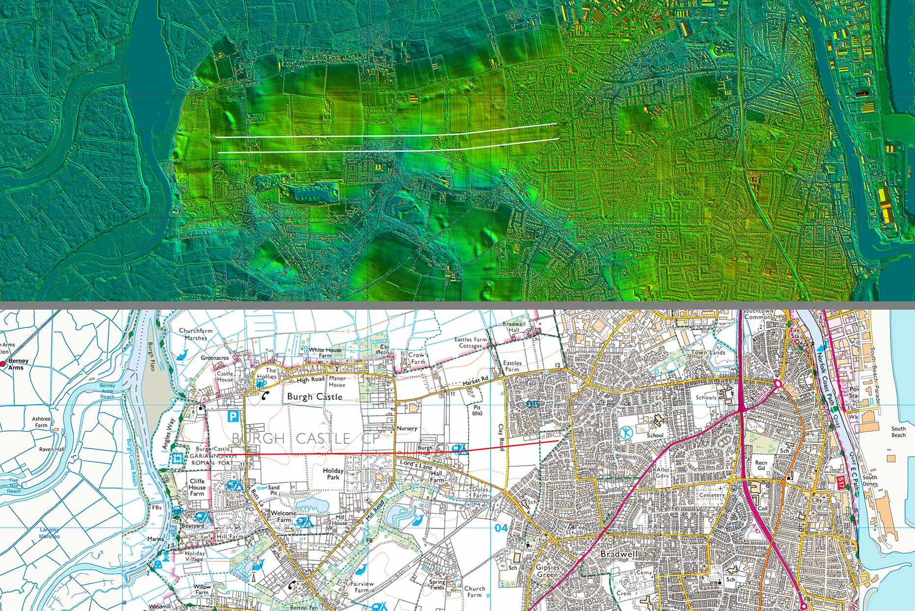
Lidar Image and (Possible) Route Map The agger in the centre of the plot is obvious and with it being aligned on the fort does lend some support that this could indeed be a road. However, really more evidence would be required for certainty. |
Click for larger view
|
 |
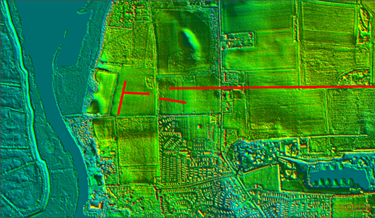
Enclosure Site A few possible road aggers around the fort are visible - again more investigation would be needed to confirm this. |
Click for larger view |
 |
|
|
|
Last update: September 2020 |
© David Ratledge |