|
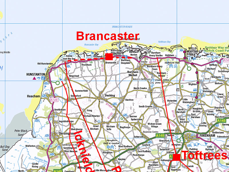
Brancaster East-West Coastal Roman RoadMargary Number: noneDistance: 10.5 milesA somewhat speculative Roman road - the Lidar evidence is not overwhelming but the need for just such a road cannot really be denied. Unfortunately there are several what appear to be sea bank defences along this stretch of coast and deciding what is a bank and what is a potential road is fraught with difficulty. Brancaster (Branodunum) dates from around 230AD so would have been constructed after the the initial Roman road system was established but perhaps a bit earlier than most of the Saxon Shore forts. At first its location looks a puzzle but its position exactly half way between the Roman road to Holme and that to Burnham Overy Marshes cannot be a coincidence. It was surely centrally located to provide equal protection for these two Roman ports. They must not have warranted a fort each so they got one midway between the two. An east-west road would therefore have been essential.
|
Historic Counties: Norfolk Current Counties: Norfolk HER: Norfolk
|
|
|
|
|
|
Lidar Image: Holme-Brancaster-Burnham Overy The location of the fort with respect to the two Roman roads and presumed Roman harbours is clear from this Lidar plot. It is midway between them. |
Click for larger view
|
 |
Branodunum Site - Historic England Map This is from Historic England's Aerial Archaeology Mapping Explorer. As can be seen the vicus was huge. This was by no means a minor outpost. The east and west roads leading from the fort gates are clearly evident. |
Click for larger view |
 |
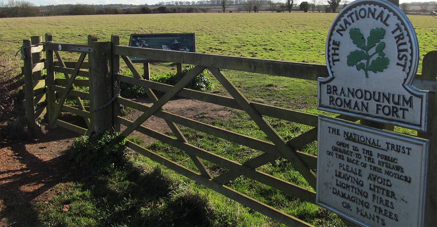
Branodunum Site The fort site is protected and under the stewardship of the National Trust. The fort was garrisoned by the Equites Dalmatae Brandodunenses ("Dalmatian cavalry of Bran[d]odunum"). Perhaps strange it was a cavalry unit but as it was midway between the existing Roman roads and harbours perhaps this was what was required. Image: National Trust |
Click for larger view |
 |
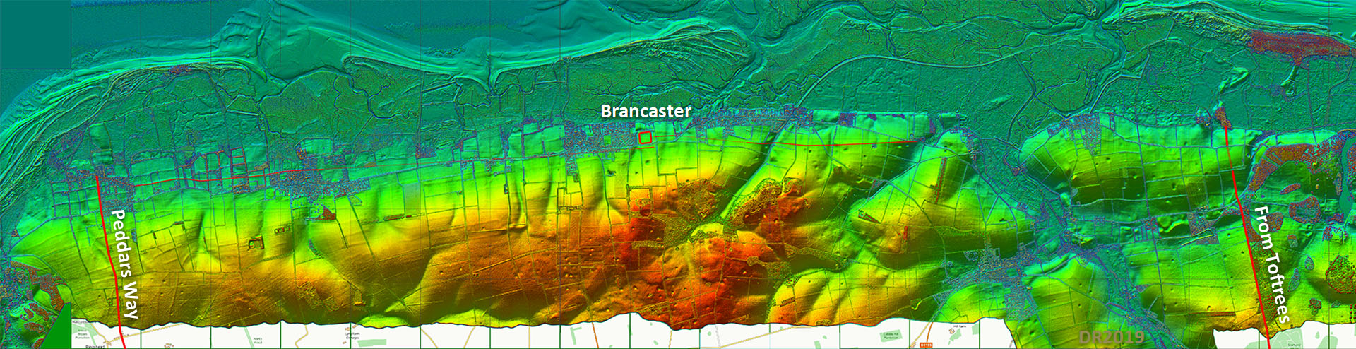
Oblique 3D Lidar Image - Brancaster Fort looking West There are two options for the road west. I have gone for the more northerly (right) one as it fits best with the road from the fort. It would also align well with the modern road. The second option is marked with a couple of "?". |
Click for larger view |
 |
Oblique 3D Lidar Image - Holme-next-the-Sea This section is a little more obvious and would link with a harbour at the end of the Peddars Way. This was no doubt for onward travel by ferry across the Wash for Lincoln. The Icknield Way also terminated here at a natural inlet previously known as Haven Gate. Perhaps it had silted up by Roman times and the Peddars Way went to a new harbour at Holme? |
Click for larger view |
 |
Oblique 3D Lidar Image - Brancaster Eastwards A little bit of a gap between the road from the fort and where the Lidar starts to show but it aligns well. A couple of little doglegs where it gets down and up little valleys. |
Click for larger view |
 |
River Burn Estuary - Causeway/Embankment Crossing For this route to be feasible there would have to be a causeway across the River Burn Estuary. There is a modern sea bank here but just inland of it is an older bank which would match the road alignment perfectly. This panorama view exaggerates the curve but the old bank runs from Burnham Norton to the dry land below the old windmill. Image: DR |
Click for larger view |
 |
Oblique 3D Lidar Image - Approaching the Roman Harbout & RR39 Beyond the River Burn estuary the road angles across the slope before heading to Overy Marshes and the probable harbour there.Just the last section is missing but probably enough to suggest this is the continuation to the harbour at the north end of Roman road 39 from Toftrees. |
Click for larger view |
 |
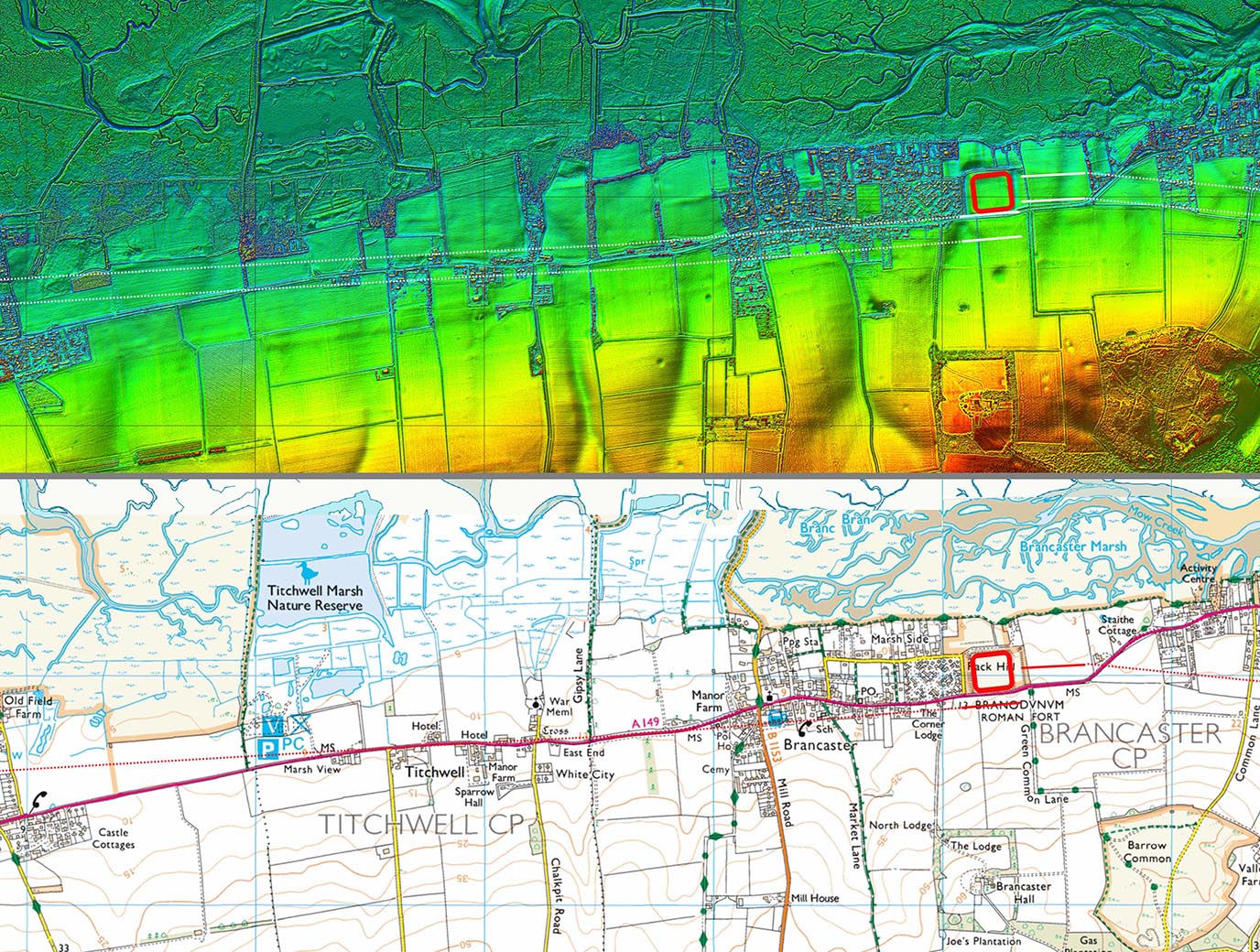
Lidar Image & Route West Map 1 The route is based on the road leaving the fort. It would connect well with the straight section of the A149 into Thornham. |
Click for larger view |
 |
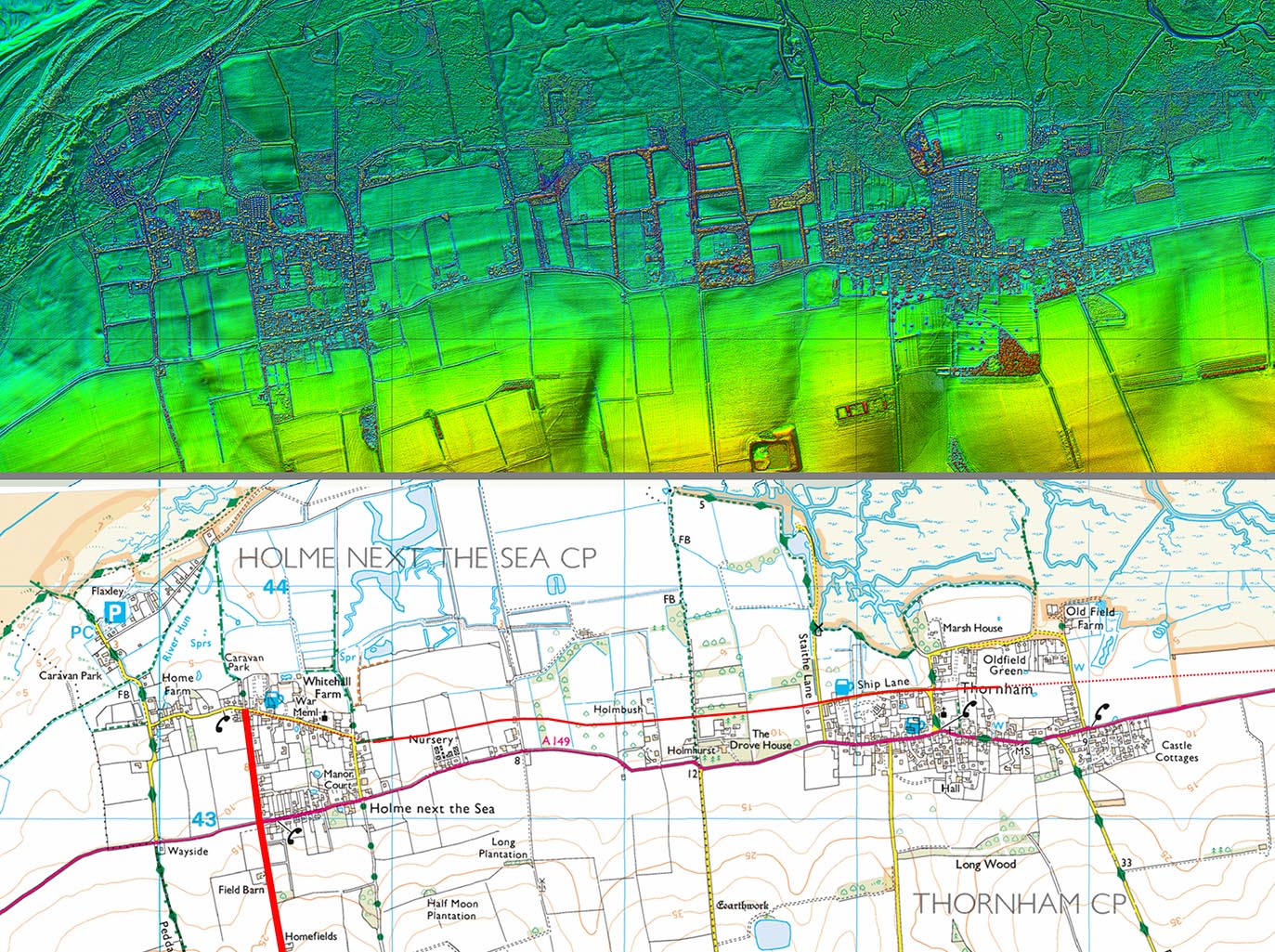
Lidar Image & Route West Map 2 There is certainly a feature west of Thornham that could be our road but it could also be a sea bank. |
Click for larger view |
 |
Lidar Image & Route East Map 1 The road through the vicus is known and the continuation onwards matches it well |
Click for larger view |
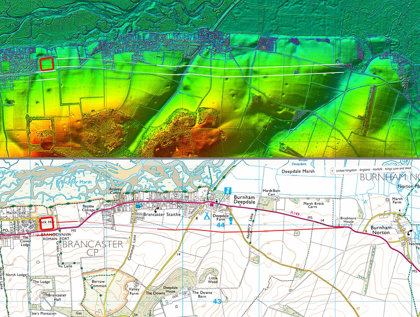 |
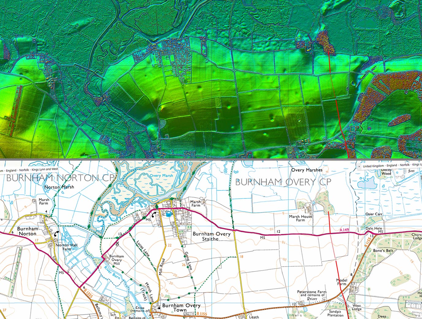
Lidar Image & Route East Map 2 Causeway across the River Burn and visible aggers continue the route either side of Burnham Overy Staithe. |
Click for larger view |
 |
|
|
|
Last update: June 2026 |
© David Ratledge |